Introduction
Belhus Park is the remnant of a mid 18th century landscape park, now a golf course.
Terrain
The ground is generally level, with the M25 sunk into a cutting which runs north/south through the eastern half of the park, isolating the woodland areas from the open parkland.www.historicengland.org.uk/listing/the-list
Remnant of a mid 18th century park by Lancelot Brown, with additions by Richard Woods, now (2000) a golf course and leisure centre.
DESCRIPTION
LOCATION, AREA, BOUNDARIES, LANDFORM, SETTING
Belhus Park is situated on the eastern edge of London, between the settlements of Aveley and South Ockendon, beside junction 30 of the M25 which cuts through the park. The c 119ha site is bordered to the west by the houses of Aveley, to the east by South Ockendon, to the south by a small area of open land, and to the north by Belhus Woods Country Park. These boundaries give the site an urban-edge setting. The ground is generally level, with the M25 sunk into a cutting which runs north/south through the eastern half of the park, isolating the woodland areas from the open parkland.
ENTRANCES AND APPROACHES
Belhus Park is approached from Aveley along a late C20 drive which leads directly to the golf clubhouse. There are no surviving drives or rides associated with the historic park.
PRINCIPAL BUILDING
Belhus House was demolished in 1957. Following its development as a recreational park in the mid C20, a clubhouse known as the Capability Brown and a swimming pool were erected c 200m to the south-east of the house site.
GARDENS AND PLEASURE GROUNDS
The gardens and pleasure grounds associated with Belhus House were removed to make way for the recreational facilities, leaving only the unmanaged remains of Lancelot Brown's Shrubbery running north/south along the western boundary of the park, c 600m to the west of the clubhouse and c 500m to the west of the site of Belhus House.
In the mid C17 Belhus was surrounded by elaborate enclosed formal gardens which included a wilderness, rock garden, and palisado garden (engraving, ERO), a layout which survived until the early part of the C18. Following a period of neglect, the grounds were brought up to date by Lancelot Brown for Lord Dacre from 1753 onwards, when The Shrubbery was planted.
PARK
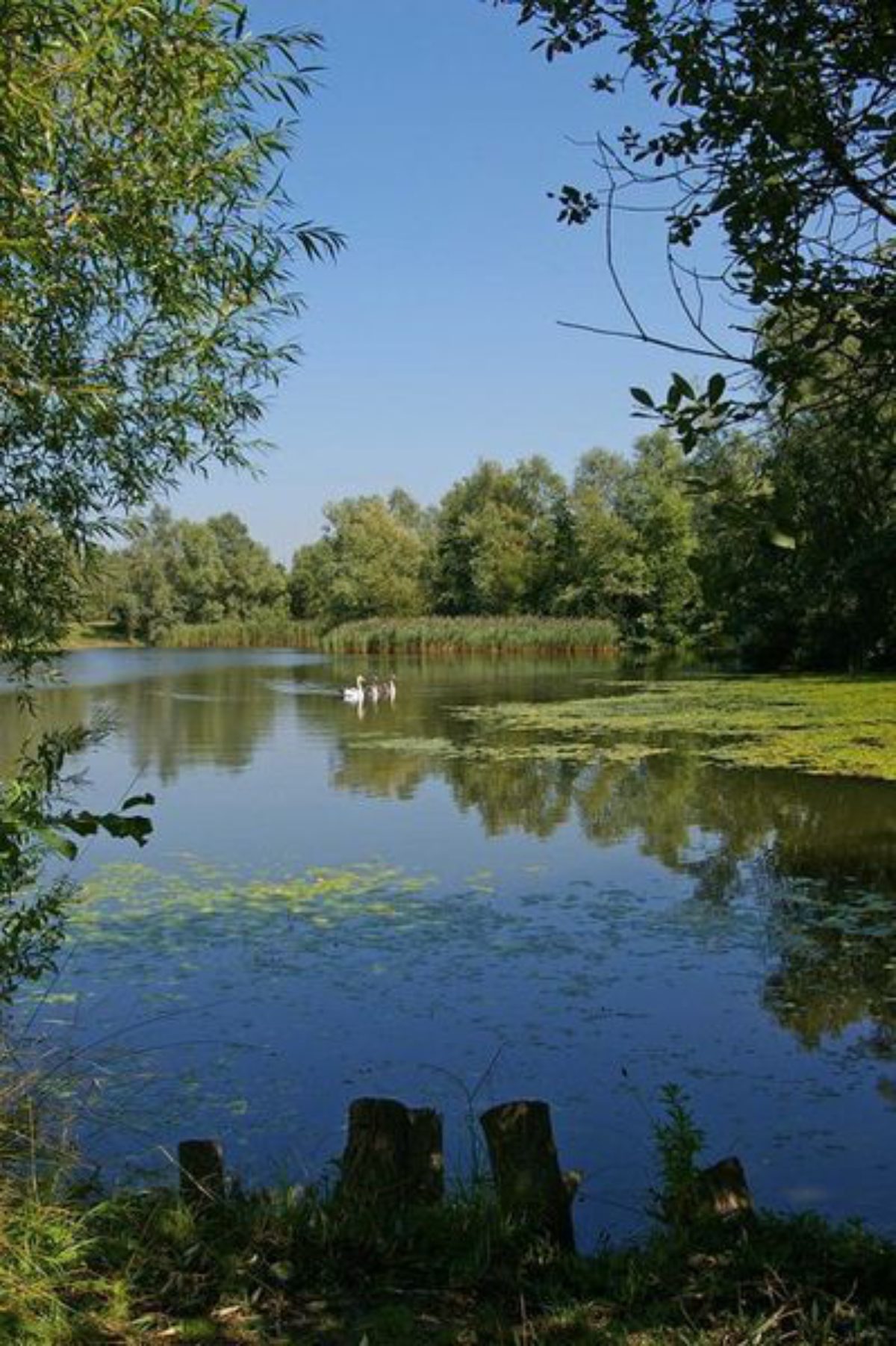
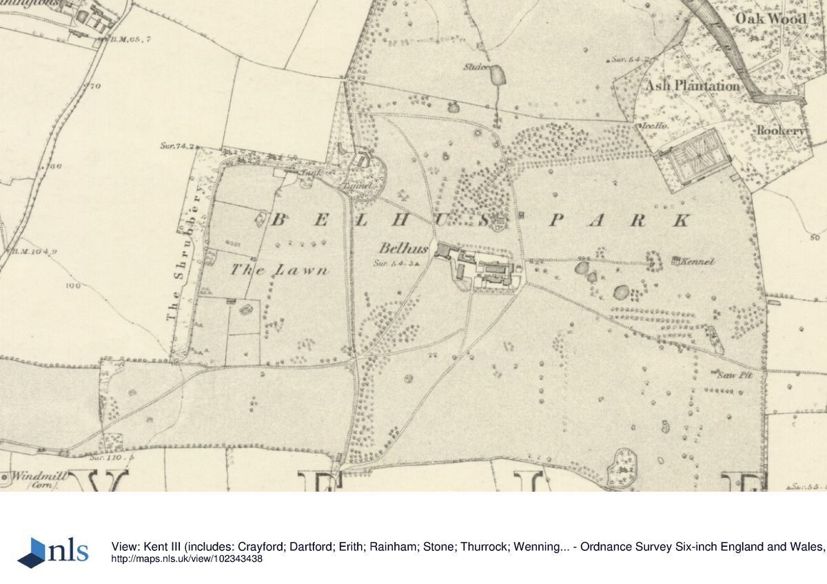
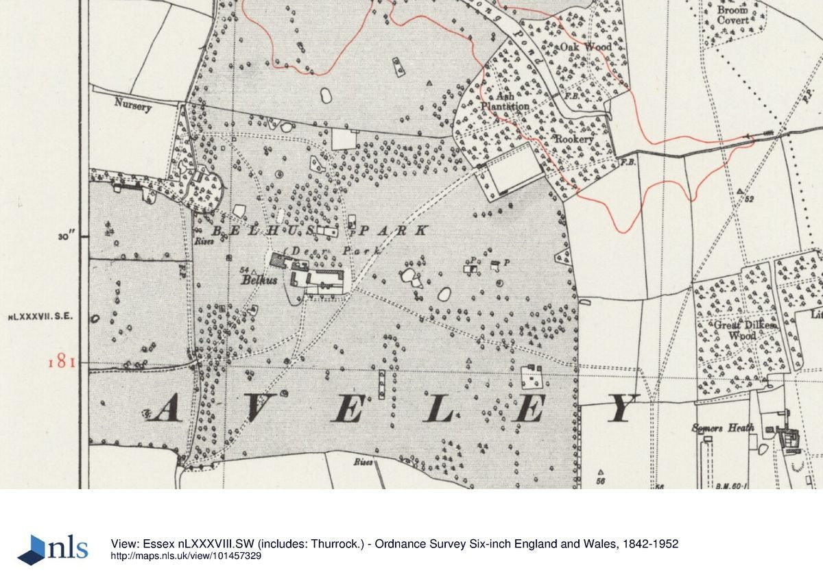
The park at Belhus is retained under grass, much of it managed for a variety of sporting uses. The central section is laid out as a golf course and contains bunkers defined by strips of late C20 shrub and tree planting. Within this area there are two mounds which survive from the C18 landscape scheme (Chapman and Andre, 1777). In the southern part of the site is a collection of late C20 buildings associated with the sports and leisure complex. A scatter of mature park trees survive in the open parts of the park, as do the woodlands known as Ash Plantation, Rookery Wood, and Oak Wood in the north-east quarter, although these have been isolated by the building of the M25. Within these woods lie the remains of the elongated Long Pond, the north-west tip of which now (2000) stands alone in the main body of the park. Although Lord Dacre and Brown had plans for a piece of water, these proved too expensive and it was left to Richard Woods who was commissioned in 1770 to create the more modest Long Pond by adapting an existing canal. Just to the west of the northern tip of the Long Pond, a mid to late C18 stench pipe (listed grade II) stands on the northern boundary of the park. It comprises a tall, octagonal, Tudor-style chimney of red brick with black brick dressings, moulded at the top and bottom in an elaborate pattern to act as an eyecatcher from across the park.
Just beyond the north wall of the kitchen garden, in the north-east corner of the park, stands the well of the mid C18 icehouse, excavated in 1979.
KITCHEN GARDEN
The walls of the kitchen garden (listed grade II) survive in the middle of the eastern boundary of the site, c 500m to the north-east of the clubhouse (outside the area here registered). During the C20 the area was mostly developed for housing and, apart from a strip along the western edge associated with the gardener's cottage, has thus been lost to the historic landscape. In 1744 the walled garden south of the House was demolished and a new one built in the present position as part of the improvements undertaken by Lord Dacre, Sanderson Miller, and Lancelot Brown.
REFERENCES
P Morant, The History and Antiquities of the County of Essex (1763-8)
P Muilman, A New and Complete History of Essex I, (1771), p 133
T Barrett-Lennard, The Families of Lennard and Barrett (1908)
L Dickens and M Stanton, An eighteenth century correspondence (1910) [letters between Lord Dacre and Sanderson Miller]
Country Life, 47 (15 May 1920), pp 656-62; (22 May 1920), pp 690-6
D Stroud, Capability Brown (1975), pp 72-4
N Pevsner and E Radcliffe, The Buildings of England: Essex (1979), p 83
Panorama Journal of the Thurrock Local History Society 23, (1980)
Victoria History of the County of Essex VIII, (1983)
Garden History XV, No 1 (1987), pp 34-5
F Cowell and G Green, Repton in Essex (2000), pp 21-2
Maps
Belhus Park in 1619 (D/DL M14 and P1), (Essex Record Office)
J Chapman and P Andre, A map of the county of Essex from an actual survey ..., 1777 (Essex Record Office)
Tithe map for Aveley parish, 1839 (Essex Record Office)
OS Surveyor's drawings, 1799 (British Library Maps)
OS 6" to 1 mile:
1st edition published 1869
2nd edition published 1897
1938 edition
OS 25" to 1 mile: 2nd edition published 1897
Archival items
Engraving of the gardens in the mid C17 (D/DL T1/779A), (Essex Record Office)
Bird's-eye view of Belhus in the late C17/early C18 century (Thurrock Museum)
Engraving from Peacock's Polite Repository (1807) [reproduced in Cowell and Green 2000]
Engraving by W Wallis from drawing by J P Neale, 1819 (Thurrock Museum)
Engraving by J C Armytage from drawing by W Bartlett, 1835 (Thurrock Museum)
Description written: January 2001 Amended: April 2001
Register Inspector: EMP
Edited: September 2001
- Visitor Access, Directions & Contacts
Access contact details
The site is open daily, 8am to dusk 01 708 865628 http://www.belhusparkgc.co.uk/
- History
The following is from the Register of Parks and Gardens of Special Historic Interest. For the most up-to-date Register entry, please visit the The National Heritage List for England (NHLE):
www.historicengland.org.uk/listing/the-list
HISTORIC DEVELOPMENT
The name Belhus derived from 14th century tenants of the manor who, according to Morant (1768), came from Ramsden Bellhouse. The first of the family, Nicholas, settled at Aveley in about 1327 and by the early 15th century the Barretts had inherited by marriage a share of the Belhus estate. This they added to and consolidated until by the mid 17th century they had built up one of the largest estates in Essex. John Barrett, who died in 1526, rebuilt Belhus House towards the end of his life.
In 1618 Sir Edward Barrett obtained a license to make a park, and the elaborate parterre shown on an estate map of 1619 was probably of the same date. A bird's-eye view of the property in the late 17th/early 18th century shows much the same layout (Thurrock Museum). Following his succession to the estate, Thomas Barrett-Lennard, later Lord Dacre, made extensive improvements to both house and grounds between 1744 and 1777. Dacre's friend, the architect Sanderson Miller (1716-1780) advised on the building, while Lancelot Brown (1716-1783) was commissioned to remodel the grounds between 1753 and 1763. Correspondence between Dacre and Miller shows that the owner was short of money but Brown nevertheless created a modern park which was given minor additions by Richard Woods, who was commissioned in 1770. The landscape they created is depicted on the Chapman and Andre county map of 1777.
After Dacre's death the Belhus estate was inherited by his natural son, Thomas Lennard (created baronet in 1801) who was friendly with Humphry Repton (1752-1818). Although there is no evidence in the estate account books of payment to Repton, Belhus is illustrated in Peacock's Polite Repository for 1807, suggesting that Repton may have given some advice there. Comparison between Chapman and Andre (1777) and the Ordnance Survey Surveyor's drawings (1799) shows that the avenue flanking the main approach had disappeared by the later date, with just a length of it retained beyond the house.
Thomas Lennard died in 1856 at the advanced age of ninety-five, a year after his own son had passed away. Belhus was thus inherited by Thomas's grandson, also Thomas, who lived at Belhus until his death in 1919. The third Baronet, Sir Thomas Barrett Lennard, was sixty-six when he inherited Belhus and had long resided at Horsford Manor, the family estate in Norfolk. Although he spent time maintaining and repairing the house and estate, Sir Thomas did not live there, retaining Horsford as his principal seat, and in 1923 he dispersed the contents of the house.
During the Second World War Belhus was damaged by bombing and by military occupation and it was demolished in 1957. Belhus Park was purchased by Essex County Council and developed as a recreation centre, with swimming pool, gym, and golf course focused on a new clubhouse built in the southern half of the park. The site remains (2000) in local authority ownership.
- Associated People
- Features & Designations
Designations
The National Heritage List for England: Register of Parks and Gardens
- Reference: GD1730
- Grade: II
- Key Information
Type
Park
Purpose
Recreational/sport
Principal Building
Commercial
Survival
Part: ground/below ground level remains
Hectares
119
Open to the public
Yes
Electoral Ward
Ockendon
- References
References
- Stroud, D {Capability Brown} (1975) pp 72-74 Capability Brown (Country Life article)
- {English Heritage Register of Parks and Gardens of Special Historic Interest} (Swindon: English Heritage 2008) [on CD-ROM] Historic England Register of Parks and Gardens of Special Historic Interest
- Pevsner, N and Radcliffe, E {The Buildings of England: Essex} (Harmondsworth: Penguin, 1965) p 83 The Buildings of England: Essex