Introduction
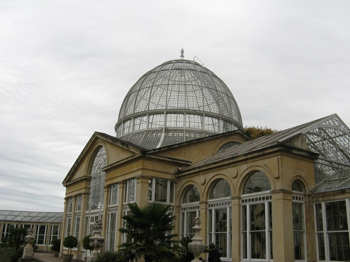
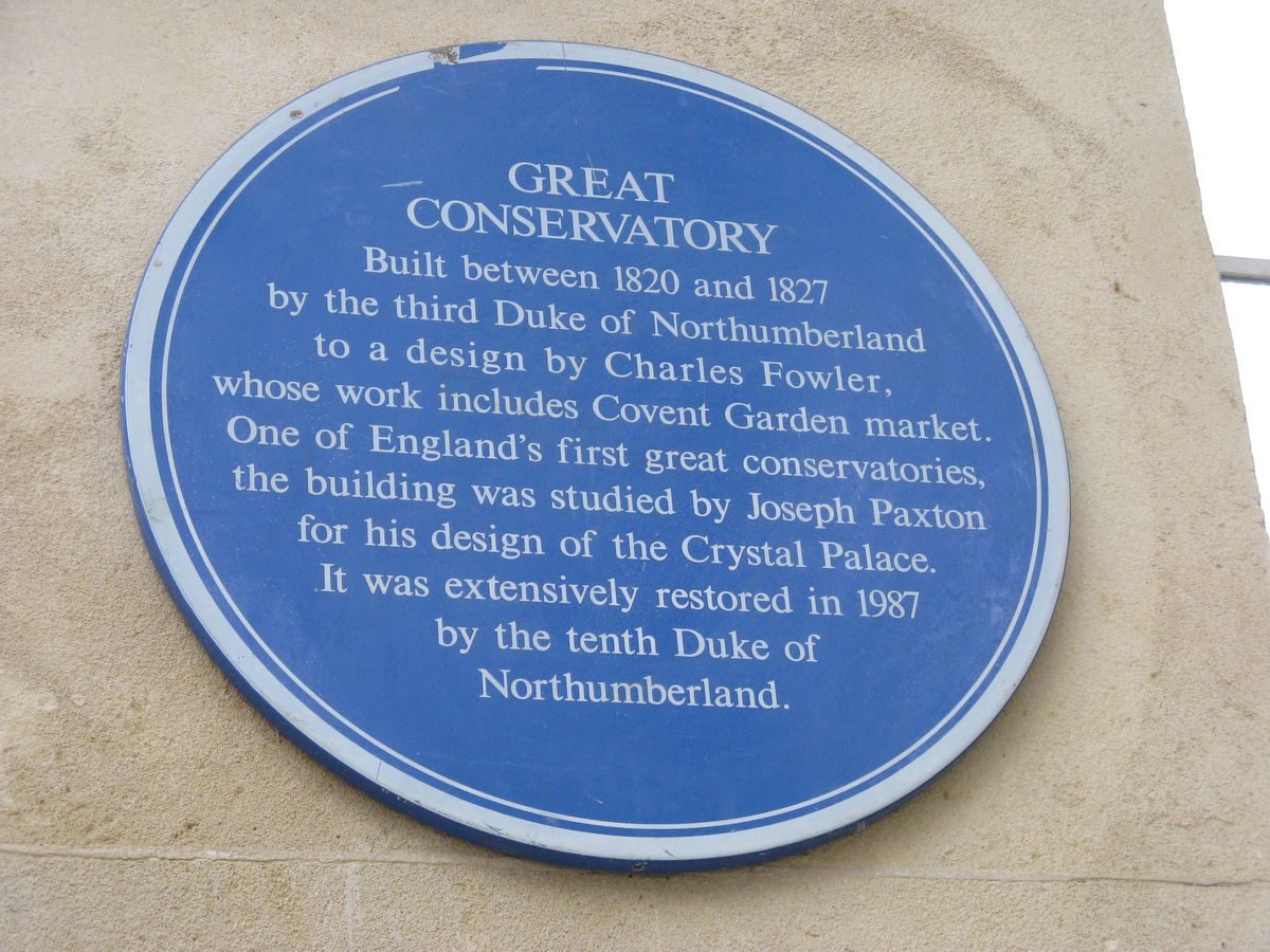
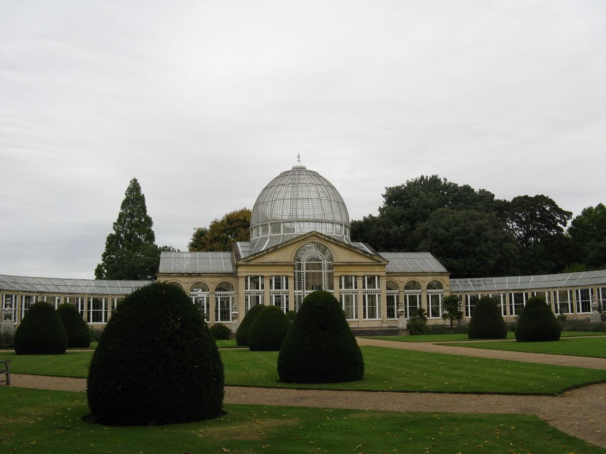
Syon House was constructed in the mid-16th century on a former Abbey site. The park was redesigned in the mid-18th century in the English Landscape style by Lancelot Brown. The park covers about 80 hectares and includes 16 hectares of ornamental gardens developed in the 19th century. Some of the botanic collections originated in the 16th century. The Great Conservatory was designed by Charles Fowler in 1826.
Terrain
The largely level site slopes gently down to the River Thames.The following is from the Register of Parks and Gardens of Special Historic Interest. For the most up-to-date Register entry, please visit the The National Heritage List for England (NHLE):
www.historicengland.org.uk/listing/the-list
C17 formal terraced gardens which were landscaped in the mid C18 by Lancelot Brown. Extensive development of the pleasure grounds continued in the later C19 and mid C20.
DESCRIPTION
LOCATION, AREA, BOUNDARIES, LANDFORM, SETTING
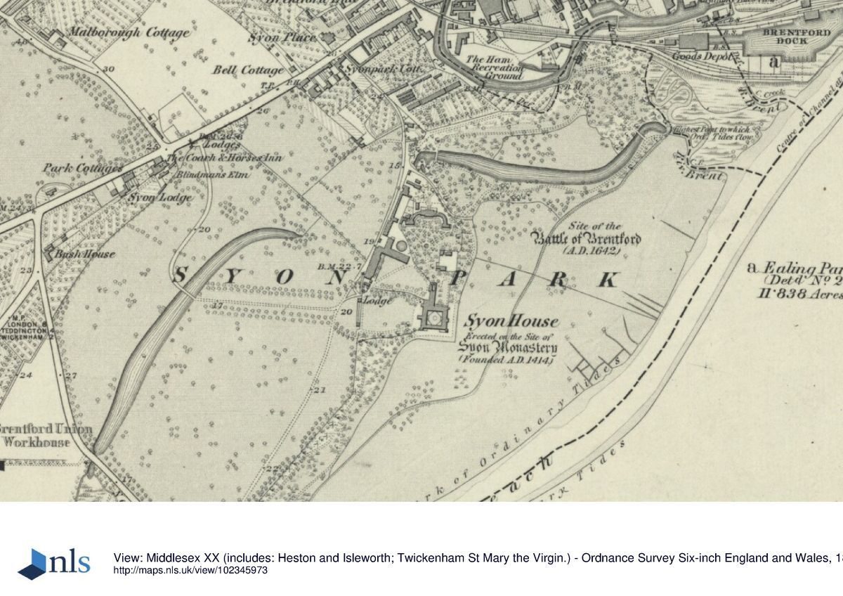
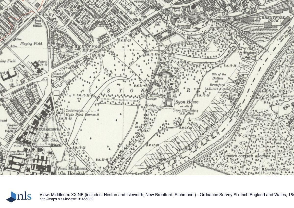
Syon Park is situated c 6km to the west of the centre of London, c 1km south-east of Brentford. Gunnersbury Park (qv) lies 2.5km to the north-east, with Chiswick House (qv) c 4km to the east. The Royal Botanic Gardens, Kew (qv) lie c 250m to the east, on the opposite bank of the River Thames.
The c 80ha site is bounded to the north-west by London Road (A315). Residential and industrial developments form the boundary to the north. The River Thames provides the eastern boundary and Park Road the western boundary. A small residential development, Busch Close and Lodge Close, borders the site in the north-west corner. The largely level site slopes gently down to the River Thames. Brick walls of C17, C18, and C19 dates (listed grade II) mark the boundary to the north and west along much of London Road and Park Road.
ENTRANCES AND APPROACHES
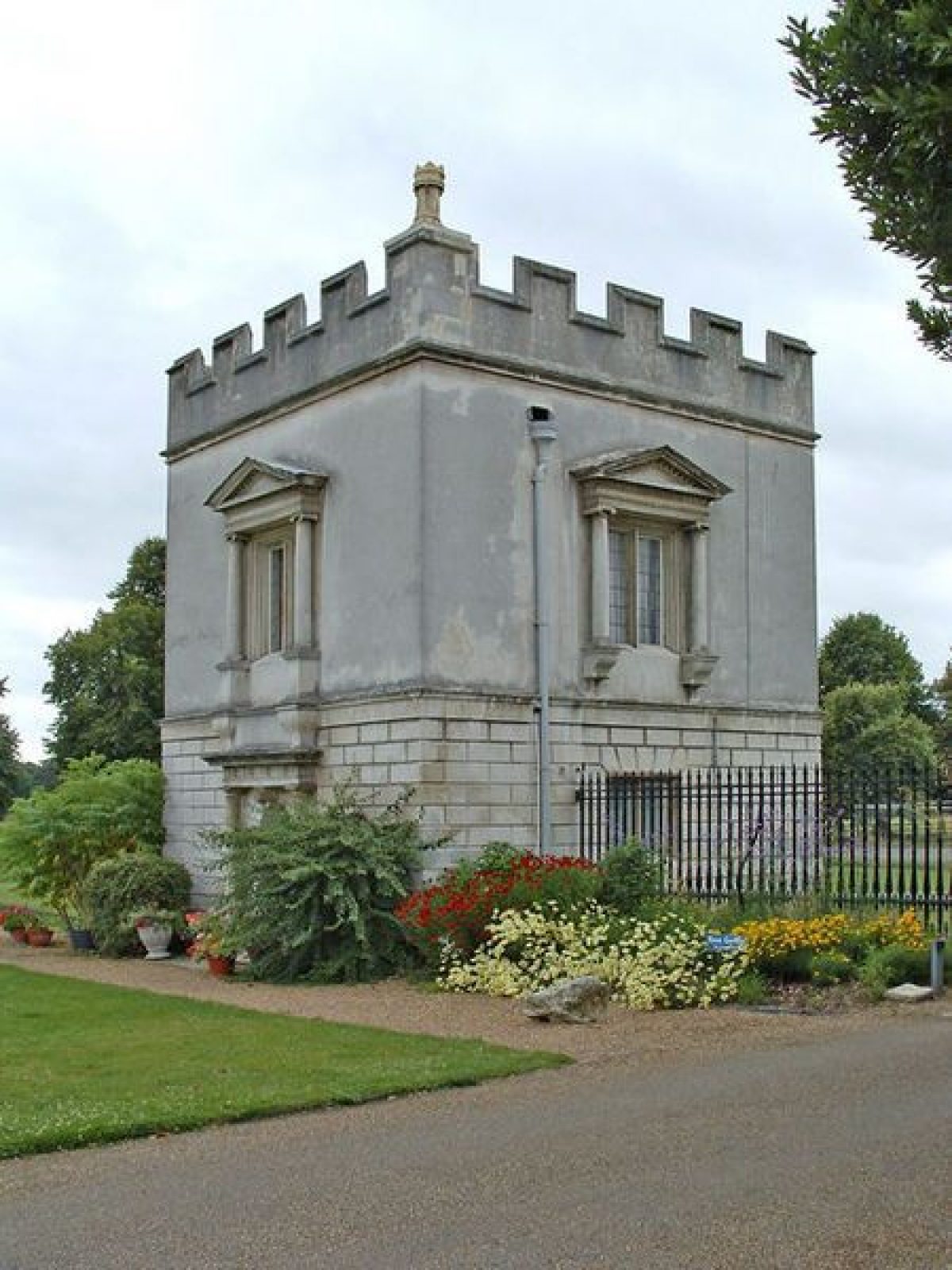
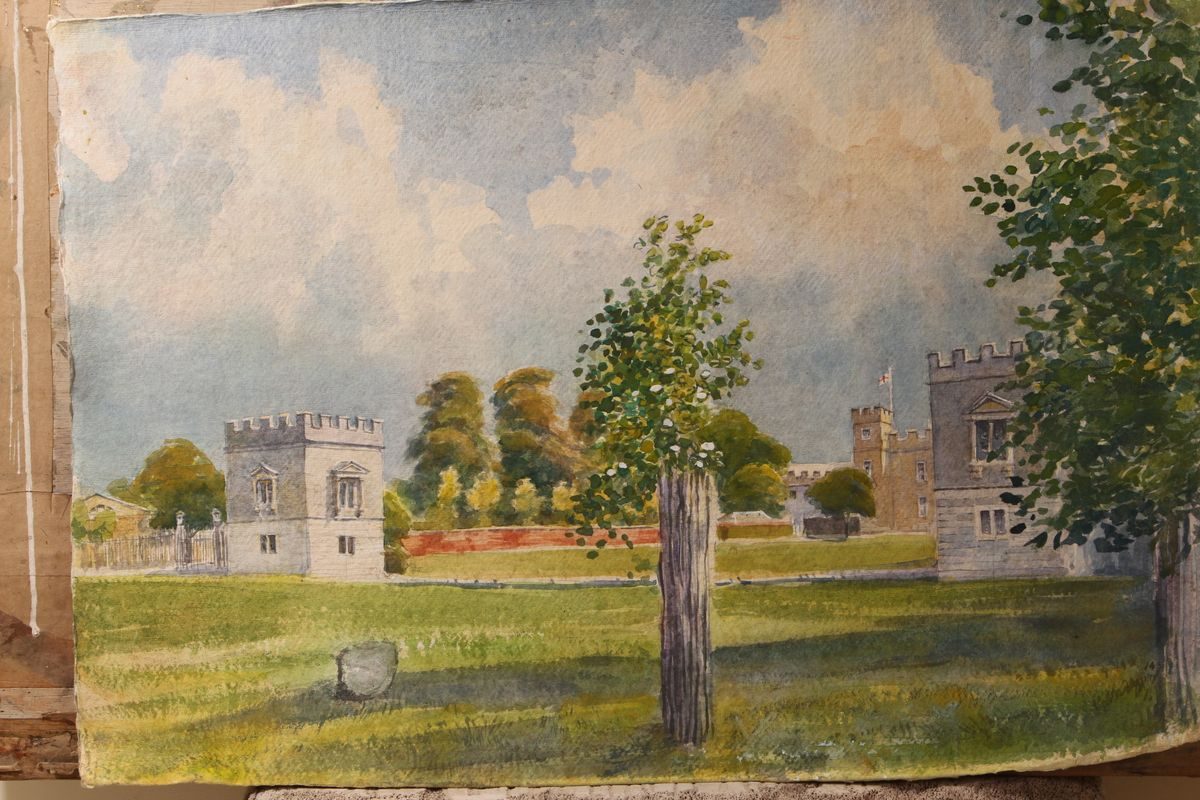
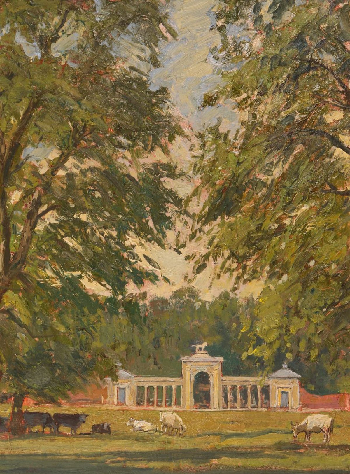
Syon Park is entered from Park Road at the south-west corner of the site. A tarmac road, which largely follows the line of one of a pair of avenues recorded on Fairchild's map of c 1739, leads through C20 wrought-iron gates, guarded to the east by a single-storey, early C19 porter's lodge (listed grade II), and continues north-east for c 700m before passing to the east the two early C17 battlemented lodge houses (listed grade I) built to guard the C17 entrance onto the Great Lime Avenue. North of the northern lodge the drive divides; the main drive continues north to the Garden Centre and car park, the branch to the east entering through wrought-iron gates into the oval forecourt to the west of Syon House. The drive from Park Road became the main entrance in the late C20 when the Lion Gate from London Road was permanently closed. The former main entrance is marked by a screen and entrance archway (listed grade I) designed by Robert Adam in 1769. This is a unified composition of two single-storey square lodges connected by a colonnaded screen and with a central arched gateway. The Archway, topped by a Northumberland lion, is hung with iron gates, the columns being filled in with railings of a similar style. The drive from the Lion Gate was made in the mid C18 and wound across the northern parkland, crossing Brown's lake before linking up with the Great Lime Avenue.
PRINCIPAL BUILDING
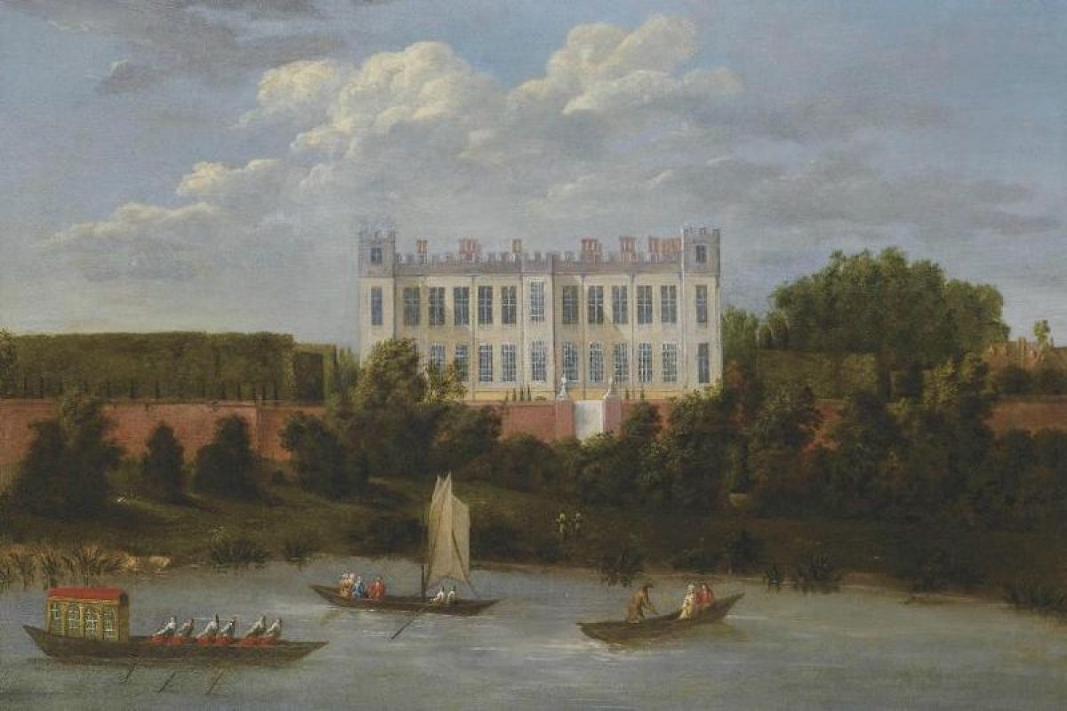
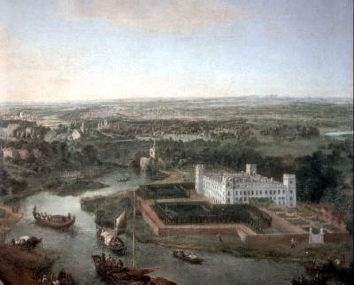
Syon House (listed grade I), a large three-storey, four-square, stone-faced, battlemented building with regular Georgian fenestration stands c 100m back from the main entrance drive, behind the forecourt lawn. Built on the remains of a Brigettine nunnery (1430-70), the mansion was substantially reconstructed between 1547 and 1552 by Protector Somerset, to its present shape. Along the east front, at ground level, is a plain open loggia by Inigo Jones (1573-1652) which probably dates from the time of the tenth Earl of Northumberland who died in 1668. The House was later remodelled inside and out by Robert Adam from 1762 onwards. The stone facing, probably by Thomas Cundy I, dates from 1816 to 1826 and the Percy Lion on the roof of the east range was transferred from Old Northumberland House at Charing Cross in 1874.
To the north-west of the House are the stables (listed grade II). Built c 1831 in yellow brick, the stables and the gothic clock tower are, like the adjoining C19 Riding School (listed grade II), now part of the Garden Centre.
GARDENS AND PLEASURE GROUNDS
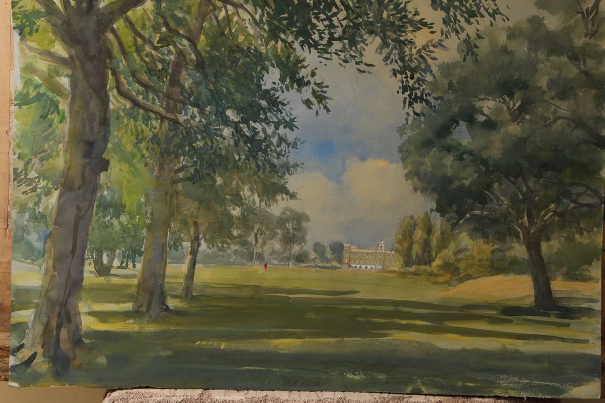
The main part of the pleasure grounds, occupying c 10ha, lie to the north and north-east of the House, with the Wilderness (c 7ha) to the south-west. The two areas are linked by the East Lawn.
The East Lawn extends east from the colonnaded east front of the House towards the River Thames. After c 100m the level ground is divided from the riverside tidal meadows by Lancelot Brown's ha-ha. This runs for more than 1km from the pleasure grounds in the north to a point c 100m to the north of the Pavilion at the southern end of the site. The East Lawn was until 1749 part of the formal gardens.
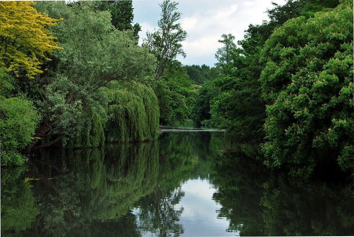
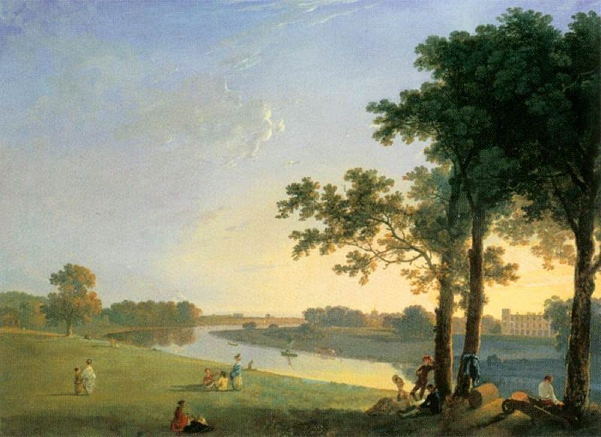
From the East Lawn a path leads north, passing to the west C18 laundry buildings and, after a further c 100m, veteran mulberry trees and C20 sports facilities to the east. The path then enters the informal woodland which lies to the south of the Serpentine River. The River, which runs for c 500m from west to east, was made by Lancelot Brown by 1764. Brown's bridge to the north was replaced as part of the 1974 Garden Festival. His second bridge, to the west, was removed and not replaced. The wooded area contains a number of fine trees including notable oaks, swamp cypresses, and copper beech. From the south bank of the Serpentine River there are views to the lawns and C20 shrubberies. The rising ground to the north of the water is largely laid to lawn decorated by C20 island beds and shrubberies, relicts from the 1974 Garden Festival when the ground was laid out as individual display areas. Flora's column (listed grade I) provides a focal point. This c 18m high late C18 Roman Doric column is topped by a statue of Flora (restored in the C20). Laid out on agricultural land (Tresswell, 1607; Glover, 1635), Brown's design for the area included not only the Serpentine River but also clumps and serpentine belts of trees forming generous spaces related to and looking across the Serpentine River to the wooded grounds, with discreet framed views going beyond to the tidal meadow on the north bank of the River Thames and across the Thames to Kew and Richmond on the south side. These views are now (2000) largely blocked by the informal woodland on the south bank of the Serpentine River.
To the south of the East Lawn is the Cedar Mound. Made in the mid C18 on the site of the triangular terrace, the Cedar Mound is thought to pre-date Brown's improvements (LUC 1991). The Mound has been periodically replanted with cedars, the latest phase being undertaken in 2000.
To the south-west of the Cedar Mound is the Wilderness. An elongated 7ha strip of land, enclosed between a mid C18 brick wall to the west and the ha-ha to the east, the Wilderness extends for c 500m towards the southern boundary. The line of the Wilderness has been truncated to the north by the mid C20 Rose Garden and to the south by the late C18 Pavilion (listed grade I). Designed by James Wyatt, the single-storey building once housed a boathouse. The Wilderness is largely laid to lawns decorated with varied, loose groups of specimen trees and retains the spirit if not the form of the C18 Wilderness. The formation of the area seems to have been achieved after 1739 (Fairchild) and before 1746 (Rocque). The layout is most clearly seen on Rocque's revised plan of 1762 and Sauthier (1787). Following the loss of elms in the formal walks and groves after the great frost of 1739 and the demolition of the formal gardens, there was a need for a suitably planted backdrop to the sweeping riverside lawns. The plan which emerged contained a serpentine walk passing through loose groves and more formal glades and leading to a flower garden/shrubbery at the southern limits where a formal chestnut avenue formed a channel to the tidal Thames. Accounts in C19 journals refer to the splendours of the South Walk leading to the rosery, oval pond, and the pineground as well as fine mature cedars (LUC 1991).
PARK
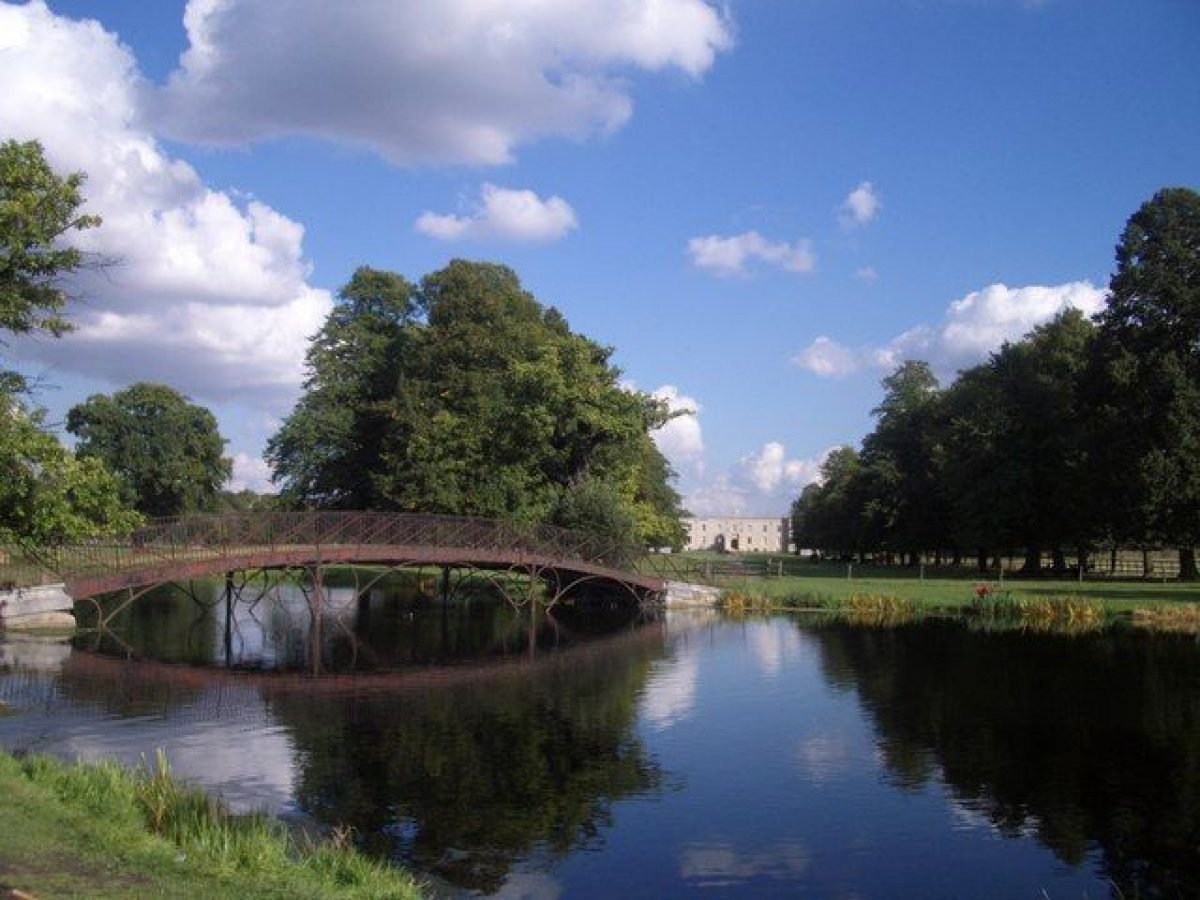
The c 26ha park lies to the west of the House and is bordered to the south and south-east by the main drive and the western boundary wall of the Wilderness, and to the west by London Road. The C20 Garden Centre provides the boundary to the north. Belts of trees grow along the south and west boundaries and clumps grow within the park. Many of the trees survive from C18/C19 plantings (LUC 1991). The park is dominated by Lancelot Brown's second (c 3ha) piece of water, with an iron bridge (listed grade II) designed by Charles Fowler c 1827, which replaced the original by Robert Adam.
The parkland took on its present shape in the mid C18; previously there was a series of fields and meadows. The area may have become parkland by 1700, coinciding with the laying out of Great Lime Avenue and other splayed rows of trees (Fairchild, c 1739). The extent of the early parkland was constrained until Syon Farm (to the west of the House) was demolished in the early 1760s and the road to Isleworth diverted. The OS plan of 1869 shows that some 100 years after Brown's intervention there were c 100 parkland trees.
KITCHEN GARDEN
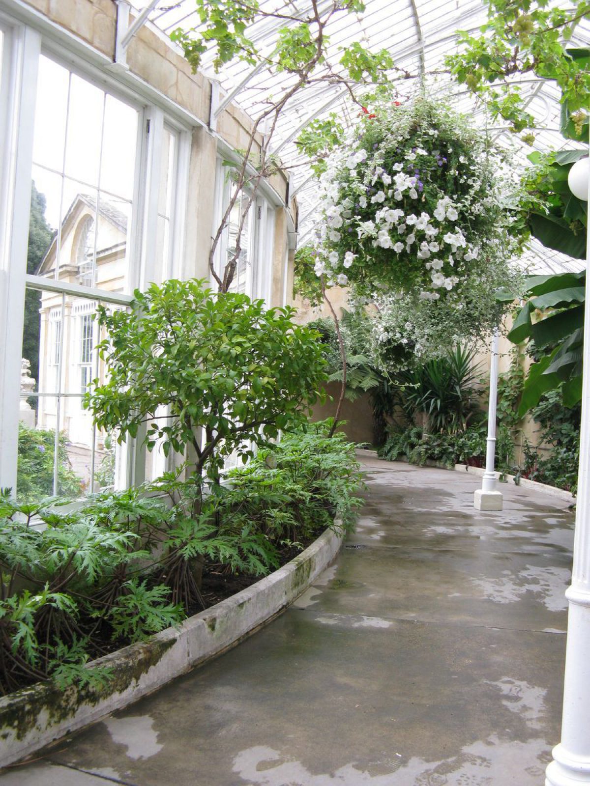
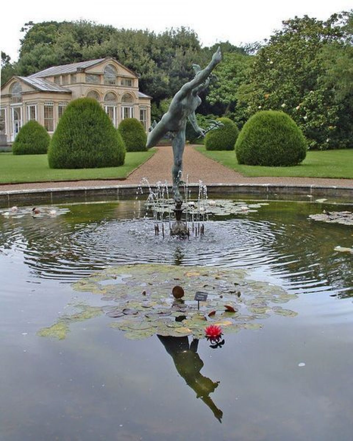
The main walled kitchen garden was situated to the north of London Road and has been subsumed under residential developments in the mid C20. The C19 Flower Garden survives however to the east of the stables and is enclosed within a high brick wall to the west and south, the laundry buildings to the south-east, and a wooden fence to east and north-east. The focal point of the garden is the Conservatory (listed grade I), built for the third Duke c 1827 and designed by Charles Fowler, with advice from Robert Forrest the head gardener. The domed centre is linked to end pavilions by curving glazed wings.
The Garden, which provides the setting for the Conservatory, is decorated with twelve carved Portland stone vases (listed grade II) reputed to be by Grinling Gibbons and a circular pool with a bronze statue of Mercury (listed grade II). The ground to the south of the Conservatory is laid to lawn, the flower beds which changed in shape and content over the 150 years since Robert Forrest designed them having been grassed over. To the south, set in the earthworks which form banks around the Flower Garden is a tunnel which gave access to the stable yard. The earthworks are further decorated with rockeries originally made by Robert Forrest.
OTHER LAND
Between the ha-ha to the east of the East Lawn and the river are the tidal meadows. Extending along the full 1.5km river frontage of Syon Park, the tidal meadows are partly grazed. The river front has an almost continuous band of self-seeded willows linking older clumps of poplar and swamp cypress and as a result, with the exception of the vista to and from the Royal Botanic Gardens, there is now little direct visual relationship to or across the River Thames.
REFERENCES
R and J Dodsley, London and its Environs Described 6, (1761), pp 7, 14
G J Aungier, History and Antiquities of Syon Monastery (1840), pp 120-2
Historical Survey and Landscape Management Strategy for Syon Park, (Land Use Consultants 1991)
Maps [all reproduced in LUC 1991]
Ralph Tresswell, Map of Isleworth, 1607
Moses Glover, Map of Isleworth and Syon, 1635
Fairchild, A plan of the grounds of Syon House, c 1739
J Rocque, Plan of the Cities of London and Westminster and Borough of Southwark, published 1746, revised 1762
C J Sauthier, Plan of Isleworth-Syon, 1786/7
W James and Thomas Chapman, Isleworth Enclosure Award Plan, 1818
Wm Thos Wayne, Survey of Syon House, surveyed 1813-14, corrected 1850
OS 25" to 1 mile:
1st edition published 1869
2nd edition published 1894
3rd edition published 1914
Description written: March 2000
Register Inspector: LCH
Edited: July 2001
- Visitor Access, Directions & Contacts
Telephone
020 8560 0882Website
https://www.syonpark.co.ukAccess contact details
The gardens are open: March - October, 10.30 to 17.00 (or dusk if earlier). November to February - weekends only, 10.30 - 16.00.
Directions
Off the A315/A310 junction.
Owners
Duke and Duchess of Northumberland
- History
The following is from the Register of Parks and Gardens of Special Historic Interest. For the most up-to-date Register entry, please visit the The National Heritage List for England (NHLE):
www.historicengland.org.uk/listing/the-list
HISTORIC DEVELOPMENT
Syon Monastery, founded in 1415, moved to the site of Syon Park in 1431. At the time of the Dissolution in 1539, when it became the property of the Crown, there were 30 acres (12.5ha) of garden and orchard within its walls. In 1547, the same year that Henry VIII died, the Duke of Somerset, Protector of the Realm, was granted the monastery and the estate. He built a new house with raised terraces, one of which was triangular. The intention of the design of the terraces was to give views out to the Thames but the plan was misconstrued and Somerset was accused of plotting against the Crown, the terrace being said to be the first step towards fortification. In 1552 he was charged with felony and executed.
In 1553 Syon House was presented to the recently created Duke of Northumberland, John Dudley. Northumberland, his son, and Lady Jane Grey were all executed when their attempt to make Lady Jane Queen of England failed. In 1594, Henry Percy, the ninth Earl of Northumberland was granted the lease of Syon and between 1604 and 1606 spent over £3000 on improvements which included the two lodges in front of the west lawn. The plan of Syon by Ralph Tresswell, made in 1607, shows the lodges, the formal walled gardens, and the triangular terrace. A very severe frost in the winter of 1739 followed by several very dry summers resulted in the loss of almost all the elm trees in the groves and walks at Syon. In 1748 Syon House was given to Sir Hugh Smithson by his father-in-law, the seventh Duke of Somerset. Smithson considered it to be ruinous and inconvenient and accounts for the year 1749 include £2620 for 'Repairs necessary to be done at Sion House'. It is thought that the terraces to the south of the House were removed at this time (LUC 1991). Two years later the earldom of Northumberland was recreated and granted to Sir Hugh. In the same year he inherited extensive estates including Syon and Alnwick (qv) and embarked upon a programme of work on the House and grounds at Syon. Lancelot Brown (1716-83) was commissioned to redesign and enlarge the gardens and the park in 1754, and in 1762 Robert Adam (1728-92) was employed to remodel the House. At around the time that the earldom was raised to dukedom in 1766 (Sir Hugh becoming the first Duke), the park to the west of the House was created and a second lake made. In 1769 Robert Adam designed a bridge for the new lake. Brown's account book records payments for Syon from the Duke of Northumberland continuing until the 1770s. Brown's improvements are recorded on a plan commissioned by the second Duke, who inherited to the title in 1786 (Sauthier, 1786/7).
The third Duke, who succeeded to the title in 1817, made a number of major improvements and it was he who opened the gardens to the public in 1837.
During the First World War the House was used as a military hospital and during the Second World War a number of incendiary devices were dropped onto the House and grounds. In 1962 the kitchen garden to the north was developed for housing and in 1964 the idea for a National Garden Centre at Syon was first considered. The project was confirmed in June 1965 as a joint venture by the tenth Duke of Northumberland and ICI. James Gardener was appointed designer. Works for the Garden Centre were undertaken between 1965 and 1968, these including conversion of the stable block for a new sales outlet, and the layout of new display gardens. The Garden Centre was opened by Queen Elizabeth, the Queen Mother on 12 June 1968.
A National Garden Festival was held at Syon in 1974 and major alterations were made to the northern pleasure grounds to accommodate display areas. Syon Park lost 114 trees during the great storms of 1987 and 1990.
The site continues (2000) in private ownership.
- Associated People
- Features & Designations
Designations
The National Heritage List for England: Register of Parks and Gardens
- Reference: GD1045
- Grade: I
Style
English Landscape Garden
Features
- Conservatory
- Icehouse
- Column
- Herbaceous Border
- Specimen Tree
- River
- Description: The River Thames provides the eastern boundary.
- Boundary Wall
- Description: Brick walls of 17th, 18th and 19th century dates mark the boundary to the north and west along much of London Road and Park Road.
- Mansion House (featured building)
- Description: The Tudor house was re-modelled in 1762.
- Earliest Date:
- Latest Date:
- Key Information
Type
Park
Purpose
Ornamental
Principal Building
Domestic / Residential
Survival
Extant
Hectares
80
Open to the public
Yes
Electoral Ward
Brentford
- References
References
- {English Heritage Register of Parks and Gardens of Special Historic Interest} (Swindon: English Heritage 2008) [on CD-ROM] Historic England Register of Parks and Gardens of Special Historic Interest
- Land Use Consultants {Syon Park Heritage Landscape Management Plan} (2011) Syon Park Heritage Landscape Management Plan
- {Syon Park Heritage Management Plan 2} (2011) Syon Park Heritage Management Plan 2
- Related Documents