Introduction
Audley End has an 18th-century landscape park and woodland, which has been partly returned to agriculture. The site covers approximately 240 hectares, with 40 hectares of parkland surrounding the house and five hectares of kitchen garden which was acquired for the nation in 1948. Other notable features include the 52-metre (170 feet) long vine house and Robert Adam's ornamental garden buildings.
Terrain
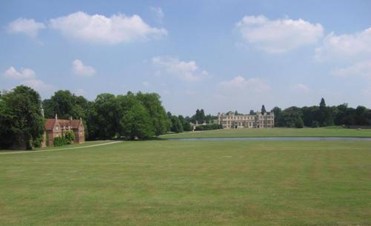
The ground at Audley End slopes down from east and west towards the winding course of the River Cam, which flows from south to north through the park. Audley End House stands c 300m to the east of the river, with rising ground further to the east.
The following is from the Register of Parks and Gardens of Special Historic Interest. For the most up-to-date Register entry, please visit The National Heritage List for England (NHLE):
A house of C17 origins beside a mid C19 parterre garden, with pleasure grounds by Richard Woods, surrounded by an C18 park conceived and partly laid out by Lancelot Brown between 1762 and 1767.
Location, Area, Boundaries, Landform and Setting
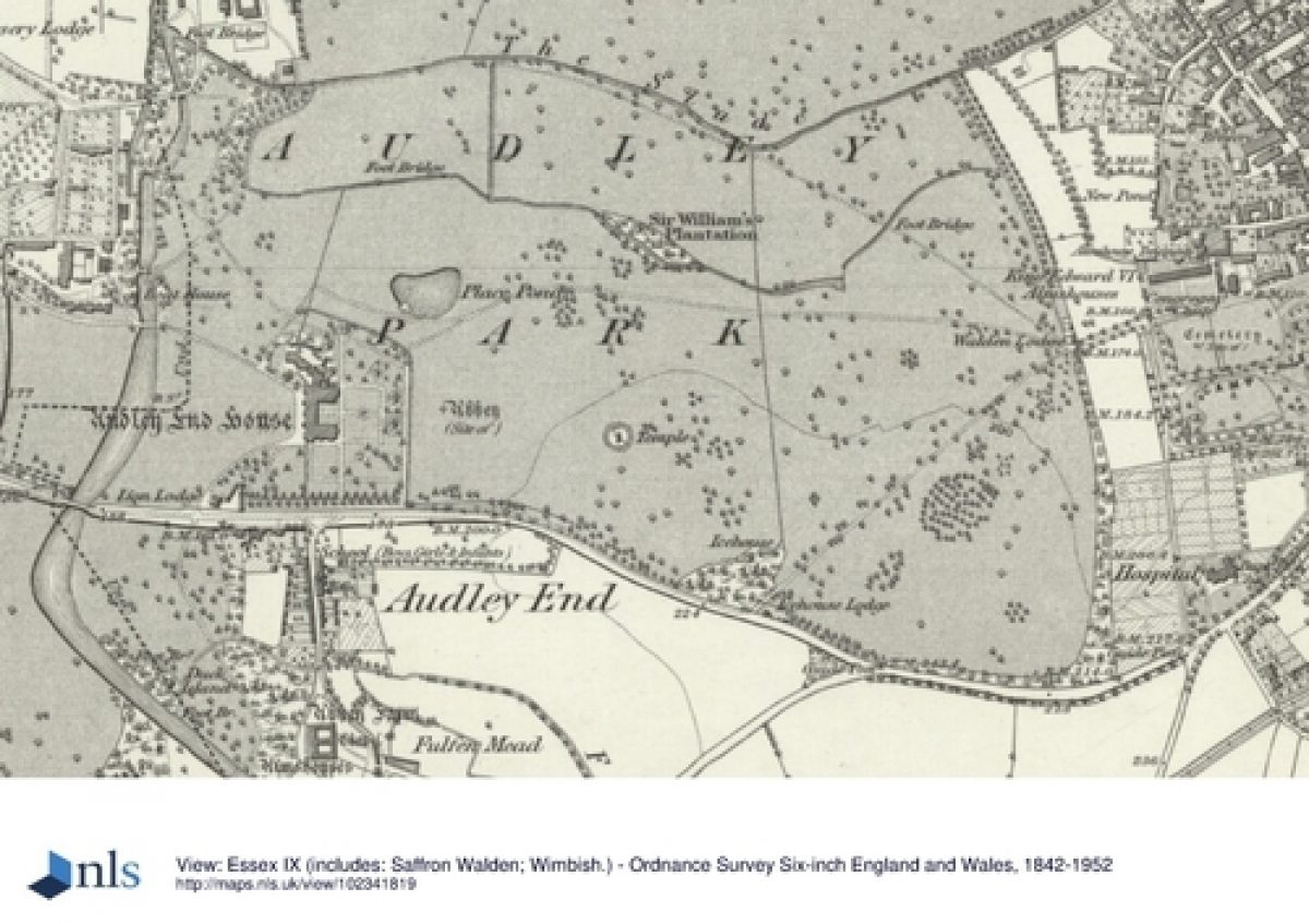
Audley End occupies a rural setting immediately to the west of the Essex town of Saffron Walden. The irregularly shaped c 240ha site is bounded to the north-east by Windmill Hill, to the east by properties on the edge of Saffron Walden, to the south partly by an early C17 wall (listed grade II*) along Audley End Road, and partly by the estate village of Audley End, the River Cam, and Gamages Wood. The boundaries to the west and north-west are formed by farmland. The village of Littlebury lies just beyond the north-west corner of the park. The ground at Audley End slopes down from east and west towards the winding course of the River Cam, which flows from south to north through the park. Audley End House stands c 300m to the east of the river, with rising ground further to the east. There are extensive views into and out of the site, particularly from the road which runs through the park to the west of the Cam.
Entrances and Approaches
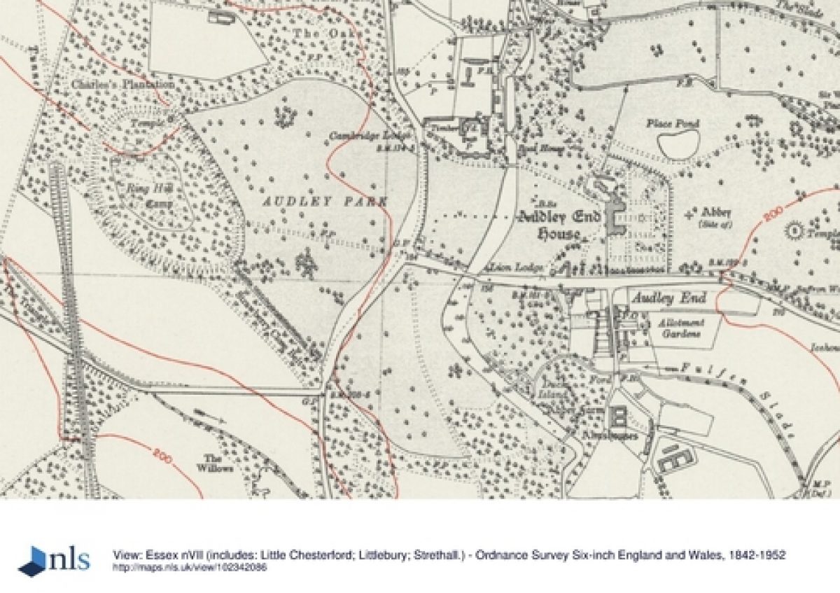
The main approach to Audley End enters the park c 150m to the south-west of the House via the Lion Gate (dated 1616, remodelled 1786, listed grade II*), built of plaster-rendered brick with a carved Coade stone lion over the central arch, standing beside the Lion Lodge (also known as Main Gate or Audley End Lodge). Lion Lodge (listed grade II), built of red brick with stone dressings in the Elizabethan style, was added in 1834 by Thomas Rickman.
The drive curves north-east to arrive at the west front of the House. A secondary drive enters the park c 400m to the north-west of the House. Gates and gate piers (listed grade II) stand on the London Road beside Cambridge Lodge (listed grade II) which was built of red brick in the Jacobean style in 1834 by Thomas Rickman. The drive runs east past the late C16 stables and crosses the River Cam via the Stable Bridge (listed grade II) to arrive at the west front.
There are several further lodges on the boundaries of the estate which are not connected to drives. They are Icehouse Lodge and gateway (mid C19, listed grade II) c 600m east-south-east of the House, Nursery Lodge (listed grade II) c 650m to the north-west of the House, Walden Lodge (C19, listed grade II) c 900m to the east-north-east of the House, Swan Lodge c 1.1km north-east of the House, the 'Tudor-style' Northend Lodge (mid C19, listed grade II) 1km to the north-north-west of the House, Gamages Lodge (listed grade II) c 850m south-south-west of the House, and London Lodge, c 400 west of Gamage's. Keeper's Lodge, c 1.35km west-south-west of the House on the westernmost edge of the park was estate cottages rather than a park lodge.
Principal Building
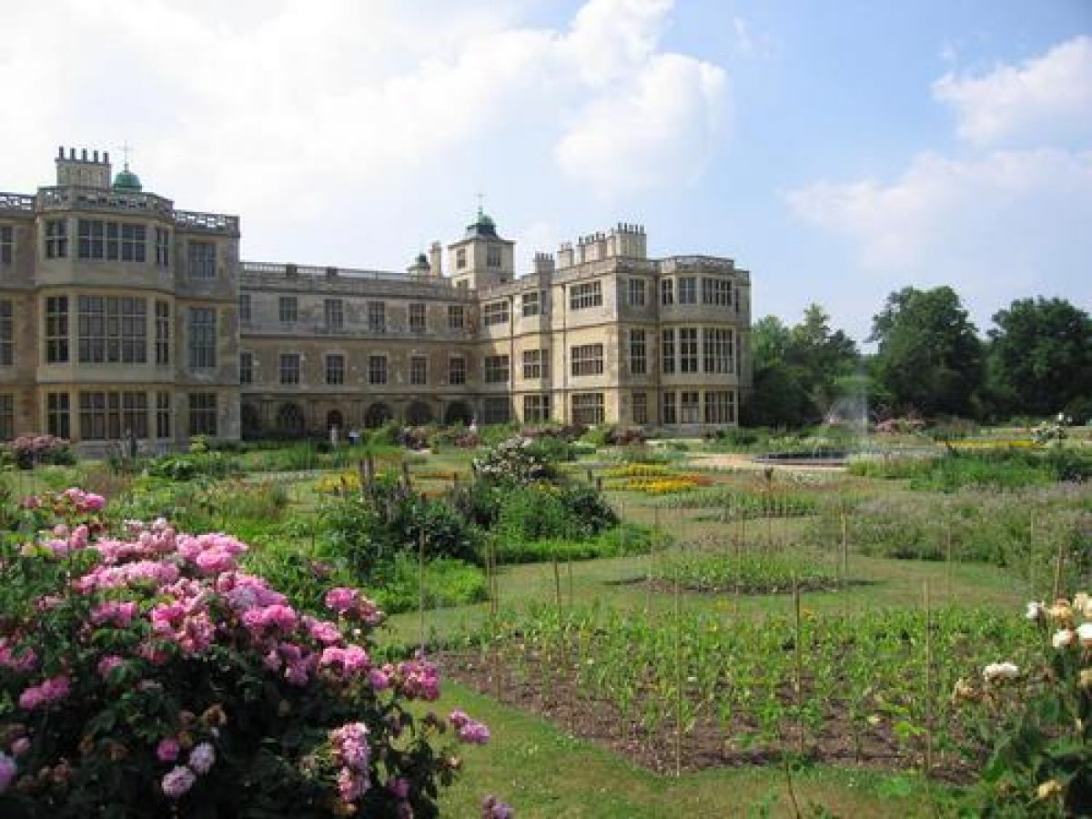
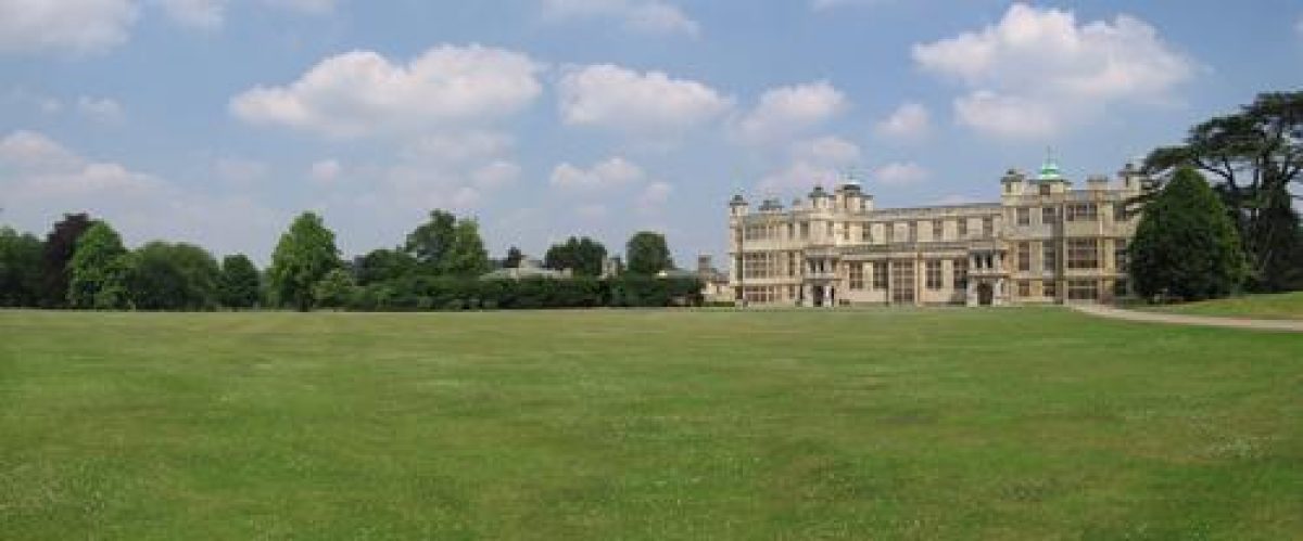
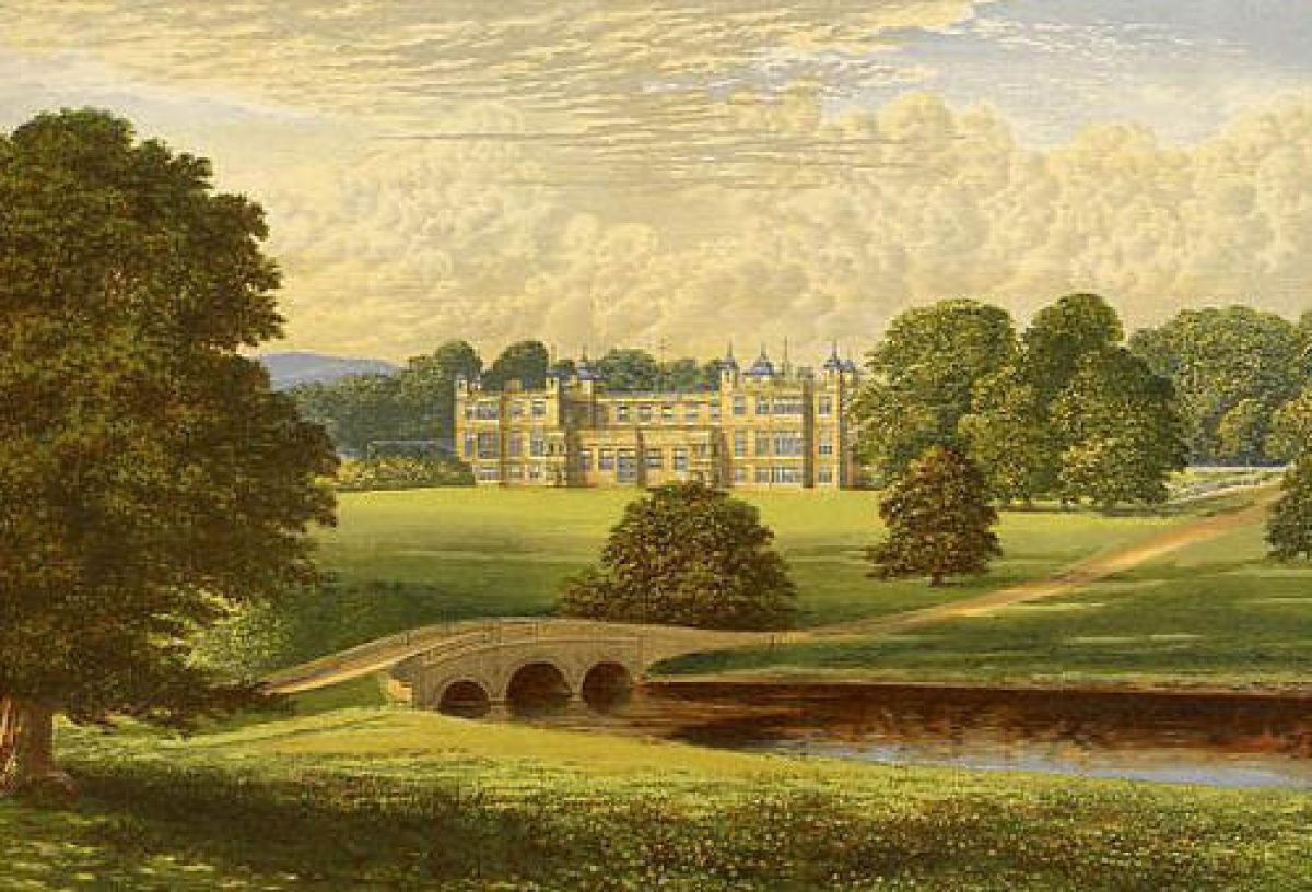
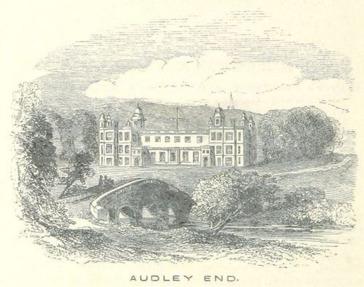
Audley End House (listed grade I) is part of a palatial country house of faced ashlar under lead roofs. It is built to a U-shaped plan in three storeys with mullioned windows and parapets to hide the roof line. It was first built between 1605 and 1614 by John Thorpe, Earl of Northampton with Bernard Janssen, mason, for Thomas Howard, first Earl of Suffolk. Reduced in size and remodelled on several occasions, particularly by Sir John Vanburgh in 1721 including demolition of the decaying outer court; by John Phillips and George Shakespeare in c 1752 including the demolition of the east wing and parts of the north and south wings for Lady Portsmouth; reconstruction and repair work in two phases from 1763 onwards for Sir John Griffin Griffin, including the addition of the kitchen court c 1762(87 and work by Robert Adam in the 1770s; and restoration work by Henry Harrison for the third Lord Braybrooke in c 1825(6.
The late C16 stable block (listed grade I) lies c 300m to the north-west of Audley End House. It is built of red brick and has gabled wings extending from the centre and the north and south ends of the range.
Gardens and Pleasure Grounds
The garden lies to the south and east of the House. It is enclosed to the north and east by a ha-ha (Lancelot Brown mid C18) and is bounded to the south by a high red-brick wall (listed grade II), part of which survives from the early C17 formal garden where the Mount Garden was situated. The Mount Garden was altered by Lancelot Brown in the mid C18 and was laid out in its present form of undulating lawns leading to paths through trees and shrubberies in the 1830s.
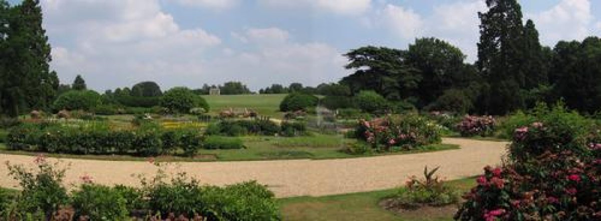
Below the east front is a complex flower parterre cut into a lawn, with central basin and fountain. The eastern boundary of the garden is formed by a raised walk (steps listed grade II) running alongside the ha-ha, which gives views back over the parterre and out into the park. The parterre garden stands on the site of the C17 bowling green, which was remodelled by Lancelot Brown in the C18 to create an informal flower garden. The parterre, which is based on an C18 pattern book, was started in c 1831 by the third Lord Braybrooke, who had received advice on its layout from William Sawrey Gilpin (guidebook 1995). It was restored by English Heritage in the 1980s.
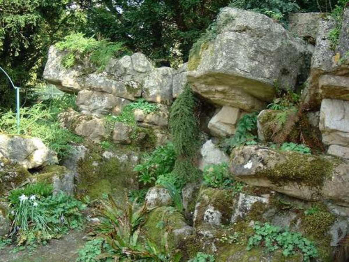
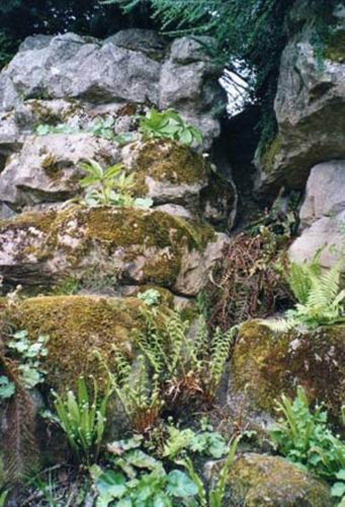
Two further garden areas lies detached from the House, c 350m to the north-west outside the east wall of the kitchen garden. Between the River Cam and the east wall of the kitchen garden lies the Pond Garden. Wrought-iron hoops clad with roses run beside a gravel path along the banks of the river overlooking small areas of lawn cut with flower beds. The Garden contains a rockery at its southern end and two square stone ponds, the Otter Pond and the Fish Pond, all of which were constructed by James Pulham and Son in the mid C19 for the sixth Lord Braybrooke.
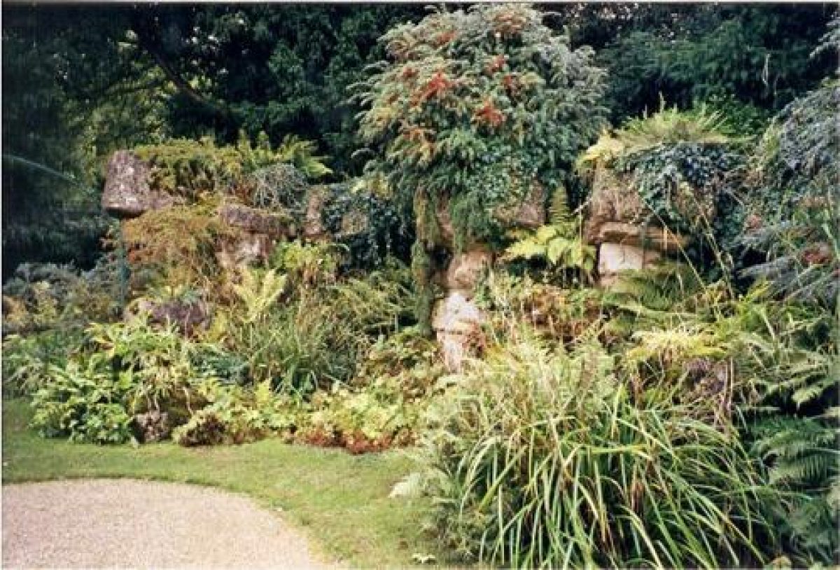
From the Pond Garden a footbridge over the River Cam leads east into the Elysian Garden, laid out as a walk on either side of the Cam. The bridge runs over the top of a cascade (Richard Woods 1770s) which drops the water of the Cam into a lower section on the north side of the bridge. The Elysian Garden runs up to the boundary of the park and where the Cam leaves the garden the river is crossed once again, at this point by the Palladian Tea Bridge (listed grade I), built of brick clad with ashlar stone in c 1780 by Robert Adam. This area was detailed in the early 1780s by Placido Columbani to a design by the Essex landscaper Richard Woods and featured elaborate gateways, temples, and statues along a walk decorated with flower beds. The Garden proved to be a frost trap however and the borders were grassed over in the 1830s when a number of the structures were demolished.
Park
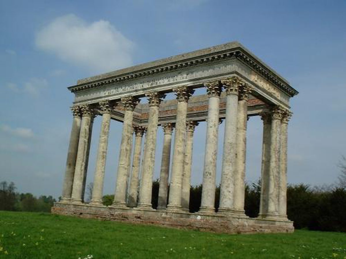
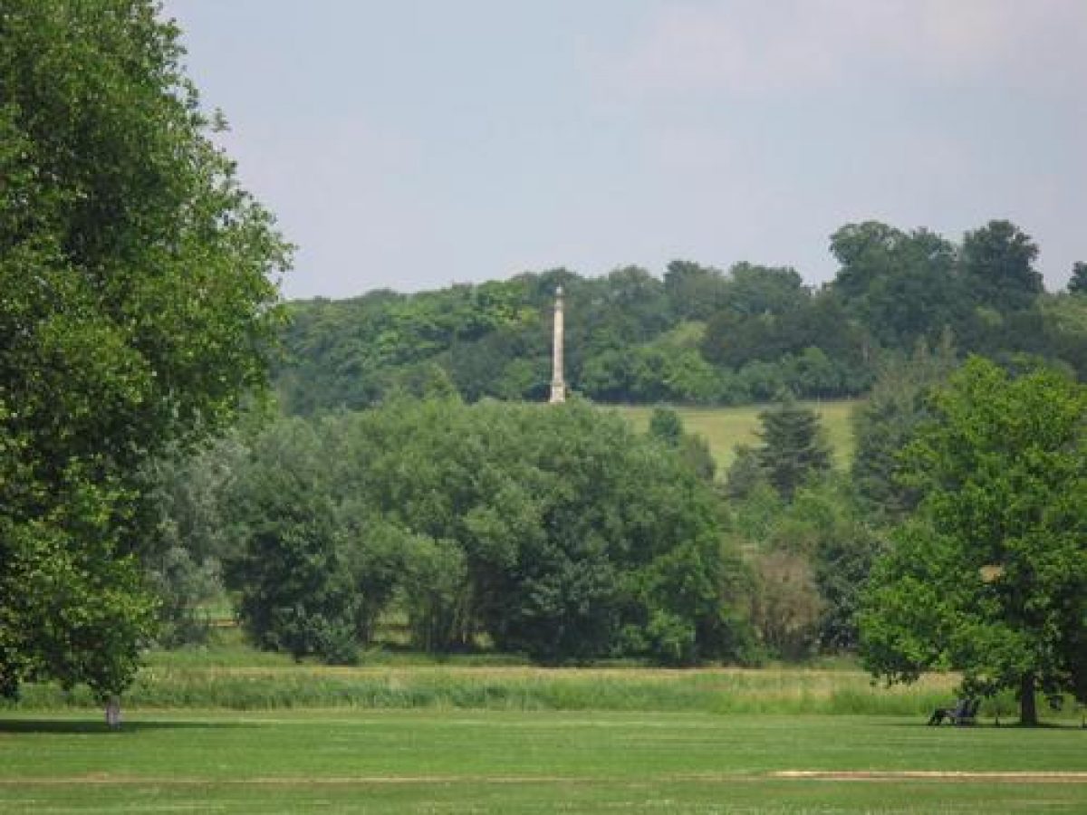
The park at Audley End extends to the west, south-west, east, and north-east of the House and is bounded by belts of trees. The north-east quarter is partly wooded and partly open and is currently (2000) used as a golf course. It contains an obelisk (listed grade II*) located c 800m north-north-east of the House, designed by Robert Adam in 1763 and erected in 1774 as an eyecatcher against Spring Wood. To the east of Audley End House is open parkland well scattered with mature trees. The brick, stone, and Coade Temple of Concord (listed grade II*) which stands c 400m east of the House was designed by R W Brettingham in 1790 in the open park conceived by Lancelot Brown some thirty years before.
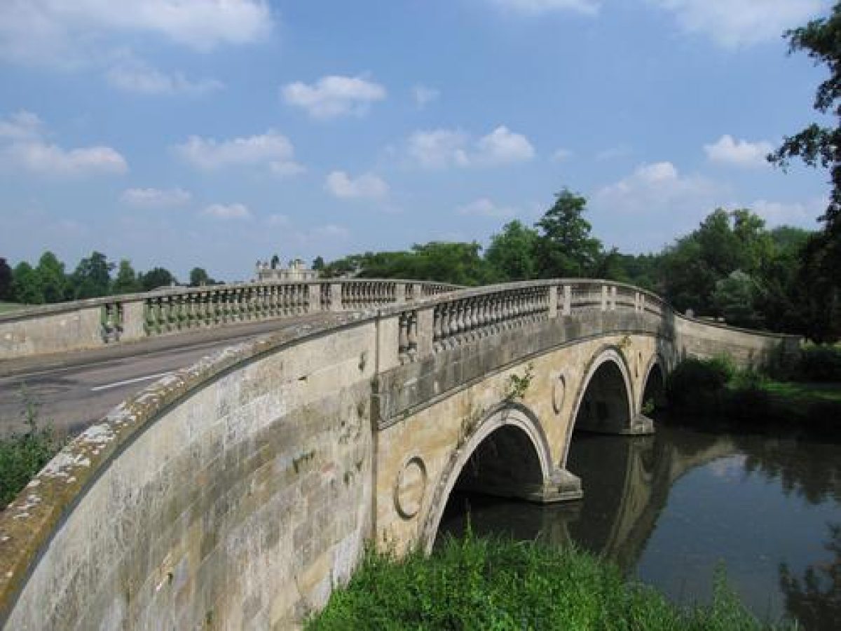
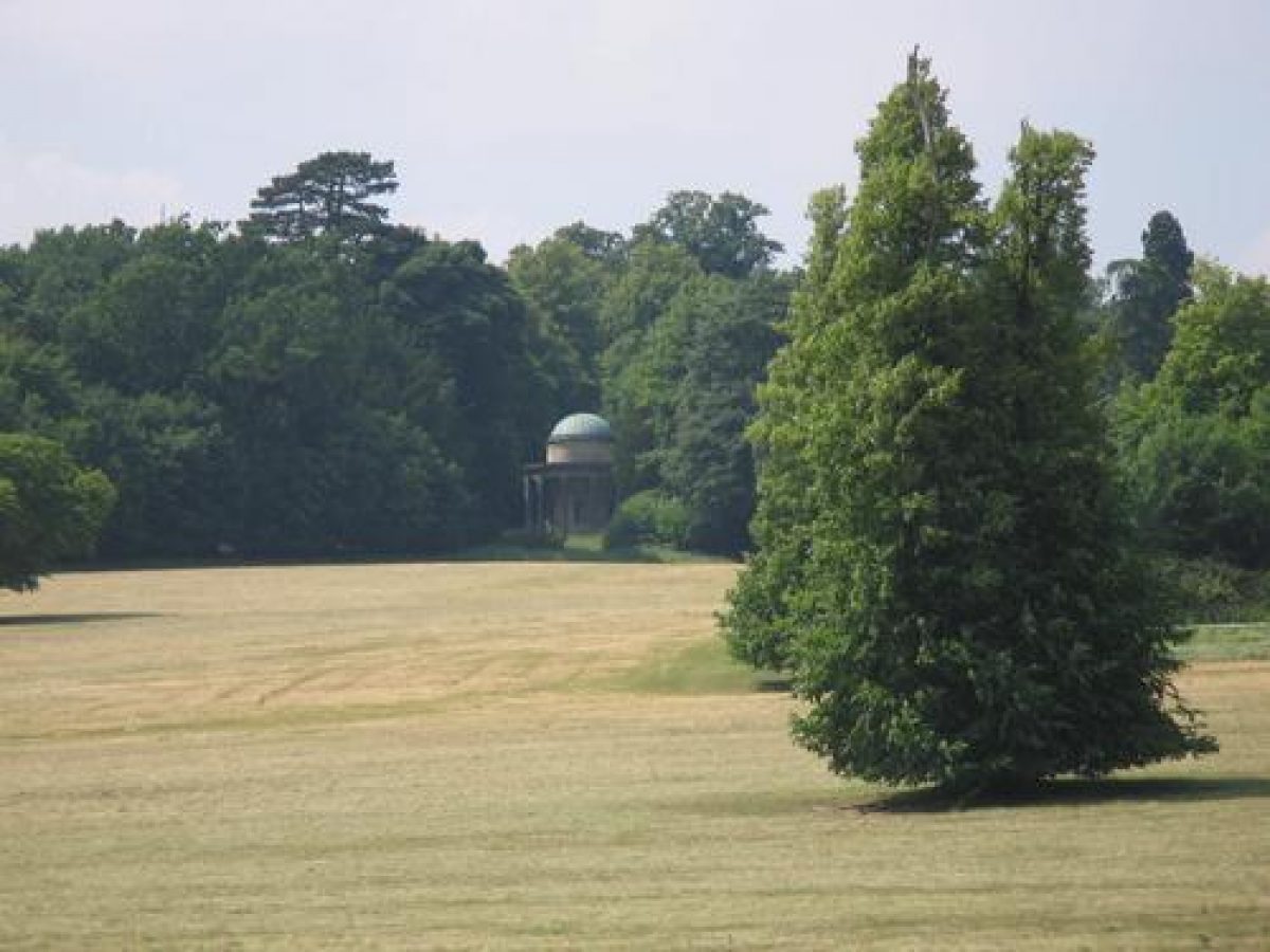
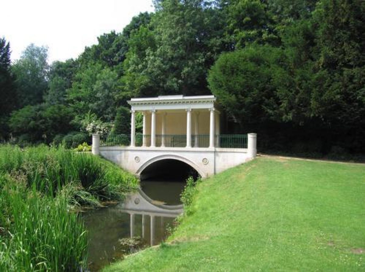
An open level lawn off the west front leads to the banks of the River Cam which was widened by Brown in the mid C18 to form a sinuous lake. It is crossed by a three-arch bridge (listed grade I) c 300m west-south-west of the House, designed by Robert Adam and erected in 1764 (altered in 1784). Beyond the Cam the west park, divided from the House by the London Road, rises up to Ring Hill, at the summit of which stands the Temple of Victory (listed grade II*), c 1km west-north-west of the House. It was built by Robert Adam in 1772 to complete Lancelot Brown's western prospect and gives fine panoramic views to the east. Ring Hill is flanked to north and south by woodland belts which flow down the slope of the park and help to focus the view.
South of the three-arch bridge, to the south-south-west of the House much of the park is covered by Gamage's Wood, the northern end of which contains a C20 miniature railway.
Kitchen Garden
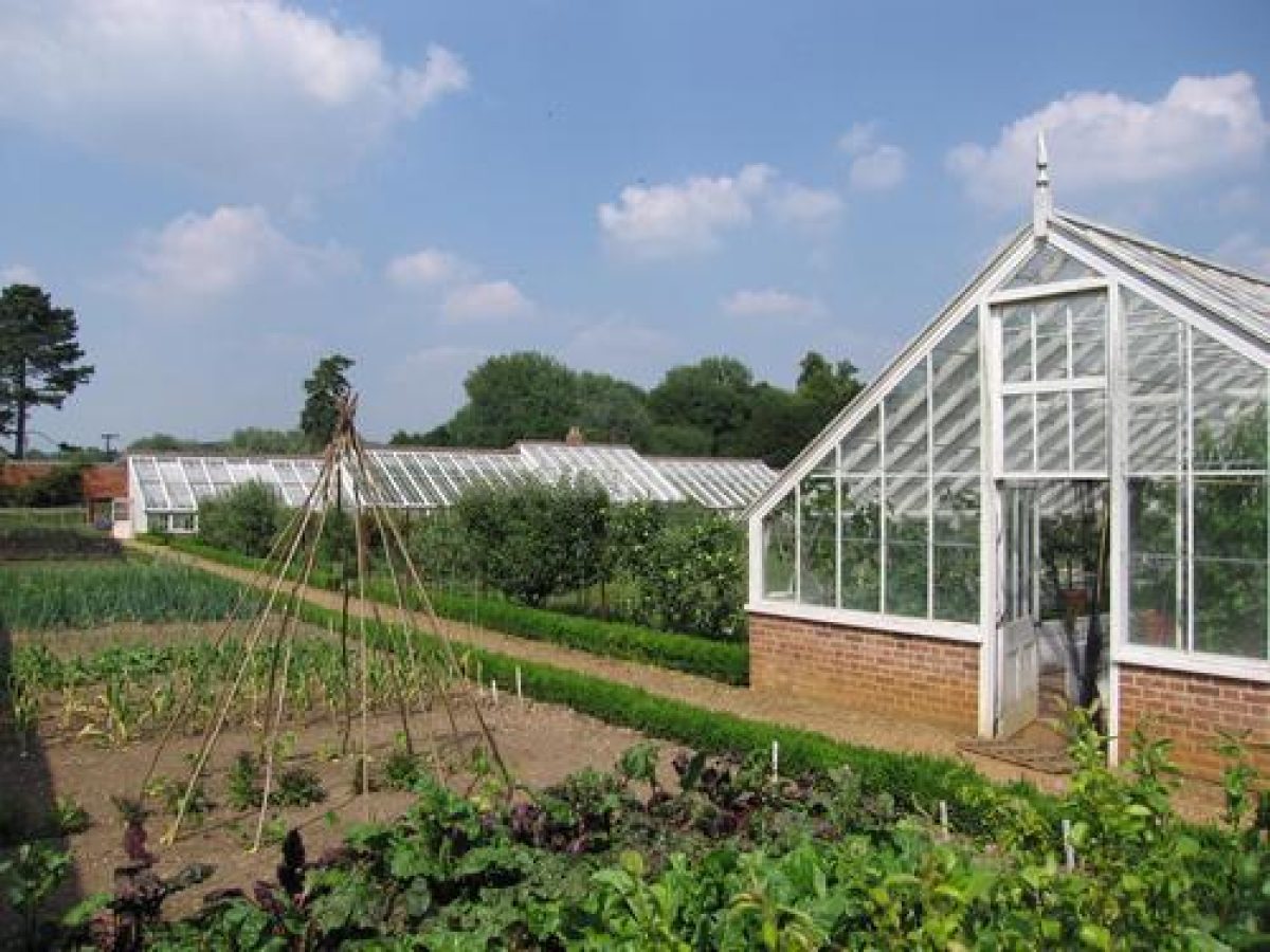
The walled kitchen garden lies c 350m to the north-west of Audley End House. It contains four enclosures and has partly been restored to its C19 form (2000). An early C19 vine house survives in one of the compartments. The walled gardens were established in the 1750s by the Countess of Portsmouth and extended in 1768 by Sir John Griffin Griffin who added glasshouses and an orangery. These were demolished in 1802 when the vine house was built.
References
- Country Life, 59 (19 June 1926), pp 872-9; (26 June 1926), pp 916-24; 60 (17 July 1926), pp 94-101; (24 July 1926), pp 128-36
- D Stroud, Capability Brown (1975), pp 113-14
- J Harris, The Artist and the Country House (1979), p 101
- N Pevsner and E Radcliffe, The Buildings of England: Essex (1979), pp 61-5
- Architectural History, (1980), pp 1-39
- Garden History XV, 1 (1987), pp 44-6
- M Sutherill, The Gardens of Audley End (1995) Audley End, guidebook, (English Heritage 1997)
Maps
- N Dubois (?), Scheme for alterations to house and garden at Audley End, c 1725 (DD/BY/P1), (Essex Record Office)
- C Bridgeman (?), Plan for Audley End, nd (Bodleian Library Gough Drawings A4 Fol 67R)
- E J Eyre, Plan of Audley End park, house and gardens, 1757 (private collection)
- T Warren, Survey of Audley End, 1783 (D/DQ/Y/8), (Essex Record Office)
- OS 6" to 1 mile:
- 1st edition published 1881
- 2nd edition published 1898
- OS 25" to 1 mile:
- 2nd edition published 1897
- 3rd edition published 1921
Archival items
- The Audley End archives, with many plans including those by Brown and Woods, are held in a private collection.
Description written: January 2001
Amended: April 2001
Register Inspector: EMP
Edited: September 2001
- Visitor Access, Directions & Contacts
Access contact details
The gardens are open Wednesdays to Sundays between February and October, and open weekends only in the winter months.
For more detailed visitor information visit the Audley End website.
- History
The following is from the Register of Parks and Gardens of Special Historic Interest. For the most up-to-date Register entry, please visit The National Heritage List for England (NHLE):
17th - 18th Century
Audley End was built between c 1605 and 1614, on the site of the abbey of Walden, for Thomas Howard, first Earl of Suffolk. His surveyor was Bernard Janssen and in 1614 Suffolk began to lay out extensive formal gardens. Following conviction for embezzlement however he suffered great financial trouble and his property declined. Suffolk died in 1626, leaving his son Theophilus to bear the twin burden of his debts and enormous maintenance costs. When James, the third Earl inherited in 1640 the situation had not improved and after the Restoration the house and some parkland were sold to Charles II in 1668.
Extensive works to the house were undertaken by Christopher Wren (1632-1723) but successive monarchs showed little interest in the property which in 1701 was returned to the Howards and settled on Henry, Earl of Bindon who assumed the title of sixth Earl of Suffolk in 1708. The sixth Earl commissioned Sir John Vanburgh (1664-1726) to make improvements which resulted in the demolition of part of the house, after which the property passed to Charles William Howard, seventh Earl who died in 1722 at the age of twenty-nine.
The estate was left to his younger uncle, Charles Howard, while the title passed to his elder uncle, Edward. When Edward died, Charles became the ninth Earl and in 1725 he commissioned a plan for a great formal garden by the French architect Dubois. A less ambitious landscape scheme was eventually implemented however, possibly to a design by Charles Bridgeman (d 1738). Charles Howard died in 1733 and was succeeded by his son Henry, the tenth Earl who made further changes to the house. Henry died childless in 1745 and the property was divided between four co-heirs. One of these, Elizabeth, Countess of Portsmouth purchased the house and part of the park in 1751 to add to her share, commissioning John Phillips and George Shakespear to demolish the east, and parts of the north and south wings.
Lady Portsmouth bequeathed her property to her nephew John Griffin Whitwell, who inherited in 1762 and assumed the name Griffin Griffin. Sir John, later Baron Braybrooke, carried out extensive reconstruction and repair work on the house from 1763 onwards, in the same year that he commissioned Lancelot Brown (1716-83) to landscape the grounds. Richard Woods also carried out work within the pleasure grounds for Sir John, in 1780. Braybrooke died in 1797 without heirs, so the estate and the title passed to Richard Aldworth Neville, son of the Countess of Portsmouth's heir.
19th - 20th Century
When his son Richard, the third Lord Braybrooke inherited in 1825, Henry Harrison was brought in to restore the house and William Sawrey Gilpin (1762-1843) to advise on the gardens, which in 1831 were laid out in a formal parterre. Richard died in 1858 and was succeeded by his eldest son Richard Cornwallis who survived his father by only three years. The fifth Lord, Richard's brother Charles, continued to maintain the property until his death in 1902 when he was succeeded by his younger brother, the Hon Rev Latimer Neville. When the seventh Lord Braybrooke died in 1941 the house was requisitioned for war use and in 1948 it passed to the State in lieu of death duties.
21st Century
It is now maintained by English Heritage. The site remains in divided ownership.
- Associated People
- Features & Designations
Designations
The National Heritage List for England: Register of Parks and Gardens
- Reference: GD1254
- Grade: I
Features
- Walk
- Garden Building
- Lake
- Parterre
- Earliest Date:
- Latest Date:
- Great House (featured building)
- Description: The house was built by Sir Thomas Audley having been given the lands of Walden Abbey by Henry VIII. The Abbey buildings were adapted and the house rebuilt between 1605 and 1614.The house was bought by Charles II in 1668 and subsequently sold to Sir John Griffin in 1745. A suite of Neo-Classical style rooms and a gothic chapel were added, designed by Robert Adam.
- Earliest Date:
- Latest Date:
- Temple
- Pulhamite
- Description: Pulhamite rock garden was created in 1867 by James Pulham (2).
- Earliest Date:
- Latest Date:
- Key Information
Type
Estate
Purpose
Ornamental
Principal Building
Heritage Site
Survival
Extant
Hectares
240
Open to the public
Yes
Civil Parish
Saffron Walden
- References
References
- {English Heritage Register of Parks and Gardens of Special Historic Interest} (Swindon: English Heritage 2008) [on CD-ROM] Historic England Register of Parks and Gardens of Special Historic Interest
- Stroud, D {Capability Brown} (1975) pp 113-114 Capability Brown
- Pevsner, N and Radcliffe, E {The Buildings of England: Essex} (Harmondsworth: Penguin, 1965) pp 61-65 The Buildings of England: Essex
- Hitching, C {Rock Landscapes: The Pulham Legacy} (Garden Art Press, 2012) Rock Landscapes: The Pulham Legacy
- Land Use Consultants {Audley End: landscape management report} (1993) Audley End: landscape management report
- Related Documents
-
CLS 1/322/2
The Landscape of Audley End - Digital copy
LUC - 1983
-
CLS 1/476
The Landscape of Audley End - Hard copy
Land Use Consultants - 1983
-
CLS 1/324
The Restoration of the Flower Garden at Audley End - Digital copy
LUC - 1988
-
CLS 1/477
The Restoration of the Flower Garden at Audley End - Hard copy
Land Use Consultants - 1988
-
CLS 1/322/2