Introduction
The 18th-century landscape park originally covered some 480 hectares. This land is now in divided use. There is a golf course, tennis grounds, cricket ground, and a public park with a lake. The lake is a survivor from the earlier landscape and is one of the largest in London. The park opened to the public in about 1914. Surviving part of an C18 park extended and re-landscaped by Lancelot Brown for the first Earl Spencer.
Terrain
The site slopes down to the lake from the north and south.
The following is from the Register of Parks and Gardens of Special Historic Interest. For the most up-to-date Register entry, please visit The National Heritage List for England (NHLE):
Location, Area, Boundaries, Landform and Setting
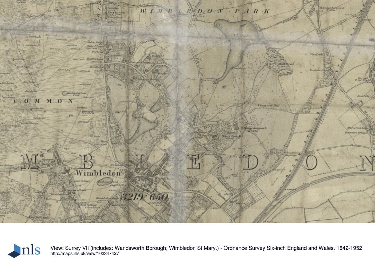
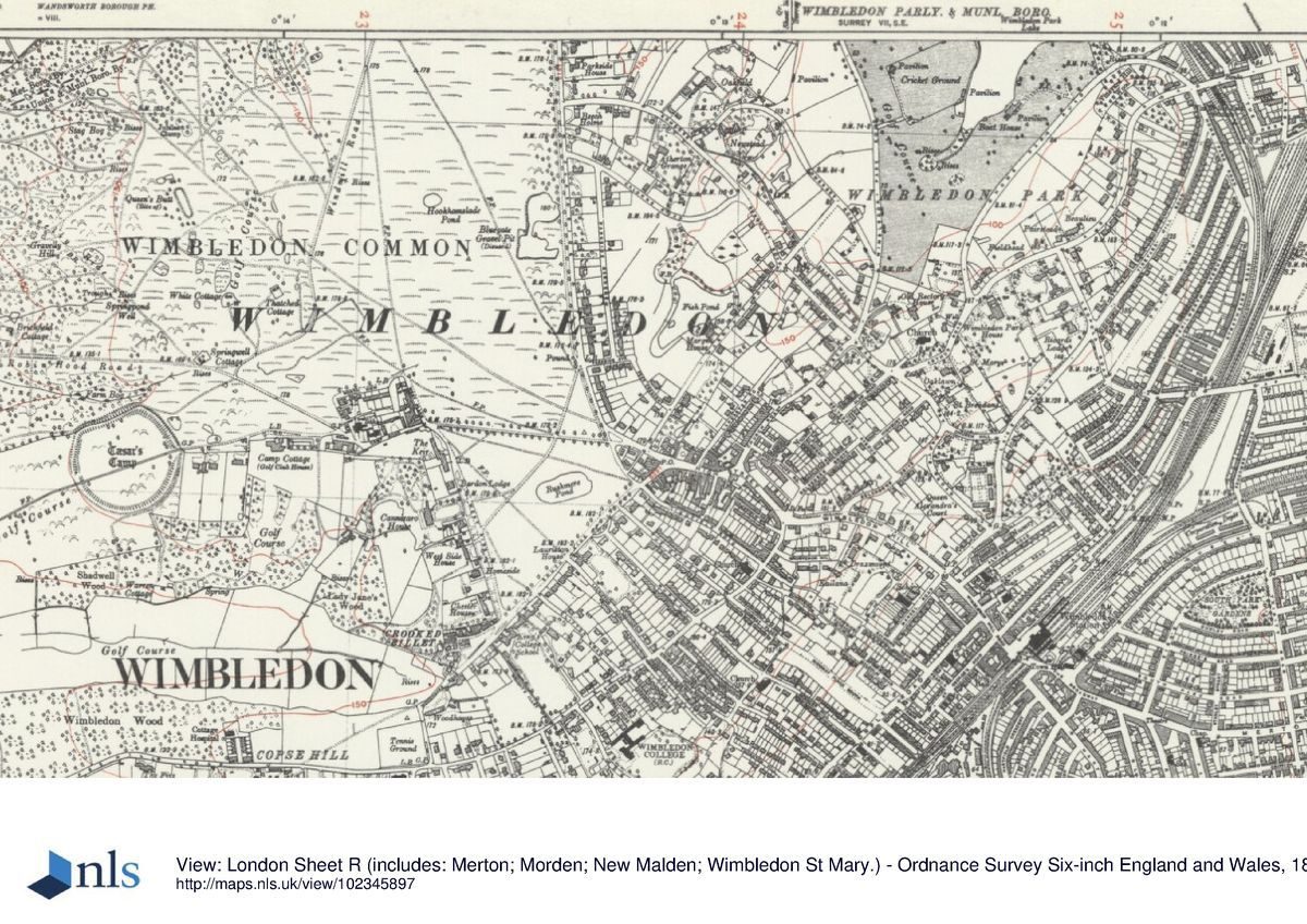
The remains of the C18 Wimbledon Park, which amount to c 60ha, are situated within the urban housing of south-west London and are bounded on the north-east by the railway line which runs between Wimbledon and Southfields, and on the south-east by Home Park Road. To the west is Church Road which was laid out on the line of the southern part of Park Road, shown on John Corris' map of 1787 as an estate road leading to the house from the new lodge on the Turnpike Road to London. To the north-west the boundary is the C19 Wimbledon Park Road which is shown on the same map as a 'Foot Road' leading from Wimbledon to Wandsworth. The All England Lawn Tennis Club ground lies immediately to the south-west and Wimbledon Common c 1km to the west. The site slopes down to the lake from the north and south.
Entrances and Approaches
The principal public entrance to the park is through late C20 iron gates from Wimbledon Park Road at the north end of the site.
Principal Building
Wimbledon Park House was situated on high ground to the south of the estate and commanded fine views over the parkland and lake to the north. The mansion is shown on the OS map of 1933, south of the junction of Arthur Road with Home Park Road and c 250m north-east of St Mary's church. Isolated from the park by late C19 development, Wimbledon Park House was demolished c 1949.
Park
Wimbledon Park is in divided usage: a major part, c 29ha, is a private golf course, c 19ha is a public park, and c 3ha a private sports club, the remaining 9ha being the lake. The main entrance to the public park from Wimbledon Park Road leads c 3m along an asphalt path before dividing. The perimeter path to the north crosses the site between Horse Close Wood to the north and open grass, football pitches, and Wimbledon Park Stadium (an athletics ground) to the south.
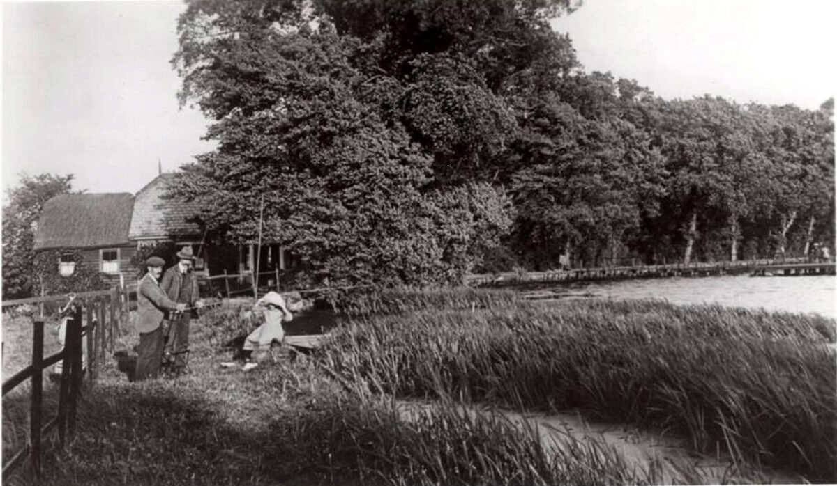
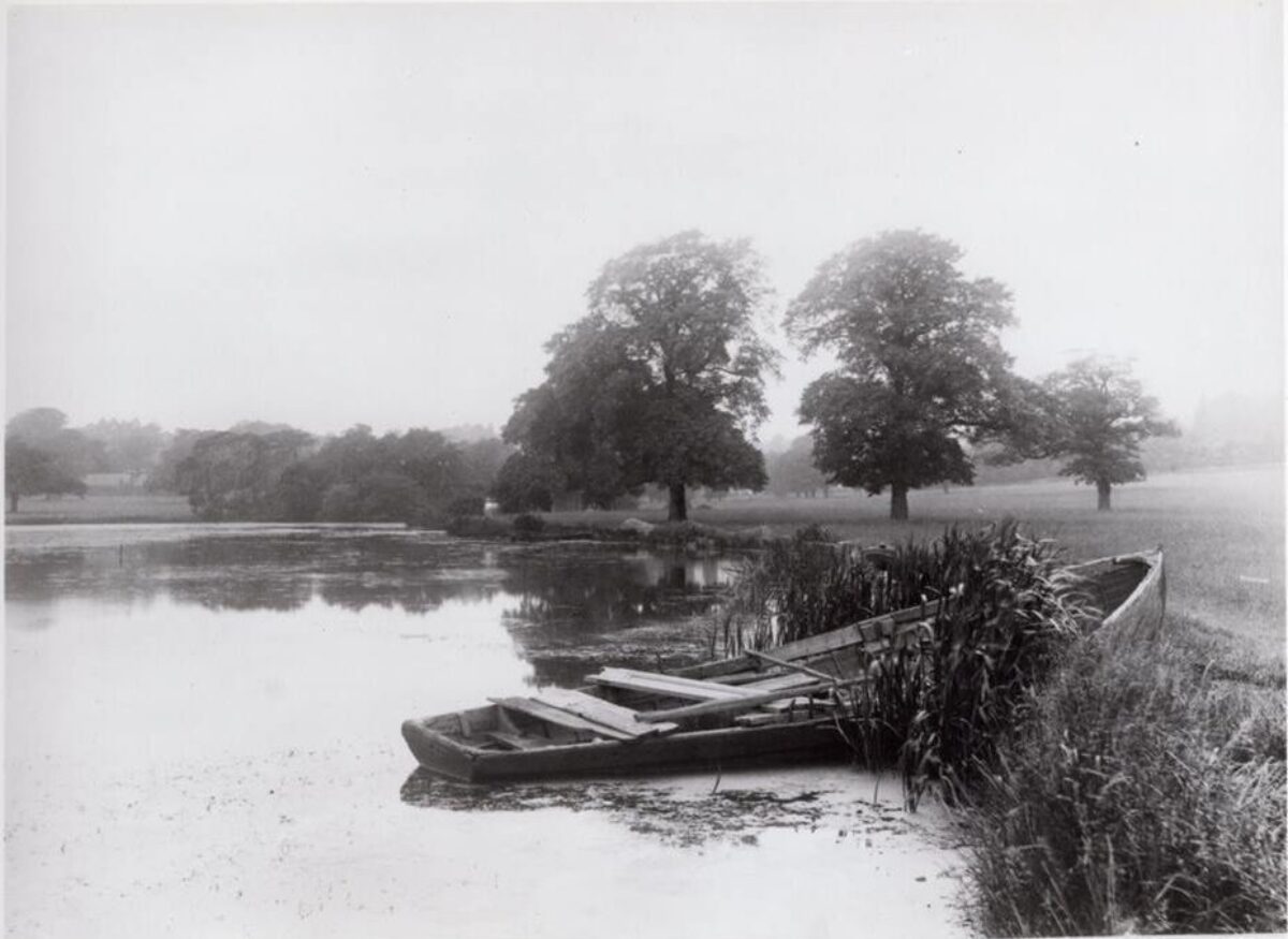
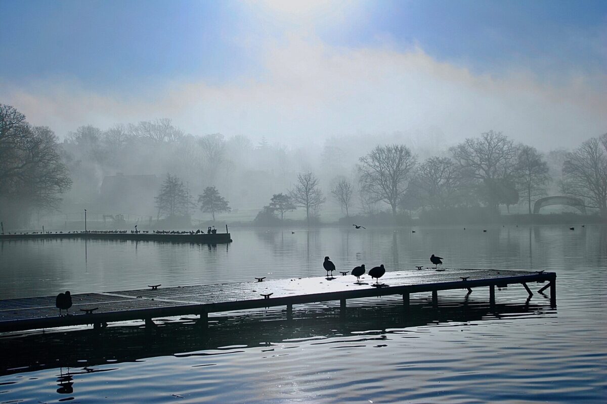
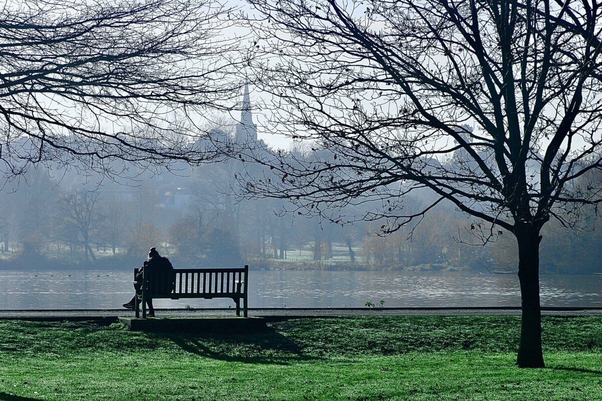
Horse Close Wood predates Lancelot Brown's improvements and is shown on a map of 1740, as well as John Corris' map of 1787, as a small rectangular piece of woodland to the north of the lake. The perimeter path continues east for c 300m where it turns sharply to the south-east and continues for 300m, running parallel to the railway line to the east. A C20 avenue of lime trees has been planted along this last stretch of the path. After 300m the path turns to the south-west and continues c 13m alongside the northern boundary of the C20 bowling greens before arriving at the side of the C18 lake. The lake was made as part of Brown's improvements for Earl Spencer in 1765-6. It was made by constructing a dam, the east bank of the lake, which held the water from two streams which originated at the edge of Wimbledon Common. The outflow runs underground for c 1.5km east to Dunsford Road where it follows the old boundary between the parishes of Wandsworth and Wimbledon, eventually flowing into the River Wandle at Earlsfield. To the south-east, in the grounds of the golf clubhouse, are the last remnants of Ashen Grove, an ancient wood that used to extend south over what is now Home Park Road. There are views south across the lake to the rising ground, the C19 St Mary's church, and the site of the C18 mansion.
The lake-side path divides at the lake, part continuing south-east, alongside the lake, passing the C20 buildings used variously as a Water Sports Centre, public conveniences, and a storage depot for the local authority. After c 15m the path turns east, away from the lake, the ground sloping down beside a small area of C20 landscaping to a large area set aside for a number of hard tennis courts and children's play facilities, before exiting from the site via a high-level stone balcony viewing point and the gate in Home Park Road. The second part of the lake-side path continues west along the lake until it reaches an iron fence which marks the boundary between the public park and the private golf course. Here it turns north-west along the rear of the stadium back into the park where after c 200m it meets up with the northern perimeter path.
The main entrance to the golf club is from Home Park Road; the principal views across the site from the adjoining private car park are of the lake. The occasional mature trees in this area are possibly survivors from the C18. The northern part of the golf course has numerous C20 plantings including evergreens, and bunkers dominate the scenery.
Some 3ha of land to the west of the lake was, by 1899 (OS), made into a cricket ground with a pavilion and other subsidiary buildings. The entrance to this area is from the southern end of Church Road, opposite the All England Lawn Tennis Club.
Maps
- J Rocque, Plan of London 1762 with new improvements 1766
- J Corris, Plan of Wimbledon and surrounding Parishes, 1787
- C and J Greenwood, Map of Surrey, 1825
- OS 6" to 1 mile:
- 2nd edition published 1897
- 3rd edition published 1920
- 1936 edition
- OS 25" to 1 mile: 1st edition published 1867
Description written: February 1998
Register Inspector: LCH
Edited: January 2002, February 2022
- Visitor Access, Directions & Contacts
Access contact details
This is a municipal park for general public use. It is open from 8am - dusk (weekdays); 9am - dusk (weekends/Bank Holidays).
More information about the park opening can be found by visiting the Friends of Wimbledon Park website.
Directions
The park can be accessed from the Wimbledon Park Road.
Owners
London Borough of Merton
Civic Centre, London Road, Morden, SM4 5DX
- History
The following is from the Register of Parks and Gardens of Special Historic Interest. For the most up-to-date Register entry, please visit the The National Heritage List for England (NHLE):
16th - 17th Century
The original Wimbledon House was built in the C16 and was extensively rebuilt and enlarged c 1588 for Sir Thomas Cecil; it was then known as Wimbledon Palace. The property was bought in 1639 by King Charles I for his Queen, Henrietta Maria, and remodelled in the 1640s by Inigo Jones and Nicholas Stone. The formal gardens beside the C17 house were designed by Andre Mollet, and John Evelyn advised in the later part of C17, and Charles Bridgeman (d 1738) was consulted in 1731-2.
18th Century
The C17 building was demolished in the early C18 and another begun for Sir Theodore Janssen after he purchased the estate in 1717. The estate, which included the unfinished mansion and 365 acres (152ha) of parkland, was purchased c 1723 by Sarah, Duchess of Marlborough, who had the unfinished building demolished.
In 1733, on the second attempt, the structure of her new house was completed. The Duchess died in 1744 leaving her considerable estate to her grandson, John Spencer, who died two years later leaving the Marlborough inheritance to his son John, a boy of twelve. When young John Spencer came of age in 1755 he was the biggest landowner in Surrey. His position was recognised by the king who first made him a Viscount and then, in 1765, an Earl.
In 1761 Spencer took a close interest in his estates and planned to make improvements to the gardens at Wimbledon which included ornamenting the canal with a grand stone bridge, an exact replica of the Ponte Rialto in Venice; the bridge does not appear to have been built.
From 1765 Lancelot Brown (1716-83) was commissioned to prepare a design for landscaping the park which lay north of the house (Stroud 1975). The grounds, by this time enlarged to 480ha, extended around Brown's 12ha lake.
Between 1799 and 1802 Earl Spencer had Wimbledon House rebuilt, the architect being Henry Holland (1745-1806).
19th Century
During the 1870s much of the park was sold for housing development.
20th - 21st Century
The mansion became separated from the park by urban development and was eventually demolished in 1949. In the later part of the C19 the London and South Western railway line between Wimbledon and Wandsworth cut across the east side of the estate and a cricket ground was made to the west of the lake. The northern part of the park, including the lake, was purchased by the then Borough of Wimbledon in 1914 and made into a public open space. At about the same time a private golf course was laid out over a major part of the remainder of the site and c 1930 the All England Lawn Tennis Club was established on land to the west of Church Road. The mid C20 division of the site remains the same in 1998.
- Merton Council owns the public park and the lake.
- The All England Lawn Tennis Club (AELTC) owns the golf course land, which was leased to Wimbledon Park Golf Club, but the lease has now been acquired by AELTC.
- The Wimbledon Club owns and occupies land on the west side of the lake.
- The Friends of Wimbledon Park was formed in 2012
Period
18th Century (1701 to 1800)
- Associated People
- Features & Designations
Designations
Conservation Area
- Reference: Wimbledon North
The National Heritage List for England: Register of Parks and Gardens
- Reference: GD1848
- Grade: II*
Site of Local Importance for Nature Conservation
Features
- Lake
- Tennis Lawn
- Description: All England Lawn Tennis Ground
- Rockery
- Pavilion
- Bowling Green
- Pool
- Entrance
- Description: principal public entrance
- House (featured building)
- Description: Wimbledon Park House was situated on high ground
- Recreation ground
- Description: Wimbledon Park is in divided usage a private golf course
- Woodland
- Description: Horse Close Wood predates Lancelot Brown's improvements
- Dam
- Description: constructing a dam, the east bank of the lake, which held the water from two streams
- lake-side path
- Description: lake-side path divides at the lake
- Key Information
Type
Park
Purpose
Recreational/sport
Principal Building
Parks, Gardens And Urban Spaces
Period
18th Century (1701 to 1800)
Survival
Extant
Hectares
60
Open to the public
Yes
Electoral Ward
Wimbledon Park
- References
References
- Stroud, D {Capability Brown} (1965) p 121 Capability Brown (Country Life article)
- {English Heritage Register of Parks and Gardens of SPecial Historic Interest} (Swindon: English Heritage 2008) [on CD-ROM] Historic England Register of Parks and Gardens of Special Historic Interest
- Harris, J {The Artist and the Country House} (London: Russell Chambers, 1979) 102 The Artist and the Country House
- Malden, H.E. {Victoria County History: Surrey, Volume 4} (Archibald Constable, 1912) 122-3 Victoria County History: Surrey, Volume 4
- {Wimbledon Park Restoration, development and management plans} (1997) Wimbledon Park Restoration, development and management plans
- 105 (18 March 1949), p 615; 132 (2 August 1962), pp 248-50 Country Life, 105
- Willis, P., (1977), pp 58-9, 159, 184 Charles Bridgeman and the English Landscape Garden
- Milward, R., (1986), pp 41-7 A Georgian Village, Wimbledon 1724-1765
- Matthews, T., Vol. 18, (2013-14), 91-9 ''Capability' Brown in Wimbledon, Roehampton and Putney: A Review of Five Commissions' in The London Gardener