
Introduction
Wallington has landscaped pleasure grounds and a park covering some 45 hectares. Other features include the East and West woods. Formal landscape laid out 1729-77, incorporating wooded pleasure grounds, park, and improvement landscape developed by Sir Walter and Lady Elizabeth Blackett.
Terrain
The parkland and pleasure grounds are ranged east and west of the main axis, on the south-facing slopes of the Wansbeck valley.
The following is from the Register of Parks and Gardens of Special Historic Interest. For the most up-to-date Register entry, please visit The National Heritage List for England (NHLE):
Location, Area, Boundaries, Landform and Setting
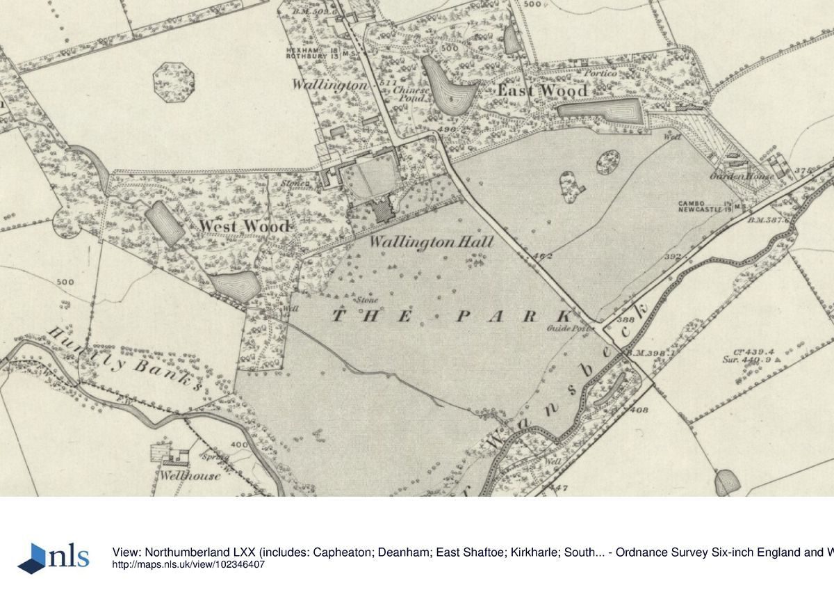
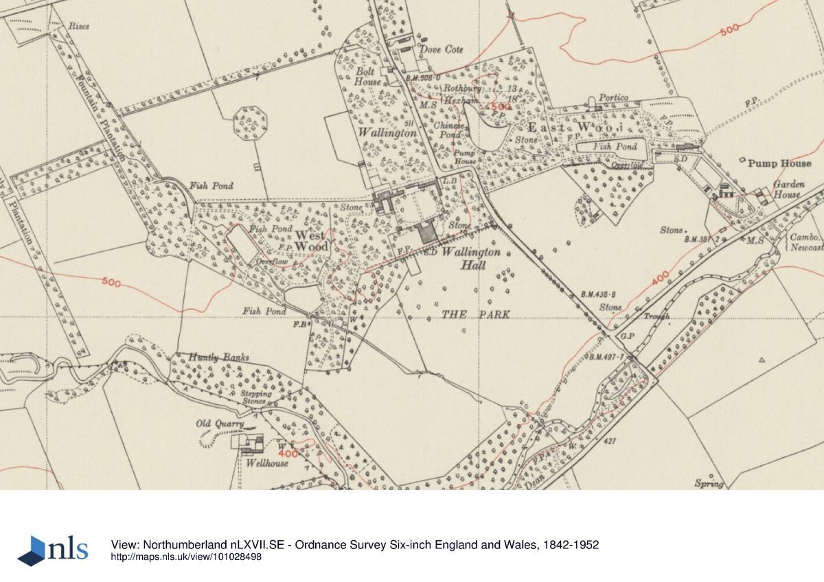
Wallington lies 19 km west of Morpeth, along the B6343 and 1.5 km south of Cambo village. The B6342, Hexham to Cragside road runs north-west to south-east through the registered area, and effectively divides it in two. Leading directly south-eastwards from Cambo to the north-east corner of the boundary wall of Wallington Courtyard, it then turns a sharp dog-leg to the east and once more leads south-eastwards, passing 140 m away from the east front of the Hall. Leading 450 m downhill to the River Wansbeck, the road crosses by Paine's Bridge, before turning at right angles, westwards, to lead either through Wallington Dean to Little Harle (qv Kirkharle), or southwards to Rothbury.
The 125 ha parkland and pleasure grounds are ranged east and west of this main axis, on the south-facing slopes of the Wansbeck valley. The registered area includes the west parks, regular enclosure fields delimited on their west side by a tributary of the River Wansbeck and, to the east, the enclosures south of Prior Hall.
Rothley Park, 6 km to the north-east, lies outside the area here registered. Its major contribution to Wallington Park is in contributing views of Rothley Castle, located within Rothley Park.
Entrances and Approaches
The principal approach leads south along the North Avenue, which also forms the public road (B6342) from Cambo. Some 320m north of Wallington Courtyard, a drive (C19) leads off westwards then, turning southwards through North Wood, leads up to the Clock Tower Gate, which forms the main entrance, set centrally on the north side of the Courtyard. Visitor parking, laid out by the National Trust (mid-late C20), lies within North Wood to either side of the drive. Gate piers and a screen wall (mid C18, listed grade II) originally marked the drive entrance off the main road but in 1963 were moved further southwards. They now sit 180m to the north of Wallington Courtyard.
Previous to 1963 the principal entrance (created 1740) led off the public road directly to the north-east of the Hall, arriving at a turning circle on the east front. The mid C18 gate piers and screen wall (listed grade II) still mark this entrance, on the route to East Wood.
Principal Building(s)
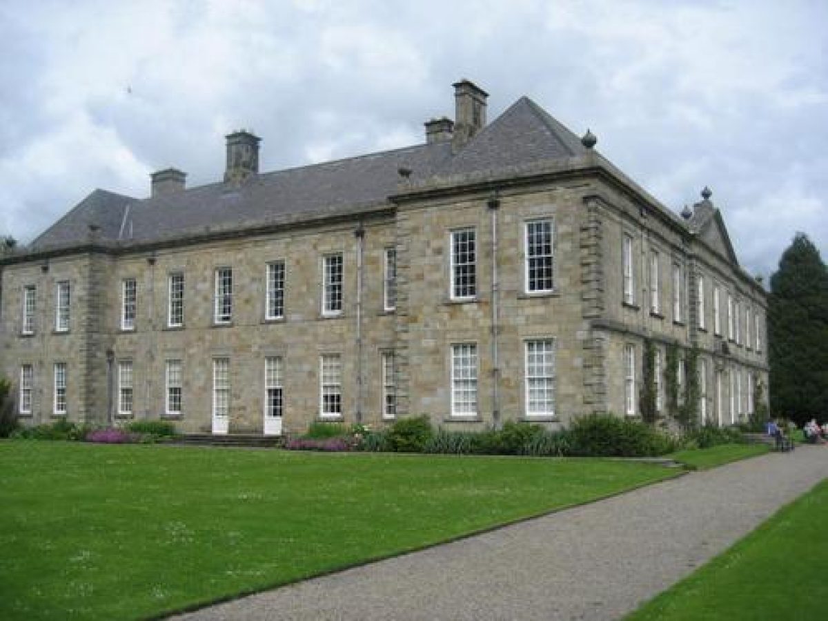
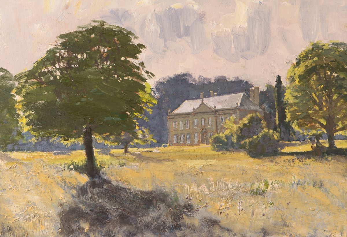
Wallington Hall (1688, listed grade I) incorporates the basement of the old Fenwick Castle in the cellars. It was extensively remodelled by Daniel Garrett between 1735 and 1745, who reconstructed the south front, rebuilt the roof, refenestrated the whole house, and built a new entrance front.
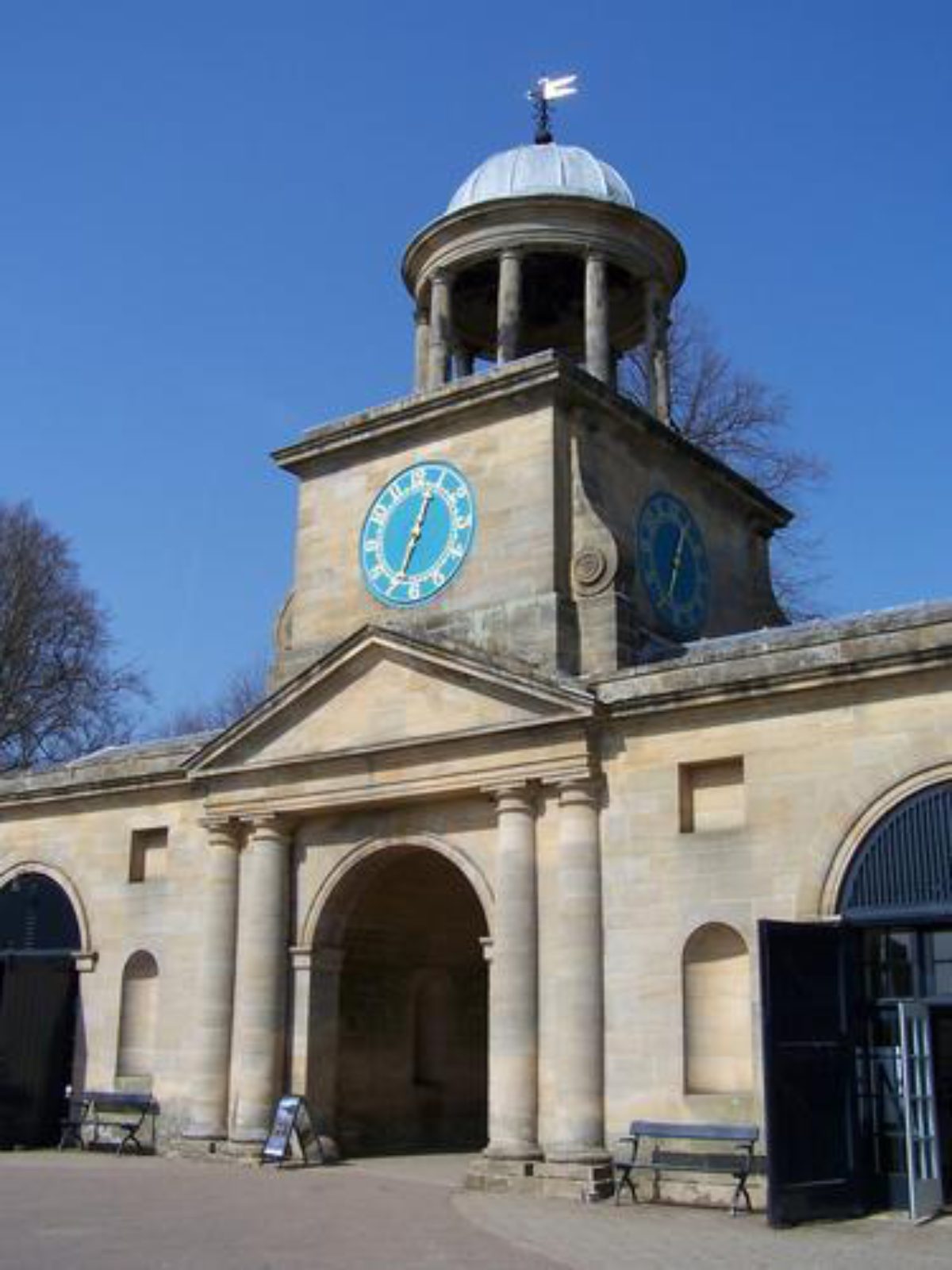
Wallington Courtyard is situated directly adjacent, and to the north of, the Hall, separated from it by a screen wall and gate piers (mid C18, listed grade II). The Stable Courts form the north-west and north-east ranges of the Courtyard (both mid C18, listed grade II*) and lie to either side of the central Clock Tower Gate (Garrett 1754, listed grade I). The latter was originally designed as a chapel, replacing The Arches (see Park below).
Gardens and Pleasure Grounds
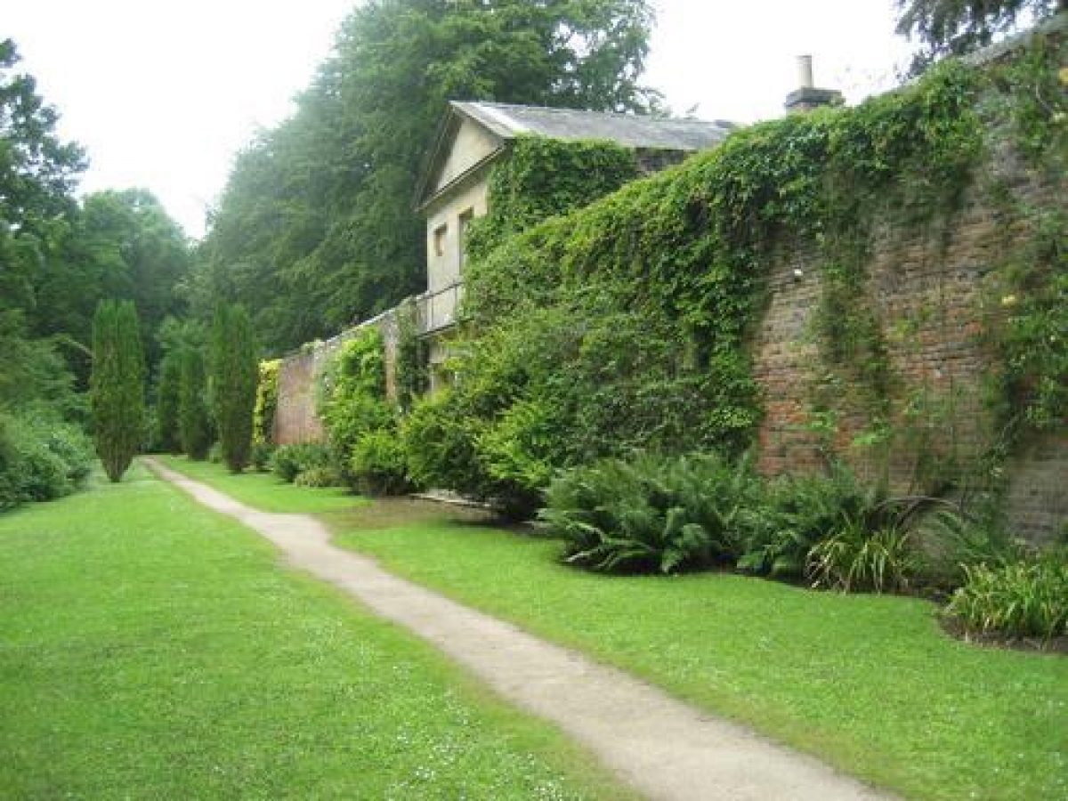
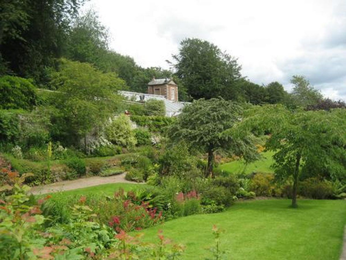
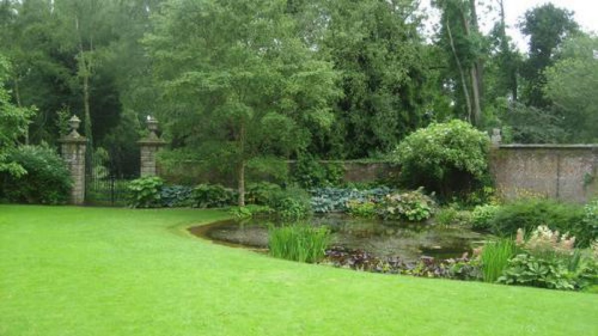
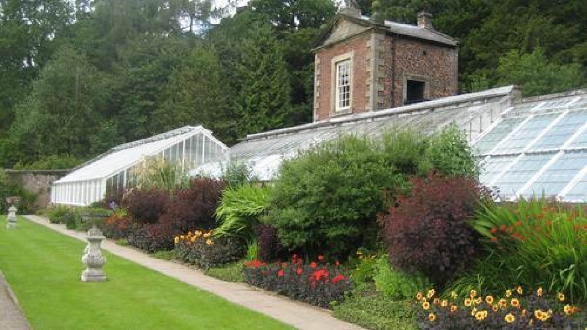
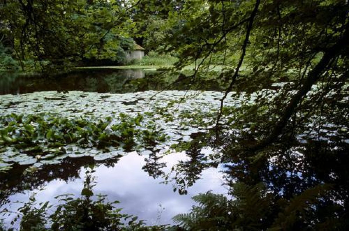
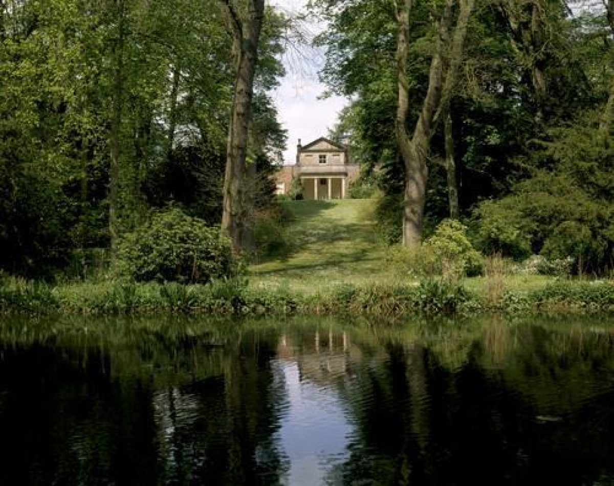
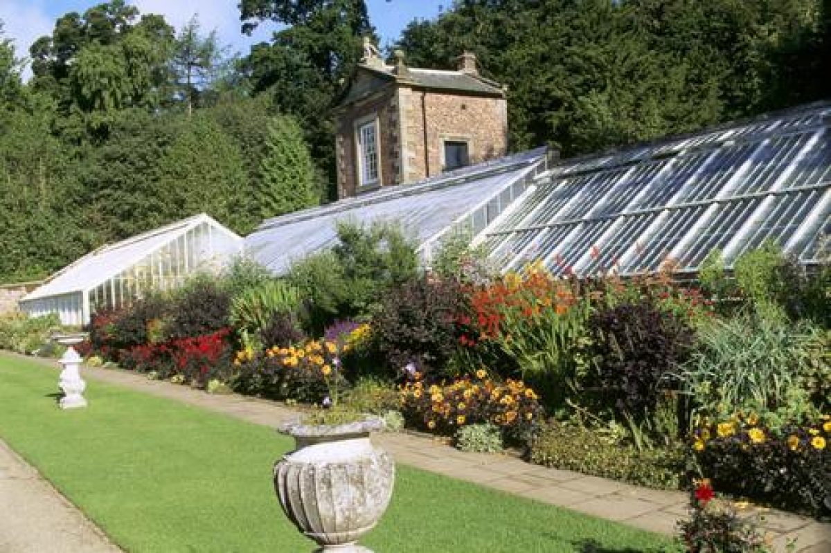
The gardens and pleasure grounds are set within West Wood and East Wood, the latter separated from Wallington Hall and the East Lawn by the B6342. The Hall lies at the centre of these two woodland pleasure gardens. The broad gravel terrace, 200 m in length on the south front of the Hall, links these areas. It extends to either side of the south front of the Hall, overlooking the ha-ha and The Park to the south. At the west end of the terrace, a Lime Avenue (planted by the National Trust) leads to a series of informal walks through West Wood, by way of the icehouse (late C18, listed grade II) and the remains of a Battery standing 220 m south-west of the Hall, both constructed by 1742 (Richmond, 1742). West Wood is set with three ponds laid out along a stream; the Lower Pond (the easternmost) has a boathouse.
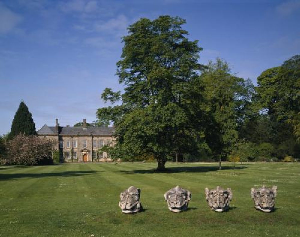
From the terrace a path leads north-eastwards across the East Lawn, planted with specimen trees, to the principal 1740s entrance (see above) and then, across the road, into East Wood. On the roadside boundary of the East Lawn and central to the east façade of the Hall, are four monumental, stone-carved dragon heads. These were placed here in 1928, having previously decorated Rothley Castle, and were originally brought to Wallington from Bishopsgate, London in 1760 as ballast in one of Sir William Blackett's colliers.
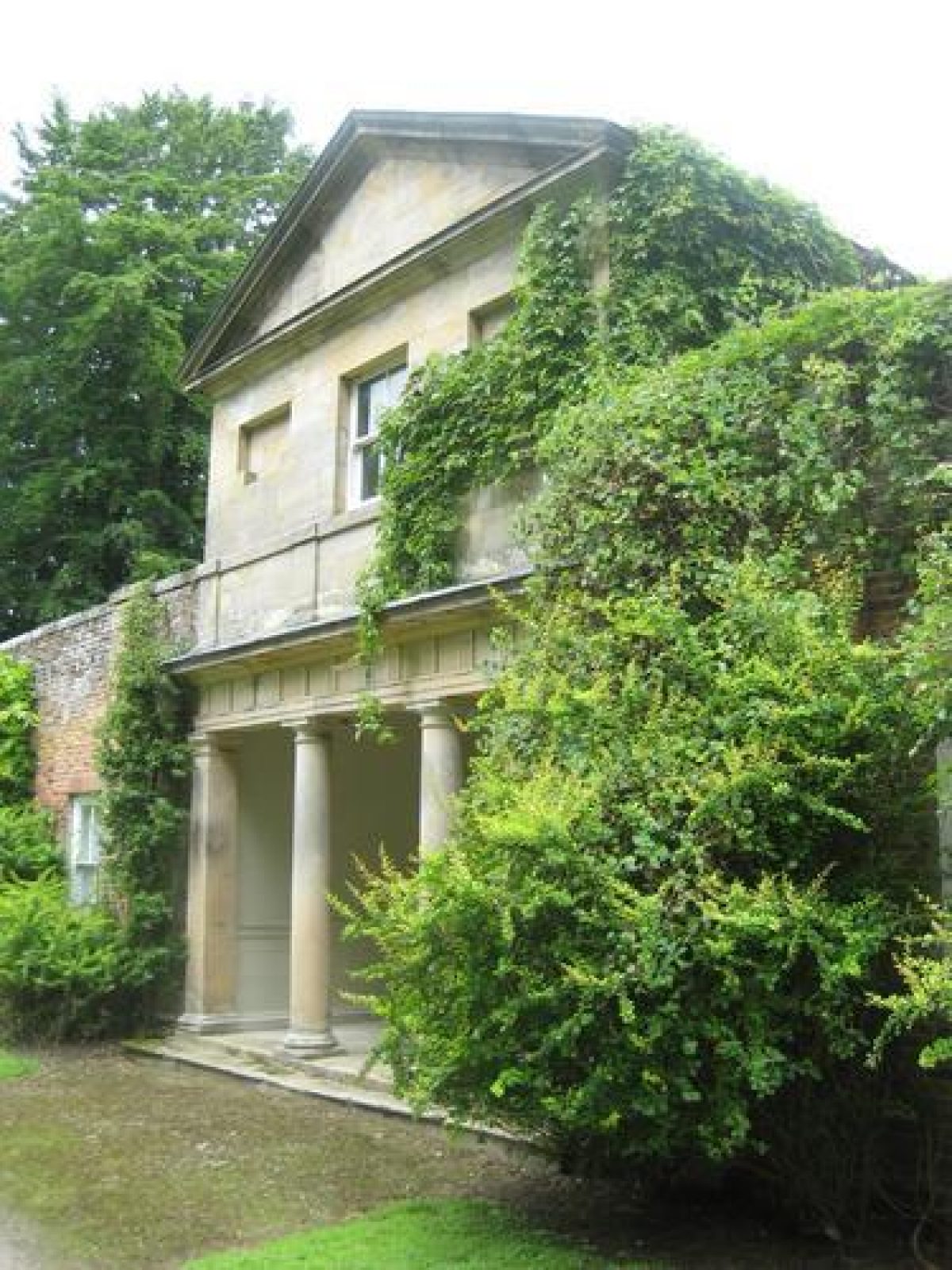
In East Wood a series of walks lead eventually to the Walled Garden, lying 650 m directly east of the Hall. From the roadside entrance into East Wood, a serpentine walk leads to the Garden Pond, 400 m north-east of the Hall. Landscaped as part of a pleasure ground in the 1760s, the Pond was created on the site of an earlier walled garden. Portico House, a cottage (c 1750, probably by Garrett, listed grade II) with summerhouse and flanking C17 walls (listed grade II), all situated together on a terrace, survive from this earlier, pre-1760 scheme. The portico acts as an eyecatcher over the water, a view which was retained in the 1820s when the pleasure ground was then developed into a woodland garden. Another route through East Wood leads north to the China (or Chinese) Pond, created in 1760, named from the Chinese building in its vicinity, constructed in the 1750s but no longer extant.
Kitchen Garden
The Kitchen Garden was located north-east of Wallington Hall within East Wood. It has partially survived and is now known as the Walled Garden. The original extent of the garden was much larger. The Garden pond and Portico House were both enclosed within the original garden.
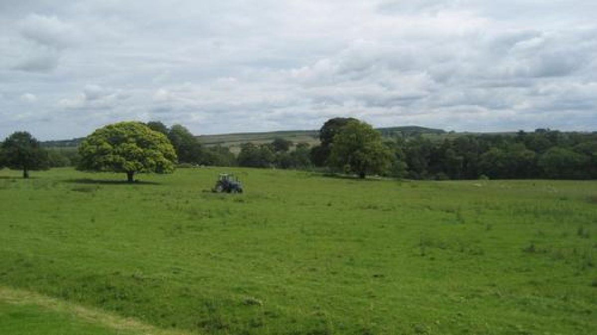
Park
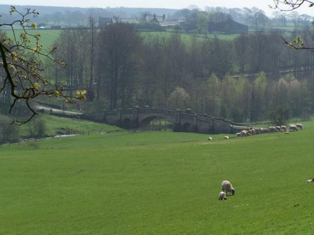
Directly to the south of the Hall lies The Park, open parkland of c 15 ha, its south boundary delimited by the river and Fenwick's Drive, both within a woodland belt. Paine's Bridge (1755, listed grade I) carries the public road over the river, and forms a grand approach to the Hall.
The B6342 divides The Park from Barn Flatt, an open area of parkland lying to its east, enclosed on its north side by East Wood and on its south-east by the river. Gate piers (mid C18, listed grade II), 80 m north-west of Paine's Bridge, mark the entrance to Fenwick's Drive and The Park. To the east of the public road, Fenwick's Drive is continued by a formal drive leading north-eastwards up to the Garden House. A roadside wall, 100 m in length, with monolithic square domed gate piers (mid C18, listed grade II) marks the entrance to a small-scale farm layout, attributed to Lancelot Brown. This is the Garden House (1766, listed grade II*), with its yard and outbuildings (listed grade II) which is separated from Barn Flatt by, and lies directly to the east of, the Walled Garden.
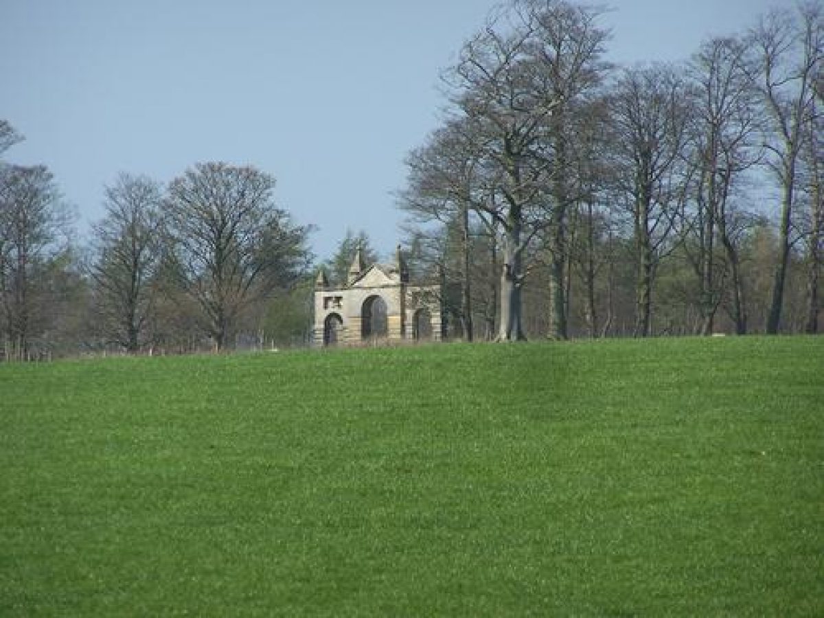
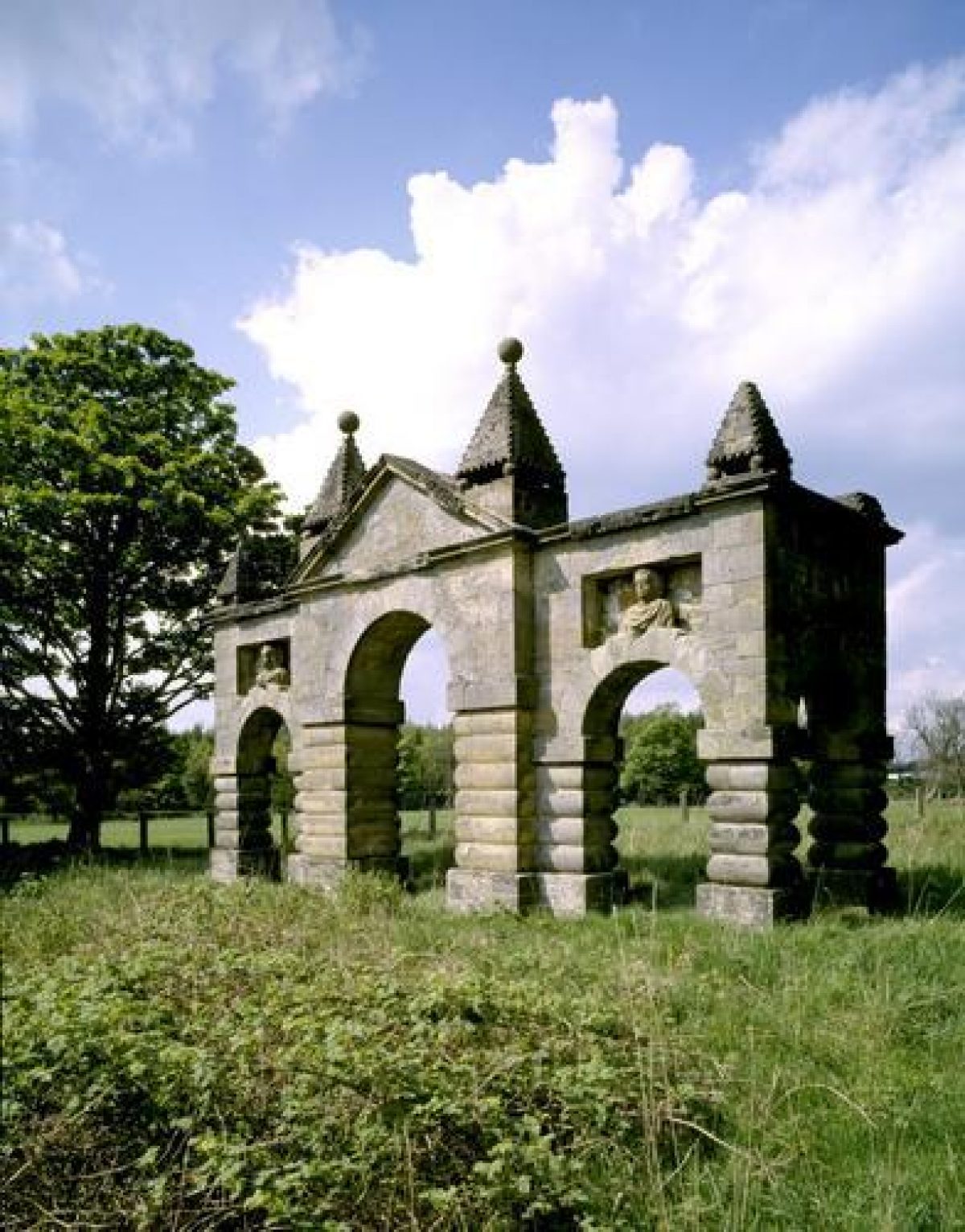
The area north-east of East Wood consists of a series of regular enclosure fields (early-mid C18), some now amalgamated. The Arches (1735, listed grade II*) stands in the north-east park. Originally the major gateway into the courtyard, it proved too narrow for the passage of coaches so it was re-erected in the park in 1751, to act as an eyecatcher from walks in East Wood. Built of squared stone with ashlar dressings, the central bay has heavy pyramidal finials with dog-tooth ornament and other, smaller finials decorate its façade.
The area to the north-west of West Wood also consists of a series of regular enclosure fields (early-mid C18) with distinctive shelter belts running north/south. The large woodland clumps, Round Plantation and Octagon, had been laid out by 1777 (Duffield), but only the Octagon survives, Round Plantation having been felled mid C20.
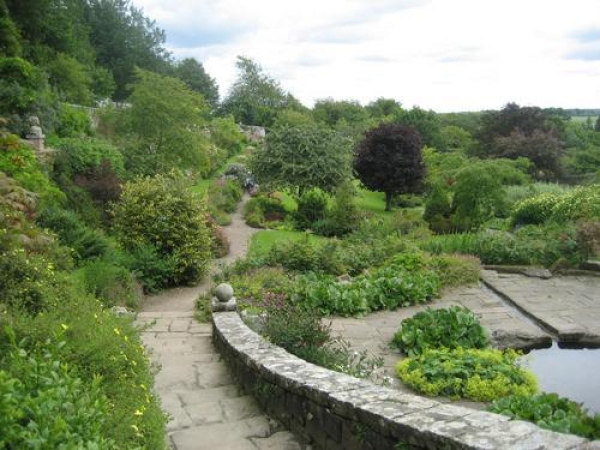
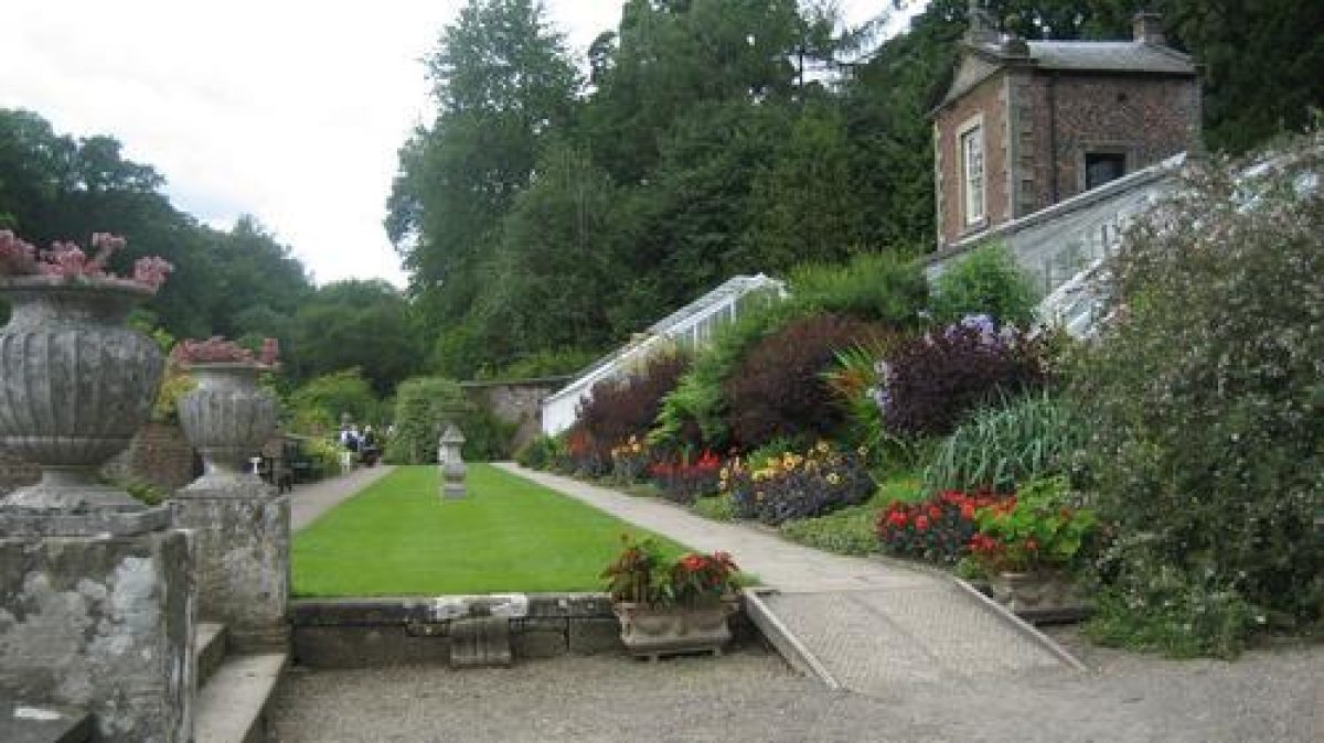
Walled Garden
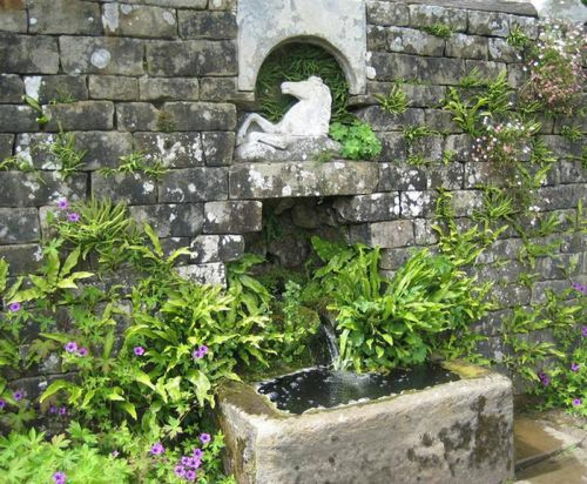
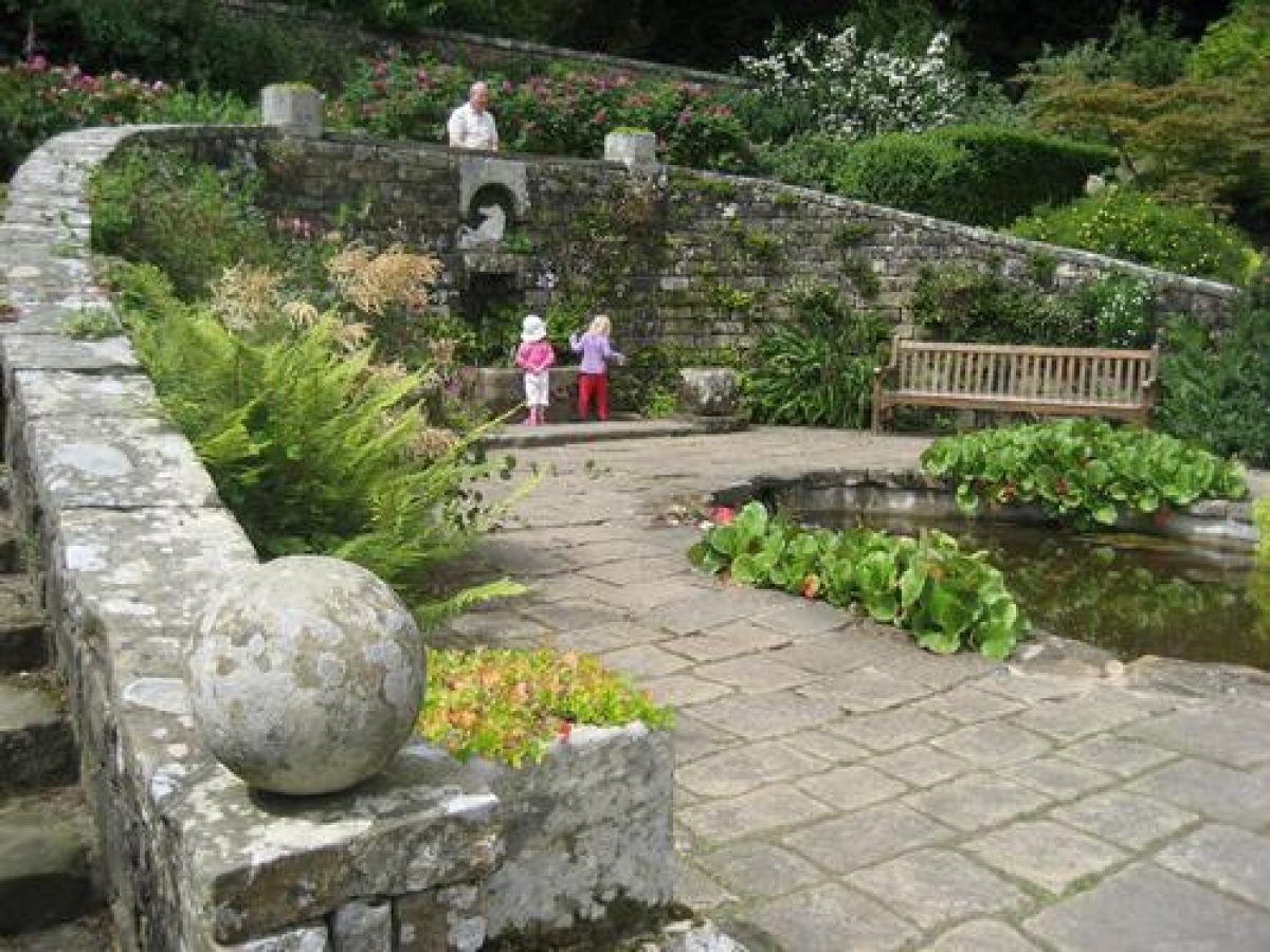
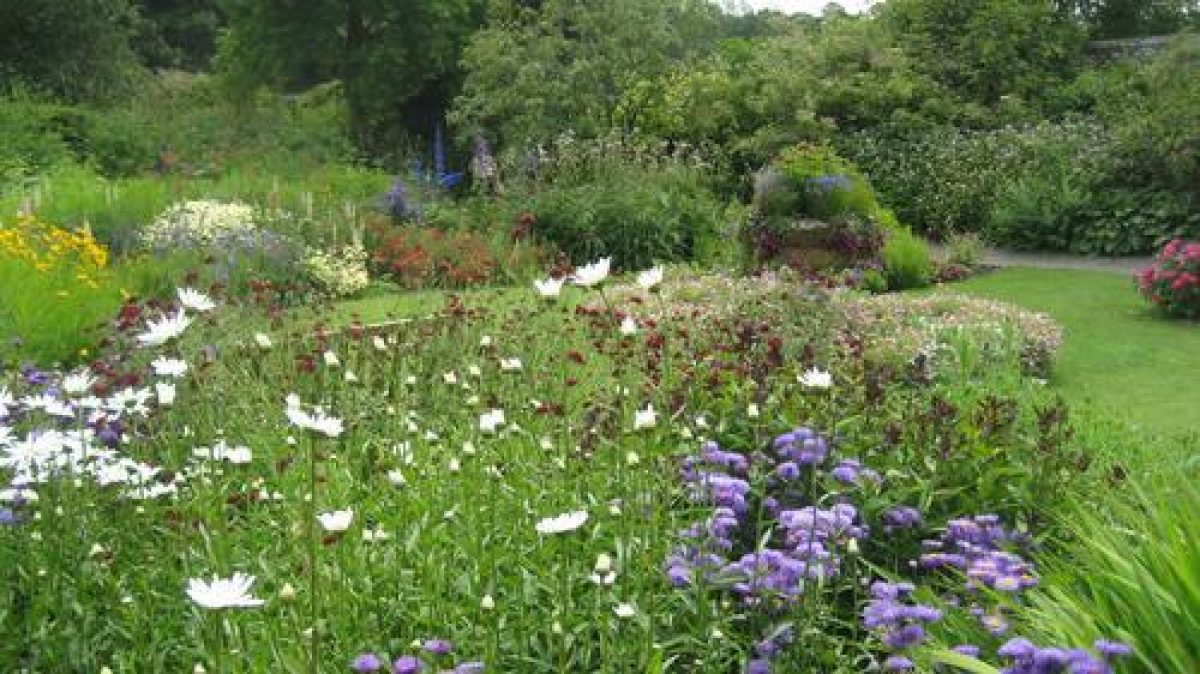
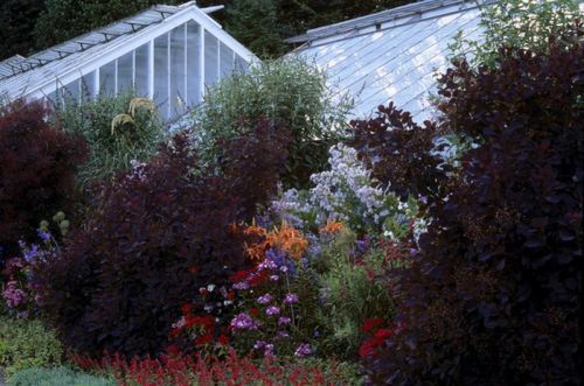
The L-shaped ornamental Walled Garden, thought to be c 1766 by Lancelot Brown (listed grade II*), is set on its north side with a Conservatory (1908 for Sir George Otto Trevelyan, listed grade II) and the Owl House (c 1766, listed grade II), a gazebo with an external stair and so-called because it is surmounted with a central stone owl. A raised brick-built terrace (c 1766, listed grade II) leads around the north side of the garden.
The conservatory has a fuchsia of 1908, lemon verbena pre-1908, and a heliotrope, 1940. Lady Trevelyan laid out a terrace at the west end of the garden in 1938.
Maps
- John Robinson, Map of the Estate of Wallington surveyed in the year 1728, 1728 (Wallington Hall)
- Survey of Wallington, 1728, schedule to accompany Robinson plan (ZWN D2/2), (Northumberland Record Office)
- H Richmond, A Plan of the Lordship of Wallington 1742, 1742 (Wallington Hall)
- T Duffield, Estate map, 1777 (Wallington Hall)
- OS 6" to 1 mile:
- 1st edition surveyed 1861, published 1865
- 2nd edition surveyed 1896
Archival items
- The Trevelyan Papers are held at the Northumberland Record Office and include: Book of plans, 1777 (ZWN/A4); Plans, 1778-9 (ZWN/A5); Estate accounts, 1737-1928 (ZWN/D10-18)
Description written: January 2001
Register Inspector: KC
Edited: July 2003
- Visitor Access, Directions & Contacts
Telephone
441670773606Access contact details
The grounds are open daily throughout the year from 10 am until 7 pm.
For more detailed visitor information visit the National Trust website.
Directions
The site is off the A1 between Newcastle and Morpeth.
Owners
The National Trust
Heelis, Kemble Drive, Swindon, SN2 2NA
- History
The following is from the Register of Parks and Gardens of Special Historic Interest. For the most up-to-date Register entry, please visit The National Heritage List for England (NHLE):
16th and 17th Century
In 1542 there was a 'stronge toure and a stone house' (CL 1918) at Wallington, important for defence in an area of Border warfare. The estate, which included a mill and village, belonged to the Fenwick family who sold it to Sir William Blackett (d 1705) in 1684.
18th and 19th Century
In 1702 Sir William's son, also called Sir William Blackett (d 1728) inherited the estate. On his death he left it to Elizabeth Ord. By this time the property consisted of Blackett's shooting lodge, surrounded by 6.5 ha of formal plantations and gardens including 'The Levels', a long, regular, linear strip of pasture running from the south front of the lodge to the River Wansbeck (Robinson, 1728).
Elizabeth Ord married Walter Calverley in 1729, who adopted the name Blackett. From the 1730 to the 1770s he reorganised the Wallington estate on a grand scale, carrying out agricultural improvements, remodelling the house, building stables, laying out extensive gardens, and ornamenting the park, building a new deer park nearby at Rothley Park (1740-6) and making new plantations throughout.
Finance for some of these works arose in part from Blackett's interests in collieries in Kenton and the Wansbeck valley, the latter held in partnership with Sir Charles Loraine (qv Kirkharle). By 1767 coal was being extracted from Rothley Park and a pit in Wallington Park was worked out by 1774. Income also arose from lead mines in Allendale, whaling, and farm rents but mainly from the sale of his Yorkshire estates, which realised £106,000 in 1749.
During the 1730-40s Blackett commissioned Daniel Garrett (d 1753) to remodel Wallington Hall, design Rothley Castle (an eyecatcher to be seen from Wallington), and estate housing in Cambo and elsewhere on the estate. Garrett, a protégé of Lord Burlington's, published the first book devoted entirely to farmhouses in 1747 which proved popular due to the rapid land enclosures in northern counties at this period.
By the 1760s, Sir Walter had consulted with various architects to design follies, although not all were executed. Thomas Wright (1711-86) prepared designs for a castellated north entrance gateway into Rothley Park, and for Wallington Park designs for a shepherd's castle, Codger's Fort (1769), and a Chinese House. James Paine (1717-89) designed a monumental bridge over the Wansbeck. Of Lancelot Brown's (1716-83) design scheme for Rothley Park, only Rothley High and Low Lakes (1769) were implemented. Five unsigned and undated drawings for planting, a banqueting house, and rockwork for a bridge-dam exist, attributed to Brown.
Following Sir Walter's death in 1777 the estate passed to his nephew Sir John Trevelyan, fourth Bt (1734-1828) whose main seat was at Nettlecombe, Somerset (qv). Rothley Park ceased to be a deer park when the deer were sold and area of parkland were planted up or put under cultivation.
The next major development of Wallington was carried out by Sir Walter and Lady Pauline Calverley Trevelyan during the 1850s when they employed John Dobson (1787-1865), the Newcastle architect (qv Belsay Hall) to roof in the open courtyard enclosed by the house.
20th Century
The Wallington estate, a total of 5261 ha, was donated by Charles Philips Trevelyan (1870-1958), Minister for Education in the first and second Labour governments, to the National Trust in 1942. It remains (2001) in their ownership.
- Associated People
- Features & Designations
Designations
The National Heritage List for England: Register of Parks and Gardens
- Reference: GD2056
- Grade: II*
Features
- Historic House (featured building)
- Description: Wallington Hall (1688, listed grade I) incorporates the basement of the old Fenwick Castle in the cellars. It was extensively remodelled by Daniel Garrett between 1735 and 1745,
- Earliest Date:
- Latest Date:
- Sculpture
- Description: Four Griffins' heads which are located on the front lawn. They were originally obtained by Sir Walter Calverley when Aldersgate and Bishopsgate in London were demolished. Lady Mary Trevelyan moved them to the front lawn in 1928.
- Earliest Date:
- Latest Date:
- Garden Building
- Description: A clock tower located in the central courtyard. The tower is topped by a cupola on nine doric columns.
- Earliest Date:
- Latest Date:
- Ornamental Bridge
- Earliest Date:
- Latest Date:
- Cascade
- Description: A water cascade found below the ornamental bridge.
- Ornamental Pond
- Description: China Pond.
- Earliest Date:
- Latest Date:
- Folly
- Description: Rothley Castle is a ruined castle built of Black Moor Stone. The folly was purchased by the National Trust in 2004.
- Earliest Date:
- Latest Date:
- Folly
- Description: The triumphal arch was originally in the centre of the stables. It was moved to a field in 1754 following the construction of the clock tower. It was turned into an eye catching folly which is visible from the gardens by the China Pond.
- Earliest Date:
- Latest Date:
- Pond
- Description: Boathouse pond is located within West wood.
- Icehouse
- Pond
- Description: Middle pond is located within West wood.
- Pond
- Description: Top pond is located within West wood.
- Pleasure Garden
- Description: Two woodland pleasure grounds either side of Wallington Hall
- Courtyard, Stables, Clock Tower
- Description:
- Terrace, Conservatory, Gazebo, Walled Garden
- Description: Ornamental Walled Garden, c 1766 by Lancelot Brown (listed grade II*), with a Conservatory (1908 for Sir George Otto Trevelyan, listed grade II) and the Owl House (c 1766, listed grade II), a gazebo A raised brick-built terrace (c 1766, listed grade II) leads around the north side of the garden. Sir George Trevelyan established the terrace in 1886. 18th century lead figures were placed along it. The garden is now large ornamental. It also contains the national Collection of Elders (Sambucus)
- Cottage
- Description: Portico House, a cottage (c 1750, probably by Garrett, listed grade II) with summerhouse and flanking C17 walls (listed grade II)
- House
- Description: Garden House (1766, listed grade II*), with yard and outbuildings (listed grade II)
- Garden House
- Description: The Garden House is located in the north-east corner of the garden. It lies just outside the walls.
- Pool
- Description: Lady Mary Trevelyan added the Mary Pool to the garden in 1938.
- Key Information
Type
Park
Purpose
Recreational/sport
Principal Building
Heritage Site
Survival
Extant
Hectares
125
Open to the public
Yes
Civil Parish
Wallington
- References
References
- White, S., {Gardens of Northumberland and the Borders} (Cramlington: Sanderson Books Limited, 2006), pp. 186-93 Gardens of Northumberland and the Borders
- {English Heritage Register of Parks and Gardens of Special Historic Interest}, (Swindon: English Heritage, 2008) [on CD-ROM] Historic England Register of Parks and Gardens of Special Historic Interest
- Stroud, D., {Capability Brown} (London: Faber, 1975), pp. 25-6, 43 Capability Brown
- Trevelyan, Raleigh, {Wallington: The National Trust} (Swindon: National Trust Enterprises Ltd, 1994) Wallington: The National Trust
- (22 June 1918), pp 572-8; (29 June 1918), pp 592-7; 147 (16 April 1970), pp 854-8; (23 April 1970), p 922; 164 (7 December 1978), p 1977 Country Life, 43
- D Stroud, Capability Brown (1975), pp 25-6, 43 Capability Brown (Country Life article)
- No 2 (1981), pp 166-74 Garden History 9
- pp 78-85, 138-40 An English Arcadia
- Related Documents
-
CLS 1/916
Parkland and Landscape Management Plan - Digital copy
Nick Owen (Debois Landsdcape Survey Group) - 2010
-
CLS 1/850
Wallington Hall: A survey of the landscape, Part 2 Photocopies - Hard Copy.
Debois Landscape Survey Group - 1999
-
CLS 1/851/1-6
Wallington Hall: Parkland and Landscape Management Plan - Hard Copy.
Debois Landscape Survey Group - 2012
-
CLS 1/916