Introduction
Mesnes Park occupies a 12 hectare site immediately to the north-west of Wigan town centre. It was opened as a public park in 1878, and includes a number of Victorian park features including a bandstand, a pavilion and a Pulhamite rock feature.
Terrain
Gently sloping ground, falling from north-east to south-west.The following is from the Register of Parks and Gardens of Special Historic Interest. For the most up-to-date Register entry, please visit the The National Heritage List for England (NHLE):
www.historicengland.org.uk/listing/the-list
A public park laid out by John McClean and opened in 1878.
DESCRIPTION
LOCATION, AREA, BOUNDARIES, LANDFORM, SETTING
Mesnes Park occupies a c 12ha site immediately to the north-west of Wigan town centre. The park is laid on gently sloping ground, falling from north-east to south-west. Its boundaries are formed by a railway line to the west, Parson's Walk and Mesnes Park Terrace to the south, the Wigan College of Technology (the former Gidlow (cotton) Works) and Bridgeman Terrace (with its row of good quality houses of similar date to the park) to the east and an area of car parking on the Works land to the north.
ENTRANCES AND APPROACHES
The main gates of the park stand with the lodge, designed by W H Fletcher of Wellbeck Street, London, at the south-east corner of the park. There are further entrances off Parson's Walk to the south, Bridgeman Terrace to the east, and at the northern tip of the site, the latter linking through to Walkden Avenue. The main gates were removed along with the railings as part of the war effort, but were subsequently retrieved, refurbished and rehung in 1950.
GARDENS AND PLEASURE GROUNDS
From the main entrance, the central walk, the 'carriage drive', leads north to the site of a cast-iron fountain, supplied by Coalbrookdale Ltd (removed in the 1920s). Beyond are semicircular grass terraces with a central double flight of steps, supplied by Dalton & Co, London, leading up to the platform on which the Pavilion stands. The steps were originally decorated with terracotta vases, only one of which now (1990s) survives. The Pavilion (1880, listed grade II), designed by W H Fletcher, forms the focus of the park. It occupies an elevated position from which there are wide views out over the park and town.
On the east side of the central walk stands a statue of Sir F S Powell MP, by Ernest G Gillick, erected by public subscription in 1910. At the top of the steps, on the south-eastern side of the Pavilion, is the Boer War 'Volunteers and Yeomanry Memorial', unveiled in 1903.
The turf to either side of the lodge end of the central path is broken up by a pattern of flower beds backed by plantings of evergreens.
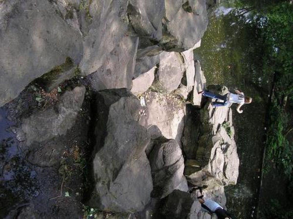
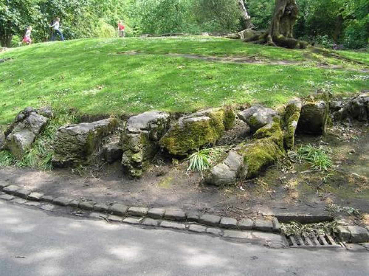
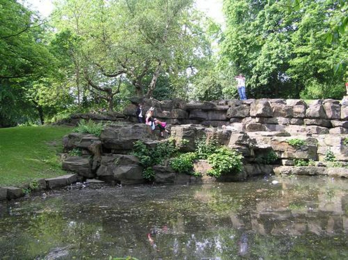
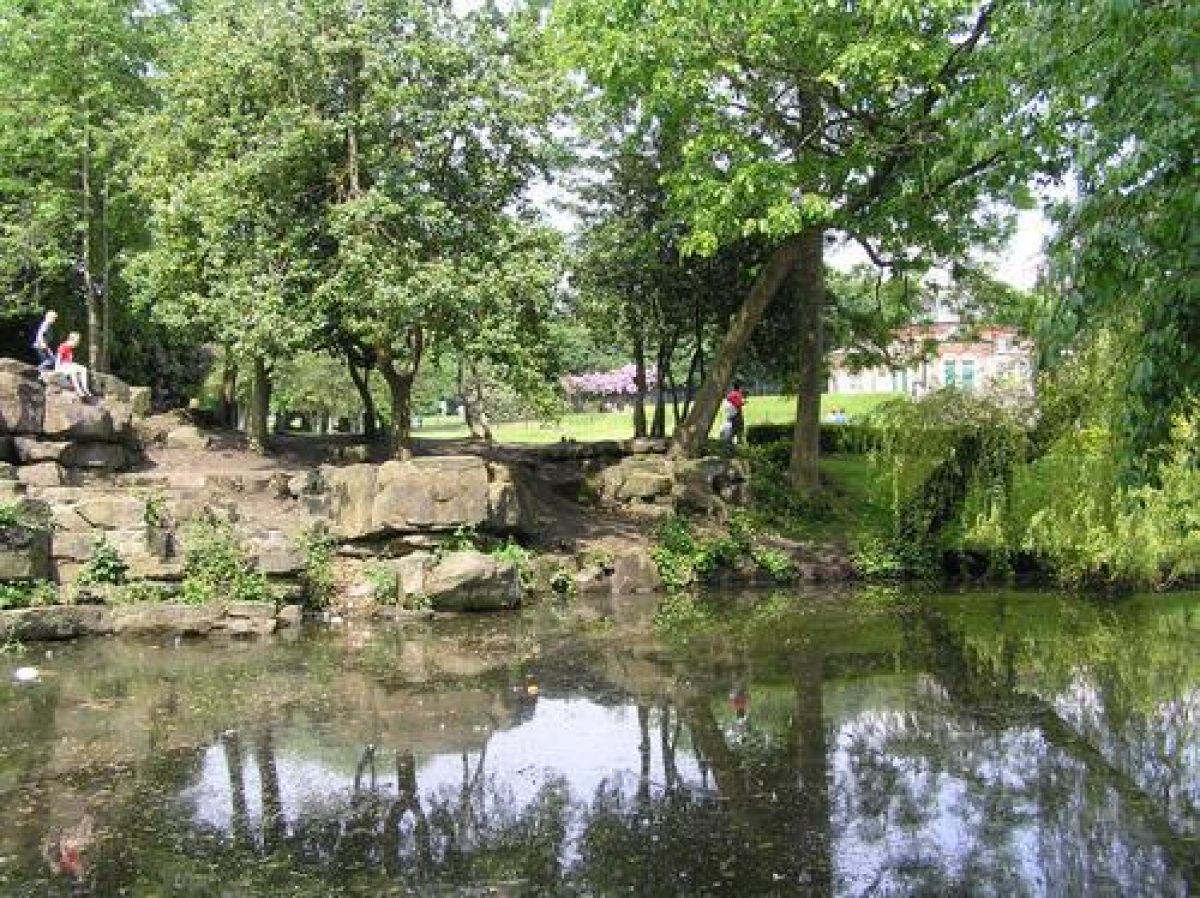
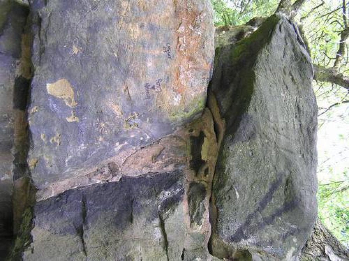
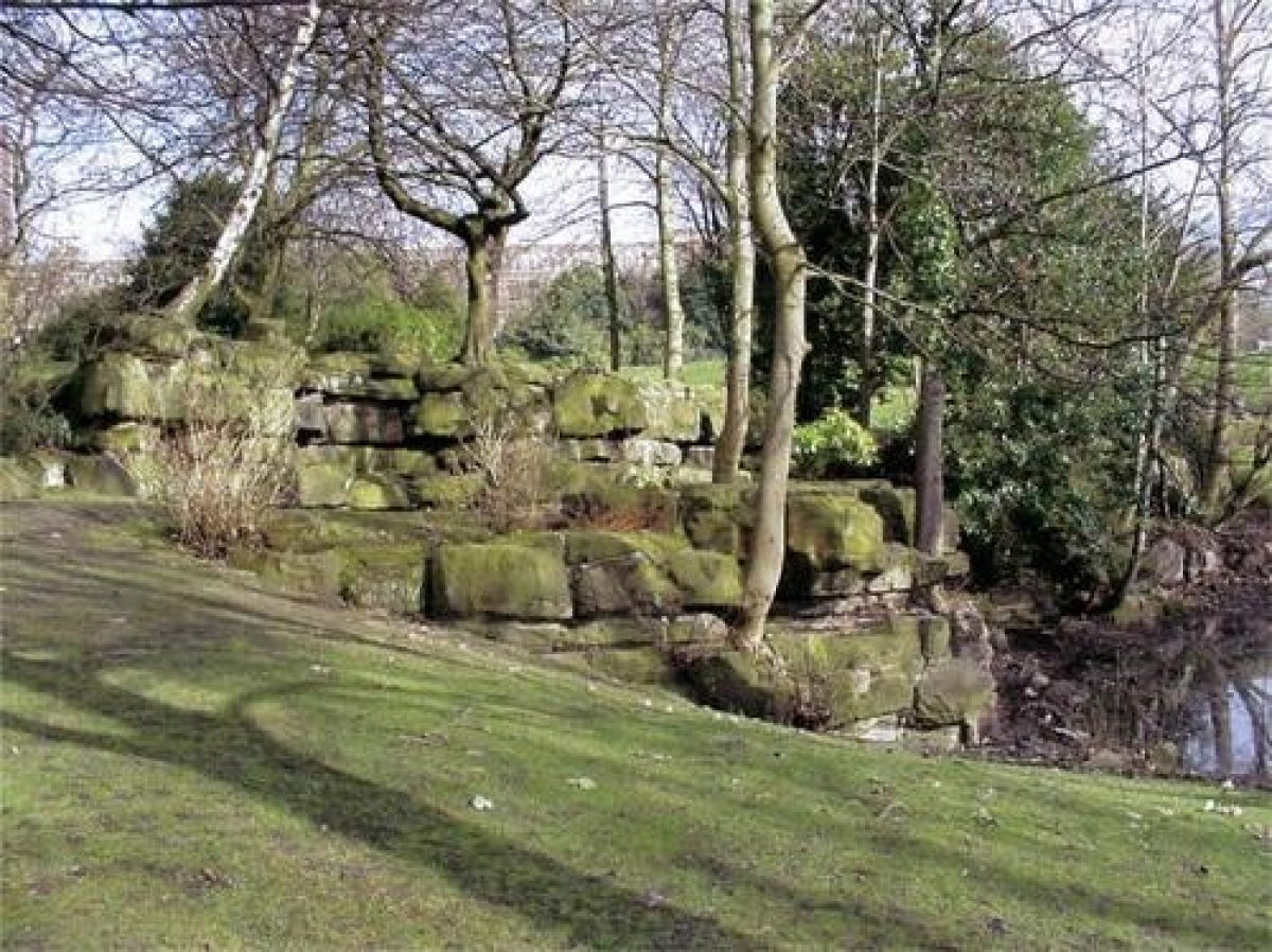
Along the south-western side of the park lies the lake, this having been created from two marl pits. It is accompanied by rockwork and a waterfall constructed by Pulham & Sons.
South of the lake, between the water and the college (formerly the Grammar School) land beyond the park boundary, is the Padgett Memorial Garden, a rose garden within a hedged enclosure. This was laid out in memory of Alderman Padgett c 1950 and replaces an earlier tennis court.
North of the lake and west of the pavilion stands the bandstand (listed grade II), supplied by Messrs Ges Smith & Co, Glasgow. It was added into the park design in 1890 by the Property, Markets and Mesnes Park Committee who were responsible for the development of the park. The hardstanding which surrounds it was later greatly extended (perhaps c 1927 when new shutters were erected round the bandstand). The bandstand was refurbished by Wigan Borough Council in conjunction with the Wigan Civic Trust c 1985.
North of the bandstand, on the path which leads to the northern entrance, is the site of a drinking fountain donated c 1880 by teetotallers, in memory of a Mr Grant. This feature was removed in the 1930s.
In 1978 a disabled centre with a garden for the blind was laid out on the formerly open grassed area between the bandstand and the bowling greens. Since 1991, the disabled centre building has also been used as a play centre, and a new play area for toddlers was put in, adjacent to the building, at this time. Also in 1991, a new large play area was added to the north and east of the bandstand, replacing the early C20 playground on the eastern edge of the park, towards the northern end of the site.
Backing on to the railway embankment at the western side of the site, and separated from the rest of the park to the east by a fence and low hedging, two pavilions overlook the bowling greens and putting green. Tennis courts lie further to the north. The southern pavilion was present by 1908 (OS 3rd edition), while the second was opened in 1926 following further development of the sporting facilities and the associated culverting of the Barley Brook. Beyond the tennis courts, at the northern tip of the park, is the site of the park nursery and associated horticultural glass. This complex was removed in 1989 and is now used as a contractor maintenance depot.
North of the main Pavilion, the open ground below the former factory has been levelled (late C20) to form a games area. To the east of the Pavilion, walks leads through a rockery added c 1965 by the then assistant Parks Superintendent, Mr Jones.
REFERENCES
Information provided by Wigan Borough Council (newspaper cuttings, maps, photographs and postcards)
Maps
Local Health Plan, c 1894, (Wigan Borough Council)
OS 6" to 1 mile:
1st edition published 1849
2nd edition published 1895
OS 25" to 1 mile:
1st edition published 1876
2nd edition published 1894
3rd edition published 1908
1929 edition
1939 edition
Description written: February 1999
Register Inspector: CB
Edited: April 1999
- Visitor Access, Directions & Contacts
Telephone
441942486999Access contact details
This is a municipal site for general public use.
Directions
Immediately to the north-west of Wigan town centre, off the B5376
Owners
Wigan Council
Town Hall, Library Street, Wigan,, WN1 1YN
- History
The following is from the Register of Parks and Gardens of Special Historic Interest. For the most up-to-date Register entry, please visit the The National Heritage List for England (NHLE):
www.historicengland.org.uk/listing/the-list
CHRONOLOGY OF HISTORIC DEVELOPMENT
The area within which Mesnes Park lies was traditionally known as the Mesnes after the manorial demesnes land. The land, which was mostly meadow and pasture, formed part of the Wigan Rectory Glebe Estate, the Rector also being Lord of the Manor. By 1847 there were two collieries within the area of the present park, and the land was crossed by two tramways and a ropewalk.
The Mesnes was sold to Wigan Corporation under the Wigan Rectory Glebe Act of 1871, which included provisions for a Grammar School and public park. The 6.5ha (16 acres) of land were purchased for the Council at a cost of £2000 by the then Mayor, Nathaniel Eckersley of Standish Hall, a local mill owner. A further 5.5ha (14 acres) of land was leased and included the site of Turner's Colliery which continued in operation until 1880. In 1877 a competition was held for the design, the winner of which was John McClean of Castle Donington. His scheme was estimated to cost £2500 to execute, without the construction of the buildings. McClean was subsequently awarded the contract to oversee the implementation of the work. Eckersley, by then High Sheriff of Lancashire, performed the opening ceremony for the Park in August 1878.
- Associated People
- Features & Designations
Designations
The National Heritage List for England: Register of Parks and Gardens
- Reference: GD2558
- Grade: II
The National Heritage List for England: Listed Building
- Reference: The bandstand
- Grade: II
The National Heritage List for England: Listed Building
- Reference: The Pavilion
- Grade: II
Features
- Lake
- Island Bed
- Lawn
- Fountain
- Bandstand
- Pavilion
- Gateway
- Statue
- Pulhamite
- Key Information
Type
Park
Purpose
Recreational/sport
Principal Building
Parks, Gardens And Urban Spaces
Survival
Extant
Hectares
12
Open to the public
Yes
- References
References
- {English Heritage Register of Parks and Gardens of Special Historic Interest}, (Swindon: English Heritage, 2008) [on CD-ROM] Historic England Register of Parks and Gardens of Special Historic Interest
- University of Manchester and University of York, {A Survey of Historic Parks and Gardens in Greater Manchester}, York, 1994 A Survey of Historic Parks and Gardens in Greater Manchester
- {Mesnes Park Management Plan} (2007) Mesnes Park Management Plan
- Wigan Leisure and Culture Trust {Mesnes Park Wigan Restoration Project: Conservation Management Plan} (2006) Mesnes Park Wigan Restoration Project: Conservation Management Plan
Contributors
Lancashire Gardens Trust
Greater Manchester Archaeological Unit