Introduction
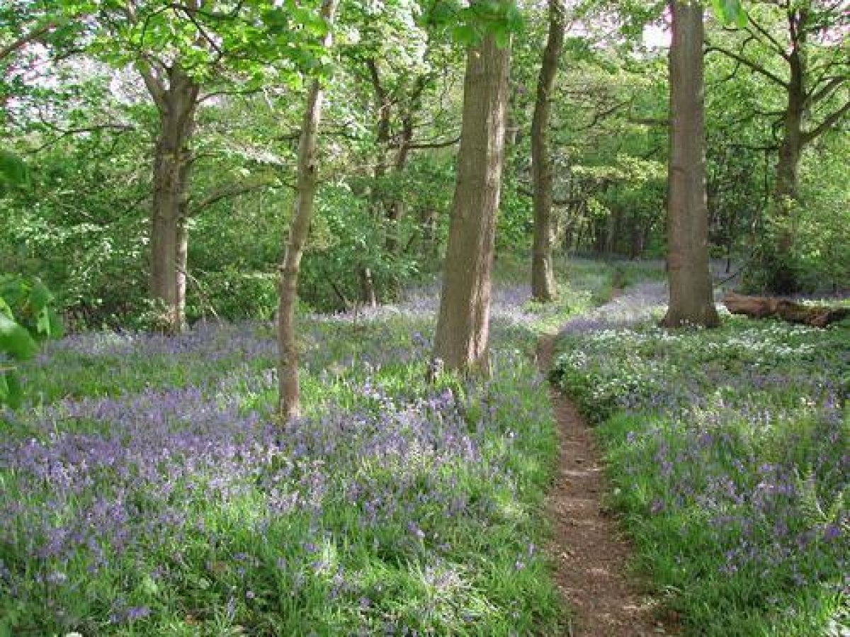
Hackfall has a semi-natural ancient woodland which is set in a natural gorge. Paths and vistas cut through the wood lead to follies, cascades and water features.
Terrain
Steep gorge.The following is from the Register of Parks and Gardens of Special Historic Interest. For the most up-to-date Register entry, please visit The National Heritage List for England (NHLE):
Location, Area, Boundaries, Landform and Setting
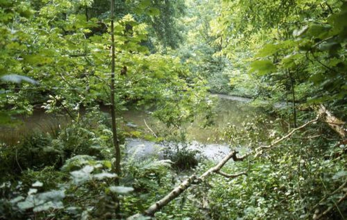
Hackfall lies c 1 km north-east of Grewelthorpe and occupies the south and west sides of a steep craggy gorge through which the River Ure flows in a sweeping bend. The Grewelthorpe Beck runs north-east across the site to join the Ure through a steep, narrow-sided ravine lined with springs, including calcareous springs which were a source of tufa used for many of the structures on the site. The c 42 ha site is bounded on the east side by the River Ure and on the other sides by fencing separating it from open agricultural land.
The entrances to the site are informal. A footpath leads north-east into the site from the north end of Grewelthorpe, and another entrance, c 700 m north of the village, is via a footpath leading east from the road between Grewelthorpe and Masham. There are a number of other paths leading into the site. In the C18 the entrance was from a wicket gate next to the gardener's cottage on the road just north of Grewelthorpe from which the gardener conducted tours around the site.
The Grewelthorpe Beck forms a natural axis, at the top of which are four masonry dams, believed to date from before 1845, and a chain of cascades pre-dating 1806. There are a number of spectacular follies and features, many of which have fallen into a state of disrepair.
At the confluence of Grewelthorpe Beck and the River Ure is a knoll on which is built Fisher Hall, an octagonal Gothic pavilion dating from 1750, overlooking the River Ure. To the south of the woods is the ruined Mowbray Castle; to the west is Mowbray Hall, a banqueting house with viewing balcony in a mix of Gothic and Romanesque styles, constructed between 1776 and 1777.
Deeper in the woods is a Rustic Temple overlooking the Fountain Pond, which was created in 1759. Along the Grewelthorpe Beck are the Alum Spring and Kent's Seat, constructed in 1752.
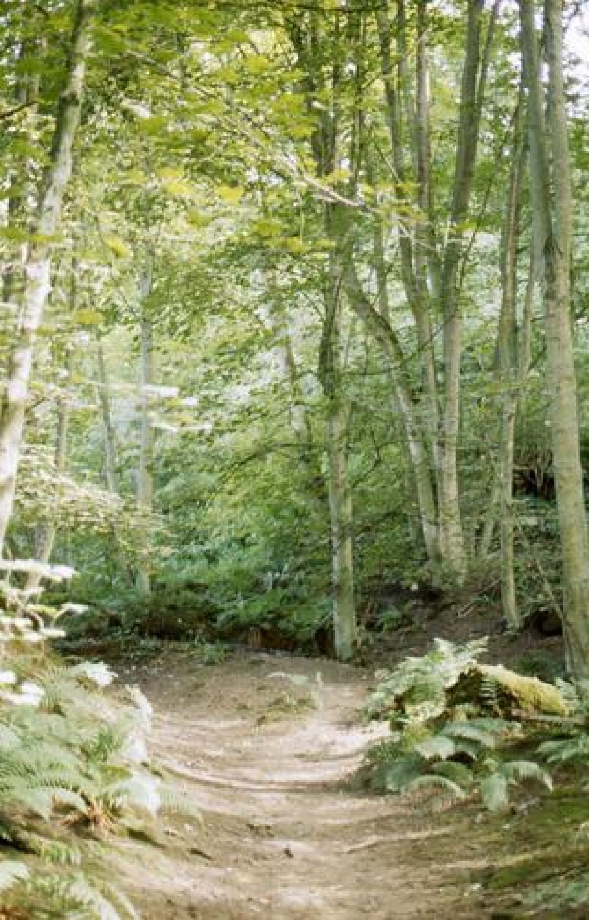
There are a number of winding paths through the woods, allowing access to the River Ure and Grewelthorpe Beck.
At the time of writing (December 2007) the paths are being improved and additional restoration is taking place. This work is being carried out by the Woodland Trust and the Hackfall Trust, aided by a grant from the Heritage Lottery Fund.
Pleasure grounds laid out between about 1749 and 1767 by the then owner, William Aislabie, with cascades, ponds, rustic seats, follies and grottoes set in dramatic and varied natural scenery. The site is an important and early example of one which exploited wild natural scenery for its own sake.
Gardens and Pleasure Grounds
Hackfall is a heavily wooded site on a steep-sided gorge cut through by numerous streams and springs. A survey of 1991 (Alex Gordon Partnership) has shown that most of the watercourses were adapted as cascades, and one of the chief characteristics of Hackfall is the sound of rushing, falling or dripping water which can be heard in almost every part of the site. The pleasure grounds are laid out in a naturalistic style on the slopes of a deep gorge cut by the River Ure.
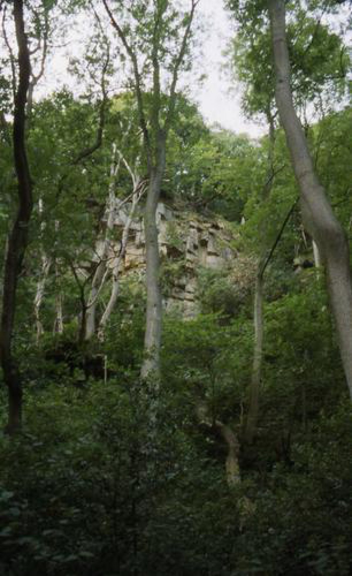
The path from Grewelthorpe leads north-east alongside the Grewelthorpe Beck and c 400 m north-east of the entrance a secondary path doubles back and leads south-westwards to Kent's Seat, a ruinous stone alcove at the edge of a glade. This was named in honour of William Kent and constructed to take advantage of views of the Alum Spring, a modified natural feature which lies c 20 m south of the seat and is composed of several springs issuing from the base of a small crag which have created tufa formations. Kent's Seat is mentioned in correspondence dated 1755 and is probably one of the earliest structures made by Aislabie. The spring feeds into the Grewelthorpe Beck, and a path on the south side of the Beck runs eastwards up the steep side of the gorge. At the top of the gorge, c 300m east of the Alum Spring, is Mowbray Castle (listed grade II), a substantial gothick folly built during the 1760s. Views to the north over the gorge are available from it but views of it from the site have largely been obscured by trees. It is in ruinous condition (1998). Lands in the area had been owned by Sir Roger de Mowbray in the C12, and the connection with a romantic medieval figure may have been influential in the choice of a Gothic style of architecture for the building.
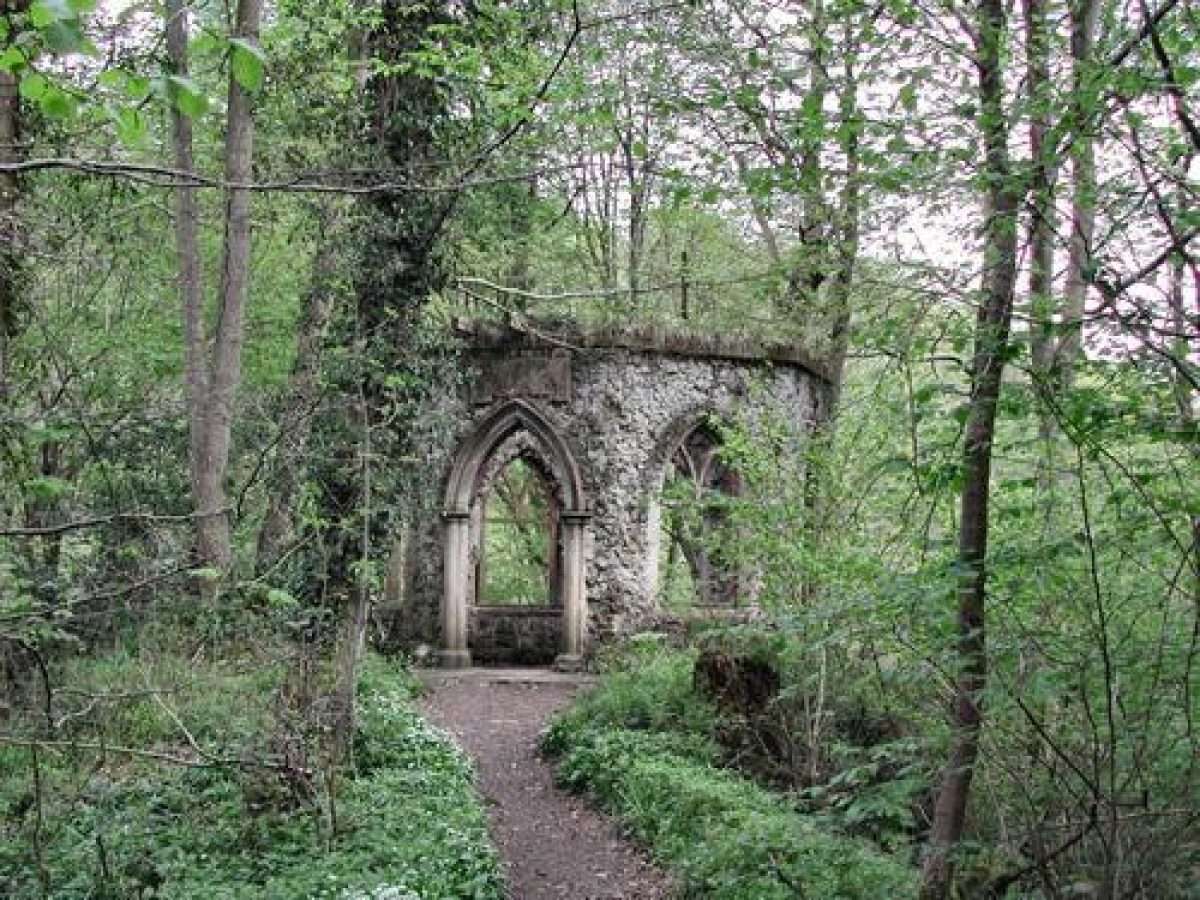
From the Alum Spring the main path continues north-east to Fisher's Hall (listed grade II), a folly dated 1750 which was probably the first structure to be erected on the site. This is an octagonal gothick building clad in tufa which is now (1998) in poor condition and roofless. The folly is close to the centre of the site and paths lead off in several directions. A path to the east leads to the riverside, and turns northwards along the riverbank to Weeping Rock, c 300 m to the north. This is a large outcrop of tufa overhanging the river, now largely obscured by trees, which is shown on an engraving of 1809 and a watercolour by J M W Turner (reproduced in Alex Gordon Partnership 1991). A channel cut into the top of the rock was designed to feed a stream along it to point where it cascaded into the Ure but the channel is now (1998) dry. Some 80m north of Weeping Rock is the site of Sandbed Hut, now completely overgrown, which takes its name from its proximity to a sandy beach on the riverside, and was used as a vantage point, most famously by Turner, for views of the river and Weeping Rock.
Paths run through the woodland to the south and east of Fisher's Hall in an area which was added to the site in the C19 and is shown as woodland with paths running through it on an estate map of 1832. The Dropping Well lies in dense undergrowth c 750 m south-east of Fisher's Hall and is a ruinous alcove and culvert which probably dates from the C19 enlargement of the site.
A path which runs north-west from Fisher's Hall leads to the Grotto, c 60 m to the north-west, a ruinous covered seat constructed in the 1750s or 1760s from sandstone and tufa. There were views from it of Forty Foot Fall, a cascade c 30 m to the south-west, which is adapted from a natural stream course and was made by constructing stone cascades which interrupted the natural course of the stream. It now has only a trickle of water and is heavily overgrown (1998). It was fed by a reservoir constructed c 1751 c 100 m south-west of the Grotto and the flow of water was controlled by sluices.
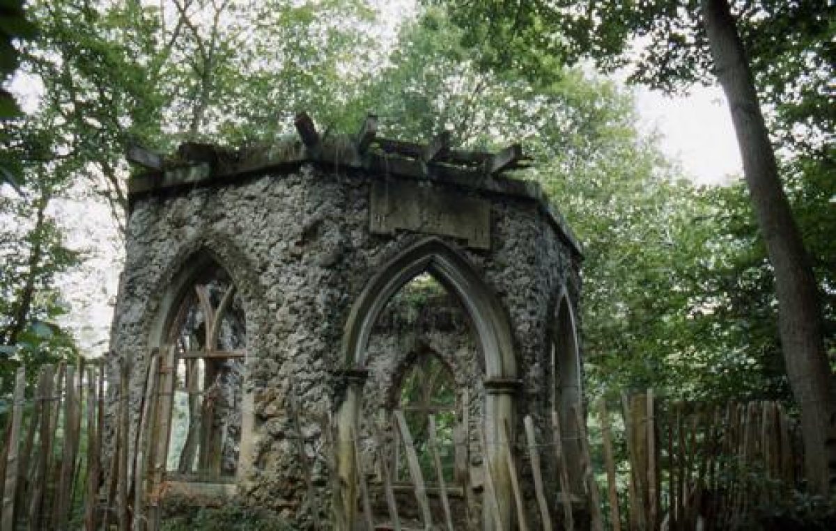
The path continues from the Grotto to a level area called Fountain Plain, c 70 m to the north-west, where there is a ruinous building called the Rustic Temple (listed grade II), sometimes referred to as the Fountain House. The building is of half octagon plan and is constructed of stone laid in Cyclopean blocks to evoke a primitive or wild character. Some 10m south-west of the Temple there is a pond called Fountain Pond which is shown, with a fountain, in a painting of 1767, which also shows the Rustic Temple. The pond is partially silted up and overgrown (1998).
Some 70 m north of Fountain Plain an area called Tent Plain was the site of a structure described in 1769 as an open octagonal bench. This is shown on the 1832 map but not on later maps. The 1852 OS map marks a number of summerhouses around Tent Plain but little trace can be seen of these (1998).
Paths lead north and north-west up the steep side of the gorge until the edge of the drop is reached and the path turns southwards and follows a route on the edge of the gorge which affords views, partially obscured by trees, to the east. The route leads past a shallow rectangular seating alcove in ruinous condition and on to the Banqueting House (listed grade II), reached from a short flight of stone steps at a spot called Mowbray Point. This lies c 200 m west of Fisher's Hall but can only be reached by a circuitous route owing to the steepness of the sides of the gorge. The building, which is in ruinous condition (1998), is of stone and tufa with a mixture of gothick and classical motifs. A terrace immediately in front (to the east) of it is on the edge of a sheer drop and gives impressive views over the wooded gorge. The drop between Mowbray Point and the river is more than 100 m. Panoramic views through 180 degrees (now partially obscured by trees) could be obtained from this point in which York Minster and the towns of Northallerton and Thirsk could be seen. One of the most thrilling effects (for example for Arthur Young in 1771) was the contrast between the view to distant horizons with the sheer drop at one's feet with views down to Fisher's Hall and the Ure far below. Trees and undergrowth obscure views of the structures in the valley below (1998).
The Banqueting House was probably built in 1767, as one of the last buildings on the site to be completed. It was used by William Aislabie as a private dining room and remained in use through the C19 when it served as tea rooms. Some 20 m to the south the ruinous remains of a service building and kitchen, erected in 1771, stand amongst trees.
Maps
- Estate Map of Hackfall, 1832 [reproduced in Woodland Trust 1994]
- OS 6" to 1 mile: 1st edition published 1852
Archival items
- The Woodland Trust and Alex Gordon Partnership reports contain references to and analysis of 18th- and 19th-century visitors' accounts, guides and estate records relating to Hackfall.
Description written: September 1998
Amended: March 1999
Edited: October 1999
- Visitor Access, Directions & Contacts
Owners
The Woodland Trust
Autumn Park, Dysart Road, Grantham, Lincolnshire, NG31 6LL
- History
The following is from the Register of Parks and Gardens of Special Historic Interest. For the most up-to-date Register entry, please visit the The National Heritage List for England (NHLE):
18th Century
The area was bought in 1731 by John Aislabie, who had laid out the grounds at nearby Studley Royal (see description of this site elsewhere in the Register). After his death in 1742 his son William (1700-81) continued to develop the grounds at Studley, and turned his attention to Hackfall where his mason and gardener, Robert Doe, supervised the work.
The site was much visited during the 18th and 19th century, and visitors' accounts include those by Arthur Young (1771), William Gilpin (1772), Sir Richard Colt Hoare (1800) and James Casmey (1859).
Colt Hoare's account contrasted the 'detestable, narrow, round, oval canals' at Studley with Hackfall, saying 'it is impossible to convey by words a proper idea of the beautiful disposition of wood, rock and water which nature has here so happily displayed' (quoted in Alex Gordon Partnership 1991).
19th Century
More than two hundred parties of visitors were received on the site in 1801 alone, and it was a 'mandatory stop on any northern garden itinerary' (Journal of Garden History 1987) which remained a popular destination for visitors until the 1920s.
In the mid-19th century the grounds were acquired by Lord Ripon who expanded the system of paths to the south-east. Hackfall was sold in 1932 and almost all the mature trees were removed. Since that time there has been natural regeneration of trees and undergrowth. The Woodland Trust acquired the site in 1989 and it remains in their ownership (1998).
- Associated People
- Features & Designations
Designations
Area of Outstanding Natural Beauty
Conservation Area
The National Heritage List for England: Register of Parks and Gardens
- Reference: GD1026
- Grade: I
Site of Special Scientific Interest
Ancient Replanted Woodland
County Wildlife Site
Ancient and Semi Natural Woodland
Style
Picturesque
Features
- Banqueting House
- Description: The Banqueting Hall at Mowbray Point has a Gothic facade to the west or field side, and a Romanesque facade to the east or wood side. There is a viewing balcony with spectacular views. The roof is a triple-domed 'ruin'.The Landmark Trust bought the property in 1999. It has since been restored and is available as holiday accommodation.
- Earliest Date:
- Latest Date:
- Garden Building
- Description: Mowbray Castle, sited on the south side of the woods, almost certainly dates from before 1772.
- Latest Date:
- Temple
- Description: A rustic temple built of large sandstone blocks overlooking the Fountain Pond.
- Earliest Date:
- Latest Date:
- Folly
- Description: Fisher's Hall is a small octagonal-shaped room with a pointed arched window on each side. It is made from sandstone clad with tufa. There is a date-stone over the doorway carved WA.
- Earliest Date:
- Latest Date:
- Garden Ornament
- Description: Kent's Seat is a vaulted structure with curving tufa walls.
- Earliest Date:
- Latest Date:
- Grotto
- Description: The grotto is first mentioned in 1806, but probably dates from much earlier than this.
- Latest Date:
- Garden Building
- Description: Sandbed hut.
- Gate
- Key Information
Type
Managed Woodland
Purpose
Ornamental
Survival
Part: standing remains
Hectares
45
Open to the public
Yes
Civil Parish
Grewelthorpe
- References
References
- William, W, {A Guide Through the District of the Lakes in the North of England, with Description of the Scenery, &c. For the use of Tourists and Residents} ([n.p.]: Hudson and Nicholson & Longman & Co, Moxon, & Whittaker & Co., 1835) A Guide Through the District of the Lakes in the North of England, with Description of the Scenery, &c. For the use of Tourists and Residents
- {English Heritage Register of Parks and Gardens of Special Historic Interest}, (Swindon: English Heritage, 2008) [on CD-ROM] Historic England Register of Parks and Gardens of Special Historic Interest
- Alex Gordon Partnership and The Landscape Agency {The woodland garden at Hackfall: exploration, catalogue and survey of garden features with recommendations for future work} (1991) The woodland garden at Hackfall: exploration, catalogue and survey of garden features with recommendations for future work
- Alex Gordon Partnership {Hackfall: a management plan for the conservation of the historic garden: its landscape, building and features} (1993) Hackfall: a management plan for the conservation of the historic garden: its landscape, building and features
- Woodland Trust {Hackfall, Grewelthorpe, North Yorkshire: management plan 1994} (1994) Hackfall, Grewelthorpe, North Yorkshire: management plan 1994
- The Landscape Agency {Hackfall Conservation Management Plan} (2002) Hackfall Conservation Management Plan
- pp 231-8 The History of Ripon
- pp 307-411 Journal of Garden History 7, no 4
- Related Documents
-
CLS 1/1/3
Hackfall, Grewelthorpe: Conservation Management Plan - Hard copy
The Landscape Agency, Thirsk, N.Yorks - undated
-
CLS 1/1/5
Hackfall, Grewelthorpe: Conservation Management Plan: Volume III: Appendix G - Hard copy
The Landscape Agency, Thirsk, N.Yorks - undated
-
CLS 1/1/4
Hackfall, Grewelthorpe: Conservation Management Plan: Volume II: Appendices A- F - Hard copy
The Landscape Agency, Thirsk, N.Yorks - undated
-
CLS 1/1/3