Introduction
Forty Hall is a country park with late-18th-century pleasure grounds overlying earlier 17th-century gardens. The present mansion house is set in parkland, within which lies the site of a Tudor palace and the earthwork remains of a series of ponds which may have formed part of the Palace grounds. The house is now a museum.
Terrain
To the north the ground falls to the boundary here formed by the Turkey Brook.The following is from the Register of Parks and Gardens of Special Historic Interest. For the most up-to-date Register entry, please visit The National Heritage List for England (NHLE):
Late 18th century pleasure grounds overlying 17th century gardens, providing the setting for a mansion house, accompanied by 17th and 18th century parkland within which lies the site of a Tudor palace and the remains of its associated water gardens.
LOCATION, AREA, BOUNDARIES, LANDFORM, SETTING
Forty Hall lies to the west of Forty Hill, 10km north of Enfield, the surrounding area being mainly residential to the south but with more open country to the north. The public road, Forty Hill, forms the east side of the 19ha site. To the north the ground falls to the boundary here formed by the Turkey Brook; to the west the park gives onto farmland; to the south a lane divides the Hall site from the grounds of the Dower House (listed grade II).
ENTRANCES AND APPROACHES
The main entrance is via the gateway (c 1800, listed grade II) adjacent to the lodge on Forty Hill, at the north-east corner of the pleasure grounds. From here the drive crosses the lawns to arrive at the north side of the Hall, continuing to the north side of the stable block. A car park has been constructed within the parkland to the north of the lodge.
PRINCIPAL BUILDING
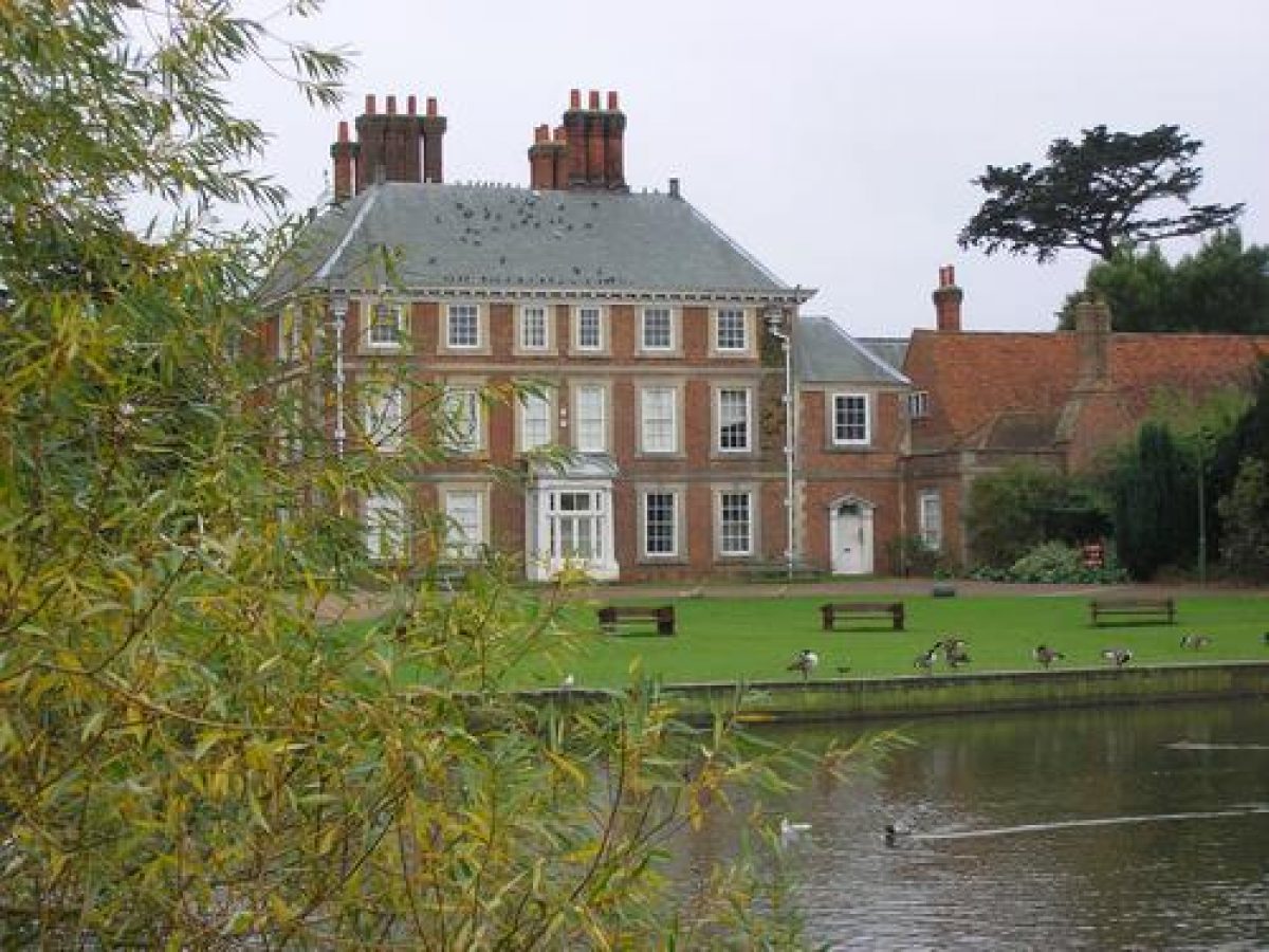
Forty Hall (listed grade I) stands at the centre of the west side of its pleasure grounds. Built in 1629-36 for Sir Nicholas Rainton, it is a square, three-storeyed house of light red brick with a high pitched, hipped, green slate roof.
To the west of the Hall stands the stable court (C17 but much altered for modern requirements, listed grade II), entered via a gateway between flanking pavilions in the embattled screen wall (c 1630, together listed grade I).
GARDENS AND PLEASURE GROUNDS
To the north of the Hall, beyond the drive, a lawn slopes down to an irregular pond, described in 1773 (sale catalogue) as 'a fine sheet of water'. At its western end is a wooded area, within which is a mound formed from the spoil from the lake. On the edge of the north lawn, close to the Hall, are two stone lions: one from Broomfield, placed here in the 1980s, the other an older feature of the site, appearing on an early C19 drawing. Excavation trenches on the lawn, dug by the Enfield Archaeological Society in 1993, revealed evidence of brick terraces, the brickwork suggesting an early C17 date.
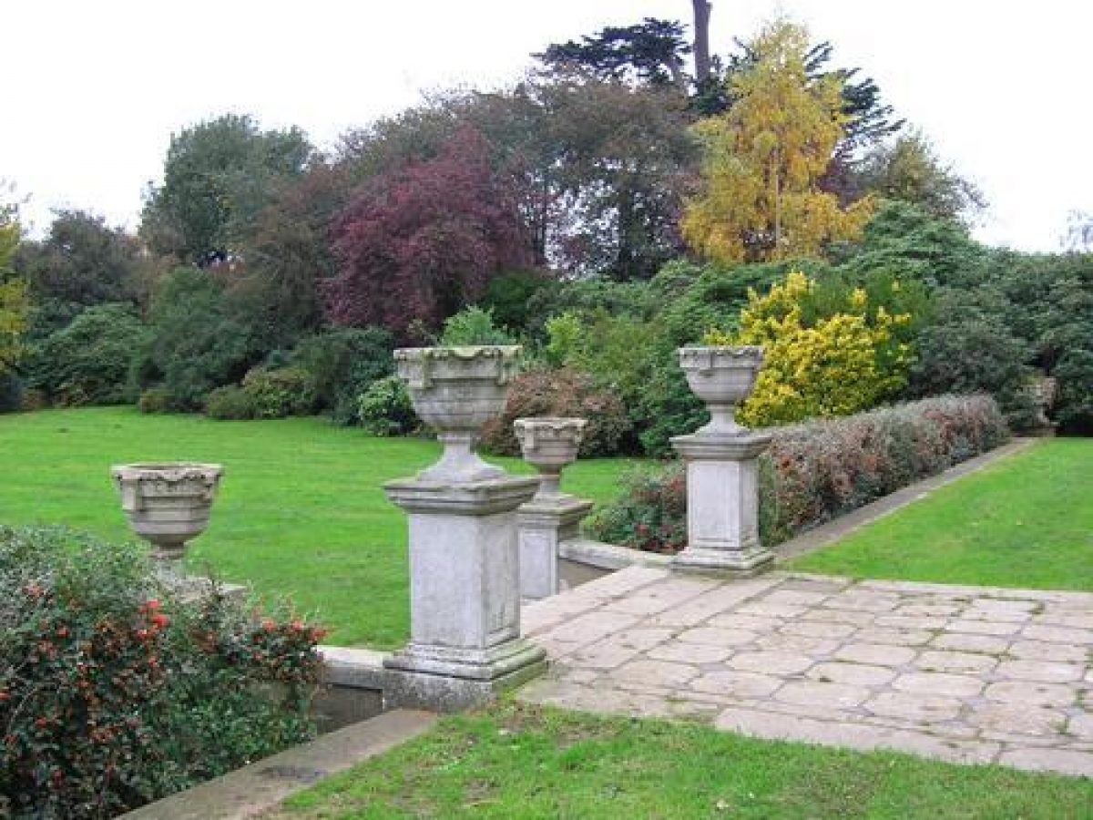
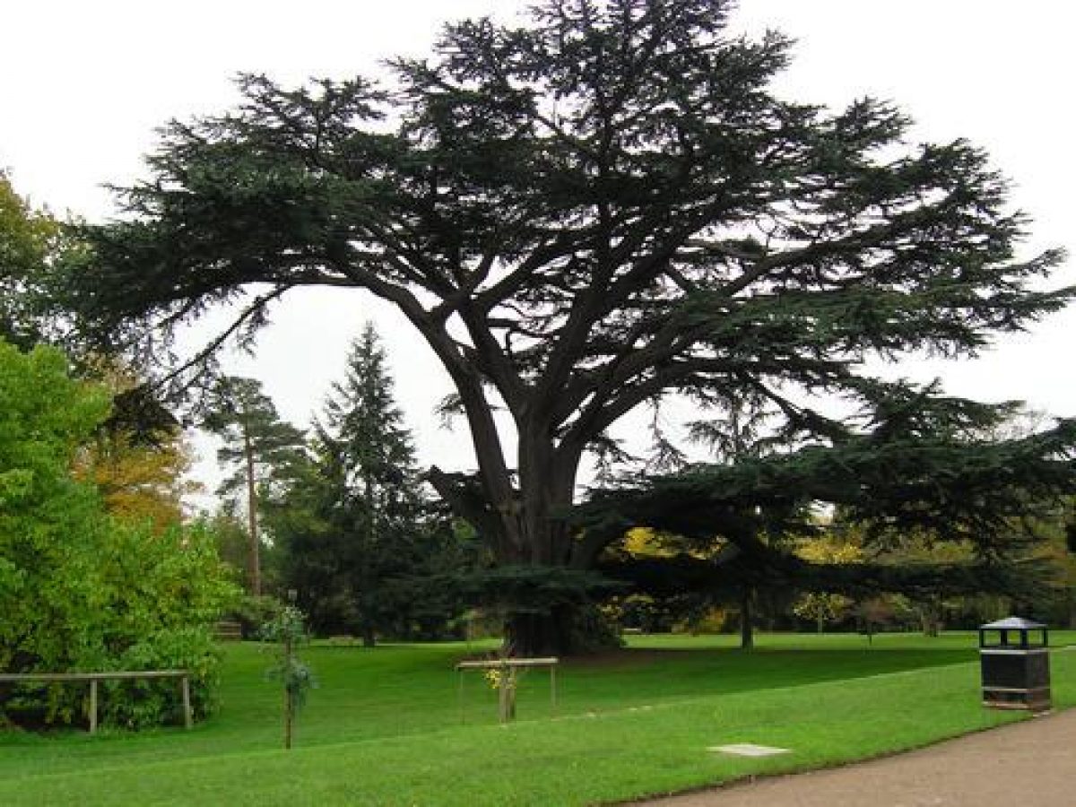
To the south of the Hall, beyond a stone-paved terrace the flags of which were laid c 1951 to replace the earlier gravel surface, is a rectangular lawn held by a retaining wall. To the east of the Hall, a brick wall supports the continuation of the terrace. The ground beyond is levelled turf, and a magnificent cedar, mentioned in the sale catalogues of 1773 and 1787, stands on a slight bank which forms the southern edge of this lawn. Further east lies grass planted with specimen trees, and a perimeter belt of planting along the east and south sides of the gardens to screen the site. A path winds through the belt, leading from the east end of the drive round to the south side of the Hall.
PARK
To the north of the Hall, beyond the retaining wall of the pleasure grounds, lies the park, with the ground sloping gently down towards the Turkey Brook. On an axis with the north front of the Hall is a double lime avenue, a feature which formerly continued on the far side of the water. A clear depression confirms that the Brook was once widened to form a basin on the line of the avenue.
The main park, known as the New Park or Little Park, was taken out of Enfield Chase after 1547; the lane west from the Hall is believed to have its origins as the southern boundary of the deer park (Gillam 1997). By the time of the 1785 estate map, the park occupied the ground between the pleasure grounds and the Maiden Brook known as the Great Field, with Primrose Hill, the land to the west, divided into two large fields.
At the north-west corner of the park, lying partly within woodland labelled 'Pond Groves' on the 1773 sale plan, is a complex of earthworks. The text of the sale catalogue states that these 'canals' are 'fortunately placed for Embellishments and form Cascades that rush impetuous', while Lysons (1811) subsequently describes them as the remains of fishponds. It is possible that they formed C16 water gardens accompanying the former Palace. The 1787 sale catalogue suggests that, 'to augment the natural beauties of the Vale in front of the Home, a Magnificent Lake could be easily formed' out of the 'running Brook and successive Ponds'. The wood containing the fishponds and associated earthworks is cut through with walks, and a walk leads along the narrow causeway between the long rectangular main pond set with islands, and the Brook. The Brook itself runs through a deep cut and appears formerly to have been dammed at a point just to the east of the line of the north avenue.
KITCHEN GARDEN
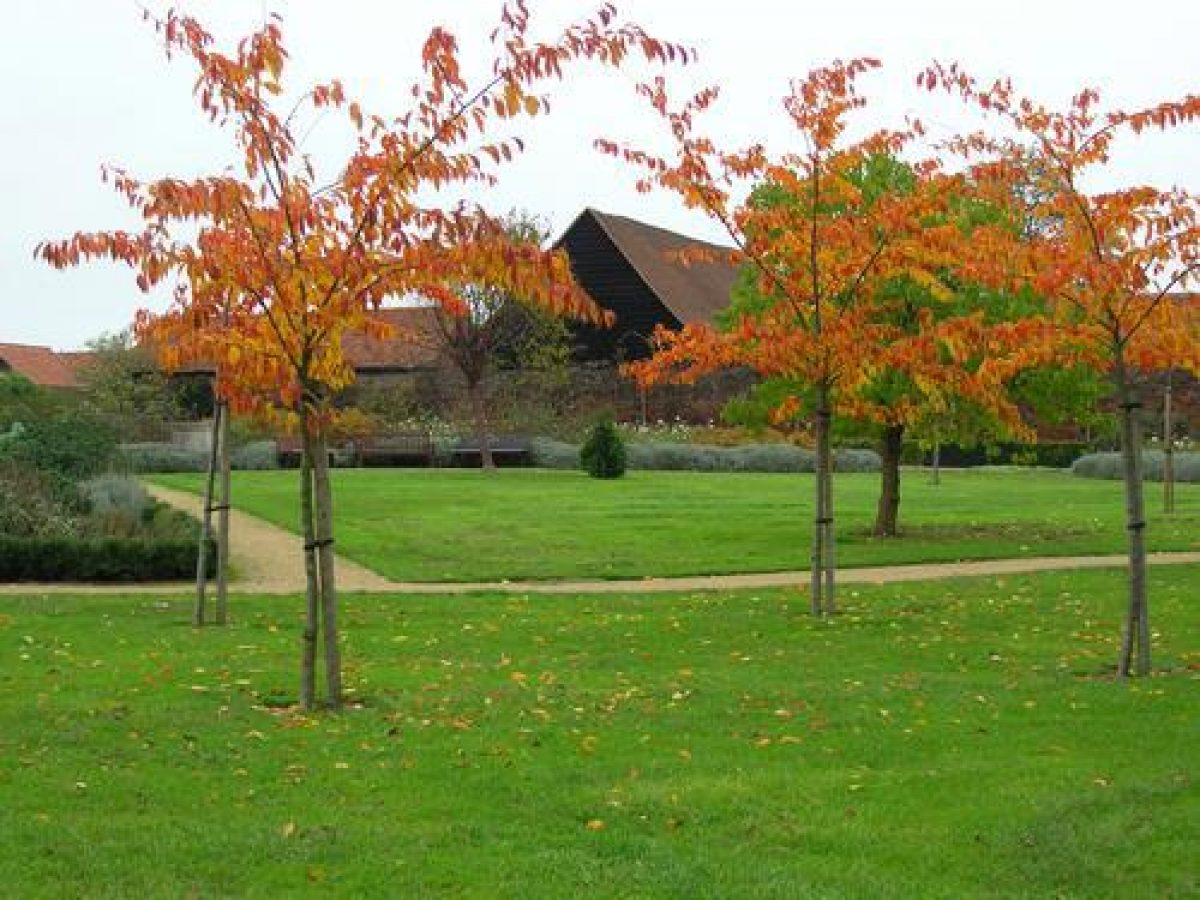
South-west of the Hall and stable block stands a brick-walled garden dating from the C17. A little under 1ha in extent, it is currently (1997) laid to grass with specimen trees and shrubs, but was identified in the 1773 sale particulars as containing fruit and as being 'capable of producing vegetables in vast profusion'. At its northern end is a complex of farm buildings.
OTHER LAND
The main drive continues as a lane westwards from the stables across farmland towards the New River. The enclosure to the south of this track, and to the west of the gardens, is called 'The Warren' on the 1773 sale plan and the 1785 estate map.
Off the lane to the north, a substantial ditched bank, serving as a raised walk, up to 2m high in places and hedged on both sides, leads towards the Brook. At its southern end, flanked to the east by a strip of plantation, is a square pond at the eastern end of which is the site of a summerhouse. This building is marked on the 1785 estate map, the summerhouse with gabled roof and sash windows which then occupied this position having been demolished in the 1950s. Also marked on the estate map, at the northern end of the walk near the Brook, is a second building, while on the lane further to the west are the remains of a third building, both of which having possibly been summerhouses. To the west of the last-mentioned spot, two further raised walks branch off the lane, one leading north to join with a walk alongside the Brook, the other leading south to the old course of the river. Both are shown on the late C18 plans of the estate and form part of the set of similar walks across the estate fields described in the 1787 sale particulars as 'The Walks and Double Hedges'.
REFERENCES
D Lysons, The Environs of London II, (2nd edn 1811), p 298
W Keane, The Beauties of Middlesex (1850)
I Jones, and I Drayton, The Royal Palaces of Enfield, (Enfield Archaeological Society 1984), pp 8-17
G Gillam, Forty Hall, Enfield 1629 (1997, (Enfield Archaeological Society 1997)
Maps
Sale plan, 1773 (696/1), (Greater London Record Office)
T Bainbridge, Plan of Forty Hall Estate, 1785 (Enfield Local History Unit)
OS 25" to the mile: 1st edition published 1865
2nd edition published 1895
3rd edition published 1913
1936 edition
Archival items
Sale particulars for Forty Hall for 1773, 1786, 1787, and 1799 are held in the Enfield Local History Unit.
Description written: March 1999
Edited: May 2000
- Visitor Access, Directions & Contacts
Telephone
020 8363 8196Access contact details
Opening is unrestricted (parkland). Courtyard Café open daily from 10.30am-4pm (closed Christmas, Boxing Day)
Directions
Rail: Turkey Street; Enfield Town; Enfield Chase then bus/walk. Bus: 191, W10 then walk.
Owners
Enfield Borough Council
- History
The following is from the Register of Parks and Gardens of Special Historic Interest. For the most up-to-date Register entry, please visit the The National Heritage List for England (NHLE):
www.historicengland.org.uk/listing/the-list
HISTORIC DEVELOPMENT
The site was originally that of Elsynge Palace (scheduled ancient monument), acquired and enlarged by Sir Thomas Lovell in 1492. Lying adjacent to the Royal Enfield Chase, the Palace attracted many royal visitors and, after about 1539-1540, became a royal residence housing the children of Henry VIII. In the first half of the 16th century about 375 acres (approximately 156 hectares) of the Chase were imparked to form the New Park. Towards the end of the 16th century, its use as a Palace declined and the estate passed out of royal ownership. In 1624, Sir Nicholas Rainton (d 1646), later Lord Mayor of London, began building a new house, Forty Hall, on a ridge to the south of the old palace (completed by about 1636). By 1656, Rainton's nephew and heir, also Nicholas, had acquired the Palace, which shortly after he was to demolish.
The Palace, as acquired by Rainton, stood surrounded by 'Court yardes Gardens Orchards and Courtyard with the field adjoining called the Walks' (LMA: Acc 16/8). Early 17th century sources refer to a Portland stone sundial in the garden round the Palace, and the building of an arbour and latticed seats. These gardens were probably cleared at the time of the demolition of the Palace.
The grounds, including the drive and pond, are shown in much their present form (1999) on surveys of 1773 and 1785 when the estate of Eliab Breton (d 1785), the then owner, was sold. The estate passed through a number of different private ownerships until purchased by Enfield Urban District Council from Derek Parker Bowles in 1951 and converted into a museum, in which use it remains, with much of the grounds forming a public park.
Period
18th Century (1701 to 1800)
- Features & Designations
Designations
The National Heritage List for England: Register of Parks and Gardens
- Reference: GD 3016
- Grade: II
The National Heritage List for England: Listed Building
- Reference: Dower House
- Grade: II
The National Heritage List for England: Listed Building
- Reference: Forty Hall
- Grade: I
The National Heritage List for England: Listed Building
- Reference: gateway
- Grade: II
The National Heritage List for England: Listed Building
- Reference: screen wall
- Grade: I
The National Heritage List for England: Listed Building
- Reference: stable block
- Grade: II
Style
English Landscape Garden
Features
- Lake
- Earliest Date:
- Latest Date:
- Walk
- Herbaceous Border
- Kitchen Garden
- Specimen Tree
- Description: Very old Cedar of Lebanon.
- Country House (featured building)
- Description: Forty Hall was built by Sir Nicholas Raynton between 1629-36, at the top of the hill south of Elsyng Palace, which existed here by the 14th century.
- Earliest Date:
- Latest Date:
- Key Information
Type
Park
Purpose
Recreational/sport
Principal Building
Parks, Gardens And Urban Spaces
Period
18th Century (1701 to 1800)
Survival
Extant
Hectares
19
Open to the public
Yes
- References
References
- {English Heritage Register of Parks and Gardens of Special Historic Interest} (Swindon: English Heritage 2008) [on CD-ROM] Historic England Register of Parks and Gardens of Special Historic Interest
- {Forty Hall Farm Management Plan} (1998) Forty Hall Farm Management Plan
- Drury McPherson Partnership {Forty Hall Estate: Conservation Management Plan} (2008) Forty Hall Estate: Conservation Management Plan
- {Forty Hall Management Plan 2007-2011} (2007) Forty Hall Management Plan 2007-2011