Introduction
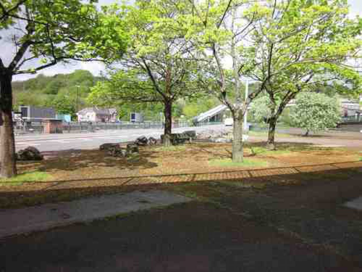
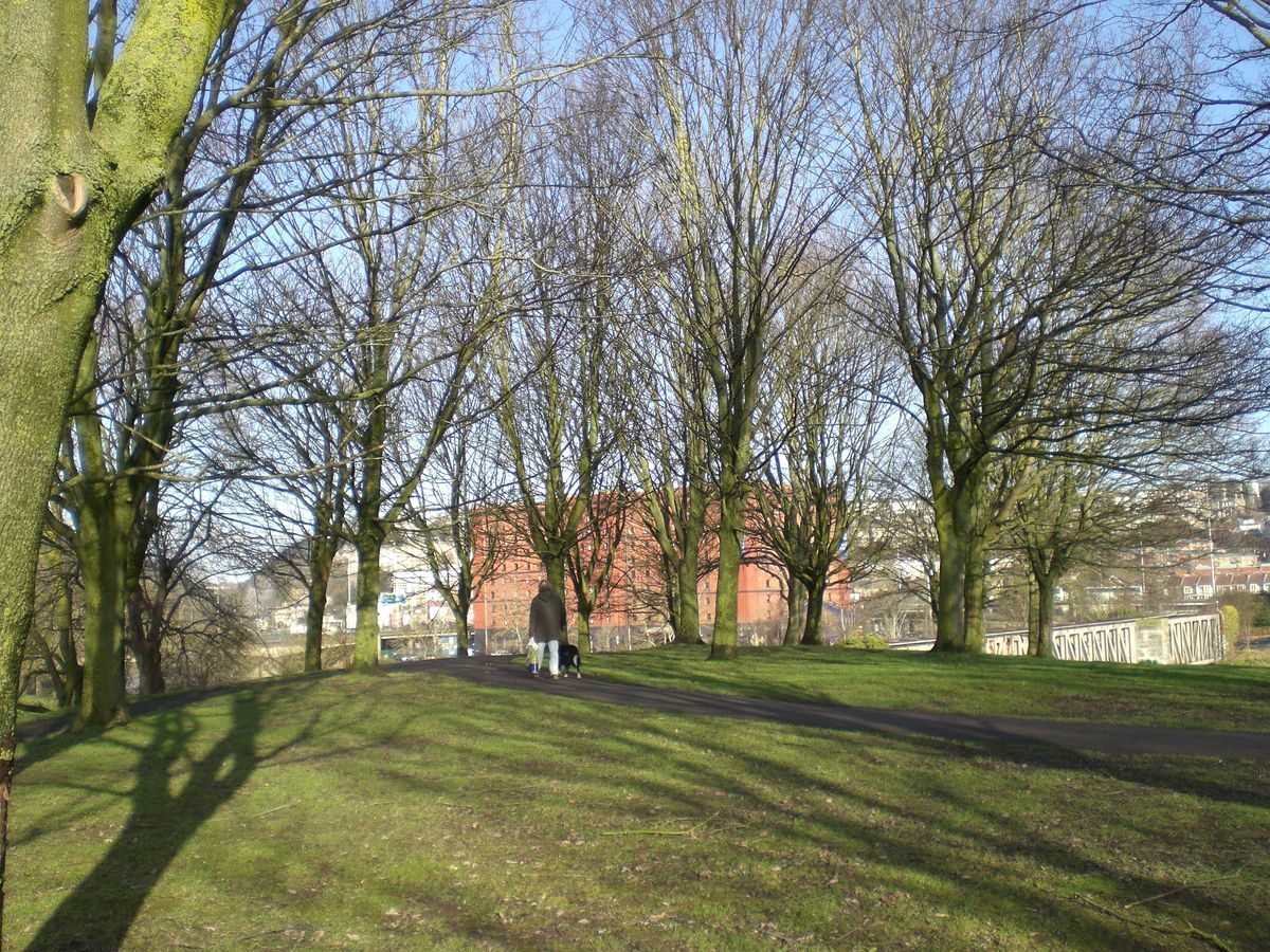
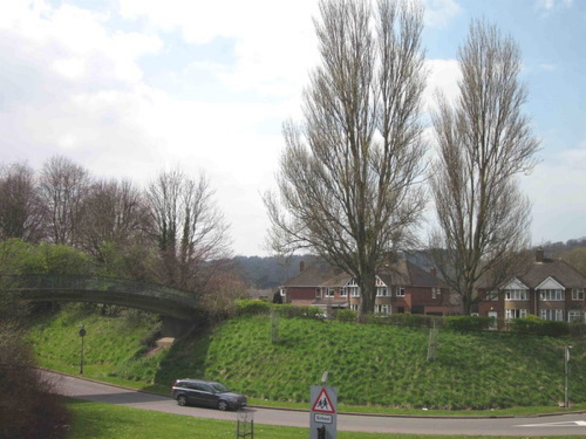
This is a designed landscape associated with a highway scheme and includes urban space, parkland and roadside planting.The North Side consists of an area partly under the Cumberland Basin flyover and partly exposed with some tree planting which includes a catalpa. Originally designed and built as a piazza by Dame Sylvia Crowe, the area had become degraded and 2011/12 the local community, in conjunction with Bristol City Council, took the first steps to regenerate the space for community and public use.The South Side incorporates Ashton Meadows, the western edge of Greville Smyth Park and Ashton Gate Junction. Dame Sylvia Crowe's landscape and planting are extant and the now mature trees and green space provide a soft edge to the sweeping dual carriageway, associated access roads and junctions (See Image 1).
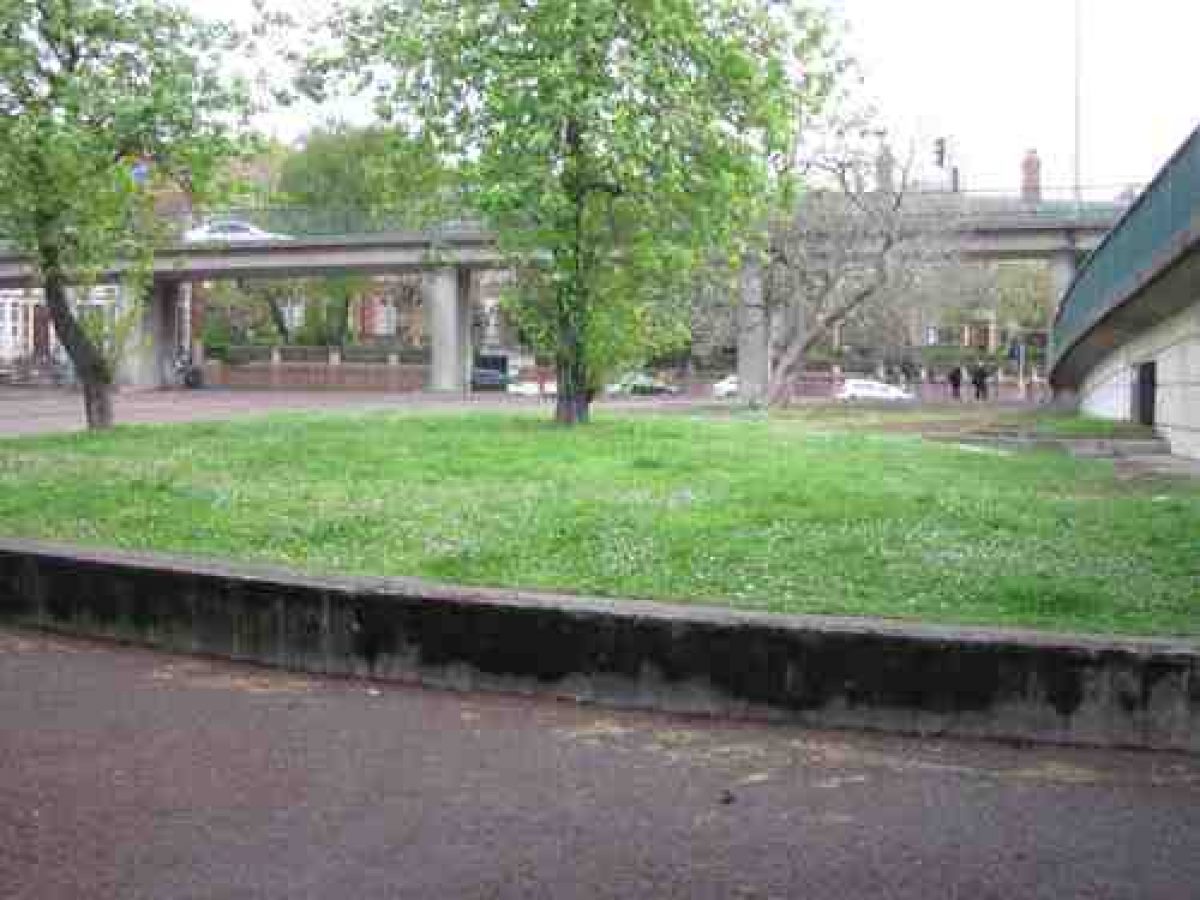
Area to the North of the Cumberland Basin
In 2011/2012 the Hotwells and Cliftonwood Community Association put forward plans to Bristol City Council to regenerate this space for the local community and general public to enjoy once again. Currently (2014) the local community are planning to plant eight trees. Any further regeneration will depend on the availabilty of funds.
Area to the South of the Cumberland Basin:
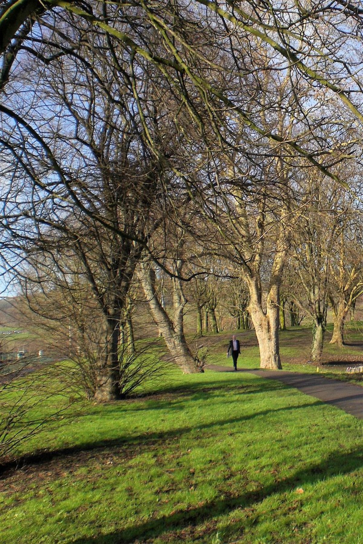
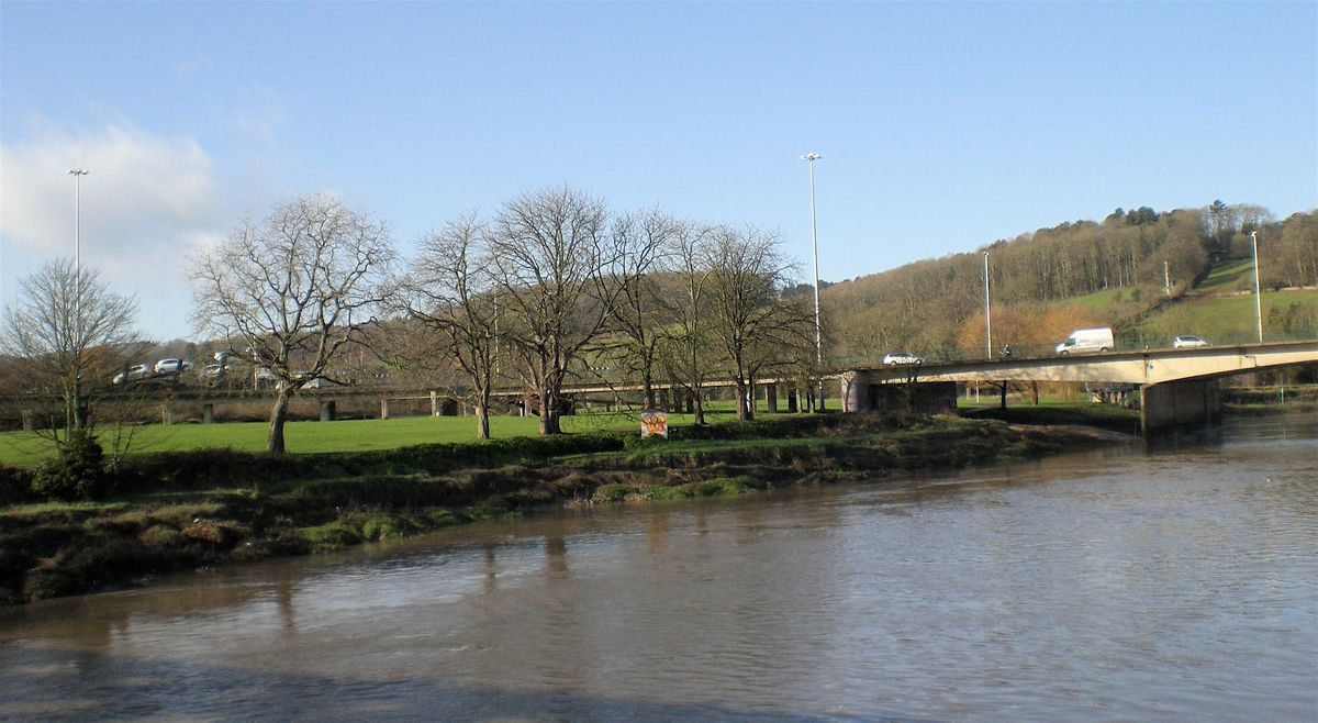
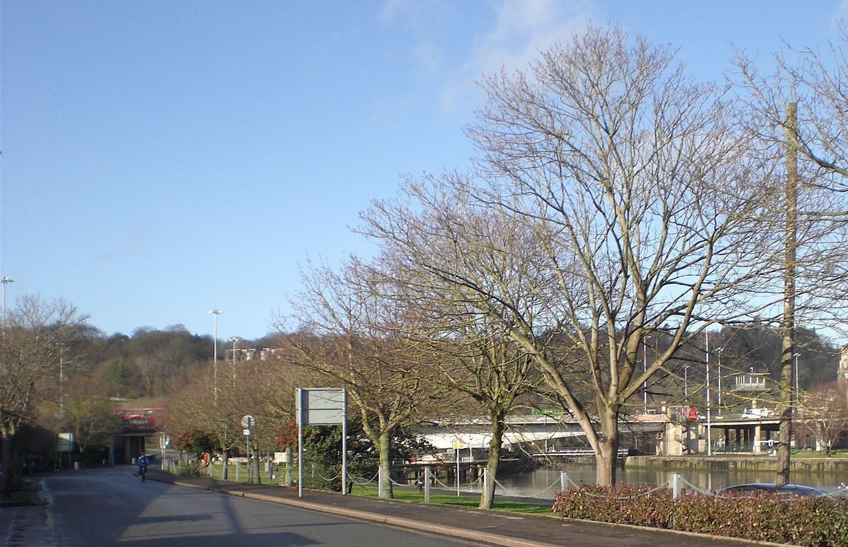
The landscape to the south of the Cumberland Basin is extant with what is now mature planting, which, together with the undulating landscape, has resulted in Ashton Meadows becoming an area of contrast to the hard landscaping of the rest of the Cumberland Basin site. The views into and out of Ashton Meadows, so skilfully planned by Sylvia Crowe, continue to add to the enjoyment of those using the park area as well as to those looking down into it from surrounding heights (See Images 6,7 and 8).
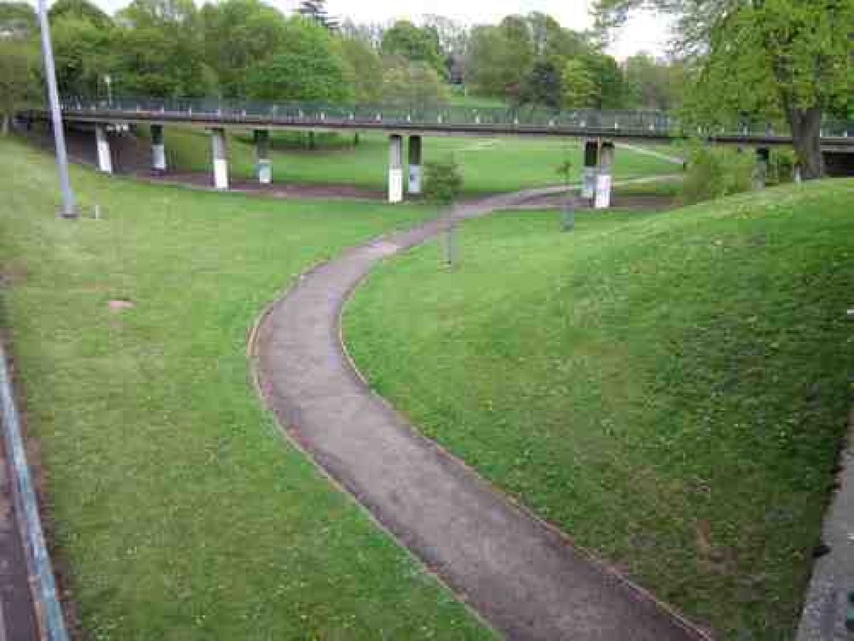
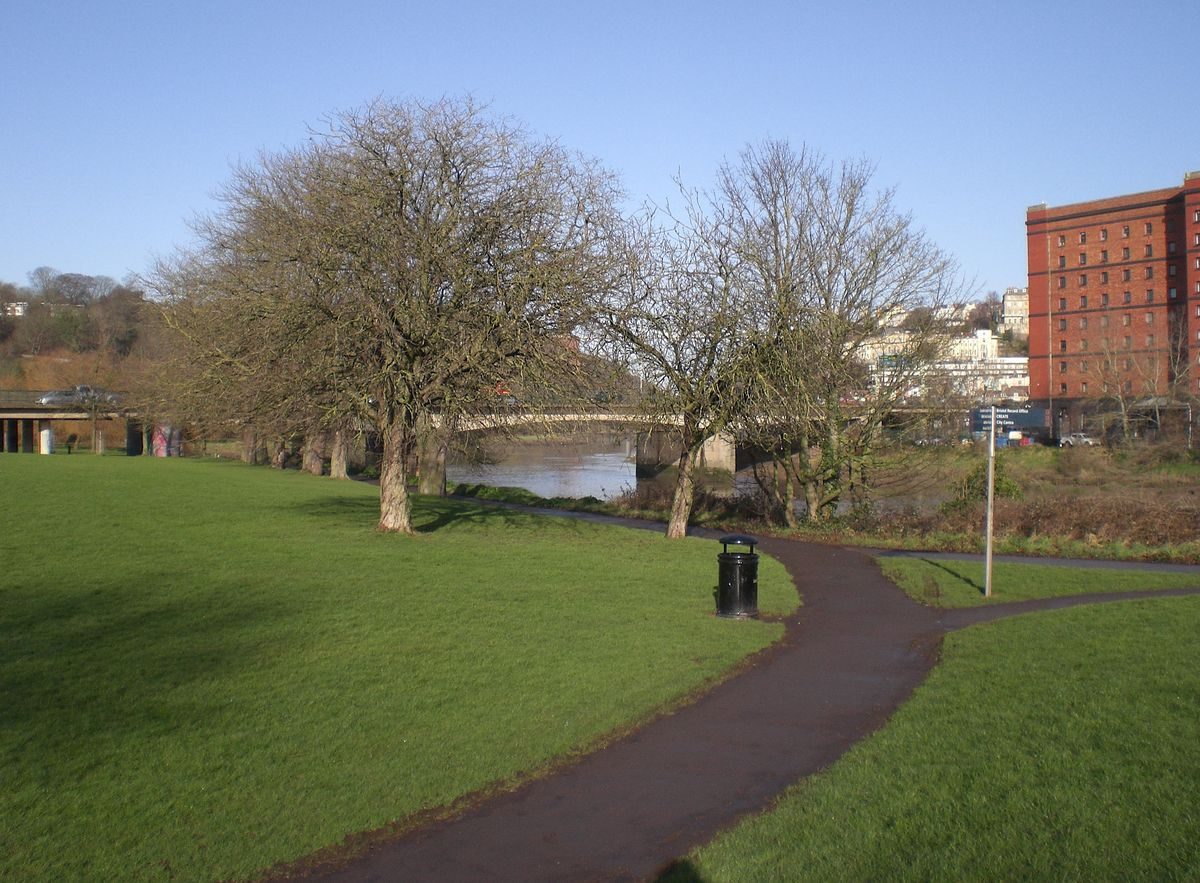
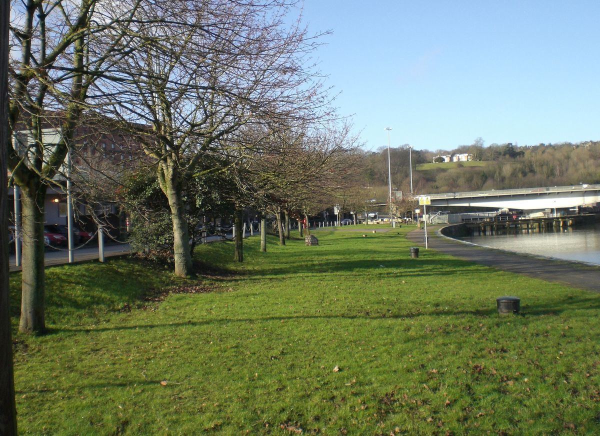
The area involved is not large, the many tricks played on the eye are all intended to make the area appear larger than it is. A 1 km circuit walk reveals continuously changing vistas along the route. One of the key elements is not to be able to see from end to end giving the illusion it might be wider than the tree line. It is given extra visual width by the adjacent water environment (See Images 9 and 10).
The gently undulating landscape includes grass, avenues of chestnut trees, willows, a tidal river, staircases to the road system and cycle ramps. There are no formal barriers to the bank of the tidal River Avon. Another key factor in the design by Sylvia Crowe is that views out of this area provide some classic vistas which include the dramatic urban terraces of Clifton and Clifton Wood, the sublime Avon Gorge and Brunel's Suspension Bridge, as well as Leigh Woods and the Ashton Court parkland (See Images 11, 12 and 13).
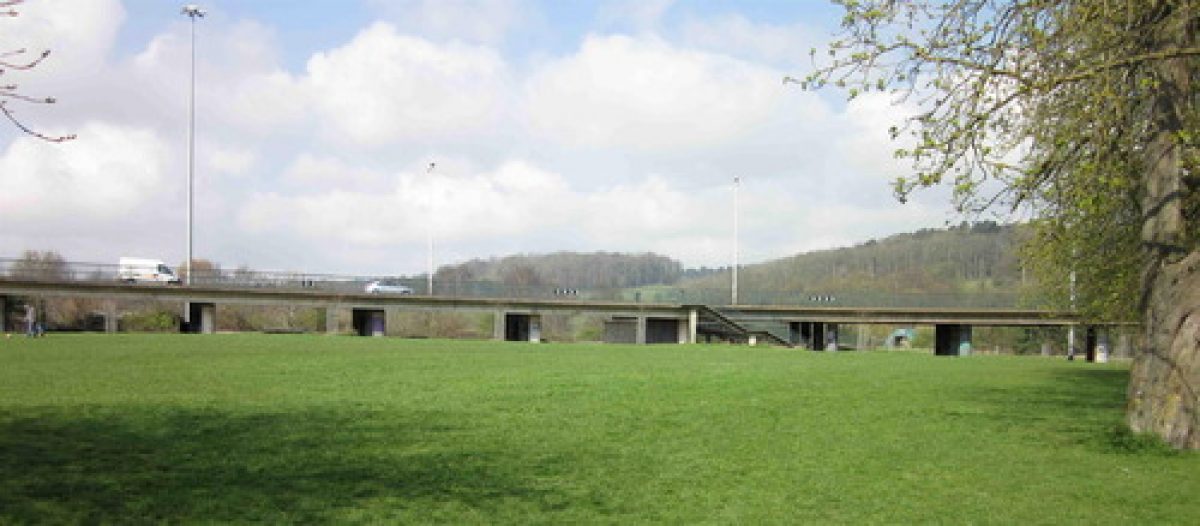
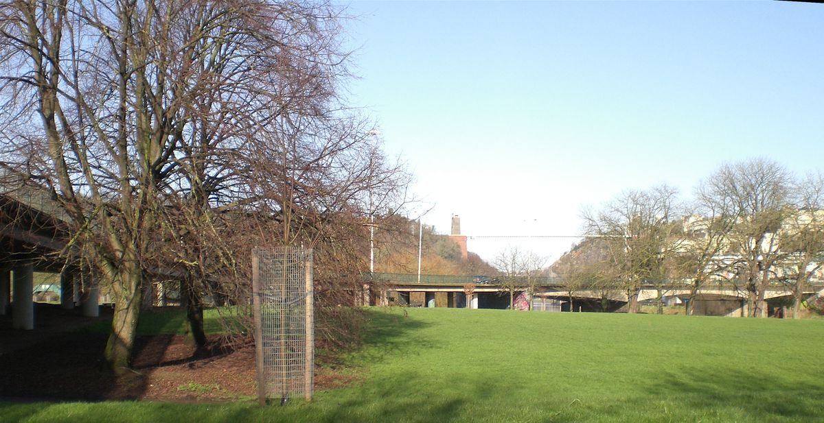
The elevated road carriageway or 'Southern Approach Viaduct' to the Avon River Bridge is woven into the schene with its massive round legs and curved and cambered soffit to form a permeable public area and dry walk space within the park. The landscape rises and falls within the viaduct length again giving a perspective of greater distance than is real. It is an elegant example of soft landscaping design and spatial planning (See Image 14).
In 2012/13 a cycle path was constructed along the lower east side of the Crowe designed landscape. It forms part of a larger network to encourage cycling.
The scheme continues south to the western perimeter of Greville Smyth Park. This popular public park is the largest public space in Bedminster, with many mature trees, playing fields and play areas. An area of the park was taken by the 1960s road scheme - the earth has been banked up from the park, with roadside tree and shrub planting providing a buffer between the park and the busy road (See Image 15).
The Ashton Gate Junction area to the southern end of the scheme contains some sweeping compositions of grass banks. Its disposition and planting illustrates some good cross-disciplinary work between landscape architect and engineers. Footpath routes meander through the open spaces and lead up towards Greville Smyth Park and beyond. A small neighbourhood park adjacent to Blackmoors Lane is the culmination of the scheme, an extant piece of Crowe design, responding to the existing post war housing - providing both a local space and a screen between the housing and the road (See Image 16).
- Visitor Access, Directions & Contacts
Owners
Bristol City Council
City Hall, College Green, Bristol, BS1 5TR
- History
Area to the North side of the Cumberland Basin:
The area of Hotwells derives its name from a warm spring that emerged from the River Avon. Although first recorded in the late-15th century, by William Worcester, difficulties of access meant it was not until 1662 when a carriage road was built and Hotwells House was constructed, that people began to visit for its curative properties. By 1750 the area had become a fashionable summer spa that boasted a pump room, hotels, assembly rooms, river gardens, elegant houses, shops, a library and theatre. By 1800, the popularity of the spa was in decline depite attempts to revive it with the building of a new pump room in 1832.
By the 1750s Bristol was the second largest port in Britain. The large tidal range of the River Avon combined with the difficult access up the river to the docks meant that by 1800 trade was being lost to other ports with greater capacity and easier access. To try and halt some of the decline in trade, William Jessop remodelled the existing harbour between 1804 and 1809 to create a non-tidal, impounded dock: The Floating harbour. By the river in adjoining Hotwells, the half-tidal Cumberland Basin was created to hold larger ships passing through to the Floating Harbour via entrance locks. This feat of engineering gave Bristol a new lease of life as a major working port. Hotwells, situated at the entrance to the Floating Harbour, became home to dock workers who lived there in tenement buildings.
Clearance of the tenements in the 1930s and World War 2 bombing destroyed parts of Hotwells and, with new docks built downriver on the Severn estuary to cater for larger ships at Avonmouth and for container cargo at Royal Portbury, mercantile industry at the Floating Harbour slowly decreased. The City Docks closed to commercial traffic in 1975. Today, Bristol City Docks have been redeveloped as an area for leisure, retail and residential developments.
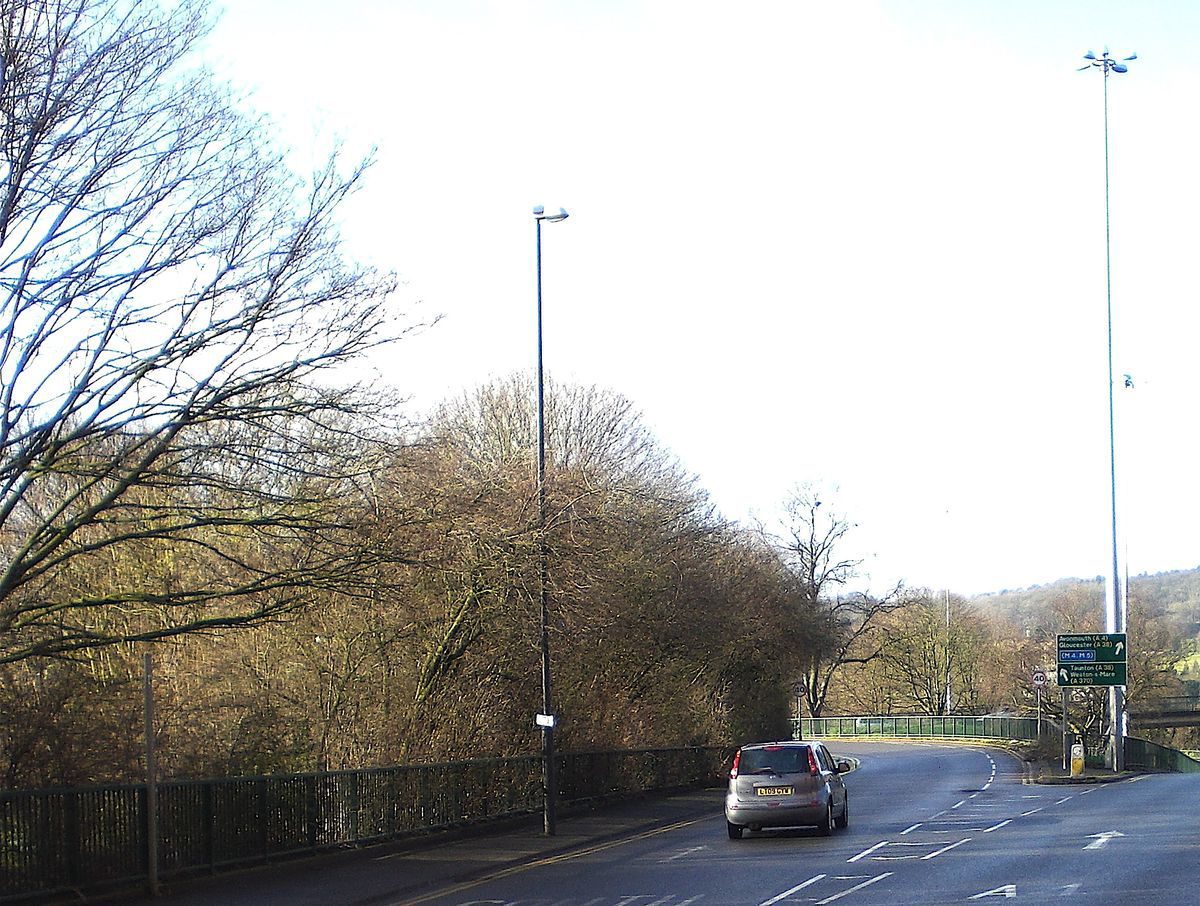
The Floating Harbour and New Cut formed a barrier to north-south road communication which meant there were only three possible road crossings into central Bristol from the south. The Cumberland Basin was the most westerly crossing and attracted both long-distance and local traffic. The growth in car ownership and leisure travel expanded rapidly during the 1950s and 1960s. Prior to the Cumberland Basin Bridges and Ashton Gate Junction road scheme, traffic jams of day trippers and holiday makers, mainly from the Midlands, heading to the coast would block the roads, especially over summer weekends.
The situation was made worse at the junction Lock Swing Bridge to the east of the Cumberland Basin which could swing open for up to ten times a day to enable shipping to pass. This inevitably had a dramatic effect on the flow of traffic and would lead to long traffic jams in either direction. At this time, the M5 and the M5 Avonmouth Bridge which would subsequently take through traffice over the river Avon, had not been built. The Cumberland Basin Bridges scheme and the Ashton Gate junction road scheme were created to develop a new traffic system to alleviate the traffic jams and ease the flow of north-south traffic.
Landscape Report by Dame Sylvia Crowe
This elevated dual carriageway extended from the base of the hill leading up to Clifton to Winterstoke Road and Ashton Gate; with associated slip roads this created a hard landscape. Its construction had necessitated the demolition of part of the old Hotwells area. Therefore, in 1964, Bristol City Council commissioned the eminent landscape architect Dame Sylvia Crowe to produce a Landscape Report. Her brief, and aim, was to ensure the new roads added to the attraction of the existing landscape and did not detract from it.
The scheme, which was largely implemented, is in two parts; the northern, Hotwells side of the Cumberland Basin incorporating areas underneath the flyover and the southern, Ashton Meadows open area leading to Ashton Gate and Winterstoke Road.
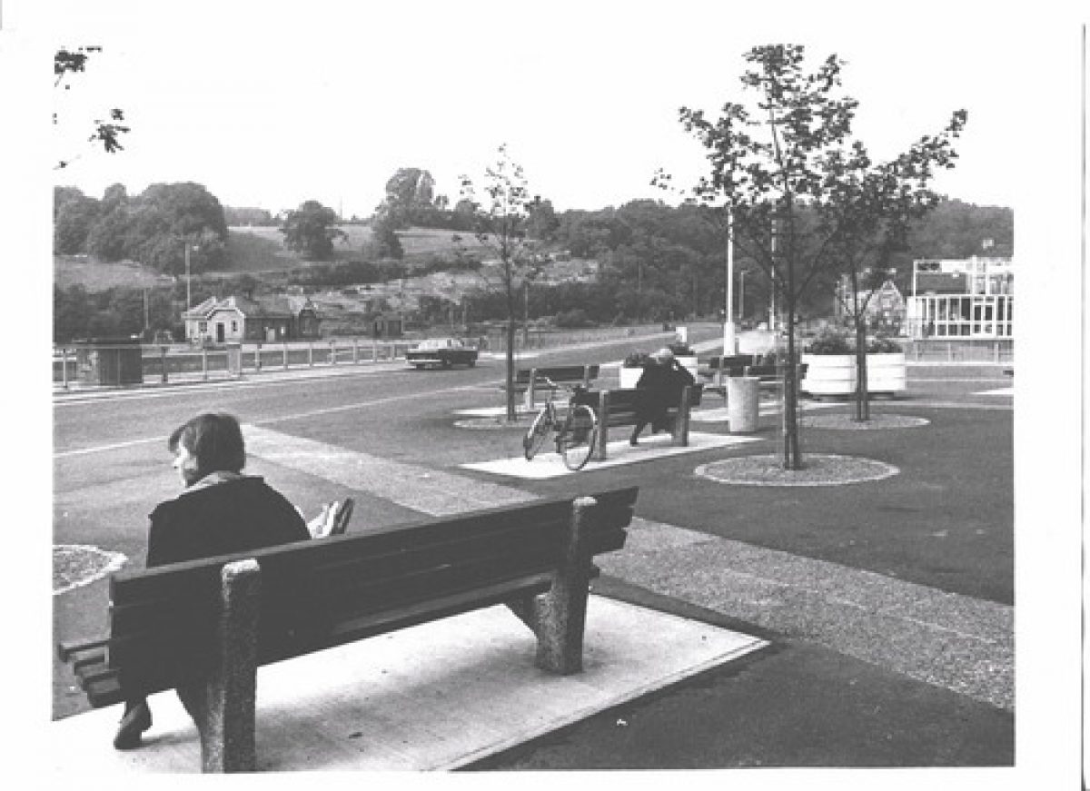
In 1965 it was possible to see sea-going ships negotiating raised or swing bridges at several points on their way to berths near the centre of the city. For the northern part of the area, Sylvia Crowe designed the Cumberland Piazza Scheme (which is completely surrounded by roads) under the arches of the new road system but also with seats in an open area. This open space was originally designed as an amenity and urban park for the local community of Hotwells as well as for those visitors who might stop off at the Piazza for a break on their car journey to or from the coast. In 1974 completion of the M5 Avonmouth crossing removed much of this national network traffic through the Cumberland Basin.
Sylvia Crowe intended this area would be 'frequented and enjoyed by the people' and envisaged open-air artwork exhibitions, flower stalls and information points to achieve this as well as providing seats for 'the interest of watching shipping coming into the docks' (Crowe)
Central to her design was a pond and fountain 'to bring light down into the shadowed space beneath the arches' (Crowe). She also planned a café with outdoor seating, toilets with a mural on the outer wall, benches, lighting, an advertising column to display city events and a subway under Faraday Road to a car park on the eastern side. The nautical themed playground was incorporated into the design to compensate for the loss of one previously on that site. The central piazza was surfaced with red asphalt, patterned with concrete lines and curves.
Her landscaping plan for the Cumberland basin bridges scheme reveals many signs of the spirit of 1960s optimism about urban communal life with it emphasis on public spaces. Over the ensuing forty years, the area under the flyover became rundown, the fountain was grassed over, the playground disappeared and the café and public toilets were closed.
Area to the South of the Cumberland Basin
The area to the south of the river incorporates Ashton Meadows. In this area Sylvia Crowe created a riverside park out of what, in 1962-1965, was a major civil engineering site compounded with major drainage outfalls, two railways, an abandoned principal highway and a new elevated carriageway (the Avon Bridge was in effect the M5 river crossing for its first ten years of use).
In 1902, Ashton Junction was built to control traffic and included Ashton Meadows sidings that followed an alignment of a tramway that led from Frayne's Colliery in Ashton Vale, to the River Avon. The junction opened in 1906 following the completion of a branch to Wapping Railway Wharf on the southern side of the Floating Harbour. The Junction was closed in 1991 and demolished eight years later.
It was for this area to the south of the Cumberland Basin, where Sylvia Crowe wanted to ensure 'the new constructions are welded into the surrounding landscape of land shaping and tree planting'. In order to achieve this the objectives of her Plan were:
(i) To ensure the new road works shall add to the attraction of the existing landscapes and not detract from it
(ii) To ensure that the project shall benefit pedestrians equally with motorists by making the pedestrian routes easy and attractive
(iii) To make practical use wherever possible of the shelter provided by the elevated roads (Crowe)
- Associated People
- Features & Designations
Designations
Conservation Area
- Reference: Bristol City Council
Features
- Parkland
- Planting
- Trees
- Road
- c
- Key Information
Type
Designed Urban Space
Purpose
Recreational/sport
Principal Building
Parks, Gardens And Urban Spaces
Survival
Extant
Hectares
5
Open to the public
Yes
- References
References
- Buchanan, A. and N. Cossens {Industrial Achaeology of the Bristol Region} (Newton Abbot:: David & Charles, 1969) Industrial Achaeology of the Bristol Region
- Crowe S. {Cumberland Basin Bridges and Ashton Gate Junction Landscape Report} (1964) Cumberland Basin Bridges and Ashton Gate Junction Landscape Report
- Foster, R. {Hotwells Piazza, Hotwells, Bristol - Design and Access Statement} (2011) Hotwells Piazza, Hotwells, Bristol - Design and Access Statement
- Hotwells and Cliftonwood Community Association {Cumberland Piazza Heritage Statement} (2012) Cumberland Piazza Heritage Statement
- Hotwells & Cliftonwood Community Association {Cumberland Piazza Masterplan Proposals} (2012) Cumberland Piazza Masterplan Proposals
- Jones E., {Cumberland Basin Bridges Scheme, Bristol - Landscaping and Piazza by Dame Sylvia Crowe - A Conservation Statement} (unpublished, 2005) Cumberland Basin Bridges Scheme, Bristol - Landscaping and Piazza by Dame Sylvia Crowe - A Conservation Statement
- Smith, B. and Ralph, E {A History of Bristol and Gloucestershire} (Chichester; Phillimore, 1996) A History of Bristol and Gloucestershire
- Tippett, W. {A Conservation Management Plan for the Cumberland Basin} (unpublished, 2013) A Conservation Management Plan for the Cumberland Basin
- Wickham. S, {Elements of the Sylvia Crowe Landscape Project Report} (unpublished report for Bristol Civic Society, 2010) Elements of the Sylvia Crowe Landscape Project Report
- Sylvia Crowe and Associates {Cumberland Piazza Landscape Plan, Drawings: (214/35C)} (Landscape Institute Archive, 1965) Cumberland Piazza Landscape Plan
- Perkins, C. {Cumberland Piazza, Bristol - A Conservation Statement} (unpublished, 2012) Cumberland Piazza, Bristol - A Conservation Statement
- Sylvia Crowe and Associates {Ashton Gate Junction Landscape Plan (214/58F)} (1966) Ashton Gate Junction Landscape Plan (214/58F)
- Wendy Tippett {Landscape associated with Cumberland Basin Bridges and Ashton Gate Junction} (2013) Landscape associated with Cumberland Basin Bridges and Ashton Gate Junction