Introduction
Crystal Palace Park is a mid-19th-century public park modified in the 20th century. The park was the site of 'Crystal Palace' which was moved from Hyde Park after hosting the Great Exhibition of 1851. Some of the trees from the original planting survive and the park has a number of lakes, initially part of the elaborate waterworks scheme. The London Development Agency (LDA) have started a programme of regeneration in the park. The park is also the home of The National Sports Centre (NSC).
Terrain
The site is set on the south-east side of one of the highest hills in south-east London.www.historicengland.org.uk/listing/the-list
19th century pleasure grounds designed by Sir Joseph Paxton as a setting for the Crystal Palace when it was moved from Hyde Park in 1852.
DESCRIPTION
LOCATION, AREA, BOUNDARIES, LANDFORM, SETTING
Crystal Place is situated at the top of Sydenham Hill in a densely populated area of south-east London. The area immediately around the site has taken on the name of Crystal Palace. Lower Sydenham lies c 700m to the east and Penge 400m to the south-east. Dulwich Park (qv) is c 1km to the north, and West Norwood Cemetery (qv) c 1.5km to the north-west. The site is enclosed within iron railings and fencing and is bounded to the north by Westwood Hill (A212); to the north-east round to the south-east by Crystal Palace Park Road; to the south-west by Anerley Hill; and to the west and north-west by Crystal Palace Parade. Thicket Road provides the boundary to the south-east, while the railway line which runs between London and Beckenham forms the boundary to the south. The c 80ha site is set on the south-east side of one of the highest hills in south-east London. The views, so important to the Company when they chose the site, have changed. The City of London is largely obscured by buildings but the views across to Kent still exist. Of the whole area, c 42ha is open as a public park, c 17ha forms the National Recreation Centre, and c 20ha includes the Terraces and the site of the exhibition building to the north-west.
ENTRANCES AND APPROACHES
The park was originally approached through the turnstiles of the Crystal Palace Exhibition Building on the west side of the site. Additional entrances were provided from the pneumatic railway to the north-east, and the London to Brighton steam railway to the south-west. Today (1999), entrance to the Terraces is from the Rockhills entrance to the north, and through a late C20 paved sunken garden, above the remains of the southern water tower, at the south-west end of Crystal Palace Parade. The main entrance for the sports centre is via Ledrington Road, a minor road off Anerley Hill. The main entrance to the pleasure grounds is from Thicket Road (Penge entrance) to the south-east where a tarmac road leads to a car park. The Penge entrance, formerly a lesser pedestrian entrance, was enlarged c 1880 to include a small ticket office. Additional pedestrian entrances to the pleasure grounds are situated around the site and include that in Crystal Palace Park Road (Sydenham entrance), and a pedestrian gate immediately north-east of the railway bridge over Thicket Road (Anerley entrance).
PRINCIPAL BUILDING
Since the destruction by fire of the Crystal Palace, the focal point of the park has transferred to the National Recreation Centre (listed grade II*). In 1951 Sir Gerald Barry, Director of the 1951 Festival of Britain, was commissioned to advise on the best use of the land recently taken over by the LCC. His proposal of a new exhibition centre was not adopted but the LCC did take up his idea of using the area in the centre of the former race track for recreational sports and training. The Sports Centre was designed in 1953-4 and built between 1960 and 1964 by the LCC Architects Department (Architects J 1967). The reinforced concrete frame, exposed externally and largely infilled with glass at the upper level, houses sports halls and swimming baths. Entrance for participants is at the lower level, while spectators enter at the upper level from the long raised terrace which is on the line of the principal axis of the park.
GARDENS AND PLEASURE GROUNDS
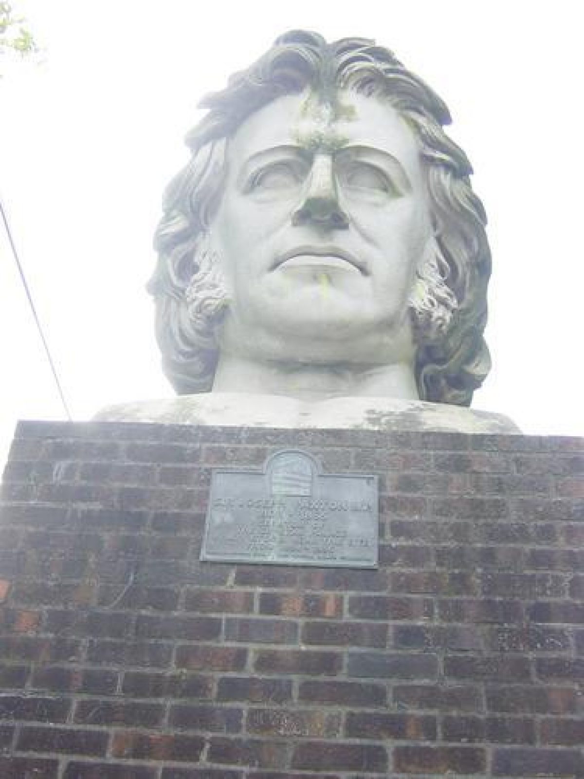
The gardens and pleasure grounds are situated on the lower slopes to the east and along the north side of the park. From the Penge entrance in Thicket Road a tarmac road leads north-west up though the centre of the site. This is all that remains of the Grand Central Walk which extended the length of the site from the Lower Terrace. Originally c 810m long and 29m wide, it now only extends c 300m to link up with the raised terrace of the sports centre. To the south-west of the central road is the C20 refreshment house with, c 50m to the north-west, the mid C20 life-size model of a gorilla. South-west of the refreshment house is the 3ha boating lake, constructed in 1854 as a lower reservoir for Paxton's extensive water displays. When Paxton's full system of waterworks was in operation the level of the lake was subject to great changes, being low when water was drawn off to feed the fountains and high when the water was returned. The 'tidal' lake and its three islands were dedicated to geology. In conjunction with the geologist Professor David Anstead, Paxton constructed a geological landscape which included the first attempt in the world to interpret at full-scale extinct prehistoric animals. The islands were created to represent the rocks and plants from these times and the twenty-two statues (listed grade II*), made of artificial stone and iron rods, were built by the artist and sculptor Benjamin Waterhouse Hawkins in 1854. His work was supervised by Professor Sir Richard Owen, Director of the Natural History Museum in London. From the north-east end of the lake near to the C20 boathouse, a numbered trail now (1999) guides the visitor around the area. A narrow tail of water, the limits of the lake to the north-west, is crossed by Paxton's rustic iron bridge (listed grade II). The bridge provides a platform from which to view, to the south and east, the geological landscape, and to the west, water issuing from a spring beneath a representation of geological strata. From the bridge the path continues c 100m before dividing, the path to the south-west passing, after c 100m, the Anerley entrance before completing the 350m circuit around the lake to the refreshment house. The path to the north passes a reconstructed cave complete with artificial stalactites (made as part of the geological landscape but sealed as a safety measure in 1993) and continues to the site of polo stables, converted into the Palace Farmyard in 1992. To the west of the farmyard is the last surviving element of Paxton's water display, part of the South Basin, which is currently (1999) used as a pool for flamingos. The path continues north-west past the sports stadium and links up after 200m with the entrance from Anerley Hill.
To the north of the central avenue is the park information centre (1990), built near to the site of a small expansion reservoir filled in when the Penge entrance was remodelled c 1880. The central avenue, lined by plane trees, extends c 200m before dividing: the path to the south-west links up with the network of paths around the lake; the path to the north follows the line of the boundary with the sports centre, passing, to the south-east, the late C20 children's play area and after 150m the Cricket Pavilion. The present brick building (built 1960) replaced the late C19 pavilion, a two-storey brick and weatherboard building with a spectators' gallery. It was used by Dr W G Grace (1848-1915), founder and captain of the London County Cricket Club based at Crystal Palace, who lived in Crystal Palace Park Road. Some 30m further on to the west of the path is a small open-sided timber structure with a ship's bell, known as HMS Crystal Palace. This was originally situated on the Lower Terrace and it commemorates the men of the Royal Navy who occupied the park during First World War. After c 100m the path divides, the north-east branch leading past the site of the pneumatic railway which was built as an experimental railway between the Sydenham and Penge entrances, before terminating at the Sydenham entrance. The north branch of the path broadens out and curves to the north-west along part of the former motor-racing track. Racing, which had been halted at the onset of the Second World War, returned to the park in 1957 after improvements to the circuit in 1954; the circuit was finally closed in 1972. The widened path divides around the English Landscape Garden, a grand sweep of lawn with the c 1ha lake (Paxton's Intermediate Reservoir), now (1999) used by a private fishing club. Here survive the remains of shaded walks, cool inviting groves, fine cedar trees, and a rhododendron valley. The natural amphitheatre to the north-west of the English Landscape Garden is used in summer months as a Concert Bowl. Open-air concerts were introduced to the park in 1961 by the LCC. They were halted in 1986 and reintroduced in 1990. The permanent steel stage, erected c 1997, is separated from the surrounding lawns by a rectangular pool. Some 25m to the south-west of the Concert Bowl is the maze; the original was developed c 1866 but fell into disrepair after the Palace fire and was levelled in the 1960s. Recreated by Bromley Council in the 1990s following the original design and using hornbeam hedges, the maze, at c 49m in diameter, is reputed to be one of the biggest in the country.
OTHER LAND
A path runs north-west from the English Landscape Garden to the Terraces. Situated immediately below the site of the Crystal Palace, the area was laid out formally by Paxton in a series of great terraces, with broad paths, lawns, flower beds, fountains, and statues. The Terraces provided, by way of a wide central stone staircase and lesser stairs at intervals along its length, access from the Palace to the pleasure grounds. The upper and lower terraces survive (1999), supported by a series of round-headed stone arches containing semicircular, semi-domed niches arranged in groups of three with taller pilasters between the groups (listed grade II*). The statues were sold in 1952 and the remains of the gardens were levelled in 1962. Currently (1999) the Terraces are laid to grass and used for large-scale events and car parking. Much of the site of the Crystal Palace itself has remained derelict since 1936. An area of c 2ha to the north is leased as a site for touring caravans, and in 1954 the British Broadcasting Company (BBC) constructed a major transmitting mast on a piece of land to the north of the campsite. The tower has become a well-known local landmark. Crystal Palace became closely associated with the early days of television when in 1933 the Baird Television Company established new offices, studios, and laboratories within the grounds. The buildings were removed in the 1950s.
Plans are in hand (1999) to redevelop the site of the Palace and enhance the Terraces.
REFERENCES
E Wolford, London Old and New (nd), pp 307-314
Gardeners' Chronicle, 14 (1853), p 219; 16 (1853), p 263; 37 (1853), p 583; 47 (1853), p 739
S Philips, Crystal Palace, A Guide to the Palace and Park (1854, revised 1859)
Routledges Guide to the Crystal Palace Park at Sydenham (1854)
The Builder, (1856)
Guide to Crystal Place and Park (1893)
C F Chadwick, The Works of Sir Joseph Paxton (1961), pp 16, 137-159
P Beaver, The Crystal Place (1970)
B Cherry and N Pevsner, The Buildings of England: London 2 South (1983), pp 182-183
Crystal Palace Park, Draft Management Plan, (London Borough of Bromley 1986)
B Elliot, Victorian Gardens (1990), pp 107, 110, 127, 173.
New Crystal Palace Matters [Journal of the Crystal Palace Foundation (founded 1979)]
Maps
[all reproduced in London Borough of Bromley 1986]
Site plan, guidebook, Philips 1854
Site plan, guidebook, Routledges 1854
Sale plan, 1912
OS 25" to 1 mile: 1st edition published 1865
2nd edition published 1898
Archival items
Crystal Palace Sale catalogue, 1912 [reproduced in London Borough of Bromley 1986]
Description written: March 1999
Edited: June 2001
- Visitor Access, Directions & Contacts
Telephone
07889 338812Access contact details
The park is open from 7.30am weekdays/9am Sat/Sun/BHs - half hour after dusk.
Directions
London Overground: Penge West; Crystal Palace. Bus: 2, 3, 63, 122, 137a, 202, 227, 249, 322, 358, 410, 417.
Owners
London Borough of Bromley
- History
The following is from the Register of Parks and Gardens of Special Historic Interest. For the most up-to-date Register entry, please visit the The National Heritage List for England (NHLE):
www.historicengland.org.uk/listing/the-list
HISTORIC DEVELOPMENT
After the success of the Great Exhibition of 1851, there was great public pressure to retain Sir Joseph Paxton's Crystal Palace, the magnificent glass and steel structure which housed the exhibition in Hyde Park. The Crystal Palace Company was formed, purchased the building for £70,000, and re-erected it in Penge Place, south London. Situated on the top of Sydenham Hill, the site was then rural in aspect and offered magnificent panoramic views over the Capital and the Kent countryside. In August 1852, work began on moving the huge structure to its new location. Paxton (1803-1865), assisted by his protégé Edward Milner (1819-1884), created a new landscape as a setting for the Palace, one that suited the increased scale of the rebuilt exhibition centre. The design, published in The Builder of 1856, was probably influenced by Paxton's visit in 1834 to Versailles (Chadwick 1961). Areas of formal and informal landscape were created around a great central axis which ran the length of the park from the exhibition building in the west to the Penge gate in the south-east corner. The heart of the park, set below two immense terraces, themselves decorated with gardens and fountains, was the water display comprising almost 12,000 individual jets. The display focused on the great circular fountain which occupied the central position below the Terraces, the main jet attaining a height of about 45 metres. The water from the basin was channelled into two water temples, down long stepped cascades, and into the north and south basins, each with their own grand fountains. The water was pumped from reservoirs designed as informal lakes to two tall towers situated at either end of the Upper Terrace.
The park was not completed in time for the opening of the Palace by Queen Victoria in 1854 and she returned the following year to witness the fountains' inaugural display.
In spite of the immense popularity of the Palace and the park, the Crystal Palace Company twice went bankrupt (1887 and 1901). By 1871 the fringes of the park had been sold to offset debts and parts along Thicket Road and Crystal Palace Park Road were developed for housing. By 1874 the cascades and the North Basin were no longer in use and by 1880 the latter had been converted to a cycle track. The South Basin had been filled in and used for football and polo by 1890 and the first Cup Final was played there in 1895. The cricket ground, which was in place by 1857, flourished and in the early decades of the 20th century, cycling, motorcycling and motor-car racing became popular in the park. Other large-scale events were held on a regular basis: the Lower Terrace (identified in 1910 as the Firework Terrace) was home for 'Brocks' fireworks displays which took place there for over seventy years. The Crystal Palace Company's School of Practical Engineering and their School of Art, Science and Literature were housed in buildings on the south-west boundary.
The fire that destroyed the Crystal Palace in 1936 was the biggest peace-time fire of 20th centuryondon. The park became neglected and the public were not admitted for safety reasons. The surviving water tower was demolished in 1941 as it was thought to be too prominent a landmark for enemy aircraft. In 1952 the park and Palace lands were transferred to the London County Council (LCC) and the lowest part of the site was reopened as a public park. Between 1956 and 1964, the National Sports Centre was developed on the site of the former football ground and cycle track. Opened by the Duke of Edinburgh in 1964, it was awarded a Civic Trust design award in the same year.
The Greater London Council (GLC) succeeded the LCC as managing authority for the estate in 1965 and under their management some of the peripheral areas of the site, which had been sold in 1871, were incorporated once more as public open space. These included the 2.5 hectare site of Rockhills, Paxton's own house. With the break-up of the GLC in 1986, management of the park was taken over by the London Borough of Bromley who developed a management plan which identified key areas for restoration and enhancement within the park. Following this, an application for grant aid was made to the Heritage Lottery Fund. In addition proposals were drawn up to redevelop the site of the Crystal Palace. These plans are, in 1999, awaiting implementation.
Period
- Post Medieval (1540 to 1901)
- Victorian (1837-1901)
- Associated People
- Features & Designations
Designations
Conservation Area
- Reference: Crystal Palace Park
The National Heritage List for England: Register of Parks and Gardens
- Reference: GD1324
- Grade: II*
The National Heritage List for England: Listed Building
- Reference: 22 statues of prehistoric animals
- Grade: II*
The National Heritage List for England: Listed Building
- Reference: Paxton’s rustic iron bridge; Upper Terrace; Lower Terrace; National Sports Centre
- Grade: II
Features
- Lake
- Tower
- Description: The north tower was originally the public viewing tower with stairs and lift. During World War 2 it was intended to be used as a standby (never used) RADAR transmitting station and was used by the Ministry of Projectile Development (as was the Pagoda at Kew) for testing that bombs would drop correctly from aircraft. This tower was blown up on 16 April 1941.
- Tower
- Description: The south tower was always private, and until 1914 was used as classrooms for the Crystal Palace School of Practical Engineering. After World War 1 it was used until 1941 by John Logie Baird for television experiments. The intention was to blow that tower up as well but it was not done as there were fears that so many hundreds of tons of iron and brick falling nearly 300 feet would start an earthquake. There were also great fears about the potential damage that would be caused to houses on Anerley Hill. The demolishing of the tower was therefore achieved by placing an upside down umbrella like structure around the tower to catch sections sliced off and moving it progressively down the tower as it got lower and lower. The umbrella structure was removed once the tower was low enough. This task was complete by the end of 1941.
- Key Information
Type
Park
Purpose
Recreational/sport
Principal Building
Parks, Gardens And Urban Spaces
Period
Post Medieval (1540 to 1901)
Survival
Extant
Hectares
80
Open to the public
Yes
- References
References
- {English Heritage Register of Parks and Gardens of Special Historic Interest} (Swindon: English Heritage 2008) [on CD-ROM] Historic England Register of Parks and Gardens of Special Historic Interest
- Cherry, B. and Pevsner, N. {The Buildings of England: London 2: South} (Harmondsworth: Penguin, 1983) pp 182-183 The Buildings of England: London 2: South
- Sarah Couch Historic Landscapes (with Conway, Hazel and Morton, Ed) {Crystal Palace Park Conservation Management Plan} (2007) Crystal Palace Park Conservation Management Plan
Contributors
The Crystal Palace Foundation