Introduction
Gardens, pleasure grounds, parkland, and landscape created from 1863 onwards by William George Armstrong, Lord Armstrong and his wife
Margaret. Cragside has a parkland and richly wooded pleasure grounds within the Debdon Valley.
Terrain
HillyThe following is from the Register of Parks and Gardens of Special Historic Interest. For the most up-to-date Register entry, please visit The National Heritage List for England (NHLE):
Location, Area, Boundaries, Landform and Setting
Cragside lies 1.5 km north of Rothbury on the B6341, Rothbury to Alnwick road. The designed landscape covers 380 ha between two tributaries of the Coquet extending from the Debdon Burn, eastwards to the Black Burn. The Debdon Burn cuts through the Northumberland Sandstone Hills to form a steep and rocky glen. The south boundary follows the B6344, Rothbury to Longframlington road, skirting the steep banks of the hills which make up most of Cragside's grounds. The parkland lies at the south-western extremity of the registered landscape between the B6341 at Knocklaw and the gardens at Cragside Lodge, with the Debdon Burn itself forming its eastern boundary. This parkland area contrasts with the majority of the designed landscape, which consists of wooded pleasure grounds along the glen and eastwards across the hills.
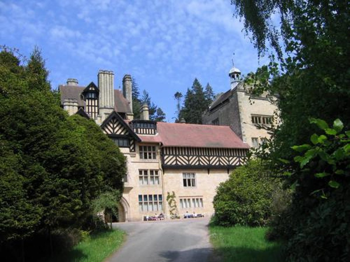
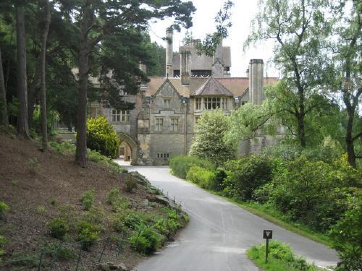
Cragside is set on a dramatic site, situated on a narrow platform cut into the steep valleyside, overlooking the Debdon Burn gorge.
Entrances and Approaches
Eight lodges were built at the same time as Cragside in 1863-6, marking various entrance drives from the public roads (B6341, B6344) which form over 5 km of the boundary. Dunkirk Lodge, standing 1.4 km directly to the south of Cragside, forms the major approach to the entrance front of the house. Reiver's Lodge lies 800 m south-west and its drive leads downhill to run parallel to the Dunkirk Lodge drive. The principal entrance to the estate now lies at Debdon, some 900 m north-west of Cragside mansion and 450 m south of North Lodge.
Principal Building
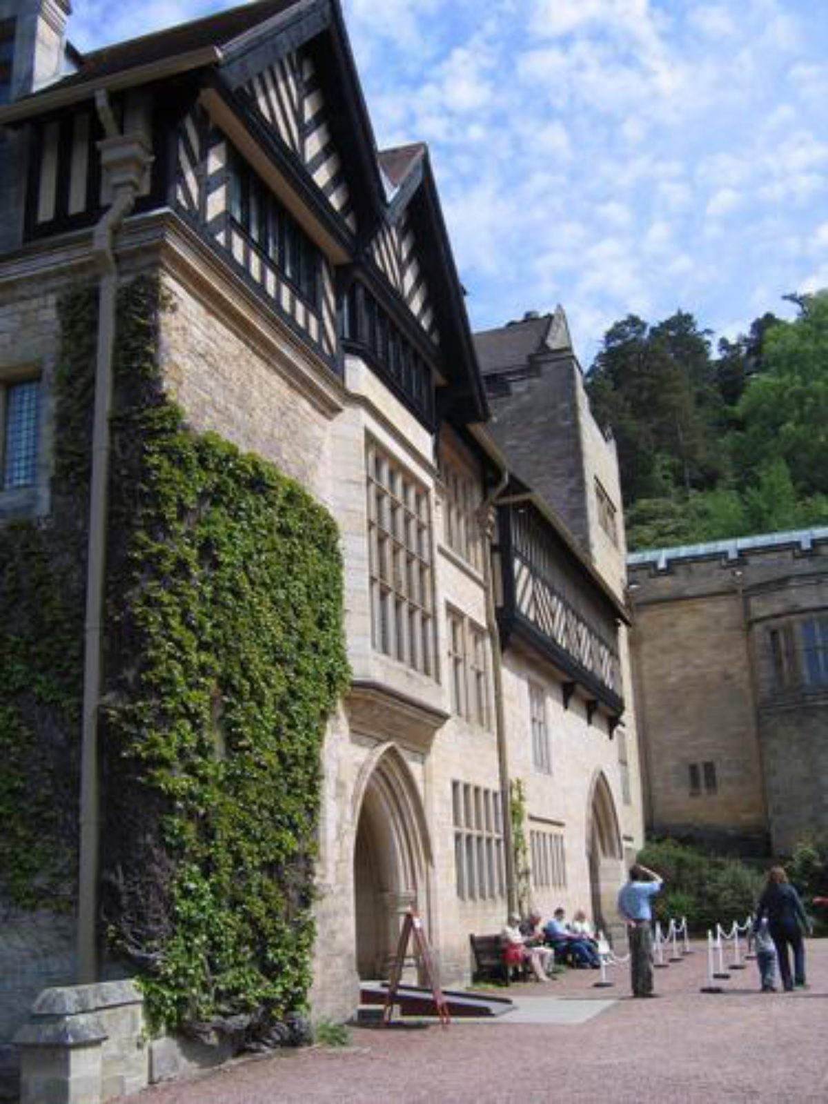
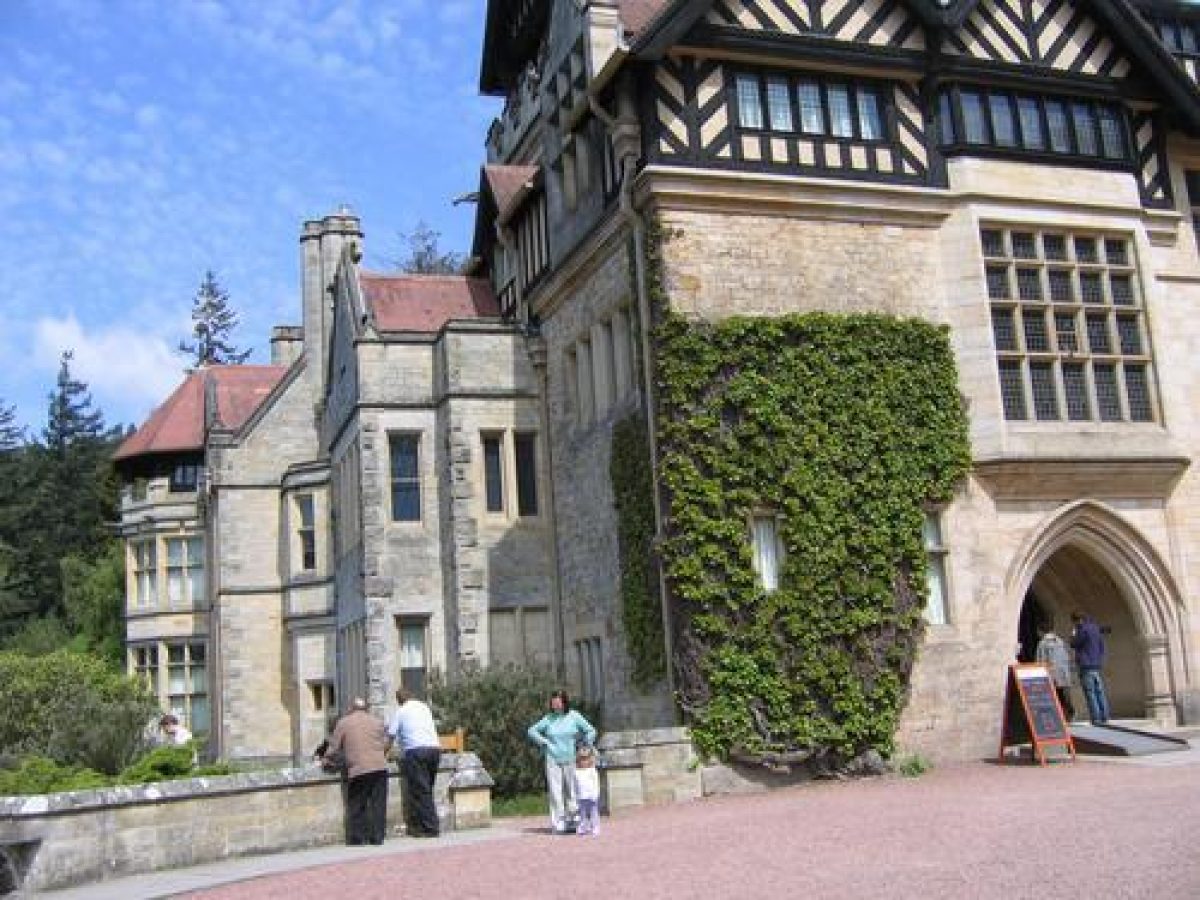
Cragside (listed grade I), built in 1864, was progressively enlarged between 1869 and 1883 by Norman Shaw (1831-1912). Additions in 1895 are by F Waller, for Sir William George Armstrong, first Lord Armstrong.
Two other building complexes are focal to the design scheme. Cragside Lodge, previously known as Cragside Park House, was the estate office situated on the east side of the B6341. It is surrounded by formal gardens (listed grade II) with an adjacent Clock Tower (l864, listed grade II*), 110m north-east of Cragside Lodge.
The third complex, to the north of Cragside, is formed by the Stables and Home Farm (c 1864, extended 1892-3, now, 2002, National Trust Visitor Centre, listed grade II), along with estate cottages and an experimental hydraulic silo (c 1895, listed grade II*).
Gardens and Pleasure Grounds
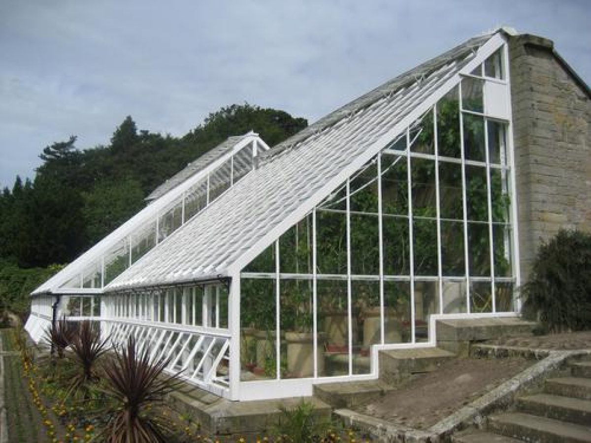
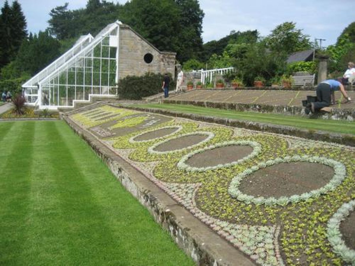
The area of the formal gardens was in William George Armstrong's original purchase. It was originally small fields on a south facing slope with views over the coquet valley (Dixon, 2007: 38). Armstrong created terracing on three main levels. The top terrace was originally dominated by a great glasshouse range which was divided into different sections. These included; the palm house, tropical and temperate ferneries, an orchid house and show house. The glasshouses were demolished during the 1920s but the walls and the rockwork in the two ferneries has survived (Dixon, 2007: 39). The original divisions are planted annually and the National Trust hope to restore the glasshouses. The middle terrace is a broad lawn with banks to the east and south. This is also where the orchard house is located. Armstrong originally placed a heliograph or sun recorder in this area (Dixon, 2007: 40). The lowest terrace, or Italian terrace has a loggia and the cottage which was the home of the estate manager. Beside the orchard house is a large area devoted to carpet bedding. Since 1993 the National Trust has changed the design annually. The design usually pays reference to the Armstrong family or an anniversary (Dixon, 2007: 41).
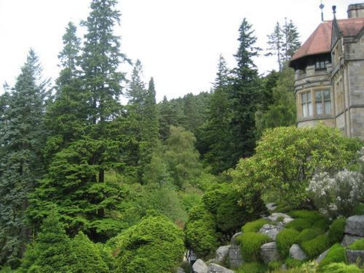
Rock gardens of 1.4 ha extend on all sides of Cragside mansion and down to the Pinetum on the west side. To the south the rock platform on which the house is built forms a natural rock garden. To north and west the rockwork is formed of repositioned boulders, with two cascades, and is closely planted with small planting pockets. These areas have been progressively restored by the National Trust in the 1990s. A rough-flagged path between the rockeries leads southwards to a lawn surrounded by a stone terrace wall.
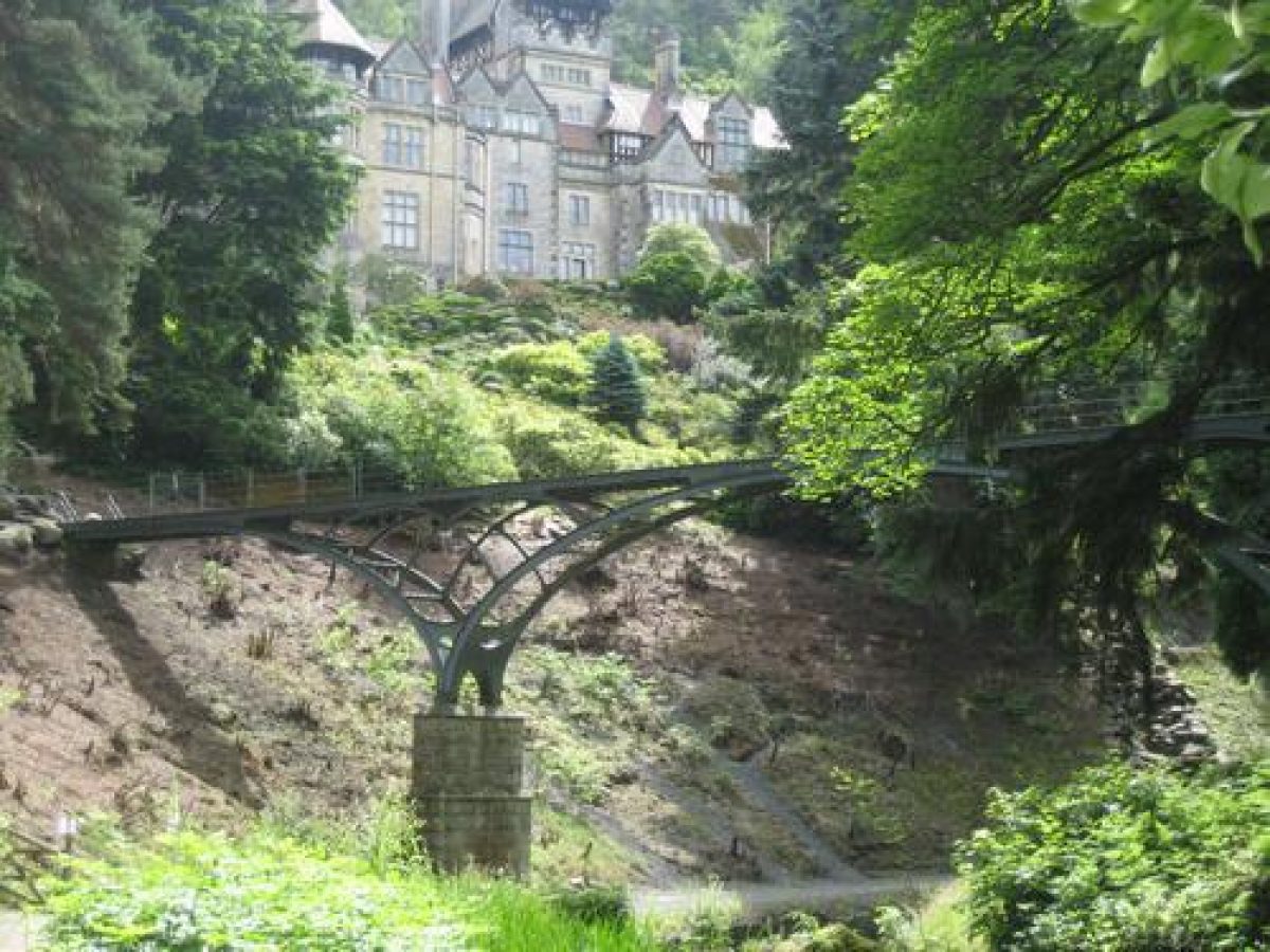
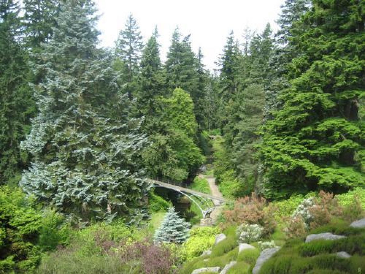
The pleasure grounds lie between the mansion and the formal gardens at Cragside Lodge, 400m to the west-south-west. They extend to 40 ha, being the nucleus of those laid out by Lord Armstrong between 1864 and 1900. Within them the Pinetum is planted along the steep, rocky, Debdon gorge which is crossed by a series of rustic footbridges linking flagged paths, planted with rhododendrons and other flowering shrubs and highlighted by a series of waterfalls. The outstanding tree collection includes North American conifers, Caucasian, Spanish, and Grecian firs. Of a series of five waterfalls shown on the OS 3rd edition (1926), only one remains.
A series of paths criss-cross the gorge, carried across on bridges to link Cragside with Cragside Lodge. The Iron Bridge (listed grade II*), a steel bridge manufactured in the 1870s by the Elswick Works, spans the gorge 80 m north-west of Cragside. On the main footpath to Knocklaw, 220 m south-west of Cragside, is a stone footbridge (late C19, listed grade II).
At Cragside Lodge is a series of south-facing, 'High Victorian' terraces and kitchen gardens. These are being progressively reinstated by the National Trust and stand behind a roadside wall (late C19, listed grade II) which screens them from the public road (B6341). The Orchard House and stables (late C19, listed grade II), 60 m north-east of Cragside Lodge, is notable for eighty huge earthenware pots on turn-tables set on a massive sandstone terrace. These enabled ease of access to, and even-growth of, the soft fruit grown for the table. On the upper terrace a fernery (late C19, listed grade II) stands 20m north-east of the Orchard House, surviving from a formerly extensive glasshouse complex. The carpet-bedding scheme on the middle terrace has been replanted (Horticulture Week 1995). A late C19 heliograph by Brady & Martin of Newcastle (listed grade II) stands 16 m to the south-east of the Orchard House. A dahlia walk lines the southern walk on the terrace, which overlooks the terrace below. This lower terrace comprises a rose arbour and terrace wall (late C19, listed grade II), 15m north-east of Cragside Lodge. These survive from the Italian Garden, which also has a double Italian staircase leading down to the Kitchen Garden. Two chimneys (both late C19 and listed grade II) are situated 100 m north-north-west and 420 m north-west respectively from the public road and belong to an elaborate ventilation system designed for the Orchard House.
Tumbleton Lake, 450 m to the north-west of Cragside, provides a picturesque lakeside setting for the Stables and Home Farm. A boathouse (late C19, listed grade II) lies on its east bank, at the point at which it issues south-east into the Debdon Burn. There is also a Ram House (c 1866, listed grade II) with a restored hydraulic ram.
Kitchen Garden
The partially walled kitchen garden lies immediately to the south of the Italian Garden, abutting the roadside wall. It is situated as Cragside Lodge, described above.
Park
The 30 ha parkland is situated on a large area of glacial deposit and lies 400m south-west of Cragside mansion. This intentionally provided a contrast between the resulting smoothness of ground cover, falling towards the Coquet, and the rugged topography of Cragend Hill. The parkland is planted with specimen trees and clumps.
Other Land
Moorland extends to the north and east of the mansion, comprising part of the modern Rothbury Forest, an area of the Northumberland Sandstone Hills that was historically part of Rothbury Forest. Central to this lies Nelly's Moss Lakes, which formed a reservoir for the mansion water supply.
Maps
- OS 6" to 1 mile: 1st edition surveyed c 1860, published 1865; 3rd edition surveyed 1924, published 1926
Description written: October 2001
Edited: July 2003
- Visitor Access, Directions & Contacts
Telephone
01669 620333Access contact details
The gardens are open between March and December, but are closed on Mondays.
For more detailed visitor information visit the National Trusts website.
Directions
The site is 1 mile north of the town of Rothbury, off the B6341.
Owners
The National Trust
Heelis, Kemble Drive, Swindon, SN2 2NA
- History
Until the 1870s the main family home had been at Jesmond, then on the edge of Newcastle Upon Tyne. William George Armstrong impulsively bought 3.2 acres (8 hectares) in the Debdon Valley whilst on holiday. Armstrong intended to build a small holiday home for the family. The small detatched villa was completed in 1863 (Dixon, 2007: 8).
As the locations potential grew the site soon became the chief family residence (Dixon, 2007: 8). By his death in 1900 Armstrong had bought up 279 acres (698 hectares). The villa went through a series of extensions between 1869 to 1884. The site was so famous that in August 1884 the Prince and Princess of Wales and their five children visited the Armstrong's (Dixon, 2007: 10-12). The gardens were also always open to the public throughout the year.
The National Trust took over ownership in 1977. In 1991 the formal terraced gardens, glasshouses and original estate managers house and parkland were acquired and reunited with the rest of the estate.
The following is from the Register of Parks and Gardens of Special Historic Interest. For the most up-to-date Register entry, please visit The National Heritage List for England (NHLE):
19th Century
Cragside was created by Lord Armstrong (1810-1900), the inventor, notable engineer, and founder of the Elswick Engine-Works, Newcastle. The works produced hydraulic cranes, engines, accumulators, bridges, and ordnance. By the 1860s, Armstrong was at the forefront of engineering developments and technological research. During his childhood in the early 19th century he had spent holidays in Rothbury, returning for holidays as an adult during the 1830s. By 1863, when Armstrong resigned his government appointments and began to devolve the running of the Elswick works, he started to plan a country retreat in the Debdon valley, and to buy up land to form his own, new, estate.
Initially in 1863, he purchased 20 acres (about 8 hectares) from Archdeacon Thorpe and started to construct a small house for occasional summer visits, named Cragside from Cragend Hill above the house. This modest, two-storey picturesque lodge, for shooting and fishing parties, was completed in 1866. A priority from the start was planting the surrounding moorland hillsides with trees. Armstrong's wife Margaret (1807-93) was a major partner in the development of the gardens at Cragside, and their first-hand experience at their Newcastle home, Jesmond Dene was fundamental to Cragside. William Bertram, resident land steward at Cragside until 1903 and Henry Hudson, the head gardener, who started in 1866, supervised the long-term project.
To avoid water shortage in the Debdon Burn, Armstrong dammed the stream to form Tumbleton Lake in 1866. Below, he installed a hydraulic ram to pump water up to a reservoir 200 feet (about 60 metres) above the house. This supplied water to the house, gardens, and conservatories at Cragside Lodge. A further four lakes were created: Blackburn Lake, two lakes at Nelly's Moss, and Debdon Lake (west of the Alnwick Road, outside the area here registered). The latter provided power to a sawmill and generated electricity for the house.
The estate, house, and gardens were developed further. By 1900 the pleasure grounds immediately around the house extended to over 1000 acres (405 hectares), with a further 700 acres (283 hectares) of estate farmland and moorland. There were some 40 miles (64 kilometres) of drives and footpaths laid out along the burns, crags, and valleys. Masses of rhododendrons were planted on the hillsides, which transformed them with colour (Elliott 1986). A pinetum was planted along the Debdon valley. Armstrong stated that his landscaping was achieved with 'pleasure to me to add to the locality's natural beauty by operations which have given healthy employment to a large section of the population' (National Trust 1992).
Rock gardens consisting of different forms of rockwork were built. One area contained natural boulders, rearranged on-site to create a natural-looking scree between the house and the Debdon Burn. Water from uphill was piped down to form springs, falls, and pools. Level areas of flagged rock slabs, south of the house, were luxuriantly planted. Directly to the north of the house, rockwork was constructed to link eastwards with the quarry which had provided the building stone. The quarry face was extended with large rocks, laid to simulate the natural strata.
The formal gardens were laid out at Cragside Lodge, about 400 metres west-south-west across the valley from Cragside, alongside the Land Steward and Head Gardener's houses. They included a series of terrace gardens. The upper terrace was furnished with glasshouses and ferneries. The central terrace was set with a dramatic carpet-bedding display and a large Orchard House. The lower terrace was laid out with an Italian Garden and below this was the Kitchen Garden. From the Kitchen Garden, open parkland contrasting with the surrounding rugged, natural landscape extended westwards to Knocklaw.
Lord Armstrong died at Cragside in 1900, his heir being his grandnephew William Watson-Armstrong, first Lord Armstrong of the second creation. Upon his death in 1972 the house with 911 acres (369 hectares) and two farms was transferred to the National Trust through the National Land Fund and it remains (2001) in their ownership.
- Associated People
- Features & Designations
Designations
The National Heritage List for England: Register of Parks and Gardens
- Reference: GD2048
- Grade: I
Features
- Lake
- Description: Tumbleton lake.
- Maze
- House (featured building)
- Description: A detached villa in the Arts and Crafts style.
- Earliest Date:
- Latest Date:
- Lake
- Description: One of five lakes on the estate.
- Lake
- Description: One of five lakes on the estate.
- Lake
- Description: One of five lakes on the estate.
- Lake
- Description: One of five lakes on the estate.
- Garden Building
- Description: Tumbleton House is located by Tumbleton lake.
- Stable Block
- Key Information
Type
Estate
Purpose
Recreational/sport
Principal Building
Heritage Site
Survival
Extant
Hectares
380
Open to the public
Yes
Civil Parish
Cartington
- References
References
- White, S., {Gardens of Northumberland and the Borders} (Cramlington: Sanderson Books Limited, 2006), pp. 56-63 Gardens of Northumberland and the Borders
- {English Heritage Register of Parks and Gardens of Special Historic Interest}, (Swindon: English Heritage, 2008) [on CD-ROM] Historic England Register of Parks and Gardens of Special Historic Interest
- Elliott, B., {Victorian Gardens} (London: Batsford, 1986), p. 195 Victorian Gardens
- Thomas, G. S., {Gardens of the National Trust} ([London]: Weidenfeld and Nicolson, 1979), pp. 72. 82, pl. 127 Gardens of the National Trust (1979)
- Pevsner, N., J. Grundy and I. Richmond, {The Buildings of England: Northumberland} (London: Penguin, 1992) pp. 134-5 The Buildings of England: Northumberland
- Dixon, Hugh, {Cragside: The National Trust} (Swindon: The National Trust, 2007) Cragside, Northumberland, Parks and Gardens guide
- (11 September 1880), p 325; (1 April 1882), pp 436-7 Gardener's Chronicle
- (6 October 1900), p 271; (12 January 1901), p 31 The Garden
- (18 December 1969), p 1640; (25 December 1969), p 1694; 168 (4 September 1980), p 759 Country Life, 146
- (1986), p 195 Victorian Gardens
- Horticulture Week