Introduction
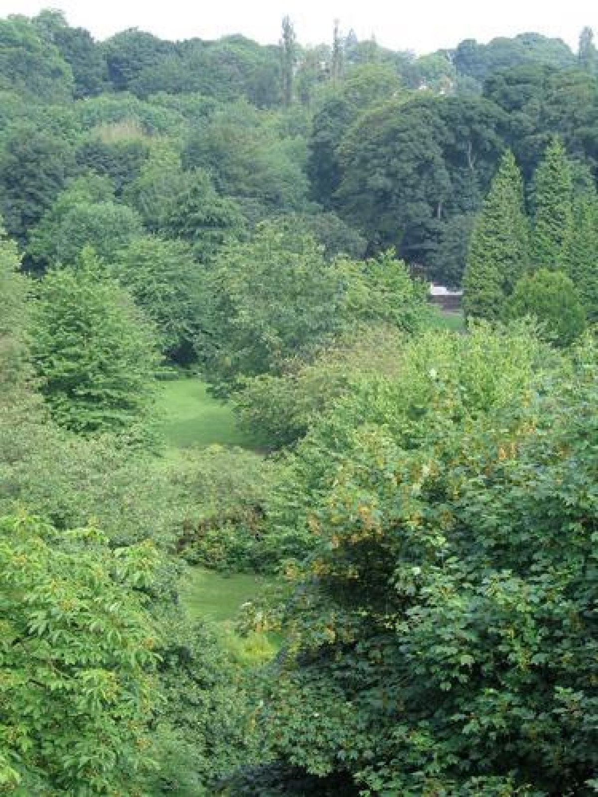
Jesmond Dene is a 19th-century valley park of around 18 hectares. The Ouseburn, a small river that joins the River Tyne, runs along the bottom of the valley.
Terrain
The parks run north/south along the steep-sided valley or dene of the Ouse Burn with Jesmond Dene to the north, Armstrong Park immediately south of Jesmond Dene, followed by Heaton Park to the south.The following is from the Register of Parks and Gardens of Special Historic Interest. For the most up-to-date Register entry, please visit The National Heritage List for England (NHLE):
Mid 19th-century pleasure grounds along the valley of the Ouse Burn, including the adjoining grounds of Heaton Hall which were laid out in the late 18th century. The areas were used as public parks from the late 19th century.
Location, Area, Boundaries, Landform and Setting
The parks run north/south along the steep-sided valley or dene of the Ouse Burn with Jesmond Dene to the north, Armstrong Park immediately south of Jesmond Dene, followed by Heaton Park to the south. The parks lie c 0.5 km north-east of the centre of Newcastle in a residential area. Jesmond Dene Road forms the western boundary as far as Armstrong Bridge, south of which walls divide the park from Ouseburn Road. Dene Bridge forms the northern boundary, fencing dividing the park from gardens and allotments the eastern boundary, and Heaton Park View the southern boundary.
Entrances and Approaches
On the north side of the A1058 at the east end of Armstrong Bridge, there is an entrance into Jesmond Dene with stone gate piers and a lodge. On the south side, there is an entrance into Armstrong Park. A metalled drive leads north-west into Jesmond Dene and runs to Heaton Dene and Millfield House before continuing alongside the river to Deep Dene House, from which point it continues as a path and connects with other entrances, including one on the north side of Jesmond Dene Road with a lodge called North West Lodge. An entrance to the Banqueting House (see below) has a lodge (listed grade II) by R Norman Shaw. The two main entrances to Heaton Park are from Heaton Park View and from Jesmond Vale Road. There are numerous secondary and informal entrances to the park around its perimeter.
Gardens and Pleasure Grounds
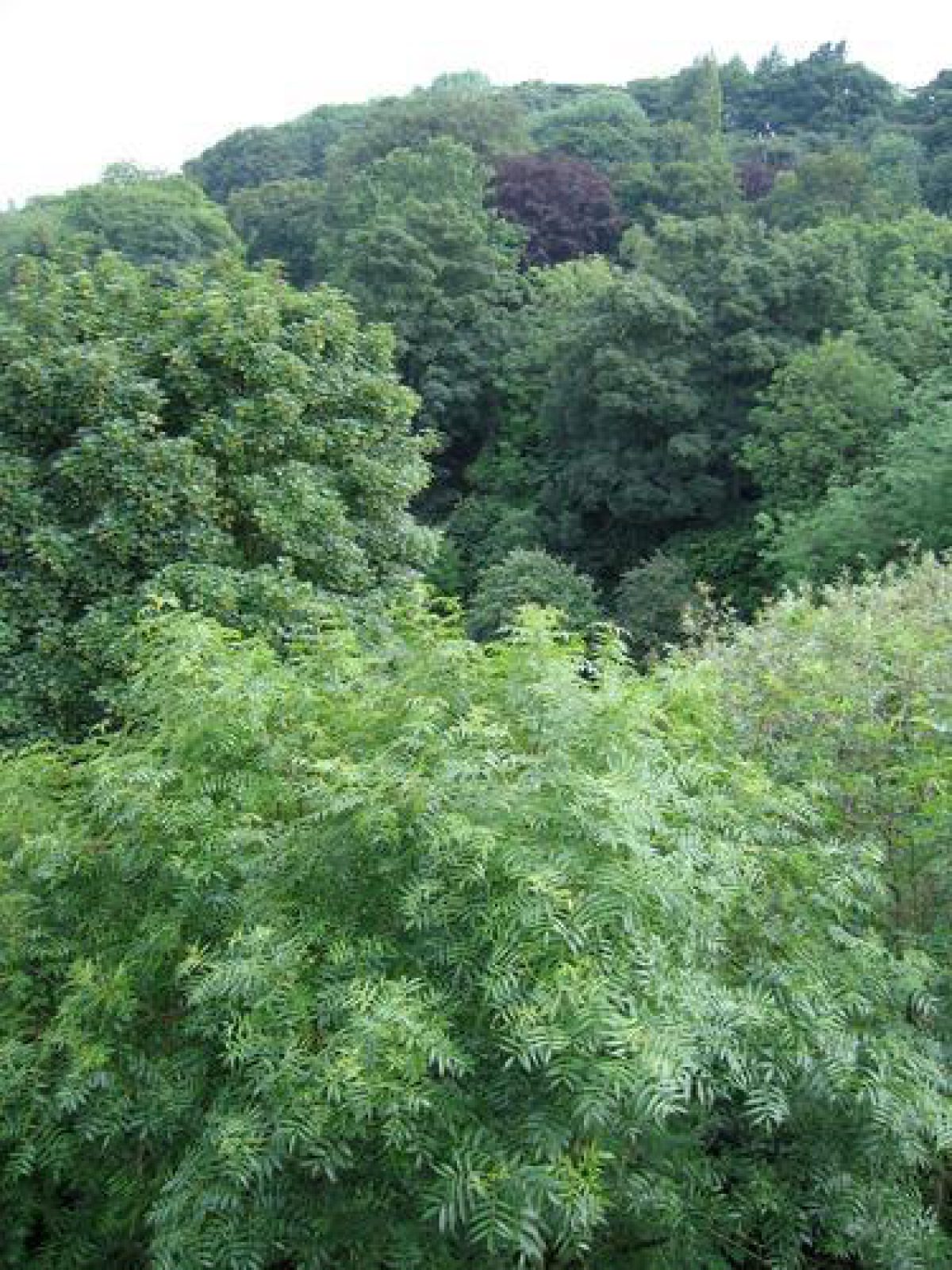
From Dene Bridge, at the north end of the site, a path leads southwards alongside the Ouse Burn. The steep sides of the Dene, and a former quarry, Blackberry Crag, to the east, are planted with a variety of exotic and native trees, and paths lead up the east side of the Dene to a level grassed recreation ground with a boating lake, shown on the 1884 plan of the park.
Some 350 m south of the Bridge, immediately south of a waterfall, are the remains of a flint mill (listed grade II) of early C19 date. The mill and waterfall were identified through annotations on the 1884 map as features contributing to the 'very romantic character' of this part of the Dene. An ornamental stone footbridge (c 1860, listed grade II) crosses the river immediately west of the mill.
South of the mill there is an area of grassland with a shelter of early to mid C20 date west of a bend in the river. South of the shelter the path divides, with one branch continuing southwards along the east side of the river and another crossing the river via a stone bridge and running north to an entrance from Jesmond Dene Road. A path (closed for safety reasons, 1998) runs high along the west side of the Dene with views through trees to the river. Deep Dene House, in use (1998) as a restaurant, lies on the east side of the river c 800 m south of Dene Bridge.
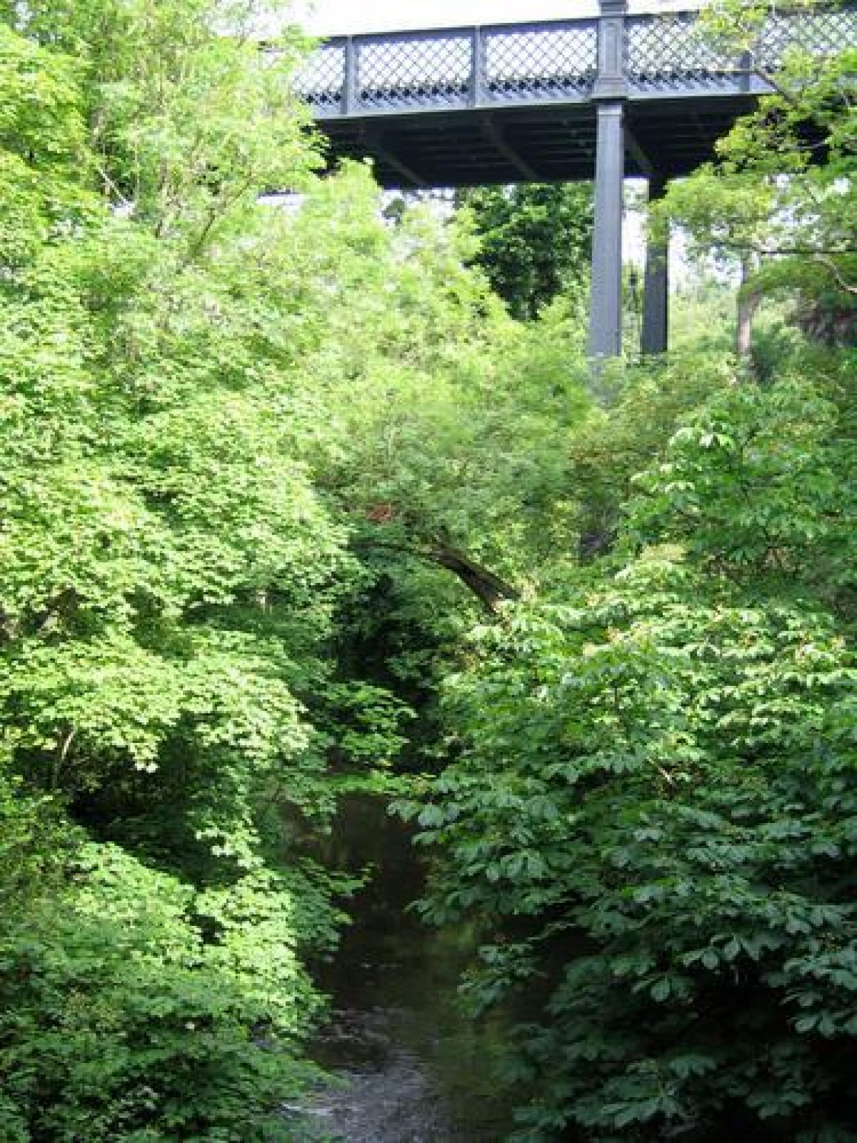
The river is crossed by a stone bridge (listed grade II) c 250 m south of Deep Dene House, carrying a path which leads to the roofless remains of the Banqueting House (listed grade II) which was built 1860(2 by John Dobson for Sir William Armstrong. The building commands views of the river and wooded Dene and according to the 1884 map it was 'built by Sir W Armstrong, in 1862, since used for Public Entertainments, but mainly for Picnic Parties and Popular Gatherings'.
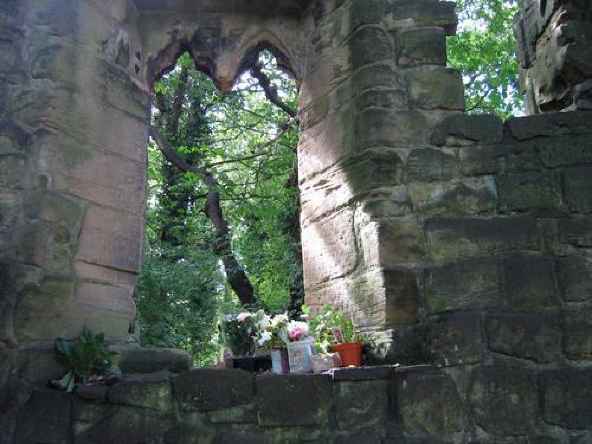
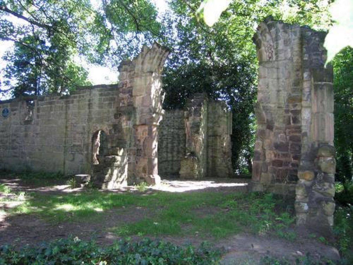
Incorporated into the pleasure grounds c 100 m west of the Banqueting House are the ruinous remains of the medieval St Mary's Chapel (listed grade II*) which stand in an area of woodland on the west side of Jesmond Dene Road. This is another feature highlighted on the 1884 map.
The path along the east side of the river continues southwards, and the water descends over a series of simple cascades. At a point c 200 m south of the Banqueting House the valley bottom widens, and two C19 houses (in use as offices, a café and residences, 1998), Millfield House and Heaton Dene House, lie alongside the river.
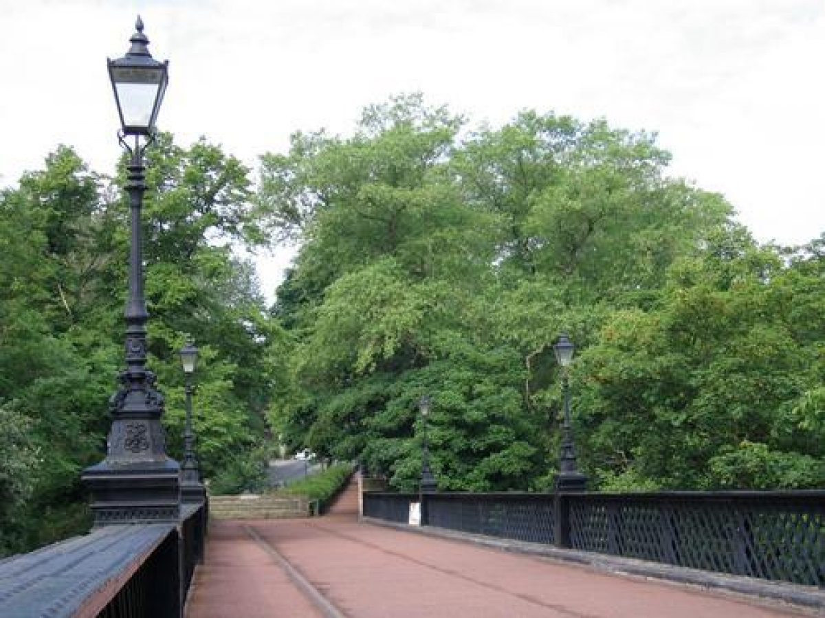
Between these and Armstrong Bridge (listed grade II) there is a late C20 'pets corner' and an area of open lawns with beds and specimen trees. Views up and down the Dene can be obtained from the bridge and were commented upon in the Gardeners' Chronicle in 1894: 'in crossing over this bridge anyone can see the beautiful valley, so richly ornamented with trees and shrubs and undergrowth of all kinds'.
On the south side of Armstrong Bridge is Armstrong Park, which is on the wooded east bank of the Dene. Paths lead through woodland with views of the Ouse Burn to the west. The area is marked Bulman Woods on the 1st edition OS map. Bridges carry the paths over a sunken walkway of c 1880, c 400 m south of Armstrong Bridge, which may have been constructed to give cattle access to the river. A stone well-head called King John's Well lies alongside the westernmost path c 250 m south of the Bridge. The remains of an C18 windmill (listed grade II), which is shown on an engraving of 1743, stand on a grassed area overlooking the wooded banks of the Dene c 450m south-east of the Bridge, and there are tennis courts c 80m to the west of the mill which were added in the mid C20.
Armstrong Park is divided from Heaton Park to the south by Jesmond Vale Road. This area was acquired by the Corporation in 1878 before which time it had been the grounds of Heaton Hall. Winding paths lead around the wooded perimeter, and in the central area there is a late C19 pavilion with a balustraded terrace overlooking bowling greens, shown on the 1894 OS map, in an area which is shown as a kitchen garden on the 1872 OS map.
The land rises to the south, and paths radiate from a mound at the top of the slope close to the centre of the southern boundary which was the site of an C18 garden temple removed in the early C20. The 1st edition OS map shows straight rides radiating from the temple, but some of these were altered to form serpentine paths, as shown on the 1894 OS map.
North of the mound, which commands long-distance views to the north, there is terracing down to an area of open grassland which was the site of a mining shaft shown on the 1st edition OS 25" map. In the north-east corner of the park are the remains of a C12 tower house (listed grade II) called King John's Palace (also known as Adam of Jesmond's Camera). The north-west side of the park was the site of a bearpit, which was infilled in 1891.
The 1st edition OS 25" map shows that the pattern of planting in Heaton Park has changed little with the exception of the Hall (erected c 1713, demolished mid C20) and its immediate surroundings which lay south-east of the present park boundary in an area which has been built over and is outside the registered area.
A lake which is shown c 100 m north-east of the temple was drained in the mid C20. It is possible that the grounds were laid out by Richard Woods (c 1716-93) for Matthew White Ridley during the 1760s as there was contact between Woods' foreman and the Ridley family at that time.
Maps
- OS 6" to 1 mile: 1st edition surveyed 1872; 2nd edition published 1894
- OS 25" to 1 mile: 1st edition surveyed 1859-64; 2nd edition published 1916
- Plan of Armstrong Park, 1884 (Newcastle upon Tyne Central Library) [reproduced in F Graham, Maps of Newcastle (1984)]
- [The following maps are reproduced in Green 1997.]:
- Plan of Heaton Estate showing the Old Pits, no date, 18th century
- Armstrong, Map of Northumberland, 1769
- Fryer, Map of Northumberland, 1820
- Greenwood, Map of Northumberland, 1828
Archival items
- Details of the primary sources in Northumberland Record Office, Tyne and Wear Archives and Newcastle upon Tyne Council Minutes can be found in Green 1997.
Description written: July 1998
Edited: September 2000
- Visitor Access, Directions & Contacts
Telephone
44 191 814 4574Website
http://www.jesmonddene.org.uk/Access contact details
This is a municipal space for general public use.
- History
The following is from the Register of Parks and Gardens of Special Historic Interest. For the most up-to-date Register entry, please visit The National Heritage List for England (NHLE):
18th - 19th Century
The land alongside the Ouse Burn is shown as open fields with coal pits on 18th-century maps, when the river was exploited by water mills. By the mid-19th century, Jesmond Dene and the area occupied by Armstrong Park to the south had been acquired by Sir William Armstrong who laid out Jesmond Dene as private pleasure grounds during the period 1850 to 1860, although the grounds were opened to the public for a number of years before he gave the land to the Corporation in 1884. Armstrong Park, which had been laid out at a cost of £6000, was given to Newcastle Corporation in 1883.
Heaton Park had been acquired by the Corporation in 1879, and a map showing the three linked areas was drawn up in 1884. At that time the whole area was referred to as Armstrong Park, but the areas were subsequently called by their separate names in Council minutes, probably for clarity. The whole area was open to the public by 1884 and remains in use (1998) as a public park.
A number of houses were built within Jesmond Dene during the 19th century and Deep Dene House and Heaton Dene are shown on the 1st edition OS map surveyed 1859-64. The 1894 OS map shows that Millfield House had been built by that time.
Period
- Post Medieval (1540 to 1901)
- Victorian (1837-1901)
- Associated People
- Features & Designations
Designations
The National Heritage List for England: Register of Parks and Gardens
- Reference: GD2185
- Grade: II
Features
- Waterfall
- Description: Created by Lord Armstrong, one of many water features throughout Jesmond Dene
- Banqueting House
- Description: Designed for Lord Armstrong by John Dobson, the Newcastle architect with a gatehouse added to in 1870 designed by Norman Shaw.
- House (featured building)
- Description: The house no longer remains.
- Earliest Date:
- Latest Date:
- Pleasure Garden
- Description: The parks along the Ouse Burn; Jesmond Dene to the north, Armstrong Park immediately south then Heaton Park
- Bridge
- Description: Armstrong Bridge, designed by William Armstrong and built at his Elswick works
- House
- Description: Millfield House and Heaton Dene House: C19 houses in use as offices, a cafe and residences
- Tower House
- Description: remains of a C12 tower house (listed grade II)
- Chapel
- Description: Remaining ruins of St Mary’s Chapel (C15th)
- Ornamental Bridge
- Description: An ornamental stone footbridge (c 1860, listed grade II)
- Key Information
Type
Park
Purpose
Recreational/sport
Principal Building
Parks, Gardens And Urban Spaces
Period
Post Medieval (1540 to 1901)
Survival
Extant
Hectares
18
Open to the public
Yes
- References
References
- {English Heritage Register of Parks and Gardens of Special Historic Interest}, (Swindon: English Heritage, 2008) [on CD-ROM] Historic England Register of Parks and Gardens of Special Historic Interest
- Pevsner, N., J. Grundy and I. Richmond, {The Buildings of England: Northumberland} (London: Penguin, 1992) pp. 512-3 The Buildings of England: Northumberland
- (16 June 1894), pp 748-51 Gardener's Chronicle
- A Guide to the Historic Parks and Gardens of Tyne and Wear,
- 1997 Heaton and Armstrong Parks and Jesmond Vale, Newcastle upon Tyne