Introduction
The site occupies about 243 hectares and includes the earthwork remains of the original Thorndon Hall which dated from between 1558 and 1603. A new hall was built in the early-18th century, designed by James Paine, with the deer park landscaped by Lancelot Brown in the 1760s. Part of the estate was designated as a country park in the 20th century, whilst part is given over to use as a golf course designed by Colt and Alison in 1920.
Terrain
The site is on undulating ground which has a gentle rise from south to north as far as the Hall before falling again to the northern boundary.www.historicengland.org.uk/listing/the-list
The site of an early C18 park and woodland by Lord Petre, with mid C18 developments to park and pleasure grounds by Lancelot Brown and subsequent minor additions in the 1790s probably by Richard Woods, now a C20 country park and golf course.
DESCRIPTION
LOCATION, AREA, BOUNDARIES, LANDFORM, SETTING
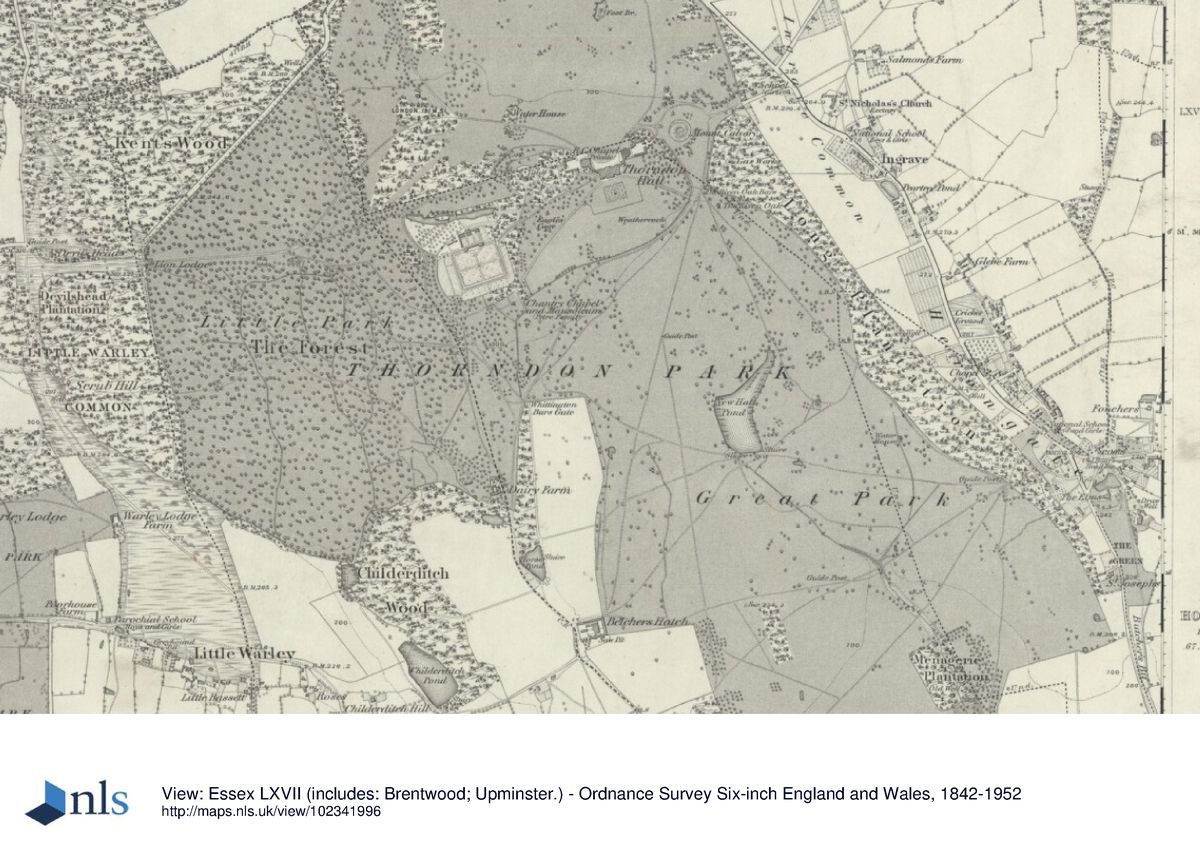
Thorndon Park lies c 5km east of the M25 on the north side of the A127 road to Basildon and Southend. The A127 forms the south boundary, while the majority of the north-east boundary is formed by the A128 which runs from the A127 to Brentwood, situated just to the north of the site. A minor country road called The Avenue runs along the north-west boundary, with a mixture of farmland and woodland enclosing the site to the west. The park covers c 243ha in a heavily developed part of the Essex countryside, on undulating ground which has a gentle rise from south to north as far as the Hall before falling again to the northern boundary.
ENTRANCES AND APPROACHES
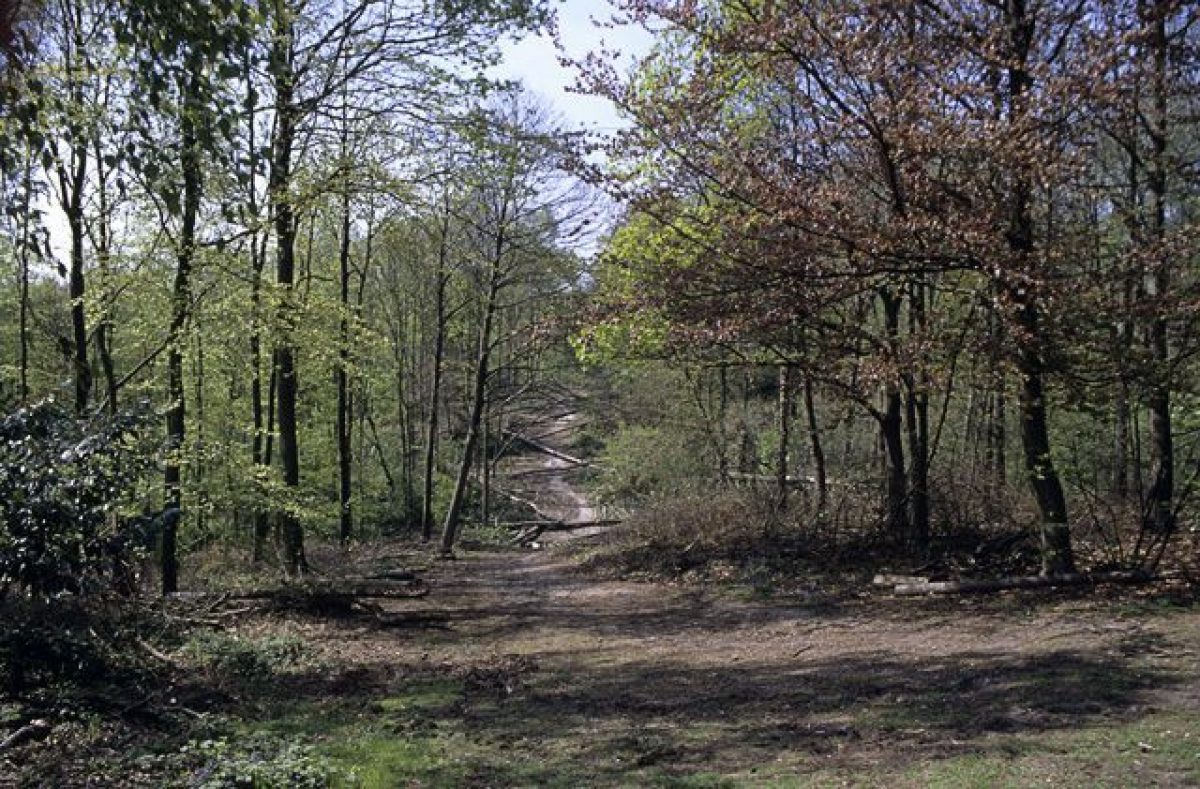
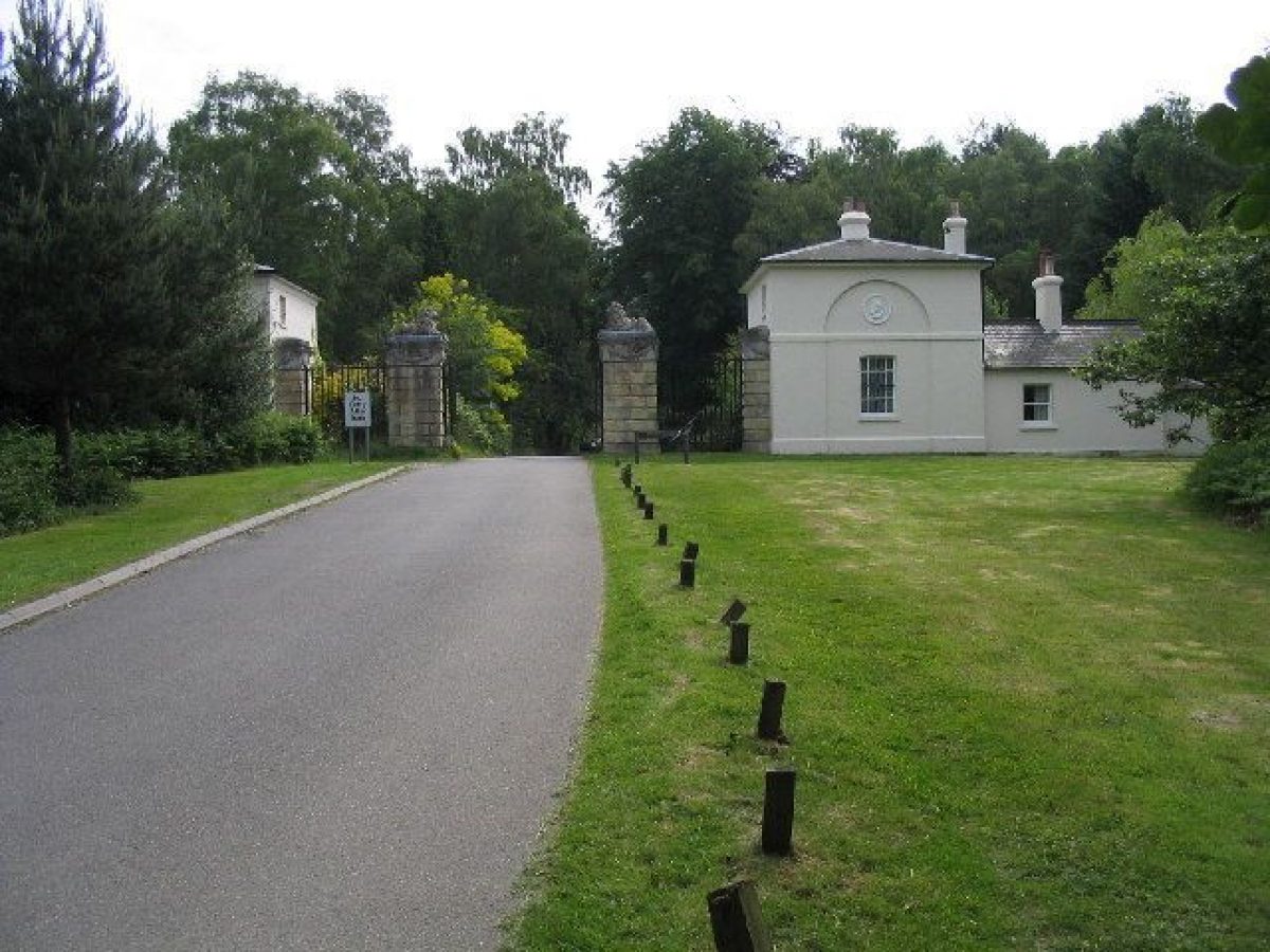
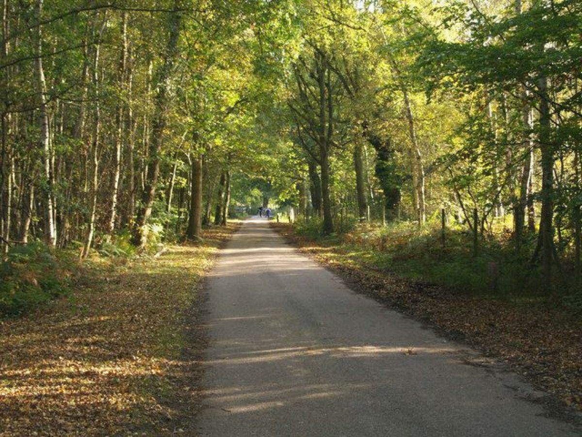
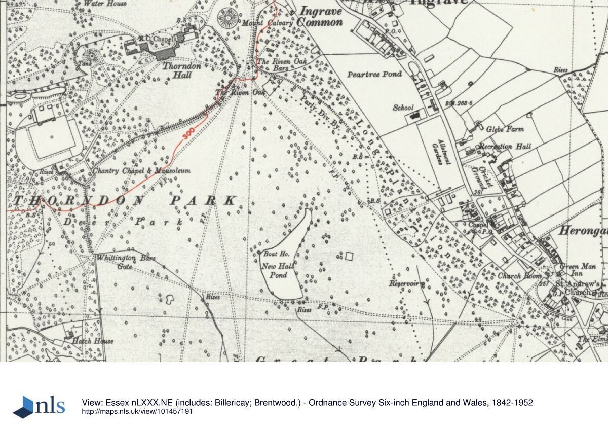
There are two lodged entrances to Thorndon, although neither of these are now (2000) connected to the Hall. The Lion Gates (listed grade II), c 1.25km west-south-west of the Hall, comprise twin square stuccoed brick pavilions with pyramidal roofs (mid(late C18) flanking ornamental gates hung on rusticated stone piers surmounted by reclining lions (James Paine 1764). The drive runs east through mixed woodland known as The Forest, and now (2000) terminates at the walled garden and Chantry Chapel and Mausoleum (listed grade II*) located c 400m south-west of the Hall. Just below the northern tip of the site on The Avenue stands Octagon Lodge (listed grade II), an octagonal plastered brick cottage under a slate roof, built in the late C18/early C19 possibly by Richard Woods (F Cowell pers comm, 2000). The drive from Octagon Lodge, of which little remains, swept south and east. It no longer reaches the forecourt on the north front of the Hall, which is now (2000) reached via a short drive off the A128 to the east of the Hall shared with the Thorndon Park Golf Club. Up until the early C20 Keeper's Lodge, an estate cottage, stood close to a minor drive which entered off the southern boundary c 300m to the west of Octagon Plantation. The lodge has been demolished but the drive survives as a track through Menagerie Plantation.
PRINCIPAL BUILDING
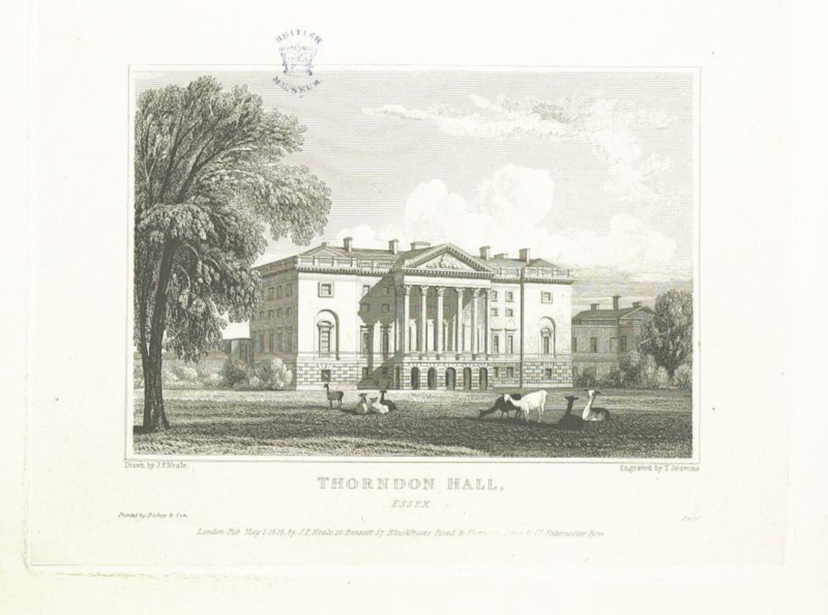
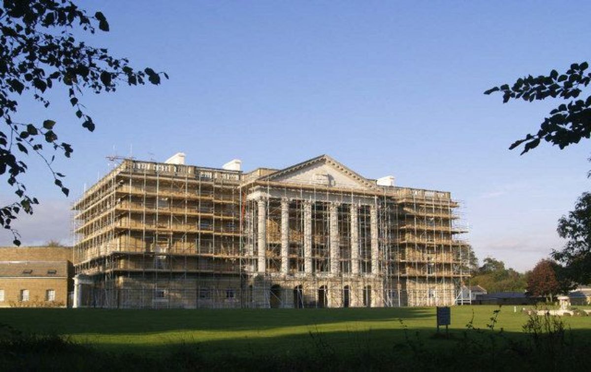
Thorndon Hall (listed grade I) is a large country mansion built of brick with stone dressings. It has a rectangular central block of three storeys with quadrant wings to rectangular pavilion blocks which together form a long, centrally porticoed Palladian palace with rusticated podium and first-floor piano nobile. To the south, the garden elevation has end bays broken forward with the central five bays having a Corinthian portico with loggia openings in the podium. Beyond the pavilion blocks are service buildings to the east and stables to the west. The Hall was built for the ninth Lord Petre by James Paine between 1763 and 1770, to replace the old C16 hall which lay c 1.8km to the south. Following a disastrous fire in 1878 the Hall lay unused until 1975 when it was restored and converted into private apartments.
GARDENS AND PLEASURE GROUNDS
The gardens associated with Thorndon Hall lie to the south and are laid to lawn set with a small circular stone basin. Within the woodlands which lie beyond the east and west fronts are two mounts which appear on the eighth Lord Petre's 1733 plan of the landscape. On the 1778 estate map by Spyers they are seen flanking the new Hall, probably retained to enjoy the views over the new park. On the OS map of 1881 the eastern mount is labelled Mount Calvary. The woodland pleasure grounds which surround the mounts and contain some late C20 planting, are depicted by 1777 (Chapman and Andre) and appear to have been the work of Brown (Collins 1994).
PARK
The park surrounding Thorndon Hall, which sits in the north-east corner of the site, is extensive and contains remnants of the early C18 layout, together with features of Lancelot Brown's work, all partly overlaid by C20 developments. To the north of the Hall, an area of open parkland which survived as a softened form of the early C18 formal landscape until at least 1805 (Clayton map) has, during the C20, been developed as a golf course, now planted with ribbon strips of trees. To the west of the Hall lies the extensive mixed woodland known as The Forest, which now (2000) contains the country park visitors' centre. Also within this dense woodland lies the walled kitchen garden (see below) and the private Petre family Roman Catholic Chantry Chapel and Mausoleum (listed grade II), built of ragstone under a red clay tiled roof in the Gothic style in c 1850.
The open park lies to the south of the Hall and contains the Thorndon Park Golf Club, with the clubhouse situated immediately beyond the garden boundary. Within the course, which has been planted with blocks of woodland, lies New Hall Pond c 750m south-south-east of the Hall. The pond was created by Lancelot Brown and was remodelled, probably by Richard Woods, in the late C18 (F Cowell pers comm, 2000). The C20 planting in the golf course has partly obscured the views through the south park created by Brown using remnants of the eighth Lord Petre's great formal avenue. To the south-west of the golf course a more open area of parkland has, since the 1990s, been planted with groups of mixed species trees by the Woodland Trust and here on the western border of the park stands the red-brick Hatch Farm (listed grade II), built by Samuel Wyatt in 1776 as an animal feeding place for Thorndon Park.
Below the new woodland and the golf course lie some of the oldest features of the Thorndon landscape. Located centrally in this southern section are Menagerie Plantation within which lies Old Hall Pond, and below it Mill Wood. The woodlands were developed from the mid C18 onwards although Old Hall Pond was retained from the early C18 formal scheme. To the west of Menagerie Plantation stands the site of the Old Hall, now (2000) enclosed in a small plantation. Immediately to the east of the Plantation, earthwork remains of the formal gardens survive while c 150m to the south-west is Pigeon Mount, a feature also associated with the gardens of the Old Hall. On the west side of Menagerie Plantation, the land to the south of the golf course is partly under the plough and partly under grass. In the middle of this area, on the west side of the late C20 car park associated with the country park, stands Octagon Plantation, c 700m to the east of the Old Hall site. This feature dates from the early C18. It was retained by Brown and has survived although its distinct outline has become somewhat obscured during the C20.
KITCHEN GARDEN
The walled kitchen garden lies c 350m to the south-west of Thorndon Hall. It was built in this position when the Hall was erected in 1763 and remained in use as a kitchen garden until the C20. It was retained by the sixteenth Lord Petre when the rest of Thorndon Park was sold. The ground is laid to lawn and planted with a variety of specimen trees and shrubs.
OTHER LAND
Beyond the south-west boundary (of the site here registered) is an area of farmland associated with the Old Hall estate. Since the 1990s Essex County Council have begun to reinstate the original field pattern of this area by restoring many of its hedgerows.
REFERENCES
Garden History Society Occas Pap 2, (1970), pp 27-40
D Stroud, Capability Brown (1975), p 243
H Grieve, A transatlantic gardening friendship 1694-1777, (Historical Association, Essex Branch 1981)
G Carter et al, Humphry Repton (1982), p 152
Garden History 19, no 1 (1991); 24, no 2 (1996)
C V Collins, Thorndon Park: Phoenix of an Age, (unpub AA dissertation 1994) [copy on EH file]
Maps
J Walker Snr, Survey of Thorndon estate, 1598 (D/DP P5), (Essex Record Office)
W Stane, Survey of Glebe lands, 1689 (D/DP), (Essex Record Office)
Le Sieur Bourgignon, two versions of the eighth Lord Petre's design for the landscape, 1733 (D/DP P23/1), (Essex Record Office)
J Chapman and P Andre, A map of the county of Essex from an actual survey ..., 1777 (Essex Record Office)
J Spyers, Plan of Thorndon Park, 1778 (D/DP P30), (Essex Record Office)
H Clayton, Survey of Thorndon Park, 1805 (D/DP P41), (Essex Record Office)
OS 6" to 1 mile:
1st edition published 1881
1938 edition
OS 25" to 1 mile:
1st edition published 1872
2nd edition published 1895
Illustrations
Engraving after drawing of Old Thorndon Hall, 1699 (Essex Record Office)
Engraving of New Thorndon Hall, 1770s (Essex Record Office)
Archival items
The Petre archive is extensive but patchy as much was lost in the 1878 fire. It is held at the Essex Record Office (D/DP).
Description written: November 2000 Amended: April 2001
Register Inspector: EMP
Edited: September 2001
- Visitor Access, Directions & Contacts
Telephone
01277 810345Website
https://www.thorndonpark.comAccess contact details
The site is now a country park and golf course.
Owners
Thorndon Park Golf Club
Brentwood Borough Council
Town Hall, Ingrave Road, Brentwood, Essex, CM15 8AY
- History
The following is from the Register of Parks and Gardens of Special Historic Interest. For the most up-to-date Register entry, please visit the The National Heritage List for England (NHLE):
www.historicengland.org.uk/listing/the-list
HISTORIC DEVELOPMENT
The first contrived landscape at Thorndon came in c 1412 under the ownership of Lewis John, who built a brick lodge and obtained permission to enclose 300 acres (125ha) of parkland (Collins 1994). In 1528 Thorndon passed by inheritance through the female line to the Mordaunt family, who sold it in 1573 to John Petre, whose father had already built up a considerable land holding in the area. In 1576 John Petre was knighted and started an ambitious programme to rebuild the house and remodel the garden; on its completion, John Walker Snr was commissioned to survey the estate surrounding Thorndon Hall (Walker, 1598). Sir John was raised to the barony in 1603 and on his death in 1613 was succeeded by his eldest son, William. During the C17 little activity occurred on the Thorndon estate and in 1706 when the seventh baron succeeded, the landscape had changed little for 100 years. Robert James, son of the seventh baron, married in 1732 and moved the family from nearby Ingatestone Hall back to Thorndon. During his short life the eighth Lord Petre became a plantsman and garden designer and was at the forefront of a movement to fund and organise the importation of seeds from America. He commissioned Giacomo Leoni to partially remodel the Hall and went on to devise an extensive and highly elaborate formal scheme for the Thorndon landscape which is depicted on a plan of 1733, drawn up by the French surveyor Sieur Bourgignon. Petre created a renowned nursery at Thorndon to supply the design but although the work was underway by 1736, it was not completed before his death in 1742. The eighth Baron was succeeded by his son, Robert Edward, who in 1763 embarked on the building of a new Hall designed by James Paine (1717-89), on a site north of the old one. Lancelot Brown (1716-83) was commissioned to bring the landscape up to date and between 1766 and 1772 he received over £5000 for his work in the park. In 1783 Richard Woods was appointed as Lord Petre's surveyor, during which time the New Hall Pond created by Brown was adapted to improve the view of it from the Hall. When the tenth Lord Petre inherited the estate in 1801 it was burdened with debt from all his father's spending. Throughout the C19 the family maintained the Hall and its park with few alterations but in 1878 the Hall was virtually destroyed by fire and in 1919, following the early death of the sixteenth Lord Petre, the family moved back to Ingatestone Hall and began to dispose of Thorndon. Immediately after the First World War the Hall and 240 acres (100ha) of park to the south were acquired from the trustees of the seventeenth baron by Thorndon Park Golf Club, the 18-hole course being designed in 1921 by Cole and Alison. Much of the remainder of the park was acquired by Essex County Council in 1939 and 1951, and was opened as a country park in 1971. The burnt-out Hall was converted into private flats in 1975, and in 1992 the Woodland Trust purchased some of the woodland in the park. The site remains (2000) in multiple ownership.
- Associated People
- Features & Designations
Designations
The National Heritage List for England: Register of Parks and Gardens
- Reference: GD1256
- Grade: II*
Features
- Hall (featured building)
- Earliest Date:
- Latest Date:
- Key Information
Type
Park
Purpose
Recreational/sport
Principal Building
Domestic / Residential
Survival
Part: standing remains
Hectares
243
Open to the public
Yes
Civil Parish
Herongate and
- References
References
- Stroud, D {Capability Brown} (1975) p 243 Capability Brown (Country Life article)
- {English Heritage Register of Parks and Gardens of Special Historic Interest} (Swindon: English Heritage 2008) [on CD-ROM] Historic England Register of Parks and Gardens of Special Historic Interest
- {Thorndon Park Conservation Management Plan} (2001) Thorndon Park Conservation Management Plan
- Essex County Council {Thorndon Country Park Management Plan 2009-2013} (2009) Thorndon Country Park Management Plan 2009-2013
- Land Use Consultants {Thorndon Country Park Conservation Management Plan} (2001) Thorndon Country Park Conservation Management Plan