Introduction
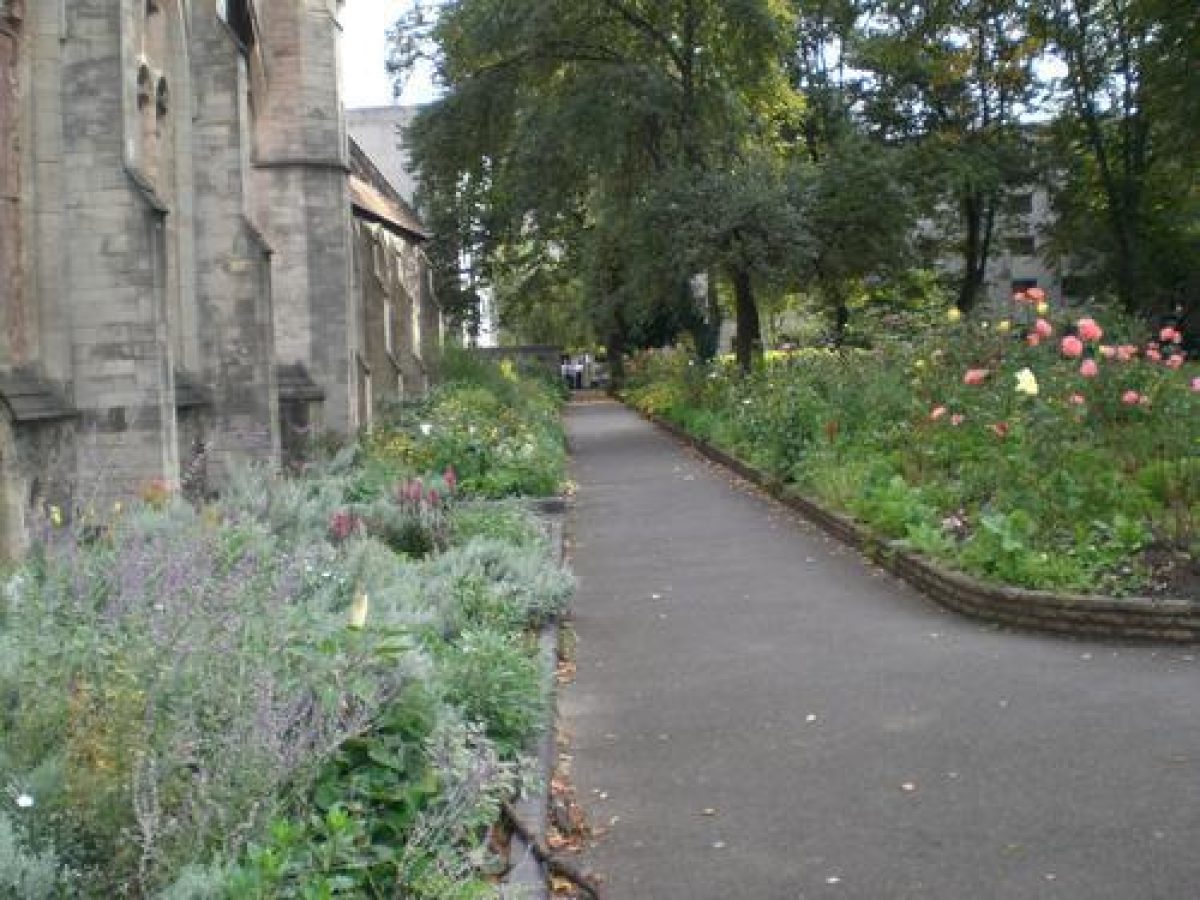
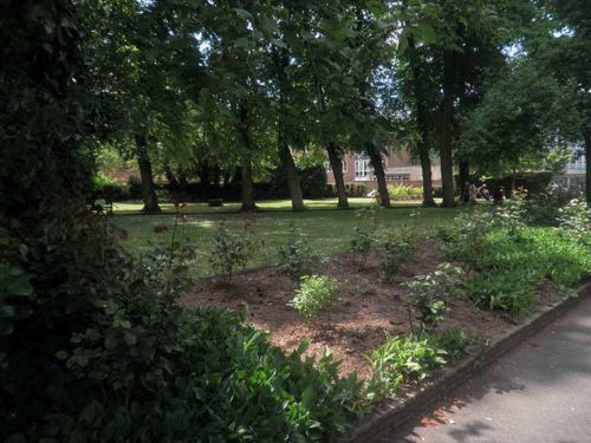
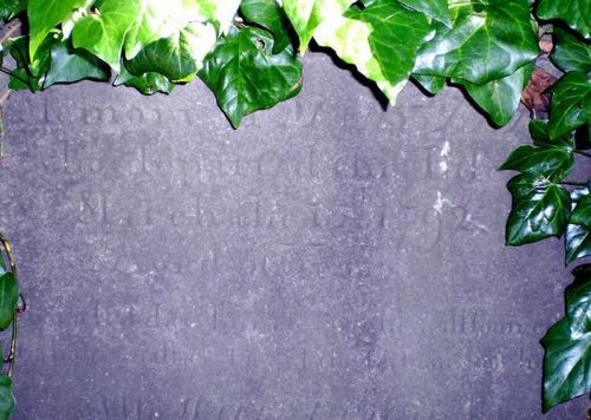
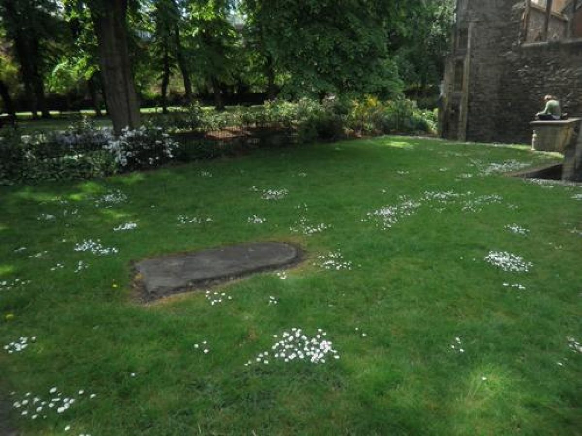
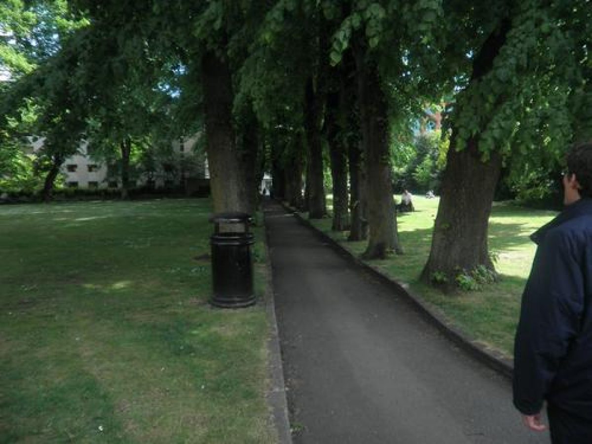
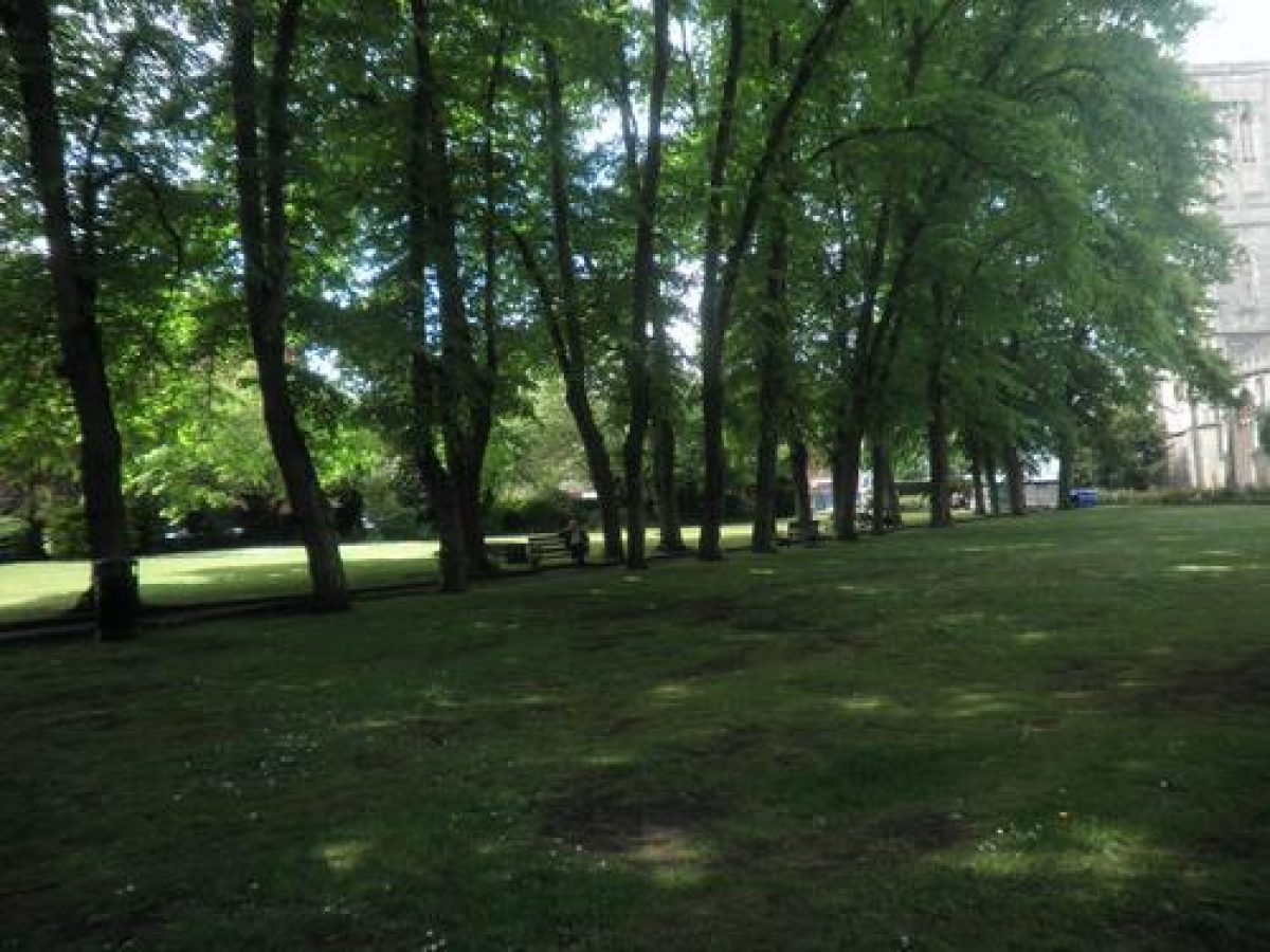
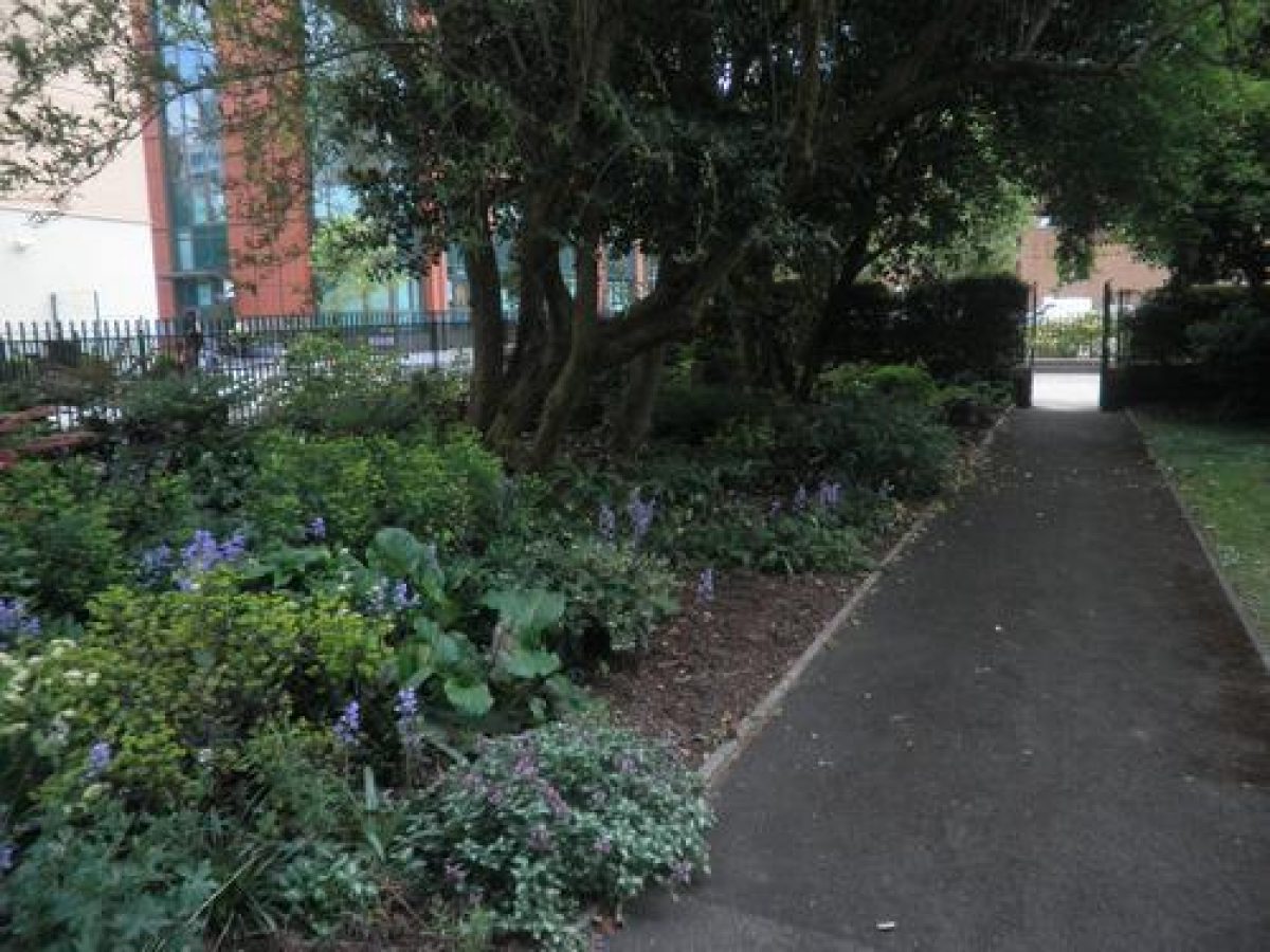
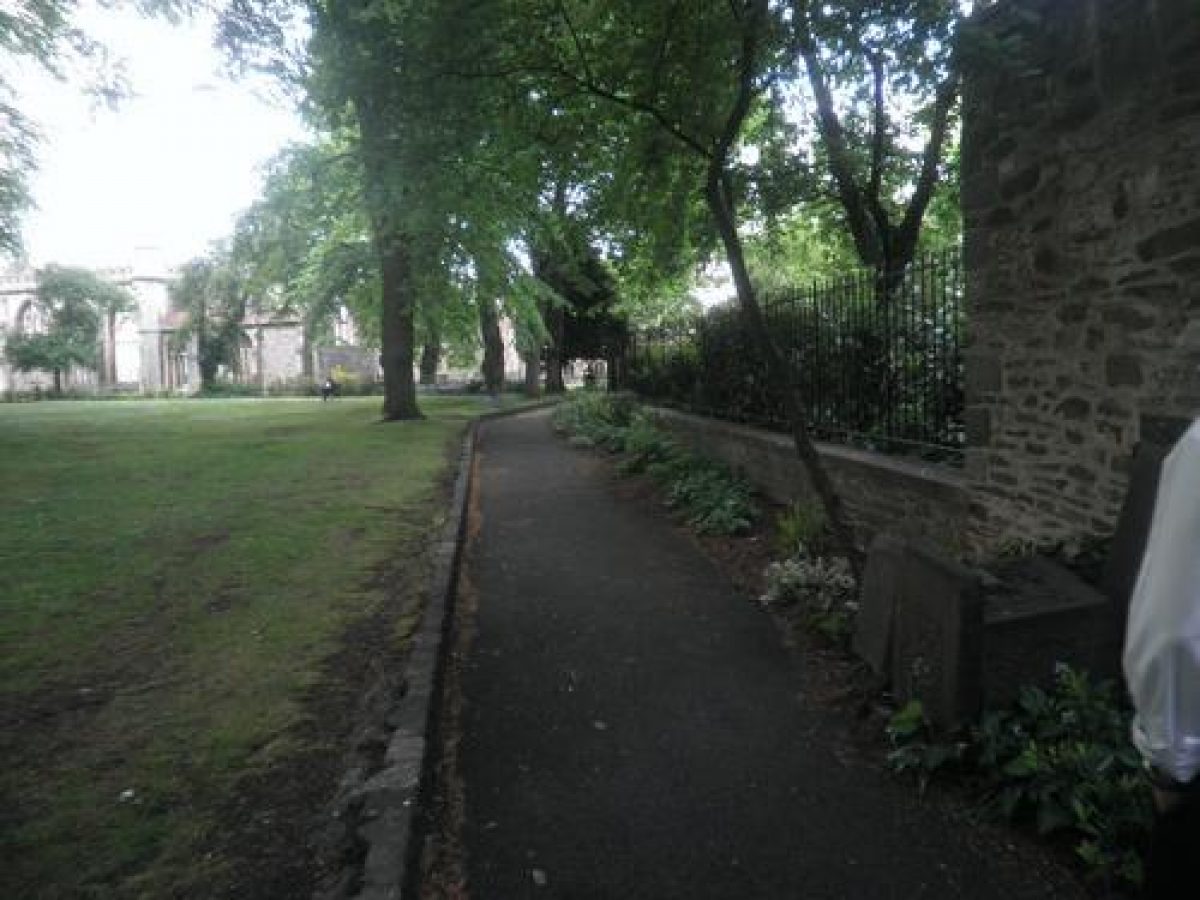
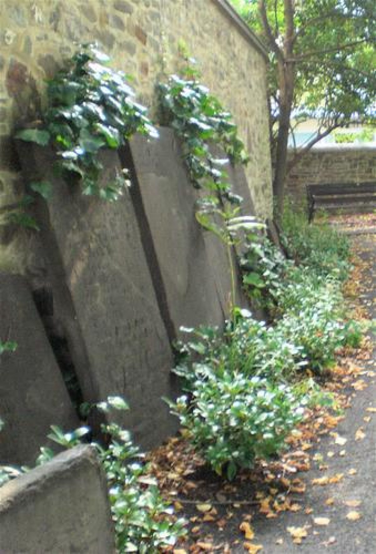
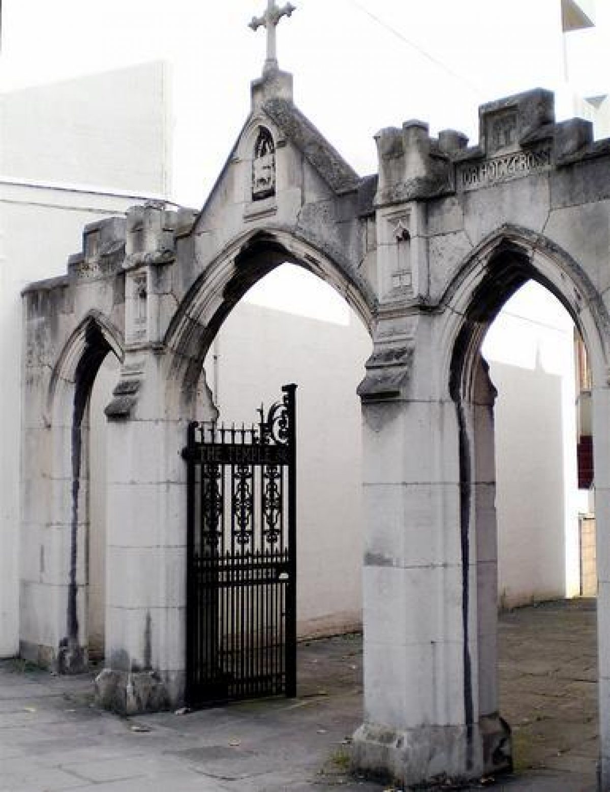
The churchyard and ruined church today form a peaceful garden within the business district of modern day Bristol. There are four entrances into the churchyard with a diagonal path flanked by mature lime trees bisecting the area. At the far end of the churchyard there is a high wall which may possibly be part of the original complex. Extensive shrub borders extend along the west side of the former churchyard and are planted with an assortment of mostly evergreen shrubs. There are both circular and a rectangular rose bed. Immediately in front of the ruined shell of the church is an extensive herbaceous bed. Ten benches provide seating. Three individual graves together with seven large and five fragments of headstones remain spread through the former churchyard.
The former churchyard of Temple Church continues to be a public open space under the care of Bristol City Council.
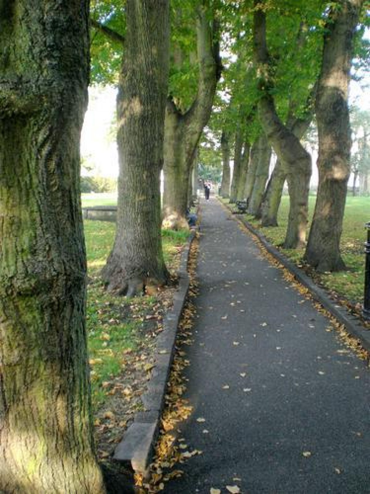
Within the churchyard there are remnants of an avenue of lime trees. Donne's map of 1773 (See Fig.6) shows two avenues of trees within the churchyard which were probably planted following the refurbishment of the church earlier in the century. The adjoining Rack Close appears as an area of waste ground.
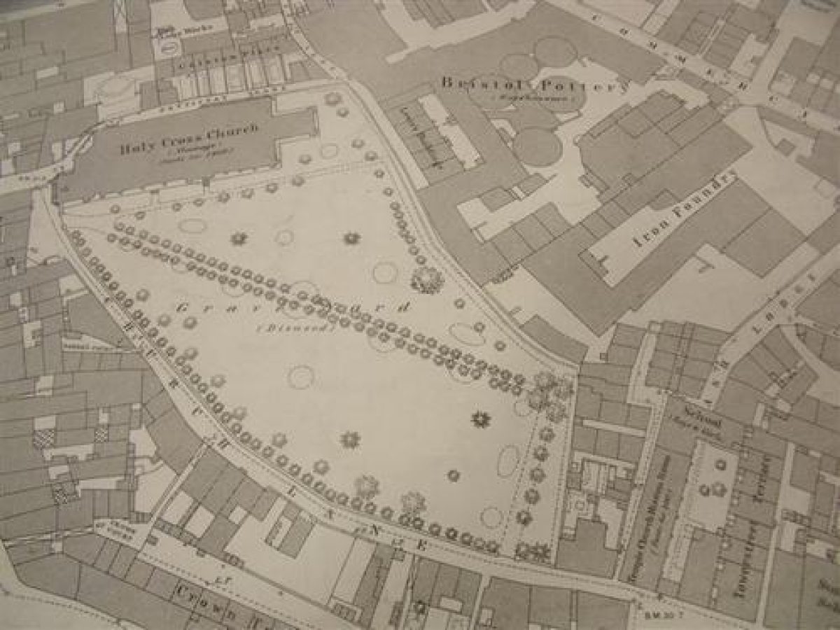
The Ordnance Survey map of 1883 (See Fig. 8) shows the churchyard in greater detail. The diagonal avenue of deciduous trees is intact (See Fig. 7) and deciduous trees line the churchyard adjoining Church Lane. There are individual specimen trees planted in the churchyard and a number of circular and oval flower beds. There are two copper beech trees growing in the churchyard which may be original plantings and depicted on the 1883 map.
Two engravings dating from the early 19th century (See Figs. 9a & 9b) show some of the trees as well as an assortment of headstones within the churchyard.
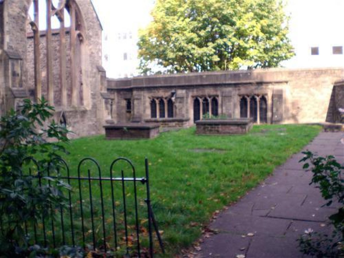
There are currently seven large and five fragments of headstones remaining spread throughout the former churchyard. (See Figs. 10a & 10b) There are also three individual stone graves remaining. The first strcture comprises a horizontal stone resting on four stone piers. It is approximately 45cm high by 180cm wide. The other two structures are solid stone and are approximately 45cm high by 180cm wide.
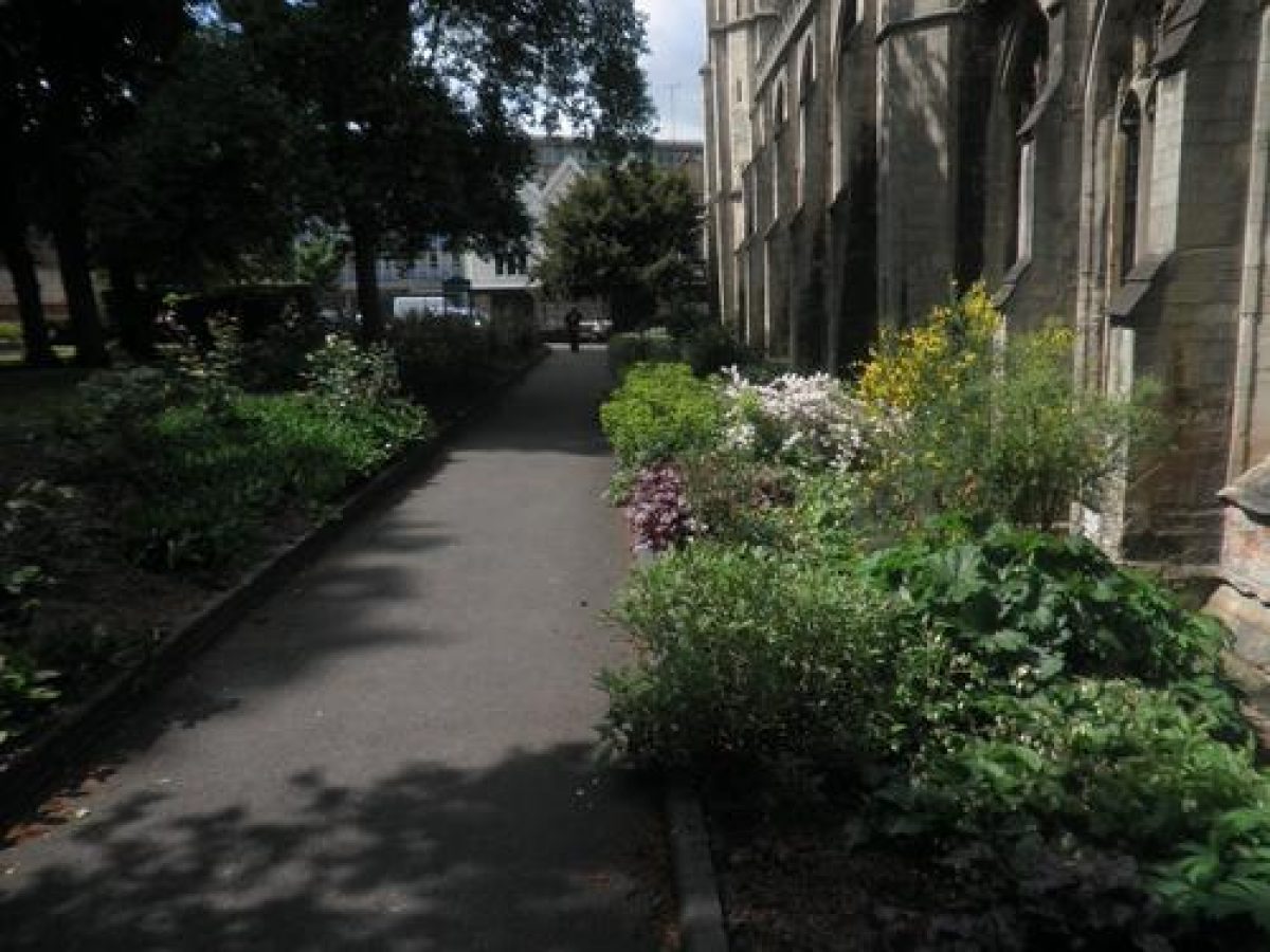
There are four entrances (See Fig. 11) with a diagonal path flanked by mature lime trees bisecting the area. Another path extends for three sides around the perimeter of the churchyard. At the far end of the churchyard there is a high wall which may possibly be part of the original complex.
Extensive shrub borders extend along the west side of the former churchyard and are planted with an assortment of mostly evergreen shrubs including cotoneaster, privet, lonicera, box, philadelphus, holly trees and a ground cover of ivy. This curved border is 3-4m wide and is backed by railings and a privet hedge. There is both a circular and a rectangular rose bed. Immediately in front of the ruined shell of the church is an extensive herbaceous bed. Ten benches provide seating. (See Fig. 12)
- Visitor Access, Directions & Contacts
- History
Temple Church in Bristol (NGR ST5932 7273) lies to the south of what is now the Floating Harbour but was originally part of the course of the river Avon. The area was marshland lying outside the Saxon Town of Bristol which lay on higher ground to the north. During the Norman period Bristol expanded rapidly as a major port and this led to the development of quays along the river banks. By about 1150 the quays had spread to the south bank of the river Avon.
Between 1128 and 1147, Robert, Earl of Gloucester, and the natural son of Henry I, gave land in the area to the south of the river Avon to the Knights Templar. The Temple Fee as this land subsequently became known as, was the eastern part part of the marshland belonging to the manor of Bedminster. Although the exact boundaries of the estate are not known, its core was this area later known as Temple Fee centred on the Temple Church. The Temple Fee was exempted from the control of the city and the Knights Templar appear to have established it as the headquarters for their estates in south west England.
The Knights Templar constructed circular churches which they copied from the Church of the Holy Sepulchre and the Temple of Solomon, both in Jerusalem. A church in this style was constructed in Temple Fee in the second part of the 12th century. Although no visible traces of this circular church survive above ground, archaeological evidence has shown the outline of this building, around 1300, the original church was enlarged and modified - the chancel was lengthened and new chapels were built. In addition, the trading activities of the Templars meant the Temple Fee area increasingly became a centre for wool merchants and weavers.
In 1313, this church, known as Holy Cross,was transferred to the Knights Hospitallers, but by 1330 they had transferred their local headquarters to Templecombe and the Bristol Temple declined in importance. However as the church's importance to the Hospitallers declined, the involvement of the Weavers Company increased. The earlier circular church of the Templars was replaced with a new building, around 1400, which included a Weavers Chapel. Documentary evidence shows that Edward I granted land and a chapel to the Company of Weavers in 1299. By the late medieval period, weaving was the staple industry of Bristol with its centre being in Temple parish.
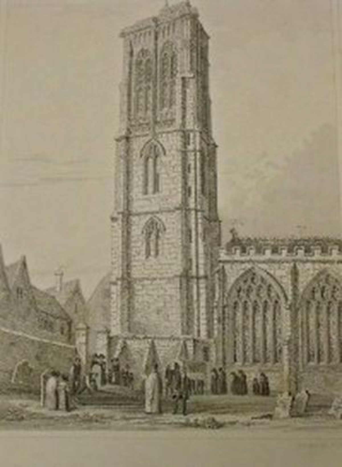
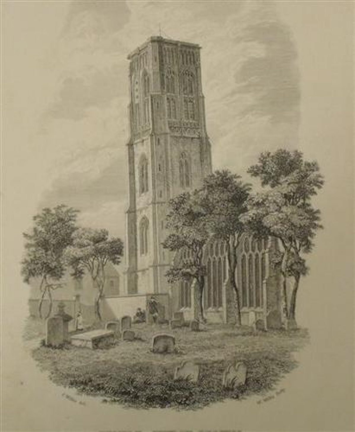
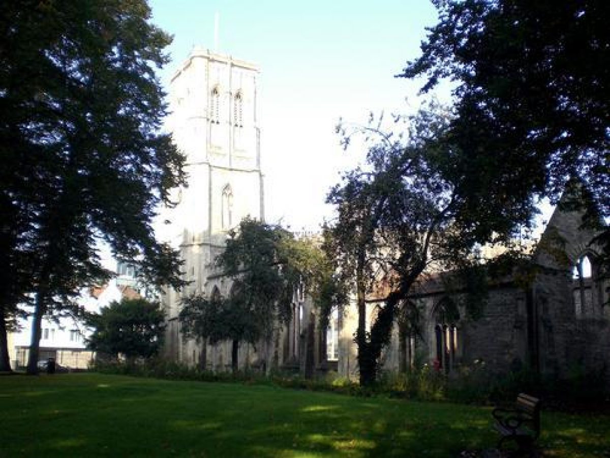
The Gothic tower which is 35 metres tall was built in 1441-60 but the insufficient foundations in the alluvial clay subsoil caused the tower to start leaning at an early stage in its construction. At its top the tower is 1.63 metres out of the vertical on its western face.
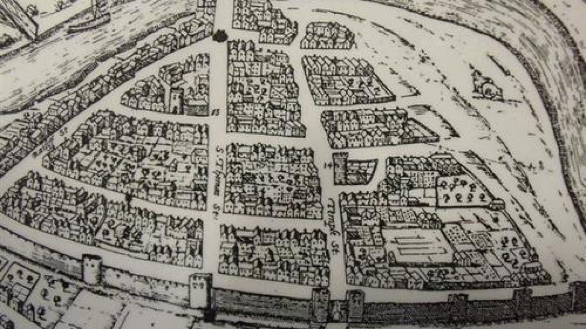
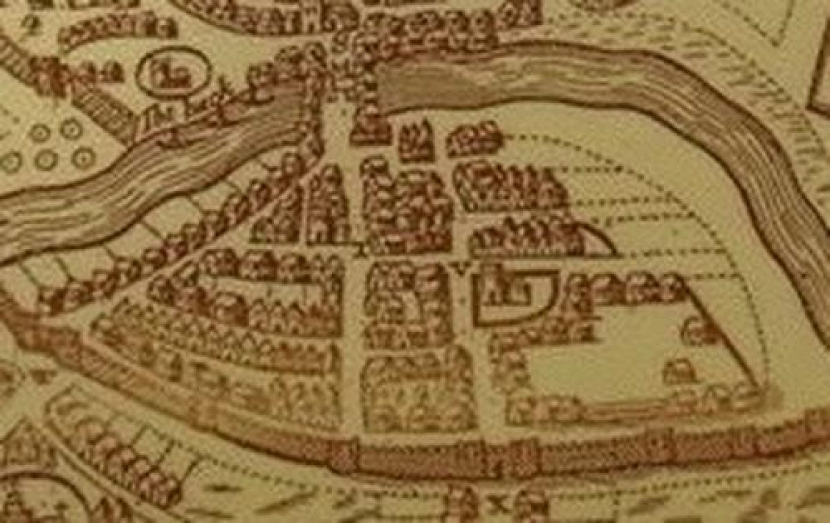
The order of the Knights Hospitallers was suppressed by Henry VIII in 1540 but the church continued to function as the Holy Cross parish church with the patronage of the living being purchasd from the Crown by the City of Bristol. The etching by Hoefnagels (Fig. 2) was made in 1581 and shows the church with its tower surrounded by dwellings. Thirty years later, Speed's map of 1610 (Fig. 3) shows the church enclosed within a semicurcular area but surrounded by a lesser density of housing.
Detials taken from Miller's map of 1671 (Fig. 4) shows the church surrounded by houses but the continued importance of the Temple area for weaving and cloth production is illustrated by the drying racks in The Rack Close. In the early 18th century, the area declined in importance as cloth production moved elsewhere and pottery, glass and other industries moved into the area. The church was given a major refit in this period, mainly due to the generosity of Edward Colston.
On 24th November 1940, the church was burnt out by German bombing. The roof was completely destroyed although the walls remained standing. In 1944, the benfice was united with St Mary Redcliffe and, as the building was no longer required for worship, Temple church (as it is popularly called rather than Holy Cross) remained a ruin by default. (See fig. 5) In 1958, Temple Church came under the auspices of the then Ministry of Works as an 'Ancient Monument'. The same year the churchyard was handed over to the city for use as a public open space. In addition to being added to the Schedule of Ancient Monuments, the church was also listed as Grade II* in 1959. Management of the Church passed to English Heritage in 1984.
Period
- Medieval (1066 to 1540)
- 12th Century (1101 to 1200)
- Features & Designations
Designations
The National Heritage List for England: Listed Building
- Grade: II*
Scheduled Ancient Monument
Style
Informal
Features
- Religious, Ritual And Funerary Features
- Tomb
- Church
- Wall
- Trees
- Path
- Shrub Feature
- Rose Garden
- Herbaceous Border
- Garden Bench
- Key Information
Type
Funerary Site
Purpose
Sacred / Ritual / Funerary
Principal Building
Religious Ritual And Funerary
Period
Medieval (1066 to 1540)
Survival
Part: standing remains
Open to the public
Yes
- References
Contributors
Dr Ros Delany