Introduction
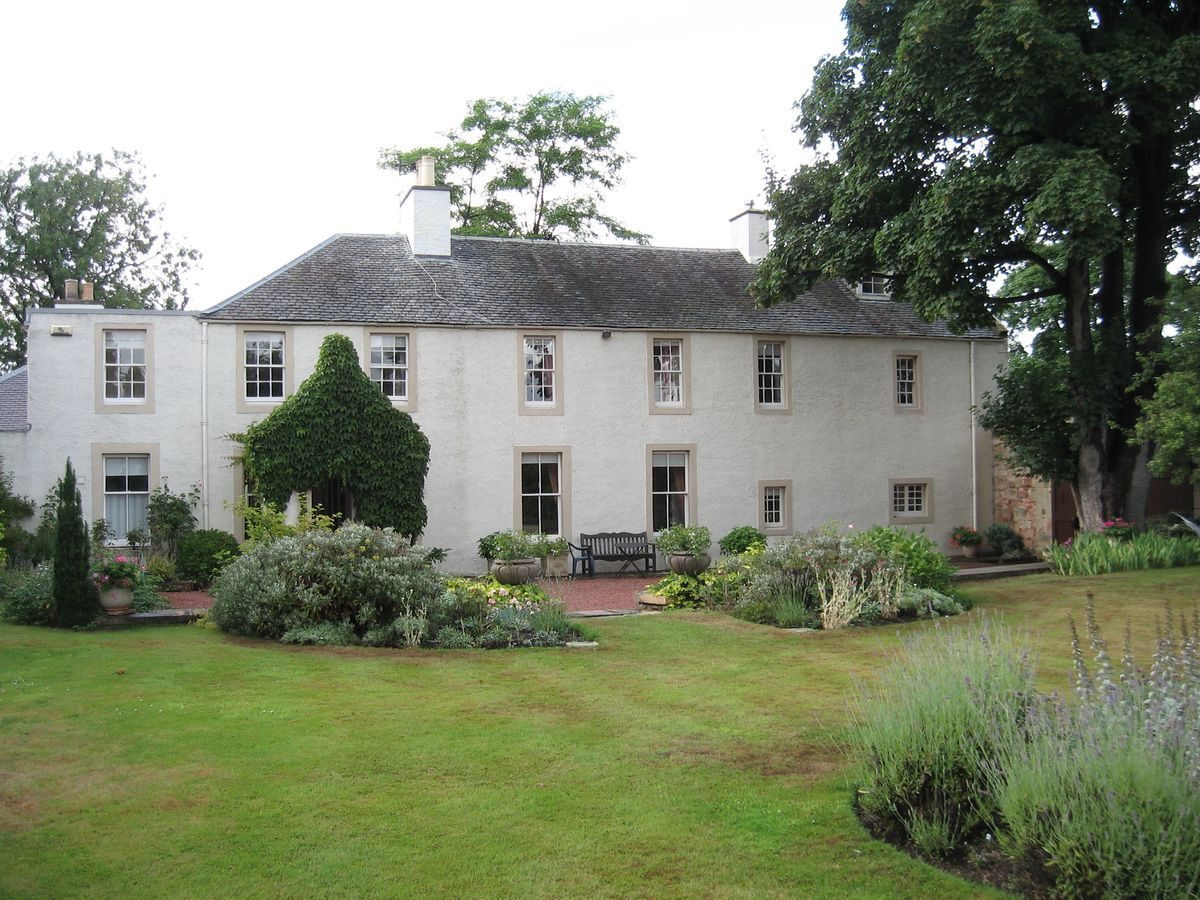
The site has the remnants of a house with once expansive walled gardens, which date back to at least the mid-17th century. Stoneyhill House is now surrounded by the later development and expansion of Musselburgh.
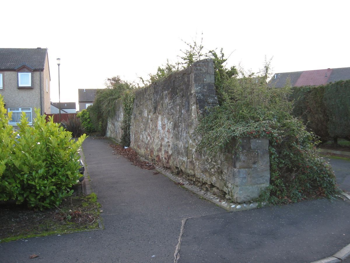
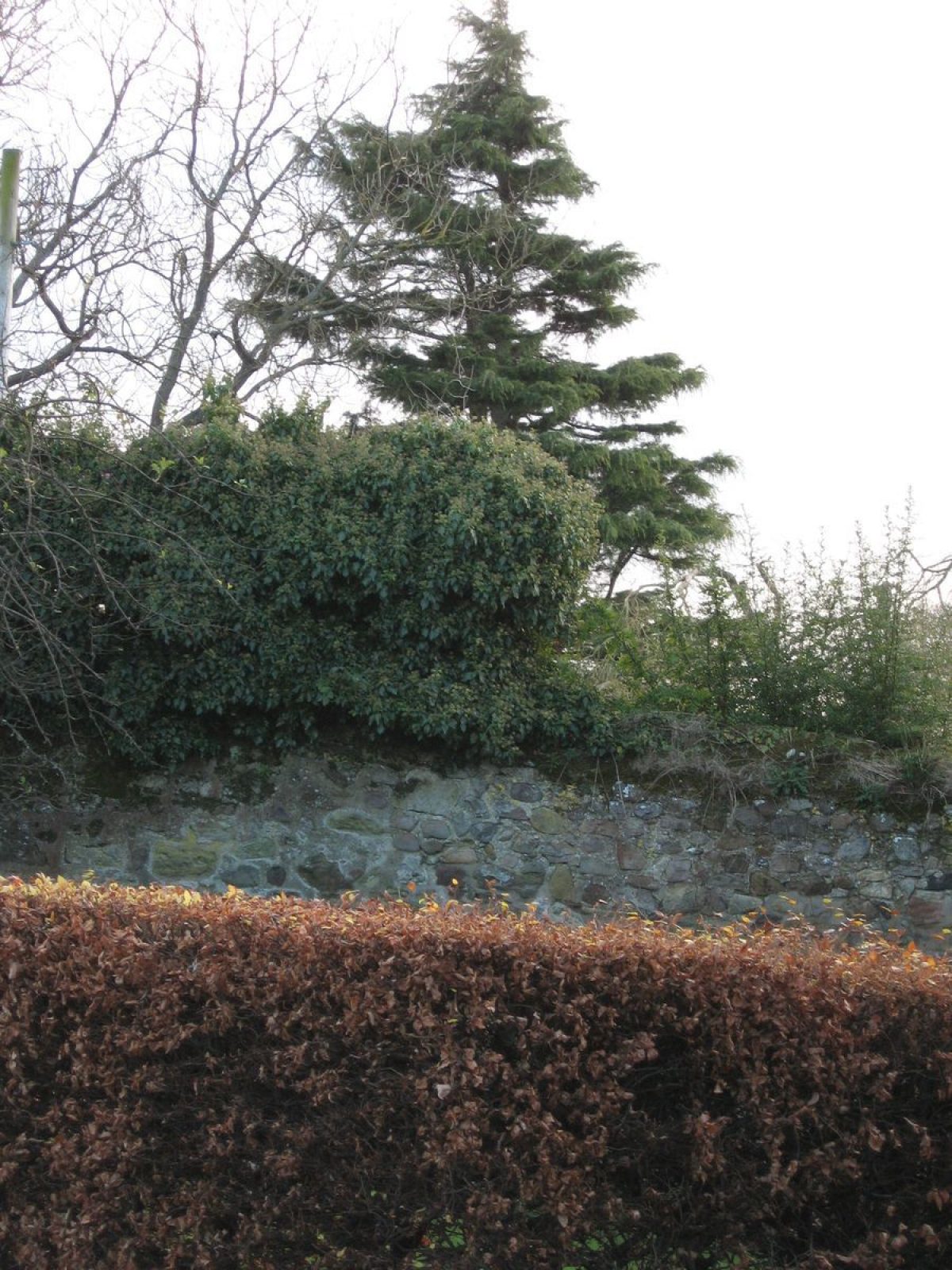
A property at Stoneyhill House surrounded by enclosed ground is indicated as far back as at least John Adair's 1682 Map of Midlothian. The surviving house with its high walled gardens dates from the mid- to late-18th century. Much sub-division of the designed landscape occurred during the mid-20th century with houses built in the western section of the walled garden. However the walled boundaries have been respected and remain as boundaries for the newer properties.
Further details about Stoneyhill House are available on the Royal Commission on the Ancient and Historic Monuments of Scotland website:
http://canmore.rcahms.gov.uk/en/site/346336/details/stoneyhill+house/
http://orapweb.rcahms.gov.uk/wp/00/WP003809.pdf
REFERENCES
1. MAPPED SOURCES
Unless otherwise stated all maps referenced are from the online National Library of Scotland Map Collection
http://maps.nls.uk
1654 Joan Blaeu, Lothian & Linlithgow ‘Stony Hill’ on road to Edinburgh
1682 John Adair Map of Midlothian (Shown with two walled gardens)
1735 John Adair Map of Midlothian (Walled garden and trees)
Circa 1755 Roy Military Survey of Scotland (Lowlands) (shows wall)
1745 Herman Moll Lothian : contains The Shire of Linlithgow or West Lothian. The Shire of Edinburgh or Midlothian. and Haddington or East Lothian
1766 John Laurie A Plan of Edinburgh and Places Adjacent ‘Stonyhill’ (Square plot surrounded by trees)
1773 Andrew & Mostyn Armstrong Map of the Three Lothians (North Centre Section)
1775 Map Roll Act of Parliament 6th June 1775 reference to holding (In private ownership)
1786 John Laurie A plan of Edinburgh and Places Adjacent
1812 James Knox Map of the Shire of Edinburgh – North East Section
1817 Robert Kirkwood A Map of the Environs of Edinburgh
1821 John Ainslie’s Map of the Southern Part of Scotland
1821 John Thomson Edinburghshire
1824 James Hay’s New Plan of Musselburgh & Its Environs National Records of Scotland RHP1855. Also reproduced in facsimile at about one inch to 100 yards by East Lothian District Library, 1993.
1850 William Forrester Map of the County of Edinburgh showing the turnpike and statute labour roads...etc
Ordnance Survey Town Map of Musselburgh Sheet 10 Scale 1:1056 Surveyed 1853 Garden wall extant with summer house (building to south still in existence 1995) now outside the boundaries of Stoneyhill House & fits with Ainslie
Ordnance Survey Musselburgh Town Map Edinburgh Sheet IV.11.7 Scale 1:500 Surveyed 1893
Ordnance Survey Second Edition & Later Editions 25 inches to One mile Edinburghshire Sheet 004.II Revised 1912-13, Published 1914
2. PRIMARY & DOCUMENTARY SOURCES
Survey of Stonyhill near Musselburgh made for the use of the Duke of Argyll when bargaining for this place in anno vio 1753 Earl of Wemyss and March RCAHMS 1249/1
Plan Lands at Stoney Hill John Ainslie Estate Map Earl of Wemyss and March circa 1806 Archive of the Charteris Family, Earls of Wemyss & March held at Gosford House. Access via National Register of Archives of Scotland NRAS208/74
Plans of the Lands in East Lothian (Book of Estate & Farm Plans) circa 1807 Archive of the Charteris Family, Earls of Wemyss & March held at Gosford House. Access via National Register of Archives of Scotland NRAS208/155/189 (Wall shown as at time of Ainslie survey and comparing to Duke of Argyll House and Garden 3.64 acres)
Writs of Stoneyhill by Jane Dobie circa 2000 in the possession of the current owner
Deeds of the house in the possession of current owner 2013
3. HISTORICAL ILLUSTRATIONS & PICTORIAL SOURCES
Aerial photograph Sortie 106G_UK_0011 Frame 5306 1946 Vertical Aerial Photograph Collection RCAHMS
Theatrum Scotiae 1718 John Sleazer Prospectus Orce maritmae Lothianae a Praedio de Stony hill The coast of Lothian from Stony hill (This is not an image of the property but of the view from the property)
4. BIBLIOGRAPHY OF PUBLISHED SOURCES
The First ‘Old’ Statistical Account of Scotland: Inveresk, County of Edinburgh vol 16 1795 page 10
The Second ‘New’ Statistical Account of Scotland: 1845 pages 281-282
Paterson History of the Regality of Musselburgh 1857 pages 186-189 Reference to fruits and vegetables grown at Stoneyhill 17th century
Dennison, E Patricia & Coleman Historical Musselburgh 1893 Russell
Langhorn, Reminiscences, (father was founder of Loretto and resided at Stoneyhill in 1820)
The Scottish Burgh Survey 1996 Historic Scotland
Hopkins, Bob East Lothian Life Magazine 2002 Issue 44 pages 5-6
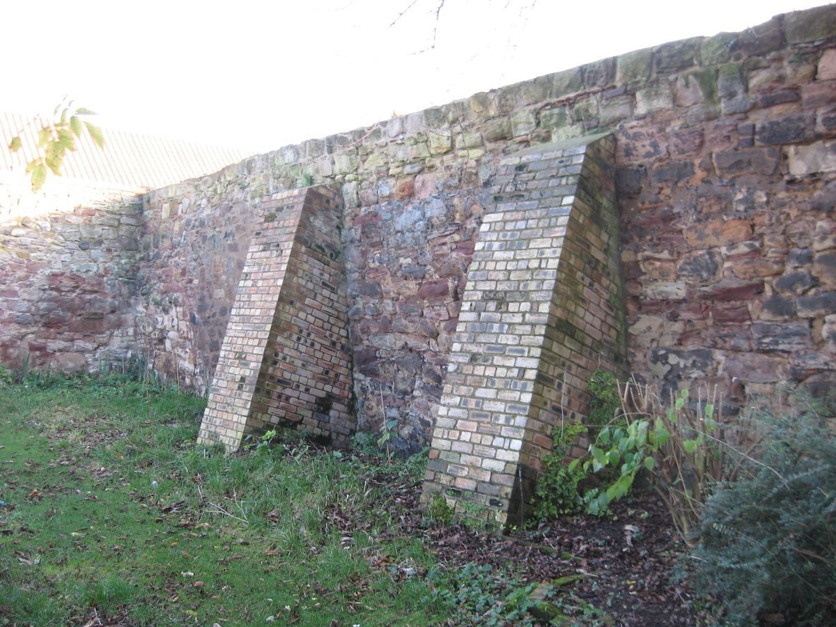
Menary, Life and Letters of Duncan Forbes of Culloden 1936 Published Maclehose (gigantic buttressed wall surrounding garden of great age with an ancient mulberry tree coeval with Shakespeare)
- Visitor Access, Directions & Contacts
Directions
Situated approximately 500 metres south-west of Musselburgh town centre on the west side of the River Esk.
- History
Stoneyhill House and walled gardens are significant remnants of a property and designed landscape which has stood since before the 1654 Blau map. Reports of fruit growing from the 17th century within the walled garden confirm its success. Though the entire landscape has been divided since 1946 and houses built inside the west section of the walled garden, the boundaries have been respected and the walls remain in the gardens of those houses outwith the wall, forming their land boundary. The infamous Colonel Charteris died whilst owning the house, and the property was eventually sold by the Wemyss & March estates in 1870.
The property had a significant ownership by the Lowe family who created a market garden to the south of the walled garden (seen on the 1946 aerial) in World War 2 whilst retaining the inner walled garden to the west as a pleasure ground and the south garden as part orchard.
The avenue of trees which was prominent on early maps leading along the service drive to Musselburgh to the north-east was removed before the Second Ordnance Survey of 1893. However the northern pastures seen in the Ainslie survey of 1806 with a pond and stream remain as a rugby ground. There are no remains of the dovecot.
- Features & Designations
Features
- Small Mansion House (featured building)
- Description: Mid/Late 18th century with later additions and alterations, small two storey mansion with high walled garden to south and west.
- Earliest Date:
- Latest Date:
- Key Information
Type
Garden
Principal Building
Domestic / Residential
Hectares
0.45
Electoral Ward
Musselburgh South
- References
Contributors
Kristina Taylor with Lord Cameron of Lochbroom, East Lothian Gardens and Designed Landscapes Recording Project under the auspices of the Garden History Society in Scotland