Introduction
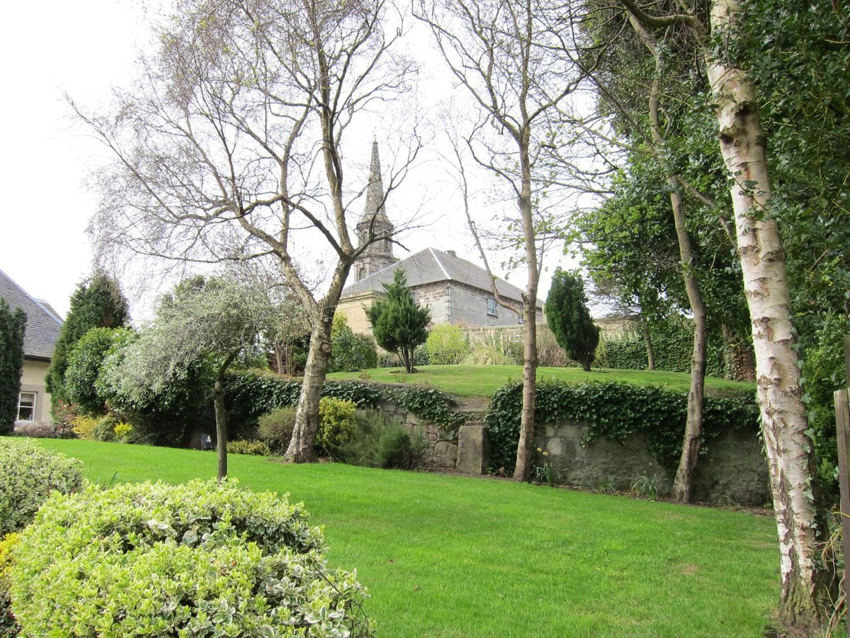
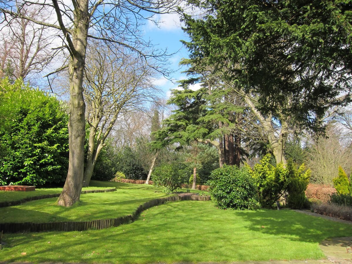
The Inveresk House landscape today represents the remains of a larger landscape probably laid out in the late-18th century, although there has been a house on this site since the 17th century. Much of the north of the landscape has been lost to development and the balance is in divided residential ownership.
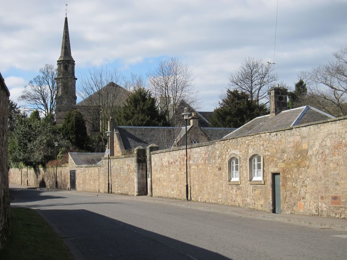
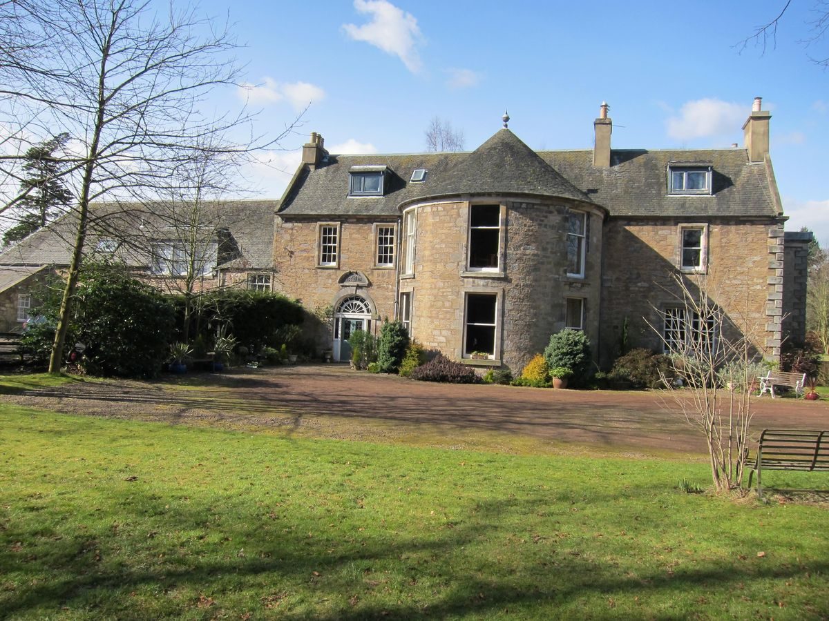
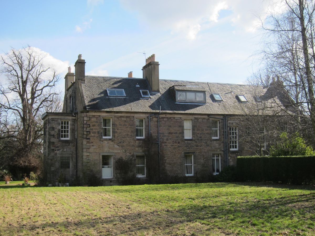
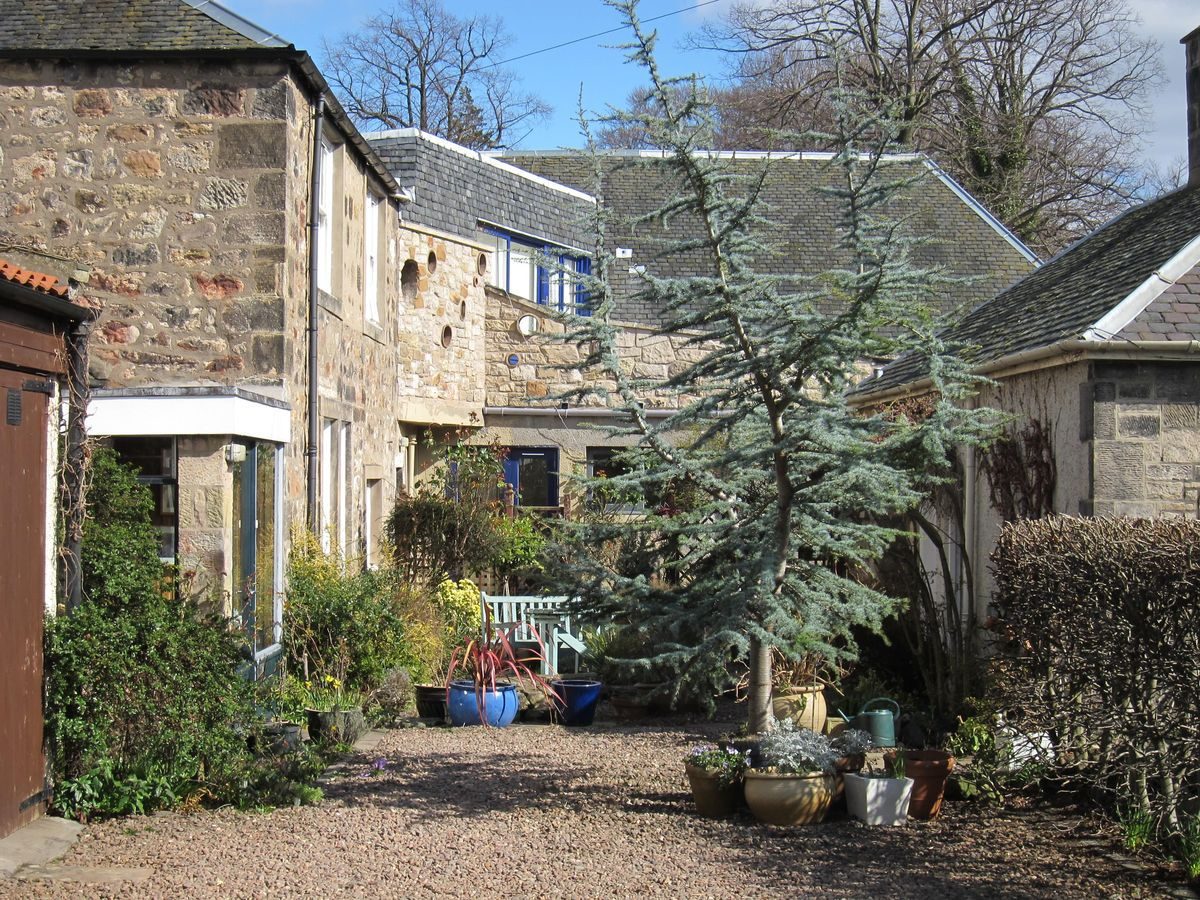
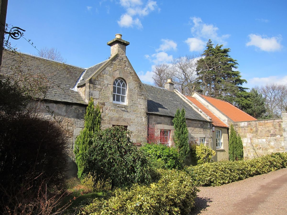
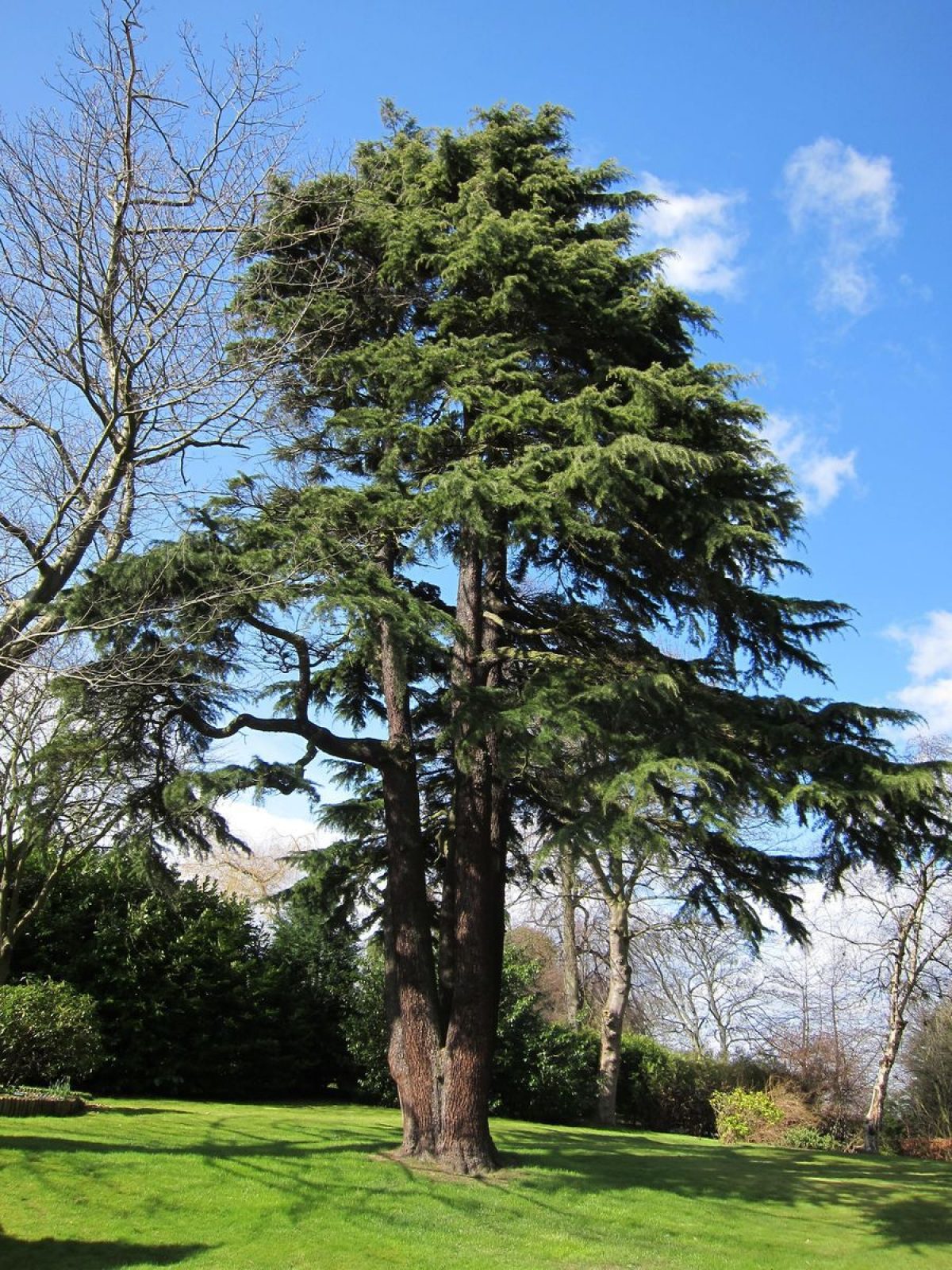
Parts of Inveresk House, originally the Manse, date from the late-17th century with mid-18th and early-19th century additions. The first details of the designed landscape, which includes Roman remains, are recorded on the Ordnance Survey of 1853. Further exotic tree planting was undertaken in the mid-20th century but large numbers of trees were felled in the west of the landscape to accommodate a new house, Oliver's Mound, in the 1990s. The former stables, kitchen, laundry and boiler-house attached to Inveresk House are now all in separate ownership as individual residences. Access to the house is from the former service drive off Inveresk Village Road, the principal drive from Inveresk Road being lost with the construction of Musselburgh Grammar School in the north of the landscape.
Further details about Inveresk House are available on the Royal Commission on the Ancient and Historic Monuments of Scotland website:
http://canmore.rcahms.gov.uk/en/site/210542/details/inveresk+inveresk+village+road+inveresk+house+gardens/
http://orapweb.rcahms.gov.uk/wp/00/WP003810.pdf
REFERENCES
1. MAPPED SOURCES
Unless otherwise stated all maps referenced are from the online National Library of Scotland Map Collection
http://maps.nls.uk
1682 John Adair Map of Midlothian
1763 John Laurie A Plan of the County of Mid-Lothian (North East)
1766 John Laurie A Plan of Edinburgh and Places Adjacent
1775 Map Roll Act of Parliament 6th June 1775 (private ownership)
1821 John Thomson Edinburghshire
1824 Hays New Plan of Musselburgh & its Environs by James Hay, surveyor, Musselburgh & Charles Thompson, engraver, 19 Shakespeare Square, Edinburgh. NRS ref RHP1855. Also produced in facsimile at about one inch to 100 Yards by East Lothian District Library.
1832 Great Reform Act Map Musselburgh (House of Commons) Map 51
1834 W Hunter & J Anderson Plan of Environs of Edinburgh
Ordnance Survey Town Map of Musselburgh Sheets 11(showing northern drive) & 12 Scale 1:1056 Surveyed 1853
Ordnance Survey First Edition Six inches to One mile Edinburghshire Sheets 3 (showing northern drive) & 7 Surveyed 1852-3 Published 1854
Ordnance Survey Musselburgh TownMap Edinburgh Sheet IV.11.14 Scale 1:500 Surveyed 1893
Ordnance Survey Second Edition & Later Editions 25 inches to One mile Edinburghshire Sheet 004.II Revised circa 1893, Published 1895
Ordnance Survey Second Edition & Later Editions 25 inches to One mile Edinburghshire Sheet 004.II Revised circa 1906, Published 1908
Ordnance Survey Second Edition & Later Editions 25 inches to One mile Edinburghshire Sheet 004.II Revised 1912-13, Published 1914
2. PRIMARY & DOCUMENTARY SOURCES
John Young (Brewer) - (deceased) Trust 2 Volumes- Sederunt Books (1910-1925) Property of John Chute and lodged in Inveresk House
Plan The Fields of Pinkie & Inveresk by Thomas Johnston 1778. This shows the road south from Musselburgh to Inveresk Village Road. National Records of Scotland RHP 24995 (Original of photocopy listed as RHP6794). (Land to north of present boundary wall sold in 1925 for a school. The present school car park was then a market garden.)
3. HISTORICAL ILLUSTRATIONS & PICTORIAL SOURCES
Vertical Aerial Photograph Collection RCAHMS:
B0017 5297-5300 SB000389 15 April 1946 Very clear
B0019 6084 SB000394 12 June 1946 Hedge line shown at east road/path on 1919 map and the old north drive from Musselburgh shown in grass
B0492 0100 F22 SB00291 6 November 1960 Strong shadows from trees and west wooded garden intact before tree removal to build Oliver’s Mound house.
1148718 2 August 2009 Image of Inveresk church showing grounds of Inveresk House
East Lothian Council Planning Department Archive
97/00535/HIS_P extension & conservatory at Oliver’s Mound 1997
91/00841/HIS_P Erection of conservatory at Oliver’s Mound 1991
Baker, Sonia The Country Houses, Castles and Mansions of East Lothian (2009) p46
Image of conservatory and rose beds circa 1905
4. BIBLIOGRAPHY OF PUBLISHED SOURCES
Stirling, R.McD Inveresk Parish Lore 1894 Musselburgh pp. 38,41,42, 96 (illustration)
Burnett, Jane E M The Reason for Inveresk- a Scrapbook of History 1999 Courtyard Press p27-38
Baker, Sonia The Country Houses, Castles and Mansions of East Lothian 2009 p.46
Wilke, James Historic Musselburgh 1919 Wm Blackwood
Sales particulars Rettie & Company D723 INV(S) £295,000 1990s RCAHMS
Inveresk Conservation Area Appraisal East Lothian Council & Inveresk Village Society 2010 pub East Lothian Council.
Dunn, Munro & Elder, David Doocots of East Lothian 2010 Scottish Vernacular Buildings Working Group.
Watching Brief CFA Report no. 673, by Ian Suddaby, October 2001 RCAHMS Item MS 1081/21
- Visitor Access, Directions & Contacts
Directions
Situated in Inveresk Village approximately 0.5 kilometres south of Musselburgh.
- History
In 1597 Adam Colt of Gartsherrie, the local minister, owned land around the church and the family continued to own the property until 1890. The House was re-modelled in the 17th century and extended in the 18th century. The Family also owned Auldhame East Lothian in the 18th and 19th century and portraits are in The Georgian House, 7 Charlotte Square, Edinburgh. In the 19th century the house was rented to tenants; in 1880 they were Elizabeth and Emily Dickson.
In 1890 John & Fanny Park (seed merchant) bought the property, followed by: 1903 John Young (Brewer), 1926 William Martin Whitelaw, and 1928 Dr Andrew Gold when the house was modernized. From the trees surveyed in the grounds there is evidence of exotic planting during the ownership of the Golds. Around 1980 the Gold sons divided the property into five lots.
Inveresk House was bought by Illico Colt, a descendant of the original Colt family. As he was a farmer in Kenya and had difficulty getting his money out of the country it was held in Trust.
In 1996 John Chute bought Inveresk House.
When Oliver's Mound was built in the 1990s many of the original west garden trees were cut down. The aerial image of 1960 confirms the original wooded nature of this garden. Two mature lime trees were retained on the lawn beside the drive.
Period
- 18th Century (1701 to 1800)
- Late 18th Century (1767 to 1800)
- Features & Designations
Features
- Mansion House (featured building)
- Description: Two-storey rubble sandstone mansion with ashlar dressings.
- Earliest Date:
- Latest Date:
- Key Information
Type
Garden
Principal Building
Domestic / Residential
Period
18th Century (1701 to 1800)
Survival
Part: standing remains
Hectares
1.9
Electoral Ward
Musselburgh Central
- References
Contributors
Stephen Edwards, East Lothian Gardens and Designed Landscapes Recording Project under the auspices of The Garden History Society in Scotland