

Introduction
The layout of The Regent's Park remains largely as it was designed in the early-19th century by John Nash. Features include Queen Mary's Gardens (a rose garden, added in the 1930s) and extensive sports facilities developed in the later 20th century. The park houses the Royal Zoological Society (London Zoo).
Terrain
The park slopes gently to the south.
The following is from the Register of Parks and Gardens of Special Historic Interest. For the most up-to-date Register entry, please visit the The National Heritage List for England (NHLE):
www.historicengland.org.uk/listing/the-list
Details
Early C19 landscape park designed by John Nash as a setting for villa residences and subsequently, from 1835 onwards, opened as a public park. The grounds have seen continuous development into the late C20.
NOTE
This entry is a summary. Because of the complexity of this site, the standard Register entry format would convey neither an adequate description nor a satisfactory account of the development of the landscape. The user is advised to consult the references given below for more detailed accounts. Many Listed Buildings exist within the site, not all of which have been here referred to. Descriptions of these are to be found in the List of Buildings of Special Architectural or Historic Interest produced by the Department of Culture, Media and Sport.
SUMMARY DESCRIPTION
Regent's Park is situated to the west of London, c 1km west of Euston station and c 2km north of Green Park (qv).
The c 147ha of Regent's Park slopes gently to the south and is largely enclosed within a major road, the Outer Circle, this being separated from the park by chain-link fencing and privet hedges. The boundary to the north is made up from that part of Prince Albert Road which runs between the London Central Mosque to the west, and Gloucester Gate to the east. Between Chalbert Street bridge to the west, and St Mark's Bridge to the east, the strip of land between the Outer Circle and Prince Albert Road is principally taken up with Regent's Canal.
Regent's Park is largely laid to grass, much of which is set aside for recreational sports. The Bernard Baron sports pavilion situated in the centre of the park is a 1938 replacement for the one demolished in 1911. Since the early 1900s enclosures for children's playgrounds have been provided and these were added to in the 1930s.
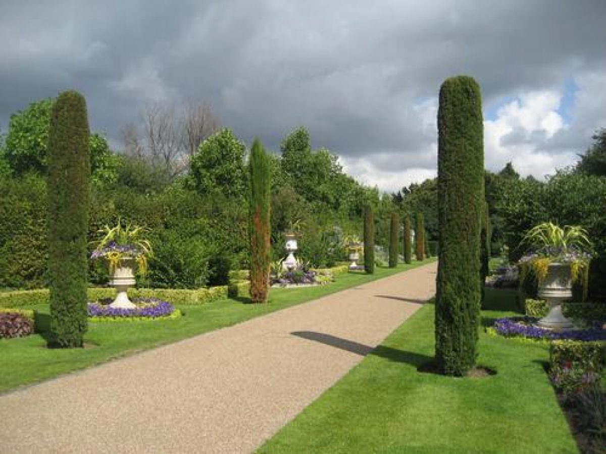
A number of tarmacked paths which radiate from the entrances and from points within the site, cut across the grass. The most significant and widest of these is the Broad Walk. Set to the east of the Zoological Gardens, the walk passes over the Grand Union Canal, then runs south from the Outer Circle. After c 500m the walk divides around an ornate marble and granite drinking fountain (1896, listed grade II) before continuing for a further c 500m where it is crossed by Chester Road, which leads west to the Inner Circle. The final c 400m of the walk runs through the formal Italian Garden. Created in 1864 by William A Nesfield, at the direction of Prince Albert, the Garden had become grassed over by the late C20. By the 1990s proposals were in hand to restore both the Italian Garden and the informal English Garden to the east, the English Garden having been made at around the same time by Nesfield's son Markham, who used mounded grass and planting to create informal glades. The restoration of the Italian Garden was completed in 1996; the renewal of planting in the English Garden is (2000) ongoing.
To the north of the site, housing a collection of exotic animals and birds, are the Zoological Gardens (c 17ha). In 1828 the Royal Zoological Society rented a triangular plot of land of c 8ha to the north of the site. Few examples of the original animal buildings by Decimus Burton (1800-81) survive; those that do include the former Camel House, the Raven House (both listed grade II), and the Giraffe and Hippopotamus House (1830-1, listed grade II). The Zoological Gardens grew rapidly in popularity, expanding to the north of the canal and, in order to accommodate the ever-increasing collection of birds and animals, new buildings were made, one of the latest (1961-5) being the walk-in aviary by Lord Snowdon (listed grade II*). Other listed buildings within the Zoological Gardens include the Mappin Terrace (Belcher and Joass, 1913-14, listed grade I), and the Penguin Pool (Tecton 1934, listed grade I).
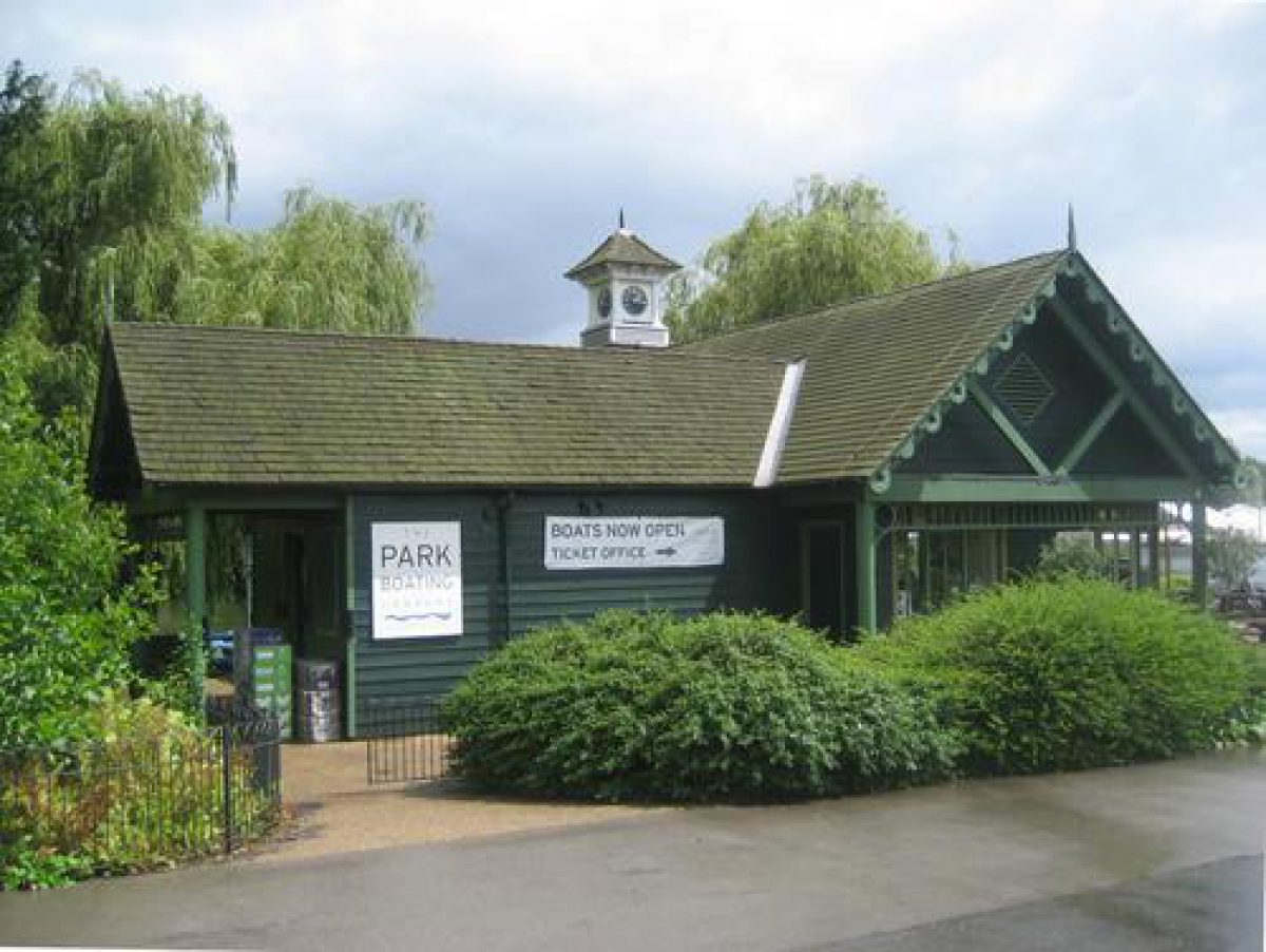
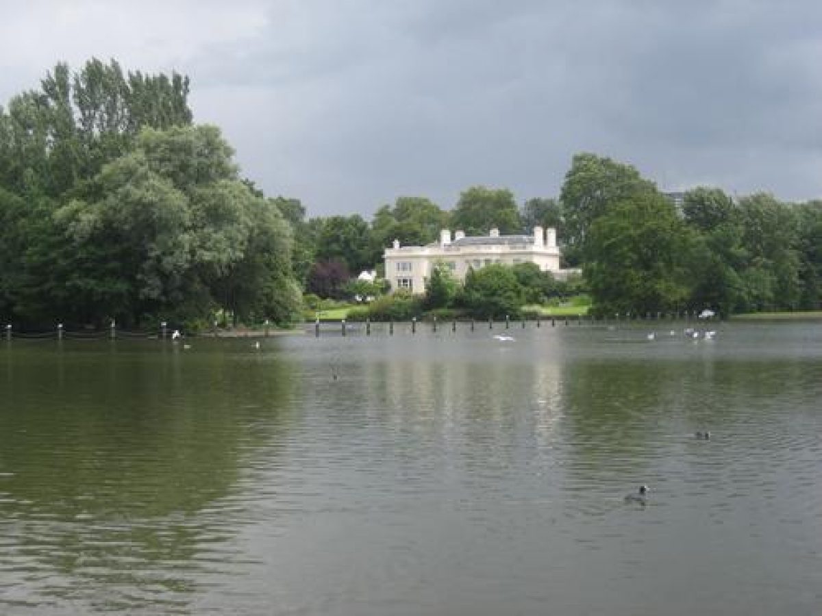
To the south-west of the Zoological Gardens is the Boating Lake. The c 8ha Y-shaped lake, situated to the south-west side of the park, is decorated with a number of islands, including two to the north-east arm, one to the north of the west arm, and two towards the centre. The east and west arms of the lake are crossed by ornamental footbridges, the southern arm being crossed by York Bridge (listed grade II) which carries cars between the Outer and Inner Circle. In 1930 a small children's boating pool was added c 50m to the west of the western arm of the lake.
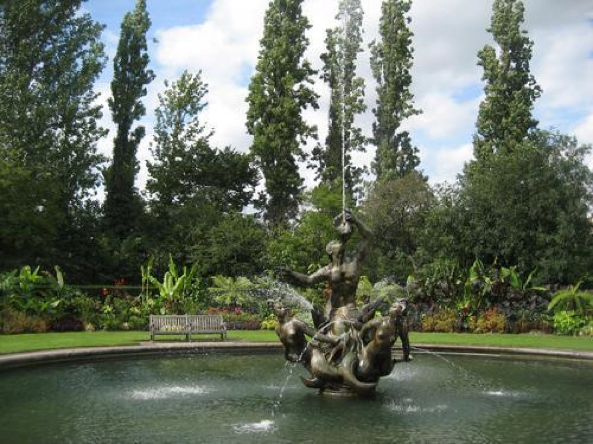
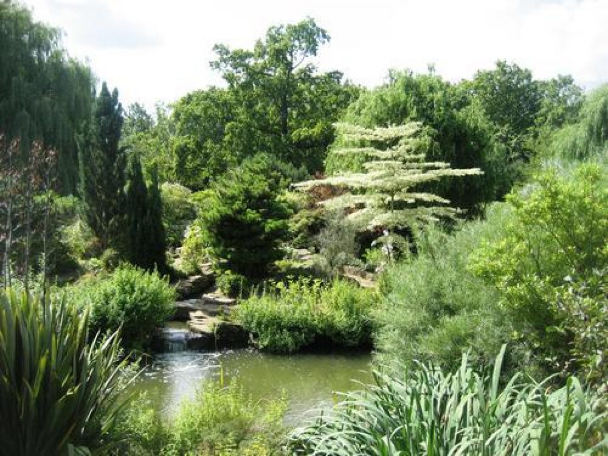
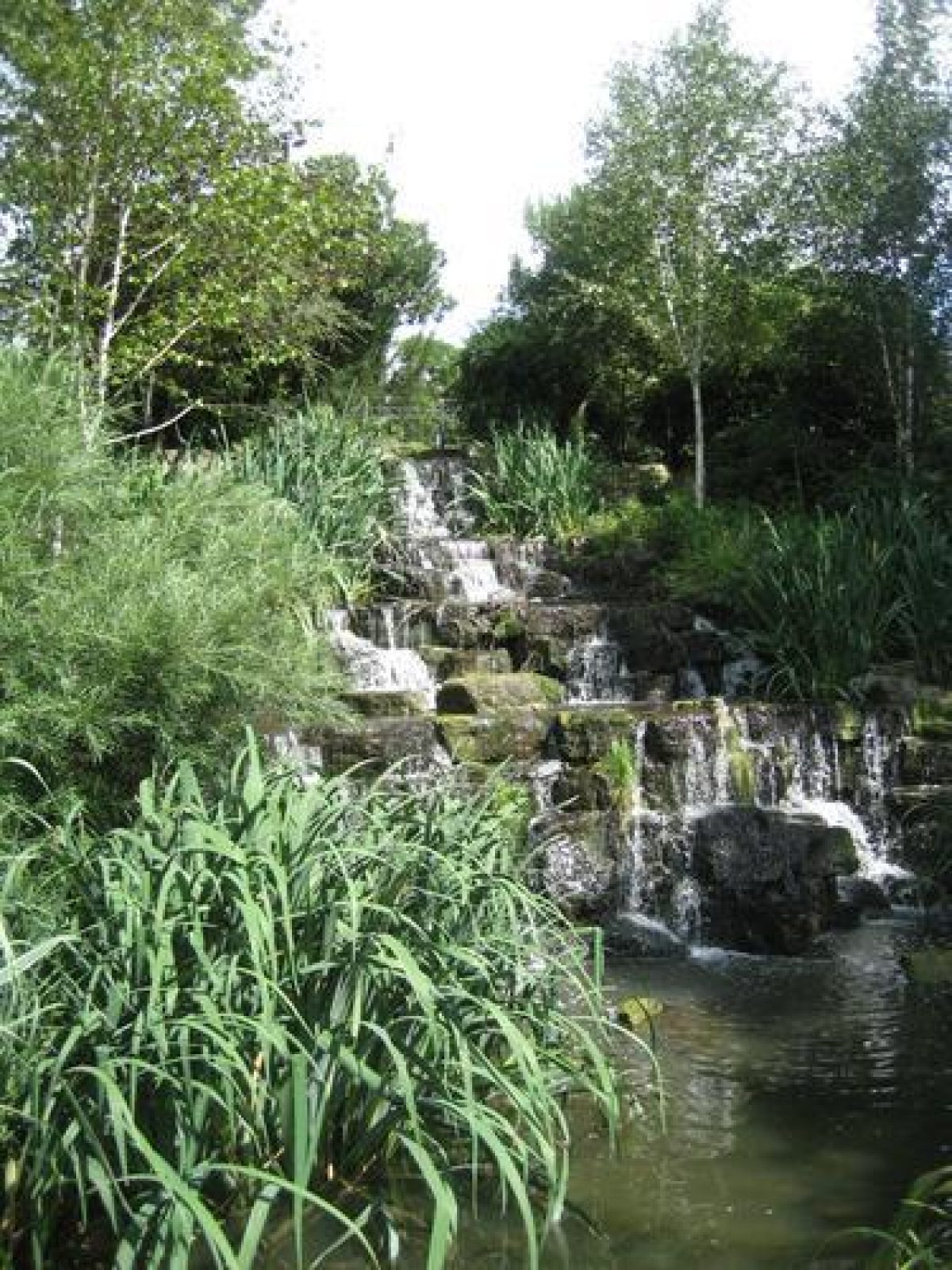
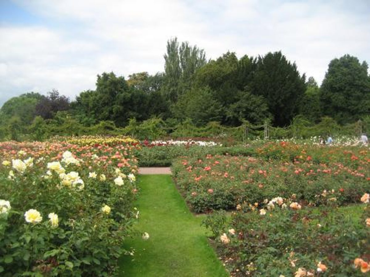
Some 100m to the east of the Boating Lake and set within the Inner Circle are Queen Mary's Gardens (c 7ha). To the south and south-west the ornamental gardens, largely laid out with roses introduced by Duncan Campbell c 1932, run east to a miniature lake with an island and a bridge. A central path leads north from ornamental gates (listed grade II), erected to commemorate King George V and Queen Mary's Jubilee in 1935, to a pool and fountain (listed grade II). The pool and fountain replaced the Royal Botanic Society's C19 conservatory which was demolished c 1932 as part of the work undertaken by Campbell. To the north-east and east of the central path the garden is decorated with an extensive rockery and water features. To the north-west is the open-air theatre and cafe. The latter, opened in 1932, was made on the site of the Royal Botanic Society's museum and secretary's house. Two sets of heavily gilded gates decorate the entrances to the gardens. The eastern gates, from Chester Road, were provided by Sigismund Goetze, a wealthy local artist, in 1932. Goetze also funded the Jubilee Gates which guard the entrance from south side of the Inner Circle and provided trees, hedging, and advice for Campbell's new design. Between 1838 and 1932 the gardens within the Inner Circle were leased to the Royal Botanic Society and laid out to demonstrate the visual qualities of plants. The plants were grouped according to their uses in medicine, agriculture, or manufacturing processes. In 1935 the gardens were re-opened as Queen Mary's Gardens.
OTHER LAND
Nash's original grand vision included a full circus to provide a grand entrance to the new Crown Estate at its south-east corner, but in the event only the southern semi-circle, Park Crescent, was realised. Work began in 1812 but the builder, Charles Mayor, went bankrupt when only six houses had been completed in the south-eastern quadrant. Work only recommenced in 1818. Map evidence indicates that the early layout of Park Crescent Gardens comprised a perimeter planting belt with inner path, with a statue of the Duke of Kent (d.1829; listed Grade II) at the centre of the south side of the gardens, terminating the vista down Portland Place. There are small lodges in the Greek Doric style at the north-east and north-west corners of the Garden matched, across Marylebone Road (beneath which runs a curving underpass, connecting the two Gardens), by identical lodges at the top corners of Park Square Gardens. All are of 1823-5 and by John Nash, and all are listed Grade II. Ventilating shafts of 1976 for the Fleet Line just inside the north edge of the Gardens are disguised as summer houses. The landscaping is informal, with shrubberies and mature trees around the perimeter, broad gravel paths, and a lawned interior.
The northern half of the planned circus was replaced by Park Square, with two terraces designed by Nash and built by William Mountford Nurse in 1823-5 facing each other across a grass square defined by iron railings of 1823-5 (listed Grade II) designed by John Nash. Map evidence shows that in the early C19 there was a narrow belt of planting around the edge of Park Square Gardens with a perimeter path around its inner edge. A path curved into the park joining the north-east and north-west gates, with a similar path linking the south-west and south-east gates. A further curving path linked the north and south paths, and there was some informal planting in the interior. The present path layout and planting, with shrubberies, a number of mature trees, and a lawned interior, is little if any different to this (the early mapping is too small-scale for detailed analysis) although a circular path had been added within the arc of the south path by the later C19. Two small lodges in the style of John Nash were built in the north-west and north-east corners of Park Square Gardens in the later C20 (pre-1968).
Both Gardens are private.
REASONS FOR DESIGNATION DECISION:
Regent's Park is included on the Register of Historic Parks and Gardens for the following principal reasons:
* as a key element of John Nash's major improvement scheme of 1811-28 for north-west London which also included Regent Street;
* as one of the most ambitious urban parks of the early C19;
* for the specific interest of some of its designed landscape elements such as WA Nesfield's Italian Garden of 1864 and the near-contemporary English Garden by his son Markham;
* as the setting for a large number of listed structures within it including early C19 villas and those of the Zoological Gardens, and the surrounding terraces.
REFERENCES
A Saunders, Regent's Park: A Study of the Development of the Area from 1066 to the Present Day (2nd ed 1981)
J Summerson, John Nash (1980) The Regent's Park: Royal Parks Survey, (William Gillespie & Partners 1981) [Report contains numerous references and maps.]
Royal Parks Review, St James's and Green Parks, Regent's Park and Primrose Hill, (Royal Parks Review Group 1993), pp 41-84
Maps [reproduced in Gillespie & Partners 1981]
G Richardson, Marylebone Park Farm, 1794
J Nash, Plan for Marylebone Park, 1812
J Nash, Plan of The Regent's Park Estate belonging to His Majesty, 1827
Barnett and Britton, Survey of St Marylebone and Paddington, 1834
Plan of Regent's Park and Primrose Hill Estate belong to the Crown, 1850
W A Nesfield, Plan for Avenue Garden, 1864
OS 25" to 1 mile:
1st edition published 1870
2nd edition published 1895
Description written: September 2000
Register Inspector: LCH
Edited: January 2002
Amended: November 2008
- Visitor Access, Directions & Contacts
Access contact details
The park is open daily from 5 am. Closing times vary seasonally. Please see:
Directions
Rail/London Overground/Tube (Northern/Victoria): Euston. Tube: Camden Town (Northern), Baker Street (Metropolitan, Hammersmith & City, Circle). Numerous buses
Owners
The Royal Parks
- History
Originally known as Marylebone Park, the land was seized by the Crown after the dissolution of the monasteries and became a royal hunting park.
After 1646 the land was farmed, until in 1811 a large part of the original site was sold for development. The Prince Regent (later William IV) commissioned John Nash to design the present park, which he intended to be the grounds of a summer palace. Only the park was constructed, and the design remains much the same as it was originally.
The park houses the Royal Zoological Society (London Zoo), and was formerly the home of The Royal Botanical Society (RBS), whose gardens were designed and curated by Robert Marnock in 1839. After the RBS left the park in the 1930s, the space was redeveloped as Queen Mary's Gardens with a large collection of roses.
The following is from the Register of Parks and Gardens of Special Historic Interest. For the most up-to-date Register entry, please visit the The National Heritage List for England (NHLE):
www.historicengland.org.uk/listing/the-list
HISTORIC DEVELOPMENT
Having been a Crown estate since 1539, the area of Regent's Park, then known as Marylebone Park, was by the end of C18 largely farmland (Richardson, 1794). Schemes to develop the area, including an unsuccessful design competition, were considered from c 1809. It was decided that the Commissioners of Woods, Forests, Parks and Chases should put forward alternative proposals which were required to include the creation of a new street linking the park with the city. John Nash (1752-1835) had been appointed as their architect in 1806 and, together with his partner James Morgan, produced the favoured solution (Nash, 1812) which included proposals for Regent Street (built between 1814 and 1819). The character of Nash's design was essentially one of villas in a parkland setting. Space was to be provided for barracks and other major features including the Prince Regent's Palace, a huge basin of ornamental water, and an informal lake. A large central double circus of houses, the Great Circus and the Inner Circus, was intended as the focal point for the scheme with a new branch of the Grand Union Canal, called the Regent's Canal, passing through the park. Nash had worked closely with Humphry Repton (1752-1818) between 1795 and 1802 and the influence of this association is reflected in the design for Regent's Park, especially in the positioning of groups of trees and the use of ornamental water running through parkland. Regent's Park and its buildings took seventeen years to construct, work having started in 1811. The first operations consisted planting as well as excavations for the lake and ground modelling, Nash arguing that planting in advance of building gave a maturity to the site (Summerson 1980). The park, as it was completed by 1827 (Nash, 1827), was developed from the 1812 proposals with a number of alterations and omissions. The Prince's Palace, the basin, some of the terraces and crescents of houses, and the Great Circus were not built, and the canal was re-routed to the north of the Outer Circle. The forty villas Nash had proposed to be sited within the park were reduced to eight in number. Regent's Park as built was largely a fashionable residential estate set in extensive private parkland and occupied by wealthy merchants and professional people. In 1828 however the Royal Zoological Society (founded in 1824) acquired 8ha of land in the northern part of the site. Four years later a further 7ha was leased to the Toxophilite Society and in 1838 the 7ha of land within the Inner Circle was leased to the then newly formed Royal Botanic Society.
Recommendations for opening part of the park to the public were recorded in 1834 (Barnett and Britton, 1834). The addition of fence lines and footpaths to a slightly later plan of 1850 (Crown plan, 1850) illustrates the extent to which public access had increased by this date.
Primrose Hill (qv) to the north of Regent's Park became Crown property in 1841 and in 1842, after an Act was passed securing the land as public open space, the public were freely admitted. A year later the bridge connecting Regent's Park with Primrose Hill was completed and opened.
In 1851 the parkland of Regent's Park was transferred by means of the Crown Land Act from the management of the Commissioners of Woods, Forests, Parks and Chases, to the newly formed Ministry of Works. Pressure from the public for further access to the park continued and several alterations to private fence lines and public footpaths are related to this. The image of Regent's Park was being transformed and the park was no longer one of the more fashionable areas of London, the ground being used increasingly for recreation. Extensions to the Zoological Gardens were undertaken in 1905 and again in 1908. Replacement of the wooden railings around the park was started in 1906 and largely completed by 1931 using iron railings.
During the First World War the park was requisitioned by the Ministry of Defence, land to the north-west and along the east side being used as a military camp and drill ground. At the end of the war the buildings in these areas were demolished and replaced with sports fields. By the 1920s the remaining villas in the park were too large and expensive to be maintained as private dwellings and were taken over by public institutions. Consequently it became the policy for the Ministry of Works that as properties became vacant their land, where ever possible, should be transferred to parkland. In 1932 the land within the Inner Circle, which had until that date been leased by the Royal Botanic Society, reverted to the Ministry of Works. Duncan Campbell, the then Parks Superintendent, was largely responsible for redesigning the gardens. The offices of the Botanic Society were converted into a tea house and the museum closed. An open-air theatre was given premises on the north side of the garden.
The park and its surroundings, particularly Nash's terrace and villas, were severely damaged during the Second World War and rubble from damaged buildings was used to fill in the eastern arm of the Regent's Canal, the reclaimed land later being made into a car park for the Zoological Gardens. Iron railings from around the park were largely removed as part of the war effort and much of the replacement chain-link fencing still (2000) remains. By 1970 almost 121ha of the 147ha of Regent's Park were open to the public and managed by the Ministry of Works, the remainder of the site staying under the control of the Crown Estates Commission.
Today (2000) Regent's Park remains a public park managed by the Royal Parks Authority.
- Associated People
- Features & Designations
Designations
Conservation Area
- Reference: Regent's Park
The National Heritage List for England: Register of Parks and Gardens
- Reference: GD1156
- Grade: I
Features
- Boating Lake
- Ornamental Fountain
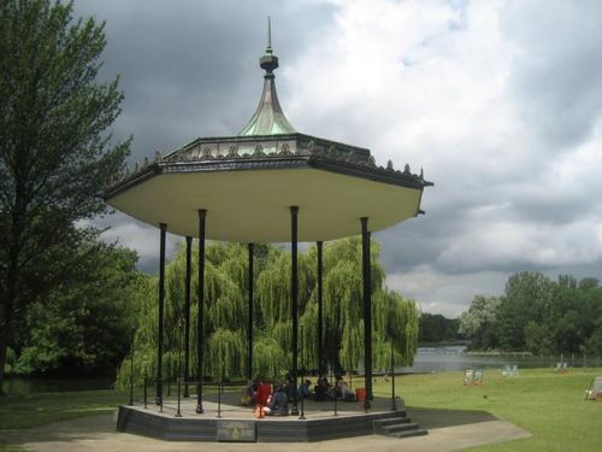
- Bandstand
- Sculpture
- Key Information
Type
Park
Purpose
Recreational/sport
Principal Building
Parks, Gardens And Urban Spaces
Survival
Extant
Hectares
147
Open to the public
Yes
- References
References
- {English Heritage Register of Parks and Gardens of Special Historic Interest} (Swindon: English Heritage 2008) [on CD-ROM] Historic England Register of Parks and Gardens of Special Historic Interest
- William Gillespie and Partners {Royal Parks Survey: The Regent's Park and Primrose Hill} (1981) Royal Parks Survey: The Regent's Park and Primrose Hill
- Land Use Consultants {Regent's Park, The English Gardens: Historic Outlines and Management Proposals} (1995) Regent's Park, The English Gardens: Historic Outlines and Management Proposals
- Land Use Consultants {Regent's Park: Strategic Management Plan} (1999) Regent's Park: Strategic Management Plan
- Related Documents
-
CLS 1/304/1
An Archival review of the Nash Landscape and its Development 1811 - 1945 - Digital copy
Colvin and Moggridge - 1999
-
CLS 1/308/2
St. John's Lodge Garden - Digital copy
Colvin and Moggridge - 1993
-
CLS 1/309/1
Queen Mary's Gardens (formerly The Royal Botanic Society Garden) - Digital copy
Colvin and Moggridge - 1995
-
CLS 1/304/1