Introduction
Heligan has the grounds of a country house, altered in the late-18th and early-19th centuries from a formal design to a landscape style. The gardens include Victorian productive gardens and surrounding Pleasure Grounds, and a sub-tropical jungle valley.
Terrain
The site is undulating, with steep-sided valleys extending from north to south.The following is from the Register of Parks and Gardens of Special Historic Interest. For the most up-to-date Register entry, please visit the The National Heritage List for England (NHLE):
www.historicengland.org.uk/listing/the-list
Park and gardens developed in the late 18th century and early 19th century, partly to a design by Thomas Gray, with an extensive early 20th century plant collection.
DESCRIPTION
Location, Area, Boundaries, Landform and Setting
Heligan is situated c 2.5km north-west of the coastal village of Mevagissey, some 5km south-south-west of St Austell. The c 70ha site is bounded to the north by a minor road which runs east from St Ewe to Tregiskey, while to the south-west, south, and east it adjoins agricultural land. The west boundary is formed in part by a minor road which leads south from Pengrugla to Heligan Mill; this road turns sharply east to form the southern boundary of the park, separating it from Temple Wood to the south-east. To the north-east a belt of plantation bordering the Long Drive extends to the B3273 road from Pentewan to St Austell, and to the south-east Temple Wood adjoins a further area of woodland, Treleaven Plantation. The site is undulating, with steep-sided valleys extending from north to south to the east and south-east of the house, and from west to east to the south of the house. There are views south-south-east along the main valley to the south of the house to Mevagissey and the sea, while from the pleasure grounds to the north of the house there are views across the park to Pentewan.
Entrances and Approaches
Heligan is today (2000) approached from the minor road to the north. A late C20 vehicular entrance to the north-west of the mid or late C19 Upper Lodge and gate (listed grade II) gives access to an area of car park, to the south of which are located late C20 single-storey buildings comprising a visitors' entrance and other facilities. From the Upper Lodge a tarmac drive extends south, parallel to the minor road forming the western boundary of the site; it is screened from the road by a belt of mixed shrubbery and trees. The drive sweeps south-east to approach the west front of the house. This north drive was laid out in the late C18 or early C19 and accords with proposals made by Thomas Gray.
The Long Drive approaches the site from the B3273 road from Mevagissey to St Austell, at a point c 750m north-west of Pentewan and c 1.7km north-east of the house. A mid C19 lodge stands to the south of the entrance, beyond which the drive rises gently south-west for c 1km, bordered by mid C19 ornamental planting, New Road Plantation. It then passes under an ornamental mid C19 stone bridge at Peruppa which carries the St Ewe to Mevagissey road across the drive. To the west of the Mevagissey road the drive passes for c 500m along the southern edge of the boundary plantation to the north of the park. Passing to the east of the Upper Lodge, the Long Drive joins the north drive c 250m north-north-west of the house. The Long Drive was formed by John Hearle Tremayne c 1830, and was planted with large numbers of Bentham's Cornel (Cornus capitata) raised from the original introduction of seed collected in Nepal by Sir Anthony Buller. The drive was noted by the Gardeners' Chronicle in 1896, when it was said to be one of the finest in the country.
A further drive, now disused, approaches Heligan from Heligan Mill to the south-east. The former drive led north through a wooded valley to approach the house from the south. It formed part of a boundary ride through the western and southern shelter plantations, and through Old Wood. The south-east drive was constructed in the late C18 or early C19, and reflects Thomas Gray's late C18 proposals.
Principal Building
The house at Heligan (listed grade II) stands towards the top of a steep-sided valley which falls to the south-west, enjoying views east to St Austell and south-west to Mevagissey. The house comprises a main block constructed in white-painted brick under a hipped slate roof. The south or garden facade has a slightly projecting centrepiece two bays wide with a string-course above the ground-floor windows. A two-storey block adjoins the south facade to the east. The present house was constructed in 1692 by Sir John Tremayne, who extended and partly rebuilt an early C17 house which had in turn replaced an earlier house on or near this site. The late C17 house was remodelled in 1810, and a service wing was added in 1830. The house fell into disrepair in the mid C20 and was converted into apartments in 1970.
The mid C18 stables (listed grade II), an C18 walled yard (listed grade II), farm offices (listed grade II), and the former steward's house, now (2000) known as Palm Cottage (listed grade II) stand to the north of the house.
Gardens and Pleasure Grounds
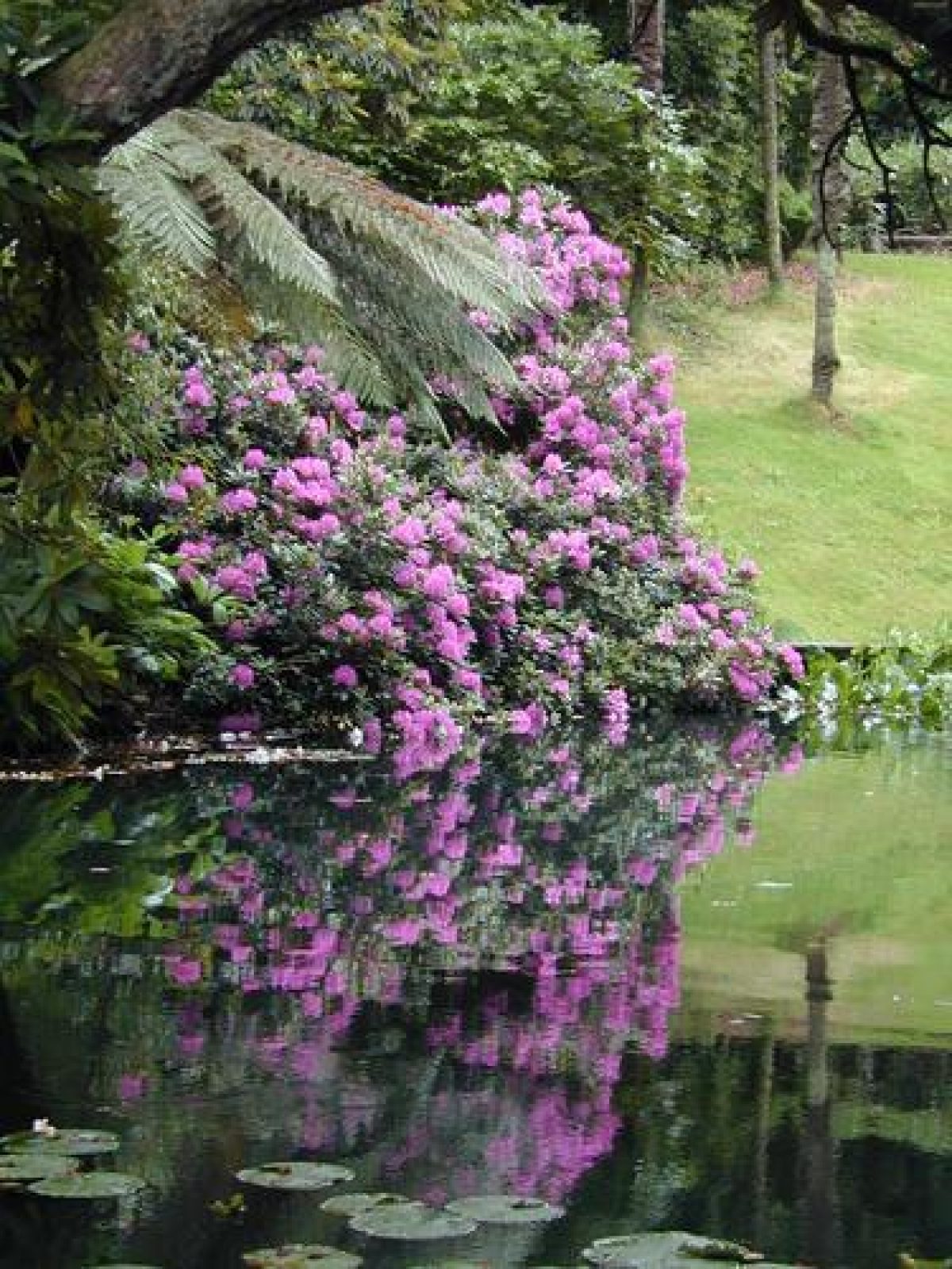
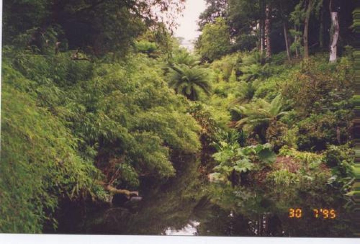
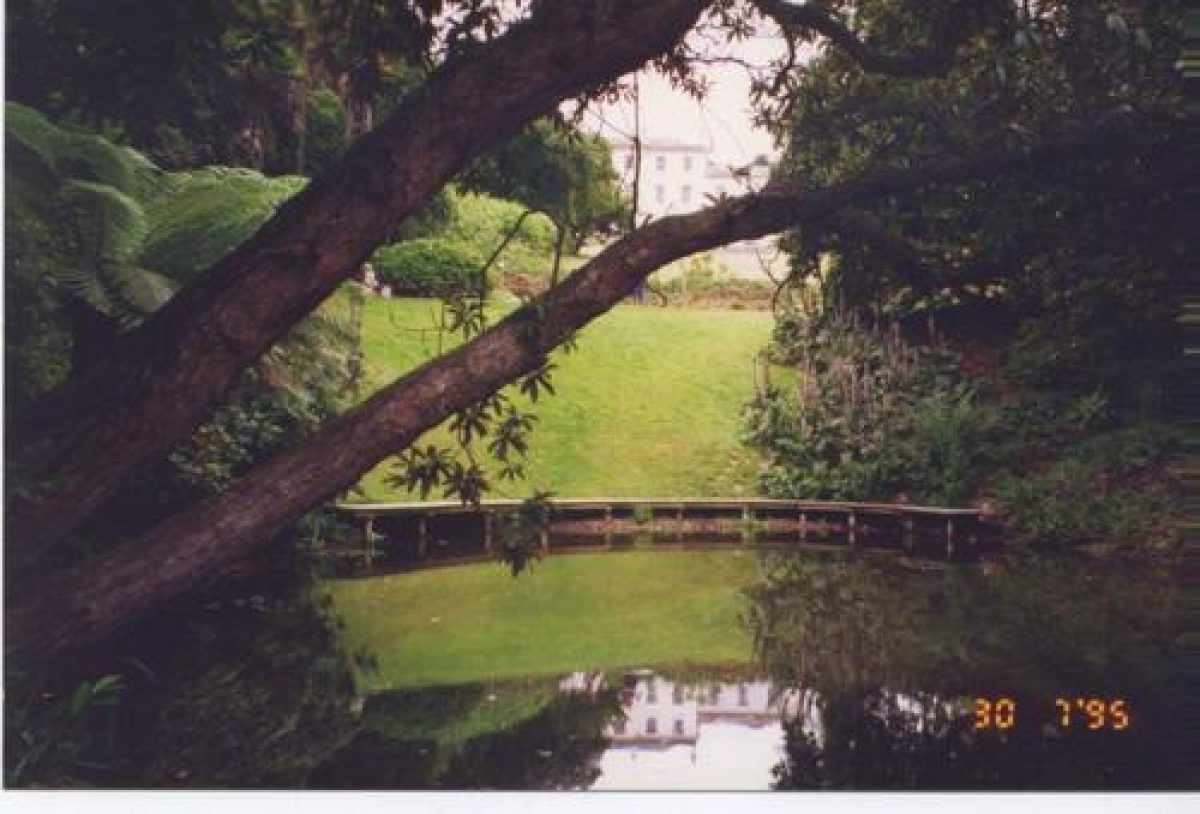
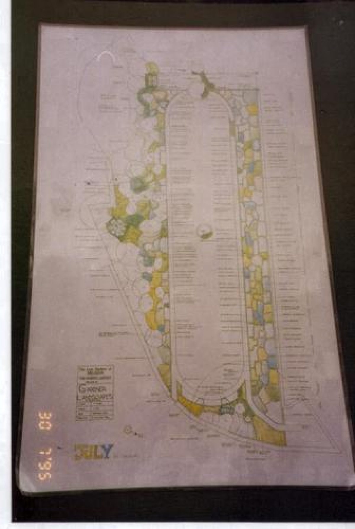
The gardens and pleasure grounds lie principally to the north and south of the house. Two grass terraces ascend the east-facing slope above the west front of the house, while a further grass terrace extends below the south facade; a pre-Conquest Celtic cross (listed grade II) is placed at the south-west corner of the south terrace. These terraces survive from early C18 formal gardens which are shown on a plan of 1735 by John Wade (CRO), and for the construction of which accounts survive indicating that the terraces and parterres were completed in 1736 (CRO). Lawns slope south below the south terrace to a wooded valley, where late C20 boardwalks extend through mid and late C19 and early C20 exotic planting around a stream which is dammed to form a chain of three ponds. The valley garden, formerly known as the Japanese Garden but today (2000) known as the 'Jungle', was developed by John Tremayne who inherited in 1851, and his son John Claude, who inherited in 1901; the effect of the exotic planting was described in the Gardeners' Chronicle in 1896. In the late C18 the kitchen garden stood between the house and the head of the valley, with a pond to its south; the two lower ponds were formed by John Claude Tremayne in the early C20 (LUC 1993).
To the south-east the valley garden joins a further valley which extends north-east along the south-east edge of Old Wood. A stream is dammed to form a further chain of ponds, while a mown grass rise extends along the north-west side of the ponds to connect with Horsemoor Wood to the north. This area, known today as the 'Lost Valley', formed part of the late C18 or early C19 circuit of rides and drives which linked the northern and southern shelter plantations, and reflects the late C18 proposals for improvements made by Thomas Gray. This area was developed from woodland of medieval origin, with the ponds being connected with the supply of water power to Heligan Mill to the south-east (ibid).
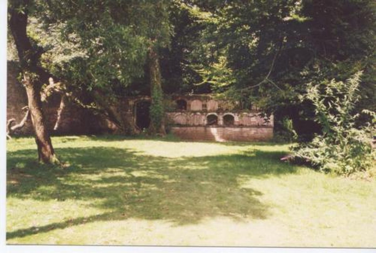
To the north of the house is a second area of pleasure grounds, known as the Northern Gardens. 'Flora's Green', an approximately elliptical-shaped lawn is surrounded by informal walks leading through an extensive collection of ornamental shrubs planted under mature trees. Many of the specimens in this well-documented collection are original introductions acquired by John Hearle Tremayne from Sir Joseph Hooker's expeditions to the Himalayas in the 1840s; this planting was continued into the early C20 by John Tremayne and his son John Claude. To the north of the lawn a mount, believed to be a beacon mentioned in an account of 1623 (guidebook) survives in the shrubbery, while to the south-east a late C18 brick summerhouse, the Northern Summerhouse, with a three-arched south-east facade overlooks a rectangular slate-edged pool. There are views from the Summerhouse over a laurel hedge which encloses the garden, to the northern park and to Pentewan. The Northern Summerhouse is shown on a plan of 1770, and was restored in 1992 (ibid).
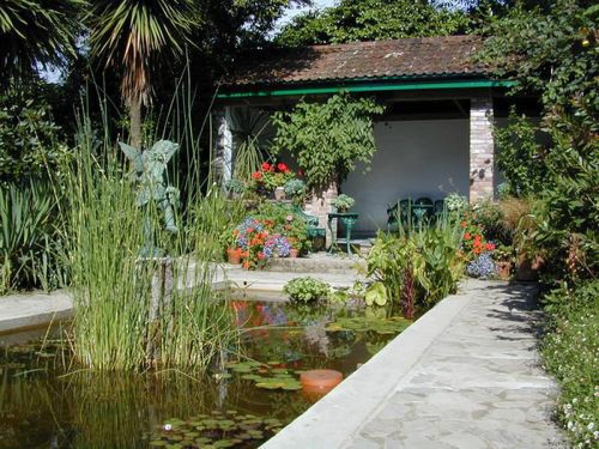
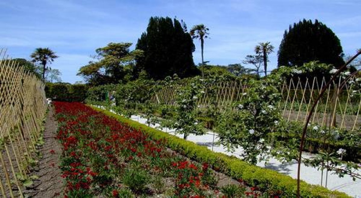
The south-facing slope to the south of 'Flora's Green' forms a vegetable garden which is flanked to east and west by further areas of pleasure ground which adjoin broad sand-covered walks which lead south to the house, walled garden, and service quarters. The walk to the east of the kitchen garden is terminated to the south by an extensive mid C19 rockery which comprises a series of informal serpentine walks separated by high banks ornamented with rockwork. A grotto to the north-east incorporates ornamental quartz crystals, while a rocky recess to the south contains a spring-fed pool which feeds the dipping pool in the walled garden and the ponds in the valley garden. To the west of the kitchen garden there is a further area of late C19 rock garden known as the 'Ravine'. An informal walk is flanked by rocky banks and an artificial watercourse; the banks were planted in the late C20 as a fernery, replacing early C20 alpine planting (ibid). The watercourse was fed by water from a reservoir supplied by late C19 rams which were restored in the late C20 (ibid). South of the Ravine and adjacent to the west wall of the Melon Ground, the Italian Garden comprises a rectangular pool with a central late C20 bronze figure and fountain surrounded by a crazy-paved path and borders containing ornamental shrubs. A lean-to tile-roofed summerhouse encloses the garden to the north, while to the west and south it is enclosed by hedges. The Italian Garden was constructed as a 'sun-trap garden' by John Claude Tremayne in 1909 and was restored in 1992.
A further area of gardens lie to the south of the walled garden and to the north of the house and stables. To the west, the Sundial Garden, formerly known as Mrs Tremayne's Garden, comprises a rectangular lawn enclosed by a brick walk and herbaceous borders. This garden was in 1896 described as 'the finest herbaceous border in England' (Gardeners' Chronicle); it was recreated in 1995-6. To the east of a walk flanked by Irish yews which leads from the service court to the walled garden is an area of lawn and a group of late C19 dogs' gravestones.
Park
The park is situated to the north, east, and south of the house, and is ringed by mixed shelter belts, a belt of woodland along the bottom of the valley running from north to south marking its eastern boundary. The park is today (2000) in mixed agricultural use, with areas of pasture to the north-east and south. The open areas within the boundary plantations were never fully imparked and have always retained field boundaries; these broadly reflect the arrangement shown on the estate plan of 1774, the Tithe map (1839), and the OS map published in 1888. The areas known today as East Lawn and West Lawn, to the south and south-east of the house, partially reflect Thomas Gray's late C18 proposals for a paddock dotted with ornamental planting and woodland in the valley to the south-east of the house.
To the south of the minor road at the southern end of the park is Temple Wood. This was described in the C18 as being laid out with rides, and in the early C19 Gilbert referred to it containing temples; the foundation of one unidentified structure has been located in the wood, together with several rides (LUC 1993).
Kitchen Garden
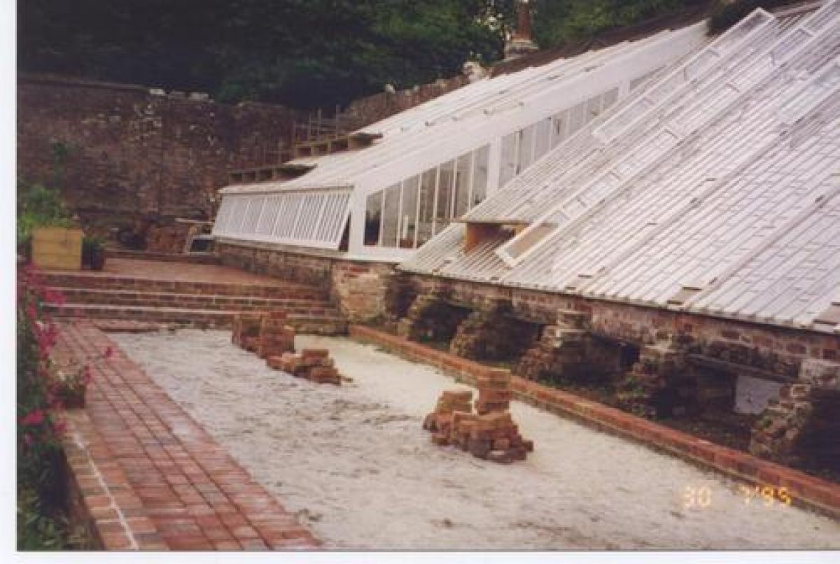
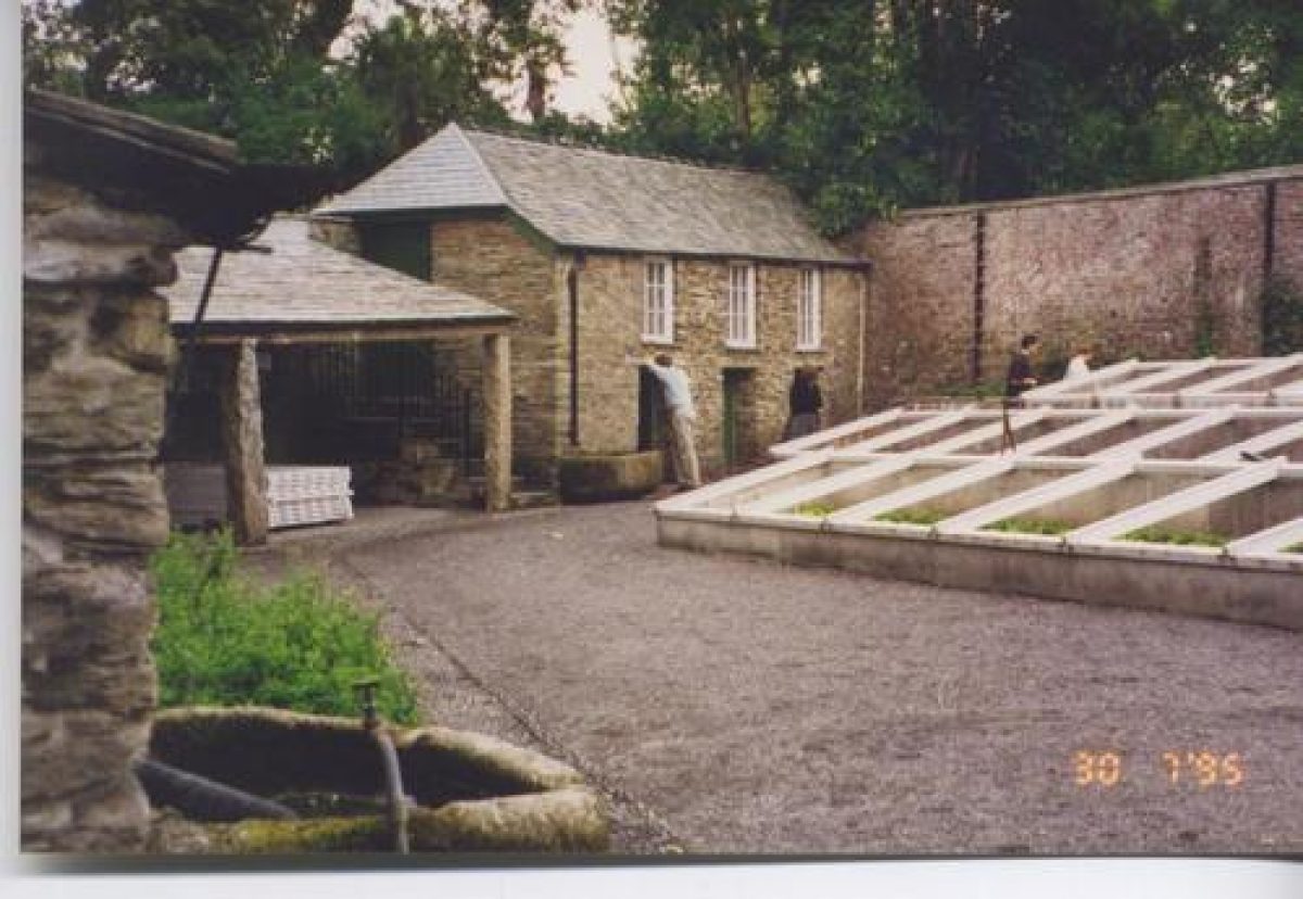
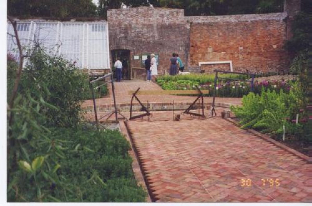
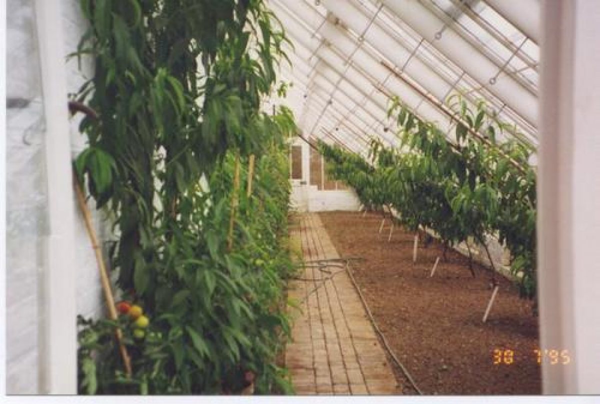
The kitchen garden comprises two walled gardens and a vegetable garden situated to the north of the house. The southern garden, known as the Flower Garden, is approximately trapezoid in shape and is enclosed by late C18 walls c 5m high constructed from imported brick (listed grade II) (guidebook). The garden is today (2000) used for growing a variety of vegetables and flowers, while fruit trees are trained against the walls. The garden is entered from the south through an entrance flanked by early C20 stone piers surmounted by ball finials. The south entrance leads to a central brick-paved walk which extends north to a central circular dipping pool, beyond which the walk continues to a door in the north wall. A transverse walk to the west divides the west half of the garden into two large beds, while the single area to the east is divided into geometrical-shaped planting areas by low box hedges. The late C20 path pattern replaces the Y-shaped pattern shown on the late C19 OS map (1881). Two glasshouses, a citrus house, and a vinery of 'Paxtonian' form stand against the inner face of the north wall, while a later peach house is built against the inner face of the east wall. A range of associated structures including a bothy and office, and a small square glasshouse for growing bananas stand against the outer face of the north wall.
The Flower Garden corresponds to a walled garden shown on Thomas Gray's late C18 proposals, and had assumed its present form by 1839 (Tithe map). Having ceased to be cultivated in the mid C20, the garden and glasshouses have been restored and recreated in the late C20. To the east of the Flower Garden are two further, smaller walled enclosures, that to the north being the reserve garden, and that to the south the poultry yard.
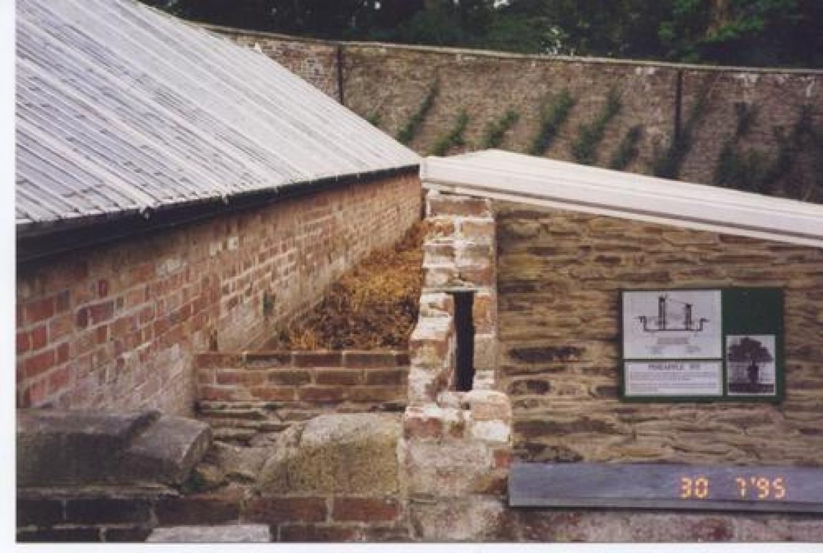
To the north of the Flower Garden a further walled garden is known as the Melon Ground. Enclosed by brick walls c 5m high, the garden is approximately segmental-shaped on plan with a curved north wall. A central walk connecting doors in the north and south walls is flanked to the east by a pineapple pit and melon house, and to the west by three ranges of cold frames. A curved wall corresponding to the north wall of the Melon Ground is shown on Thomas Gray's late C18 plan, while the 1839 Tithe map shows the garden in its present form. The Melon Ground and its glasshouses were restored in the late C20. To the north-east of the Melon Ground, an early C19 brick wall c 5m high contains three tiers of arched-topped recesses for bee skeps.
North of the Melon Ground, and entered through the door in the north wall of that garden, the vegetable garden is rectangular on plan and is enclosed by laurel and conifer hedges. The central box-edged north/south sand walk passes beneath late C20 wrought-iron fruit arches, while a transverse walk divides the garden into quarters. The vegetable garden is shown in its present form on the 1839 Tithe map.
A late C20 orchard of traditional varieties and a nut walk have been planted to the north-east of the house adjoining a path connecting the northern pleasure grounds to the valley garden south-east of the house.
References
C S Gilbert, Historical Survey of Cornwall ii, (1820), p 853
The Botanical Magazine, 78 (1852)Gardeners' Chronicle, ii (1896), pp 747-748
The Cornish Garden, 26 (1983), pp 41-49
Country Life, no 43 (22 October 1992), pp 50-51
Heligan Manor Gardens Project: Historical Survey and Restoration Plan (Land Use Consultants 1993)
The Lost Gardens of Heligan A Brief History and Guide, guidebook, (Heligan Gardens Ltd 1997)
D E Pett, The Parks and Gardens of Cornwall (1998), pp 137-139
Maps
Garden plan, c 1692 (DDT1284/20/4), (Cornwall Record Office)
J Wade, Garden plan, 1735 (DDT1284/20/6), (Cornwall Record Office)
W Hole, Estate plan, surveyed 1774, drawn 1777 (see Cornwall Garden Trust Survey 1990-1991)
T Gray, A plan of intended alterations for Helligan the Seate of Rev Mr Tremayne, c 1780-1790 (X148/10), (Cornwall Record Office)
Tithe map for St Ewe parish, 1839 (Cornwall Record Office)
OS 6" to 1 mile: 1st edition published 1888
2nd edition published 1908
OS 25" to 1 mile: 1st edition published 1888
2nd edition published 1907
Archival items
The Tremayne family papers, including building and garden accounts and estate plans are held in the Cornwall Record Office (DDT 1284).
Cornwall Garden Trust, Survey of Heligan, 1990-1991 (Cornwall Record Office)
Early and mid C20 photographs (private collection) [reproduced in LUC 1993]
Description written: September 2000
Amended: July 2001
Edited: October 2001
- Visitor Access, Directions & Contacts
Access contact details
The gardens are open daily throughout the year from 10 until 5 (6 pm in summer). Please see: http://heligan.com/visiting-us/opening-hours-and-prices/
Directions
Visitors are encouraged to travel via St. Austell, taking the B3273 towards Megavissey. http://heligan.com/visiting-us/find-us/
- History
The following is from the Register of Parks and Gardens of Special Historic Interest. For the most up-to-date Register entry, please visit the The National Heritage List for England (NHLE):
www.historicengland.org.uk/listing/the-list
HISTORIC DEVELOPMENT
In the 12th century Heligan formed part of an estate belonging to the Arundell family (guidebook). The property was sold to Sampson Tremayne (died 1593) of Trelissick, St Ewe in the late 16th century. Sampson's son, William (died 1614), built a house on the site of the present mansion in 1603. A new range was added to this building by William Tremayne's great-grandson, Sir John Tremayne (died 1694) in 1692. A large walled garden was constructed to complement the late 17th-century house and this was expanded by Sir John Tremayne's grandson, also John Tremayne, in 1735, when parterres and terraces were laid out. The early 18th century formal garden is recorded on a plan of 1735 by John Wade (Cornwall Record Office (CRO)). In 1766 Heligan was inherited by the Reverend Henry Hawkins Tremayne, curate of Lostwithiel, who in 1809 also inherited estates at Croan, Cornwall and Sydenham, Devon. In 1774-1777 Henry Hawkins Tremayne commissioned a survey of the estate from William Hole which records the disposition of the gardens and pleasure grounds prior to a series of improvements undertaken in the late 18th and early 19th centuries (Cornwall Garden Trust Survey). Thomas Gray provided 'a plan of intended alterations for Helligan' (CRO) for Henry Hawkins Tremayne in the late 18th century, which formed the basis for these improvements, but which was not fully implemented (Land Use Consultants 1993 (LUC 1993)). The effect of Henry Hawkins Tremayne's improvements was described by Gilbert in 1820, who noted that:
Heligan ... is situated at the head of an extensive paddock spotted with masses of foliage commanding the richest and most diversified views ... the whole of the grounds ... are rendered delightful by their natural unevenness, deep valleys ... with lively plantations, adorned with temples. (Gilbert 1820)
John Hearle Tremayne succeeded in 1829 and constructed a new approach from the north and planted shelter belts to enclose parkland to the north-east of the house; these developments are shown on the tithe map of 1839. In the mid and late 19th century John Hearle Tremayne (died 1851), John Tremayne (died 1901), and John Claude Tremayne undertook extensive planting of new and exotic subjects, including rhododendrons raised from seed supplied by Sir Joseph Hooker (1817-1911) in 1851, and a collection of bamboos in the 1890s. Plants were also obtained at this time from Joseph Knight of The Exotic Nursery, Chelsea, and from the Veitch nurseries at Exeter and Chelsea (LUC 1993). The gardens and planting were described by the Botanical Magazine in 1852, and by the Gardeners' Chronicle in 1896.
In 1916 the house was requisitioned for use as a convalescence home for officers. After the First World War it was occupied briefly by the family before being let. During the Second World War the house was used by American forces who practised the Normandy landings on Pentewan Beach. After the war the property was let to Commander and Mrs Thomas, and in about 1970 the Tremayne family converted the building into apartments which, together with the immediate grounds, were sold in 1983. Today (2000) the site remains in divided private ownership, with the gardens and pleasure grounds being leased to Heligan Gardens Ltd.
A major programme of restoration of the gardens and pleasure grounds, which had fallen into decline and dereliction, has been undertaken from 1990 under the supervision of Tim Smit and John Nelson.
Period
- 18th Century (1701 to 1800)
- Late 18th Century (1767 to 1800)
- Associated People
- Features & Designations
Designations
The National Heritage List for England: Register of Parks and Gardens
- Reference: GD1521
- Grade: II
Features
- Kitchen Garden
- Description: The productive gardens contain over 200 varieties of mostly heritage fruit, vegetable, salad and herb.
- Planting
- Description: The Jungle, an area of exotic planting in a steep-sided valley.
- Country House
- Formal garden
- Landscape garden
- Pleasure Garden
- Gardens
- Key Information
Type
Estate
Purpose
Ornamental
Principal Building
Domestic / Residential
Period
18th Century (1701 to 1800)
Survival
Reconstructed
Hectares
70
Open to the public
Yes
Civil Parish
St. Ewe
- References
References
- {English Heritage Register of Parks and Gardens of Special Historic Interest} (Swindon: English Heritage 2008) [on CD-ROM] Historic England Register of Parks and Gardens of Special Historic Interest
- Pett, D E {The Parks and Gardens of Cornwall} (1998) pp 137-139 The Parks and Gardens of Cornwall
- Gardner Musgrave Associates, Lear Associates {Restoration of planting at Heligan Gardens: report of research and area by area planting strategy and policy for Heligan Garden Limited} (1996) Restoration of planting at Heligan Gardens: report of research and area by area planting strategy and policy for Heligan Garden Limited
- Related Documents
-
CLS 1/335/2
Historic Landscape Survey and Restoration Masterplan - Digital copy
LUC, Geoffrey Pring Associates, Peter Thoday Associates, Lear Associates - 1993
-
CLS 1/336
Historic Landscape Survey and Restoration Masterplan - Digital copy
LUC, Geoffrey Pring Associates, Peter Thoday Associates, Lear Associates - 1994
-
CLS 1/335/2