Introduction
Trewarthenick is a late-18th-century landscape park of around 75 hectares, now largely returned to agriculture. The gardens and pleasure grounds occupy about 5 hectares.
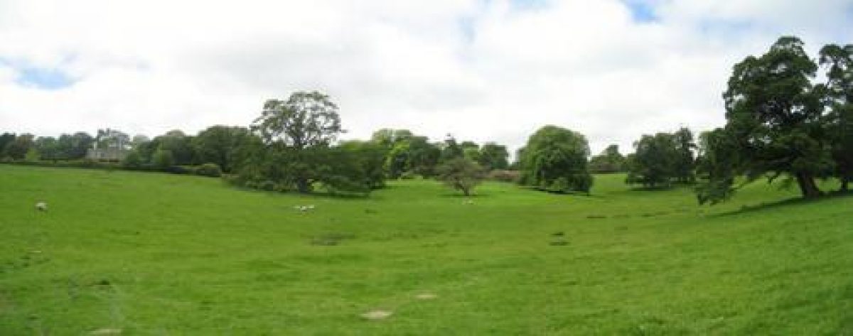
Terrain
Adjacent to the house the site is undulating, with a valley running from north to south through the centre of the park east of the house.The following is from the Register of Parks and Gardens of Special Historic Interest. For the most up-to-date Register entry, please visit the The National Heritage List for England (NHLE):
www.historicengland.org.uk/listing/the-list
Late 18th and early 19th century park and pleasure grounds for which Humphry Repton produced a Red Book in 1793.
DESCRIPTION
Location, Area, Boundaries, Landform and Setting
Trewarthenick is situated c 1.25km west of Tregoney, to the south of the A3078 road from Truro to St Mawes. The c 75ha site comprises some 5ha of gardens and pleasure grounds, and c 70ha of parkland and ornamental plantations. The site is bounded to the north by the A3078 road, and to the east by an agricultural track which leads from the A3078 road to Trelasker and the River Fal. To the south and west the site adjoins agricultural land, while to the north-west a narrow belt of woodland extends c 1.3km north-west and north from the body of the site to Freewater Lodge. This woodland, Killiow Brake, is planted on a predominantly west-facing slope and extends down to a stream which flows south to join the River Fal below Mellingoose. The A3078 road passes through Killiow Brake, following the course of an early C19 drive.
Adjacent to the house the site is undulating, with a valley running from north to south through the centre of the park east of the house; a stream flows through this wooded valley to join a further stream on the southern boundary of the site. The ground rises to the west and falls gently to the east, opening views towards Tregoney and across surrounding agricultural land. To the south-east of the site Great Downs Wood, Little Downs Wood, and a belt of woodland extending south-west from the latter form part of the setting of the site, and are shown on Repton's plan of 1793.
Entrances and Approaches
Trewarthenick is approached from the A3078 road to the north of the house, at a point opposite a minor road leading north to Killiow. A pair of late C20 wrought-iron gates lead to a tarmac drive which follows a serpentine course south-west for c 400m through lawns planted with specimen trees and shrubs to reach the carriage court on the north side of the house. The north drive is shown on Repton's 1793 scheme, but the lodge proposed to the west of the north entrance and illustrated in the Red Book was not implemented. Repton's lodge would have controlled two gates, one leading to the drive and the other to a service drive leading south behind a screen of woodland and shrubbery to the service quarters and farm north-west of the house; this service drive was not constructed and the service quarters are approached directly from a minor road to the west of the house.
A further drive enters the north-east corner of the site from the A3078 road c 640m north-east of the house. Some 50m south-west of the entrance this drive divides, one branch continuing south as an agricultural track, the other leading west for c 670m through the northern boundary plantation to join the north drive c 350m north-west of the house. Repton's proposals for a north-east drive included a lodge at the entrance which was not implemented, and a drive sweeping south-west and west across the park; this drive was not constructed in the form proposed by Repton. Another drive or track shown on the 1888 OS map leading south-west across the park to the house from a gate on the A3078 road opposite Little Grogoth does not survive (2000).
In the C19 the site was approached from the north-north-west along a drive which followed the course of the present A3078 road. The entrance to this drive at Freewater is marked by an early C19 gothic stone lodge, and today (2000) the road, which is terraced into the west-facing slope above a stream, passes through a belt of mature deciduous woodland underplanted with evergreen shrubbery. The drive was adopted as a public road in the early C20 which necessitated the realignment of the south-east end of the drive which formerly extended south-east to join the north drive c 350m north-west of the house.
The north drive, which follows Repton's late C18 proposals, replaced earlier approaches to the house from the east, west, and north which are shown on a survey of 1788-9 (CRO). The eastern approach, which passed across the park through an avenue, is shown on a drawing of c 1727 by Edmund Prideaux.
Principal Building
Trewarthenick (listed grade II) stands on a level terrace adjacent to the western boundary of the site. The house comprises two storeys and is constructed in ashlar and brick under hipped slate roofs which are partly concealed behind parapets. The north and south facades are of plain construction and assumed their present form c 1950 when symmetrical north and south wings designed by Henry Harrison were removed. The seven-bay east facade overlooking the park is symmetrical, with a central pediment surmounting a projecting section comprising three bays; the east facade is lit by sash windows. To the west of the house is a walled courtyard surrounded by service buildings and stables.
The present house incorporates a re-set date stone of 1686; the east facade of this house, then the entrance facade, is shown in both a sketch by Edmund Prideaux (c 1727) and a watercolour by Repton (1793) as having a steeply pitched pediment and a symmetrical pair of loggias to north and south. The building appears to have been remodelled along the lines proposed by Repton in collaboration with his 'ingenious friend' Matthew Brettingham (Red Book 1793). Repton and Brettingham's pair of single-storey flanking wings, that to the south containing a conservatory and that to the north a new entrance, were altered and raised to full height c 1830 by the London architect Henry Harrison; these are shown in an engraving of c 1830 by Thomas Allom. The wings were demolished c 1950.
Gardens and Pleasure Grounds
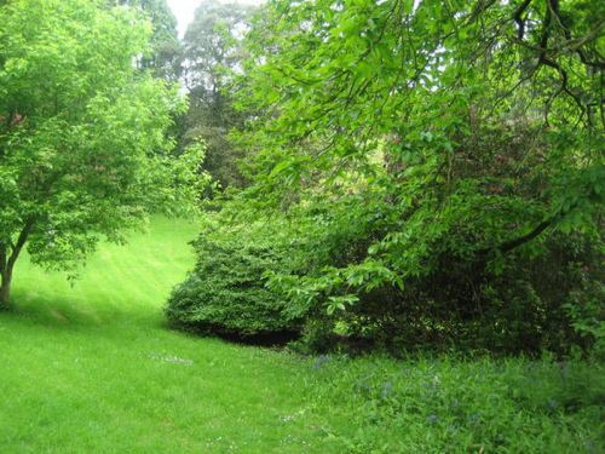
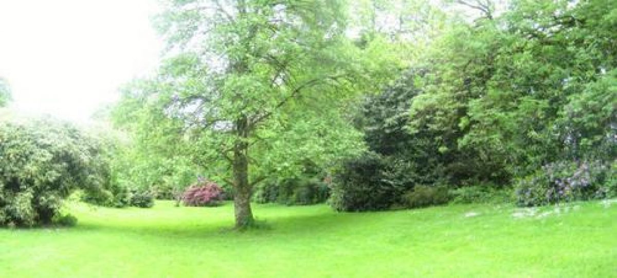
Informal gardens and pleasure grounds are situated to the north, east, and south of the house.
Below the east facade a terrace is retained by early C19 rubble-stone walls with ashlar coping (listed grade II). The terrace, which is laid to lawn and planted with a row of twelve mature Irish yews, extends c 130m from north-west to south-east and serves both to connect the pleasure grounds to the north and south of the house and as a ha-ha allowing views east across the park. Below the ha-ha a spotted laurel hedge is separated from the park by a C20 metal fence. The terrace formed part of Repton's late C18 scheme of improvement (Red Book 1793) and replaced a rectangular 'lawn' shown on the 1788-9 estate survey (CRO); Sarah Gregor described this as being separated from the park by a deep ha-ha across which the east drive passed on a bridge (Gregor Memoirs, CRO).
To the south-west of the house a high wall enclosing the service yards is screened by mixed shrubbery and specimen trees, while a further area of lawn extends below the south facade. This arrangement reflects that proposed by Repton in 1793, who suggested that the walled garden should be extended to the south, freeing its northern end to be incorporated into the pleasure grounds as an appropriate prospect from the conservatory which he proposed for the new south wing (Red Book 1793).
The axis of the terrace is continued to the east of the walled garden, beyond which there is a further informal pleasure ground comprising lawns planted with specimen trees and flowering shrubs including a collection of early C19 rhododendrons and C20 magnolias. This area, known as the Spring Garden, was developed c 1828 when the surrounding laurels were planted (Pett 1998). Repton proposed a belt of shrubbery and plantation for this area which would serve to screen the kitchen garden and, 'sweeping boldly over the hill, may be continued to connect the terrace near the house, with those walks in the wood at a distance' to the south of the park (Red Book 1793). A narrow belt of plantation extending south from the pleasure grounds and connecting with the plantations on the southern boundary of the park relate to Repton's scheme.
To the north of the house is a further area of informal pleasure grounds comprising lawns planted with groups of specimen trees and shrubs and, some 50m north of the house, a small informal pond. Laid out in a Picturesque style, this area was probably developed for Sarah Gregor c 1828 (Pett 1998), and does not relate to any of Repton's late C18 proposals. To the north of this area, and to the west of the north drive c 210m north-west of the house, is an area planted with a collection of camellias and specimen trees and flowering shrubs; known as the Summer Garden, this area was developed in the late C20 (ibid).
Park
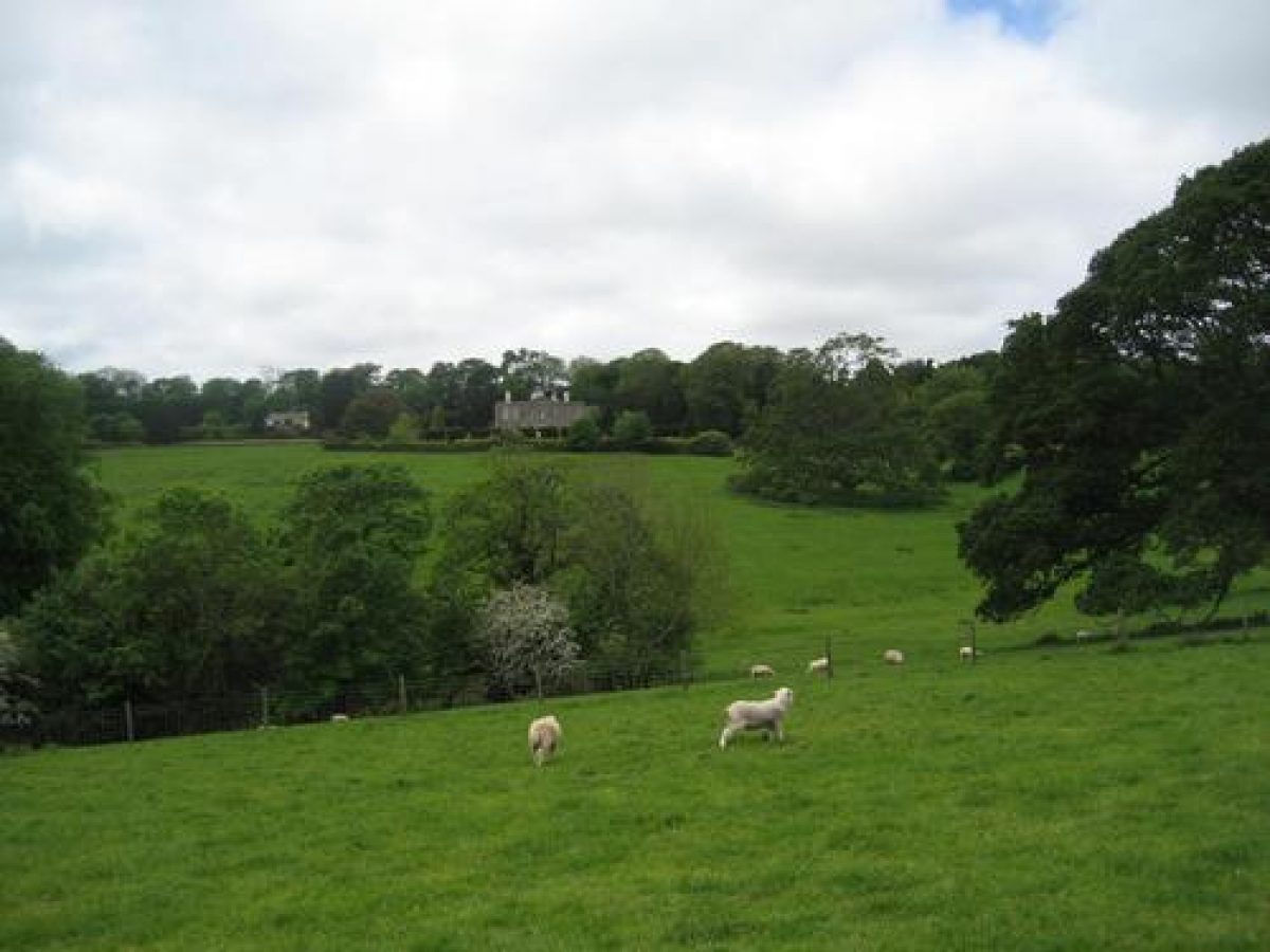
The park lies to the east of the house and is today (2000) in mixed agricultural use, with areas of pasture with scattered deciduous trees immediately to the east and north-east of the house, and areas in arable cultivation to the south-east. The park is defined by a mixed boundary plantation to the north which screens the A3078 road, and by further mixed plantations to the west, south-west, and south. There are scattered trees and groups of trees planted along the eastern boundary of the park which is formed by an agricultural track. A belt of woodland extends north-north-west up a valley which extends from the southern boundary plantation. Within this irregularly shaped plantation is an informal pond c 500m south-east of the house, and a former quarry c 520m south-east of the house; this quarry was used in the late C17 and the late C18 to obtain stone for the construction and alteration of the house (Gregor Memoirs, CRO).
The 1788-9 survey of Trewarthenick and Repton's 1793 plan (Red Book) both show this belt of woodland extending further north across the park, but by 1888 (OS) it had been reduced to its present dimensions. The north and west boundary plantations accord to those proposed by Repton in 1793; Repton commented that 'the first object of improvement at Trewarthenick should be, to lead plantations from their hiding places in the vallies, to those situations where they may be most conspicuous' (Red Book). The north and north-east boundary plantations were intended by Repton to frame a view of the 'cornfield' to the east of the park from the house (ibid).
A network of walks and rides extends through the boundary plantations forming a circuit of the park in accordance with Repton's advice that the plantations should be planted sufficiently deep to 'admit of covered walks to be cut through them with burst views' (ibid). A late C17 or early C18 avenue which is shown in Prideaux's drawing (c 1728) and on the 1788-9 estate survey leading north-east from the house across the park was reduced by Repton in 1793 to form discrete clumps (ibid).
The park was developed in the late C18 and early C19 from a series of agricultural enclosures which are described on the 1788-9 survey as the 'Fields under the Lawn'; Sarah Gregor noted that the 'present lawn [park] was divided into ten enclosures by Cornish hedges' (Gregor Memoirs, CRO). The development of the park appears broadly to have followed the scheme proposed by Repton in 1793.
Kitchen Garden
The kitchen garden is situated on a south-east-facing slope c 80m south of the house. Approximately rectangular on plan, the garden is enclosed by stone walls to the west, south, and east, and by an irregular range of buildings to the north.
The kitchen garden was extended to the south in the late C18 or early C19 following the advice of Humphry Repton (Red Book 1793).
References
C S Gilbert, Historical Survey of Cornwall ii, (1820), p 831
J Britton and E W Brayley, Devonshire and Cornwall Illustrated (1832), p 63
D Stroud, Humphry Repton (1962), pp 77-78
Architectural History 7, (1964), pp 38, 106
N Pevsner and E Radcliffe, The Buildings of England: Cornwall (2nd edn 1970), p 230
G Carter et al, Humphry Repton, landscape gardener 1752(1818 (1982), p 150
D E Pett, The Parks and Gardens of Cornwall (1998), pp 144-146
Maps
A Law, Survey of Trewarthenick, 1788-1789 (G/1879), (Cornwall Record Office)
H Repton, Plan of Trewarthenick included in Red Book, 1793 (G/1957), (Cornwall Record Office)
Tithe map for Cornelly parish, 1843 (G/1885), (Cornwall Record Office)
OS 6" to 1 mile: 1st edition surveyed 1879, published 1888
2nd edition revised 1906, published 1908
OS 25" to 1 mile: 1st edition published 1880
2nd edition published 1907
Illustrations
E Prideaux, Drawing of Trewarthenick from the east, 1727 (reproduced in Architect Hist 7, 1964)
T Allom, engraving of Trewarthenick from the east, c 1830 (published in Britton and Brayley 1832)
Archival items
H Repton, Red Book for Trewarthenick, 1793 (G/1957), (Cornwall Record Office)
Memoirs of Sarah Loveday Gregor (nee Glanville), c 1850 (G/1952, pp 208(15, 29), (Cornwall Record Office)
Description written: November 2000
Amended: January 2001
Edited: October 2001
- Visitor Access, Directions & Contacts
- History
The following is from the Register of Parks and Gardens of Special Historic Interest. For the most up-to-date Register entry, please visit the The National Heritage List for England (NHLE):
www.historicengland.org.uk/listing/the-list
HISTORIC DEVELOPMENT
The estate of Trewarthenick was purchased by John Gregor, a wealthy Truro merchant, from Mr Ceely in 1640. Gregor's grandson, also John, known as 'The Giant', rebuilt an existing house on the site in 1680 (date stone). In the late 18th century Francis Gregor married Catherine Masterman, whose father, a wealthy London lawyer, held Restormel Castle, Cornwall on a lease from the Duchy of Cornwall. This lease was sold by Francis Gregor in 1788 to defray election expenses and to fund the purchase of additional land around Trewarthenick. Writing in 1791, Gregor's niece, Sarah Glanville, described Trewarthenick as 'very destitute of beauty, with few plantations, and the surrounding ground cut up into fields ... a public cart road ran close to the house' (Gregor Memoirs, Cornwall Record Office (CRO)). In 1792 Francis Gregor invited Humphry Repton (1752-1818) to prepare proposals for the improvement of the landscape; these were presented in the form of a Red Book (CRO). Francis Gregor implemented much of Repton's scheme and remodelled the house with advice from Matthew Brettingham.
At Francis Gregor's death the estate passed to his brother, the Reverend William Gregor of Cornelly, who later lived at Caerhays Castle, Cornwall. Following the death of William Gregor's daughter at the age of twenty-four in 1825, Trewarthenick passed to Loveday Sarah Glanville of Catchfrench, Cornwall, a niece by marriage of the late Francis Gregor. In 1814 Loveday, known as Sarah, had married Francis Booker, grandson of the third Duke of Gordon, who in 1825 assumed the name and arms of Gregor. On inheriting the estate, Sarah Gregor commissioned the London architect Henry Harrison to make improvements to the house; at the same time further improvements were made in the grounds, possibly following previously unrealised elements of Repton's late 18th century scheme (Pett 1998). These changes are shown in an engraving by Thomas Allom (about 1830). Sarah Gregor's son, Francis Glanville Gregor, did not marry until he was fifty-seven and died childless, when the estate passed to his nephew, Lewis William Molesworth. He also died without issue, leaving the property to his nephew, Paul Welman. At his death in 1909 the estate was broken up. Having passed through various hands in the 20th century, the site today (2000) remains in private ownership.
Trewarthenick is one of a group of sites in Cornwall at which Repton advised in the late 18th and early 19th centuries. These include Antony House, Catchfrench, Port Eliot, and Tregothnan; the owners of these estates were connected by family and political ties.
Period
- 18th Century (1701 to 1800)
- Late 18th Century (1767 to 1800)
- Associated People
- Features & Designations
Designations
The National Heritage List for England: Register of Parks and Gardens
- Reference: GD1649
- Grade: II
Features
- House (featured building)
- Description: The house was rebuilt in 1680 and re-modelled and improved in later years.
- Earliest Date:
- Latest Date:
- Landscape garden
- Pleasure Garden
- Parkland
- Key Information
Type
Park
Purpose
Ornamental
Period
18th Century (1701 to 1800)
Survival
Extant
Hectares
75
Open to the public
Yes
Civil Parish
Tregoney
- References
References
- Carter, G et al {Humphry Repton landscape gardener 1752-1818} (1982) p 150 Humphry Repton landscape gardener 1752-1818
- {English Heritage Register of Parks and Gardens of Special Historic Interest} (Swindon: English Heritage 2008) [on CD-ROM] Historic England Register of Parks and Gardens of Special Historic Interest
- Pevsner, N and Radcliffe, E {The Buildings of England: Cornwall} (Harmondsworth: Penguin, 1970) p 230 The Buildings of England: Cornwall
- Pett, D E {The Parks and Gardens of Cornwall} (1998) pp 144-146 The Parks and Gardens of Cornwall
- Related Documents
-
CLS 1/6/20
Park and Pleasure Ground Conservation Plan, Vol. 1 - Hard copy
Colvin and Moggridge - 2006
-
CLS 1/6/20C
3 Planning Consents - Hard copy
Carrick District Council - 2007
-
CLS 1/6/21
Park and Pleasure Ground Conservation Plan, Vol. 2
Colvin and Moggridge - 2006
-
CLS 1/6/20