Introduction
After about 150 years as a manor, the site was downgraded to a rectory and there are now no traces of the original garden. The house is in private ownership and there is no public access.
- History
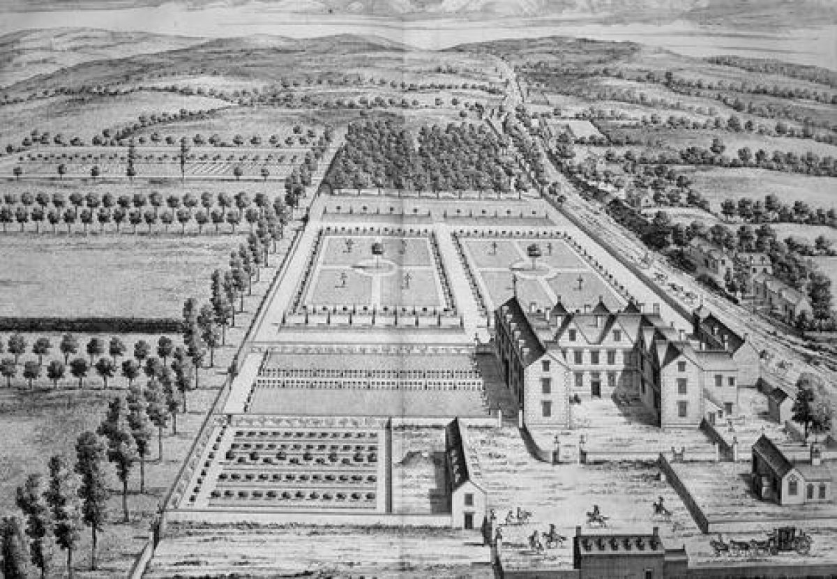
With reference to the Kip engraving included: This is a late-17th-century formal garden and park around a manor house and church lying immedately to the south of the Tetbury to Bath road. The large garden next to the house is mainly walled, with a simple grass parterre with decorative hedging and espaliered fruit trees to the south. There are more formal grass parterres to the west. Formal avenues and tree planting lie beyond the walls. An area with fruit and vegetables exists in the inner garden and there is also a large area with vegetables in the outer area. The garden to the west is terminated by a tree plantation.
- Features & Designations
Style
Formal
- Key Information
Type
Garden
Principal Building
Domestic / Residential
Survival
Lost
Civil Parish
Didmarton
- References
References
- Atkyns, R and others {The Ancient and Present State of Gloucestershire} (London: W. Bowyer for Robert Gosling,1712) The Ancient and Present State of Gloucestershire
- Kingsley, Ni {The Country Houses of Gloucestershire, Vol. I 1500-1660} (Cheltenham: Phillimore, 1989) The Country Houses of Gloucestershire, Vol. I 1500-1660
- Verey, D {The Buildings of England: Gloucestershire 1: The Cotswolds} (London: Penguin, 1970) The Buildings of England: Gloucestershire 1: The Cotswolds
Contributors
Martin McNicol