Introduction
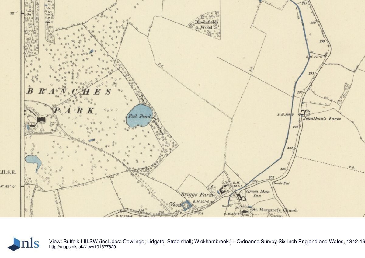
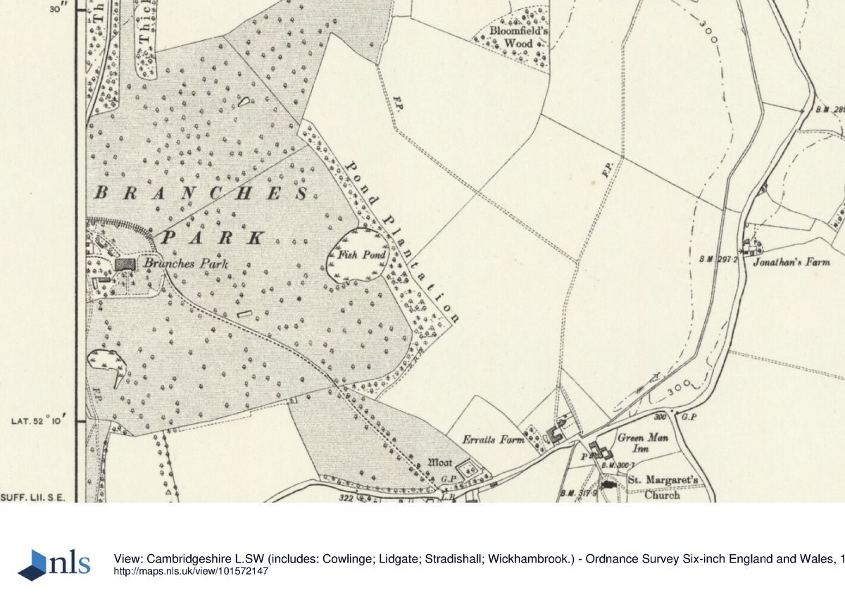
Remaining features of the Branches estate include the 18th-century stable block and the lozenge-shaped enclosure of the kitchen garden. The house itself has been demolished and the estate is now in divided ownership.
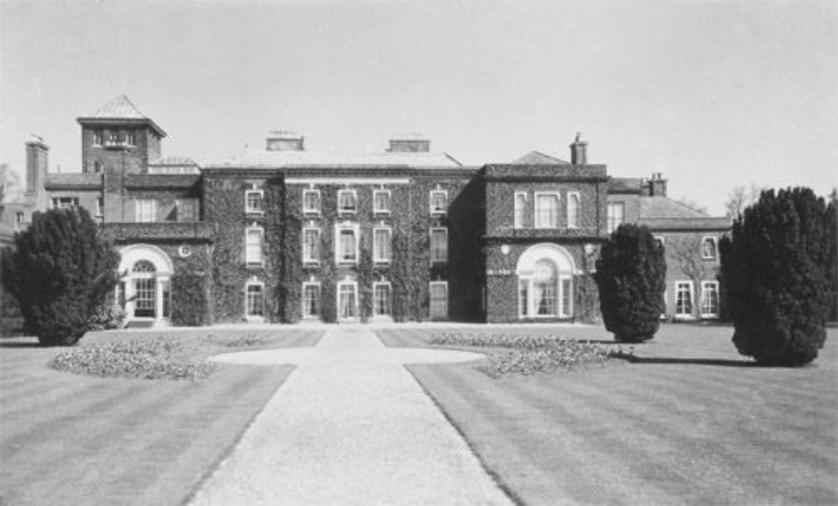
The original rectangular block of the principal building was enlarged in the later-18th century by the addition of single-storeyed side wings to the east and west. The house was enlarged and altered around 1904-8 by G.Hornblower and G.A. Tonge for Gilbert A. Tonge: the side wings were extended and heightened, and a water tower and a staff wing enclosing a small courtyard were added. Further alterations were undertaken by J. Burlison and W. Turner Lord in 1935. The house was illustrated in 1907 and again in an illustrated sales brochure of 1956.
The fixtures and fittings of the mansion were sold by auction in March 1957 and the stable block and other outbuildings sold in April 1957, reserving to the vendors a right of way to remove the structure and fabric of the mansion house until 31 December 1957. The house was demolished around 1959 and a new smaller house built on part of the site. A further smaller house was built on part of the site in 1995.
For pictures of the demolished house see:
http://www.lostheritage.org.uk/houses/lh_suffolk_branchespark_info_gallery.html
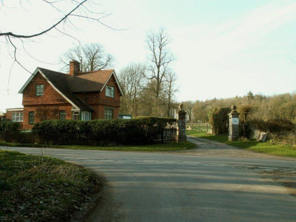
The 18th-century stable building west-north-west of the house is approximately contemporary with the original house. It is of brick, two storeyed with an open octagonal cupola on the roof. It is shown as H-shaped and named as ‘coach house and stable' on the 1766 map. The central range survives at TL 7064 55412 and is Listed Grade II (see: https://historicengland.org.uk/listing/the-list/list-entry/1031692).
The lozenge-shaped enclosed garden measuring 140m north-south x 100m east-west is shown on the 1766 estate map as divided by cross-walks and named as ‘Kitchen Garden'. A ‘Garden House' is shown in the southern corner of the garden. The enclosure still survives and is shown on the modern 1:10,000 map, but is now partly occupied by ‘The Garden Cottage'.
There was an avenue in Branches Park at TL 7086 5491, aligned on the centre of the south front of the house, but not serving as an approach road. This was shown on the estate map of 1766 as a straight ride through woodland but indicated as an avenue on Hodskinson's Map of Suffolk 1783. The avenue is still indicated on the Ordnance Survey 1:10560 map.
The park area is now in divided ownership and except for the gardens area is mainly in arable cultivation.
Detailed description contributed by Suffolk Gardens Trust 13/04/2016
- Visitor Access, Directions & Contacts
- History
The manor of Cowlinge and various other lands were acquired by Francis Dickins, a London Lawyer, shortly before 1720. He built a new house on his lands and was living at Cowlinge by 1728. A ‘good seat' called Branches is mentioned in 1735 (J. Kirby, Suffolk Traveller). Building probably continued until c.1739 (date recorded on rainwater cisterns). No park is shown on Emanuel Bowen's Map of Suffolk of 1755.
Francis Dickins died in 1747 and was succeeded by his widow Rachel, who died in 1761. The estate then went to Francis's cousin, Ambrose Dickins, a barrister of Wollaston in Northants. In 1763-5 Capability Brown did work to the value of £1,500 for Ambrose Dickens, but Dickens refused to pay an additional £58 and Brown ‘tore the account before Mr Dickens's face and had his say upon the business to him'.
There is no surviving plan, illustration or description of Brown's work at Branches Park. There is, however, a map of the estate made in 1766 for Ambrose Dickins by Thomas Spencer of Wickhambrook in the Suffolk Record Office (Bury St Edmunds) acc. no. 744/4/10. The vista through the thickets at the north end of the park appears to be indicated on J. Hodskinson's Map of Suffolk (1783) but not on the 1766 estate map. The 1766 map shows the large round pond on the east boundary and the comma-shaped pond south of the house.
Ambrose Dickins died in 1778 and was succeeded by his son Francis, who sold the estate in 1807. Estate records are in SRO (B) acc. no. 744. For later owners, see: http://www.usbornefamilytree.com/branchespark.htm
Detailed history contributed by Suffolk Gardens Trust 13/04/2016
- Associated People
- Features & Designations
Features
- Dovecote
- Description: Site of a rectangular ‘Dove House' at TL7066 5544 shown on the estate map of 1766.
- Kitchen Garden
- Description: The lozenge-shaped enclosed garden measuring 140m north-south x 100m east-west is shown on the 1766 estate map as divided by cross-walks and named as ‘Kitchen Garden'.
- Latest Date:
- Stable Block
- Description: The C18 stable building west-north-west of the house is approximately contemporary with the original house. It is of brick, two storeyed with an open octagonal cupola on the roof.
- Latest Date:
- Key Information
Survival
Part: standing remains
Civil Parish
Cowlinge
- References
References
- Stroud, Dorothy {Capability Brown} (London: Faber, 1975) Capability Brown
- Brown, Jane {The Omnipotent Magician: Lancelot 'Capability' Brown, 1716-1783} (London: Chatto and Windus, 2011) The Omnipotent Magician: Lancelot 'Capability' Brown, 1716-1783
Contributors
Suffolk Gardens Trust