
Introduction
Bowood is an 18th-century landscape park and woodland of some 36 hectares, with a 19th-century terraced garden. There is also a separate 19th- and 20th-century rhododendron woodland of 20 hectares, set within a larger park, woodland and agricultural land of some 500 hectares.
The following is from the Register of Parks and Gardens of Special Historic Interest. For the most up-to-date Register entry, please visit The National Heritage List for England (NHLE):
Bowood contains extensive and complex pleasure grounds and a park. Its main phases of development date from the C18 and C19, including mid C18 work by Lancelot Brown and Robert Adam, late C18 work by Charles Hamilton and Josiah Lane, early C19 work by Robert Smirke and Charles Barry, and mid C19 work by John Spencer and George Kennedy.
Location, Area, Boundaries, Landform and Setting
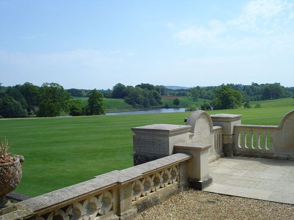
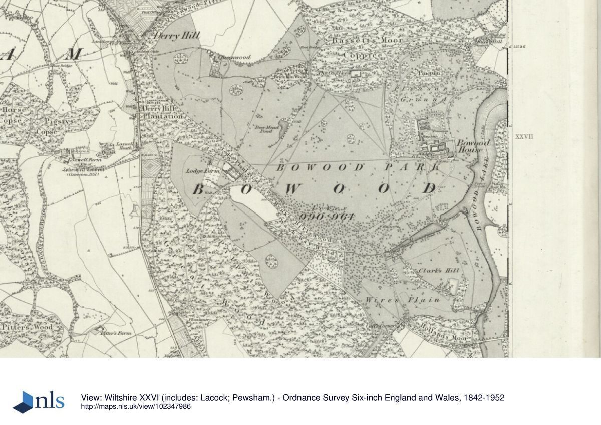
Bowood, a site of c 550ha, lies south of the A4 road between Chippenham and Calne. The western boundary of the site is formed by the A342 road between Chippenham and Devizes. To the north of the site lie the villages of Derry Hill and Studley, with to the south-west the village of Sandy Lane. To the east the site is bounded by agricultural land. The site falls gently from the south-west in a north-easterly direction, with a stream, the Whetham Brook, flowing from south to north. The latter is joined by another stream from the south-west, the Wash Way. Both streams feed Bowood Lake situated in the eastern part of the site.
Entrances and Approaches
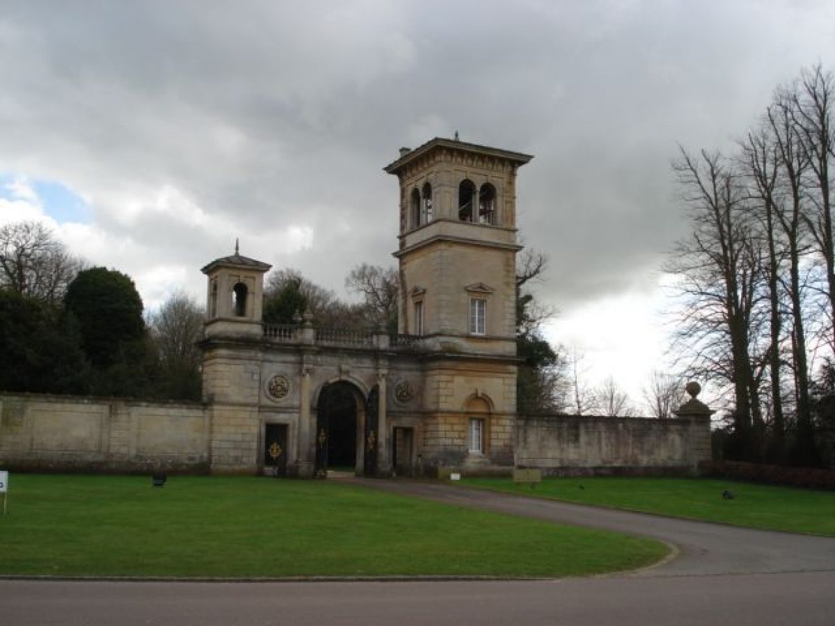
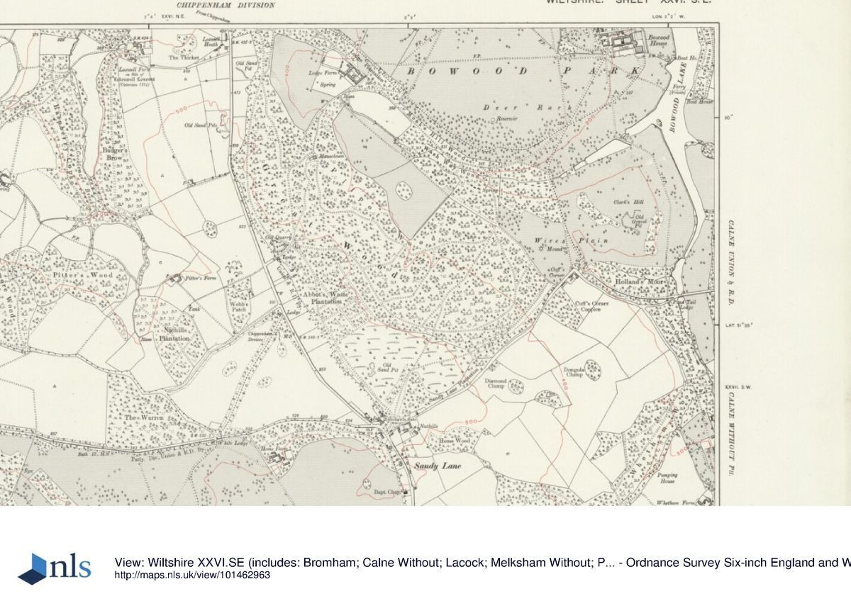
The main approach to Bowood is a late C18 drive that leads from the Golden Gates (Charles Barry 1834-8, listed grade II*) at Derry Hill to the north-west, in a south-easterly direction. It passes Home Farm (converted in the late 1990s into a golf clubhouse) and continues through Lodge Plantation and Monk's Hill Wood. In Monk's Hill Wood it turns in a north-easterly direction towards the south front of the house. At Studley, to the north of the site, stands Studley Lodge (early C19, listed grade II), which marked the entrance to a former drive, now (2001) no longer visible. This approach passed Queenwood (early C19, listed grade II), an estate house in the centre of the north-west park, and then joined the main drive from the Golden Gates. The house can also be approached from the east at Pillars Lodge (c 1840, listed grade II), 1.9km to the east. From here a drive (late C18/early C19) runs along the south-east boundary of the site, crossing Pond Tail Bridge (C18, listed grade II) with its adjacent lodge (early C19, listed grade II) c 1.8km south-west of Pillars Lodge. From here the drive curves first in a north-westerly direction and then north-north-east towards the south front of the house. The site can also be entered from the south-west at Sandy Lane, this entrance marked by The Lodge (early C19, listed grade II), and from the west-south-west along the A342, at a point marked by Kennels Lodge (c 1840-50, listed grade II).
Gardens and Pleasure Grounds
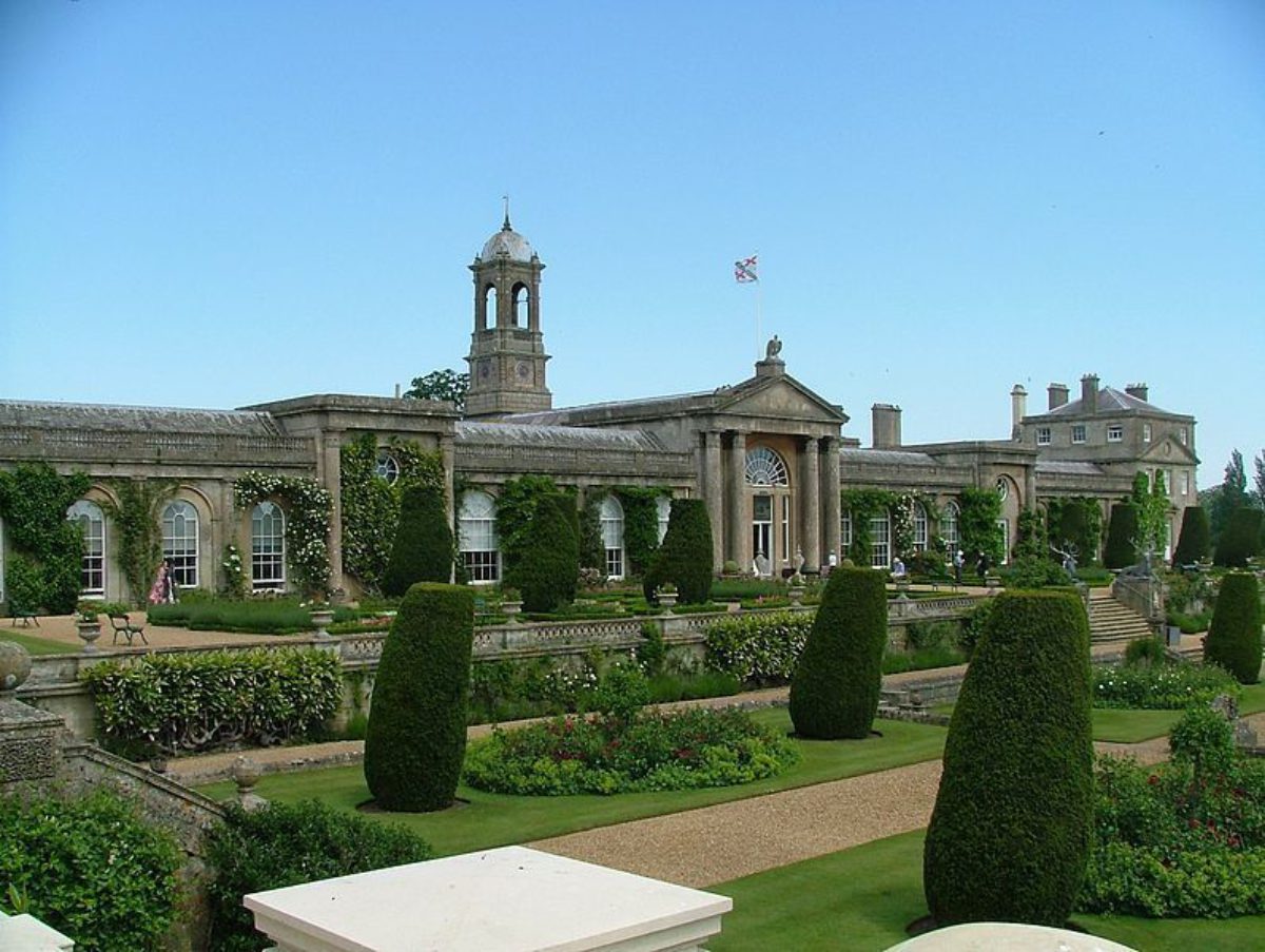
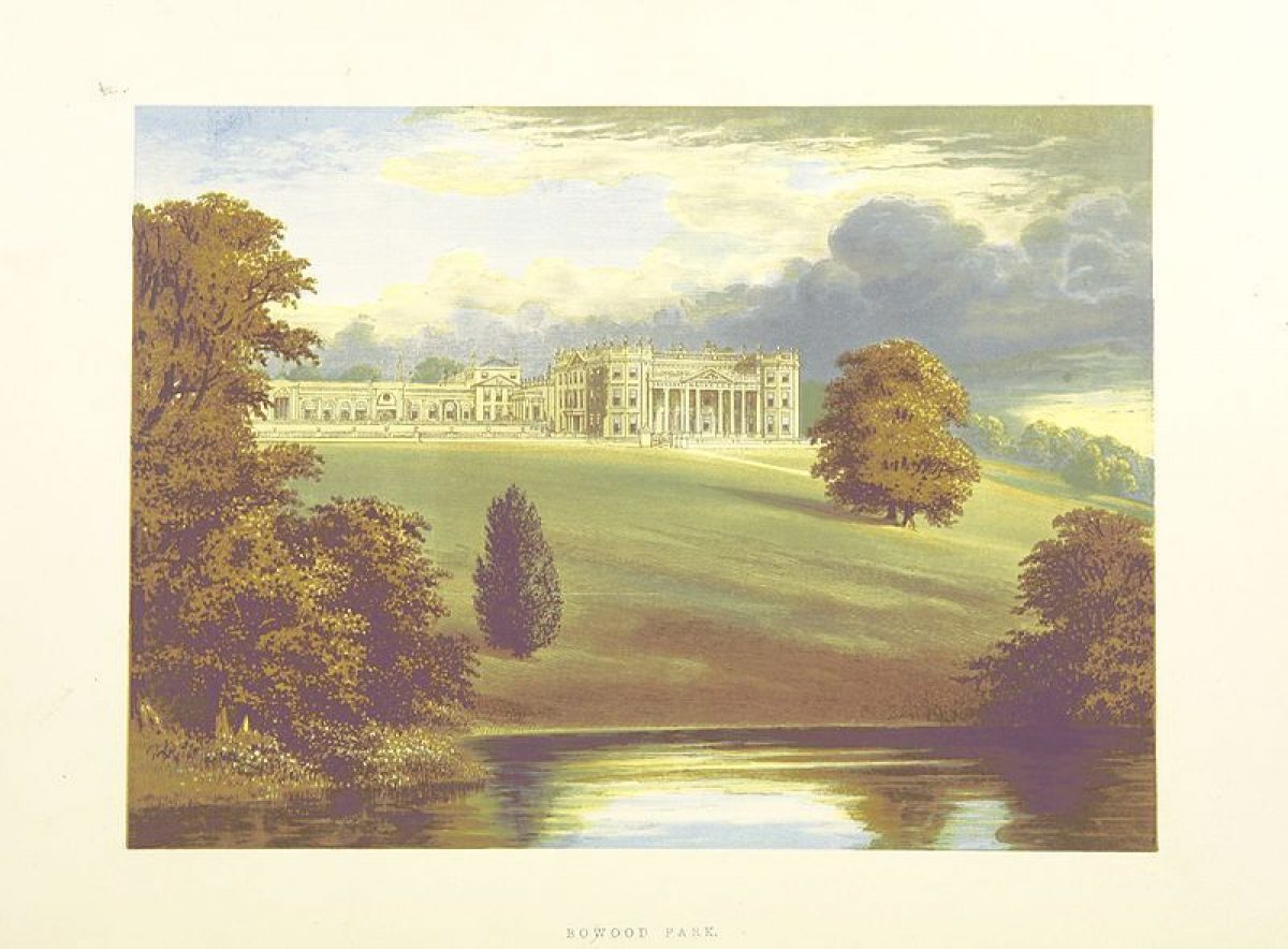
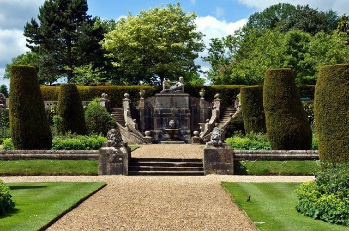
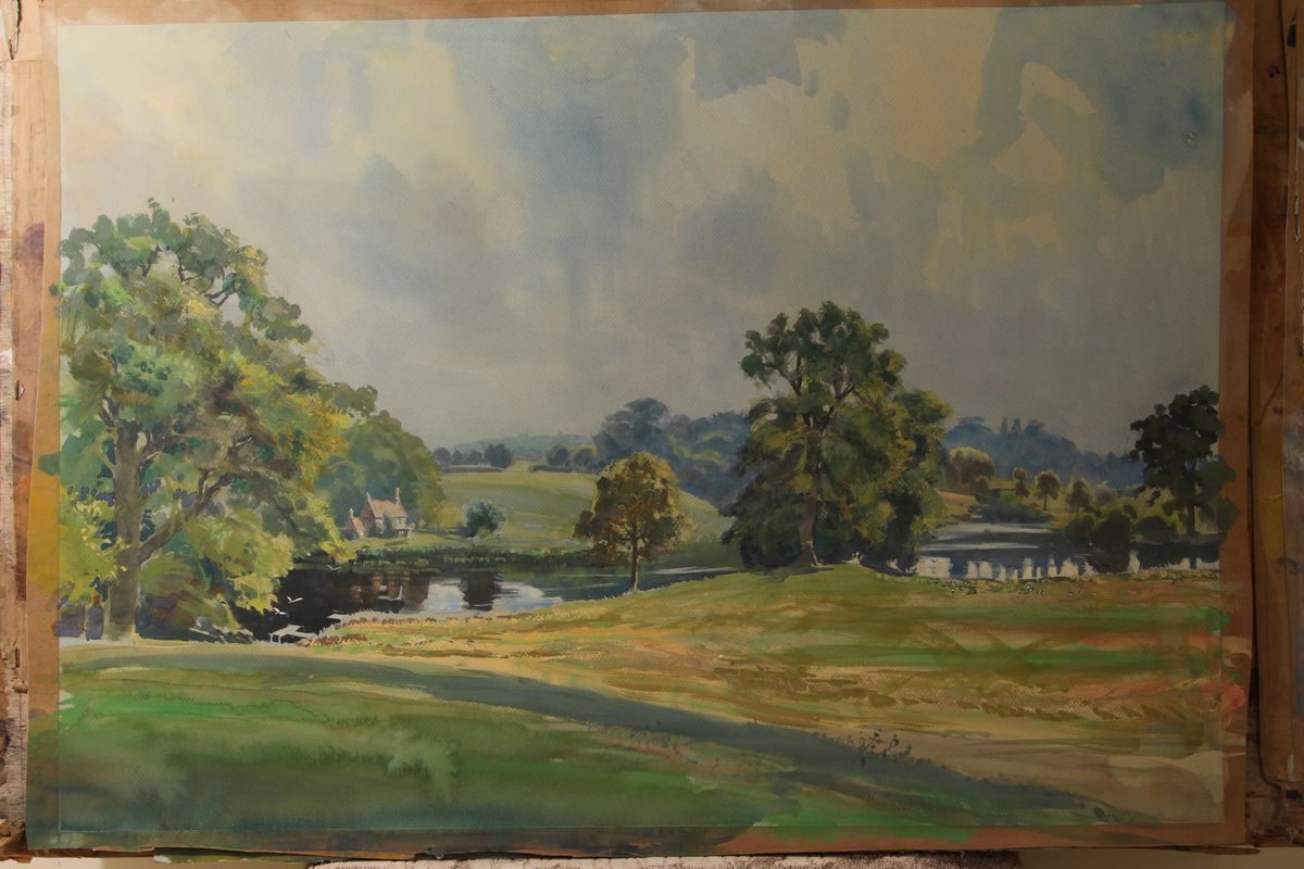
Bowood consists of a formal garden, pleasure ground, park, and woodland, all dominated by Bowood Lake (Brown c 1760-5) which was created from the two streams that run through the site. The current house (C18 and mid C20, listed grade I), built as a service court and orangery to the former house demolished in 1955, lies near the centre of the site. Immediately south and east of it lies the formal terraced garden (Smirke and Kennedy C19, listed grade II). Immediately to its north lies a rectangular walled garden of c 2.5ha (c 1760-5, listed grade II), with the pleasure ground (C18 and C19) lying beyond it.
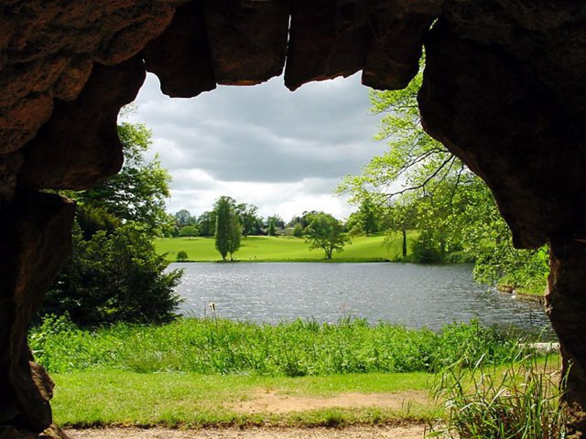
The c 40ha pleasure ground is laid out informally and is surrounded to the north, west, and south by a ha-ha which separates it from the park. To the south-east it is bounded by Lake Field, a lawn laid out on the west side of the northern arm of Bowood Lake. Along the lakeside in the south-east corner of Lake Field, c 200m from the house, stands the Boathouse (mid C19, listed grade II). In the centre of the pleasure ground lies the Pinetum (mid C19). In the south-west corner of the pleasure ground, immediately west of the house and kitchen garden, is an adventure playground (late C20). A circular walk that runs through the pleasure ground leads to a cascade and grotto (Hamilton and Lane c 1785, listed grade II*) and a hermit's cave (Hamilton and Lane c 1785-7, listed grade II) at the far northern tip of Bowood Lake. The walk continues to the Doric Temple (c 1800, listed grade II), situated at the far north-east end of the Lake and moved here in 1864 from another site within the pleasure ground. From the Doric Temple the walk enters Dunn's Lane Wood, where it curves around the northern tip of the Lake. Formerly the walk continued on from here to Icehouse Ride (now, 2001, no longer used), and Lakeside Cottage (late C18/early C19, listed grade II) on the east side of the Lake.
The park (late C18/early C19) lies to the west, south, and south-east of the house, with Bowood Lake as its main feature, and is scattered with individual mature trees and clumps. It is bounded by various woodlands and plantations, including Bassett's Moor to the north, Derry Hill Plantation to the west, Pilpot Wood and Great Wood to the south-west, and Holland's Moor, Coombe Grove, and Hill-top Plantation to the south and south-east. Through the woodland belts runs a ride (Brown 1763-5), overgrown and no longer visible in places (2001), which surrounds the park. In the centre of Pilpot Wood, on a small hill, stands the mausoleum (Adam 1761-5, listed grade I), surrounded by a rhododendron garden (C19/C20). From the mausoleum there are extensive views of the park and the house to the north-east, now (2001) partly obscured by vegetation.
During the late 1990s the north-west corner of the park was laid out as an 18-hole golf course and driving range.
Maps
- John Powell, Topographical map or plan of Bowood..., 1763 (private collection)
- Lancelot Brown, Plan for Bowood, 1763 (private collection)
- A Plan of Bowood Park, 1778 (private collection)
- OS 6" to 1 mile:
- 1st edition published 1889
- 2nd edition published 1902
- OS 25" to 1 mile:
- 1st edition published 1887
- 2nd edition published 1902
Description written: April 2002
Amended: November 2003
Register Inspector: FDM
Edited: November 2004
- Visitor Access, Directions & Contacts
Telephone
01249 812 102Access contact details
Bowood House & Gardens is open daily.
29th March – 3rd November 2024.
10:30 – 17:30, last admissions 16:30 daily.For more detailed visitor information visit the Bowood House & Gardens website.
Directions
The site is south of the M4 at junction 17.
Owners
Marquis of Lansdowne
Bowood, SN11 0LZ
- History
The following is from the Register of Parks and Gardens of Special Historic Interest. For the most up-to-date Register entry, please visit the The National Heritage List for England (NHLE):
18th Century
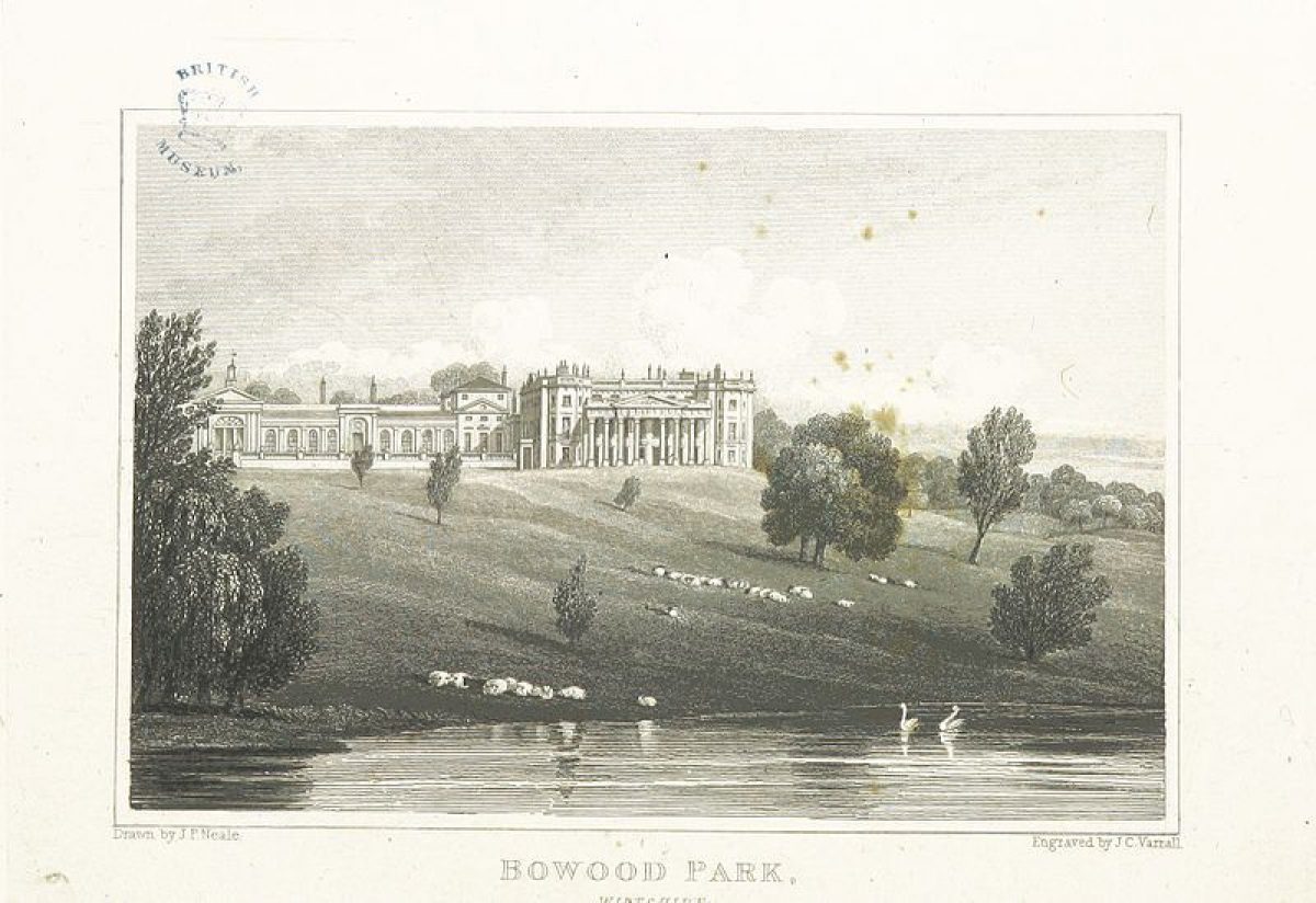
The first Earl of Shelburne purchased Bowood in 1754 and completed the house started in the early C18. An early C18 park is recorded in a contemporary painting and maps. In 1755-60 the first Earl commissioned the architect Henry Keene to enlarge the house and in 1757 he asked Lancelot Brown (1716-83) to give advice on a landscape garden to complement the new house. Brown was not formally commissioned however until after 1761 when the first Earl died and his son, the second Earl, later first Marquess of Lansdowne, inherited the estate. Brown's ideas for the park at Bowood are shown on his plan dated 1763 and include extensive tree planting and the creation of a large lake. At that time, the second Earl had also commissioned Robert Adam (1728-92) to undertake further alterations to the house. The latter designed a mausoleum in the park to commemorate the first Earl and this is shown on Brown's plan. In c 1785 a picturesque cascade and grotto with extensive rockwork were added to the head of Brown's lake, with advice from Charles Hamilton. The latter was the owner of Painshill, Surrey (qv) where Josiah Lane created similar extensive rockworks. In the late C18 (before 1801), Humphry Repton (1752-1818) possibly advised on landscape works at Bowood (Carter et al 1982).
19th Century
In 1817, under the ownership of the third Marquess of Lansdowne, Robert Smirke (1780-1867) constructed an upper terrace outside Robert Adam's mid C18 orangery, which connected the pavilions of the main house. Later, in 1848, the third Marquess introduced a large pinetum, laid out by John Spencer, head gardener at the time. In 1851 Robert Smirke's terrace was complemented by a formal garden on the lower terrace created by George Kennedy.
20th Century
In 1955 the house was demolished except for the service courts and orangery, which were converted into a new house by the architect F S Samuels.
21st Century
Bowood remains (2024) in private ownership. There are currently plans to build a new hotel and conference centre near the golf course that was laid out in the park in the late 1990s.
- Associated People
- Features & Designations
Designations
The National Heritage List for England: Register of Parks and Gardens
- Reference: GD1280
- Grade: I
Features
- Lake
- Earliest Date:
- Cascade
- Description: In about 1785 a picturesque cascade and grotto with extensive rockwork were added.
- Earliest Date:
- Latest Date:
- Terrace
- Description: Robert Smirke (1780-1867) constructed an upper terrace outside Robert Adam's mid-18th-century orangery, which connected the pavilions of the main house.
- House (featured building)
- Description: The first phase of house building was in the early-18th century. It was completed in 1754. Henry Keene was commissioned to enlarge the house in 1755-60. Robert Adam undertook further enlargements around 1763. The house was demolished in 1955.
- Latest Date:
- Mausoleum
- Earliest Date:
- Grotto
- Description: In about 1785 a picturesque cascade and grotto with extensive rockwork were added
- Earliest Date:
- Latest Date:
- Orangery
- Earliest Date:
- Tree Feature
- Description: A large pinetum, laid out by John Spencer, head gardener.
- Earliest Date:
- Latest Date:
- Terrace
- Description: In 1851 Robert Smirke's terrace was complemented by a formal garden on the lower terrace created by George Kennedy.
- Earliest Date:
- Latest Date:
- Parkland
- Woodland
- Farm
- Key Information
Type
Estate
Purpose
Ornamental
Principal Building
Domestic / Residential
Survival
Extant
Hectares
550
Open to the public
Yes
Civil Parish
Calne Without
- References
References
- Carter, G. et al, {Humphry Repton Landscape Gardener 1752-1818} (Norwich: Sainsbury Centre for Visual Arts, 1982), p. 163 Humphry Repton landscape gardener 1752-1818
- Sales, J., {West Country Gardens} (Gloucester: Alan Sutton, 1980), pp. 193-4 West Country gardens : the gardens of Gloucestershire, Avon, Somerset and Wiltshire
- {English Heritage Register of Parks and Gardens of Special Historic Interest}, (Swindon: English Heritage, 2008) [on CD-ROM] Historic England Register of Parks and Gardens of Special Historic Interest
- Stroud, D., {Capability Brown} (London: Faber, 1975), pp.90-2 Capability Brown
- Pevsner, N. and B. Cherry, {The Buildings of England: Wiltshire} (Harmondsworth: Penguin, 1975), p. 121-3 The Buildings of England: Wiltshire
- Thacker, C., {The History of Gardens} (London: Croom Helm, 1979), pp. 226-7 The History of Gardens
- Hinde, T., {Capability Brown: the story of a master gardener} (London: Hutchinson, 1986), pp. 85-7 Capability Brown: the story of a master gardener
- Batey, M. and D. Lambert, {The English Garden Tour: a view into the past} (London: Murray, 1990), pp. 225-30 The English Garden Tour: a view into the past
- Nicholas Pearson Associates {Bowood Historic Landscape Survey} Bowood Historic Landscape Survey
- (28 January 1905), pp 126-36; 151 (8 June 1972), pp 1448-51; (22 June 1972), pp 1610-13; 152 (7 September 1972), pp 546-9 Country Life, 17
- Jones, B., (1974), p 165 Follies & Grottoes