Introduction
Lacock Abbey has 18th-century parkland, with the addition of 19th-century trees. There is a Victorian rose garden, woodland garden and a recently-developed botanic garden.
The following is from the Register of Parks and Gardens of Special Historic Interest. For the most up-to-date Register entry, please visit the The National Heritage List for England (NHLE):
www.historicengland.org.uk/listing/the-list
An early C18 garden and park with which the landscape gardener Lancelot Brown was involved in the mid C18, and which was improved in the early C19 by the pioneer photographer, William Henry Fox Talbot.
Location, Area, Boundaries, Landform and Setting
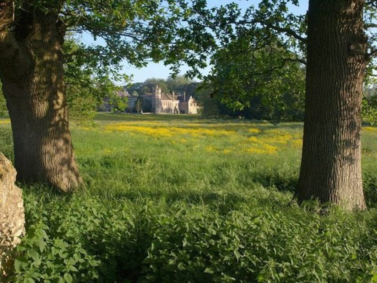
Lacock Abbey, a level site of c 15ha, lies immediately east of the village of Lacock and c 5km north of Melksham. To the south-east runs the River Avon while to the south the site is bounded by a stone wall which runs along the road leading eastwards out of the village (London Road). There are extensive views to the hills in the distance to the east, and towards the fields immediately surrounding the site, which form its setting. The latter include New Bridge Mead on the east side of the River Avon, March Mead, situated to the north-east of the site, and Lacock Fields and Fatting Leaze to the north.
Entrances and Approaches
The entrance to Lacock Abbey is situated in the south-west corner of the site on London Road and is approached either from Lacock village situated to the west, or from Lacock Bridge (listed grade II) adjacent to the far south-east corner of the site. The entrance is flanked to the north by the early C18 Barn Lodge (listed grade II), and a pair of gate piers with gates give access to a drive which runs first east and then north for c 70m. It then turns and runs east for c 100m to approach the west side of the Abbey. The drive is lined along its south side by a rubble-stone ha-ha dividing it from the adjacent paddock which lies on a slightly lower level.
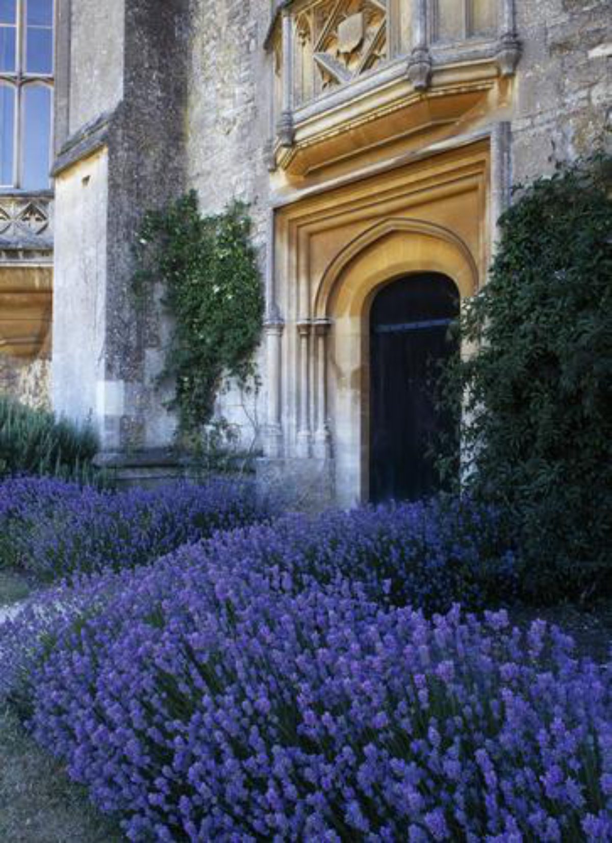
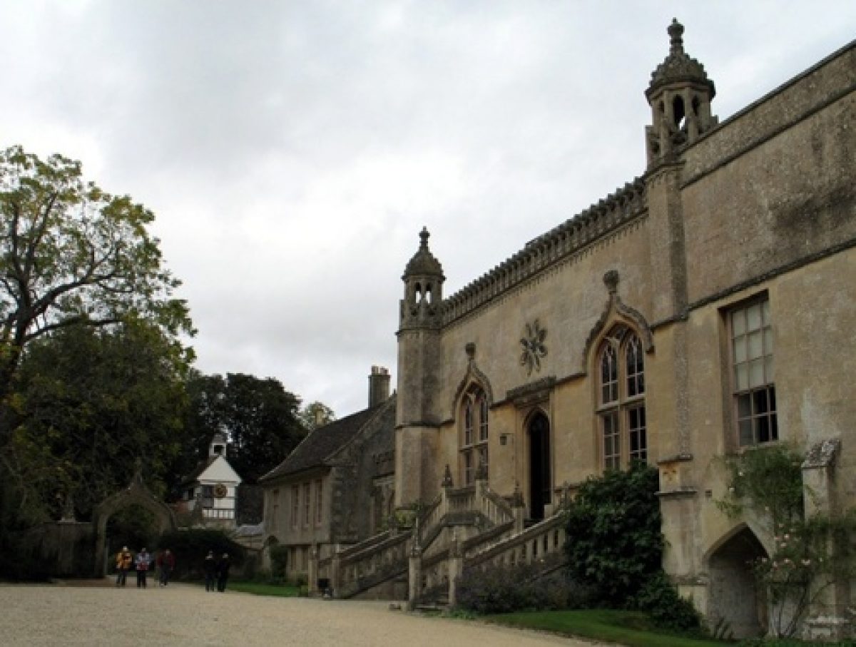
As it approaches the Abbey the drive divides, the northern branch leading eastwards into the stable courtyard, the southern branch turning south to lead under a gothic archway (listed grade II) to the west front of the Abbey. The archway was designed by Sanderson Miller in 1753, and the layout of the drive possibly dates from this period (the drive, named the Coach Road, and ha-ha are shown on the Lacock estate plan of 1764).
Principal Building
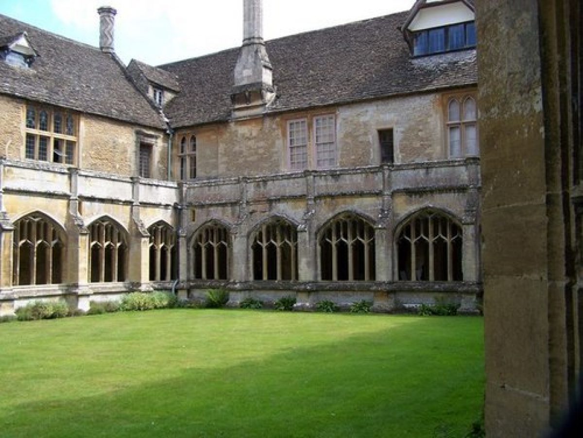
Lacock Abbey (listed grade I) is situated in the centre of the site. Attached to the north is a square-shaped stable courtyard, mainly dating from the mid C16, with to its north a walled rectangular enclosure with an C18 Dutch barn (listed grade II) in its north-east corner.
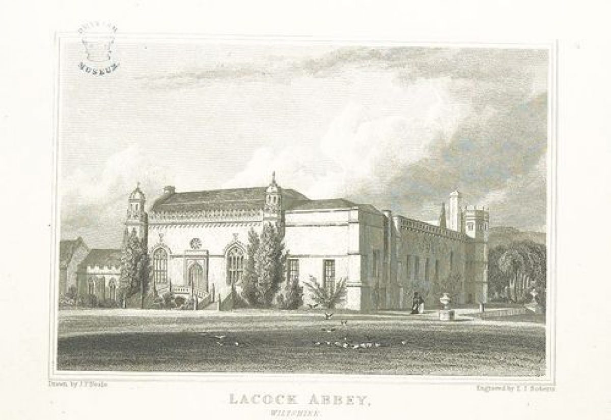
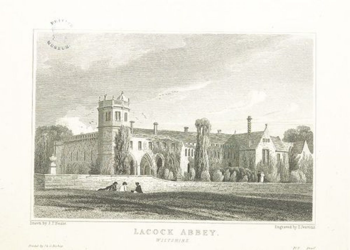
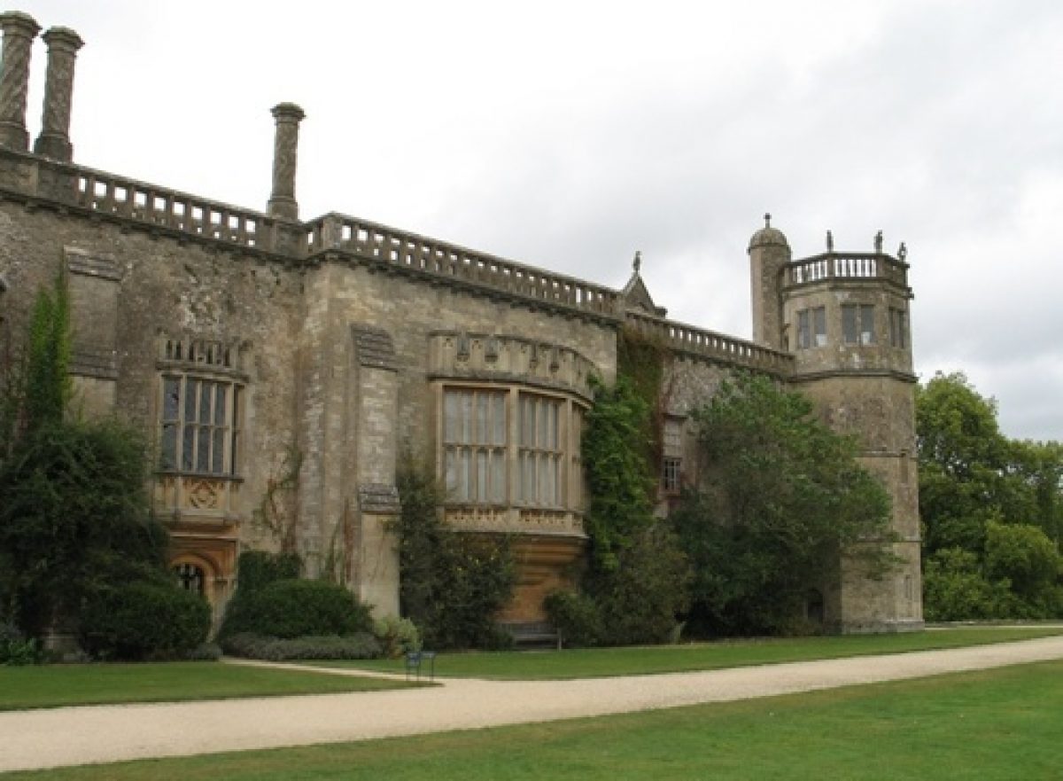
The west front of the Abbey was rebuilt c 1700 and c 1740, and again in 1754-5 by the architect Sanderson Miller, who turned it into a gothick great hall. It has a central entrance door reached by a two-arm balustraded stair, flanked by two large ogee-headed windows and two octagonal turrets on each corner. The south front is essentially the inside north wall of the medieval abbey church but it has three oriel windows which were added in 1828-30, and on the south-east corner is a mid C16 octagonal tower, added by the then owner William Sharington, possibly to designs by John Chapman. The long, two-storey east front is medieval in outline with two rows of windows, the ground-floor ones dating to 1900-10.
Gardens and Pleasure Grounds
The Abbey stands in the centre of a flat rectangular terrace laid to lawn to the south and east, which is supported by a sunken retaining wall. The terrace raises the Abbey above the floodplain of the River Avon. A path which runs immediately around the Abbey gives fine views over the paddock to the south, and to the River Avon and New Bridge Mead to the east.
On the south side of the Abbey the terrace has two bastions, each decorated with an urn of c 1770. On the terrace, c 4m to the south-east of the Abbey, stands a sundial (listed grade II) with a C16 carved stone base and an C18 brass dial on top, signed by Thomas Wright. During the Second World War a pillbox was built on the south terrace; this was removed by the National Trust in the 1970s. The terrace along the west front is gravelled and has a semicircular bastion opposite the entrance door to the Abbey. The terrace wall along the east side of the Abbey extends northwards beyond the building line to enclose the pond to the north-east of the Abbey. It then continues along the east boundary of the site for c 5m. The raised terrace with its bastions probably originates from the early C18. Buck's view of 1732 shows the Abbey from the south-east surrounded by a terrace with bastions. In the early C18, the eastern terrace wall with its bastion continued in a northerly direction (along the boundary of the registered site) where it enclosed a formal garden, with the pond forming the arm of a canal (Estate plan, 1764). The terrace wall and bastion were removed in the 1960s but they survive as earthworks within the North Park.
To the north and north-west of the Abbey lies a woodland garden containing a network of gravelled paths, lawns with bulbs, and C19 tree and shrub planting. A number of fine specimen trees (black walnut, swamp cypress, and a Judas tree) date to the first half of the C19 and were probably planted by Fox Talbot. There are also a few mature trees, such as Scotch pine along the drive, and oak, lime, yews, and horse chestnuts that possibly date from the early C18 (Pearson Assocs 1994). On the lawn immediately north of the drive stands a garden ornament (listed grade II) consisting of twin fluted Doric columns (previously chimneys) set on a stone base, topped by a female sphinx figure.
Along the path nearest to the west boundary of the site lies the rose garden. In its centre stands a stone vase on a pedestal, surrounded by beds with climbing roses growing on cast-iron arches with trellis work. A stone gothick alcove is situated to its north. The rose garden was created in 1832 for Lady Elizabeth Fields and was photographed by Fox Talbot in 1840 (ibid). In the 1960s the garden was removed, the present (2000) layout being a reconstruction by the National Trust of 1992. Situated to the west of the rose garden, along the western boundary of the site, is an orchard containing a selection of fruit trees mostly planted in the late C20, but including a mature medlar and mulberry. Formerly, the orchard was larger (Estate plans, 1714, 1764), but by 1840 (Tithe map), part of the orchard had been included in the garden.
In the far north-west corner of the site, at the end of the woodland garden, are the remains of a grotto set in a tufa arch built above the stream that forms the northern boundary of the site. The grotto is flanked by mature lime trees, possible of late C18 date. The exact function of the grotto is not known, but at some stage it may have formed part of the formal garden that was situated in the North Park (Pearson Assocs 1994).
Park
The parkland which lies to the south of the Abbey is known as the Paddock; from here there are fine views to the Abbey. It is separated from the drive by cast-iron railings, and scattered mature and young replacement trees, including oak and horse chestnut, create an open belt along the southern boundary wall. Some of these trees date from the late C18 and may have been planted as part of Lancelot Brown's proposals (ibid). The area of the Paddock to the south-east of the Abbey was formerly laid out as a series of enclosed gardens (Estate plan, 1714), which included a Little Old Orchard, a Great Court, a Ladys [sic] Garden, a Fountain Garden, and a Lower Garden. The walled Common Yard and Kitchen Garden formed part of this layout. As shown on the estate plan of 1764, and the survey of 1773, there was a double avenue situated to the south of London Road (outside the area here registered), no trace of which appears to survive.
The rectangular-shaped North Park to the north of the Abbey is bounded to the south and west by C19 iron railings which separate it off from the woodland garden. From the park there are extensive views cross the meadow Fatting Leaze to the north and March Mead to the east. There are various mature trees, probably dating from the mid to late C18, including oak, horse chestnut, sycamore, Lucombe oak, and copper beech. In the far north-east corner of the site stands a pillbox built during the Second World War. This building covers the site of the former north terrace bastion, the ditch to the north marking its outline. The L-shaped canal which formed part of the early C18 formal garden situated here (Estate plan, 1764) was filled in when the current park was created. The remains of the southern end of the canal are still (2000) visible however in the form of a dry depression, and the east side remains as a turf mark. The northern end of the canal is defined by drystone walls along the ditch on the north boundary.
Kitchen Garden
The walled early C18 Common or Stable Yard, and the Kitchen Garden, are situated along the west boundary of the site, north and west of the drive (Estate plan, 1714). The Common Yard is a square enclosure accessed from the drive and an opening in its north wall gives access to the Kitchen Garden. The Kitchen Garden is now in use as allotments for the village. Along the south boundary of Common Yard is Lodge Barn (listed grade II) while on the north wall the brick footings of two C19 greenhouses built by Fox Talbot still survive. The latter also planted the specimen trees in the Yard, which include black walnut, swamp cypress, holm oak, and tulip trees (Pearson Assocs 1994). The National Trust are currently (2000) reconstructing the layout of the Common Yard as shown on the OS 1st edition map surveyed in 1885, and are planning to rebuild the greenhouses.
REFERENCES
J Britton, The Beauties of Wiltshire (1825)
J P Neale, Views - 3, (2nd Ser 1826)
T Dingley, History of Marble (1868)
Country Life, 13 (7 February 1903), pp 176-81; 53 (3 March 1923), pp 280-7; (10 March 1923), pp 314-21; (17 March 1923), pp 352-8; 123 (1 May 1958), p 950; 162 (15 September 1977), p 674
N Pevsner and B Cherry, The Buildings of England: Wiltshire (2nd edn 1975), pp 284-9
J Sales, West Country Gardens (1980), pp 224-5
Architectural History 27, (1984), p 443
Lacock Abbey, guidebook, (National Trust 1991)
Lacock Abbey Historic Landscape Survey and Restoration Plan, (Nicholas Pearson Associates Ltd 1994)
Maps
Plan of Lacock Abbey, 1714 (Annotated on the reverse: 'To the Hon John Talbot an Iconography of Lac. House and Gardens contents of which a. r. p. 20.0.03. Descr. By his serv., 1714' (National Trust collection)
Sketch Plan of Lacock House and Environs before alterations, nd (National Trust collection)
Lacock Estate Plan, 1764 (National Trust collection)
Andrews and Drury, Survey of Wiltshire, 1773
Survey and valuation of the Estate of W H Fox Talbot, 1807 (National Trust collection)
Map of estates in Lacock, 1840 (National Trust collection)
Tithe map for Lacock parish, 1840 (Wiltshire and Swindon Record Office)
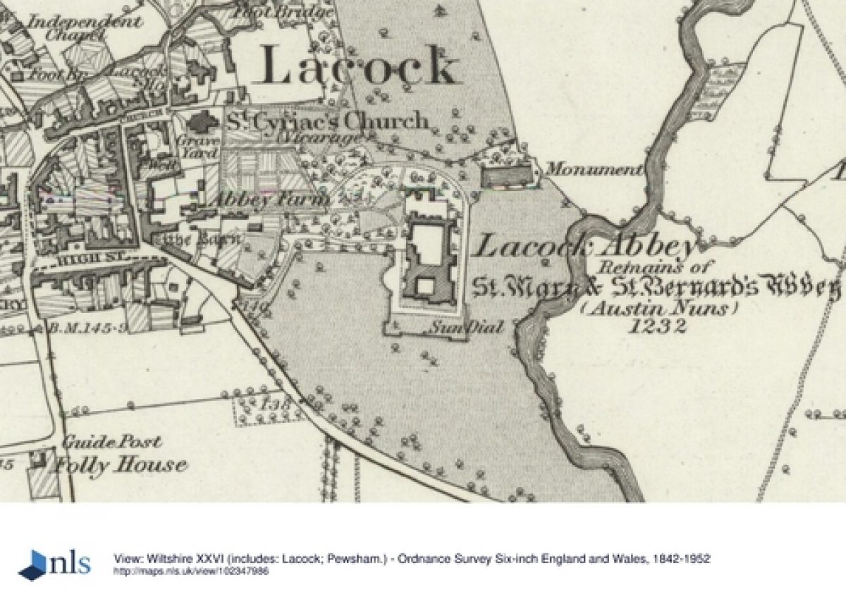
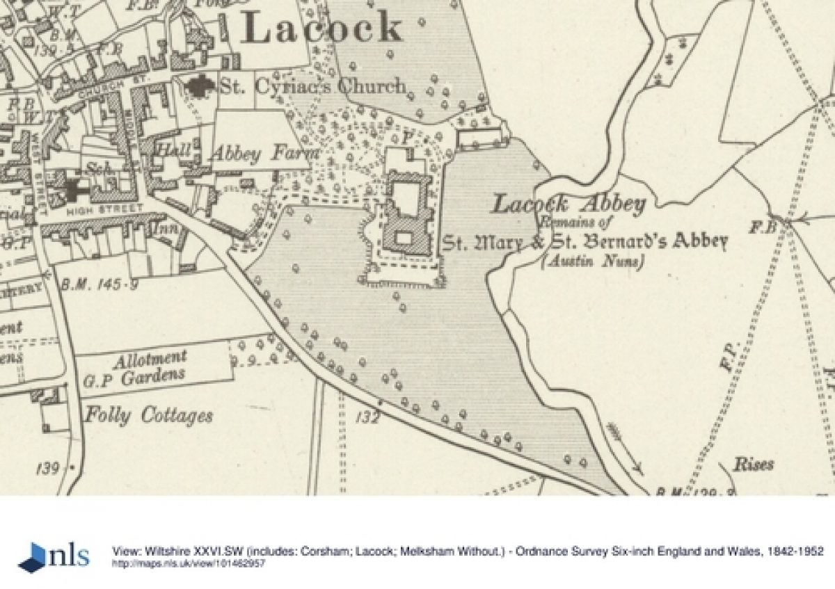
OS 6" to 1 mile:
1st edition surveyed 1885, published 1889
2nd edition published 1925
OS 25" to 1 mile:
1st edition 1885, published 1889
2nd edition published 1925
Illustrations
SW Prospect of the Abbey of Lacock Taken from Ye Porter's Lodge 30 April 1684 (drawing reprinted in Dingley 1868)
S and N Buck, The south-east view of Lacock nunnery, in the county of Wilts, 1732 (National Trust collection)
Buckler, watercolour, Lacock Abbey, a view from the river, 1808 (National Trust collection)
G Clarke Scaldwell, View of Lacock Abbey Wiltshire, 1834 (National Trust collection)
G Clarke Scaldwell, Lacock Abbey Wiltshire, 1834 (National Trust collection)
Description written: February 2000; Amended: March 2000
Register Inspector: FDM
Edited: March 2005
- Visitor Access, Directions & Contacts
Telephone
0844 800 1895Website
http://www.nationaltrust.org.ukAccess contact details
The gardens are open daily between February and October from 11 am. Please see: http://www.nationaltrust.org.uk/place-pages/197/pages/opening-times-calendar
Directions
The site is off the A350, 3 miles south of Chippenham.
Owners
The National Trust
Heelis, Kemble Drive, Swindon, SN2 2NA
- History
The following is from the Register of Parks and Gardens of Special Historic Interest. For the most up-to-date Register entry, please visit the The National Heritage List for England (NHLE):
www.historicengland.org.uk/listing/the-list
HISTORIC DEVELOPMENT
Lacock Abbey was founded in 1232 as a nunnery for Augustinian canonesses. In 1539 the abbey was dissolved and sold to William Sharington, who converted it into a country house. Sharington was succeeded by his brother Henry in 1553, whose daughter married John Talbot of Salwarp, Worcestershire. Lacock Abbey remained in the ownership of the Talbot family until the Second World War.
In the early C18, under the ownership of John Talbot, Lacock Abbey had a series of enclosed gardens to the south, east, and west of the Abbey (Estate plan, 1714). In the mid C18, the then owner, John Ivory Talbot undertook various works to both the Abbey and its gardens. In 1753 John Ivory commissioned the architect Sanderson Miller, who altered the south front and added a gothic archway. Shortly afterwards, in 1755-6, Ivory Talbot paid a bill of £250 to the landscape gardener Lancelot Brown (1716-83), which suggests the latter's involvement with alterations to the grounds (Architect Hist 1984). An estate plan of 1764 shows that the enclosed gardens to the south and east of the Abbey had been removed by this date. The Kitchen Garden, Orchard, and Common Yard are still shown however, and to the north of the Abbey are extensive formal gardens, with the former fishponds (Estate plan, 1714) turned into an L-shaped canal and a circular pond.
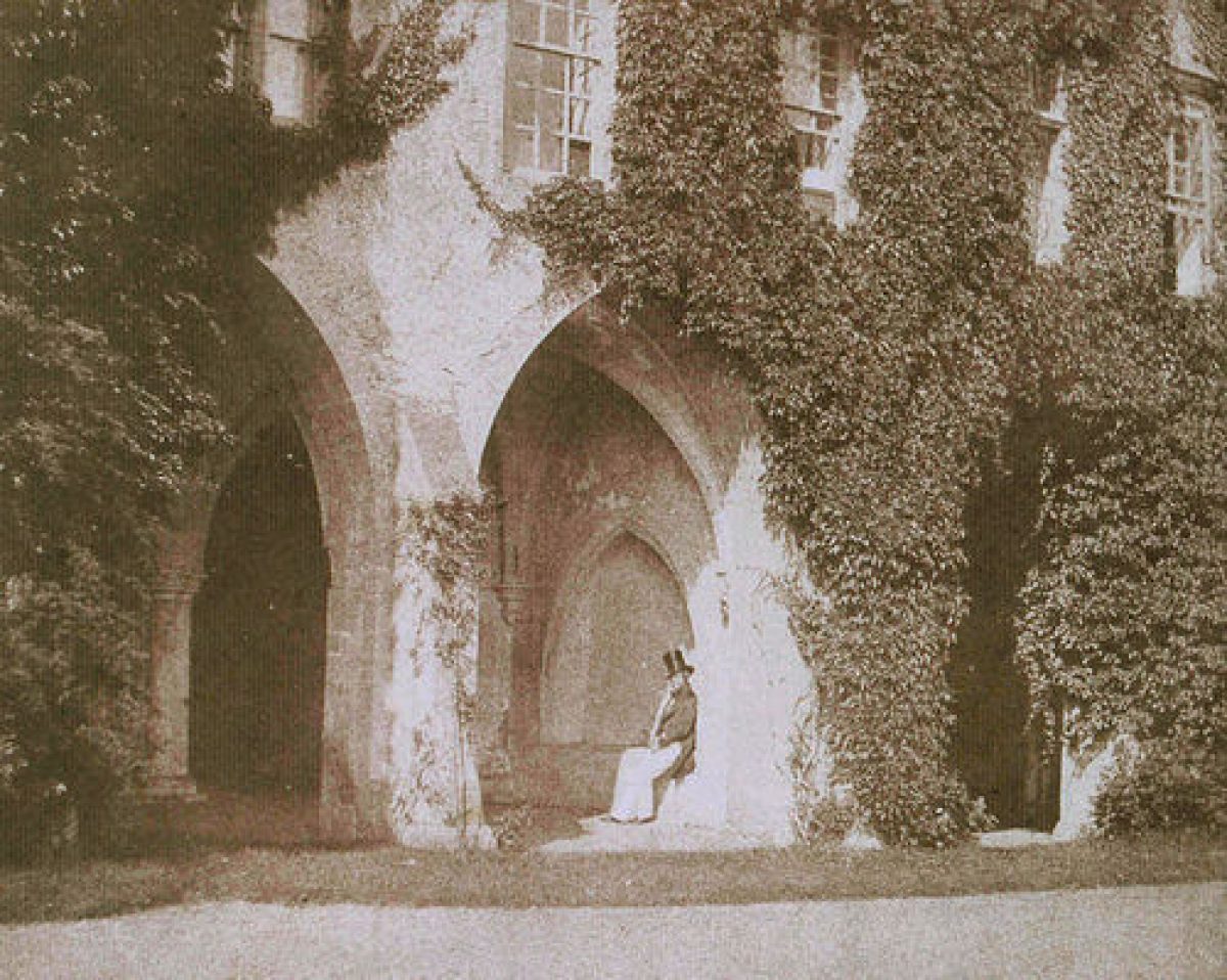
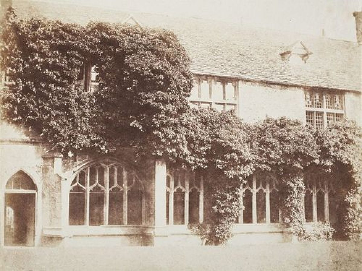
In the early C19, the Abbey's grounds were altered and replanted under the ownership of the pioneer photographer, William Henry Fox Talbot (d 1877). Between 1830 and 1840, Fox Talbot researched the history of the Abbey, and became a prominent botanist, mathematician, astronomer, and Egyptologist. As a keen plant collector, he planted various exotic species and ornamental trees in the Abbey grounds. He also informalized the layout of the garden, and reduced and partly filled in the formal water features.
Lacock Abbey passed to the National Trust in 1944 and remains (2000) in their ownership. Since the early 1980s they have carried out replacement planting in the Paddock, along the river banks, and in the orchard. In 1992 they recreated the early C19 rose garden. Works are currently being undertaken to restore the Common Yard's C19 layout, including the rebuilding of the greenhouses used by Fox Talbot.
Period
18th Century (1701 to 1800)
- Associated People
- Features & Designations
Designations
The National Heritage List for England: Register of Parks and Gardens
- Reference: GD2244
- Grade: II
Features
- Grove
- Summerhouse
- Rose Garden
- Planting
- Description: There is a recently-developed botanic garden.
- River
- Description: To the south-east runs the River Avon.
- Boundary Wall
- Description: To the south the site is bounded by a stone wall which runs along the road leading eastwards out of the village.
- Abbey (featured building)
- Now House
- Earliest Date:
- Latest Date:
- Parkland
- Trees
- Woodland garden
- Key Information
Type
Park
Purpose
Ornamental
Principal Building
Domestic / Residential
Period
18th Century (1701 to 1800)
Survival
Extant
Hectares
15
Open to the public
Yes
Civil Parish
Lacock
- References
References
- Sales, J., {West Country Gardens} (Gloucester: Alan Sutton, 1980), pp. 224-5 West Country gardens : the gardens of Gloucestershire, Avon, Somerset and Wiltshire
- {English Heritage Register of Parks and Gardens of Special Historic Interest}, (Swindon: English Heritage, 2008) [on CD-ROM] Historic England Register of Parks and Gardens of Special Historic Interest
- Pevsner, N. and B. Cherry, {The Buildings of England: Wiltshire} (Harmondsworth: Penguin, 1975), pp. 284-9 The Buildings of England: Wiltshire
- Britton, J., {The Beauties of Wiltshire, displayed in statistical, historical and descriptive sketches} (London: Vernor & Hood, 1825) The Beauties of Wiltshire, displayed in statistical, historical and descriptive sketches
- Nicholas Pearson Associates; Land Use Consultants {Lacock Conservation Management Plan} (2011) Lacock Conservation Management Plan
- Nicholas Pearson Associates {Lacock: Historic Landscape Survey and Restoration Plan} (1993) Lacock: Historic Landscape Survey and Restoration Plan