

Introduction
The formal gardens at Wrest Park developed over 150 years, from the late-17th to early-19th centuries. The style was inspired by the gardens at Versailles. The gardens dating from the late-17th to early-18th century survive almost intact, with some 18th-century landscaping and 19th-century development. The registered site covers some 380 hectares. There are a number of distinctive garden buildings.
Terrain
Largely flat
The following is from the Register of Parks and Gardens of Special Historic Interest. For the most up-to-date Register entry, please visit The National Heritage List for England (NHLE):
Extensive and complex formal pleasure grounds and park around a country mansion. Main phases early C18 and early C19, utilising late C17 base, with mid C18 work by Lancelot Brown.
Location, Area, Boundaries, Landform and Setting
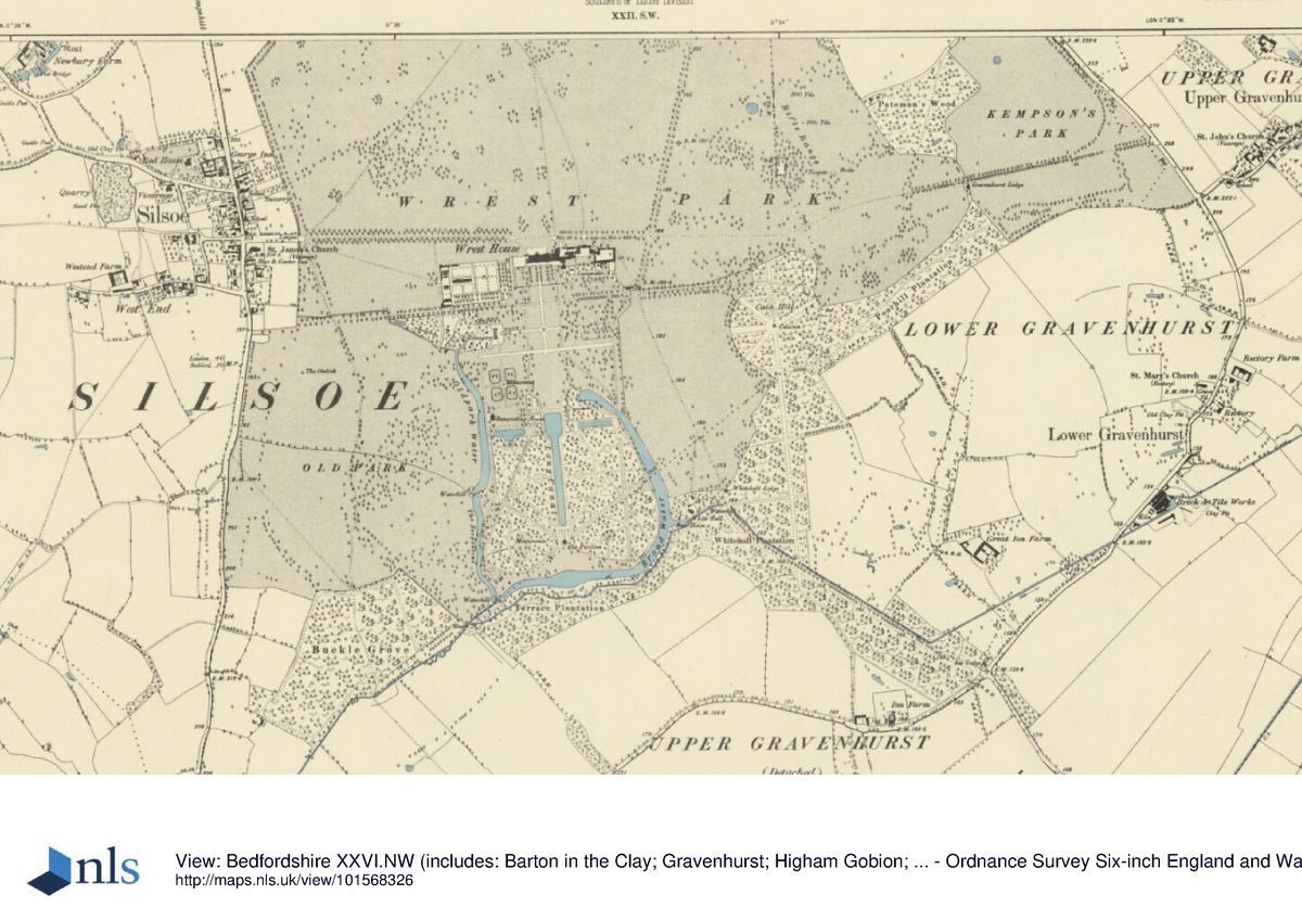
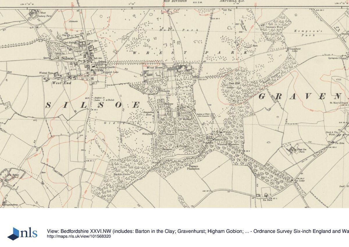
Wrest Park lies 14km south of Bedford, on the eastern edge of the village of Silsoe, on the Greensand Ridge of low hills. The c 380ha site is bounded to the west by Silsoe and the old route of the A6 Bedford to London road and on the other sides largely by agricultural land, parts of the boundary being marked by a stone wall. The late C20 A6 Silsoe by-pass cuts through the west edge of the park, set in a cutting to the north and on a low embankment to the south. The park and garden are largely level, except for the rise to the east which includes Kempson's Park and Cain Hill. The site offers views of the villages of Upper and Lower Gravenhurst from the higher ground to the east and the east drive, together with views of the low hills to north and south.
The main approach from Silsoe gives access along a straight avenue (replanted C20) through the park, past the two Louis XV-style Silsoe Lodges (Earl de Grey 1826, listed grade II) with their wrought-iron screen and gate piers. The drive crosses the sunk by-pass, then runs past the impressive entrance to the kitchen garden to the south, arriving at the house at right angles to its main axis. The drive continues eastwards to Gravenhurst Lodge, through Kempson's Park, eventually emerging at Upper Gravenhurst lane. A spur south continues between the east side of the Great Garden and Cain Hill to Whitehall Lodge, and beyond this through Whitehall Plantation to Ion Lodge. A straight spur north passes the two Louis XV Bradbury Lodges (Earl de Grey 1816, listed grade II, ruinous 1997), eventually giving access to the A507.
Gardens and Pleasure Grounds
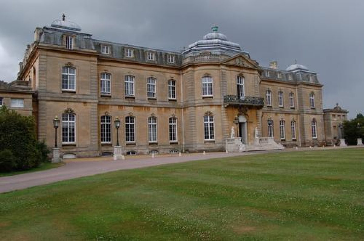
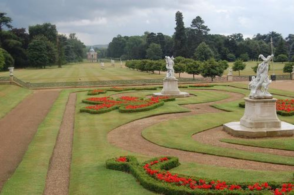
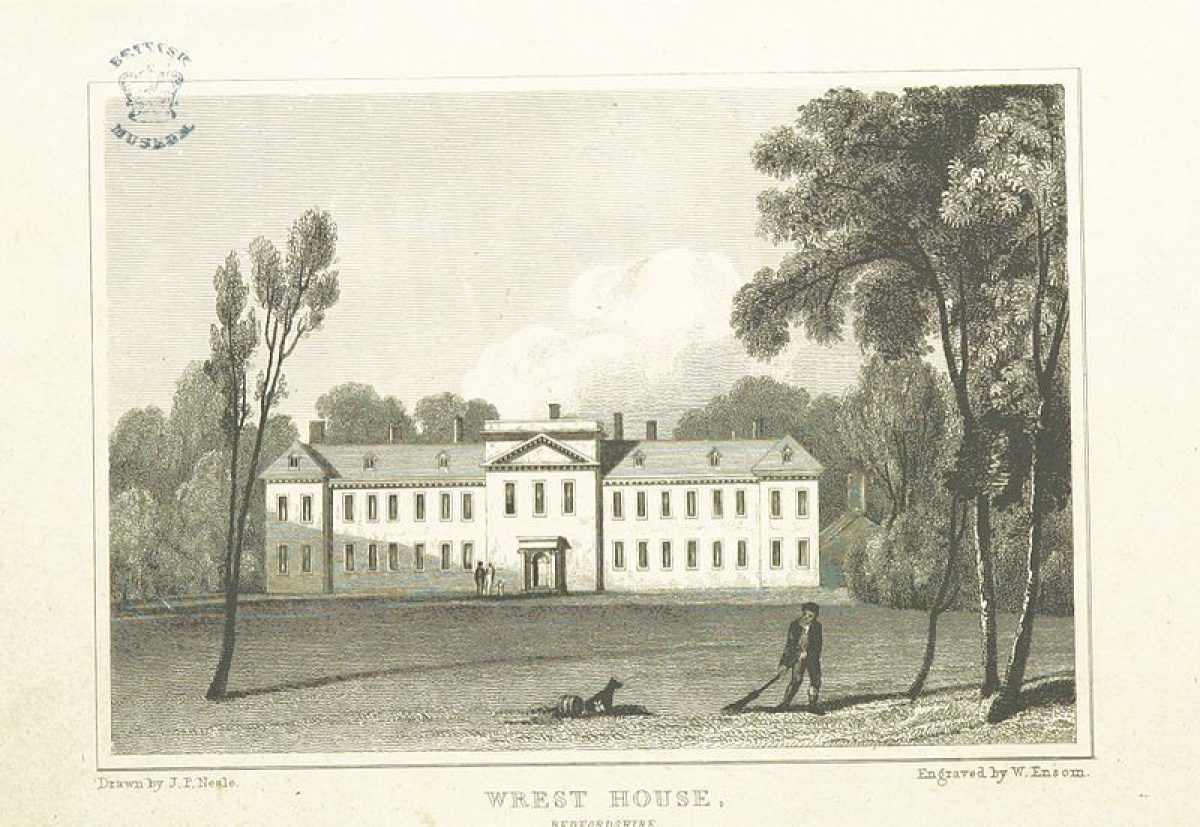
The site consists of extensive pleasure grounds, park and woodland. The rectangular mansion (Earl de Grey 1830s, listed grade I) lies near the centre of the site, on the north boundary of the pleasure grounds, built of orange ashlar in Louis XV style and flanked to the east by the adjacent stables (Earl de Grey 1830s, listed grade II) and to the west by the extensive kitchen garden (Earl de Grey 1836, listed grade II), to which it is linked by a screen wall. The main, north, entrance front overlooks informal level lawns bounded by the main drive to the north and beyond this the shortened remains of the north avenue (replanted C20) within the north park, with a view of a low ridge to the north.
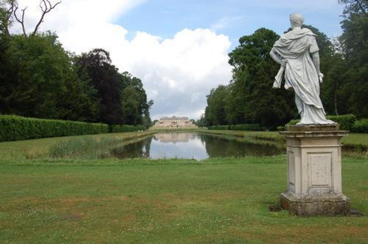
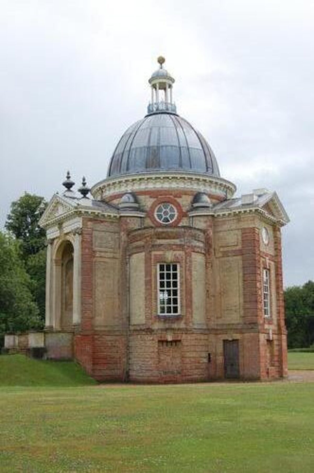
The south, garden front is aligned on the central axis of the c 40ha pleasure grounds. It overlooks the formal 1830s parterre and site of the old house 200m to the south, to the Long Water, flanked by the wooded Great Garden. At the end of the Long Water, 800m to the south, lies the Pavilion (Thomas Archer 1709-11, listed grade I), a Baroque, red-brick, domed banqueting house, with a low range of hills closing the view in the far distance. The pleasure grounds are largely enclosed by the formal canals naturalised by Brown 1758-60, flanked by Old Park, the site of the medieval park, to the west and the park leading up to Cain Hill to the east; they contain a variety of garden structures and statuary placed within various formal and informal compartments.
Park
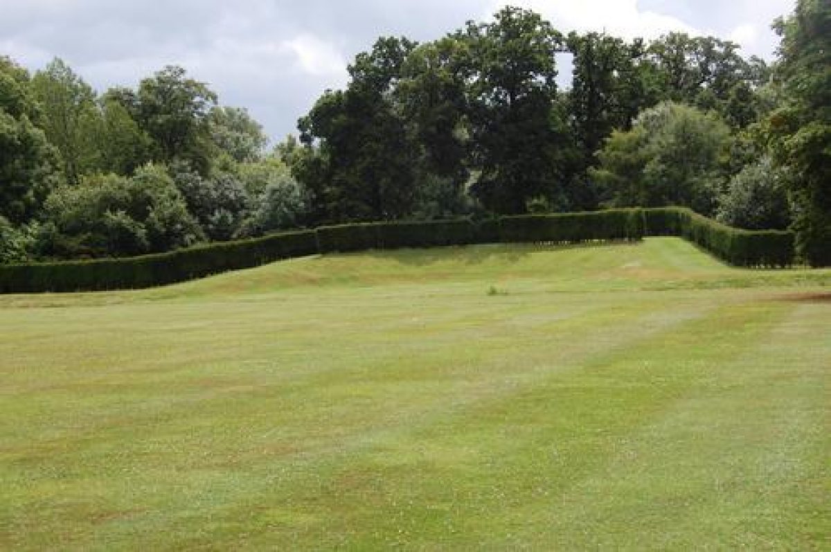
The park, which surrounds the house and pleasure grounds to the west, north and east, has been almost completely denuded of mature trees, except for an area south of the east drive, adjacent to Poorhill Plantation, which retains mature park trees and old pasture. The land is largely open arable, with some pasture, and mown grass along the west avenue and close to the north front. A considerable development of late C20 industrial farm buildings and offices lies in the park close to the east and north-east of the house, dominating this area. A belt of woodland runs south from Pateman's Wood along the east and south boundaries, parts of which have been replanted (mid to late C20). The summit of Cain Hill is the site of Hill House, also by Archer (c 1711, removed 1830), which was a Baroque cruciform building which acted as an eyecatcher from the pleasure grounds. As with the Pavilion, each façade was designed to face a different avenue and close a vista. Hill House was replaced by a stone monument, the base of which survives in the woodland.
Maps
- Rest Park in Bedfordshire, 1719 (Bedfordshire Record Office)
- Wrest Park, John Rocque, 1735 (Bedfordshire Record Office)
- Wrest Park, John Rocque, 1737 (Bedfordshire Record Office)
- T Jefferys, The County of Bedford, 1765
- Map of several parishes of Silsoe, 1814 (Bedfordshire Record Office)
- A Bryant, Map of the County of Bedford, 1826
- OS 6" to 1 mile:
- 1st edition published 1881
- 2nd edition published 1901
- 3rd edition published 1926
- OS 25" to 1 mile: 1st edition published 1880
Description written: September 1997 Amended: April 1999
Register Inspector: SR
Edited: May 1999, August 2022
- Visitor Access, Directions & Contacts
Telephone
0370 333 1181Access contact details
For more detailed visitor information please visit the English Heritage website.
Directions
Less than 1 mile east of Silsoe off the A6, 10 miles south of Bedford.
Nearest station :Flitwick, 4 miles.
Bus: Stagecoach in Northants X1, Bedford - Luton.
Owners
English Heritage
- History
The following is from the Register of Parks and Gardens of Special Historic Interest. For the most up-to-date Register entry, please visit The National Heritage List for England (NHLE):
13th Century
The de Grey family held an estate in Silsoe from the C13.
15th Century
In the 15th Century, Edmund Grey was created Earl of Kent. Anthony, the eleventh Earl, married an heiress, Mary, daughter of Baron Lucas of Crudwell, in 1662.
17th - 18th Century
From 1671-1702 the Earl and Countess altered the medieval and C16 house, laying out a formal landscape around it, largely focussed on the axial canal called the Long Water, shown in Britannia Illustrata (1705-6). The eleventh Earl was succeeded in 1702 by Henry, the twelfth Earl, created Duke in 1710, who created the Great Garden around the C17 features, incorporating iconography relating to his Whiggish beliefs and regard for William III. He laid out the woodland garden flanking the Long Water, the formal canals enclosing it and the canals at right angles to the Long Water. He also built the Pavilion at the far end of it, as well as introducing a great variety of garden buildings and ornaments, as shown by John Rocque in two plans of 1735 and 1737. The Duke died in 1740 and was succeeded by his granddaughter Jemima, Marchioness Grey who hardly altered the core of the garden, but employed Lancelot Brown c 1758-60 to work on the periphery of the Great Garden to soften the contours of the perimeter canals.
19th Century
When the Earl de Grey, an accomplished amateur architect, inherited Wrest in 1833 he demolished the old house and built a new one in Louis XV style 200m to the north, laying out new formal parterres to compliment it. He rebuilt various structures in similar style, including the orangery, kitchen garden, stables and several lodges. Following the Earl's death in 1859 Wrest ceased to be the principal residence of the family.
20th Century
The de Greys sold the estate at the end of World War I and between the 1920s and 1940s almost all the numerous park and avenue trees were felled. After the Second World War the house, gardens and part of the park were bought by the Ministry of Public Building and Works who now, as English Heritage, lease the site to Silsoe Research Institute, an agricultural research establishment.
- Associated People
- Features & Designations
Designations
The National Heritage List for England: Register of Parks and Gardens
- Reference: GD1007
- Grade: I
Style
Formal
Features
- Lawn
- Parterre
- Fountain
- Ornamental Canal
- Description: The Long Water.
- Avenue
- Pavilion
- Earliest Date:
- Latest Date:
- Sculpture
- Fountain
- Great House (featured building)
- Description: The house is built in in Louis XV style. It was designed by Thomas, Earl de Grey, and replaced an earlier house sited 200 metres to the south.
- Earliest Date:
- Latest Date:
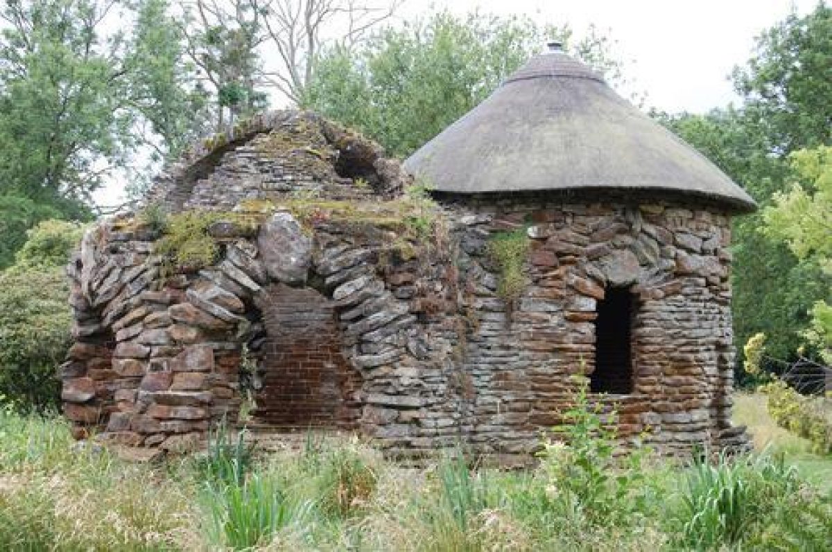
- Bath House
- Description: The bath house was designed either by Thomas Wright around 1758 or by Edward Stevens around 1769-71. It was intended to look like a semi-classical building with a thatched roof. It is built of ironstone, comprising two rooms: an octagonal one with a cobbled floor and a circular one with a sunken bath.
- Earliest Date:
- Latest Date:
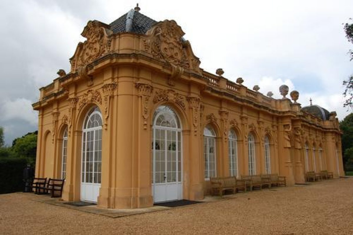
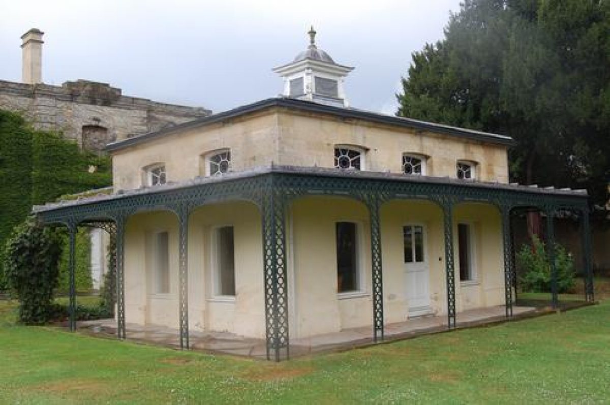
- Garden Building
- Description: The Bowling Green House was re-modelled in 1735, designed by Batty Langley.
- Latest Date:
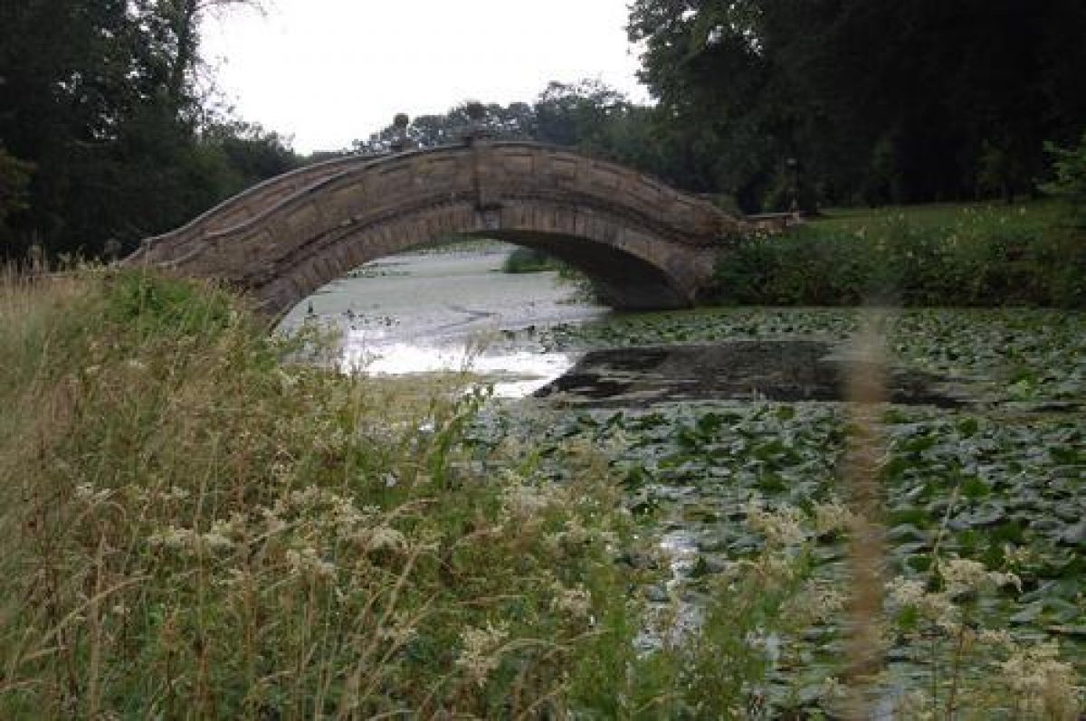
- Ornamental Bridge
- Description: The Chinese Bridge was built in the second half of the 18th century by Jemima, Marchioness Grey.
- Earliest Date:
- Latest Date:
- Temple
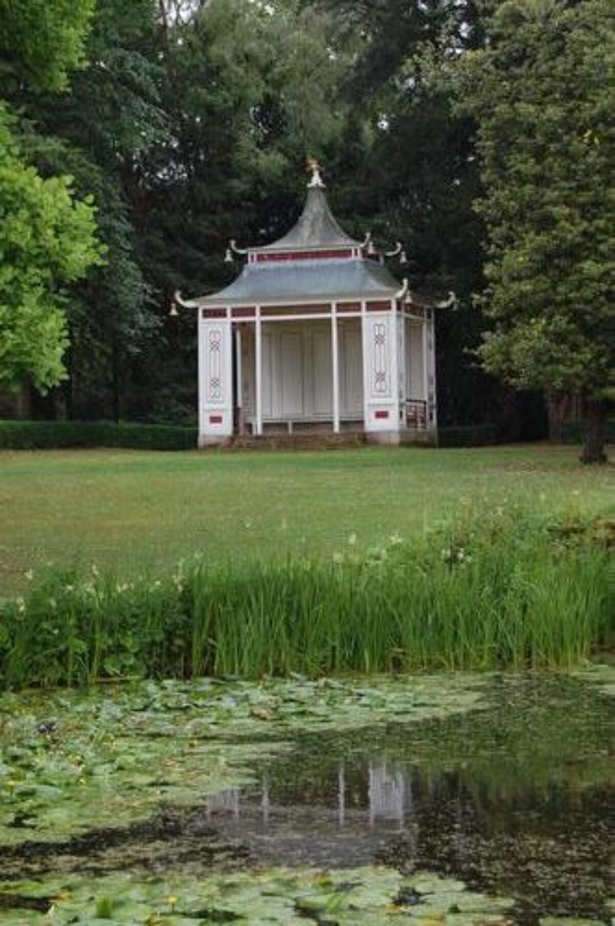
- Description: The Chinese temple was built in around 1754.
- Earliest Date:
- Latest Date:
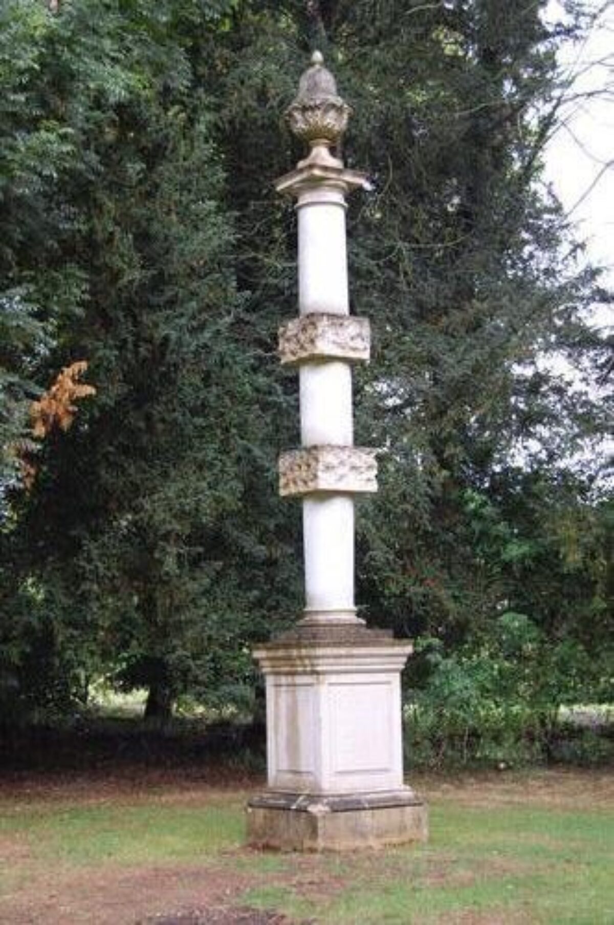
- Column
- Description: There is a column erected to commemorate the laying out of the gardens. The script reads: 'These gardens, originally laid out by Henry Duke of Kent, were altered by Philip Earl of Hardwicke and Jemima Marchioness Grey with the professional assistance of Lancelot Brown Esq. in the years 1758, 1759, 1760.' The column was originally sited near the Bowling Green House.
- Earliest Date:
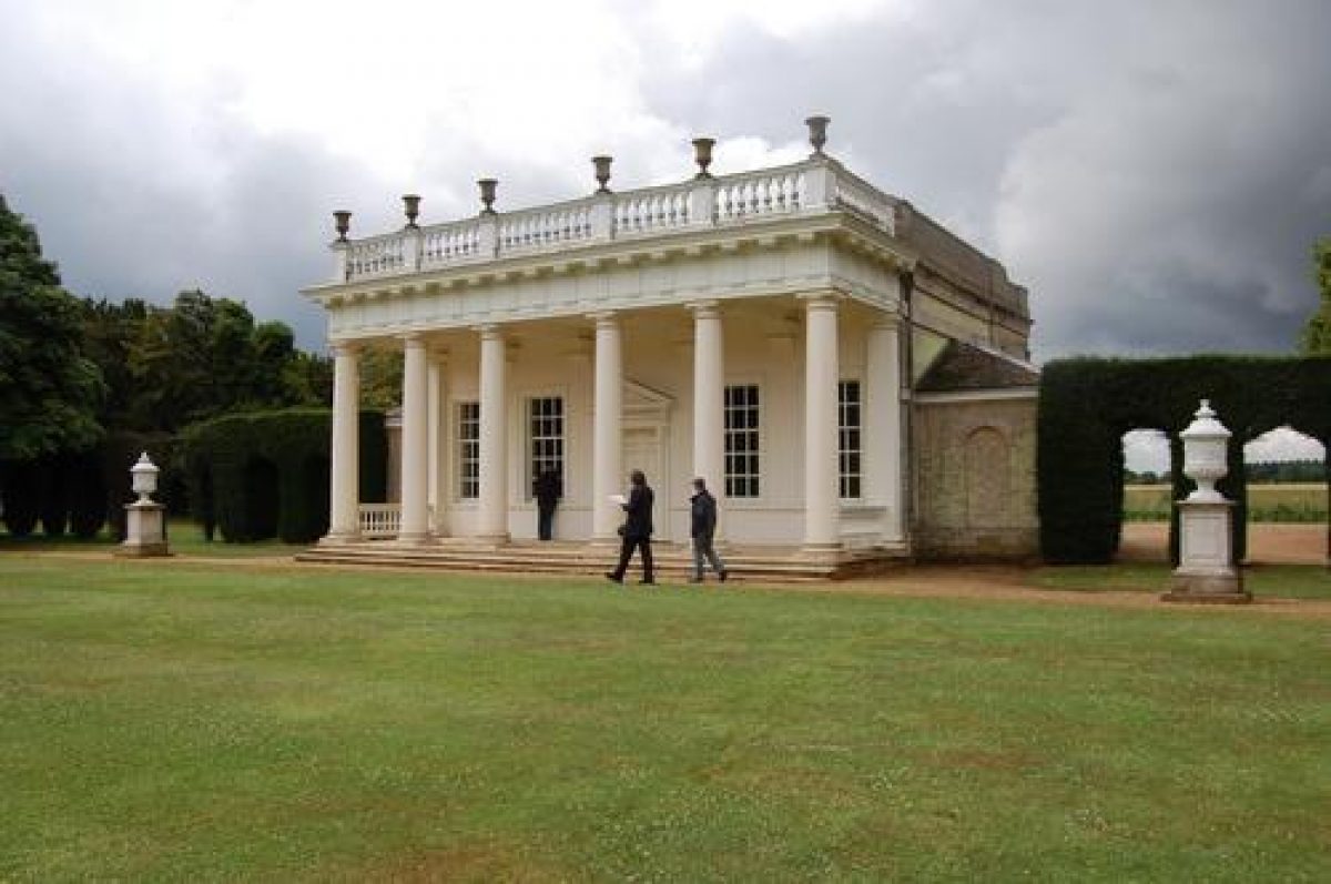
- Orangery
- Description: The orangery was designed by Thomas Philip, 2nd Earl de Grey in around 1835.
- Earliest Date:
- Latest Date:
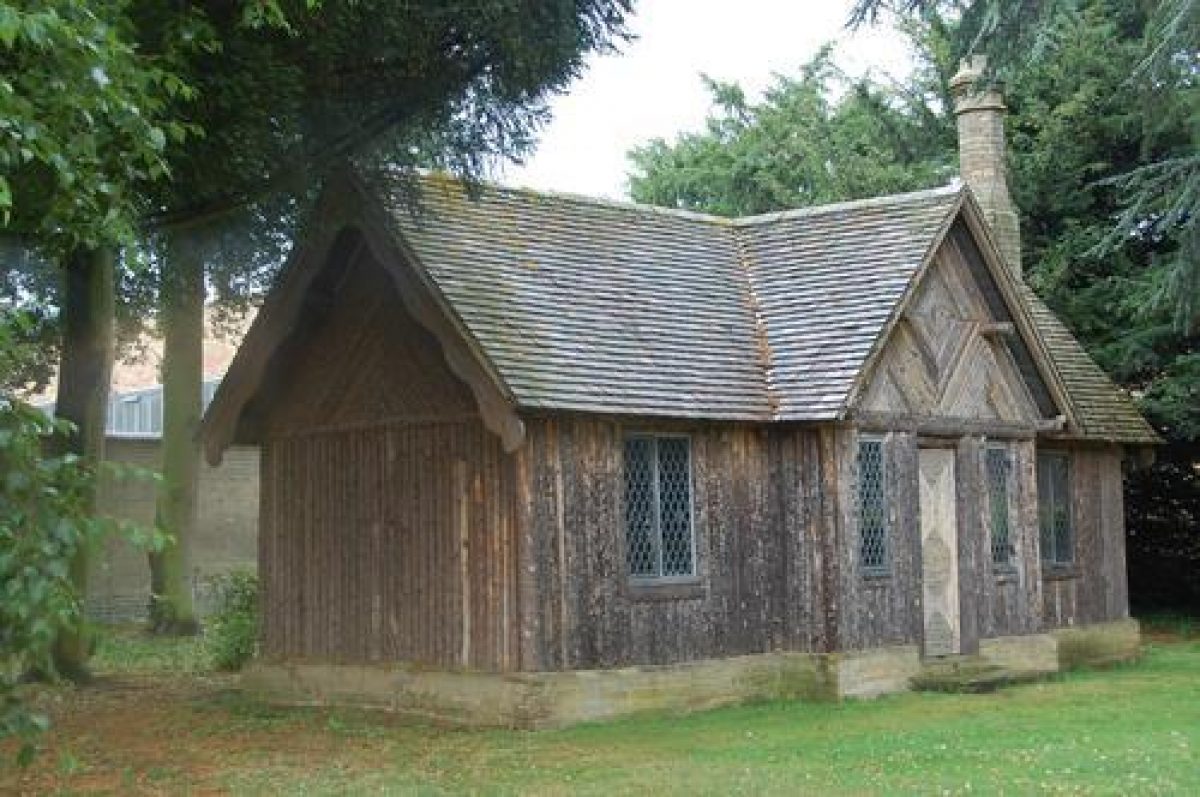
- Garden Building
- Description: The Petit Trianon is a three-roomed log cabin built in 1856.
- Earliest Date:
- Latest Date:
- Key Information
Type
Garden
Purpose
Ornamental
Principal Building
Domestic / Residential
Survival
Extant
Hectares
380
Open to the public
Yes
Civil Parish
Silsoe
- References
References
- {English Heritage Register of Parks and Gardens of Special Historic Interest} (Swindon: English heritage 2008) [on CD-ROM] Historic England Register of Parks and Gardens of Special Historic Interest
- Batey, M and Lambert, D {The English Garden Tour: a view into the past} (1990) pp 110-113 The English Garden Tour: a view into the past
- Land Use Consultants {Wrest Park masterplan (2) for restoration and management: September 1993} (1993) Wrest Park masterplan (2) for restoration and management: September 1993
- Donald Insall Associates {Wrest Park, Bedfordshire Options Appraisal and Master Plan} (2009) Wrest Park, Bedfordshire Options Appraisal and Master Plan
- {Wrest Park landscape management and maintenance plan} (2010) Wrest Park landscape management and maintenance plan
- The Landscape Agency {Wrest Park: tree and woodland management and maintenance programme} (2010) Wrest Park: tree and woodland management and maintenance programme
- Vol 16, (9 July 1904), pp 54-64; (16 July 1904), pp 90-8; 18 (2 December 1905), pp 772-3; 36 (4 August 1914), pp 112-14; 155 (17 January 1974), pp 78-81 Country Life
- no 3 (autumn 1995), pp 149-78 Journal of Garden History 15
- Collett-White, J, (ed)., (Bedfordshire Historical Record Society 1995), pp 243-51 Inventories of Bedfordshire Country Houses, 1714-1830
- Related Documents
-
CLS 1/354
Landscape Restoration and Management Plan - Digital copy
Land Use Consultants - 1999
-
CLS 1/492
Historical Survey of Wrest Park - Hard copy
Land Use Consultants - 1993
-
CLS 1/493
Landscape Restoration and Management Plan: Supplementary Studies - Hard copy
Land Use Consultants - 1999
-
CLS 1/494
Conservation Plan, Draft - Hard copy
Land Use Consultants - 1999
-
CLS 1/495
Conservation Statement, Draft - Hard copy
Fielden and Mawson LLP - 2005
-
CLS 1/496
Conservation Management Plan, Draft - Hard copy
Donald Insall Associates, Dr Twigs Way (Landscape Agency) - 2006 or later
-
CLS 1/498
Options Appraisal and Masterplan - Hard copy
Donald Insall Associates, Dr Twigs Way , Landscape Agency, Julia Holberry Associates and Katherine Eustace - 2007 or later
-
CLS 1/531
Wrest Park Revitalisation Project - Digital copy
Camilla Beresford and Sarah Cotter Craig - 2009
-
CLS 1/965
Wrest Park Landscape Management and Maintenance - Digital copy
The Landscape Agency - 2010
-
CLS 1/354