Introduction
Wardour Castle has a park and pleasure grounds surrounding an 18th-century country house, which includes the remains of a late medieval castle and is set within a medieval deer park. The landscape includes work by Richard Woods dating from the 1760s and early 1770s.
Terrain
The land at Wardour Castle is irregularly contoured, but generally slopes down from the east to the west and north-west and is lined with wooded hills to the north and east.
The following is from the Register of Parks and Gardens of Special Historic Interest. For the most up-to-date Register entry, please visit the The National Heritage List for England (NHLE):
www.historicengland.org.uk/lis...
A park and pleasure grounds surrounding an C18 country house, including the remains of a late medieval castle surrounded by a formal garden in the C17 and C18 and set within a medieval deer park. The landscape includes work by Richard Woods dating from the 1760s and early 1770s; Lancelot Brown gave advice on two occasions, in the 1750s and 1770s, although his proposals of the 1770s appear not to have been carried out.
Location, Area, Boundaries, Landform and Setting
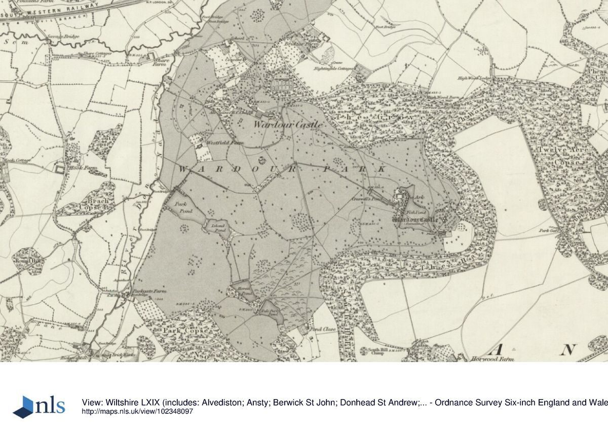
Wardour Castle, a site of c 342ha, is situated in a rural area c 8km south-west of Tisbury and immediately north-east of the village of Donhead St Andrew. The River Nadder forms the western boundary of the site, while the northern boundary is lined by Nightingale Lane. To the north-east, along High Wood, the boundary is formed by the remains of the park pale which enclosed the former deer park. To the south and south-east the building follows the edge of a series of plantations. North-west of the site runs the railway between Sherbome and Tisbury (along the River Sem), and to the south-east runs the A30 road. The site is mostly surrounded by agricultural land, with Bridzor Farm situated to its north, Park Gate Farm to the west, and Horwood Farm and Dairy to the south-east. The land at Wardour Castle is irregularly contoured, but generally slopes down from the east to the west and north-west and is lined with wooded hills to the north and east.
Entrances and Approaches
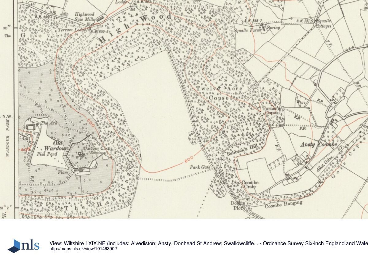
The main entrance, marked by a set of stone gate piers, is situated to the north of the site, on Nightingale Lane. From here a drive runs for c 300m south towards a turning circle below the north front of Wardour Castle. A second entrance, situated c 1.5km further east along Nightingale Lane, is marked by Terrace Lodge (C19). From here a drive curves gently through woodland for c 700m in a south-westerly direction towards a car park (introduced in the late C20) immediately north of Old Wardour Castle.
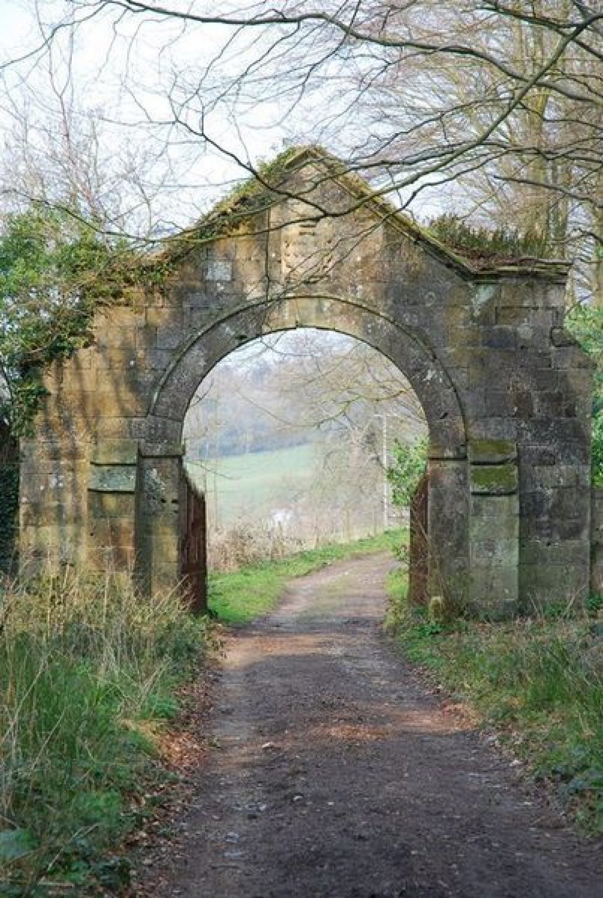
A third entrance (now, 2004, no longer used) is situated on the A30 road at the far south-east end of the site, flanked by Horwood Lodge (C19 with C20 additions). From here a track runs north-west and north through Horwood Bottom and South Hill Copse, where it leads under an early C19 ornamental arch (listed grade II) situated c 900m south-east of Wardour Castle. The stone arch is adorned with the coat of arms of the Arundell family.
Beyond the arch the track curves sharply eastwards, following the edge of a densely planted woodland called The Hanging, and then leads to the car park north of Old Wardour Castle. This drive, called The Terrace, was created in the early C19 and formerly offered extensive views not only of Old Wardour Castle situated below it, but also of the park, the lakes, Wardour Castle, and in the far distance Fonthill (qv) and the tower at Stourhead (qv), as described by John Claudius Loudon in 1833; these views are now overgrown.
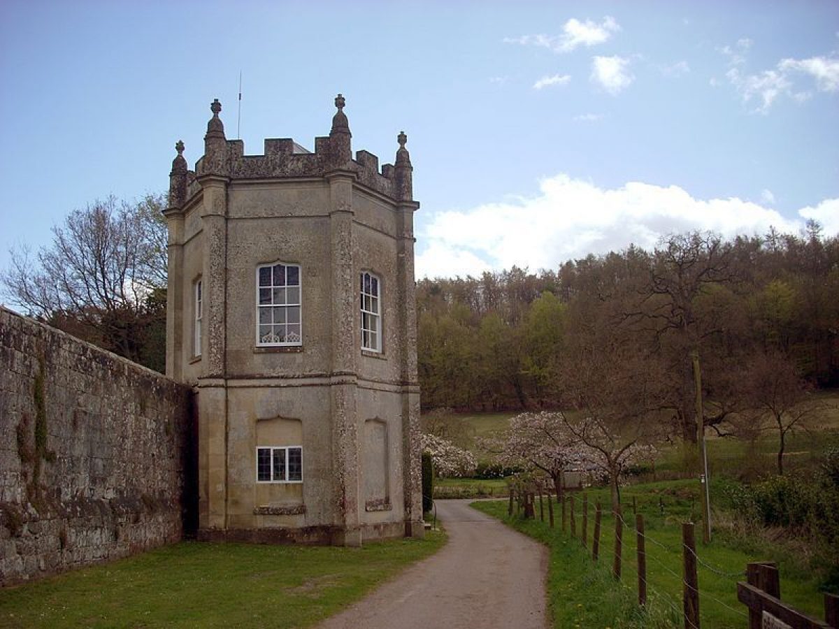
A fourth entrance is situated to the west, in the village of Donhead St Andrew. This entrance, flanked by Pile Oak Lodge (C19), gives access to a track that leads south-eastwards through Nower's Copse. A further entrance and lodge situated at the far southern tip of the site along the A30 road at Flatbury Hanging (OS 1890) had been removed by the mid C20.
Principal Building
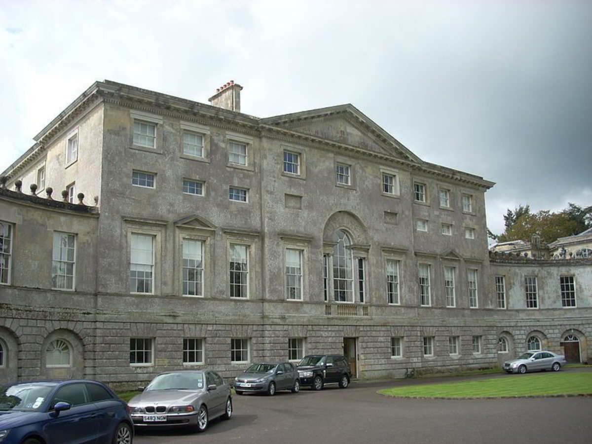
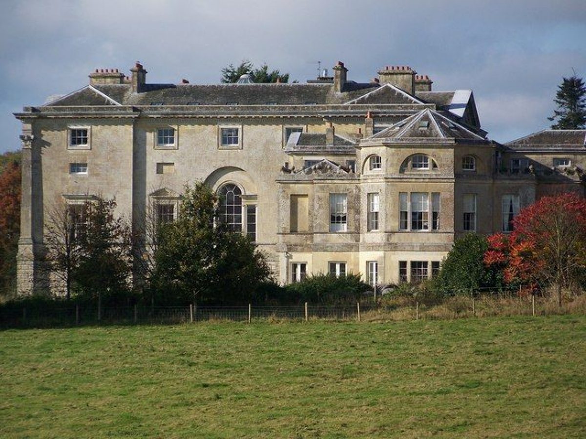
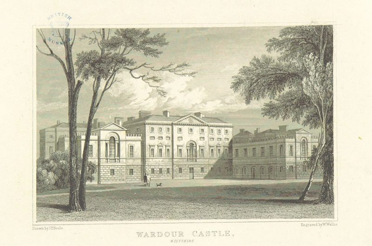
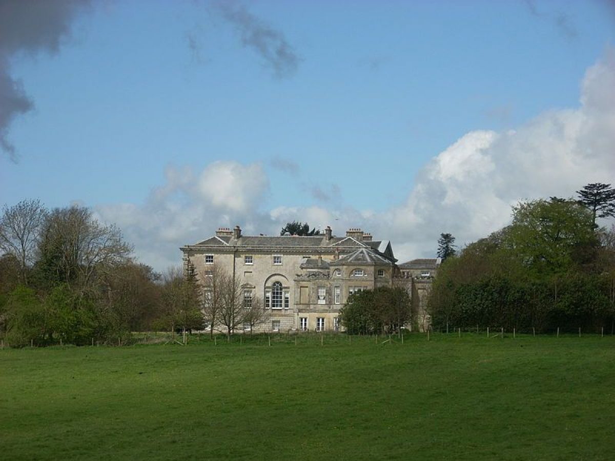
Wardour Castle (listed grade I), designed by James Paine in the late C18, is situated in the far north-west corner of the site. It is built of limestone ashlar with a hipped Welsh slate roof and ashlar chimney stacks. The house has a square main block with concave flanking pavilions on the north, entrance front. The west pavilion contains the late C18 Wardour Castle Chapel (listed grade I), a Roman Catholic parish church.
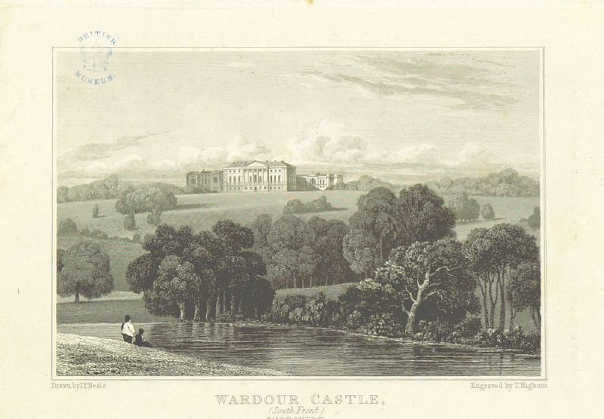
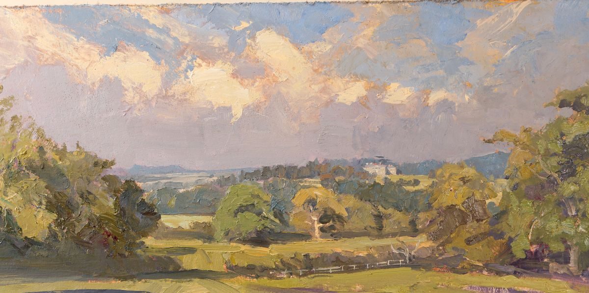
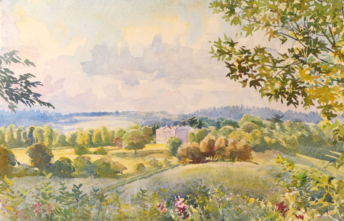
The entrance front has nine bays with the central three bays projecting forward, having a central door with a large Palladian-style window above with four sashes on either side. The south front has eighteen sashes in total, and as at the north front, a large central Palladian-style window with flanking niches above the central doors. From the windows on this side of the house are extensive views of the park leading the eye in both a south-westerly and a south-easterly direction towards the wooded hills in the distance, including Nower's Copse, Flatbury Hangings, and South Hill Copse.
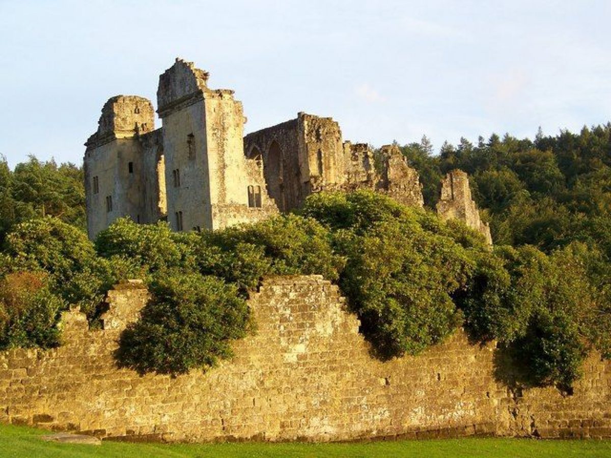
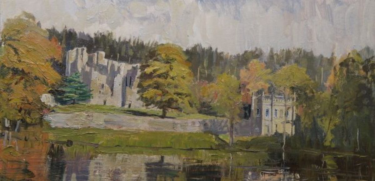
Old Wardour Castle (listed grade I), which stands c 1.2km south-east of Wardour Castle, was the main residence at Wardour until probably the mid C17 and stood in the north-east corner of an extensive deer park (Map of Wardour, ?C17). Some 70m south of Old Wardour Castle, outside the bailey wall, stands the C17 and C18 Old Wardour House (listed grade II), with a late C17 summerhouse to the rear (listed grade II). This building was probably built after Old Wardour Castle had become uninhabitable during the Civil War sieges of 1643 and 1644; it subsequently became the main family residence at Wardour and was probably used as such until the new Wardour Castle was completed in the 1770s.
Gardens and Pleasure Grounds
The gardens and pleasure grounds at Wardour Castle lie to its north-east, west, south, and east. Immediately to the south and east the house is surrounded by a lawn of c 6ha, which is enclosed by a ha-ha separating it from the park. The lawn was formerly laid out as school sports pitches, with tennis courts situated to the south-east of the house; these were removed in the early 1990s. Immediately east of the house is now (2004) a deep pit, which is the site of the recently (2002) demolished extension to the Castle built when it was in use as a school.
An ornamental dairy (1794, listed grade II) is located immediately to the north-west of the house. It overlooks a small lawn with a number of mature conifers around the edge. The dairy is surrounded by mature yews and an oriental plane. The south side of the lawn is lined with a series of fir trees, introduced in the late C20 and probably replacing a shrubbery (LUC 1993). In the corner of the lawn, c 100m west of the house, stands a limestone statue of St Anthony of Padua (listed grade II) surrounded by a small rockery. The early C19 statue was made by Joseph Theakston for William Beckford of the nearby Fonthill estate (qv), and was probably brought here after its sale in 1822.
Beyond this small garden, c 200m west of the house, lies Wardour Court, a housing development (late 1990s) consisting of a series of apartments built around a square courtyard. Wardour Court partly covers the site of former school buildings, and prior to that part of the Rookery, a wood situated to the south-west of the house. During the late C18 the Rookery was designed to include a walk lined with exotic trees and shrubs leading along the north side of the house to the kitchen garden and The Grove. The latter, also known as The Lady's Grove or Hare Grove, is a mature woodland situated c 300m north-east of the house. By the mid C18 (Survey, 1753) it included a pheasantry and was laid out with formal rides; these were partially softened and opened up following Richard Woods' proposals for the park as shown on his plan of 1764. At the south-east edge of The Grove are the remains of an icehouse that collapsed in the early 1990s (LUC 1993). The Grove was also adorned with a gothic pavilion or summerhouse designed by Richard Woods; this was later taken down and rebuilt at Hatfield Peverell. The very fine views from within The Grove towards Old Wardour Castle are now (2004) obscured by planting.
The pleasure ground of Old Wardour Castle lies within the walls of the bailey (listed grade II*), covering an area of c 2ha. It is laid to lawn and planted with mature specimen trees. A circular gravel walk, which runs along the bailey wall, starts at the visitors' entrance and ticket office situated c 80m north of the Old Castle. To the north-east, the pleasure ground is screened by High Wood and The Hangings. From the grounds are fine views of Creswell's Pond to the west, and of the park and Wardour Castle beyond it, now (2004) partly obscured by trees and planting.
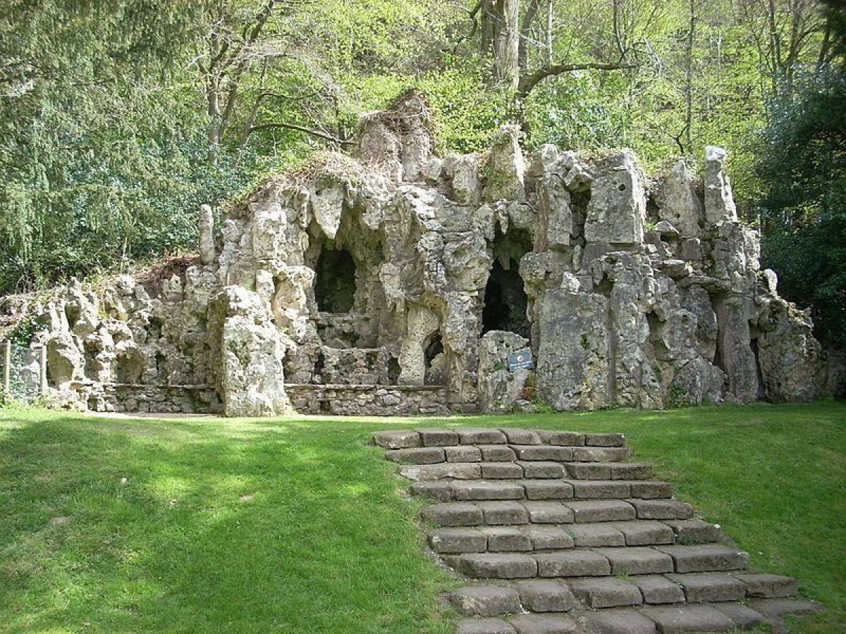
Within the pleasure ground, c 80m north-east of the Castle, stands a limestone grotto (listed grade II) built in 1792 by Josiah Lane of Tisbury, who also worked at nearby Fonthill (qv) and Bowood (qv). It is approached from the south-west by a flight of wide stone steps lined with mature yews which leads up a bank. The grotto has several entrances, rock niches at different levels, and interior tunnels. Some 80m south-west of the Old Castle is the C18 limestone Privy (listed grade II), built on the bailey walls. It has a ground-floor entrance outside the bailey and a first-floor entrance within the bailey. The mid to late C18 Banqueting House (listed grade II) stands c 50m to its north-west; this is now (2004) used as an exhibition space. The two-storey pavilion, built in Gothick style against the bailey wall, may have been designed by Lancelot Brown as part of his landscape proposals.
By the early C18 (Buck, 1732), Old Wardour Castle was surrounded by formal gardens with hedges, parterres, and topiary, probably dating from the late C17. This layout corresponds with the 'Pleasure Garden' indicated on a survey of Wardour dated 1753, which describes the area immediately to the north-east of the Castle as a 'Bowling Green'. Later, as shown on an undated view by James Canter (probably made between 1753 and the early 1770s; reproduced in Laird 1999), the Castle's ruins had a series of rectangular flower borders in the grounds to its west. During the 1770s this area may have been replanted and further improved as part of the wider landscape works recommended by Richard Woods (Laird 1999).
Park
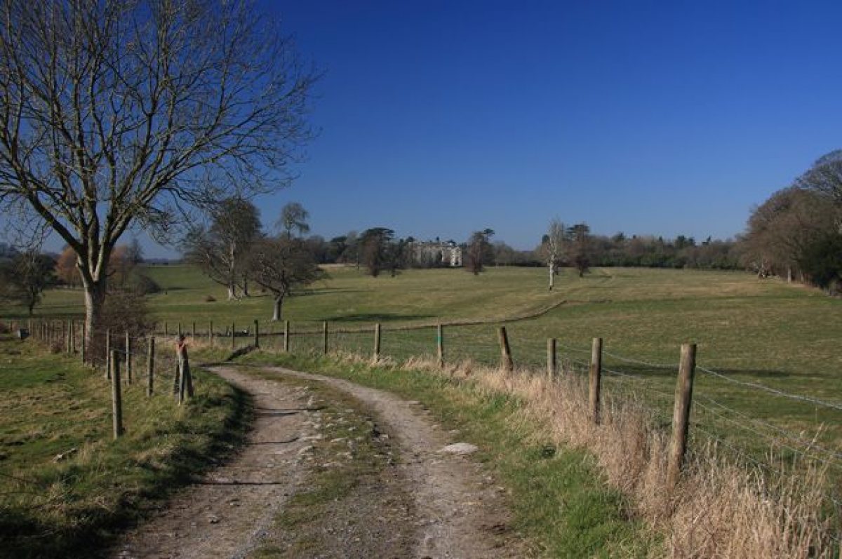
The park lies to the south and south-east of Wardour Castle and is enclosed to the north by woodland called The Grove and High Wood, to the east by The Hanging and South Hill Copse, to the south-east by Horwood Bottom and Flatbury Hanging, and to the south-west by Park Copse and Nower's Copse.
The park is planted with various clumps of mature trees (OS 1886) and is mostly grazed by sheep (2004). It slopes gently down into a valley with a series of ponds which are fed from a spring at Horwood Bottom in the far south-east corner of the park. From here, a stream supplies the water into Horwood Pond and then to Pond Close, Heron Pond, Island Pond, and Park Pond, after which it flows out into the River Nadder along the western border of the park. The ponds are now (2004) mostly silted up and the surrounding plantations are overgrown.
Two other ponds situated within the park c 400m north-west of Old Wardour Castle now (since the late C20) form part of the private garden of Ark Farm (CL 1993). The C18 Ark Farmhouse (listed grade II) is built of limestone and brick with a slate roof. The ponds, which may be of medieval origin, form an important feature throughout the development of the park and are first recorded on the early to mid C17 map of Wardour. As shown on his plan of 1764, Richard Woods proposed to create an informal lake, fed with water from the series of ponds, to be situated in the park south of the newly planned Wardour Castle but this part of his proposals appears never to have been executed.
Kitchen Garden
The walled kitchen garden and Camellia House (listed grade II*) are situated c 200m north-east of Wardour Castle and cover an area of c 3ha. The rectangular garden, which has an apsidal north wall, was designed by Richard Woods in 1769 and is shown in great detail on Ingman's survey of 1773. The Camellia House, which contains two mature camellias, stands against the internal north wall of the garden and is now flanked to east and west by six privately owned cottages. These were converted in the late 1990s from greenhouses and potting sheds that stood here. The formal garden of the Camellia House and the cottages has a central fountain with plant beds on either side and is bisected by paths, a layout introduced in the late C20.
Some 200m east of Old Wardour Castle is the site of a former diamond-shaped kitchen garden which had been removed by 1890 (OS). This garden, called the Old Garden on Woods' plan of c 1764, is also marked on the 1753 survey of Wardour; it may have been designed by Lancelot Brown as part of his landscape proposals of the 1750s (LUC 1993)
REFERENCES
John Rutter, Historical and Descriptive Sketch of Wardour Castle (1822)
Country Life, 68 (11 October 1930), pp 442-8; (22 November 1930), pp 646-52; (29 November 1930), pp 676-82; no 43 (22 October 1992), p 64; no 40 (7 October 1993), pp 62-5
B Cherry and N Pevsner, The Buildings of England: Wiltshire (2nd edn 1975), pp 549-54
T Hinde, Capability Brown (1986), pp 163-6
Victoria History of the County of Wiltshire XIII, (1987), pp 220-4
In Search of English Gardens: The Travels of J C Loudon and his wife Jane (National Trust Classics 1990), pp 153-4
Wardour Castle: Historic Landscape Survey and Management Plan, (Land Use Consultants 1993)
M Laird, The Flowering of the Landscape Garden (1999), pp 224-33
Old Wardour Castle, guidebook, (English Heritage 1999)
Maps
A Map of Wardour Castle and surrounding deer park, ?C17 (copy in LUC 1993)
A Survey of the land surrounding Wardour Castle, 1753 (copy in LUC 1993)
Plan showing proposed kitchen garden, 1754 (copy in LUC 1993)
Wardour Castle, proposal plan by Richard Wood, 1764 (Wiltshire and Swindon Record Office)
Wardour Castle, proposal plan drawn by James Ansell, assistant to Richard Woods, 1770 (Wiltshire and Swindon Record Office)
George Ingman, Wardour Castle, landscape survey of realized work, 1773 (copy in Laird 1999)
Wardour Castle, proposal plan by Lancelot Brown, 1775 (copy in LUC 1993)
OS 6" to 1 mile: 1st edition published 1890
Illustrations
James Canter, view of Old Wardour Castle, mid C18 (reproduced in Laird 1999)
Description written: March 2004 Amended: July 2004
Register Inspector: FDM
Edited: April 2005
- Visitor Access, Directions & Contacts
Telephone
01747 870487Access contact details
The site is open from 10 until 5 between March and October.
Owners
English Heritage
- History
The following is from the Register of Parks and Gardens of Special Historic Interest. For the most up-to-date Register entry, please visit the The National Heritage List for England (NHLE):
www.historicengland.org.uk/lis...
HISTORIC DEVELOPMENT
Old Wardour Castle, built for John, fifth Lord Lovel, dates from the late C14 and was remodelled in the 1570s for Sir Matthew Arundell by Robert Smythson. Smythson improved the Castle and its setting shortly after he worked at Longleat (qv) for Sir John Thynne. A map of Wardour, probably dating from the early or mid C17 (LUC 1993), shows the Castle, which is situated on an irregular hexagonal platform, set within an enclosed deer park, including a lawn, an avenue, and a series of ponds.
The Castle was partly destroyed during the Civil War sieges of 1643 and 1644 and a new house was built immediately to its south in 1686. This was surrounded by formal gardens with the Castle ruin as a picturesque centrepiece. In the early C18 further works were carried out to the formal gardens around the Castle, and the late C17 house was enlarged, possibly by Vanbrugh (ibid).
Under the ownership of the seventh Baron Arundell (1717-56), who had succeeded in 1746, the landscape retained many of its C17 and early C18 features (Survey, 1753). In 1754 the Baron consulted Lancelot Brown (1716-83), who produced a plan for alterations to the estate and may have advised on a new kitchen garden (LUC 1993). In 1763 the eighth Baron Arundell was advised by Joseph Spence on improvements to the estate with reference to Brown's plan (Garden Hist 1980). Richard Woods (1716-93) was employed to improve the gardens and park from 1764 to 1772, and he may have suggested a site for the new house planned by the eighth Baron (LUC 1993). A plan of c 1764 by Woods shows proposals for the park including Old Wardour Castle and the site of the new mansion. This became known as Wardour Castle and was built in 1770-6 to designs of James Paine (1717-89) on a site 1.2km to the north-west of the earlier building. Woods' landscape proposals were not all carried out, but by 1771 he had been paid nearly £4000 (ibid). In 1773, Lancelot Brown was once again consulted (Plan, 1775), but his proposals seem not to have been executed (Hinde 1986).
In 1822 John Rutter wrote his Historical and Descriptive Sketch of Wardour Castle as a guide to the house and grounds, and it appears that no major alterations took place in the C19 (OS 1880) and early C20. In 1934, the sixteenth Baron Arundell started a new planting scheme and repairs to Wardour Castle. In 1936 Old Wardour Castle was placed in the guardianship of the Ministry of Works (later English Heritage). After the sixteenth Baron's death in 1944, Wardour Castle and its immediate surrounds were sold to the Society of Jesus. In 1960 it became Cranborne Chase School, which closed in 1990. In 1992 it was sold into private ownership.
Period
18th Century (1701 to 1800)
- Associated People
- Features & Designations
Designations
The National Heritage List for England: Register of Parks and Gardens
- Reference: GD1484
- Grade: II*
Features
- Lawn
- Ha-ha
- Dairy
- Description: Ornamental dairy
- Statue
- Description: St Anthony of Padua
- Earliest Date:
- Latest Date:
- Rockery
- Grove
- Ruin
- Description: Old Wardour Castle, built for John, 5th Lord Lovel, dates from the late-14th century and was re-modeled in the 1570s for Sir Matthew Arundell by Robert Smythson.
- Pond
- Grotto
- Earliest Date:
- Latest Date:
- River
- Description: The River Nadder forms the western boundary of the site.
- Park Pale
- Description: To the north-east, along High Wood, the boundary is formed by the remains of the park pale.
- Plantation
- House (featured building)
- Earliest Date:
- Latest Date:
- Parkland
- Castle
- c
- Deer Park
- Key Information
Type
Park
Purpose
Ornamental
Principal Building
Domestic / Residential
Period
18th Century (1701 to 1800)
Survival
Extant
Hectares
342
Open to the public
Yes
Civil Parish
Tisbury
- References
References
- {English Heritage Register of Parks and Gardens of Special Historic Interest}, (Swindon: English Heritage, 2008) [on CD-ROM] Historic England Register of Parks and Gardens of Special Historic Interest
- Pevsner, N. and B. Cherry, {The Buildings of England: Wiltshire} (Harmondsworth: Penguin, 1975), pp. 549-54 The Buildings of England: Wiltshire
- Hinde, T., {Capability Brown: the story of a master gardener} (London: Hutchinson, 1986), pp. 163-6 Capability Brown: the story of a master gardener
- Crowley, D.A. {Victoria County History: Wiltshire, Volume 13} (London: Oxford University Press, 1987), pp. 220-4 Victoria County History: Wiltshire, Volume 13
- Related Documents
- CLS 1/96/385
-
CLS 1/350
Historic Landscape Survey and Management Plan - Digital copy
LUC - 1993
-
CLS 1/408
Strategic Masterplan - Digital copy
Dominic Cole Landscape Architects - 2014