Introduction
Sandbeck Park and Roche Abbey have gardens, pleasure grounds and a landscape park. The pleasure grounds at Sandbeck cover around 9 hectares within a park of some 250 hectares. Roche Abbey is a site of some 23 hectares.
Terrain
The site is on rolling land which slopes gently down to the north from the south-east boundary and rises to the west and north-west.
The following is from the Register of Parks and Gardens of Special Historic Interest. For the most up-to-date Register entry, please visit the The National Heritage List for England (NHLE):
www.historicengland.org.uk/lis...
Pleasure grounds and park of c 1760(78 by Lancelot Brown for the fourth Earl of Scarbrough incorporating elements of a C17 park and mid C18 landscaping with C19 alterations.
Location, Area, Boundaries, Landform and Setting
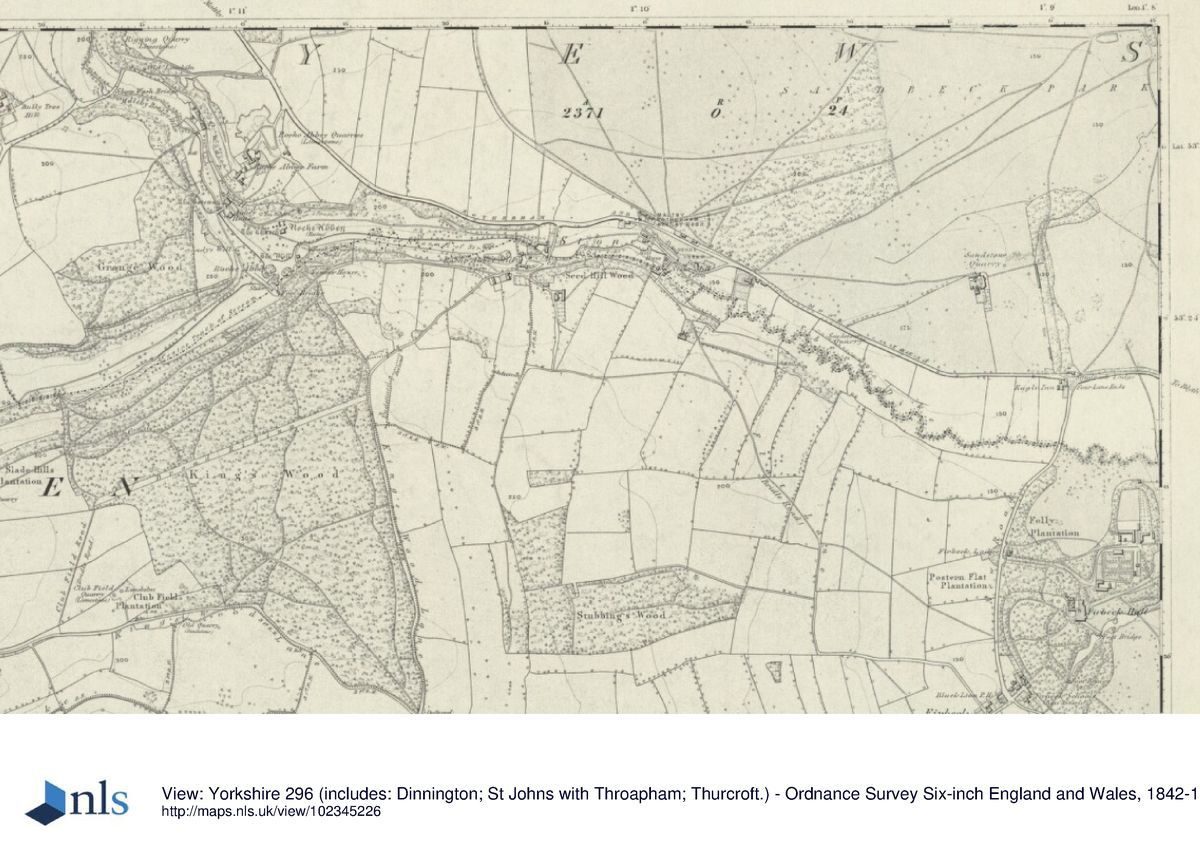
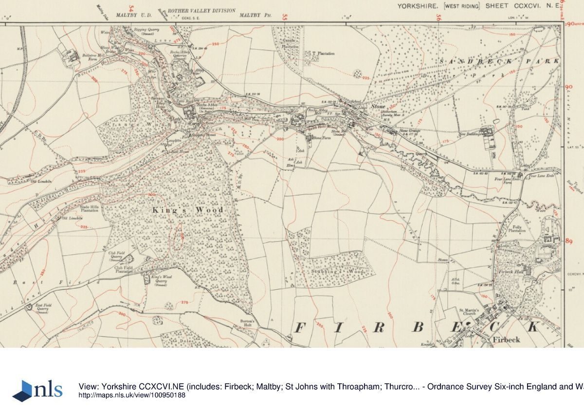
Sandbeck Park lies c 3km south-east of Maltby in a rural and agricultural setting. The A634 between Stone and Four Lane Ends marks the southern limit of the site. Other boundaries to the west and north blend into surrounding fields. On the north-east side of the site North Walk and part of Folds Lane form the boundary, and a strip of woodland called New Whin Covert extends to the east alongside the drive from the east at Malpas Hill. The c 250ha site is on rolling land which slopes gently down to the north from the south-east boundary and rises to the west and north-west.
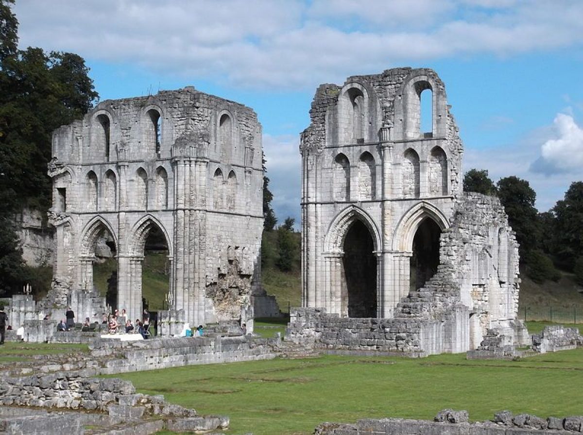
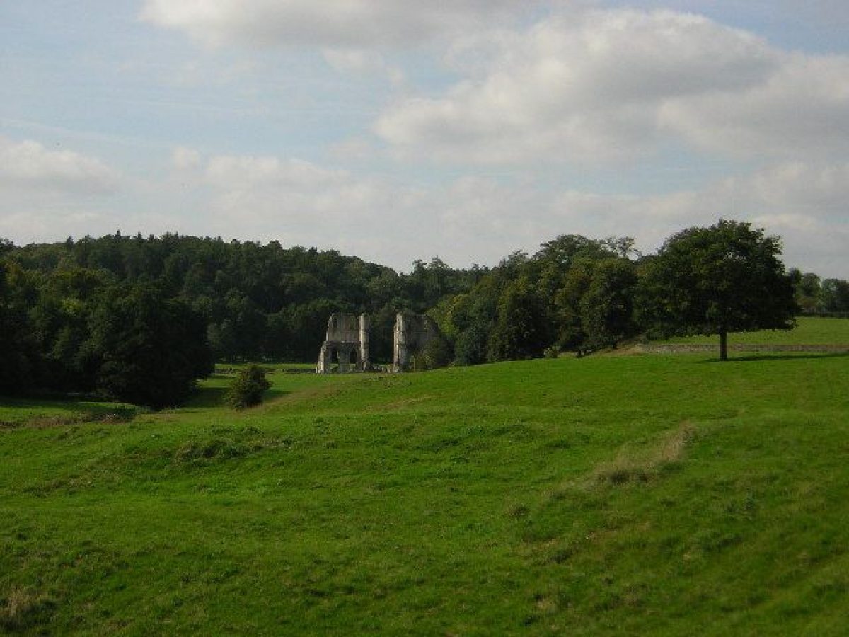
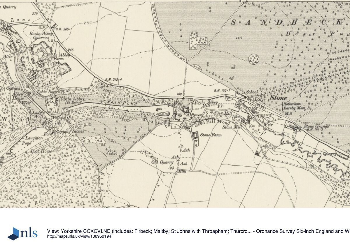
Roche Abbey lies c 400m to the south-west of the west side of Sandbeck Park in the valley of Maltby Dike at its confluence with Hooton Dike (sometimes called Laughton Dike). The c 23ha site is bounded on the north side by A634 and by a sinuous boundary leading westwards to the C12 gatehouse. The remaining boundaries blend with surrounding woodland.
Entrances and Approaches
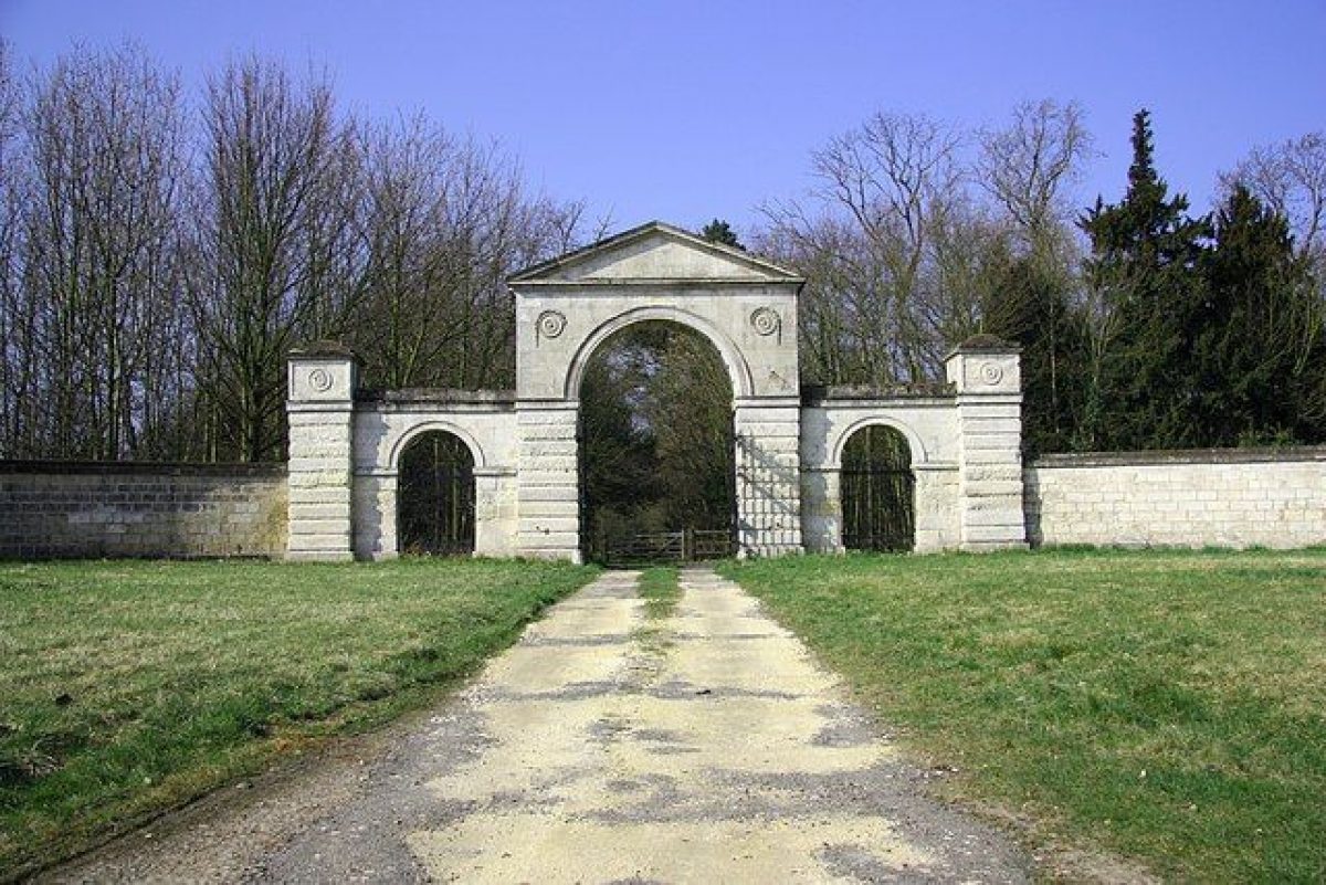
An entrance with a lodge and gateway (c 1760, attributed to James Paine, listed grade II) stands on the north side of the A634 at Four Lane Ends, and a drive, constructed in 1773, leads northwards to the Hall as an avenue. On the east side of the site there is an entrance gateway by Paine (listed grade II*) on Malpas Hill. From this, a drive laid out in 1766 leads west and joins with the drive from Four Lane Ends (this route appears in different form on Jefferys' 1771 county map which shows a proposal, probably by Brown, which was not fully executed). An entrance with a lodge on the north side of the A634 at Stone, at the south-west tip of Sandbeck Park, leads to a track which runs north-eastwards to join with tracks leading to the Hall and through the park. An entrance with stone gate piers and a lodge (probably by Paine, listed grade II), lies c 400m north-west of the Hall and is reached from private roads running south-east from Blyth Gate Lane.
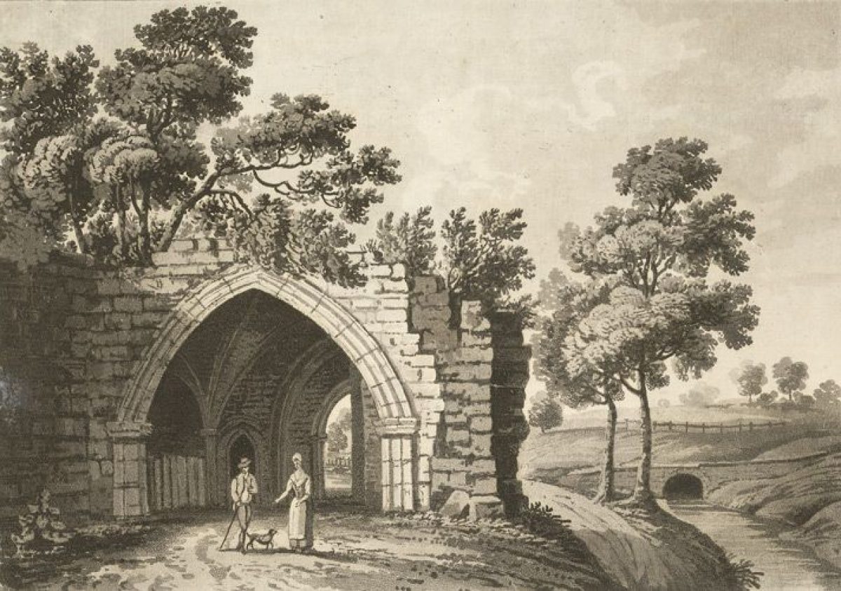
Roche Abbey is reached from a lane which runs south from the A634 and descends the valley side. The ruined remains of the C12 gatehouse lie at the foot of a limestone cliff at the entrance, and c 30m to the south is the gothic Abbey House (extant by 1784, listed grade II) which is in use as a ticket office and museum (1998).
Principal Building
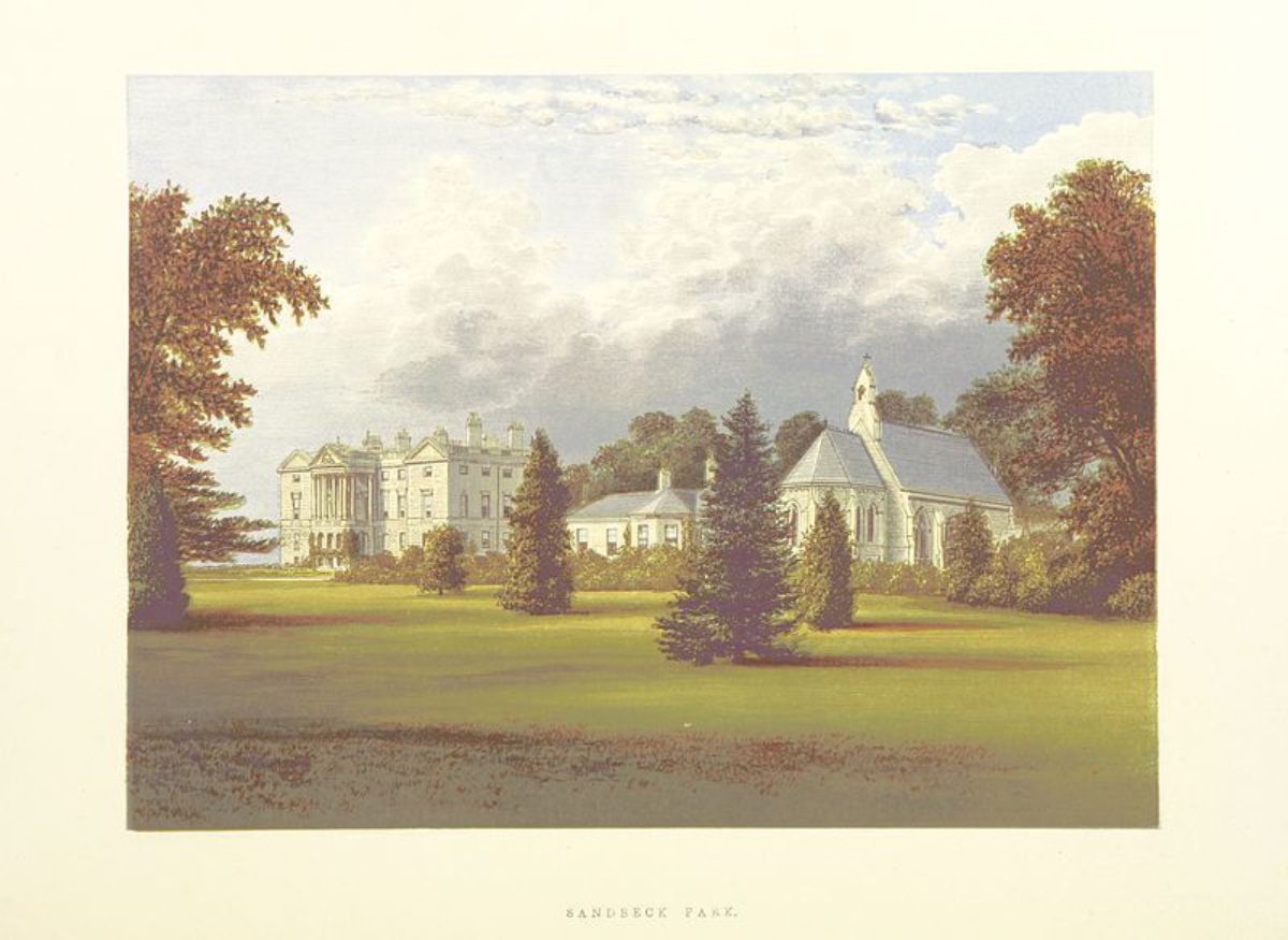
Sandbeck Hall (listed grade I) was built c 1765(8 to the design of James Paine (1717(89) for the fourth Earl of Scarbrough, replacing a house built for Sir Nicholas Saunderson in 1626(7. Interior alterations were made in 1857 by William Burn and further alterations of 1954 by Claude Phillimore included the demolition of a C19 wing which linked the house to a chapel of 1869 by Benjamin Ferrey (listed grade II), which lies c 70m north of the Hall. A stable block by James Paine (listed grade II*) lies c 70m north-west of the Hall. Sandbeck Hall is in use as a private residence (1998).
Gardens and Pleasure Grounds
There is a grassed terrace on the east and south sides of the Hall, and two flights of stone steps lead down to a sweeping lawn. The area immediately east of the Hall is shown on an estate map of 1724 as gardens and orchards. A substantial ha-ha (ha-ha and steps listed grade II) runs along the south side of the Lawn and turns northwards around a lawn on the west side of the Hall. That to the south of the Hall was dug in 1771, and that to the west in 1772, probably under the supervision of Adam Mickle senior. There are views from the terrace over Upper Lake to the east and across rising land to the south. From the west side of the Hall there are views across the park to the north-west, and along an avenue to the west.
Park
The park is a mixture of pasture and arable land. To the east of the Hall there are two lakes, Upper Lake and, further to the east, Lower Lake. Upper Lake has two arms of water reaching from its south-west tip which bound the north and east sides of the east lawn in front of the Hall. Folds House (listed grade II) overlooks Lower Lake from its east side. Estate accounts of the period 1750(3 (quoted in Rodgers 1998) record payments for building the house and for digging a 'new pond in the Cow Close', which must be the stretch of water subsequently developed as Lower Lake. The pleasure grounds in this area included a bowling green and 'chines works' (estate records, quoted in Rodgers 1998) of which no visible trace remains.
On the north side of the lakes North Field is bounded to the north by a shelter belt with a ride leading through it called North Walk. Estate accounts record work in North Field in 1763 which included fencing of clumps, and in 1765 'stubbing trees in the new pond' probably refers to work on Upper Lake.
Payments to Brown totalling £1250 made between January 1762 and February 1768 are recorded in the fourth Earl's personal account book but it is not clear what they were for and some may refer to work on his Glentworth estate in Lincolnshire. The creation of the Upper Lake and the layout of the area around the lakes was presumably the subject of Brown's first contract, which has not survived, but it is not known what else was included.
On the west side of the Hall a double avenue of limes and chestnuts, planted in 1919 to commemorate the Armistice of 1918, is aligned with the west front in an area of open pasture which is shown on the 1724 map as open land marked 'Lawn'. This was almost the only area of the park to remain open grassland when the park reverted to agricultural use, a process which had started as early as 1785 in response to a need to raise additional income after the death of the fourth Earl in 1782.
The Horsepond lies c 200m north-west of the Hall, opposite the stables, and c 800m north-west of the Hall the Gamekeeper's House (probably by Paine c 1760, listed grade II) forms an incident in the landscape. A tree-lined track running south from the Gamekeeper's House is on the line of an avenue shown on the 1724 map. The stub of another avenue shown on the map lies to the north of a farm complex called New Buildings, c 800m south-west of the Hall. Light woodland with mature oaks and chestnuts in the south-west part of the park has the remains of three rides or vistas running through it which are part of a more extensive series of rides shown beyond the Lawn on the 1724 map.
The western part of the park is shown on Jefferys' 1771 map as an oval area with shelter belts, clumps and drifts of trees, probably representing Brown's unexecuted proposal drawings which were presumably made available to Jefferys' surveyors. This part of the park was altered in some respects under Brown's second contract, which was signed in September 1774. The works mentioned included the removal of the flight of ponds north of the Lawn, the completion of the sunk fence between the park and the farm (probably the section which runs north-west towards Round House) and the making good of the Horsepond. The contract lists the phasing of future payments, amounting to £3000 in all. The actual works, which were supervised by Adam Mickle senior, bear little relation to what is shown on Jefferys' map.
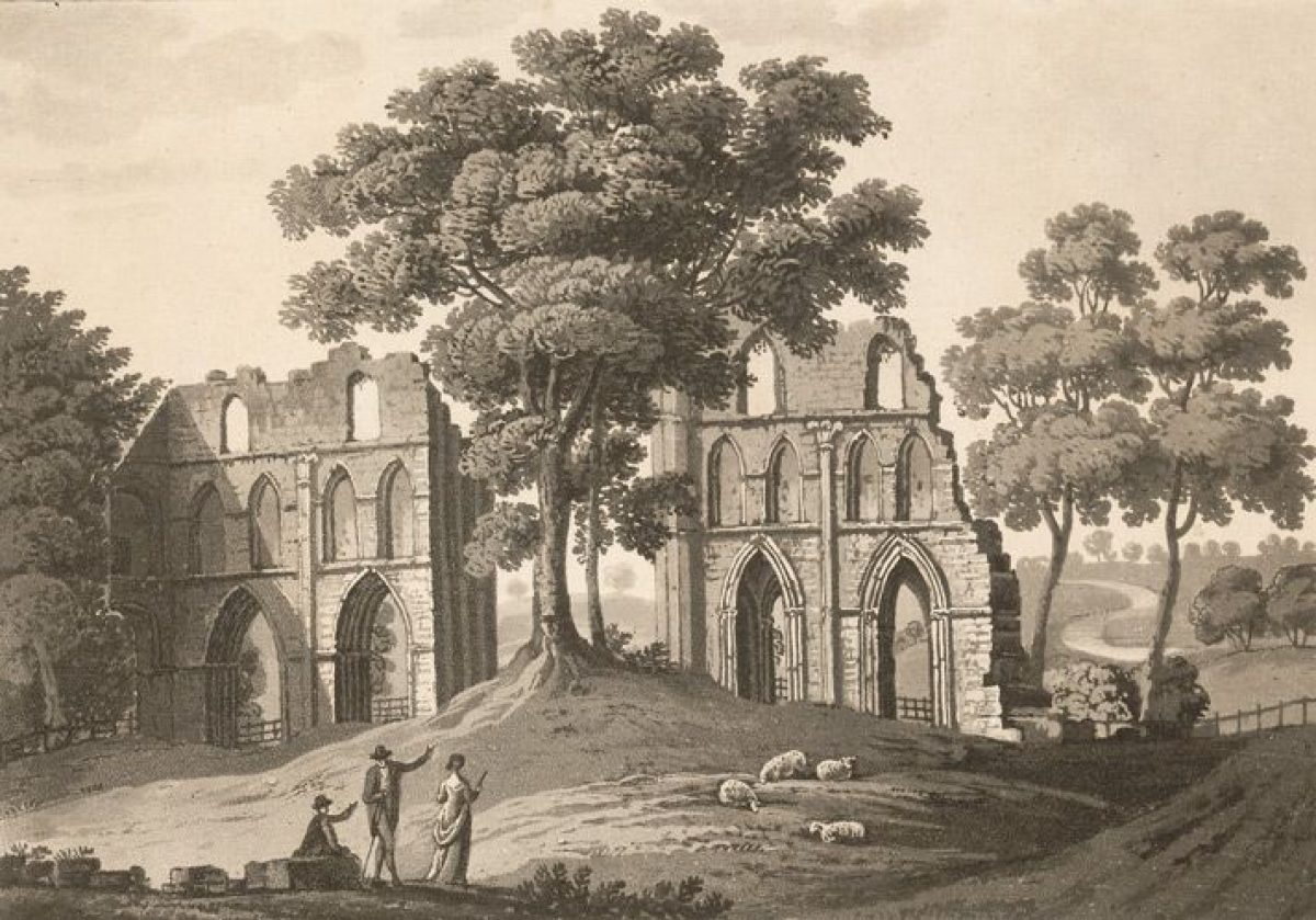
Roche Abbey can be seen from the south-west end of Sandbeck Park and from the A634. The ruins are set in the valley bottom alongside the Maltby Dike, which runs approximately east/west through a narrow valley. The slopes of the valley are wooded on all sides but that adjoining the A634. Maltby Dike, which descends to the east of the gatehouse and Abbey House before continuing south-eastwards through the ruins, was returned to its medieval course following the archaeological excavation of the site between the wars. Some 100m to the south-west, Laughton Pond is concealed by tree cover and because it is at a higher level than the ruins. A stepped cascade (listed grade II) at the south-east end of the Pond delivers water to a point c 80m south-east of the ruins where it joins with the Maltby Dike. The C18 route of the watercourse described a serpentine course and an expanse of water with islands lay to the south of the ruins at the confluence of the dikes. When the area was drained as part of the archaeological investigation of the site Laughton Dike was also returned, in part, to its medieval course through the ruins.
Brown's work at Roche Abbey was undertaken as part of the second contract of 1774 which specified that he was to 'finish all the valley of the Roach in all its Parts, According to the Ideas fixed with Lord Scarbrough (with Poets feeling and Painters eye) beginning at the head of the Hammer Pond and continuing up the valley towards Loton ... in the Morn as far as Lord Scarbroughs Ground goes, and to continue to Water and Dress the valley up by the Present Farm House untill it comes to the separation fixed for the boundaries of the New Farm. N.B. The paths in the Wood are included in this Discription and every thing but the Buildings.' (private collection).
The work of constructing Laughton Pond had been completed by 1776 when it was described, with a view over to the spire of the church at Laughton to the west, by William Gilpin, who describes the abbey ruin as appearing to stand on 'a neat bowling green (quoted in Rodgers 1998). The level of the ground around the ruins was raised by upto two metres using the spoil from Laughton Pond and the re-routing of Maltby Dike, so that the foundations were concealed and the upstanding ruins rose from a greensward.
Roche Abbey was much visited by travellers in the late C18 and early C19, but antiquarian interest led to excavations in the late 1850s which continued intermittently until the 1930s resulting in the removal of most of Brown's layout apart from Laughton Pond and the cascade from it.
Kitchen Garden
Walled kitchen gardens lie c 300m north of Sandbeck Hall, and the glasshouses and interior layout shown on the 1931 OS map have largely disappeared. An enclosure marked to the north of the Hall on the 1771 county map may represent the garden.
REFERENCES
F O Morris, A Series of Picturesque Views 5, (1866(80), pl 15
Country Life, 138 (7 October 1965), pp 880-3; (14 October 1965), pp 966(9; (21 October 1965), pp 1024-7
N Pevsner, The Buildings of England: Yorkshire The West Riding (1967), pp 414-17, 429-30
D Stroud, Capability Brown (1975), pp 138-40
T Beastall, A North Country Estate (1975), pp 82-7, 116-17
K Lemmon, The Gardens of Britain 5, (1978), p 138
Capability Brown and the Northern Landscape, (Tyne & Wear County Council Museums exhibition catalogue 1983), pp 33-4, 43
Melvyn Jones (ed), Aspects of Rotherham (1995), pp 89-98
Melvyn Jones (ed), Aspects of Rotherham 2, (1996), pp 95-114
Maps
J Dickinson, Map of the gardens and park at Sandbeck, 1724 (private collection)
T Jefferys, County Map, 1772
R Smith, Plan of the Parish of Maltby, 1841 (private collection)
OS 6" to 1 mile:
1st edition surveyed 1850
1931 edition
OS 25" to 1 mile: 2nd edition surveyed 1901
Archival items
A Rodgers, Landscaping at Sandbeck Park and Roche Abbey (1998), (unpub typescript)
Additional information and interpretation by A Rodgers.
Description written: October 1998 Amended: March 1999
Register Inspector: CEH
Edited: November 1999
- Visitor Access, Directions & Contacts
Access contact details
Roche Abbey is open between March and September on Thursday-Sunday and bank holidays. Sandbeck Park, however, is NOT OPEN TO THE PUBLIC.
Directions
The site is off the A634, south of Maltby.
Owners
English Heritage
PO Box 569, Swindon, SN2 2YP
- History
The following is from the Register of Parks and Gardens of Special Historic Interest. For the most up-to-date Register entry, please visit the The National Heritage List for England (NHLE):
www.historicengland.org.uk/lis...
HISTORIC DEVELOPMENT
The Cistercian monastery of Roche Abbey was founded in 1147. Sandbeck was granted to the abbey in 1241 and after the Dissolution it was disposed of as a monastic manor. The core of the Sandbeck estate was gradually accumulated by the Saunderson family during the second half of the C16 and first half of the C17. Roche was bought by Nicholas, first Viscount Castleton, in 1627. A Royal licence to impark c 150ha of the Sandbeck estate was granted to the second Viscount in 1637. The estate remained in the Saunderson family until 1723 when the last of the line, who had become the first Earl of Castleton, willed it to his cousin, Sir Thomas Lumley. Lumley became third Earl of Scarbrough in 1739 and it was his son, Richard, the fourth Earl, who engaged Lancelot Brown (1716(83) in 1760. The fourth Earl was noted for his 'great taste for the fine arts, particularly architecture and planting' (James Paine quoted in CL 21 October 1965) and he almost certainly contributed to Brown's design of the landscape. Brown undertook two contracts, the first of which was supervised by Thomas White (1736(1811) and Adam Mickle senior, and the second by Adam Mickle junior. The Sandbeck estate, including Roche Abbey, remains in private ownership and Roche Abbey ruins (scheduled ancient monument) are in the guardianship of English Heritage (1998).
Period
- 18th Century (1701 to 1800)
- Late 18th Century (1767 to 1800)
- Associated People
- Features & Designations
Designations
The National Heritage List for England: Register of Parks and Gardens
- Reference: GD2165
- Grade: II*
Scheduled Ancient Monument
- Reference: Roche Abbey ruins
Features
- Cistercian Abbey (featured building)
- Description: The abbey has one of the most complete ground plans of any English Cistercian monastery.
- Earliest Date:
- Walk
- Description: North Walk.
- Gardens
- g
- Key Information
Type
Park
Purpose
Ornamental
Principal Building
Heritage Site
Period
18th Century (1701 to 1800)
Survival
Part: standing remains
Hectares
273
Open to the public
Yes
Civil Parish
Maltby
- References
References
- {English Heritage Register of Parks and Gardens of Special Historic Interest}, (Swindon: English Heritage, 2008) [on CD-ROM] Historic England Register of Parks and Gardens of Special Historic Interest
- Stroud, Dorothy {Capability Brown} (London: Faber, 1975) 138-40 Capability Brown
- Pevsner, N., {The Buildings of England: Yorkshire The West Riding} (Harmondsworth: Penguin Books, 2nd edition 1967), pp. 414-7, 429-30 The Buildings of England: Yorkshire The West Riding
- Lemmon, K., {The Gardens of Britain 5: Yorkshire and Humberside} (London: Batsford, 1978), p. 138 The Gardens of Britain 5: Yorkshire and Humberside