
Introduction
Richmond Park is a royal deer park and public open space. It has woodland, gardens, water features and various residences. During the 20th century various recreational facilities have been created including two golf courses, sports pitches and a polo field.
Terrain
Undulating.www.historicengland.org.uk/listing/the-list
A royal deer park with pre C15 origins, imparked by Charles I and improved by subsequent monarchs. A public open space since the mid C19.
DESCRIPTION
LOCATION, AREA, BOUNDARIES, LANDFORM, SETTING
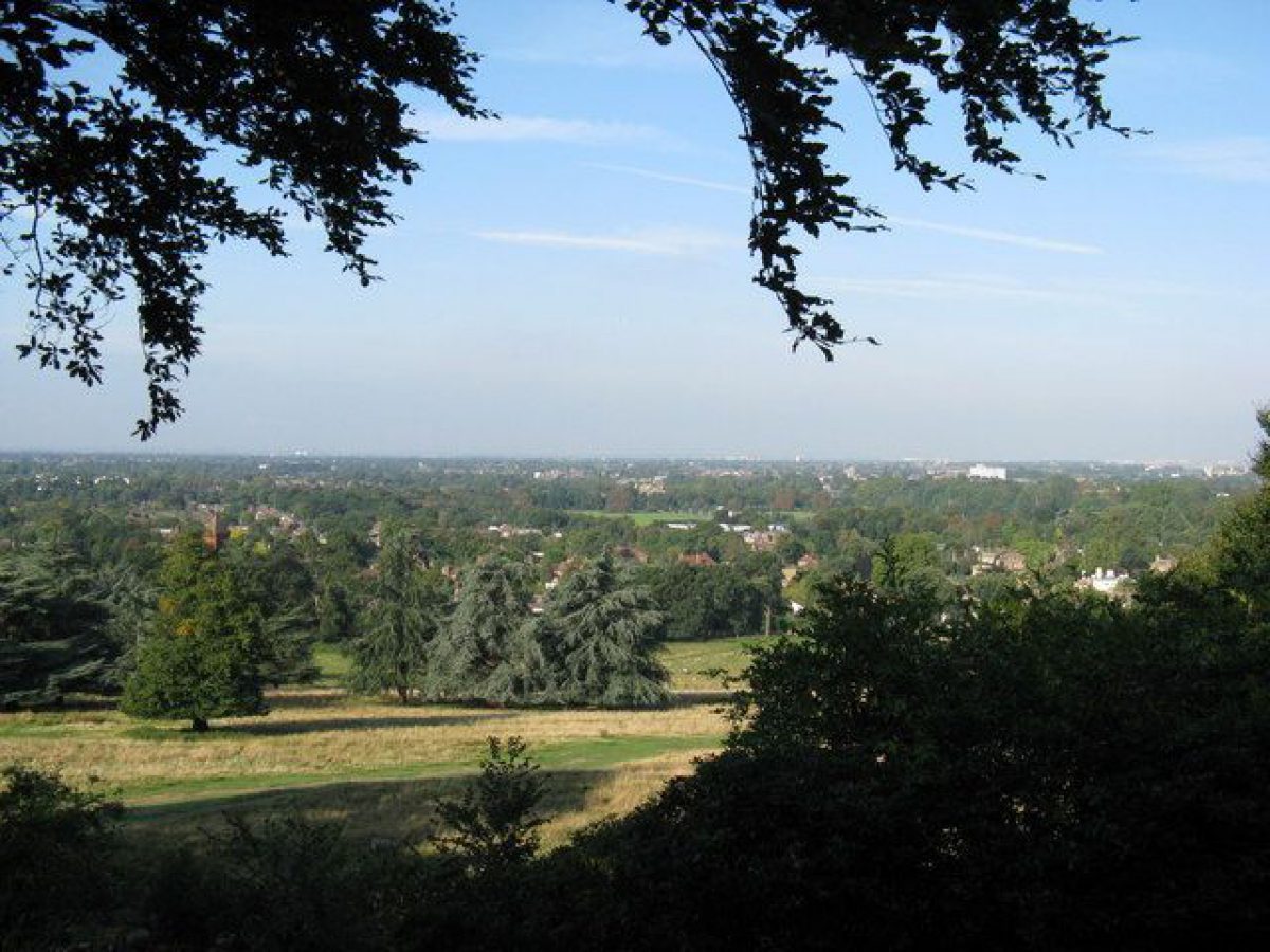
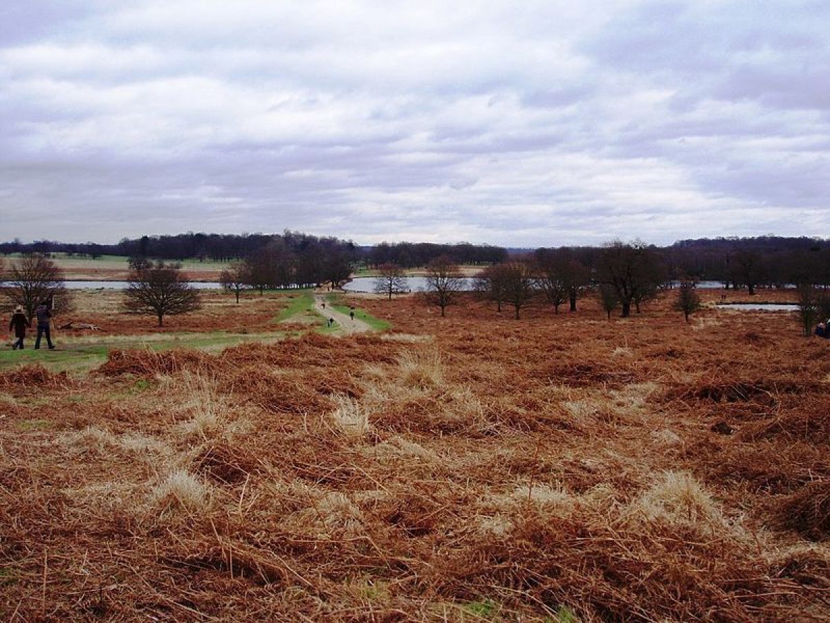
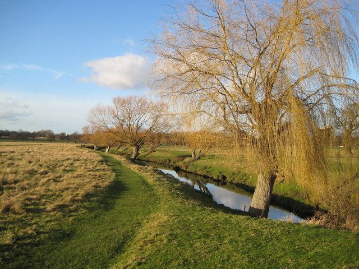
Richmond Park is located in outer south-west London and is surrounded almost entirely by urban development: houses back onto much of the park. The town of Sheen lies c 1km to the north, Roehampton c 1km to the north-east, Petersham c 500m to the west, and Richmond c 1.5km to the north-west. To the south-west the park borders with Sudbrook Park. Beyond Star and Garter Hill to the west-north-west is Petersham Common and to the north is East Sheen Common. The c 1000ha site is enclosed within eight miles of brick wall (listed grade II) built between 1630 and 1637 and repaired many times during its long history. The undulating parkland has high areas to the west, east, and south-east and is crossed by numerous horse rides and footpaths which connect with the roads, entrances, and other features. Plantations are a major feature of the park and many pieces of water are distributed around the site, with lesser streams or drains generally flowing to the north-east.
ENTRANCES AND APPROACHES
The main entrance to Richmond Park is from Richmond Hill to the north-west through Richmond Gate (widened 1896, listed grade II), and past Richmond Gate lodges (listed grade II). The road then divides, one branch, Sawyer's Hill, leading to the east and the other (un-named) to the south. These roads provide vehicular access around the park and link to five additional entrances.
PRINCIPAL BUILDING
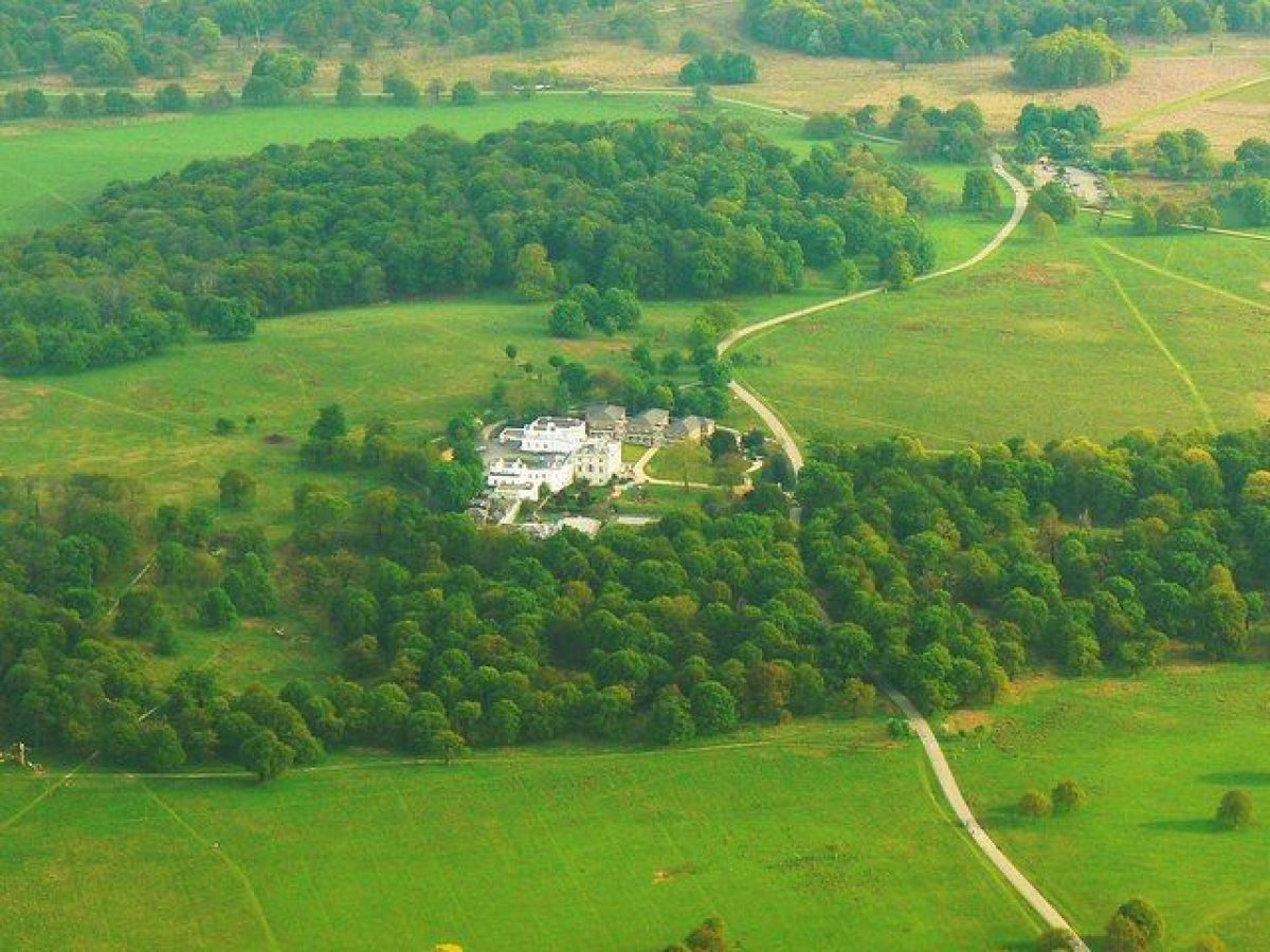
The brick- and stone-built White Lodge is situated to the south-east of the park and is approached from the west by the mid C18 Queen¿s Ride, an oak and sweet chestnut avenue over 1km in length which connects to Sawyer's Hill.
White Lodge (listed grade I), initially built as a shooting box, is an elegant Palladian villa, five bays wide with a central staircase to the first floor. The engaged Doric columns above support entablature and pediment. Building was begun in c 1727 from designs by Henry, Earl of Pembroke, probably assisted by Roger Morris, and finished two years later for George II. The Lodge was enlarged 1751-2 by Stephen Wright with further additions in 1801 by James Wyatt. Originally known as Stone Lodge, the name changed first to New Lodge and then in 1768 to White Lodge. In 1805 Humphry Repton (1752-1818) was called in to lay out c 2ha of grounds around the house. The house was further extended in the late C20 for its current (1998) occupiers, the Royal Ballet School.
PARK
From Richmond Gate, Sawyer's Hill runs c 3km east to Roehampton Gate passing, to the north, the C19 Conduit Wood and Holly Lodge (today, 1998, the Park Office and Environmental Centre). This building was shown on Eyre's map of 1754 as Cooper's Lodge, on Richardson's plan of 1771 as Lucass Lodge, and until the late C20 was known as Bog Lodge. Beyond Holly Lodge the road passes south of Two Storm Wood, planted to commemorate the trees lost in the storms of 1987 and 1990. After c 2km the road divides, the northern branch leading to East Sheen Gate with the C19 Sheen Wood to the west and C18 Adam's Pond (today used for sailing model boats) to the east. The road continues east, past the polo field to the south, to Roehampton Gate where it turns sharply to the south, crossing over Beverley Brook which runs along the boundary of the c 85ha Richmond Park Public Golf Course which lies to the east.
Continuing south the road passes paths which lead west to White Lodge, Victory Plantation (planted C20), and Spankers Hill Wood. Spankers Hill Wood was first planted in 1819 with oak, larch, spruce, sweet chestnut, and other trees, the western slopes being planted in 1824 and an extension to the north-east enclosed and planted in 1877. After 2km the road passes to the west of the Robin Hood Gate entrance. A spur road leads 0.75km north-west to a car park at the south-west corner of Spankers Hill Wood. The main route leads south-west where it climbs up through Broomfield Hill Wood passing, after c 0.75km, a car park to the east and the entrance to Isabella Plantation to the west. The 17ha Isabella Plantation was established in 1831 when Lord Sidmouth enclosed an area of oak, beech, and sweet chestnuts known as Isabella Slade. From 1950 the plantation was made into a woodland garden by J M Fisher (who also began the Waterhouse Plantation at Bushy Park (qv) in 1949). Divided from north to south by a stream which flows to Peg's Pond in the north, this garden was further developed by George Thompson between 1951 and 1953 when it was opened to the public. The Isabella Plantation is well known for displays of bluebells, camellias, azalias and rhododendrons. The road continues south-west to a network of paths west of Ladderstile Gate and then runs parallel to the south-east boundary to the Kingston Gate at the southern tip of the site. The Bog Garden was refurbished in 2000.
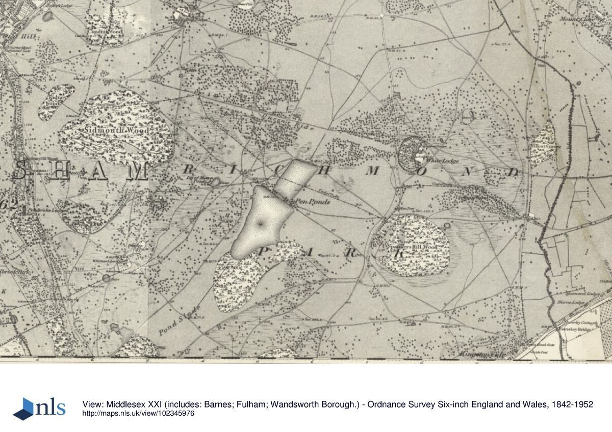
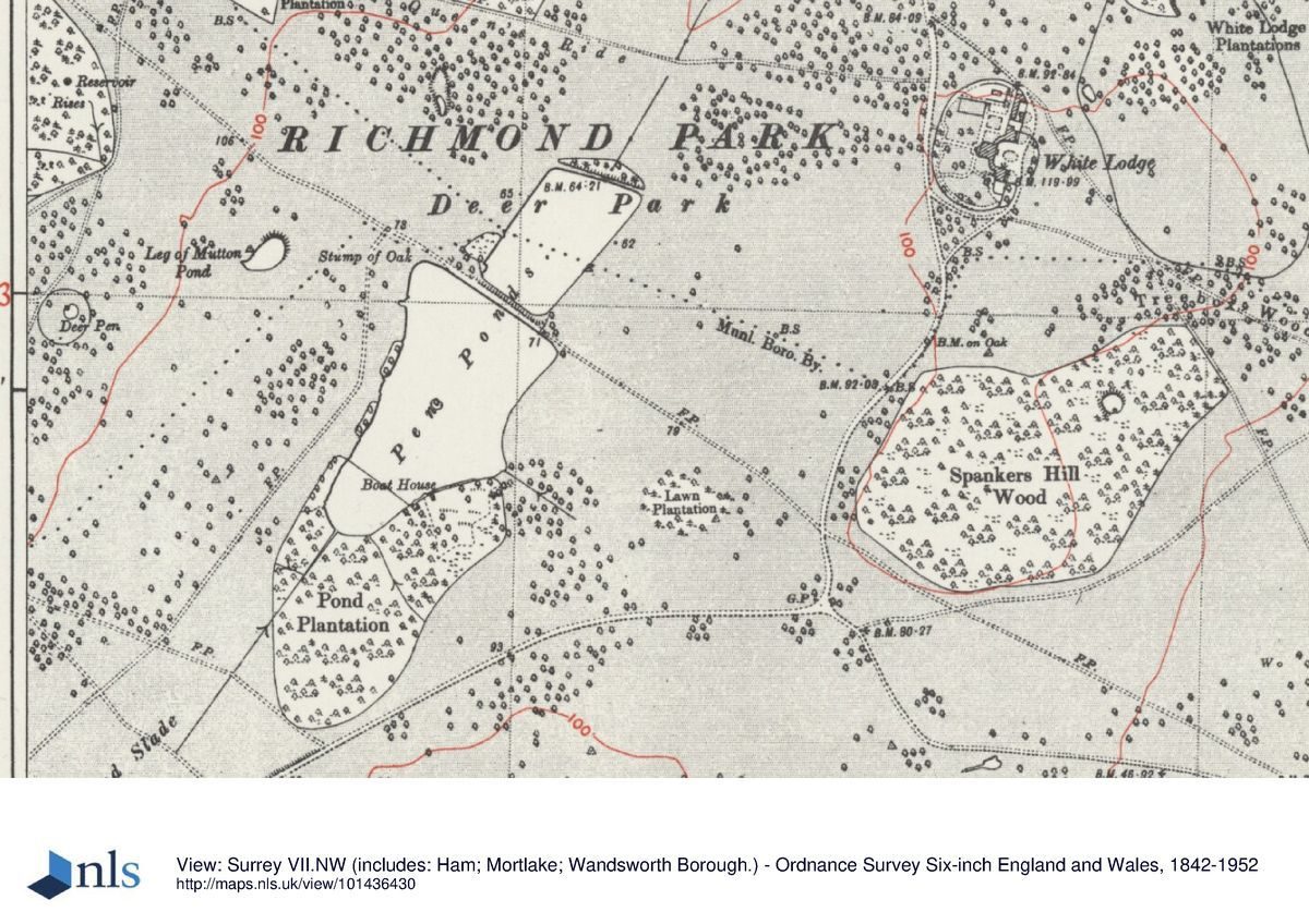
Some 200m north of the Kingston Gate the road divides again, the southern spur leading out of the park and the northern route turning north-north-west, passing c 200m west of Thatched House Lodge. Thatched House Lodge was begun in the mid C17 and enlarged c 1727, possibly by William Kent for Sir Robert Walpole, and remains a private residence. The thatched house which gives the lodge its present (1998) name is a summerhouse erected c 1727 in the 2ha grounds of the Lodge. After 1.25km the road divides, the western spur leading 0.5km to Ham Gate and Ham Gate Lodge (C19, listed grade II). To the north-east a horse ride and cycle path leads c 0.75km to the C19 Pond Plantation. Beyond the Plantation to the north-east are the c 12ha Pen Ponds. The two pieces of water, separated by a causeway, were created in the mid C18 from steams that run through the park and the ponds appear little altered from 1771 when they were identified on Richardson's map as 'Canals'.
The road continues c 1km north-west to Pembroke Lodge, passing White Ash Lodge (C18, listed grade II) c 300m to the east. Running almost parallel with the west side of the road is Hornbeam Walk. Developed in the mid C18, the walk leads c 1km north into the gardens of Pembroke Lodge, a white-painted, two-storey building with a Tuscan porch and pediment. Now (1998) used as a restaurant, the erstwhile C18 mole-catcher's house was altered and improved in 1788 by Sir John Soane for Elizabeth, Countess of Pembroke. Over the following forty years the Countess further enlarged the building. Surrounding Pembroke Lodge are c 5ha of semi-formal gardens laid out in the C20. A path leads north from the gardens to the highest spot in the park, known as the King Henry VIII's Mound. Possibly a Bronze Age barrow, it is recorded on C17 maps as The King's Standing and may well have been used by the King either to shoot deer or watch the hunt as it passed. To the west there are impressive views across Petersham Park, added to Richmond Park in 1834, to the Thames Valley; to the east is a protected view of London, the Post Office Tower, and on a clear day, St Paul's Cathedral. The path continues north in the direction of Richmond Gate, passing beneath a pergola (Laburnum Walk) and through a small pedestrian gate. To the east of Pembroke Lodge and the road to Richmond Gate lies the largest of the C19 plantations, Sidmouth Wood. Begun c 1823, the c 30ha plantation consists mainly of chestnuts, a smaller number of oaks, and a few beeches. The pathway which runs east/west through this plantation is known as the Driftway.
REFERENCES
Richmond Park Historical Survey, (Land Use Consultants 1984) [contains a number of maps and references]
G Williams, The Royal Parks of London (1985), pp 151-72
D Edgar, The Royal Parks (1986), pp 149-59
Maps
E J Eyre, A Plan of His Majesty's New Park at Richmond Surrey, 1754
T Richardson, A Plan of His Majesty's new park called Richmond Park, 1771
Standidge, Plan of the Crown's Richmond Park state and Sudbrook Park in the County of Surrey, 9" to 1 mile
OS 25" to 1 mile:
1st edition published 1864
2nd edition published 1893
1933 edition
OS 10" to 1 mile:
3rd edition published 1911
1926 edition
Description written: June 1998; Amended May 2002
Register Inspector: LCH
Edited: May 2002
- Visitor Access, Directions & Contacts
Access contact details
This is a public park, open daily from 7am (Mar-Sept); 7.30am (Oct-Feb) - 30 mins before dusk. https://www.royalparks.org.uk/parks/richmond-park/visitor-information/opening-times-and-getting-here
Directions
There are good public transport links and six car parks.
Owners
The Crown
- History
The following is from the Register of Parks and Gardens of Special Historic Interest. For the most up-to-date Register entry, please visit the The National Heritage List for England (NHLE):
www.historicengland.org.uk/listing/the-list
HISTORIC DEVELOPMENT
The tradition of hunting in the area probably goes back to the C14 when the site was part of the Manor of Sheen. A royal palace was built here and became very popular with Henry VII who named the estate Richmond after his earldom in Yorkshire.
Both Henry VIII and Elizabeth enjoyed hunting at Richmond but it was not until the reign of Charles I (1625-49) that the area was imparked and New Park created. In order to placate the poor, the King allowed pedestrian access over the walls via ladder stiles.
At the end of the Civil War (1649) the Parliamentarians sold Richmond Palace and gave the New Park to the City of London. At the Restoration in 1660, the park was given back to the Crown and the Royal family continued to enjoy hunting there. The neglected palace was later demolished when it was rejected as a residence by the Queen Mother, Henrietta Maria.
When George II (1727-60) reinstated Sir Robert Walpole as his principal advisor, Walpole's eldest son, Lord Orford, was given the post of Ranger of the Park. Encouraged by the King, Lord Orford and his father set about improving the park, draining the boggy land, clearing the overgrown area, and making it into a well-maintained and well-stocked hunting ground. A 'shooting box', Stone Lodge (now known as White Lodge) was constructed. Walpole, who felt his privacy at Richmond was being invaded by casual intruders, had the ladder stiles removed, erected lodges beside the main park gates, and initiated a system to control access. Matters came to a head when in 1751, after the death of Lord Orford, the King's youngest daughter, Princess Amelia, took over Rangership of the Park and moved into Old Lodge (Sir Robert Walpole's old house). She proceeded to treat the park as if it were her own private property and closed it to the public altogether. After a long and protracted court case, ladder stiles were again built over the park walls and pedestrian access restored. The Princess sold her Rangership to George III shortly after his accession and retired to Gunnersbury (qv), north of the Thames.
In 1761, George III (1760-1820) appointed the third Lord Bute as Ranger but continued to keep up an interest in the park and instigated many repairs and improvements. Carriages were, on production of a ticket, allowed admission to the park. When Lord Bute died in 1792 the King took the Rangership back into his own keeping and for a short time areas were given over to farming. In 1813 Lord Sidmouth was made Deputy Ranger and a year later Princess Elizabeth, daughter of King George III, was given the Rangership. As the economic climate improved after the end of the Napoleonic Wars, new plantations were made and the park enlarged. The new plantings changed the appearance of the park from open hunting ground to an estate planned partly for preservation of game for privileged shooting parties, and partly for agreeable vistas. The Old Lodge was demolished and other lodges gained status as they aged. By the mid C19 the general public enjoyed the park in greater numbers, but it was not until 1850 that carriages were admitted without prior permission.
Full public access was secured in 1851 under the provisions of the Crown Lands Act. During the First World War an army camp was set up and large areas were again put under the plough. In the inter-war years the deer herds were restored and the park reverted to a place of recreation. By 1930, two golf courses and a large number of football, rugby, and cricket pitches had been laid out within the park, and c 1932 the first car-parking places were made. A bandstand was installed at about this time. During the period 1939-45 more than a quarter of the parkland was again under the plough and Pen Ponds were drained as a precautionary measure, being too obvious a landmark for enemy aircraft. The neglect and wartime damage was rectified after the war and c 8ha of woodland were replanted. In 1955 an advisory committee on Forestry was appointed to survey the park and propose planting policies. The bandstand was dismantled and re-erected in Regent's Park (qv) in 1975. The park lost over 1000 mature trees during the storms of 1987 and 1990 and replanting included Two Storm Wood in the northern area of the park.
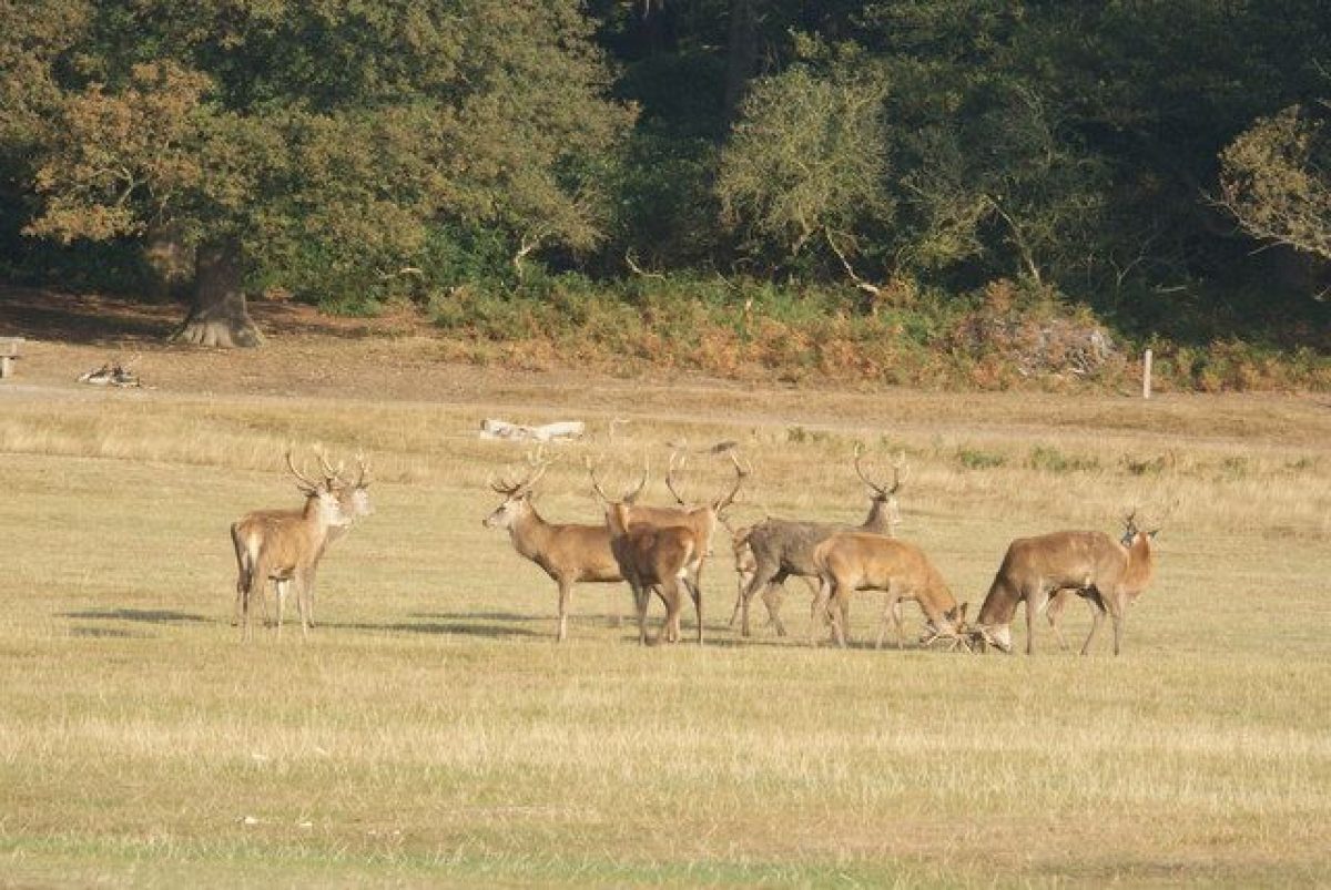
Today (2002) the park is managed by the Royal Parks Agency and supports 350 fallow and 300 red deer. The park was designated as a Site of Special Scientific Interest in 1992 and as a National Nature Reserve in 2000.
- Associated People
- Features & Designations
Designations
Conservation Area
- Reference: Richmond Park
The National Heritage List for England: Register of Parks and Gardens
- Reference: GD1823
- Grade: I
Nature Reserve
Site of Local Importance for Nature Conservation
Site of Special Scientific Interest
Features
- Lake
- Mount
- Wilderness
- Boundary Wall
- Description: The site is enclosed within eight miles of brick wall, which has been repaired many times during its long history.
- Earliest Date:
- Latest Date:
- Ride
- Description: The parkland is crossed by numerous horse rides.
- Plantation
- Description: Plantations are a major feature of the park.
- Stream
- Key Information
Type
Park
Purpose
Recreational/sport
Principal Building
Parks, Gardens And Urban Spaces
Survival
Extant
Hectares
1000
Open to the public
Yes
- References
References
- {English Heritage Register of Parks and Gardens of Special Historic Interest} (Swindon: English Heritage 2008) [on CD-ROM] Historic England Register of Parks and Gardens of Special Historic Interest
- Land Use Consultants {Richmond Park: Historical Survey} (1984) Richmond Park: Historical Survey
- Land Use Consultants {Richmond Park Strategic Management Plan} (1999) Richmond Park Strategic Management Plan
- Land Use Consultants {Richmond Park Management Plan} (2000) Richmond Park Management Plan
- Land Use Consultants {Richmond Park Management Plan 2} (2008) Richmond Park Management Plan 2
- Land Use Consultants {The Isabella Plantation Access Project Richmond Park Landscape and Building Design} (2010) The Isabella Plantation Access Project Richmond Park Landscape and Building Design
- Land Use Consultants {Terrace Gardens, Buccleugh Gardens and The Terrace Conservation Management Plan} (2005) Terrace Gardens, Buccleugh Gardens and The Terrace Conservation Management Plan
Contributors
London Parks and Gardens Trust