
Introduction
'Dales, Plants and Gardens 1900-1960' is a project collecting information about cottage gardens in the North Yorkshire Dales of Swaledale, Arkengarthdale and Wensleydale; collectively known as The Three Dales. We are recording older dales people talking about the gardens that they remember, often from their childhood. Our focus is on the food plants grown and gathered from the wild, and how they were grown, stored and used.From these memories three publicly accessible gardens have been created by volunteers to be used as workshops for children and adults today. Understanding husbandry techniques and food plants that work best in the climate, altitude and soils of the northern Pennine dales of Yorkshire will ensure local food security in the future.The Three Dales are primarily a pastoral economy. Many dales families continue to live and work in the same areas that their families always have. Memories are long and farming people are conservative, and so we made 1900 our start date. 1960 is an arbitrary end date. Some of the influences that make 1960 the project's end date include: a marked increase in second-home ownership; the increased use of plastic flowerpots; and the installing of television in homes only recently connected to electricity.
The climate of the North Yorkshire Dales is as varied as its topology; at the upper end of Swaledale there can be blizzards whilst Richmond, at the mouth of the dale, is in brisk sunshine. Average temperatures are -1 to 10C in winter and can rise to between 20 and 32C in summer. But the warmth is fleeting and the growing season short; tomatoes are more successful grown under glass than in the open.
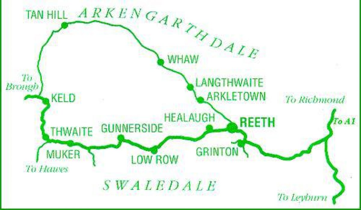
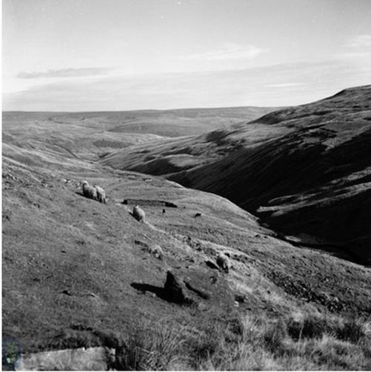
Swaledale's river begins high on the steep slopes of heather moors and rough grasslands of High Seat and Nine Standards Rigg, and only becomes known as the Swale at the point where the becks of Birkdale and Great Sleddale merge. Both Upper Swaledale and Arkengarthdale are included in DEFRA's ‘Pennine Dales Environmentally Sensitive Area' .
The dale's underlying rock, the Yoredale series, is clearly visible on the hill sides above the River Swale as a repeating pattern of banded rock outcrops, or steeper slopes of hard limestone and gritstone interspersed by broader, gentler slopes formed by the less resistant shales. The geology is visible in the vegetation of the dale sides, with the limestone supporting brighter green, species-rich grasslands in contrast with the coarser grasses on sandstones and shales.
The Swale tumbles swiftly towards Keld, over forces and cataracts, such as Kisdon force, twisting and turning as it cut its way down through the Yoredale series. The valley sides are steep; Satron gets no sun for nearly a month either side of the winter solstice.
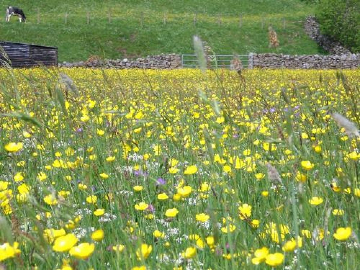
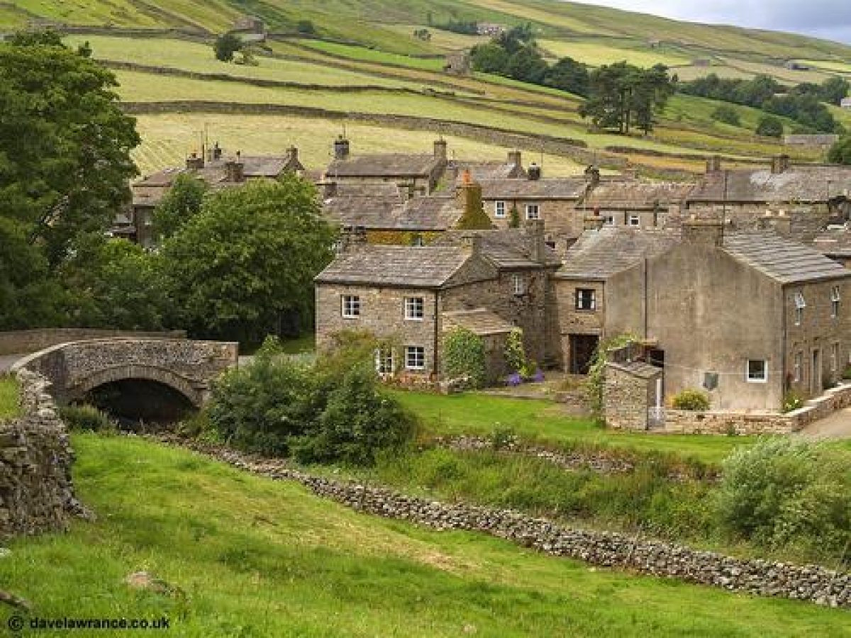
Around the Swale at Keld, Muker and Gunnerside are hay meadows and field barns, some of Swaledale's most outstanding features. Many of the best examples of these meadows are designated as SSSIs.
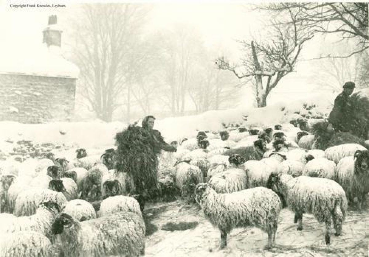
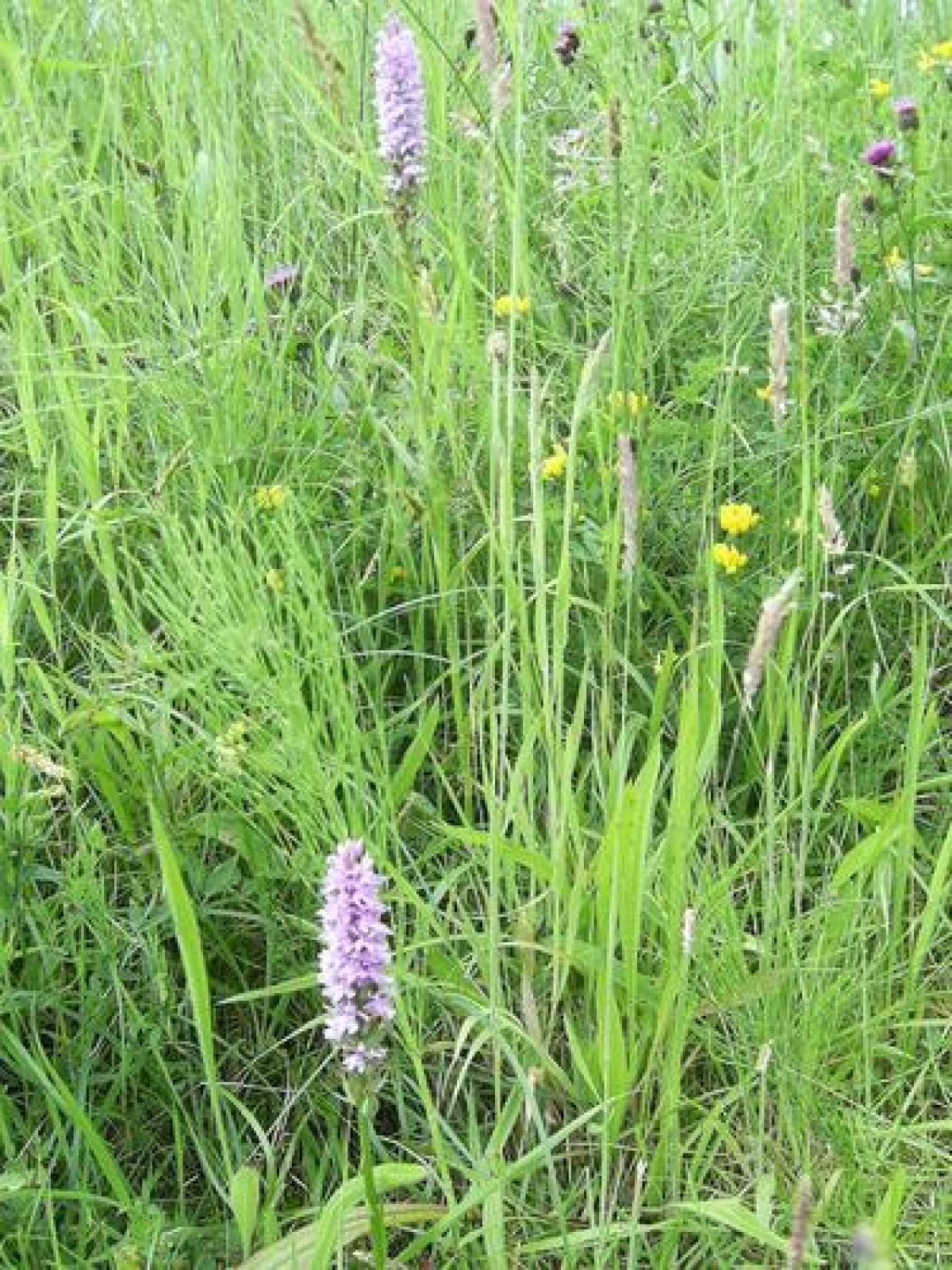
Through the winter, until mid-May, the meadows are grazed mainly by sheep; the flocks are then taken up onto rough pastures for the summer leaving the meadows to grow their crop of grasses and wildflowers for winter hay. Against dry-stone walls and stone field barns, the hay crop first turns yellow with buttercups, then white with splashes of purple, as pignut and cranesbill flower; the lush colour saturates the landscape in sun and rain.
It's not only the plants that benefit from the steady pattern of rain interspersed with sun. On the down side of gardening in the dales slugs and snails also benefit from monthly precipitation. On the plus side, there is seldom a need to water well-chosen plants.
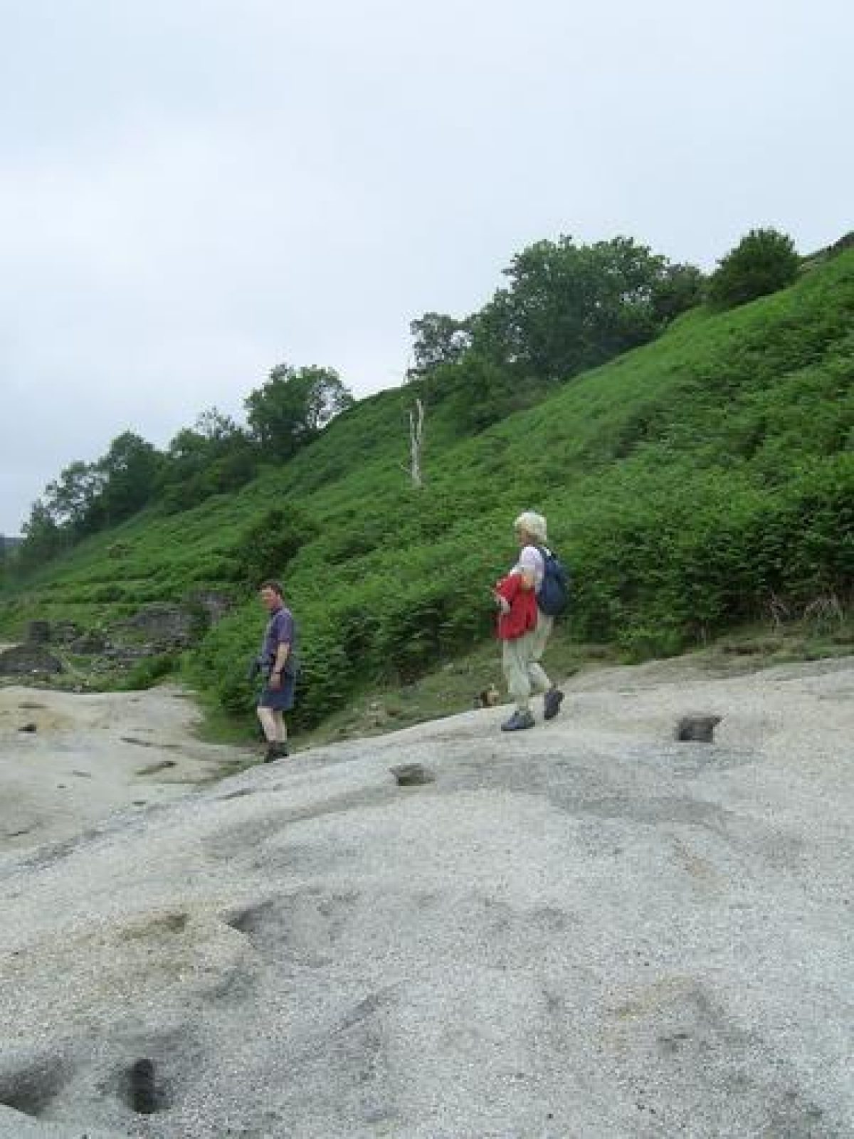
Despite its bucolic appearance, Swaledale was once an industrial dale; a triangle formed by Keld, Langthwaite and Marske was mined from the Iron Age until the end of 19th century. Whilst the river carves its course through the valley, the moorlands above still show the remains of mine workings: bell pits; dressing floors; smelt mills; and hushes. Hushing removed vast quantities of peat and soil from suspected layers of lead; this created artificial valleys up to half a mile long and sometimes as deep as 30 metres.
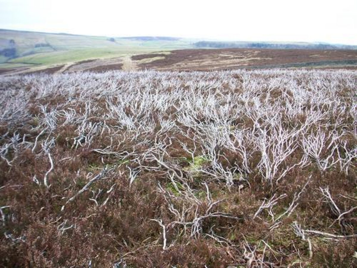
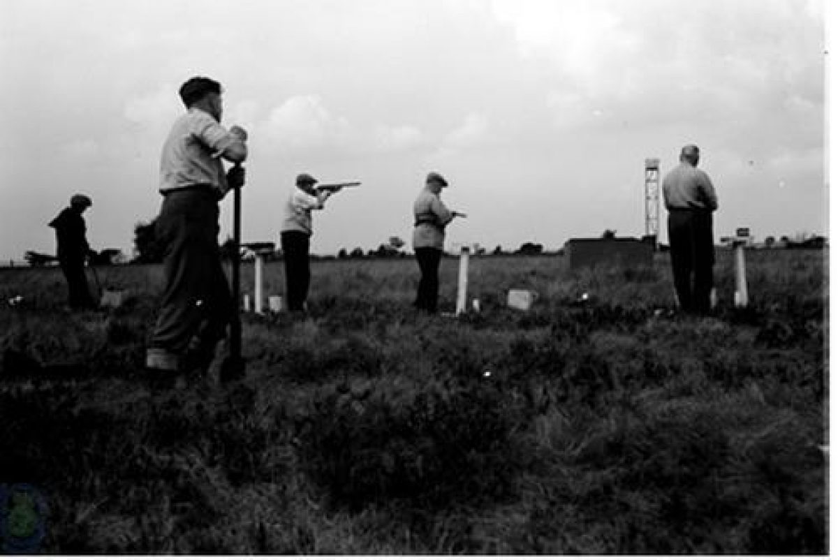
In the nineteenth century as one group of men mined the lead, another shot grouse on the moors around them. Grouse shooting, which has been carried on in Swaledale for 150 years, has its own impact on the landscape. Careful management of the breeding grounds has produced some of the broadest stretches of heather moorland in the dales. Grouse chicks feed on young heather shoots. The moorland devoted to grouse are a mosaic of burnt-over areas and various stages of regrowth; lines of shooting butts carefully built of stone and turf blend with the colours and textures of the landscape.
Walking down from the heather moorlands you pass through woods of deciduous ash, birch, rowan, bird cherry, and hawthorn alive with spring flowers and golden colours of autumn, often drier and warmer than July and August. Punctuating the deciduous colours are severe greens of yew and holly, the latter used for winter fodder for livestock.
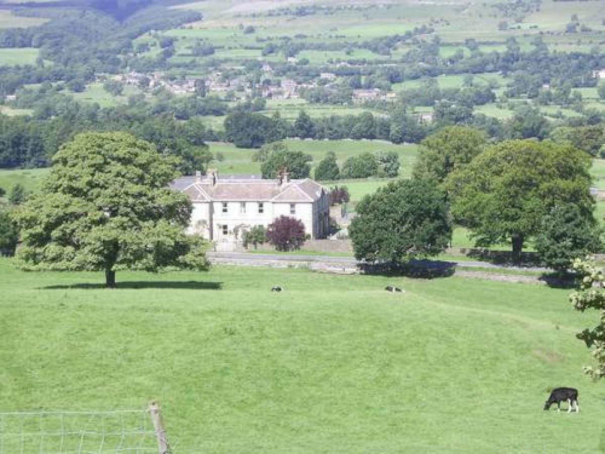
Mid-Swaledale opens out into a broader valley though the river continues twisting and turning through the low-lying ings or water meadows. These have always been highly prized, fertile ground for feeding livestock, especially dairy cows whose rich summer milk has been laid down for the winter as cheese. Here the non-native sycamore is common. The tree first planted for shade, keeping dairies and creameries cool in summer, is now the most dominant tree in some areas. Beech groves and avenues may be seen around some of the wealthier farms between Grinton and Marske; after which the valley once again narrows; ancient woodland slopes plunging down to the river before Richmond.
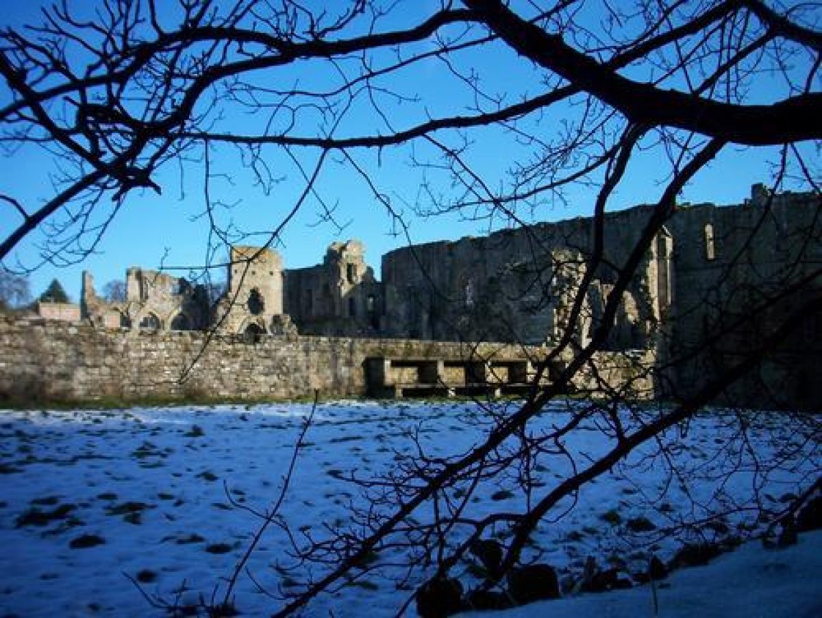
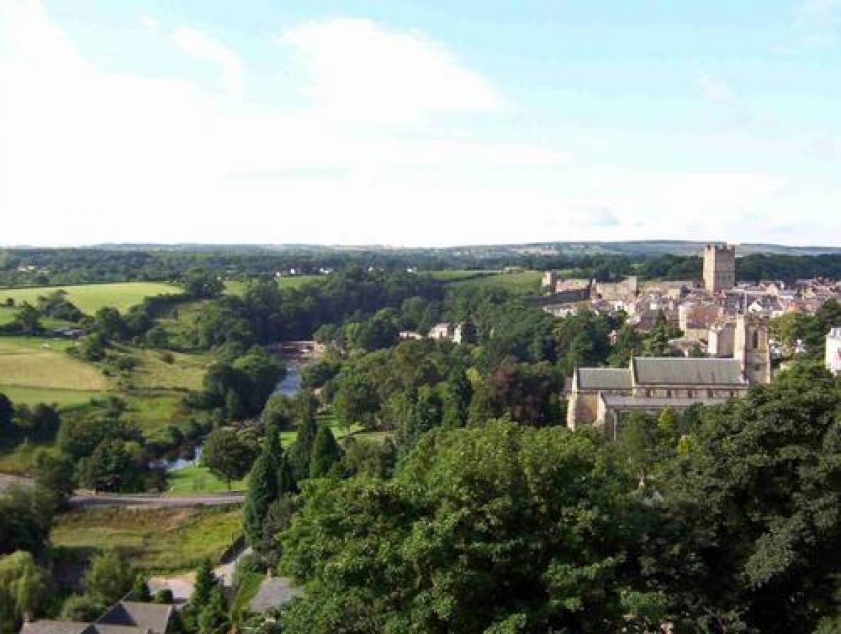
At Richmond the castle rises above the trees, but the river is often hidden from view. Such dense woodland is uncommon in Swaledale much of it having been cleared for farming and fueling the lead smelting industry even before the Romans arrived.
Around Richmond much of the land belongs to the Ministry of Defense whose base at Catterick is the largest garrison in Europe. One moment there are conifer plantations through which soldiers train for Balkan wars; the next moment the trees are felled and tanks role through tussock grass bleached by sun and wind and the wars are Iraq and Afghanistan.
Throughout its course the Swale is one of the fastest flowing rivers in England. Ground water seeps through peaty moorland like a sponge but grouse prefer drier ground and for years grikes or channels have been cut draining the water quickly into the Swale from their breeding grounds on the high moors. The river bore gives only moments of warning before breaking its bank and pulsing across the fields, enriching them as it does so with its sediments of limestone, gritstones and shales.
Finally, the alder- and willow-lined Swale calmly flows out of Swaledale, it's waters mingling with the River Ure that flows through Wensleydale. The land is now flat, the plain of the Vale of Mowbray dividing the Yorkshire Dales from the North Yorks Moors.
Sheep, lead ore, and dry-stone walls made from limestone littering the ground typified Swaledale long before the Romans arrived in A.D. 50 to transport lead back to Rome. Sheep and dry-stone walls made of limestone still typifies the dale, but the lead gave out at the end of the nineteenth century causing significant depopulation as people migrated to America. From the middle of the twentieth century there has been a significant increase in the population of Swaledale as the Ministry of Defense has expanded its garrison at Catterick in the lower dale. The base is the largest garrison in Europe and is continuing to expand, by 2025 it will be the largest town in North Yorkshire.
- Visitor Access, Directions & Contacts
Telephone
01969 666210Access contact details
Although much of the countryside in Swaledale is designated as open access under the Countryside and Rights of Way Act, the individual gardens are all private property. Please do not trespass.
Other Websites
- History
There is a great deal of history in the North Yorkshire Dales of Wensleydale, Arkengarthdale and Swaledale, much of it still to be researched. Thousands of years of pastoral farming has meant that features from prehistoric cup and ring marks to nineteenth century lead mines still remain .
For the purpose of the project ‘Dales, Plants and Gardens 1900-1960' some aspects of history seem to be more pertinent than other's, for instance the shaping of the land through: farming; lead mining; and the Yorkshire Dales National Park. Most of the land within the National Park is privately owned and despite steep slopes weathered by harsh climate it has been farmed and mined for centuries giving it the look that it has today.
The National Park since its inception in 1954 has been managed by the Park Authority which, like Janus looks both ways: outwards encouraging and educating visitors to the dales; and inwards fostering the well being of those that live within its boundaries.
Farming and Food Production
Since at least 5,000 B.C, weather and man have worked together. Man has cut and burnt woodland on the upper fells to clear land for crops. Rain, frost and wind then eroding the soil; seedlings washed away until only the moorlands remained. What can be seen today has relied on farmers and landowners traditionally working to increase food production.
Our interviewees were born on the cusp of change, for probably the first time in history farmers have been financially encouraged first to significantly increase (during WWI and WWII) and then to decrease food production. Change began in the 1980s when food-mountains rose at an alarming rate. The Common Agricultural Policy (CAP) supported a decrease in food production, subsidizing farmers to take land out of production. Instead of well-managed farmland visitors to the countryside at first saw thistles and scrub but later an increase in wildlife:
"Uncropped farmland has proved a boon for declining birds but could soon be cultivated for food and fuel instead."
Climate change and environmentalism have encouraged closer scrutiny of the landscape by urban visitors. They want to be reassured by the look of the countryside that all is well with the world. Since 2005 DEFRA (Department of the Environment, Food and Rural Affairs) through its Environmental Stewardship Scheme has been encouraging and subsidising farmers and land owners to return to historical methods of managing their land, decreasing food production to benefit wildlife and tourism.
Farming and Haymaking
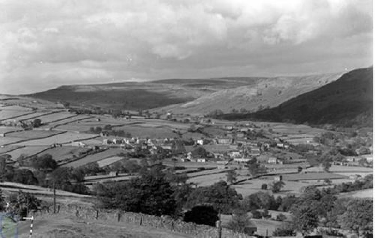
Hay meadows are a feature of Upper Swaledale. It can take up to 150 years to develop a flower-rich Pennine hay meadow, and it can be destroyed within a couple of years by the use of fertilizers and the wrong timing and cutting of the meadow. Historic methods of haymaking encourage biodiversity and meadows of beautiful wildflowers common to many areas of the Northern Dales since the Anglo-Saxons first began the practice in the fifth century A.D. Many of the names of hamlets and villages in mid-Swaledale are Old English dating from this period - Hudswell, Downholme, Ellerton, Grinton, Fremington, Reeth and Healaugh.
The Anglo-Saxons used ox to draw their heavy ploughs in late winter, a time of year when little food was available to the oxen. In the summer paths between woodland edge and cornfield were used by harvesters going from field to field, nutritious grasses and woodland plants flourished; over time they were cut and dried for the beasts in winter.
Farming and Sheep
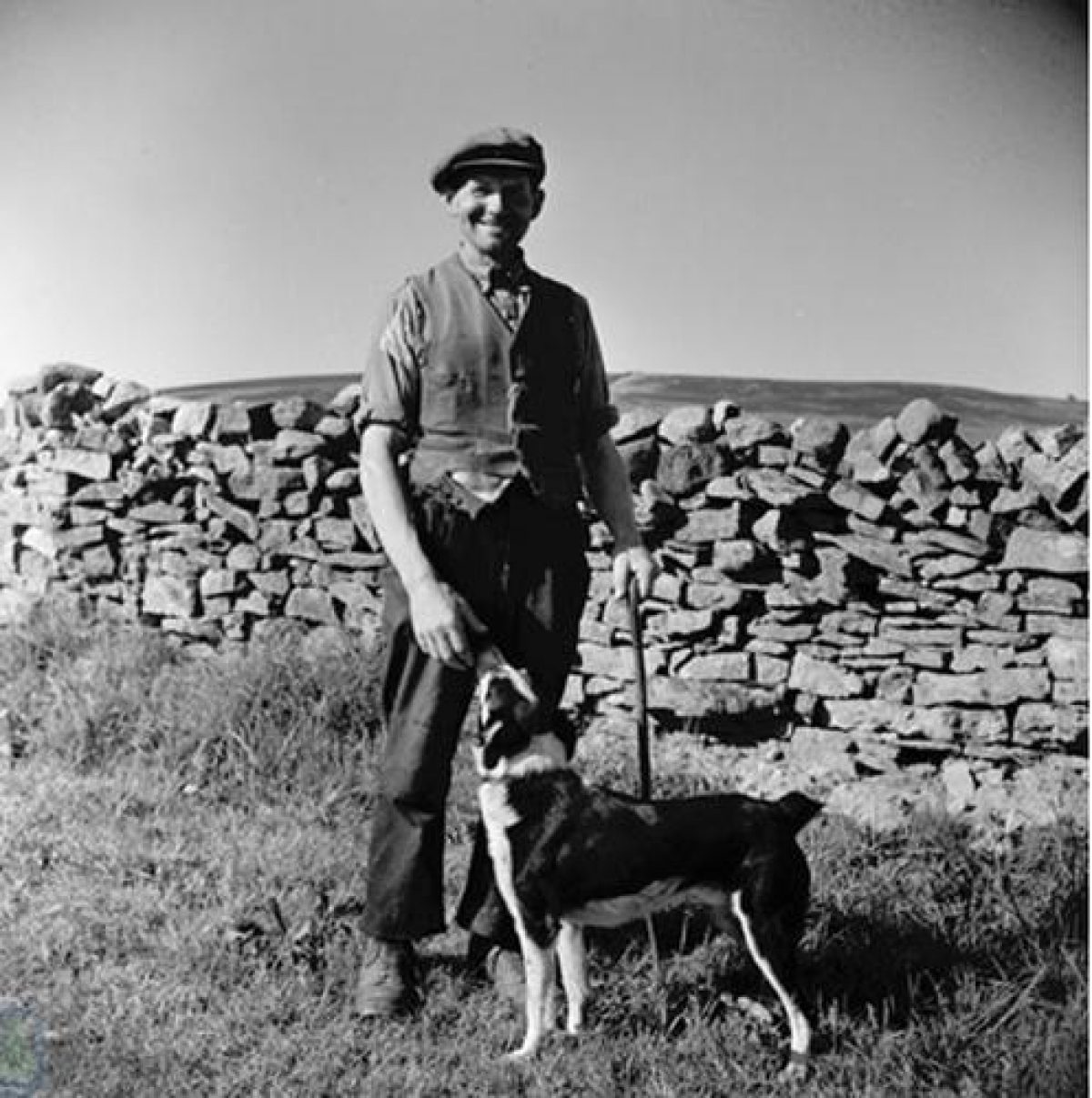
As traditional as the Anglo-Saxon hay meadows are the shepherding skills of the Norse who colonized Swaledale from the west (‘Swaldal' in tenth century Norse). They understood the land, so like theirs in the far north. Upper Swaledale is shallow, bleak and open, surrounded by an amphitheatre of giant dark fells, reminiscent of Norway and Iceland. The upper dale has an abundance of Norse place names - Thwaite, Muker, Smarber, Satron, Skaleflat and Gunnerside down to Marrick, Owlands and Applegarth in mid-Swaledale.
Whilst the Anglo-Saxons gathered their farms together in nucleated patterns around a green, the Norse preferred isolated farmhouses situated on both sides of the valley adjacent to gills or springs. They continued shepherding their sheep and families between winter and summer pasture (transhumance) just as they had always done (Gunnerside means ‘Gunners saetr' - a summer pasture, or shieling, belonging to Gunnar). Their sheep were little different to the ones that graze the fells today - hardy, black-faced Swaledale sheep, descendents of heath sheep that once roamed the European plain from the Netherlands to Russia . Marginal farming is conservative, it relies on knowledge passed between generations, and just as the Norse did, the ewes and their lambs are still brought down to kinder pastures for lambing and fattening in autumn and winter.
Farming and Seasonal Labour
The majority of our interviewers have farmed, either full-time or seasonally. Irish and Scots who worked through the country from west to east first haymaking and then back again harvesting. And when the Scots and the Irish left to fight in WW II, prisoners from Italy and Germany who were farmers in their own countries, replaced them.
Throughout Swaledale there were those in occupations outside farming who helped with seasonal work just as the lead miners had done before them: women; quarrymen and lengthsmen; electricians, store-men and lorry-drivers from the army camp at Catterick. They had no holiday pay in their annual wages so haymaking and harvesting in particular were seen as a bit of a holiday where you could also ‘earn a bit extra'; the farmer's wife adding to the festive spirit with baked goods and cans of tea and pop in the fields and providing either a haymaking picnic or harvest supper at the end.
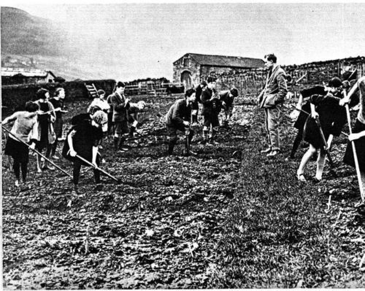
In 1943, the Minister of Agriculture, R.S Hudson appealed to people in cities and towns around the country to forgo their annual holiday and support the war effort by going to harvest camps and help bring in the crops. His appeal met with a massive response, and by April recruiting centres were inundated with requests to join the camps. For many people, particularly children, working in the countryside offered a novel experience that they wanted to continue after the war had ended.
Children had always come and gone between school and farm work but after war broke out in 1940 their absence from school for activities such as haymaking and harvesting was formalized. Children, as young as eight were given cards to be marked up by the farmer, on completing their allotted two weeks they took them back to their teacher; the October half-term is still known as potato picking holiday.
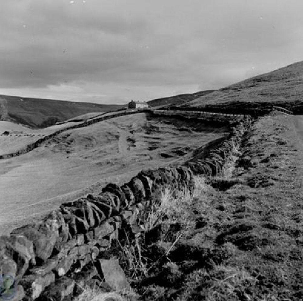
Dry-Stone Walls
Stone dominates Swaledale. Since the land was first farmed pieces of stone have had to be cleared from the fields, even today, in the twenty-first century meadows have to be walked and pieces of stone together with lamb's tails removed before haymaking can begin. The distinctive dove-grey limestone is used for walls that from a distance can look like a continuation of the natural rock as they criss-cross the land protecting flocks and plants from the harsh weather. As a result the pattern of barns and walls dominates the openness and simplicity of the fells on the ground and from the air.
Without knowledge of mortar the walls were once embedded by hand, stone upon stone in a manner so secure that the tradition of dry-stone walling still continues as a method for keeping livestock enclosed and sheltered. Without the walls few plants can grow in the soughering wind; fruit trees and brambles are scarce in many parts of the dale, few of our interviewees can remember them growing around their moorland homes.
Land enclosure was at first tribal, the Scandinavian system of partible inheritance divided land between all heirs. In the 11th century the Normans accrued land through primogeniture and marriage; under them Swaledale was hunting forest managed by Forest Law. The Enclosure Acts of Parliament between 1750 and 1820 further restricted land that could be used by commoners. In recognition of the burden that this placed on Poor Relief the Parliamentary Enclosure Act of 1845 encouraged allotments or ‘field gardens' be set aside as a condition of enclosure.
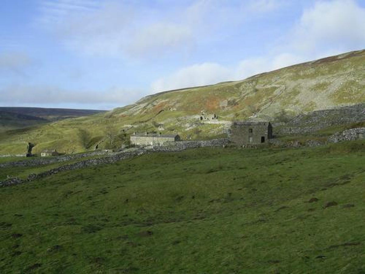
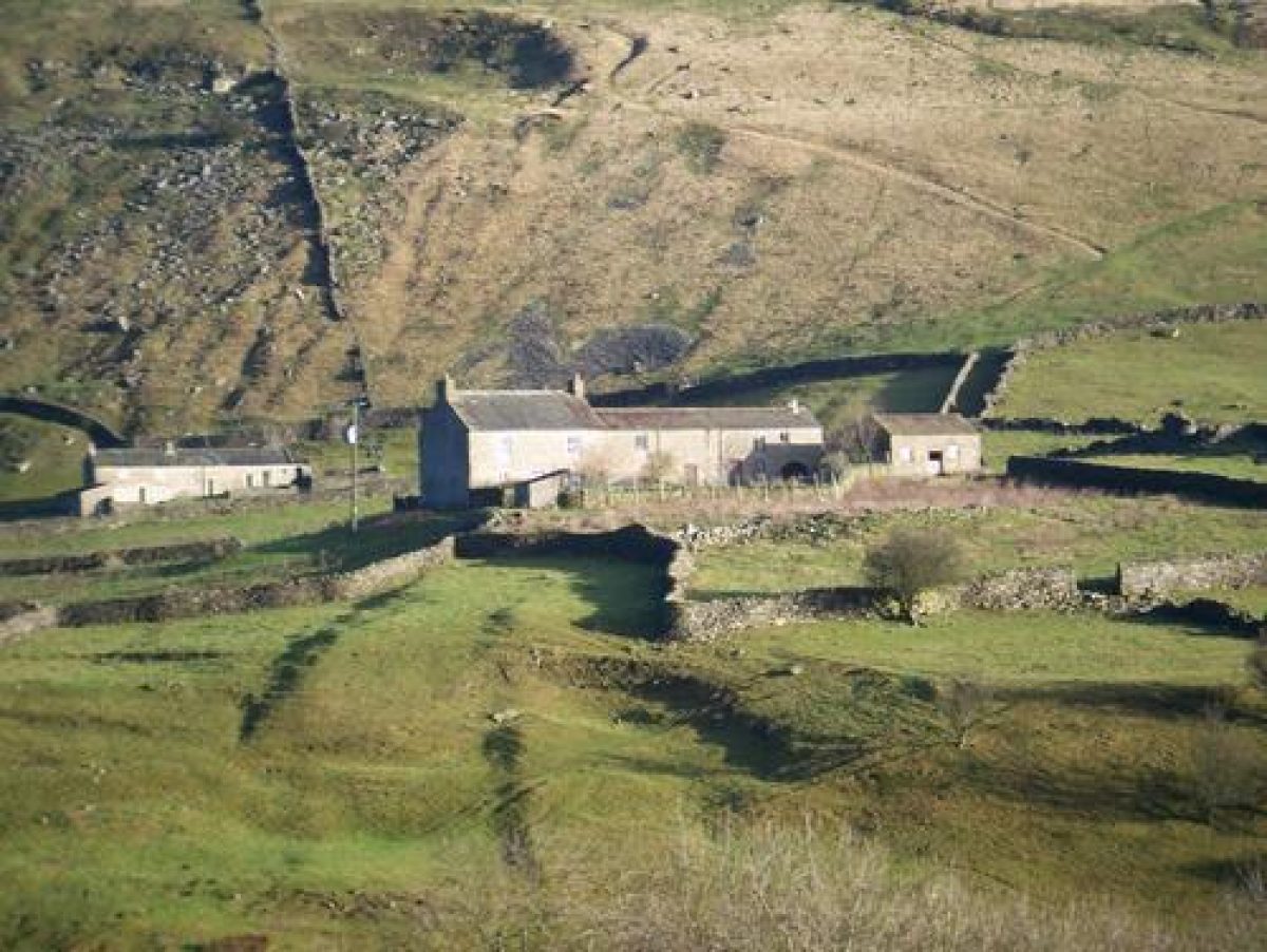
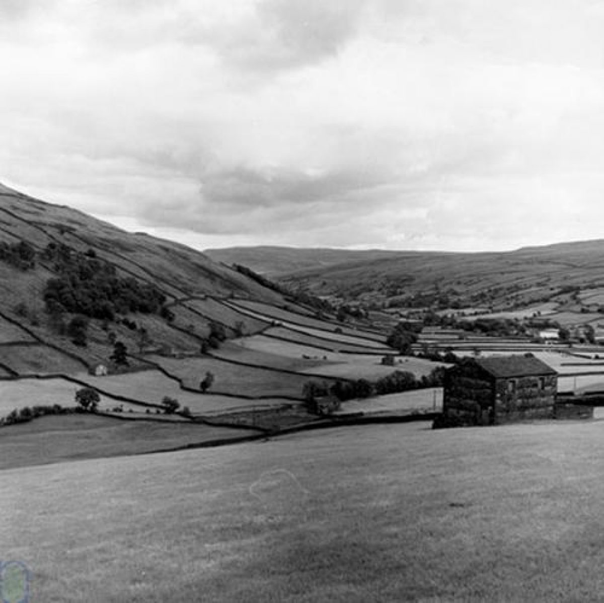
Stone and Field Barns
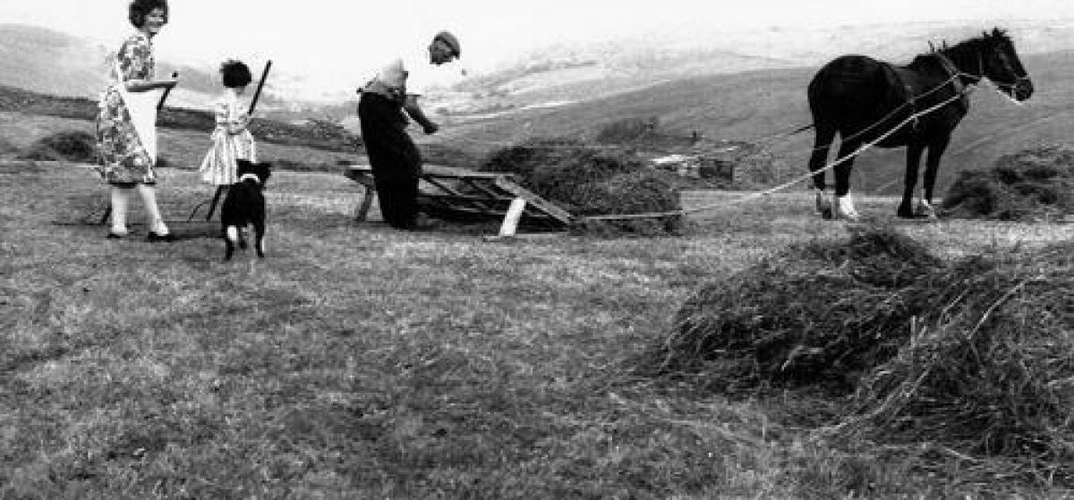
As characteristic as the dry-stone walls in Upper Swaledale are the stone field barns. The steep slopes and severe weather in this area has always made transport between farm and fields difficult, sledges being used on the steepest slopes. As many agricultural functions as possible have had to take place out in the meadows to minimize the labour needed to move animals and their fodder or manure between farmstead and field. The barns provided winter shelter for cattle at ground level and storage of hay for their fodder above. Cows were milked in the barn and their manure used on the land for next year's hay crop.
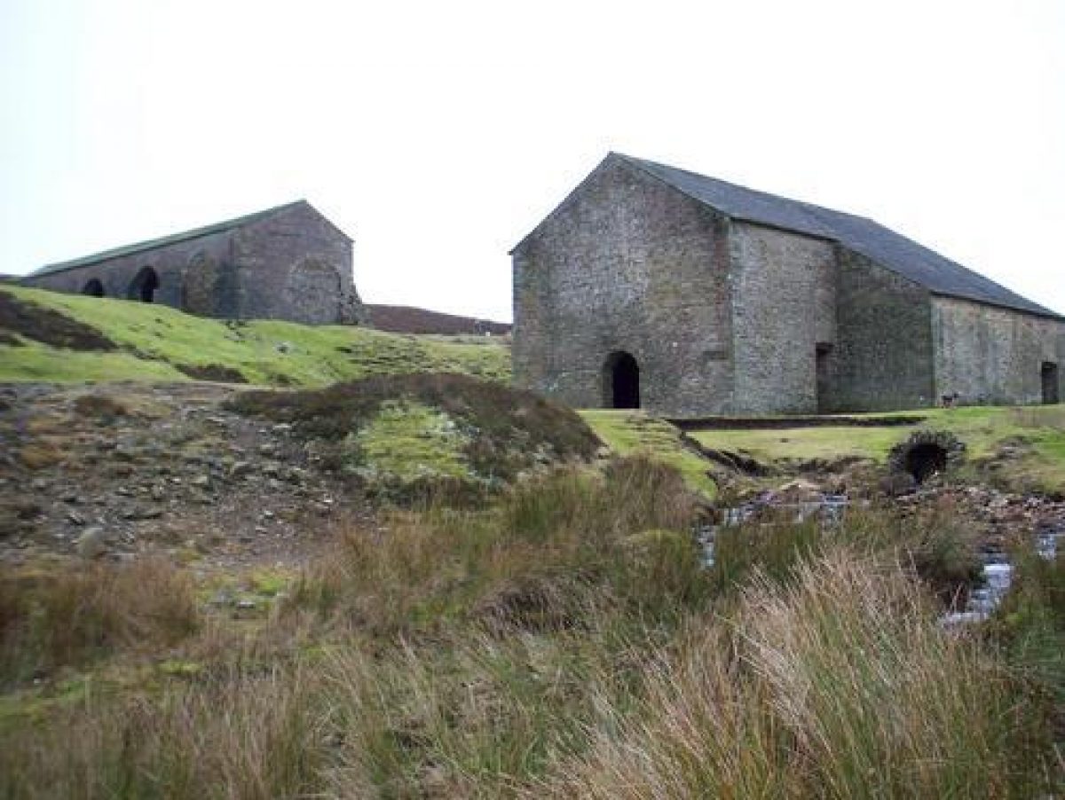
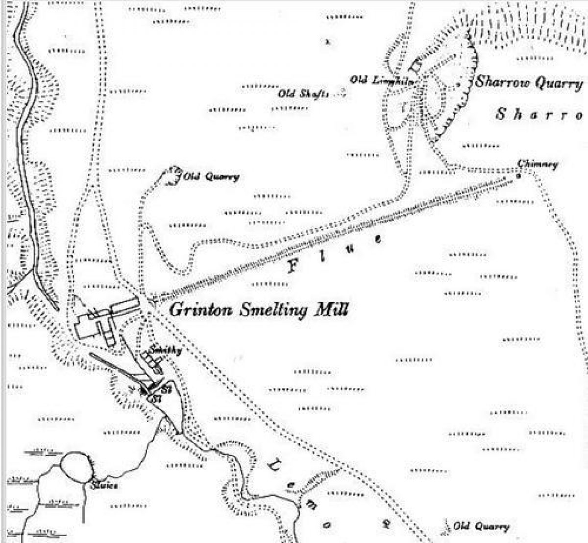
Building styles have evolved according to the needs of their owners. Pinfolds , barns and farms; walls; lead miner's cottages and shepherd dwellings; castles and religious houses; limekilns and lead smelt mills; water mills, shooting lodges and pig holes have all been built of sandstone and limestone either picked up from the fields or quarried from the Yoredale series that runs through Swaledale.
Lead Mining
Pigs of smelted lead dated to around A.D. 81 have been found with cast-on inscriptions from Roman controlled lead mines at Hurst in mid-Swaledale.
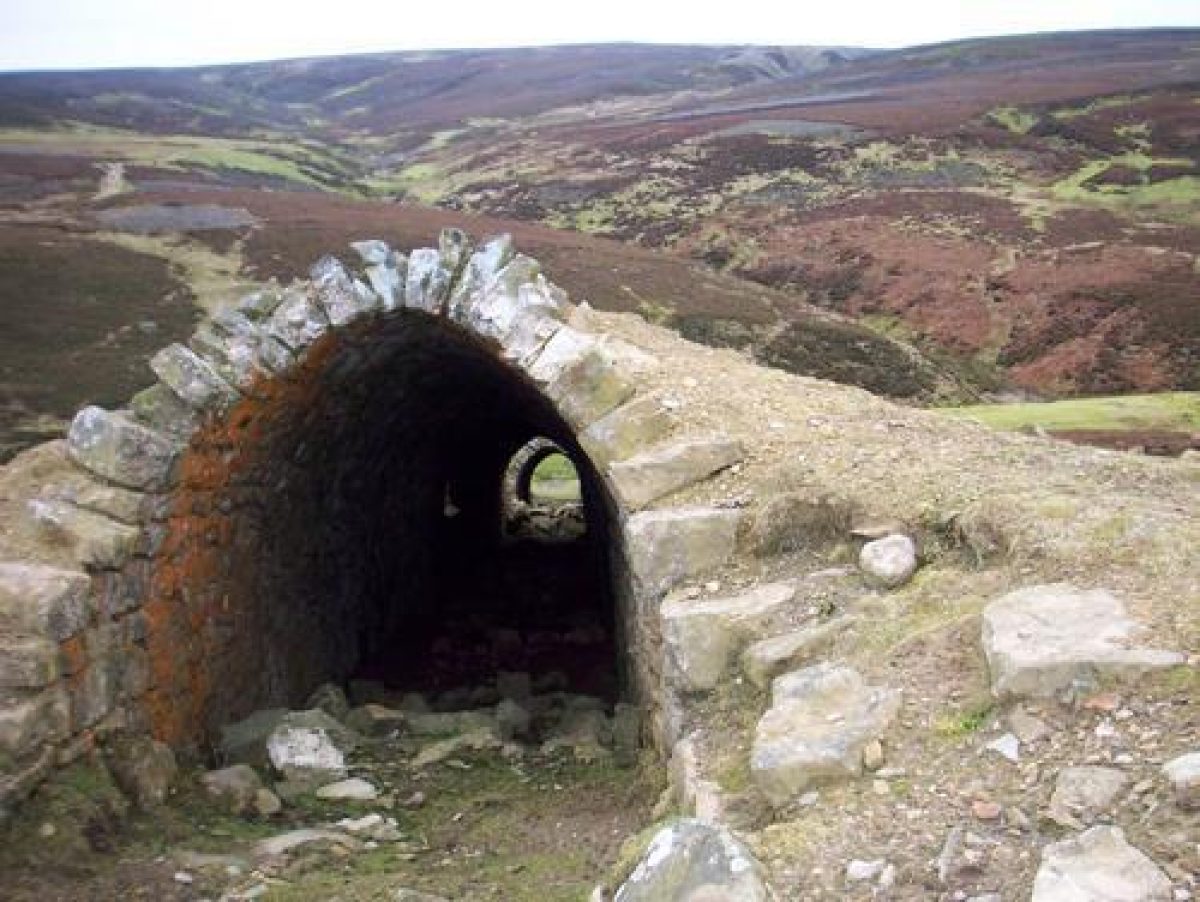
From the eighteenth century mining dramatically changed the landscape. Techniques such as ‘hushing' whereby turf dams were built across gills to hold water, and then released in a torrent down the hillside to expose the vein of lead ore; in the process artificial valleys up to half a mile long and sometimes as deep as 30 metres have been created.
Lead miners and workers
Whole families were involved in the lead industry. Mining was a young man's work. Women, older men and children worked on the dressing floor using their hands to separate the lead ore from the spoil; children crawling up condensing tunnels to clean them. Some of the tunnels were over two miles long, built to take away the noxious fumes from the mines they condensed out valuable lead crystals that needed to be scraped off. The land around these deserted mines still contains highly toxic, heavy metals that only a few plant species can tolerate; this alien habitat is essentially a metal-rich grassland.
The miners and their families rarely lived close to the mine, living instead in hamlets lower down in the valley or in isolated cottages on moorland fringes. During the eighteenth and nineteenth centuries, Reeth in mid-Swaledale was economically more important than Richmond. Families boosted their incomes by knitting and farming in between their work at the mines. Miners could regulate their own hours, either working for themselves or in partnerships giving them time to work their small-holdings and allotments on which they might keep a cow, grow hay for winter fodder, and potatoes and cabbages; a possible influence on the twentieth century Swaledale gardeners that we are interviewing. So prized was working their small-holdings that the miners of the London Lead company threatened to go on strike if their hours were regulated.
Yorkshire Dales National Park
Walking out of Richmond and up onto the top of the fells it's possible to walk up Swaledale all day and not meet anyone. At times, the silence presses in on your eardrums and it's hard to imagine that there is a world beyond the dale.
An Act of Parliament created Britain's National Parks in 1949; and The Yorkshire Dales National Park was designated as such in 1954. It covers an area of some 1762 km of mainly upland countryside, part of the central Pennines chain of hills which runs down the spine of Northern England.
The aims of the National Parks are "to conserve and enhance the natural beauty, wildlife and cultural heritage" and to encourage an understanding of the landscape, its wildlife, and its people by those visiting the park.
Visitors to the National Park see it as wild and uniquely theirs, not a patch of ‘improved' lush green should intrude into the purple and gold's of heather and bracken that cover the extensive grouse moors over which guns take precedence in August. And not a flower should be missing from the colours of the wildflower meadows. It's not difficult for marginal farming to keep this look, but it doesn't bring in much of an income. It's not from slovenliness that pieces of orange plastic twine are holding gates closed, or rusting machinery is left on the land, axil deep in mud, nor callousness that a dead sheep causing concern to the rambler might go unreported; the costs are all simply too much for a farmer who might earn himself £7,000 a year, if lucky. Upland farmers have traditionally relied on family to work on the farm and earn elsewhere as a contribution to the family's expenses; nothing has changed except that now it's now only the farmer and partner who do all the work, and have to work elsewhere for extra income.
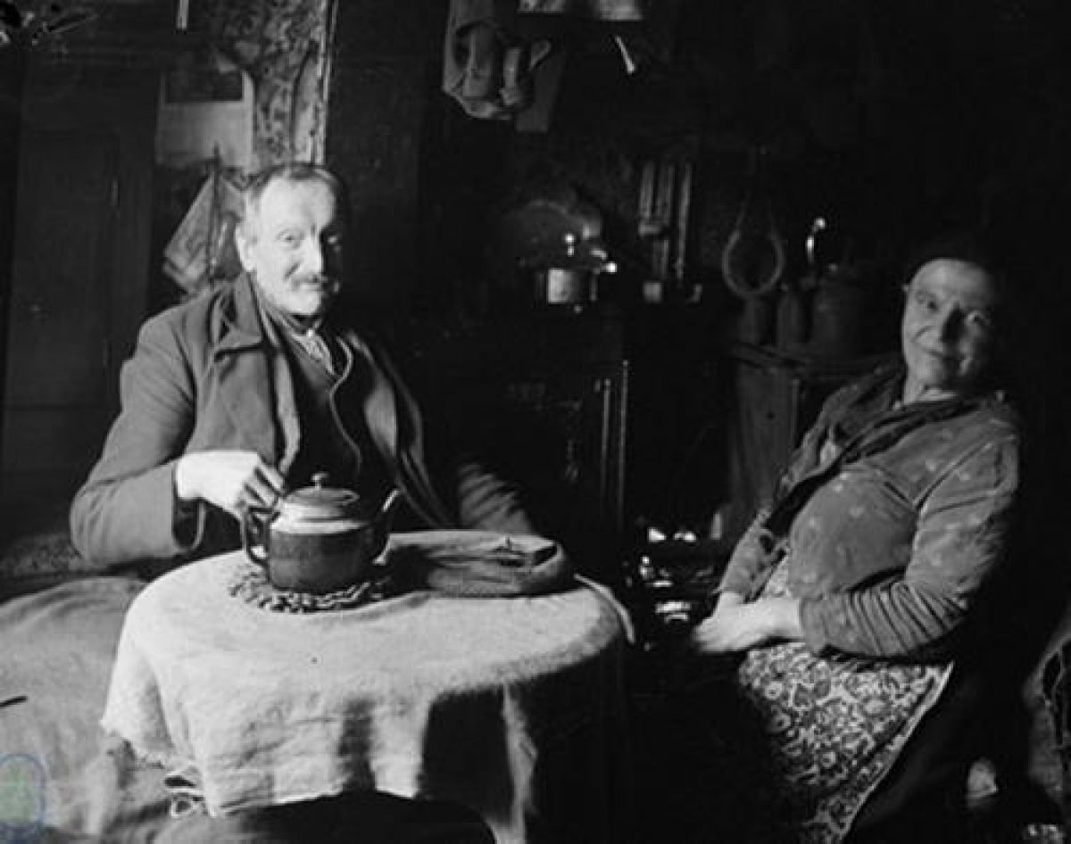
Many of the people that we've interviewed so far lived with their numerous siblings and parents in small, rented cottages often with no running water and electricity until the late 1960s. Today most of the schools, chapels and literary institutes that they used as a community have been converted into second homes and holiday lets. In 2000, average wages in the Upper Dales were 60% of the UK norm and the average price for a house was £210,000 due to the effect of the second home and retirement home market. Many of today's generation live in mobile homes on the edge of Richmond, or outside the dale altogether, and they would still rather live in the Dales than anywhere else.
- Features & Designations
Designations
National Park
Features
- Planting
- Key Information
Type
Garden
Purpose
Horticultural
Principal Building
Agriculture And Subsistence
Survival
Part: standing remains
Open to the public
Yes
- References