

Introduction
Dales, Plants and Gardens 1900-1960 is an oral history project collecting information about cottage gardens and rural allotments in the North Yorkshire Dales of Wensleydale, Swaledale and Arkengarthdale; collectively known as the Three Dales. The project is talking with people about the food plants that they remember their parents and relatives growing and gathering from the wild, how they were stored and used.From these memories three publicly accessible pieces of land are being gardened by volunteers and used for workshops. One piece is used as a food co-operative by the clients of a community centre.Through gardening stories told by older people the Three Dales project is building up a knowledge of husbandry and food plants that work best in the climate, altitude and soils of the northern Pennine dales of Yorkshire.
Terrain
moors, fells and uplandThe landscape of Arkengarthdale
A mid-nineteenth century Darlington doctor poetically began an article on the diseases in lead miners in Arkengarthdale for the British Medical Journal:
"The miners, or ‘groovers', as they are termed, of Arkendale and Swaledale, reside in a wild romantic district, abounding with craggy rocks, wood, and water, hill and dale. In this picturesque scenery, the sublime, the terrific, and the magnificent, are intimately blended; and the sight will amply repay the tourist who is an admirer of nature, in its primeval beauty, unadorned by the hand of man."[i]
Man the miner working underground in damp and very cramped conditions suffered from poisonous air, their skins absorbing fine particles of lead ore. On the surface they walked many miles between home and mine in the same wet clothes that they worked in. Food... was meager, tea, coffee, milk, cheese, potatoes, bread and sometimes bacon. Oatmeal was only used occasionally "being considered by the miners too heating; tea and coffee have in a great measure superseded it."
The influence of lead mining on the landscape
In the nineteenth century surface mines were no longer viable and shaft mining superceded them. A shaft might descend for about 10 metres or more before leveling out into a tunnel sometimes as little as a metre in width. Shafts and levels were linked to from networks of galleries through which miners either walked hunched or crawled for miles underground. The greatest area of underground mining lay between Gunnerside in upper Swaledale and Arkengarthdale. Between 1589 and 1913 when the last mines closed, some 350,000 tonnes of lead ore was extracted from many thousands more tonnes of rock; the waste left abandoned on the moors and fells.
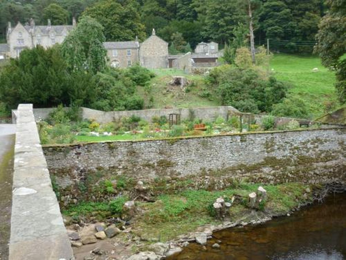
Today, if people look up from where they sit on Reeth green eating their ice cream in a moment of sunshine between showers they can see landslips of rock and rubble on the fells of Arkengarthdale above them. Looking more carefully its possible to see pale grey rock scars with a line of darker grey and dun-coloured rubble or scree below them, these are naturally weathered formations. But close by the same coloured rubble lies in large piles sandwiched between the purples and green of heather and turf; these are man-made spoil heaps, still toxic over a hundred years since the last mine closed. The only plants that have colonized these slopes are a specialist group of plants known as metallophytes. These are not unique to spoil heaps but generalized plants that can tolerate low nutrient levels due to leaching and high concentration of metals (thrift, spring sandwort, sheep's fescue, alpine pennycress, and Pyrenean scurvygrass).
Traveling up from Reeth into Arkengarthdale, the visitor can see through dank mists suspiciously straight, parallel valleys criss-crossing the moors. Barren and dry in the sun these are not once-natural water channels but man-made hushes. High on the moorland flats or benches lead miners in the eighteenth century damned becks with turf and soil to create artificial lakes. Releasing the water in a torrent down the hillside gouged out rocks and soil revealing clean bedrock where veins of galena or lead ore might be seen and mined; these were the exploratory hushes such as the Hungry hushes west of Arkengarthdale.
Extraction hushes were longer and larger following a single vein down a hillside; in effect a form of hydraulic open-cast mining. The veins of lead ore were very narrow, often less than a metre wide but as much as a half-mile long. A first pulse of water from the damned-up lake washed away the soil, miners then worked at loosening the rock with pick-axes, chisels and crowbars. A further pulse of water then washed the loosened rock down the hillside to the dressing floors where women separated the lead ore from the rock. Stodart hush is deemed one of the best examples of an extraction hush.
The landscape and grouse moors
Overlying the mines, rock and heavy till, glacial debris remaining from the last Ice Age, the soil is mainly peat. Most of the till has a matrix of clay, weathered from the shales that lie between the grit and limestone of the Yoredale series.
Firm islands of juncus reed and bilberry show the walker where to place their feet in the peaty blanket bog. In autumn purple is the dominant colour of these moors; heather so beloved of grouse and landowner with shooting rights alike. Peat acts like a sponge, constantly wet it releases water into becks and ultimately rivers in steady drips. Artificial grykes or channels were cut to drain the moors leaving the heather grounds dry for grouse chicks. Unfortunately these channels quickly add large amounts of water to the peat, the spongy peat then releases the water in a flood into the becks and finally the Swale, now one of the fastest and potentially most destructive rivers in England.
Along the valley trees still line the river but are almost completely absent from the fells. Stonewalls are the only shelters for sheep, people and plants in Arkengarthdale. Dotted between the grey slag heaps and heather-purple grouse moors are hundreds of field barns and dry-stone walls surrounding haymeadows filled in early summer with purple-blue, yellow, pink and white flowers. Summer is short, it rains all through the year but after a day of stormy weather the clarity of air makes these North Yorkshire dales very beautiful at any time of year.
Sources
[i] BMJ Special Occupations No. IV. Diseases of miners of Arkendale and Swaledale by Thomas Hayes Jackson, M.D., Darlington, No XXX London: Saturday, July 25, 1857. BMJ 1857; s4-1:619-620 (25 July), doi:10.1136/bmj.s4-1.30.619 Diseases of Miners of Arkendale and Swaledale
[ii] Black Grouse UK: The UK Biodiversity Action Plan for black grouse http://www.blackgrouse.info/
[iii] Gordon Home Yorks. Dales and Fells, pp 6-7 Copyright BiblioLife, LLC. Google Books (originally pub A&C Black, London 1906)
- Visitor Access, Directions & Contacts
Telephone
01969 666210Access contact details
Although much of the countryside is designated as open access under the Countryside and Rights of Way Act, the individual gardens are private property. Please do not trespass.
Directions
The road through Arkengarthdale runs between Reeth (Swaledale) and Barras on the A66.
Other Websites
- History
Once a busy and industrial dale, today Arkgengarthdale, the Forgotten Dale as it is sometimes known, is remoter and emptier than Swaledale and Wensleydale. The single road through the dale begins in Reeth and goes up over Tan Hill, connecting Swaledale with Teesdale. The route, once used to drive thousands of cattle down to the rich meadows in Swaledale from Scotland for fattening, became a tourist road in the twentieth century. Since then, motorists have been climbing up Arkengarthdale's "... steep slopes, bend(ing) round becks and gills, and pursue(ing) its lonely way past scars and peat hags."[i] Today all that remains of those motoring days is a rusting petrol pump in Langthwaite.
Lead mining in Arkengarthdale
Until the end of the nineteenth century, Arkengarthdale was particularly rich in minerals - lead, coal, slate and chertz in particular. Its smelting mill was the most productive in the country, so much so that the dale was bought and sold by various absentee landlords. The Lord of Richmond made a profit of £4 a year on the lead mines in 1285. In 1628, Charles I sold the dale to the citizens of London who owned it until 1655 when Dr Bathurst first leased the rights to the mines from them for £3 10s. Thereafter the Bathurst family in effect owned the dale and its contents until the end of the nineteenth century.
Hill farming and lead mining
Hill farming has been carried out on the marginal lands of the northern Pennine dales for centuries and it has never paid a living wage (in 2009 £7K was the average that could be earned from hill farming). Dales people have to be self-reliant, including growing food where other people wouldn't consider it possible. It has always been essential that all members of the family combine seasonal farming tasks such as lambing and haymaking with any other work. CS Hallas states "Miners worked a six day week but those with farming interests adapted their mining activities to the requirements of the farming year" [ii]. When there is additional employment, such as lead mining until the end of the nineteenth century and tourism today, the population of the dale is static. In times of depression people of working age leave. Even before the last mine closed in 1913, the dale had lost 35% of its working population.
Evidence for growing food in Arkengarthdale
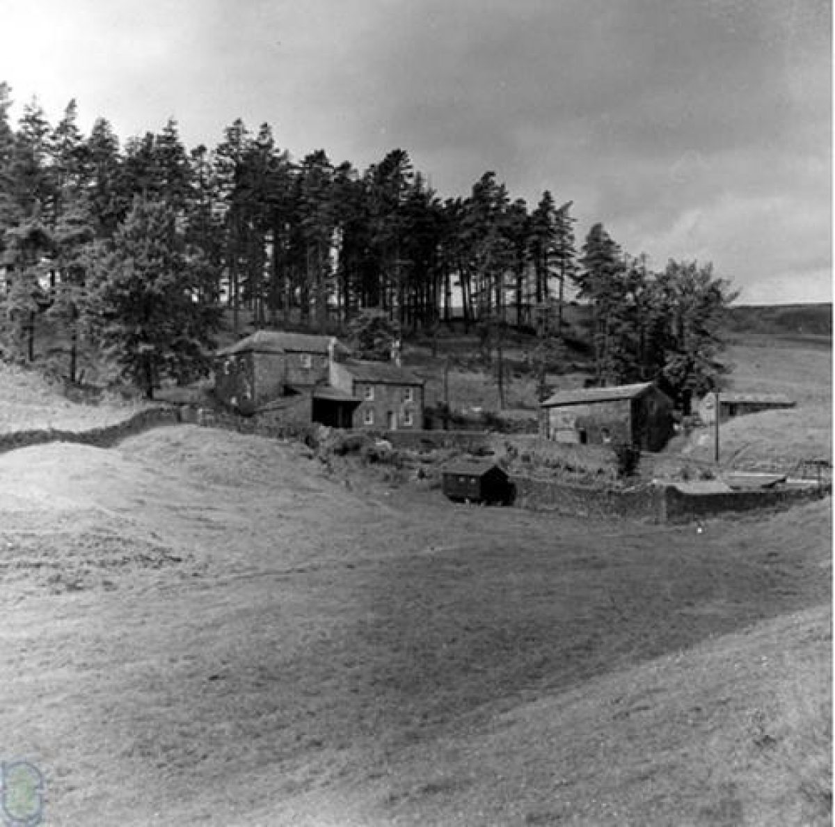
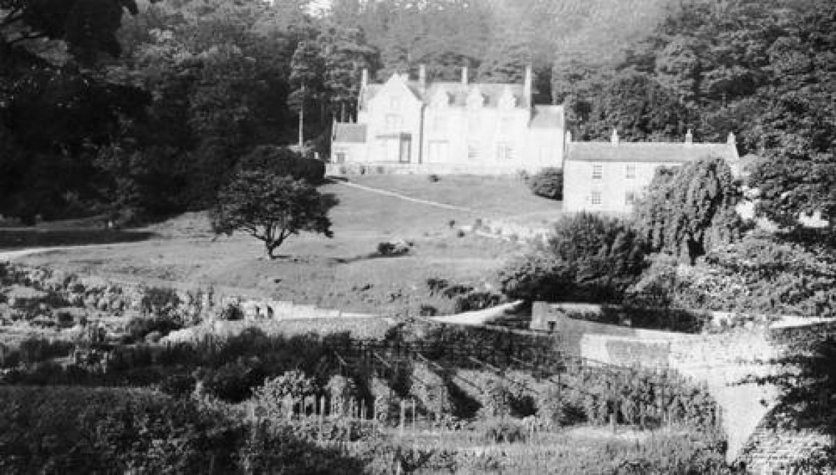
Very little is recorded about how people in Arkengarthdale grew vegetables and fruit. For the moment enough can be extrapolated from what has been written on the neighbouring dales of Swaledale and Teesdale and the recordings made for the Dales, Plants and Gardens project. The people that the Dales project has spoken with can remember back to the 1920s and 30s when their parents and uncles worked as lengthsmen, blacksmiths, inn-keepers and gardeners at the shooting lodge Scar House and, like the lead miners, every one of them took their holidays haymaking with relatives.
The average height of land in Arkengarthdale is 1000 feet and 2000 feet on the moors. Baker and Tate in 1868 recorded that most miners without smallholdings had gardens. Their report listed the plants that miners grew on the high ground of Teesdale (elevation 2,000 feet) which were turnips, rhubarb, and potatoes. Durham had been a trading centre for potatoes cultivated in the north for at least 90 years. In addition the report listed what miners in Allendale (elevation 1,600 feet) were able to grow which included cabbages, lettuces, onions, carrots, plums, raspberry and currant bushes [iii].
Enclosure Acts of the eighteenth and early nineteenth centuries and vegetable growing land
Land enclosure had little effect on the basic farming patterns of the northern dales; the land has always been too poor for any significant arable farming. If anything, the Enclosure Acts made it easier for land to be made over to rural allotments in the eighteenth and nineteenth centuries as pieces of land too small or too awkward to be farmed were either sub-let to miners or made over first to potato garths and later to allotments and small-holdings.
Mining companies such as the Quaker owned London Lead Company managed the lives of its workers, even the self-employed miners, across the Pennine dales in a uniform way "in order to compensate such of our men as have not farms we endeavour to provide them with gardens" [iv]. The mining companies valued temperate, well-fed workers.
The miners worked a complex bargain system that enabled them to set their own hours during the week. Saturday working was uncommon and Sunday unknown.
Further information about how people found time and who helped them to grow produce in the Three Dales is available in two articles on this website, located in Explore/Feature Articles.
The need to grow food
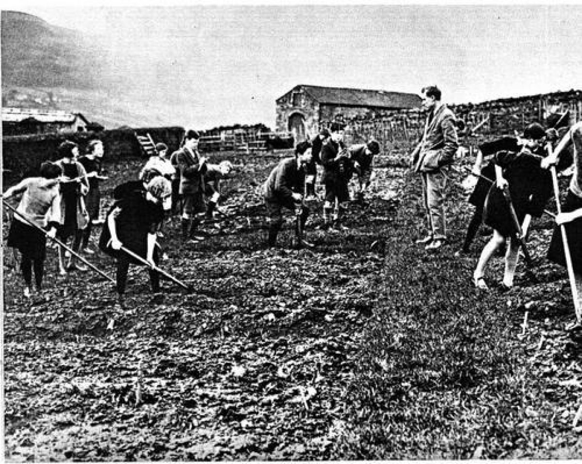
Responses to the changing seasons, weather conditions, local soil characteristics and pests and diseases created a body of knowledge passed between generations. The ability to keep livestock and the knowledge of how to grow food was essential to the miner-farmers ability to subsist. In the early twentieth century there is a photograph (in the related photographic section to this entry) that shows the headmaster of the Quaker School in Reeth teaching the children to garden.
And just as with other workers who have gardened in the Pennine dales, the problem of storage in tiny cottages was solved by growing many different varieties of the same crop that ripened at different times and so could be kept in the ground until needed.
Sources
[i] Landmark Visitor Guide to Yorkshire Dales by Ron Scholes ISBN: 9781843062097 2nd ed Landmark Publishing Ltd
[ii] Hallas, C.S Economic and social change in Wensleydale and Swaledale in the 19th century (Open University Ph.D thesis, 1988)
[iii] Baker, J.G. & Tate, G.R. New Flora of Northumberland and Durham (1868) London
[iv] in Raistrick, A. Two centuries of industrial welfare, the London (Quaker) lead company 1692-1905 (1977)
- Features & Designations
Designations
National Park
Plant Environment
Plant Type
- Key Information
Type
Garden
Purpose
Horticultural
Plant Environment
Plant Type
Principal Building
Agriculture And Subsistence
Survival
Extant
Open to the public
Yes
- References
References
- Out of Oblivion: A landscape through time
- The Yorkshire Dales: A landscape through time
- A History of Richmond & Swaledale
- A History of Lead Mining in the Pennines
- Historical Atlas of North Yorkshire
- Swaledale
- Weardale men and manners
- New Flora of Northumberland and Durham
- Inside the Forgotten Dale
- p.780 (vol 1) The reports of the Poor Law commissions of 1834 and 1909. : A paper read before the Society of Poor Law Workers on May 10, 1909.
- General view of the agriculture of Northumberland, Cumberland and Westmorland
- pp. 26-9 Report from the Select Committee on Rating of Mines : together with the proceedings of the Committee, Minutes of Evidence, Appendix and Index
Contributors
Sally Reckert