Introduction
The Moot has gardens laid out from around 1720, based on the earthwork remains of a 12th-century motte and bailey.
Terrain
The landform of The Moot is determined by the earthwork remains of the 12th-century motte and bailey, creating dramatic level changes within the site.
The following is from the Register of Parks and Gardens of Special Historic Interest. For the most up-to-date Register entry, please visit the The National Heritage List for England (NHLE):
www.historicengland.org.uk/listing/the-list
A mid- to late 18th-century garden laid out for the Coles family, making use of the earthwork remains of a 12th-century motte and bailey.
Location, Area, Boundaries, Landform and Setting
The Moot, a site of c 3.6ha, lies in the south part of Downton, a village situated east of the A338 between Salisbury and Bournemouth. To the south the site is bounded by a recreation ground with late C20 housing beyond it. To the east lies housing with farmland beyond, while to the north, beyond a c 2.5m high brick boundary wall, lie the private gardens, houses, and other buildings situated south of Downton High Street. To the west The Moot is bounded by marshland and the River Avon, which runs south from Salisbury.
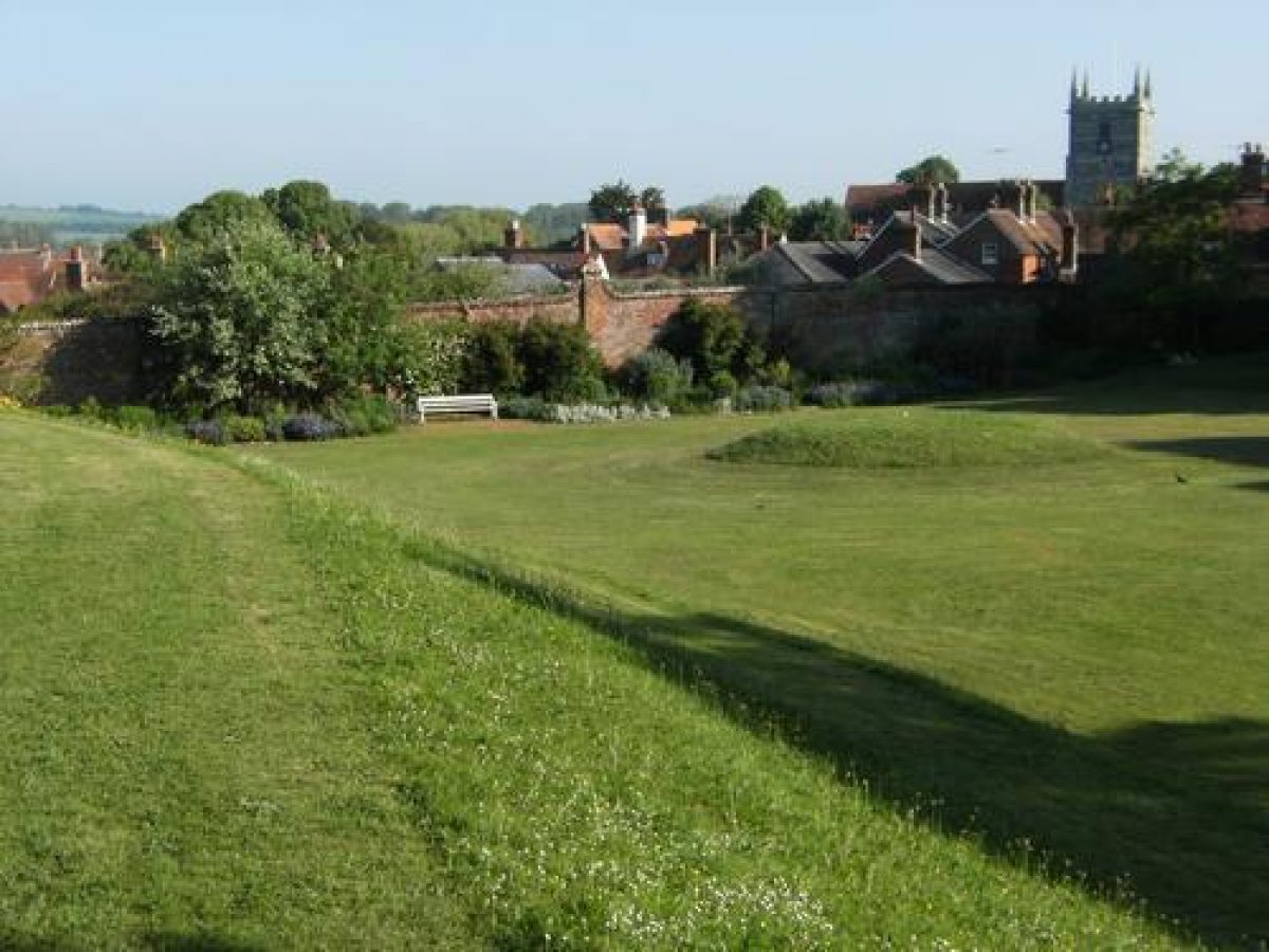
The landform of The Moot is determined by the earthwork remains of the C12 motte and bailey, creating dramatic level changes within the site. From the mounts within the site are fine views of the distant hills to the north-west of the site, including Odstock Down and Cranborne Chase, and of Downton village to the north, with the spire of St Lawrence's Church.
Entrances and Approaches
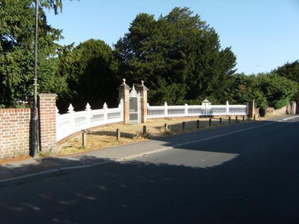
The Moot garden and Moot House are entered off Moot Lane, which runs through the eastern part of the site. The entrance to Moot House lies east off Moot Lane and is marked by an C18 wrought- and cast-iron gate and square brick gate piers with attached brick walls on either side (listed grade II). From the gate, steps lead up to a stone-paved path which leads to the west front of the House.
Directly opposite this entrance, on the west side of Moot Lane, lies the entrance to The Moot garden. It has an C18 wrought- and cast-iron gate hung between square brick gate piers (listed grade II). In around 2002, the attached dwarf walls with wooden baluster railings, as illustrated in Country Life in 1909, were reinstated and the gate piers restored.
From the entrance, a broad walk runs west, flanked on either side by a lawn, to a small flight of steps that leads up into the garden. North of the entrance is the site of a former flower walk that was separated from the kitchen garden by a yew hedge (LUC 1992).
At two points along the southern boundary of the site, wooden kissing gates (late C20) give access to The Moot garden from the playing fields and adjacent housing estate.
Principal Building
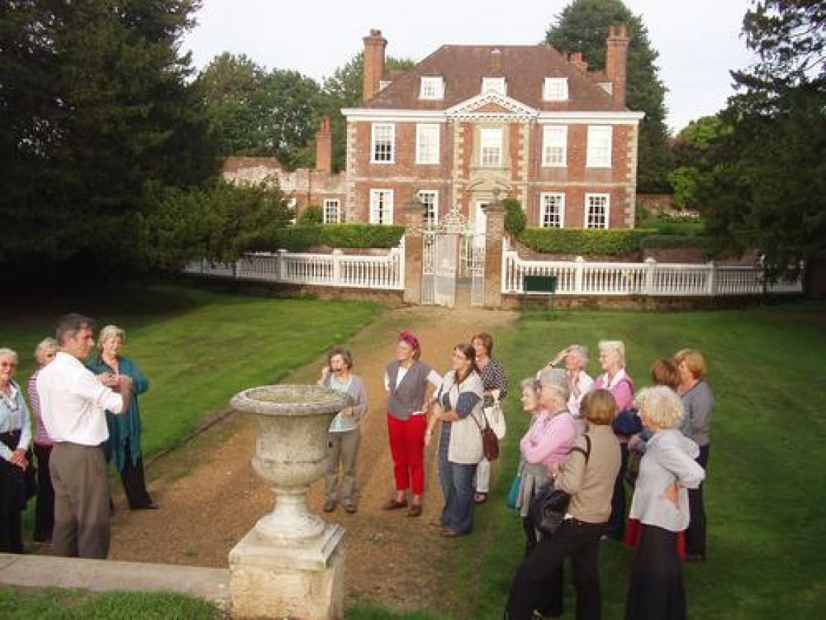
Moot House (listed grade I) lies in the north-east part of the site. The two-storey C17 house, with basement and attic, has an attached kitchen and laundry range dating from the early C18. It is built of Flemish bond brick with limestone dressings, and has a tiled hipped roof with brick chimney stacks. Large sash windows on the main, west front offer fine views of The Moot garden. Immediately north of Moot House lie the C18 stables and coach house (listed grade II).
Gardens and Pleasure Grounds
Moot House has a small garden extending to its east and south, which is laid to lawn. This is bounded along its east side by a brick wall with a planted border along its full length. The Moot garden can be divided into various areas, created by using the ditches, ringworks, and mounts of the earthwork remains. The garden is wooded in most parts, with many mature trees, and crossed by numerous paths which follow the lines and levels of the earthwork.
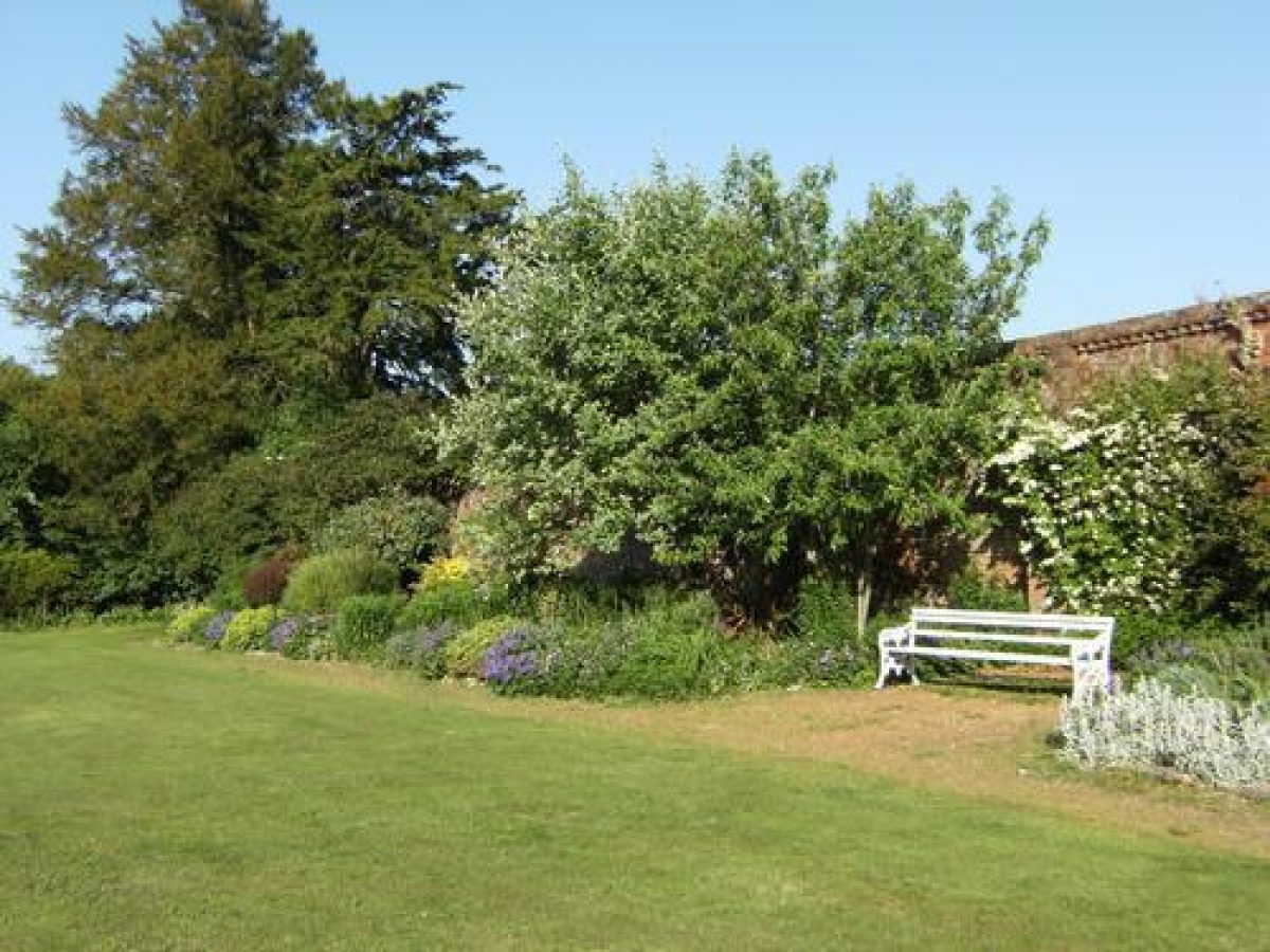
Immediately west of the entrance lies the Sundial Lawn. This is a sunken lawn surrounded to the south and east by grassed banks. To the north-west runs a gravel walk along the herbaceous border (replanted late C20) which follows the line of the north-west boundary wall. A sundial surrounded by clipped yews (CL 1909) formerly stood on the mount in the centre of the lawn. On the bank west of the lawn is the recently restored (2003) Giant's Chair, a mature topiary yew feature.
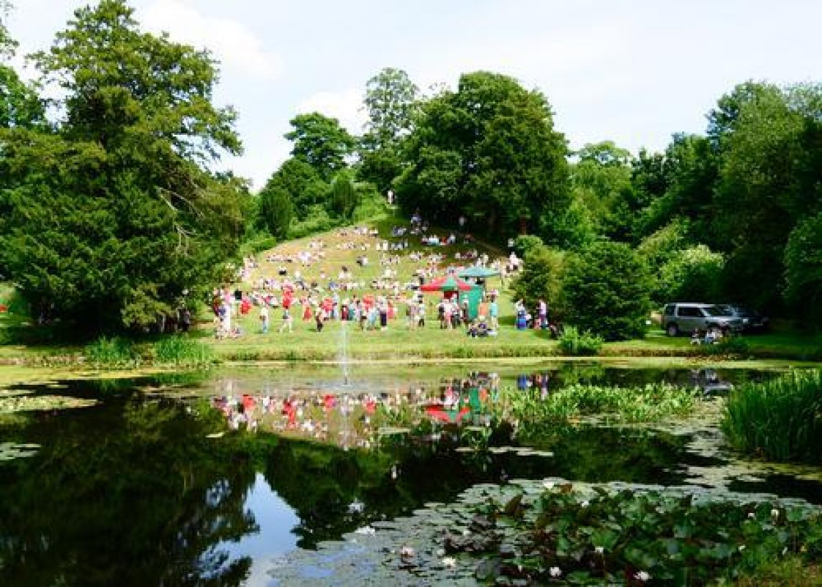
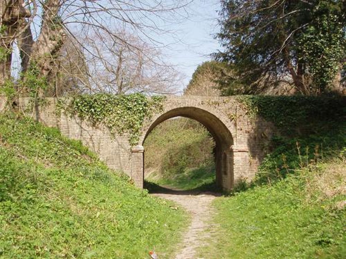
In the south corner of the Sundial Lawn, steps lead up to the Upper Terrace Walk, laid out on a bank that curves along the south-east boundary of the site, surrounding the Bailey, a semicircular area laid to lawn and planted with mature specimen trees. Planting along either side of the Upper Terrace Walk includes various mature trees. The Lime Avenue, of which only four pollarded mature lime trees now (2002) remain, runs west from the Bailey for c 75m. The Avenue runs over a brickwork bridge (dated 1815) which crosses the inner ringwork ditch to the west of the Bailey, linking the latter with the two mounts situated in the centre of the site, and the ringwork hollow beyond it.
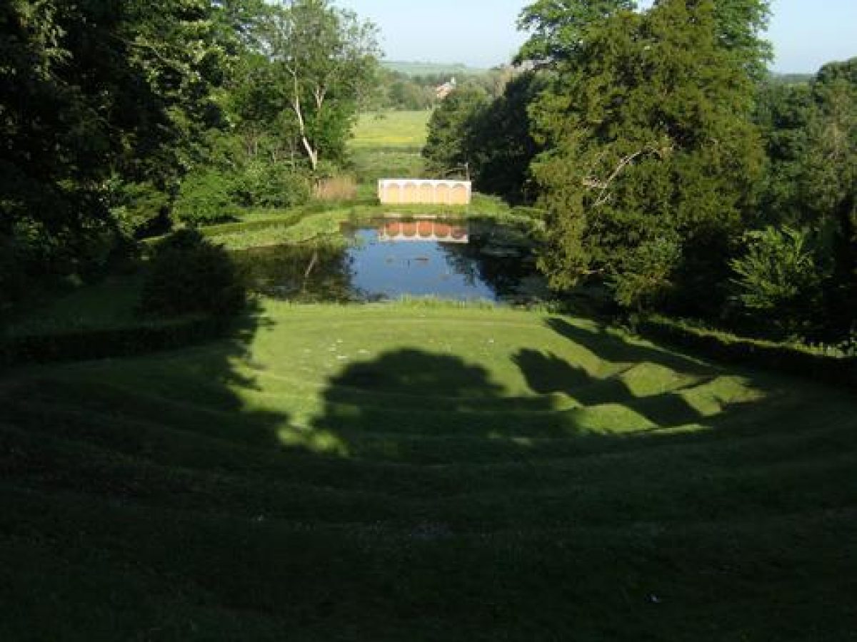
On the summit of the southern mount, called Temple Hill, are the footings of the C18 Temple of Mercury, including remains of a pebble and knuckle-bone floor. The hexagonal Temple, with Roman Doric columns and a domed roof, collapsed in the 1980s after a long period of decay. From the site of the Temple there is a fine view of an amphitheatre and a pond, extending 120m to the west. The amphitheatre has six rows of seats cut into the grassed slope which descends to the trilobate pond beyond it.
At the west end of the pond stand the remains of a curved loggia, dated 1897, probably replacing a mid C18 gothic seat (LUC 1992). The now (2002) ruinous loggia has recently (2002) been covered by a protective screen depicting a loggia. A photograph in Country Life (1909) shows the loggia as built in a Classical style, with a tiled roof and in front a balustrade with central steps leading to the pond. To the south-west and north-east of the pond lie areas of marshland along the River Avon. To the north of Temple Hill lies another mount, called Mount Bevis, just north of the centre of the site. From the summit are extensive and fine views to Downton village and St Lawrence's Church to the north, and the hills in the distance to the north-west.
In the south-east corner of the site is the site of a former orchard, now (2002) in use as a car park.
Kitchen Garden
The site of the former walled kitchen garden lies c 30m to the north-west of Moot House (outside the area here registered). The site is now occupied by a late C20 private dwelling.
REFERENCES
E P Squarey, The Moot and its Traditions (1906)
Country Life, 25 (9 January 1909), pp 54-62
G Jekyll, Garden Ornament (1918), p 198
N Pevsner and B Cherry, The Buildings of England: Wiltshire (2nd edn 1975), p 224
M Binney and A Hills, Elysian Gardens (1979), pp 44-5
Victoria History of the County of Wiltshire XI, (1980), p 30
Downton Moot: Report of Historical Survey, (Land Use Consultants 1988)
Downton Moot: Landscape Management Plan, (Land Use Consultants 1992)
Maps
Andrews and Drury, Map of Wiltshire, 1773
OS 6" to 1 mile: 1st edition published 1872
OS 25" to 1 mile: 1st edition published 1876; 2nd edition published 1901
Description written: August 2002 Amended: September 2002; February 2005
Register Inspector: FDM
Edited: April 2005
- Visitor Access, Directions & Contacts
Telephone
01725 510597Access contact details
The garden is open daily from dawn until dusk.
Directions
Owners
The Downton Moot Preservation Trust Ltd.
- History
The following is from the Register of Parks and Gardens of Special Historic Interest. For the most up-to-date Register entry, please visit the The National Heritage List for England (NHLE):
www.historicengland.org.uk/listing/the-list
HISTORIC DEVELOPMENT
In 1138, the Bishop of Winchester, Henry de Blois, built a castle at Downton. A house was built near the site of the castle, on the west bank of the River Avon, in about 1600 after ownership of the Downton estate had passed to the Coles family. A new house was built around 1650, called Downton House in 1773 (Andrews and Drury), and later known as Moot House. The building was extensively remodelled in the early to mid-18th century, and gardens were created around 1720, using the earthwork remains of Bishop Henry's castle situated in the grounds (Victoria County History 1980; Land Use Consultants 1992).
In 1754 the commentator Pococke described the garden at The Moot in his travelling journal as 'very prettily laid out and improved, being on a large old fortification with a double fosse improved into terraces above and walks below, with buildings on two mounts; the old keeps of the castle, and the river runs at the foot of it' (quoted in Land Use Consultants 1992). In 1784 the estate passed to the Rev John Shuckburgh, and it subsequently had a series of different owners. From 1873 to 1911, Moot House and its surrounding grounds belonged to the estate agent E P Squarey. Some alterations were made in the garden during the 19th century, but its main structure and layout remained the same (Land Use Consultants 1992).
In 1923 Moot House was damaged by fire but was subsequently restored. Moot House and The Moot garden were sold into divided private ownership in about 1964. Since 1988, the garden has been owned and managed by a preservation trust and is subject to an ongoing (2002) programme of management and restoration.
- Associated People
- Features & Designations
Designations
The National Heritage List for England: Register of Parks and Gardens
- Reference: GD1032
- Grade: II*
Features
- House (featured building)
- Description: A new house was built on the site in around 1650. The building was extensively remodelled in the early to mid-18th century.
- Earliest Date:
- Latest Date:
- Earthwork
- Description: The earthwork remains of Bishop Henry of Winchester's castle are situated in the grounds.
- Earliest Date:
- Latest Date:
- River
- Description: River Avon
- Amphitheatre
- Description: The amphitheatre is formed by six tiers of grass.
- Avenue
- Description: Lime avenue.
- Gardens
- g
- Motte
- Key Information
Type
Garden
Purpose
Ornamental
Survival
Extant
Hectares
3.6
Open to the public
Yes
Civil Parish
Downton
- References
References
- Jekyll, G., {Garden Ornament} (London: Country Life, 1918), p. 198 Garden Ornament
- {English Heritage Register of Parks and Gardens of Special Historic Interest}, (Swindon: English Heritage, 2008) [on CD-ROM] Historic England Register of Parks and Gardens of Special Historic Interest
- Pevsner, N. and B. Cherry, {The Buildings of England: Wiltshire} (Harmondsworth: Penguin, 1975), p. 224 The Buildings of England: Wiltshire
- Crowley, D.A. {Victoria County History: Wiltshire, Volume 11} (London: Oxford University Press, 1980), p. 30 Victoria County History: Wiltshire, Volume 11