Introduction
Luton Hoo is an 18th-century landscape park covering almost 600 hectares (475 hectares registered), designed by Lancelot 'Capability' Brown. The grounds include early-20th-century formal gardens and a rockery garden which covers two hectares. The main building is now a hotel.
Terrain
The house is sited at the top of a hill, with the park occupying the surrounding plateau and gently sloping encircling hillsides, as well as part of the River Lea valley to the north and north-east..The following is from the Register of Parks and Gardens of Special Historic Interest. For the most up-to-date Register entry, please visit The National Heritage List for England (NHLE):
Location, Area, Boundaries, Landform and Setting
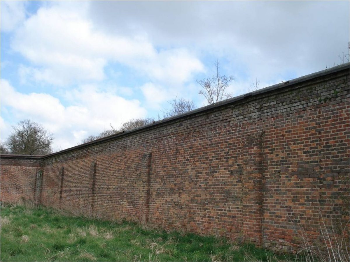
Luton Hoo lies 2 kilometres south of Luton, on the edge of the town. The estate (about 475 hectares) is bounded to the east by the B653 Lower Harpenden Road, where the boundary is largely defined by a brick wall, to the north and west by the A1081 Old London Road, and to the south by agricultural land and West Hyde Lane between Kingsbourne Green and New Mill End. The estate lies within the Chiltern Hills, the house sited at the top of a hill, with the park occupying the surrounding plateau and gently sloping encircling hillsides, as well as part of the River Lea valley to the north and north-east. The setting is agricultural and urban, most of the site being encircled by busy roads, with Luton Airport 2 kilometres north-east and the M1 motorway 1 kilometre west of the park.
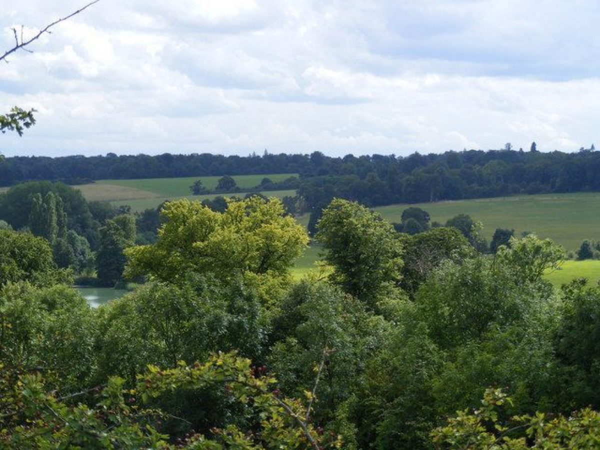
The dominant feature within the setting is the hillside east of the park, rising up from the river valley, with strategically placed woodlands defining the views across farmland. This is particularly noticeable from the north drive, and also from the east front of the house and down the east lawn. Several mixed plantations occur along this hillside, most notably George Wood and Hardingdell Woods which frame the view east from the house, east lawn and park below. The view is terminated on the ridge by Withstocks Wood some 3 kilometres to the east. It is likely that Brown created or developed these woodland features to enhance the view across the valley, although probably not drawing this hillside into the park. The east side of the valley appears to have remained agricultural land in the 19th century (sale map 1840s).
Entrances and Approaches
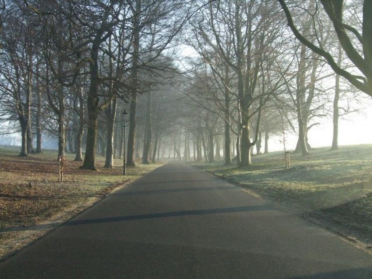
The main approach, from the south side of Luton through residential areas, is via the Luton entrance 1.5 kilometres north of the house, with its flanking iron gates, piers and railings. Two rendered two-storey lodges, dating to the late 19th/early 20th century, flank the entrance to the drive. The drive curves south through the park, flanked by mown grass verges and adjacent fencing, of iron in places, with some mature avenue trees, and views east beyond the park up the hillside beyond. The drive enters woodland 500 metres north-east of the house, running south-west up a rise. Some 75 metres north of the house a spur runs off due south, straight to the north front, the main drive turning south-east 150 metres north-west of the house to arrive at the west front with a large gravel sweep and an imposing portico.
The west drive approaches from the Old London Road past New Lodge (also called London Road Lodge), entering the park 1.2 kilometres south-west of the house. Wrought-iron carriage gates with a scrolled overthrow flank the entrance, in turn flanked by iron pillars, pedestrian side gates and railings on the top of curving low stone walls terminated by stone pillars with ball finials (early 20th century, Listed Grade II). Flanked by an avenue of trees, the drive runs north-east, dividing 700 metres south-west of the house to encircle The Plain, an open area of park surrounded by trees, lying on the level plateau south-west of the house. The two arms of this drive meet at the west front of the house.
Limetree Avenue gives access from the south, off West Hyde Lane, joining the west drive where it divides to encircle The Plain. The Avenue is entered from West Hyde Lane, 2 kilometres south of the house, between cast-iron gates and gate piers flanked by curved low stone walls with iron railings on top, terminated by stone pillars (19th century, Listed Grade II). The drive passes between Kennel Lodges, a pair of rendered single-storey lodges (19th century, Listed Grade II) in classical style which face each other, before passing north-west along the lime avenue. A short spur south-west, 500 metres north-west of Kennel Lodges, leads to Lady Bute's Lodge (19th century, Listed Grade II), a very small, single-storey, gabled Gothic building with a late Norman round-headed doorway, probably removed from another site. Limetree Avenue runs up the hillside, with views to the hills to the south-west across the Old London Road, past the estate farm to the east, to join the west drive.
The Warren Drive enters 1.4 kilometres east of the house, off the Lower Harpenden Road, flanked by gates, railings and stone walls, and Warren Hill Lodges (also known as Newmillend Lodges, all 19th century, Listed Grade II), all of which are almost identical to Kennel Lodges and related structures at the south end of Limetree Avenue. Almost immediately the drive crosses the lower, south end of the south lake, where the River Lea recovers its natural form, via a single-span cast-iron bridge (Barwell and Haggar of Northampton 1830, Listed Grade II) with decorated iron railings. The drive runs straight south-west for 800 metres before curving north-west and ascending to the plateau on which the house sits, joining the south arm of the west drive 200 metres south-west of the house.
Principal Building
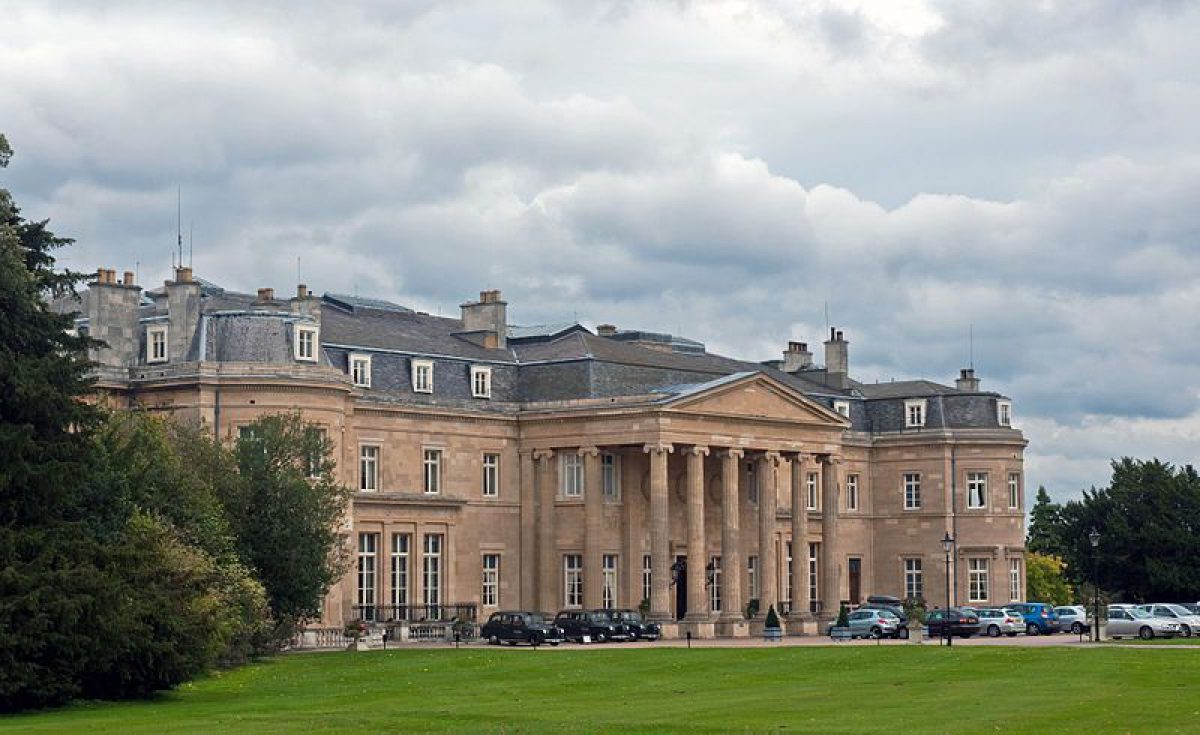
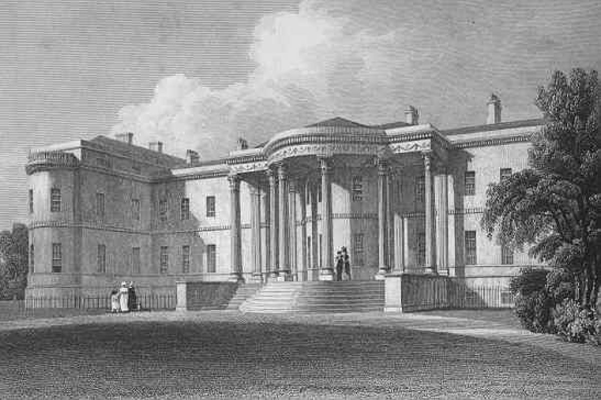
Luton Hoo (1760s, Listed Grade I), designed for the third Earl of Bute by Robert Adam, lies towards the centre of the park, sited on the edge of a hilltop facing the east side of the Lea Valley. Adam's designs were not fully executed, and further work was done by Robert Smirke (1780-1867). The building was gutted by fire in 1843, repaired, and subsequently remodelled by Charles Mewès for Sir Julius Wernher in 1903. Built of ashlar stone, the rectangular two-storey block with mansard roof is entered from the west front through a large, Ionic, hexastyle portico, only completed by Robert Smirke in the 1820s.
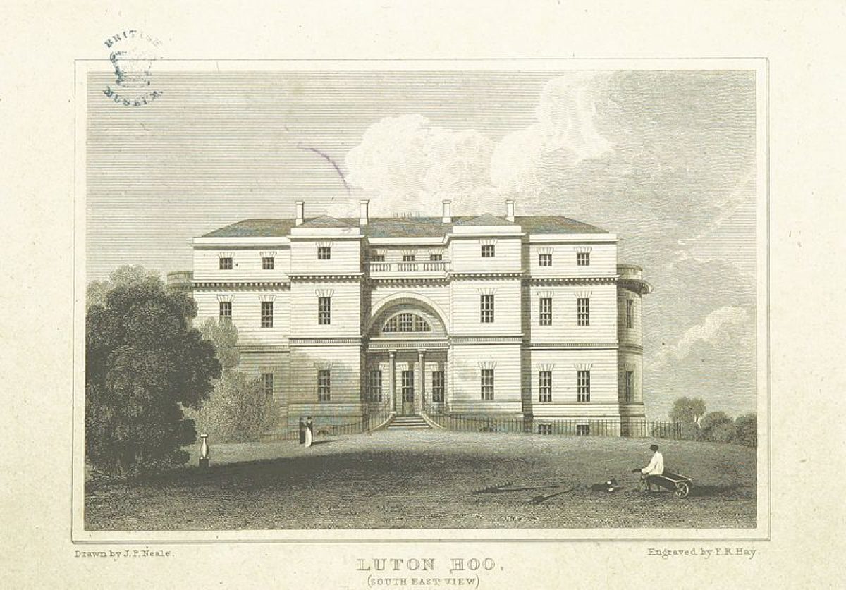
The east front, bounded by a low stone terrace and adjacent broad, straight gravel path, overlooks the sloping east park and the Lea Valley to the north-east and south-east. J P Neale's view of about 1820 shows the east front as it was completed by Adam, designed to be the main entrance to the house overlooking Brown's contemporary landscaping of the east park and lakes. The south front overlooks the formal garden (about 1912) and is bounded by a stone-flagged and balustraded terrace; the north front overlooks the sunken service court with service buildings, approached directly from the main drive to the north.
The stable yard (1760, Listed Grade I), also by Robert Adam, lies 350 metres south of the house, surrounded by woodland; it is positioned adjacent to the west and east drives as they converge to approach the house from the south. The main, west block is of two storeys, with colourwashed rendering, enclosing a rectangular courtyard entered through a central carriageway on the west side.
Gardens and Pleasure Grounds
The pleasure grounds lie to the south and east of the house, largely enclosed by a brick ha-ha, the garden features set within. The formal garden (about 1912, Listed Grade II) on the south front consists of terraced gardens on two levels, below the stone-flagged terrace adjacent to the house. A broad, axial gravel path runs through both garden terraces, broken between the terraces by a semicircular set of stone steps flanked by stone retaining walls and balustrades and angled steps at each end. The upper terrace contains two grass panels, edged by gravel paths and flower borders on the perimeter.
The lower terrace contains a central ornamental pool with a statue, with box-edged beds set in two lawns flanking the central path, a large apsidal south edge, with similar, smaller curves in the west and east edges, and two temple-style, domed, stone garden houses at the southern corners. The whole area is largely enclosed by clipped yew hedges. The terraces were laid out by William Romaine-Walker about 1912 to Mewès' design during Sir Julius Wernher's programme of extensive works to the house (Country Life 4, 1992).
A 1 hectare sunken woodland and rock garden (probably constructed in the early 20th century) lies 150 metres east of the house, set in a south-facing hollow within the pleasure grounds, from which it is enclosed and screened by mature trees and shrubs. The dominant feature is the cascade and pool system running through the area, with related cliffs, caverns, paths and bridges, incorporating what appear to be artificial and real rocks, flanked by open lawns and planted with shrubs and rock plants.
The pleasure grounds enclosing the garden features are laid to rough lawn with mature ornamental trees and shrubs, with an extensive lawn on the east front of the house stretching 250 metres east. The east lawn, flanked to north and south by mature trees, overlooks the park, stretching down the valley to the lakes and framing belt beyond, while the rising hillside beyond the park, with its woodland clumps in agricultural land, forms a backdrop.
Before 1900 (Ordnance Survey 1st edition 1881; 2nd edition 1901) the south front of the house was bounded by a path which extended west from the south end of that path along the east terrace, overlooking the informal pleasure grounds. The path returned south at the south-west corner of the house, along the west perimeter of the pleasure grounds, curving east towards the woodland 200 metres east of the house which it encircled before returning to the south-east corner of the house, forming a figure of eight in its entirety. A further path or drive appears to have led off this path 100 metres south of the house, to run along the northern perimeter of the pleasure grounds above the ha-ha. A spur south off the main path ran to the southern corner of the pleasure grounds, close to the stables. The woodland east of the house contained, by 1901, a network of paths and steps down to a semi-circular feature at its eastern edge.
Park
The extensive park, combining arable and pasture, is largely enclosed by woodland, and to the west by a narrow belt of trees, with park trees remaining to the west and north of the house. The dominant feature, the River Lea, widens into two sinuous lakes running along the whole length of the park close to the east boundary, entering at the north end and leaving at the south, separated and screened from the adjacent road by a thick belt of trees. The lakes are separated 1.2 kilometres north-east of the house by a weir and bridge. On the southern shore of the lower, south lake, 1 kilometre east of the house, stands a 19th century brick boathouse (Listed Grade II). This has a semicircular opening from the lake, the first floor being over the water, with an oriel window over the boat entrance. The south lake terminates close to Warren Hill Lodges, where the east drive is carried by the 1830s' cast-iron bridge and the natural course of the river reasserts itself.
The layout of the park appears to have changed little structurally since Bryant's map of 1826 and the sale map of the 1840s. Both maps show the lakes, woods, parkland and drives covering almost the same areas as now (1997), although with many more park trees shown on the sale map than have survived into the late 20th century. Bryant's map is likely to be an accurate reflection of Brown's work when completed in the 1770s.
Kitchen Garden
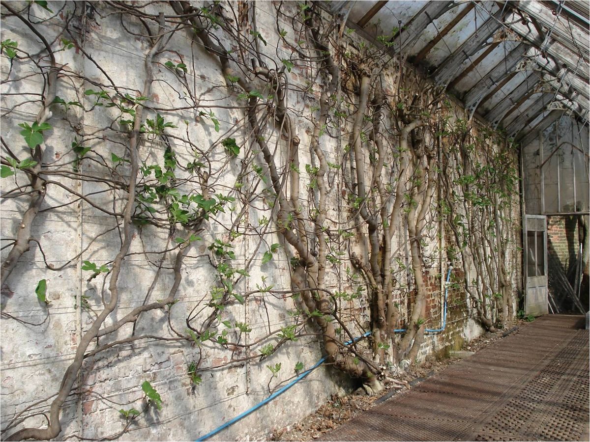
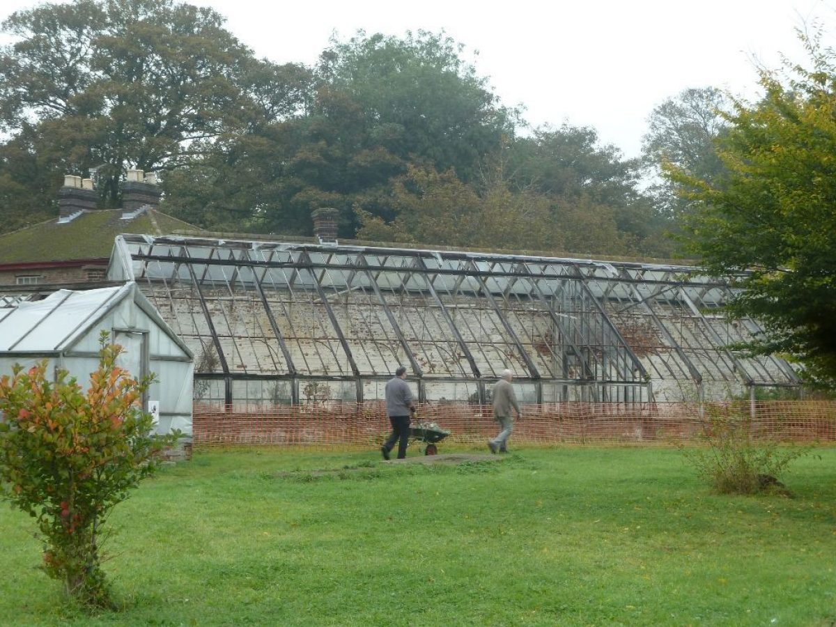
The octagonal kitchen garden lies 600 metres south-west of the house, divided in half from south-west to north-east by a central diaphragm wall. A range of glasshouses (Listed Grade II) is grouped along the inside of the west, north-west and north walls, centred on a large, late 19th century, ornamental glasshouse with projecting gabled porch and petalled glazing bars in the gable. A two-storey range of outbuildings runs along the outer side of the north-west wall. Flanking ranges included two peach houses, of which only one remains.
Further associated structures outside the octagonal wall are enclosed by an outer rectangular enclosure, entered from the drive to the north between wrought-iron gates, flanking iron screens and outer stone piers with urns facing the main glasshouse block. This octagonal walled garden is shown within a rectangular enclosure on Bryant's map of 1826, and again on the sale map of the 1840s, with internal path details and a building on the north wall, but no central wall visible.
Maps
- T Jefferys, The County of Bedford', 1765
- A Bryant, Map of the County of Bedford', 1826
- Enclosure map for Luton parish, 1842 (Bedfordshire Record Office)
- Sale Map of Luton Hoo, 1844 or 1848 (Bedfordshire Record Office)
- OS 6" to 1 mile: 1st edition published 1881
- 2nd edition published 1901
- 3rd edition published 1926
- OS 25" to 1 mile: 1st edition published 1880
Description written: August 1997
Amended: April 1999
Edited: May 1999, May 2022
- Visitor Access, Directions & Contacts
Telephone
44 (0)1582 734437Website
https://www.lutonhoo.co.ukAccess contact details
The walled garden is open on Wednesdays in the summer. For more detailed visitor information about the Walled Gardens visit the Luton Hoo website.
Much of the site is now in use as a hotel, spa and golf course.
Directions
Off the B653, 1 mile south of Luton. Railway station - Luton.
- History
The following is from the Register of Parks and Gardens of Special Historic Interest. For the most up-to-date Register entry, please visit The National Heritage List for England (NHLE):
17th Century
Sir Robert Napier bought the Luton Hoo estate in about 1600, enclosing a 150 hectare park in 1623. The Napiers built a medium-sized house during the 17th century.
18th Century
In 1762 the estate was bought by the third Earl of Bute, who employed Robert Adam (1728-1792) to rebuild the house and Lancelot Brown (1716-1783) to design the park, enlarging it to 600 hectares. Brown produced designs in 1764 (a fragment of a plan exists in the Metropolitan Museum, New York (Stroud 1975)), and continued his work at Luton Hoo until 1774, being paid a total of £10,420 by the Earl.
19th Century
The house burnt out in 1843, and in the following year the second Marquess of Bute sold the estate to John Shaw Leigh, a lawyer, who rebuilt the house.
20th Century
Sir Julius Wernher, a diamond merchant, bought the estate in 1903, having rented it since 1899, and remodelled it during the early 20th century using Charles Mewès, employing William Romaine-Walker (1854-1940) to build a formal garden on the south front to Mewès' design (CL 1992).
During World War II the Wernher family allowed the house to serve as Headquarters Eastern Command.[15] Luton Hoo's estate was used as a tank testing ground for the Churchill tanks, which were produced in factories in the town of Luton.
Following Lady Zia's death in 1977, the estate passed to her grandson Nicholas Harold Phillips, after whose death in 1991 the house and 1,059 acres were sold by his wife Lucy Phillips.
21st Century
The house was converted into a luxury hotel called the Luton Hoo Hotel, Golf, and Spa, which opened in October 2007.
- Associated People
- Features & Designations
Designations
The National Heritage List for England: Register of Parks and Gardens
- Reference: GD1567
- Grade: II*
Features
- Lake
- Specimen Tree
- House (featured building)
- Description: Built of ashlar stone, the rectangular two-storey block with mansard roof is entered from the west front through a large, Ionic, hexastyle portico, only completed by Robert Smirke in the 1820s.
- Earliest Date:
- Latest Date:
- Boundary Wall
- Description: The boundary is largely defined by a brick wall.
- Plantation
- Description: Several mixed plantations occur along the hillside, most notably George Wood and Hardingdell Woods which frame the view east from the house, east lawn and park below.
- Gate
- Description: The main entrance is approached through ron gates, piers and railings.
- Gate Lodge
- Description: Two rendered two-storey lodges, dating to the late 19th/early 20th century, flank the entrance to the drive.
- Earliest Date:
- Latest Date:
- Drive
- Description: The drive curves south through the park, flanked by mown grass verges and adjacent fencing.
- Avenue
- Description: Mature avenue trees.
- Gate Lodge
- Description: New Lodge (also called London Road Lodge).
- Gate
- Description: Wrought-iron carriage gates with a scrolled overthrow.
- Finial
- Description: Stone pillars with ball finials.
- Earliest Date:
- Latest Date:
- Boundary Wall
- Description: Low stone walls with iron railings on top, terminated by stone pillars.
- Earliest Date:
- Latest Date:
- Gate Lodge
- Description: Kennel Lodges, a pair of rendered single-storey lodges in classical style which face each other.
- Earliest Date:
- Latest Date:
- Avenue
- Description: Lime avenue.
- Gate Lodge
- Description: Lady Bute's Lodge, a very small, single-storey, gabled Gothic building with a late Norman round-headed doorway, probably removed from another site.
- Earliest Date:
- Latest Date:
- Drive
- Description: The Warren Drive enters 1.4 kilometres east of the house, off the Lower Harpenden Road, flanked by gates, railings and stone walls.
- Gate Lodge
- Description: Warren Hill Lodges, all of which are almost identical to Kennel Lodges and related structures at the south end of Limetree Avenue.
- Earliest Date:
- Latest Date:
- River
- Description: River Lea
- Ornamental Bridge
- Description: A single-span cast-iron bridge (Barwell and Haggar of Northampton 1830, Listed Grade II) with decorated iron railings.
- Terrace
- Description: The east front is bounded by a low stone terrace.
- Terrace
- Description: A stone-flagged and balustraded terrace.
- Stable
- Yard
- Description: The stable yard by Robert Adam lies 350 metres south of the house. The main, west block is of two storeys, with colourwashed rendering, enclosing a rectangular courtyard entered through a central carriageway on the west side.
- Earliest Date:
- Latest Date:
- Ha-ha
- Description: The pleasure grounds lie to the south and east of the house, largely enclosed by a brick ha-ha.
- Planting
- Description: The formal garden on the south front consists of terraced gardens on two levels.
- Earliest Date:
- Latest Date:
- Path
- Description: A broad, axial gravel path runs through both garden terraces.
- Steps
- Description: Stone steps
- Wall
- Description: Stone retaining walls.
- Balustrade
- Pool
- Description: The lower terrace contains a central ornamental pool with a statue.
- Statue
- Garden House
- Description: Two temple-style, domed, stone garden houses.
- Hedge
- Description: Clipped yew hedges.
- Planting
- Description: A 1 hectare sunken woodland and rock garden lies 150 metres east of the house, set in a south-facing hollow within the pleasure grounds, from which it is enclosed and screened by mature trees and shrubs
- Earliest Date:
- Latest Date:
- Cascade
- Pool
- Ornamental Bridge
- Lawn
- Description: The pleasure grounds are laid to rough lawn with mature ornamental trees and shrubs, with an extensive lawn on the east front of the house stretching 250 metres east. The east lawn, flanked to north and south by mature trees, overlooks the park.
- Tree Belt
- River
- Description: River Lea.
- Lake
- Description: Two sinuous lakes running along the whole length of the park close to the east boundary.
- Boat House
- Description: On the southern shore of the lower, south lake, 1 kilometre east of the house, stands a 19th century brick boathouse. This has a semicircular opening from the lake, the first floor being over the water, with an oriel window over the boat entrance.
- Earliest Date:
- Latest Date:
- Ornamental Bridge
- Description: 1830s' cast-iron bridge.
- Earliest Date:
- Latest Date:
- Kitchen Garden
- Description: The octagonal kitchen garden lies 600 metres south-west of the house, divided in half from south-west to north-east by a central diaphragm wall.
- Latest Date:
- Glasshouse
- Description: A range of glasshouses is grouped along the inside of the west, north-west and north walls, centred on a large, late 19th century, ornamental glasshouse with projecting gabled porch and petalled glazing bars in the gable.
- Key Information
Type
Park
Purpose
Ornamental
Principal Building
Commercial
Survival
Extant
Hectares
507
Open to the public
Yes
Civil Parish
Hyde
- References
References
- Stroud, D. {Capability Brown} (1975) pp 133-134 Capability Brown (Country Life article)
- {English Heritage Register of Parks and Gardens of Special Historic Interest}, (Swindon: English Heritage, 2008) [on CD-ROM] Historic England Register of Parks and Gardens of Special Historic Interest
- Brown, Lancelot {Lancelot Brown design for landscaping grounds in a park, possibly relating to Luton Hoo} (1764) Lancelot Brown design for landscaping grounds in a park, possibly relating to Luton Hoo
- Vol 107 (5 May 1950), pp 1282-5; (19 May 1950), pp 1458-9; no 3 (16 January 1992), pp 44-7; no 4 (23 January 1992), pp 50-3 Country Life
- Related Documents