Introduction
The current layout of the designed landscape at Kelburn Castle dates from about 1855. There is parkland with specimen trees, a terraced garden whose walls date from the 18th century, a late-19th-century New Zealand garden, and a small formal garden. The wider estate features a romantic glen and woodland walks.
The following is from the Historic Environment Scotland Gardens and Designed Landscapes Inventory. For the most up-to-date Inventory entry, please visit the Historic Environment Scotland website:
Location and Setting
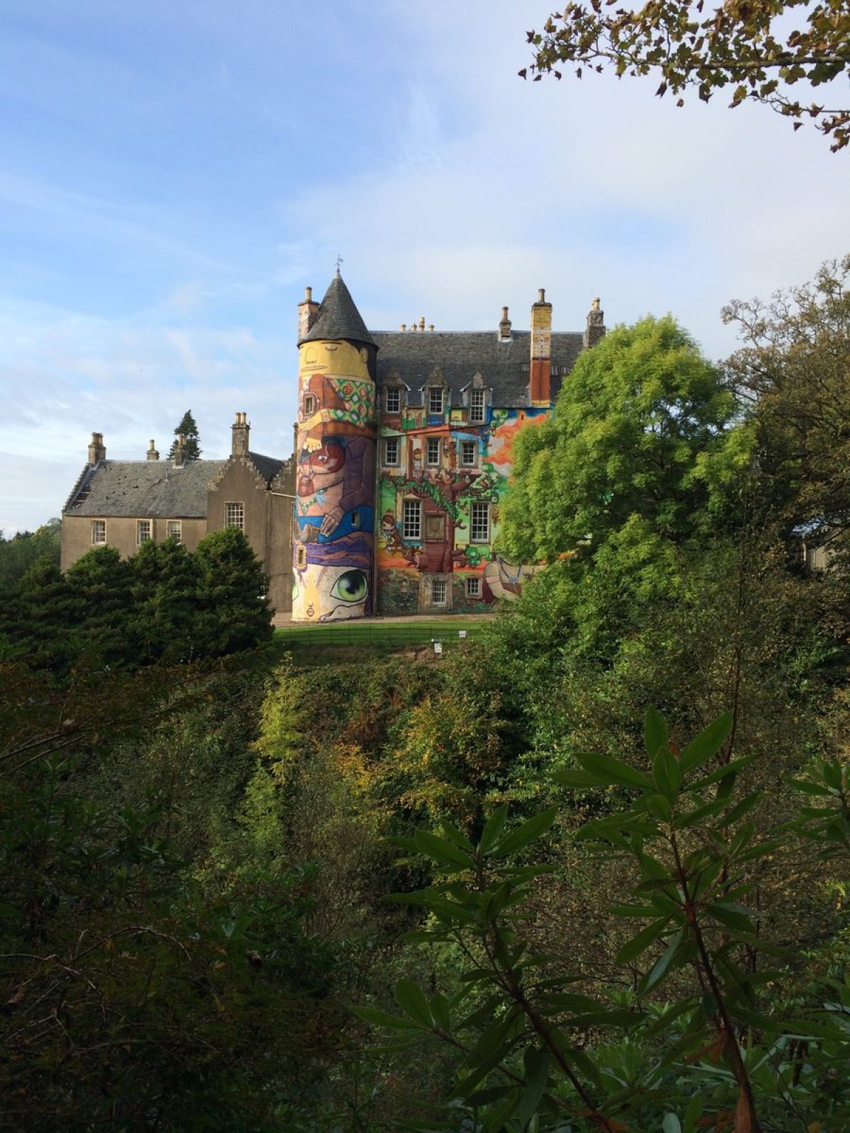
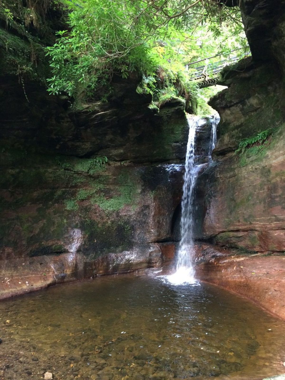
Kelburn lies in an attractive valley on the west coast of Scotland just south of the town of Largs. The hills rise steeply behind the policies to the moorland blocks above; these are sharply bisected by the Kel Burn which, in just under three miles, descends from around 1300' (400m) to sea level with several waterfalls along its short length. The lower one was recorded as being of some 50' in height in 1882 but the burn has cut back through the bedrock to form a narrow gorge and the height of this lower waterfall today is about 20'. The Castle is set on the north bank of the burn and has outstanding views to the Firth of Clyde, Arran and the Cumbrae islands.
The designed landscape at Kelburn is bounded by the A78 to the west and enclosed by the woodland plantations to the north and south which extend up to the top of Kelburn Glen. Roy's map of 1750 shows earlier plantations in square blocks, but not as extensive as the plantations today. These were put in from the 18th century onwards, the commercial softwood planting being undertaken by the 8th Earl from 1906. Within the gardens the layout has remained basically the same since 1700 when the main wing was added to the original tower house and a walled garden was enclosed. The stables and other estate offices are also thought to date from this time. The coastal setting has been used for the designed landscape, which focuses on the views to the west. The designed landscape covers some 772 acres (312ha) today.
Landscape Components
Architectural Features
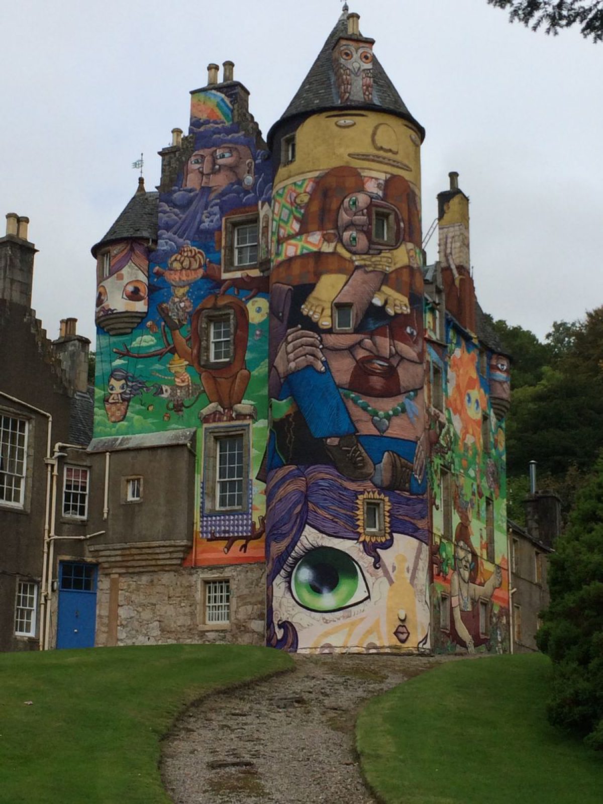
The Castle is listed A; the tower erected by John Boyle bears the date 1581, together with his initials and those of his wife Marion Crawford, above the original north entrance. In 1885 it was noted as having 'the only ancient metallic termination to the turret' in Scotland. The mansion wing was added in 1692 and the North-East Wing in 1879. The Stables are thought to date from the mid-18th century and were renovated in 1979; they are listed B, as are the cartshed and cottages to the north-west of the Castle. There are two sundials which are listed A: one in the kitchen garden and one, dated 1707, by the Children's Garden to the west of the castle. The West Lodge is listed B and is Baronial in style, while the former lodge, cut off from the main drive by the advent of the railway in 1885, is derelict and listed C(S). The gate piers to the north drive are listed C(S), while those on the south drive are listed B. Kelburn Bridge is listed C(S). Designed by Robert Adam, the Monument to the 3rd Earl, 'virtue lamenting the loss of one of her favourite sons', is sited on the north side of the Kel Burn and is listed A. There is also a late 19th century rustic-style garden house north of the kitchen garden.
Paths and Walks
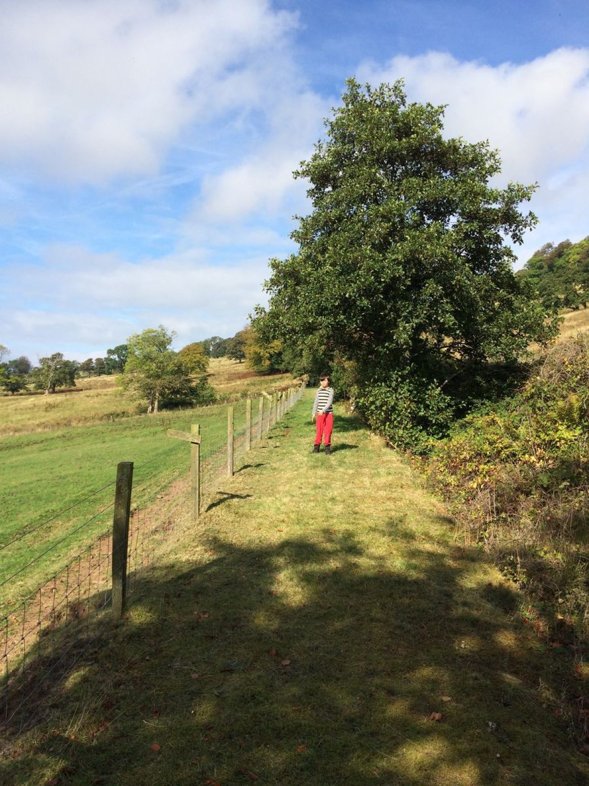
There are several woodland walks and trails which are described in leaflets available to visitors giving approximate walking times and distances. The north glen and south glen paths enable walks up the Kel Burn. Not far from the Castle is the Great Waterfall Pool where the Burn falls some 20' into a deep pool at the end of a narrow gorge carved out by the river itself. The waterfall has receded upstream by many feet in the present Earl's lifetime and has carved the gorge down through the softer rocks along its path. The monument to the 3rd Earl is also visible from the glen walks. The upper estate road provides a longer distance walk with extensive views to the west. The Countess's walk provides a more gentle-sloped approach to the upper estate road and gives spectacular views across the Firth.
Parkland
There are still many fine specimen trees within the parkland, which is grazed. The northern area of the park is a golf course and was part of the estate until 1982. The western strip of the park and the main lodge were cut off from the rest of the estate by the railway in 1885.
Woodland
There are some 500 acres of woodland within the estate; the hillsides are planted with both coniferous plantations and deciduous woodlands, while Kelburn Glen is mainly deciduous woodland. There is quite a wide variety of species within the woodlands and they are scenically very significant. Many trees were lost during the 1968 gales. Many of the beech trees planted in the 3rd Earl's time are coming to the end of their life.
The Gardens
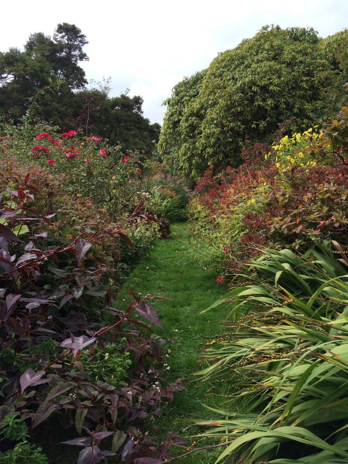
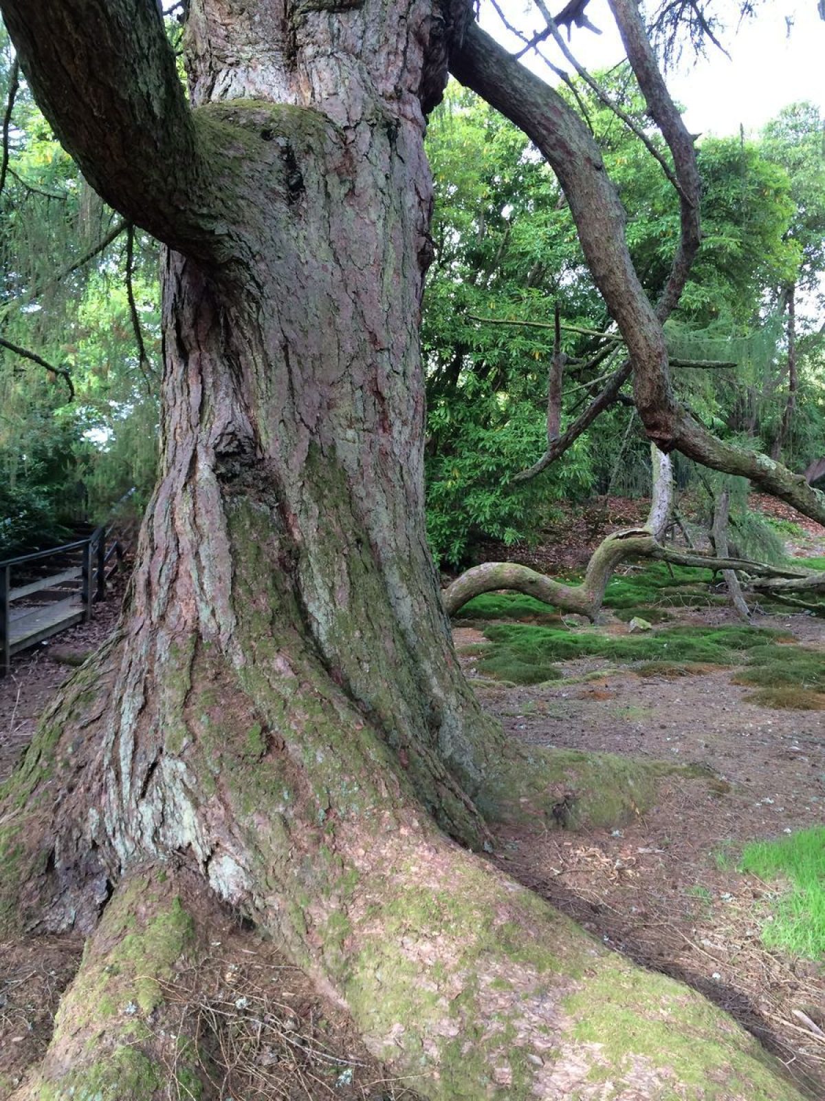
The Plaisance' originated between 1760-80; it consists of a walled and terraced area to the north and west of the castle and contains some very interesting tree and shrub species. A list of the specimen trees is given in the 'Trees at Kelburn' booklet. Amongst the more striking are the 'weeping larch' and the 'oldest and tallest' Monterey pine in Scotland. Alan Mitchell has measured the specimen trees at Kelburn, some of which are shown to be about ten years old or less in a photograph dated 1869. There are species Rhododendrons amongst the shrubbery plants.
The New Zealand Garden was designed by the 7th Countess on their return from New Zealand after the 7th Earl's term as Governor there, and contains many species from the southern hemisphere. It is currently in the process of being redesigned.
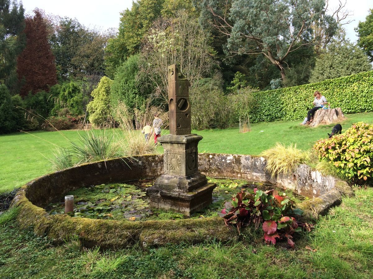
The only formal garden remaining at Kelburn is the Children's Garden on the west lawn below the Castle from which it is overlooked; it is laid out with herbs within evergreen hedge enclosures. It was designed in c.1760 during the 3rd Earl's time and each corner contains the initials of one of his four children. The 1707 sundial is on the west lawn next to the Children's Garden.
To the north of the mansion wing is an enclosed area into which the drive turns and runs up to the front door. The bowling green was within this enclosure on the east side of the drive. Photographs and paintings at various dates since 1700, when the walls were built, show hedges at various heights surrounding the outside of the garden and also edging the drive.
Walled Garden
The kitchen garden is to the north-west of the Castle by the north office court. The second sundial is sited here. The area is not totally maintained today, although some vegetables are still grown.
- Visitor Access, Directions & Contacts
Telephone
01475 568685Website
https://www.kelburnestate.comAccess contact details
The site is open from 10am to 6pm between April and October. The grounds and riding school only are open in the winter months.
Directions
The main bus route to Ayr on the A78 stops adjacent to Kelburn's entrance. The nearest station is two miles away at Largs.
- History
The following is from the Historic Environment Scotland Gardens and Designed Landscapes Inventory. For the most up-to-date Inventory entry, please visit the Historic Environment Scotland website:
Reason for Inclusion
An impressive designed landscape, most notable for its artistic, scenic and architectural qualities and with a good historical background to its development. There is also a good collection of trees and exotic plants set against the dramatic waterfalls of the Kel Burn.
No famous designers are known to have been involved with the development of the landscape at Kelburn, although there are still some uncatalogued plans in the castle which might help to trace the pattern of development. Looking at Roy's map of 1750 and comparing the pattern and the age of the trees in the woodlands today, it would appear that a major change in the layout occurred between 1750 and c.1780. The new layout is shown on the 1st edition OS of 1855 and has remained similar since then. The 8th Earl's plantations are recorded on the 2nd edition map of c.1910.
14th Century
The Kelburn Estate has been in the Boyle (formerly 'de Boyville') family since the 13th century.
16th Century
The original keep was replaced by a tower house erected in 1581 by John Boyle and, by the 17th century, the estate was described as having very beautiful orchards and gardens.
17th - 19th Century
David Boyle who had promoted the Union, was created an Earl in 1699 and it was he who added the main wing between 1692- 1700 linked obliquely to the tower. A further addition of the north-east wing was made in 1879-80 by the 6th Earl. There have been several MPs in the family, and the 4th Earl was created Lord Ross of Hawkhead. The 7th Earl became Governor of New Zealand and mementoes of his stay there are to be found in the museum, as well as in the New Zealand Garden designed by the 7th Countess. The Countess's Walk is thought to have been named after her.
20th Century
In 1979-80 the south estate offices and stables were converted into Kelburn Country Centre which provides an information office, a tea room in the old stables with additional seating area outside, toilets, a craft shop in the old laundry, and craft workshop areas in the old byre. The sawmill is still in use for the estate. Other facilities for the visitor are provided in this area and are described below.
Period
- Post Medieval (1540 to 1901)
- Victorian (1837-1901)
- Associated People
- Features & Designations
Designations
Historic Environment Scotland An Inventory of Gardens and Designed Landscapes in Scotland
Features
- Sundial
- Description: Sundial near the formal garden.
- Earliest Date:
- Latest Date:
- Specimen Tree
- Description: A weeping larch which is about 180 years old.
- Castle (featured building)
- Description: The Castle is listed A; the tower erected by John Boyle bears the date 1581, together with his initials and those of his wife Marion Crawford, above the original north entrance.
- Earliest Date:
- Icehouse
- Waterfall
- Description: Great waterfall pool
- Walled Garden
- Description: Added in the 18th Century
- Key Information
Type
Estate
Purpose
Recreational/sport
Principal Building
Domestic / Residential
Period
Post Medieval (1540 to 1901)
Survival
Extant
Hectares
312
Open to the public
Yes
Electoral Ward
Largs South and Fairlie
- References
References
-
Historic Scotland, 'Kelburn Castle', {Gardens and Designed Landscapes},
- Peter McGowan Associates with Christopher Dingwall, 'Kelburn', in {Ayrshire Garden and Designed Landscape Survey} (Prestwick: South Ayrshire Council, 2007) [on CD-ROM] Ayrshire Garden and Designed Landscape Survey
- Millar, A. H., {The Castles and Mansions of Ayrshire with Historical and Descriptive Accounts} (Glasgow: Grimsay Press, 2004), pp. 96-7 The Castles and Mansions of Ayrshire with Historical and Descriptive Accounts
- Close, R. (ed), {Ayrshire and Arran: An Illustrated Architectural Guide} (Edinburgh: The Rutland Press, 1992), p. 82 Ayrshire and Arran: An Illustrated Architectural Guide
- Sinclair, J. (ed), {[Old] Statistical Account of Scotland} ([n.p.]: [n.pub.], 1971-9), Vol. 2, pp. 360-6 and Vol. 7, pp. 503-20 [Old] Statistical Account of Scotland 1791-1799
- {Ordnance Survey County Series Six Inch} (Southampton, 1854) Ordnance Survey County Series Six Inch
- Captain M. J. Armstrong and Son {A New Map of Ayrshire} (1775) A New Map of Ayrshire
- Joan Blaeu {Atlas Novus - South Carrick/North Carrick/Kyle/Cunninghame} (Amsterdam, 1654) Atlas Novus - South Carrick/North Carrick/Kyle/Cunninghame
- Chittenden, F. J., (ed), {Conifers in Cultivation: Report of the Royal Horticultural Society Conifer Conference 1931} ([n.p.]: The Royal Horticultural Society, 1931), pp. 468-9 Conifers in Cultivation
Contributors
Historic Scotland
-
Historic Scotland, 'Kelburn Castle', {Gardens and Designed Landscapes},