Introduction
Heaton Park is an 18th-century landscape park occupying about 243 hectares. The site was purchased in 1902 by Manchester Corporation for use as a public park.
Terrain
Rises from the south and west.Since 1902 there have been many developments in the park. The lake was created in 1913, an avenue was planted along Grand Lodge approach, and a formal parterre was established before the south front of the hall. 20th century amenities include a boating lake, bowling green, tennis courts, playing fields, golf courses and picnic areas. The stables are now a Farm Interpretation Centre, and the orangery is a functions suite. The northern area of the park was considerably altered in the 1960s by the addition of the Post Office Tower, North West Water Authority treatment plant and reservoir.
The following is from the Register of Parks and Gardens of Special Historic Interest. For the most up-to-date Register entry, please visit the The National Heritage List for England (NHLE):
www.historicengland.org.uk/listing/the-list
A park and pleasure grounds retaining elements of schemes probably designed by William Emes and John Webb.
DESCRIPTION
LOCATION, AREA, BOUNDARIES, LANDFORM, SETTING
Heaton Park is situated c 5km north of Manchester city centre. The site is defined by Sheepfoot Lane to the south, Bury Old Road to the west, St Margaret's Road and the M66 motorway to the north and Middleton Road to the east. Motorway widening has encroached slightly into the historic parkland at its northernmost point and in the north-west corner a C20 reservoir cuts into the park, but otherwise the boundary is marked by a mixture of brick walls, railings and walls surmounted by railings. These generally represent the replacement or rebuilding of a 3m high wall which was built to enclose the site during the period 1807-14, probably under the supervision of John Webb and Lewis Wyatt. Some parts of the wall survive to the original height on Middleton Road and adjacent to the former main entrance flanking the Grand Lodge, on the corner of Sheepfoot Lane and Bury Old Road. The c 240ha park is situated on land which rises from the south and west, and there is a valley running through the northern and north-eastern part of the site. The setting is urban in character but there are views over partially open country to the east and south-east and to the Pennines to the north and north-west.
ENTRANCES AND APPROACHES
There are six main entrances, four with lodges. At the principal entrance is the Grand Lodge (early C19, listed grade II*) designed by Lewis Wyatt which is situated at the junction of Sheepfoot Lane and Bury Old Road. A drive leading to the Hall appears to follow the line of an avenue shown on an estate map of c 1750. An entrance called Heaton Gates, with lodge, gates and gate piers of early C20 date, is situated on Middleton Road. Another entrance north of this has a neo-classical octagonal stone lodge, known as Smithy Lodge (late C18, grade II*). This entrance, with a driveway leading to the Hall, has a late C20 golf driving range c 30m south-west of the lodge building and a late C20 golf club house c 70m west of this. An entrance on St Margaret's Road has a small lodge of simple design. The drives leading from these lodges to the Hall were widened following acquisition by Manchester Corporation and these, as well as later routes through the park, are almost all fenced with railings of various C20 dates.
PRINCIPAL BUILDING
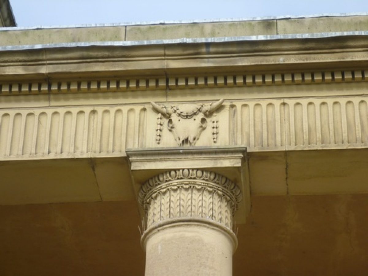
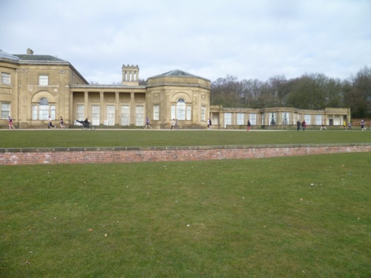
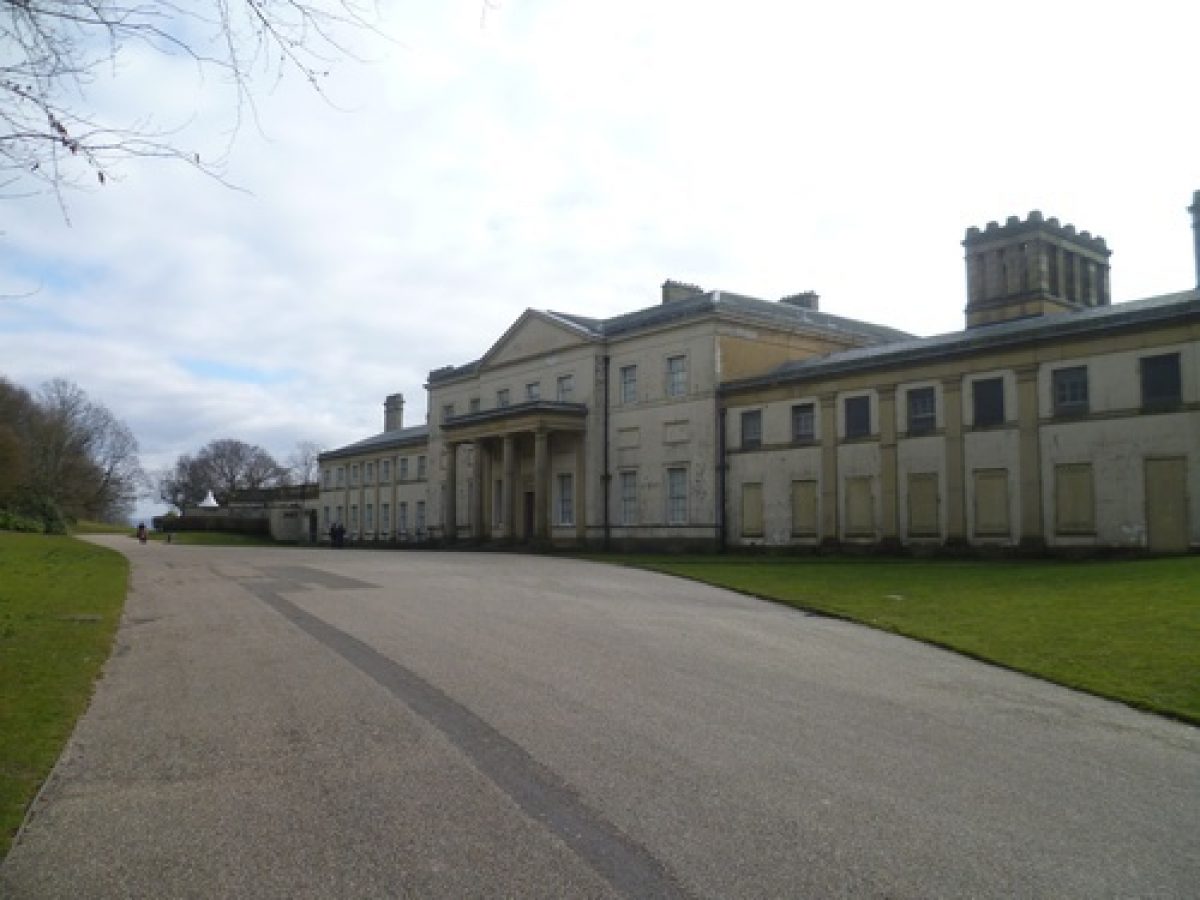
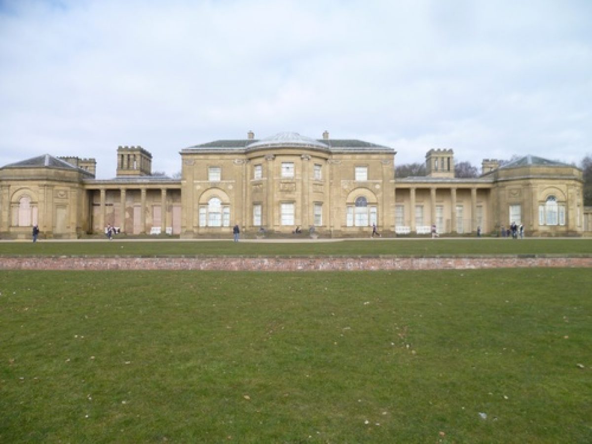
Heaton Hall (listed grade I) was designed by James Wyatt 1772-89 for Sir Thomas Egerton, seventh baronet. There is evidence that part of an earlier house, shown on an engraving of c 1750, was incorporated into the design. The Hall is considered to be the finest of its type in the region and one of the finest in the country (Pevsner 1969). It is situated almost at the centre of the park and faces south-east, with views to the south and east now obscured by C20 planting. In 1830 an orangery was added to the east wing of the Hall, probably by Lewis Wyatt.
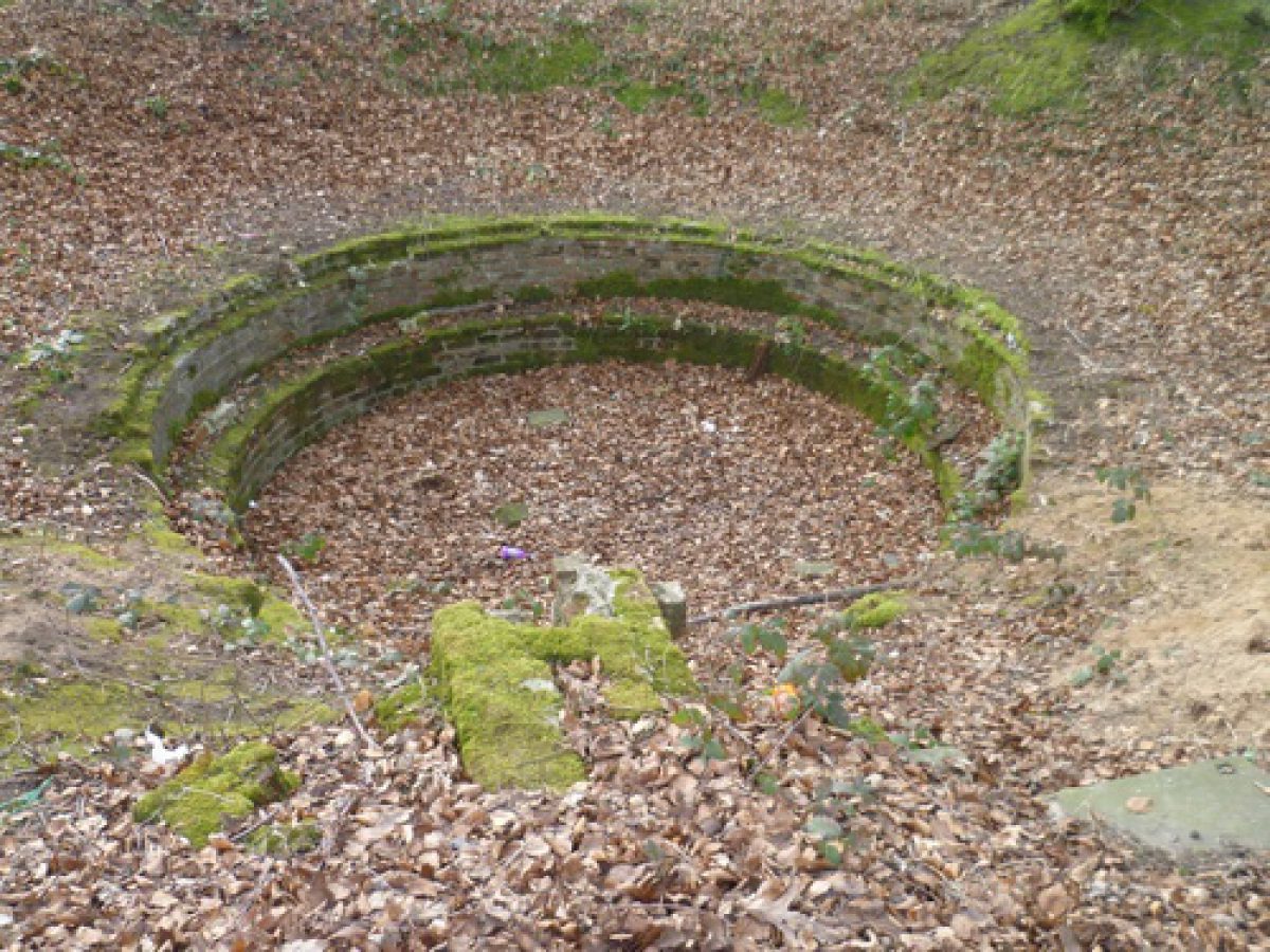
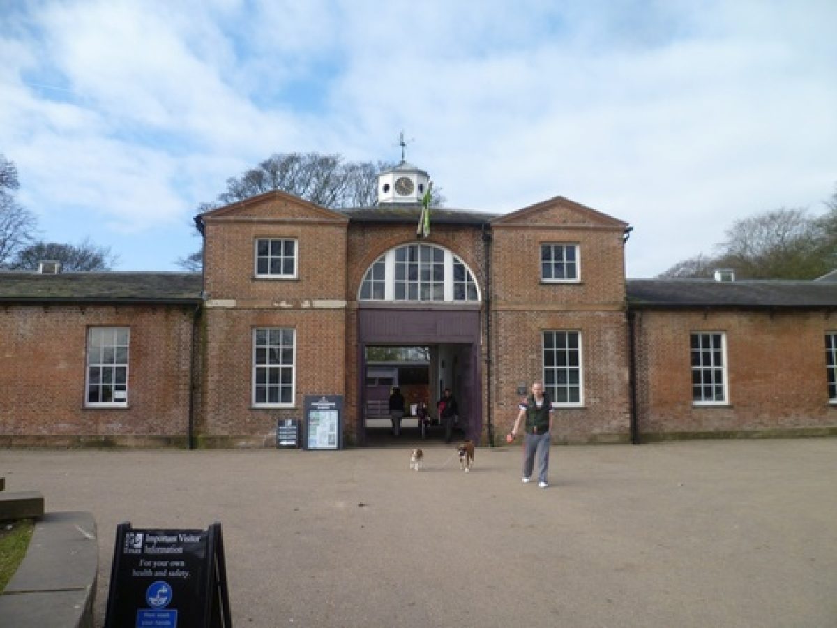
The stable block and site of a home farm are situated c 60m north-west of the Hall. The stable block, attributed to Samuel Wyatt (late C18, listed grade II), is used partly for offices and partly as stables. The home farm was situated c 100m west of the stables; the early C19 bailiff's house and part of another building of similar date survive but the rest was demolished in the 1970s. The remains of an icehouse c 20m to the north-east of the farm were excavated by the Greater Manchester Archaeological Unit in 1989.
GARDENS AND PLEASURE GROUNDS
The pleasure grounds consist of a terrace on the south-east front of the Hall and an area to the north and west, including the stables and home farm, enclosed by a ha-ha shown on a sale map of 1866. The ha-ha is partially extant and it is well-preserved in the area north of the Hall where it exhibits signs of later C20 repair. A path is shown on the 1st edition OS map surveyed 1844 leading along its inside edge, following the contours of the slope, from a point c 50m north of the Hall around to the south front of the building where the ha-ha disappears. A modern path which leads between the terrace in front of the Hall and the bowling greens beyond appears to follow its line.
The C20 terrace in front of the Hall is laid out as a formal garden with geometric beds. C20 bowling greens lie below the terrace to the south-east and the area is screened with C20 planting. The land rises steeply behind the Hall on the north and north-east sides and on the highest point of this eminence is a circular neo-classical temple, probably by Samuel Wyatt (c 1795-1802, listed grade II*). This commands panoramic views of the surrounding area and the Pennines to the north, east and south.
West of the Hall, in the area between the stables and the home farm, is a garden enclosed by a brick wall on the north side running between the stables and farm, the fenced site of the farm and a causeway on the west side, a tree belt to the south, and the stables on the east. The garden is reached by a path which runs west from drives on the south side of the Hall. The north end of the garden has lawns and geometric beds on the site of hothouses shown on the 1844 and 1933 OS maps. The land slopes down to the south where there are lawns and specimen trees fringed with a belt of trees. A stone grotto consisting of an arched recess flanked with rockwork is set into a slope c 10m south of the home farm site. On the west side of the garden a tunnel in the form of a rustic stonework bridge leads beneath a causeway. The causeway leads from the park to the home farm and was probably provided so that cattle could be driven there without entering the gardens. Beyond the bridge is a clearing and a path leading into the Dell, an irregularly shaped wooded area with curving paths leading through it, and to a small lake c 300m south-west of the stables. This is overlooked by a C20 bandstand. The walks are connected by a path leading west through a belt of woodland to the kitchen garden. This path, the causeway, the Dell and the lake are all shown on the 1844 OS map. At that time the lake was of serpentine shape.
PARK
There are tree belts around the parts of the northern, north-western and north-eastern park boundaries which are the survivors of the extensive perimeter plantings shown on the 1844 OS map. The northern and north-eastern part of the park is described as a deer park on the 1844 OS map. In this area there are three small lakes and a stream which runs in a steep wooded valley. The northernmost lake is called New Pond on the 1844 OS map. These parts of the park are otherwise mainly open grassland which has been turned into a golf course.
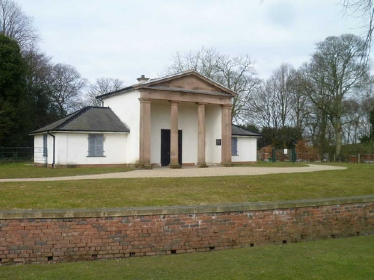
An ornamental temple called the Dower House (late C18, listed grade II) is situated c 300m north-west of the Hall on the edge of woodland which screens the south-east end of a reservoir. This was constructed in the 1930s, taking an area of c 15ha from the north-west corner of the park; a water treatment plant was added during the 1950s at the south-east end of the reservoir. A telecommunications tower was erected c 320m north-west of the Hall in the 1960s. Playing fields are situated south of the reservoir in the north-west corner of the park.
The southern part of the park is also open grassland with some tree cover, including C20 avenues along parts of the drives from the Grand Lodge and Heaton Gates. This part of the park is illustrated in a watercolour of 1802 (Manchester City Art Galleries 1972) which indicates that there was fairly extensive tree cover with planting north and west of the Hall, together with clumps and belts of trees in grassland. This view shows the park after it was redesigned in the 1770s. The redesign included the removal of a formal garden with radiating avenues and terraces on the south front of the Hall which is shown on an estate plan of c 1750. Two other views of this area by John Ferneley (ibid), painted in 1829 after John Webb had been involved with the landscape, show a racecourse in the south-eastern part of the park which had been created in 1827 and was situated c 600m south of the Hall. A comparison with the 1802 watercolour suggests that the tree cover had been thinned out to give better views to and from the Hall.
This part of the park is now dominated by a large boating lake which was made on the site of the racecourse in 1912-13. At the same time, part of the facade of Manchester's former Town Hall designed by Frances Goodwin in 1822-4 (listed grade II*) was erected c 20m south of the south end of the lake. There is a boathouse on the western shore and a tram line runs east from the north end of the lake to a large tram shed of early to mid C20 date c 280m west of Heaton Gate.
The south-west part of the park is mainly open grassland with some fenced areas where cattle are grazed. A section of railway shown on the 2nd edition OS map published 1889 emerges from a tunnel c 1km south-west of the Hall and runs for a short distance through the park and thence into a tunnel beneath Bury Old Road.
KITCHEN GARDEN
A brick-walled kitchen garden is situated c 400m west of the Hall. It is shown on the 1844 OS map when, as now, it was linked to the pleasure grounds by a path leading through a belt of woodland. The north-east wall has been reduced in height, while other walls are intact. Inside are a number of late C20 glasshouses. A gardener's house (listed grade II) lies immediately to the south-east within a garden bounded by hedges.
REFERENCES
The Victoria History of the County of Lancashire 5, (1911), pp 80-2
Country Life, 36 (28 November 1914), pp 710-17; 58 (29 August 1925), pp 322-8; (5 September 1925), pp 354-9
N Pevsner, The Buildings of England: South Lancashire (1969), pp 328-30
Heaton Hall, Manchester, (Manchester City Art Galleries 1972)
J Lomax, Heaton House (1983), (reprinted from Transactions of the
Lancashire Cheshire Antiquarian Society 82, pp 58-101)
Parks for the People, (Manchester City Art Galleries 1987), pp 19-20
Heaton Park Icehouse, (Greater Manchester Archaeological Unit 1991)
Heaton Park - Summary of Landscape History, (Elizabeth Banks Associates 1995)
Maps
Estate Map, around 1750, Greater Manchester Record Office
OS 6" to 1 mile: 1st edition surveyed 1844; 2nd edition published 1889; revised 2nd edition published 1907; provisional edition 1932 with additions 1938
Map attached to 1866 Sale Prospectus, reproduced in Lomax 1983
M66 Manchester Outer Ring Road Draft Landscape Proposals, 1991
Description written: February 1997
Amended: June 1998
Edited: March 1999
- Visitor Access, Directions & Contacts
Telephone
0161 773 1085Access contact details
The site is open daily, 8am to dusk.
Directions
The park is four miles north of the city centre, south of the M66/M60 junction 18.
Owners
Manchester City Council
Town Hall, Albert Square, Manchester, M60 2LA
- History
Heaton Park is an 18th-century landscaped park purchased in 1902 by Manchester Corporation for a public park.
Heaton Hall dates from the mid-18th-century, and was re-modelled and enlarged around 1772 by James Wyatt for Sir Thomas Egerton, later 1st Earl of Willon. The design of north front, the orangery (to east of the hall) and the lodges was probably undertaken by Lewis William Wyatt between 1806 and 1824. The hall is now an art gallery.
The stables, which lie to the north west, are attributed to Samuel Wyatt (dating from around 1777). Smithy Lodge lies at the north-east entrance to the park. There is also Grand Lodge, with an archway by Lewis Wyatt (1807) at the south-west entrance.
Other features include a fountain by T Worthington and Son, with a carved dolphin by Cassidy (1897), transferred around 1913 from Albert Square, Manchester to the formal garden before the south front of the house. There is a Tuscan Doric rotunda, dating from around 1795 to 1802, attributed to Samuel Wyatt. This lies on high ground 300 metres to the north-east. There is a second temple, now known as the Dower House, 400 metres to the north-west. A Post Office Tower dating from the mid-1960s is situated 400 metres to the north.
A colonnade by Francis Goodwin dating from 1822-4 formed part of the facade of the old Manchester Town Hall. This feature was re-erected in Heaton park in 1913 to the west end of the lake, which was also created in 1913 500 metres south of the Hall.
Heaton Park is situated on a south-facing and undulating slope with good views over Manchester and towards the Pennines. The park became part of the Egerton family estates in 1684, and was laid out before 1750 in formal style, with terraces and lawns with the old Heaton House. There were enclosed gardens to the south, and woodland to the east with radiating avenues in the surrounding park.
William Emes was called in around 1722 to ‘naturalise' the grounds around the hall, thereby eliminating most traces of the earlier layout. Further landscaping from 1807 was done by John Webb, a pupil of Emes. In this period the park was enclosed by a wall three metres high, broken by six entrances, four with lodges. Parts of the wall survive on the western boundary. Webb also developed the area behind the stables. Features included hothouses, flower gardens and an ornamental shrubbery. There was also an enclosed kitchen garden.
Race meetings were held in Heaton Park between 1827 and 1839. The racecourse was on the site of the present lake.
The following is from the Register of Parks and Gardens of Special Historic Interest. For the most up-to-date Register entry, please visit the The National Heritage List for England (NHLE):
www.historicengland.org.uk/listing/the-list
HISTORIC DEVELOPMENT
The Heaton Estate had been consolidated by the early 17th century. It was acquired through marriage by the Egertons, later Earls of Wilton, in 1684. Sir Thomas Egerton, first Lord Wilton, made several payments to William Emes (1729-1803) during the period 1770-2 when the park was being redesigned. Further works were undertaken during the period 1808-9 by John Webb (1754-1828), a pupil of Emes, at the same time that Lewis Wyatt (1777-1853) was working on the Hall. Sir Thomas Egerton’s interest in contemporary ideas about landscape is witnessed by his Grand Tour journal of 1784-5 and the fact that he bought two Claude glasses for his trip. The site was acquired by Manchester Corporation in 1902 and subsequently used as a public park.
Period
- 20th Century (1901 to 2000)
- Early 20th Century (1901 to 1932)
- Associated People
- Features & Designations
Designations
The National Heritage List for England: Register of Parks and Gardens
- Reference: GD1851
- Grade: II
Features
- House (featured building)
- Earliest Date:
- Latest Date:
- Stable Block
- Description: The stables are now a Farm Interpretation Centre.
- Earliest Date:
- Latest Date:
- Gate Lodge
- Description: Smithy Lodge lies at the north-east entrance to the park. There is also Grand Lodge, with an archway by Lewis Wyatt (1807) at the south-west entrance.
- Earliest Date:
- Latest Date:
- Fountain
- Description: Other features include a fountain by T Worthington and Son, with a carved dolphin by Cassidy (1897), transferred around 1913 from Albert Square, Manchester to the formal garden before the south front of the house.
- Rotunda
- Description: There is a Tuscan Doric rotunda, dating from around 1795 to 1802, attributed to Samuel Wyatt. This lies on high ground 300 metres to the north-east.
- Earliest Date:
- Latest Date:
- Temple
- Description: There is a second temple, now known as the Dower House.
- Tower
- Description: There is Post Office Tower dating from the mid-1960s.
- Earliest Date:
- Latest Date:
- Lake
- Earliest Date:
- Latest Date:
- Wall
- Description: The park was enclosed by a wall three metres high, broken by six entrances, four with lodges. Parts of the wall survive on the western boundary.
- Earliest Date:
- Avenue
- Earliest Date:
- Parterre
- Description: A formal parterre was established before the south front of the hall.
- Earliest Date:
- Boating Lake
- Key Information
Type
Park
Purpose
Recreational/sport
Principal Building
Parks, Gardens And Urban Spaces
Period
20th Century (1901 to 2000)
Survival
Extant
Hectares
243
Open to the public
Yes
- References
References
- {English Heritage Register of Parks and Gardens of Special Historic Interest}, (Swindon: English Heritage, 2008) [on CD-ROM] Historic England Register of Parks and Gardens of Special Historic Interest
- University of Manchester and University of York, {A Survey of Historic Parks and Gardens in Greater Manchester}, York, 1994 A Survey of Historic Parks and Gardens in Greater Manchester
- Hartwell, Clare and others {The Buildings of England: Lancashire : Manchester and the South-East} (London: Yale University Press, 2004) The Buildings of England: Lancashire : Manchester and the South-East
- Farrer, W and Brownbill, J. {Victoria County History: Lancaster, Volume 5} ([n.p.]: [n.pub.], 1911), pp. 80-2 Victoria County History: Lancaster, Volume 5
- {Heaton Park Landscape Restoration Plan} (1997) Heaton Park Landscape Restoration Plan
- Land Use Consultants {Heaton Park Historic Landscape Study and Restoration Management Plan} (1998) Heaton Park Historic Landscape Study and Restoration Management Plan
- Land Use Consultants {Heaton Park Management Plan} (2005) Heaton Park Management Plan
Contributors
Lancashire Gardens Trust
Greater Manchester Archaeological Unit
- Related Documents
-
CLS 1/374/2
Historic Landscape Survey, part of Outline Landscape Strategy - Digital copy
Derek Lovejoy Partnership/ Elizabeth Banks Associates - 1995
-
CLS 1/375/1
Landscape History - Digital copy
Elizabeth Banks Associates - 1995
-
CLS 1/374/2