Introduction
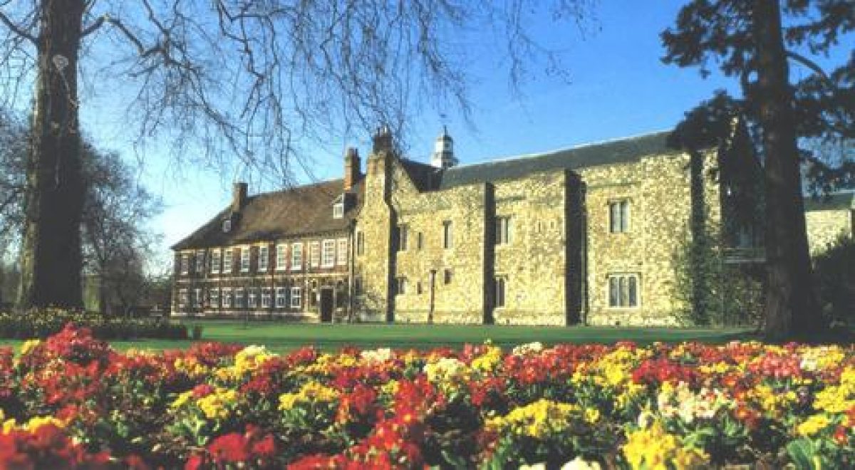
Hall Place is a Grade I listed manor house surrounded by extensive parkland on the banks of the River Cray at Bexley. There are formal gardens around the house, with topiary and herbaceous borders. The walled gardens contain a plant nursery.
Terrain
The grounds at Hall Place are mainly level, with a slight slope downwards to the south- east. The River Cray runs through the middle of the site with a flood defence to the south of the river.The following is from the Register of Parks and Gardens of Special Historic Interest. For the most up-to-date Register entry, please visit the The National Heritage List for England (NHLE):
www.historicengland.org.uk/listing/the-list/
Early C20 gardens and grounds of C16/C17 manor house, opened to the public in 1952.DESCRIPTION
LOCATION, AREA, BOUNDARIES, LANDFORM, SETTING
Hall Place is situated to the north of the main trunk road, the A2 Rochester Way, east of the Black Prince interchange. The small industrial town of Crayford lies to the north-east and the urban housing of Bexley Heath and Bexley are to the north and south-west respectively. The junction of the A220 Bexley Heath to Bexley road and the A223 road to Crayford lies to the north-west of the site and the A223 continues along the northern boundary. The Dartford to Lewisham railway line runs a few metres to the south of the southern boundary. Sports pitches and recreation grounds provide the boundary to the east.
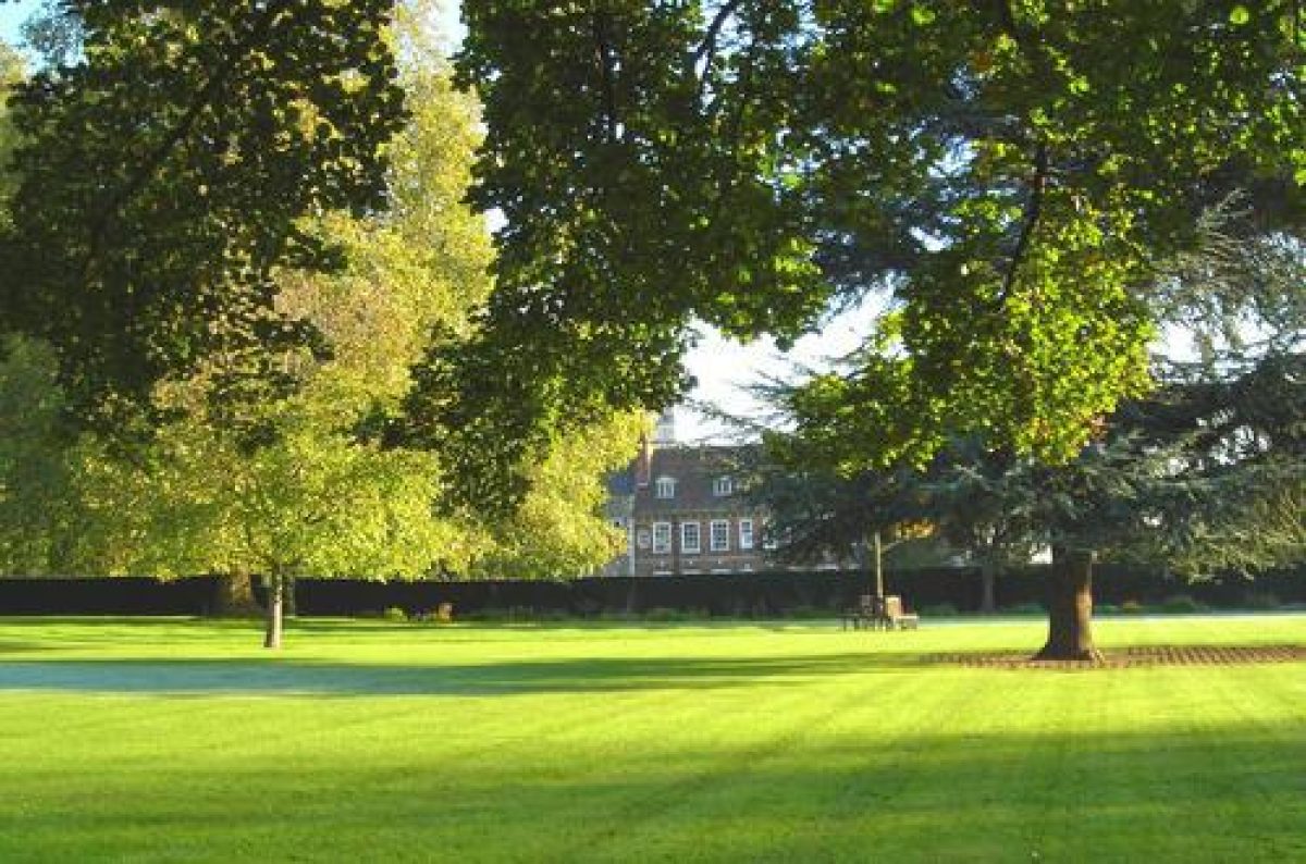
The grounds at Hall Place are mainly level, with a slight slope downwards to the south-east. The River Cray runs through the middle of the site with a flood defence (bank and ditch) sited to the south of the river. The remains of an avenue extend north-west from the A223, across open grassland (outside the area here registered). The avenue is aligned on the north front of Hall Place mansion, following the line of a double avenue depicted on an estate map of 1700.
ENTRANCES AND APPROACHES
Hall Place is approached from the car park to the north-east, past a C17 barn (listed grade II), now (1997) a restaurant, to the south. Wooden gates adjacent to the barn open onto a drive which leads towards the mansion and links with the rarely used northern carriage drive. The northern carriage drive is approached through iron gates, guarded by a C19 red-brick lodge 50m north-east of the mansion. The drive curves to the west and then runs along the east front of the mansion, linking up with the main drive to the south of the main door. The drive continues around the mansion into the garden to the south.
PRINCIPAL BUILDING
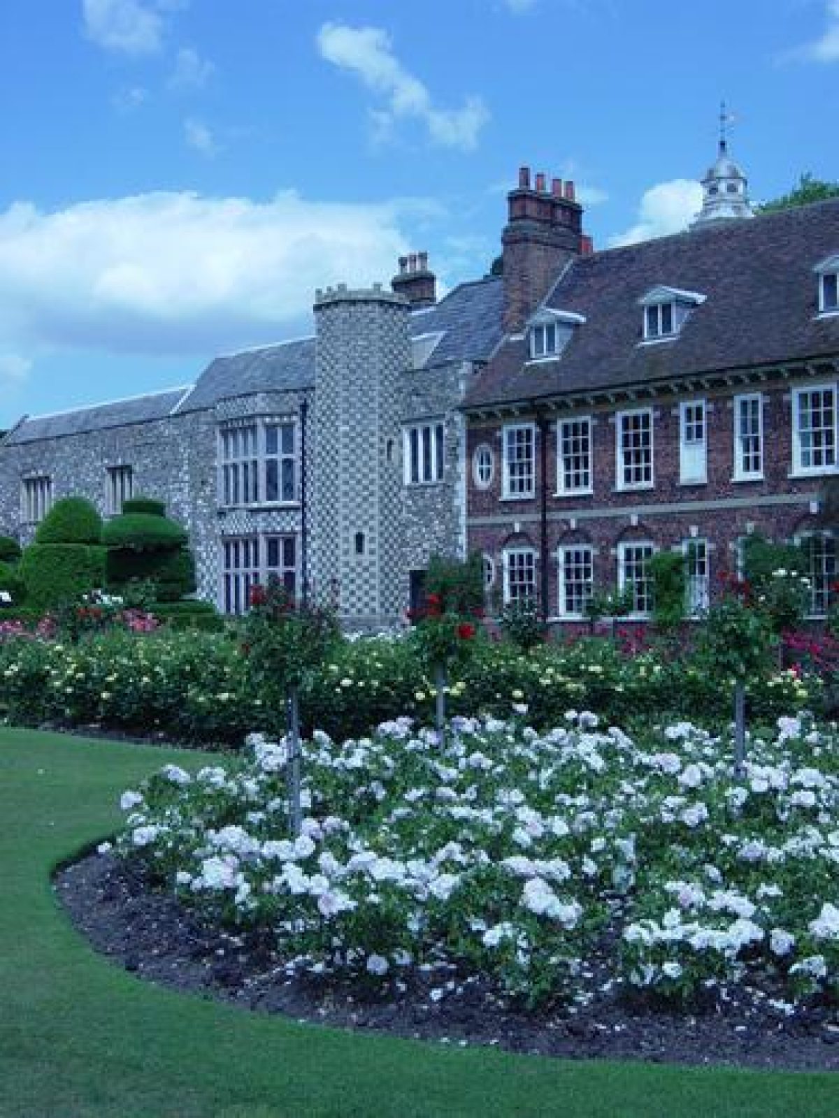
Hall Place (listed grade I) was built by Sir John Champenois in the mid C16 and modified to a half H-plan by his son, Justinian, c 1556. The early stone and flint building had the Great Hall forming the main area with two wings extending from it to the north. The roof of the Tudor building is slate covered, the rest is tiled. The house was extended on the south side in red brick by Robert Austen in the mid C17. The C17 building forms three sides of a quadrangle, and is of two storeys with a deep hipped roof on a wooden bracket cornice. The central doorway on the south side, which has a basket arch in a moulded-stone architrave surround with a fanlight of three lights, leads into the courtyard.
GARDENS AND PLEASURE GROUNDS
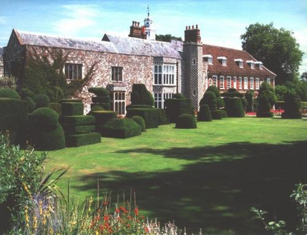
The oldest part of the garden lies to the north, enclosed within the remains of the C18 red-brick walls (listed grade II). The wall is breached by wrought-iron railings with centrally place C18 wrought-iron gates attributed to Thomas Robertson, a pupil of Jean Tijou, who designed the screen for the Great Parterre at Hampton Court (qv).The drive associated with the gates, which are focused on the C16 Great Hall, probably went out of use when Robert Austen enlarged the house to the south. The garden is laid out mainly to grass with a central circular bed, quartered and planted, as are the long side beds, with annuals. These gardens are not open to the general public. On the east front, the current (1997) entrance drive leads into a grassed courtyard planted with mature trees, some of which are thought to have C19 origins. The tarmac path continues between the south front of the house and the south lawn, beyond which lie the tree-lined banks of the River Cray. From the south front of the house the path leads west to the C20 rose garden and, to the north of the rose garden, the C20 topiary. The clipped yew topiary figures are in two phases; the earlier phase to the north-west of the house, planted by the Countess of Limerick in 1932, appears to be of abstract figures. The later figures planted along the path to the north of the rose garden represent the Queen's beasts and were planted to commemorate the coronation of Elizabeth II in 1953.
The topiary is planted around two sides of a lawn which is bordered on the north-north-west side by a raised grass terrace, with an herbaceous border against the brick boundary wall to the north.
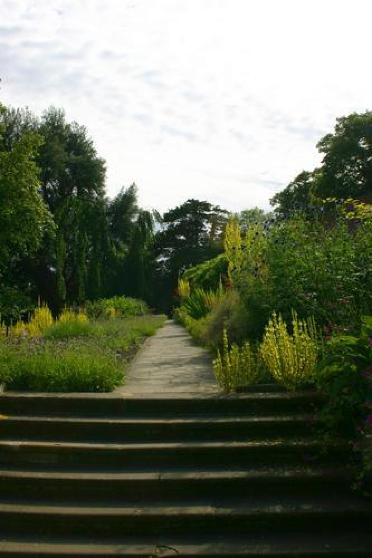
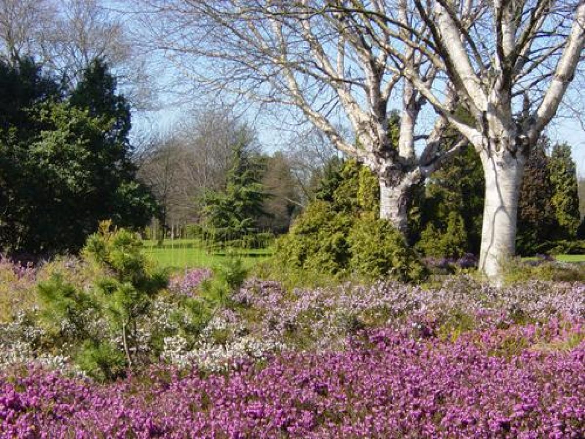
West of the topiary lawn and the rose garden are further lawns with scattered trees, and to the north-west is a yew-hedged enclosure with areas of formal bedding between buttresses of yew. Further to the west is a herb garden enclosed within yew hedges, with central paved paths. The herb beds are edged with low box hedges. To the south of the herb garden, and c 100m to the south-west of the mansion, is a sunken formal garden extending north-east/south-west, enclosed by conifers and shrubs, with a central lawn and cut beds.
Lawns extend south and east of theses features to the winding banks of the River Cray. Weeping willows grow along the southern bank and a footbridge leads over the river to water meadows which extend to the south and east. This area was modified in the late 1970s as some ground was lost when the A2 was widened. The rock garden made in 1953 from Kentish Ragstone was moved away from the south-west boundary and is now situated to the east of the water meadows; it has a water garden and shrub beds, and a conifer collection around the east side.
KITCHEN GARDEN
The walled kitchen garden lies c 100m to the east of Hall Place. Recorded on the estate map of 1700, the kitchen garden had, until the late C20, a good range of glasshouses, some of which were heated. These have now (1997) been replaced by beds featuring different garden layouts, and a large heated Palm House which is open to visitors
REFERENCES
J C M Shaw and M Scott, Hall Place A Short History & Guide (Bexley Libraries 1936)
Gardeners' Chronicle, (12 October 1963), p 266
B Cherry and N Pevsner, The Buildings of England: London 2: South (1983), pp 135-7
Maps
Estate plan, 1700
Map accompanying Sale particulars, 1912
OS 25" to 1 mile:
1st dition published 1860
2nd edition published 1895
Description written: July 1997; SR Dec 2001
Register Inspector: LCH
Edited: June 2001
- Visitor Access, Directions & Contacts
Access contact details
The house and gardens are open daily throughout the year, with shorter hours in the winter months.
Owners
Bexley Heritage Trust
- History
The gardens at Hall Place have a long history. Parts of the garden walls date back to the Tudor period and have a distinctive black diaper brickwork pattern. By 1885 the kitchen gardens, on the site of the current nursery, contained ‘A range of Vineries, Hot Houses and Cucumber Houses [...] heated by hot water […] Forcing Pits; Open and other Sheds; Tool House; Melon Ground; Orchard; Asparagus Beds &c.’ The present glasshouses were installed in 1987.
To the south and west of the house the gardens stretch out on either side of the River Cray. Adjacent to the house on the west side are the formal gardens. The first visual record of the gardens is John Bowra’s map of the estate from 1769. What is now the formal garden was then called Bowling Green Mead, a legacy of its function as a space for outdoor entertainments, such as bowls, from the 16th century onwards.
The current terrace gardens are shown on the Bowra map and a pond existed in place of what is now the sunken garden. Lady Limerick (a private tenant at Hall Place from 1917 to 1943) was responsible for the topiary chess pieces on the lawn. The Queen’s Beasts topiaries which run parallel with the river Cray are modelled on those at Kew and were installed in 1953 for Elizabeth II’s coronation. On the opposite bank of the River Cray are the rock gardens and meadows.
The Hall Place estate once included a number of additional buildings: a boathouse, pigeon house, dairy, bake-house and mill. The last mill on the estate was demolished in 1929. The Jacobean barn (now a restaurant) with its huge pitched roof was built in the 17th century as a threshing barn. Adjacent to the barn are the stables, which also date from the 17th century. The first floor was considerably altered in the 19th century.
In the corner of the east lawn next to the road is the lodge. Commissioned by Maitland Dashwood in the 1870s it shows elements of the Jacobean revivalist and Queen Anne styles. The Jacobean barn, stable block and lodge continue to be occupied though their use has changed.
The following is from the Register of Parks and Gardens of Special Historic Interest. For the most up-to-date Register entry, please visit the The National Heritage List for England (NHLE):
www.historicengland.org.uk/listing/the-list/
HISTORIC DEVELOPMENT
Sir John Champenois, a wealthy merchant who was Lord Mayor of London in 1534, purchased Hall Place in 1537 and started to build his house between 1537 and 1540. The stone- and flint-built house was altered and enlarged by his son, Justinian, who inherited the property on the death of his father in 1556. Justinian's son, Richard, lived in the house until 1649 when he sold it to Robert Austen, a London merchant from Tenterden in Kent. Robert Austen, knighted in 1660, extended the southern part of the house using brick instead of stone. Hall Place remained in the Austen family until 1772 when the seventh baronet died childless and the estate passed to Sir Francis Dashwood. The Dashwood family owned the estate for the next 150 years, although they seldom lived at Hall Place, and for seventy years the house was let as a private school. From c 1870 the property was let to a series of tenants, the last of whom was the Countess of Limerick who lived at Hall Place from 1917 until her death in 1943. Lady Limerick made many modifications to the house and garden, including planting topiary. The property was bought in 1926 by her son-in-law, the American financier James Cox Brady, who sold it to Bexley Council in 1935. The grounds are now a public open space and the mansion is used to house Bexley Museum and Bexley Local Studies Centre.
Period
- 20th Century (1901 to 2000)
- Early 20th Century (1901 to 1932)
- Associated People
- Features & Designations
Designations
The National Heritage List for England: Register of Parks and Gardens
- Reference: GD1157
- Grade: II
Features
- Manor House (featured building)
- Earliest Date:
- Latest Date:
- Topiary
- Herbaceous Border
- Tropical House
- Description: Subtropical plant house
- Rose Garden
- River
- Description: River Cray
- Key Information
Type
Garden
Purpose
Ornamental
Principal Building
Domestic / Residential
Period
20th Century (1901 to 2000)
Survival
Extant
Hectares
65
Open to the public
Yes
- References
References
- {English Heritage Register of Parks and Gardens of Special Historic Interest} (Swindon: English heritage 2008) [on CD-ROM] Historic England Register of Parks and Gardens of Special Historic Interest
- Cherry, B. and Pevsner, N. {The Buildings of England: London 2: South} (Harmondsworth: Penguin, 1983) pp 135-137 The Buildings of England: London 2: South
- Purcell Miller Tritton {Hall Place and Gardens: Conservation Plan} (1999) Hall Place and Gardens: Conservation Plan
- Sarah Foxter {Hall Place and Gardens: Green Flag Application and Management Plan 2011} (2011) Hall Place and Gardens: Green Flag Application and Management Plan 2011