Introduction
Some of the layout of the late-18th-century parkland survives at Greenbank House and there is a woodland garden with a few original trees and later 20th-century plantings of ornamental trees and shrubs. The walled garden may date from before the building of the house in 1763. It is divided into compartments by early-20th-century yew hedges and used for demonstration and trial gardens developed from the mid-20th century.
http://portal.historic-scotland.gov.uk/hes/web/f?p=PORTAL:DESIGNATIONS:0
Location and Setting
Greenbank House is situated approximately 6 miles (9.5 km) south of Glasgow City Centre. Suburban private housing developments surround the site on all sides except the south, where the remaining farmland is interspersed with housing development along the B767 road to Eaglesham, some 3 miles (5km) away. The climate within the garden is sheltered by surrounding woodland. Average annual rainfall is around 43" and the temperature ranges from 17.5ºC max to - 0.7ºC min. The surrounding housing developments are significant from the boundaries of the site and from the main drives. The tree canopy of the designed landscape is significant from the minor roads to the south and views into the park can be gained from Flenders Road which forms the northern boundary of the site.
The policies of Greenbank House extend north to Flenders Road, east to the Lodge, south to the burn beyond the walled garden and west along the drive to its junction with the main road. Reference to a survey plan of 1772 shows that the estate extended over some 220 acres, most of which consisted of fields. The designed landscape extended north beyond what is now Flenders Road in the form of an avenue which culminated in a wooded square on the opposite hill. Reference to the 2nd edition OS shows that this feature remained in 1910, standing within the surrounding fields. The remaining trees from this feature were incorporated into Beechwood Avenue which has been built up since then.
The designed landscape today includes some 7 acres (2.8ha) of parkland, 5 acres (2ha) of woodland garden and 2.5 acres (1ha) of walled garden and extends in total to 19 acres (8ha).
Landscape Components
Architectural Features
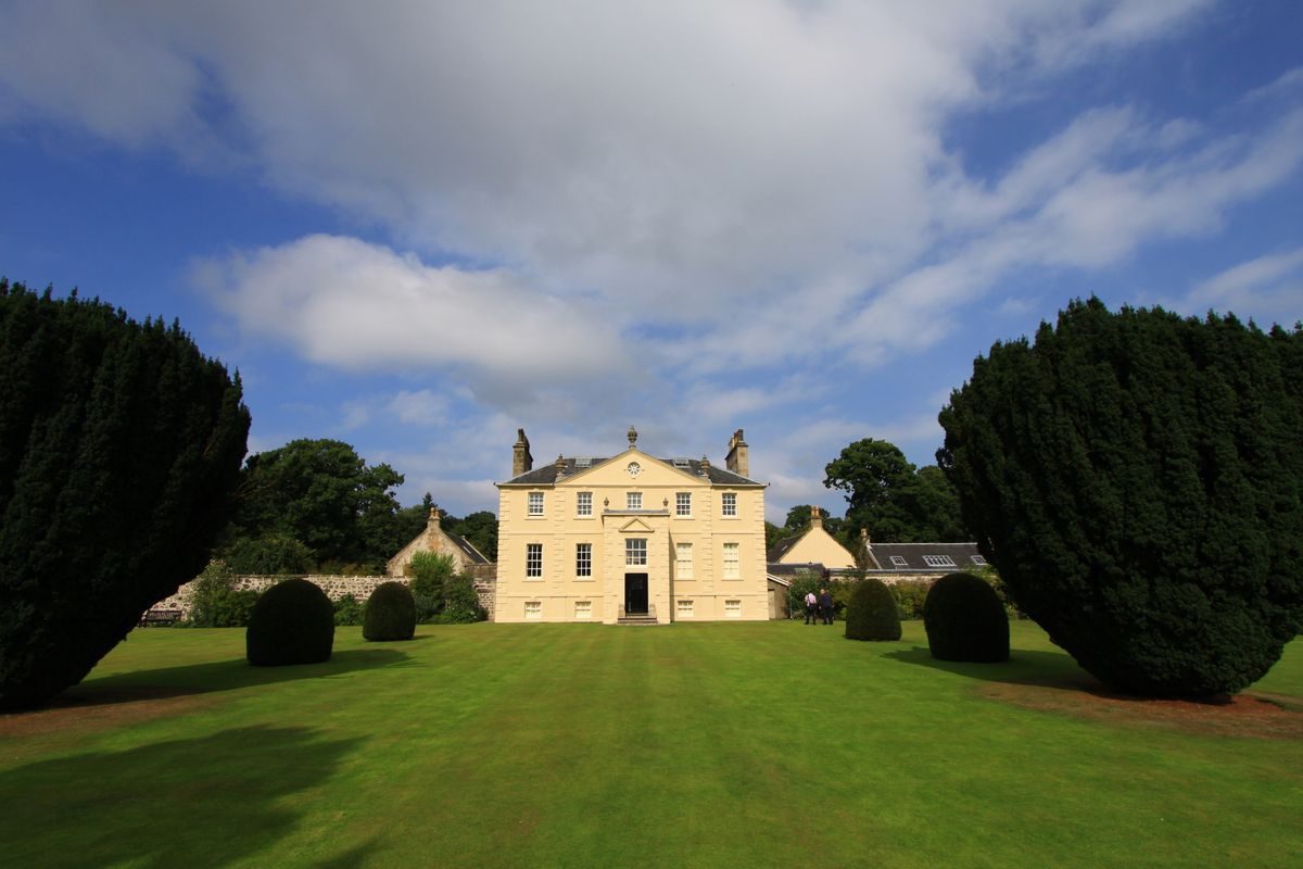
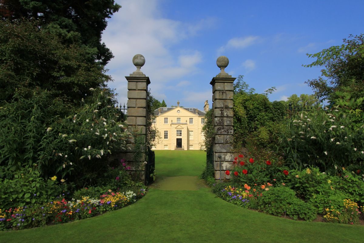
Greenbank House, listed grade A, was built in the Adam style in 1763 for Robert Allason. It is a two-storey mansion with basement; the architect is unknown. The stable-block, barn and tack room lie to the east of the house and have been converted to form a lecture hall, demonstration area, shop, office and toilet accommodation.
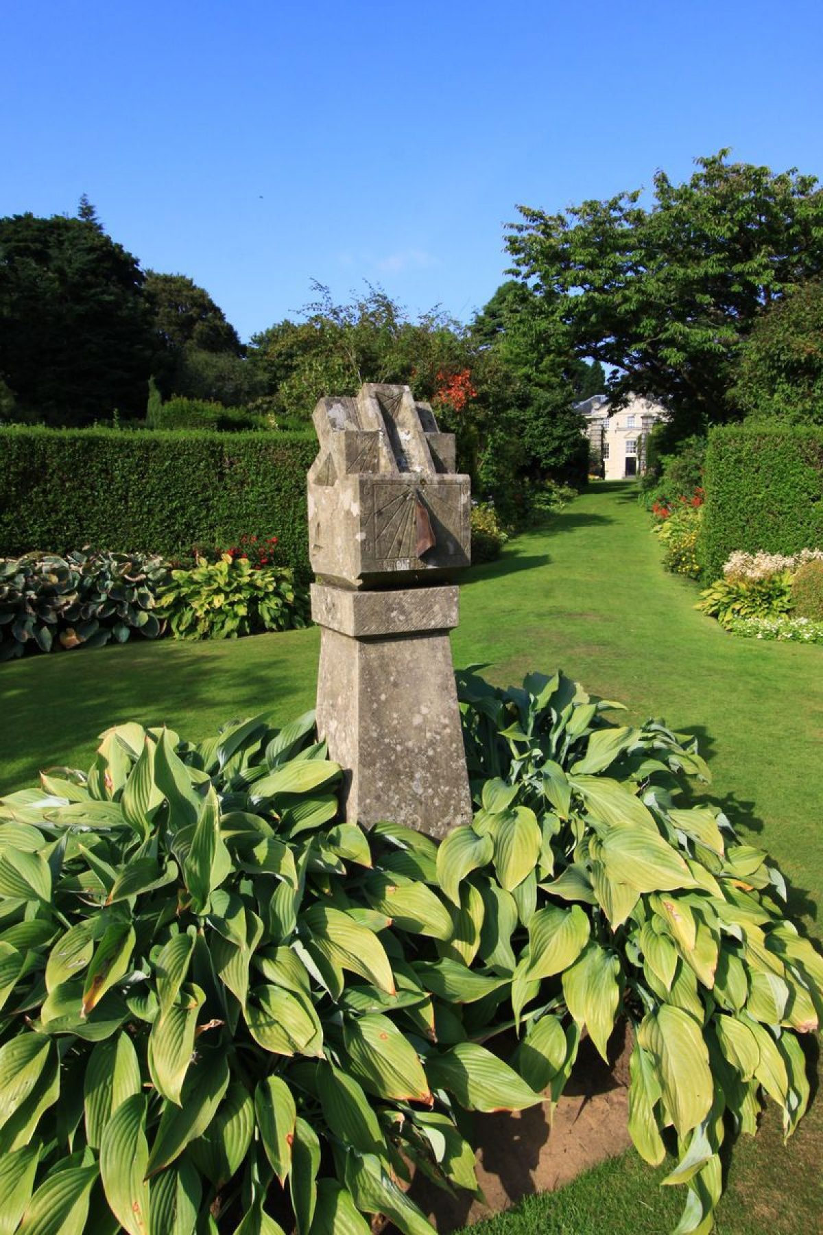
The stone bridge crosses over the burn at the south-west corner of the walled garden. Two stone ornaments, now in the disabled garden, have recently been moved from 'The Dell'. The Sundial stands in the centre of the walled garden; it has been dated at c.1600 and would support the idea that the walled garden predates the present house and was put in at the time of the first Hamiltons.
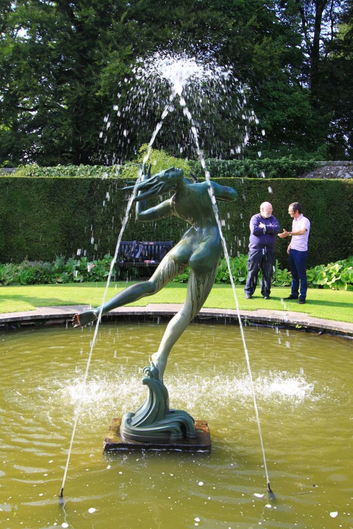
The Statue of 'Foam' stands amid a shrub bed in the south-west corner of the walled garden; it was rescued after the end of the Empire Exhibition at Bellahouston Park where it was set in an ornamental pond surrounded by dolphins. The stone Garden Furniture is reproduction.
Parkland
Reference to the 1772 survey plan shows the clear demarcation between the north, south, east and west parks. The west and south parks remain, although most of the original enclosure formed by a double hedge or tree belt has disappeared. By the mid 1850s, the avenue which extended between the north and east parks had gone and a new woodland enclosure along the edge of what is now Flenders Road had been planted. Some of the original beech remain in the park, with some younger oak and a redwood (Sequoiadendron giganteum) planted c.1900.
Woodland Garden
The woodland garden extends around the west and south sides of the walled garden. On the 1772 plan, the area is indicated as having four rows of trees down each side and the triangular area between these two strips is marked as 'Meadow'.
Some beech trees around 220 years old are part of the original shelter planting. Replacement planting, much of it in the early 1960s, now provides a mixed woodland of varying density. Varieties include oak, sweet chestnut, horse chestnut, larch, pine, cedar and rowan. More ornamental trees were planted about 15 years ago. Specimen trees have been exposed in clearings and ornamental shrubs are established at nodes, eg outside the entrance to the walled garden.
Bulbs are established throughout the garden, particularly in 'The Dell'. Major Hamilton, the proprietor of Greenbank in the 1920s and 30s, planted many during this time. The woodland trail runs through this area and the guide leaflet explains features throughout the route.
Walled Garden
The Walled Garden possibly predates the 1763 house. Reference to the plan of 1772 shows a large formal layout with a central feature and an additional formal area at the end of the garden. The 1st edition OS of c.1850 shows an arrangement of similar layout to this, although in less detail. By then, the wall which now divides the third of the garden nearest the house from the area beyond appears to have been built across its width. The area nearest the house is thought to have been retained as a formal garden whilst the area beyond was developed as an orchard. In the garden adjacent to the house, two herbaceous borders line the footpath. The remainder of the area is largely lawn with some ornamental trees and shrubs. Remnants of a former parterre can be traced during the summer when it is dry.
It is in the larger two thirds of the garden that the Garden Advice Centre has been established since 1976; up to the last war it was mainly ornamental planting, and the herbaceous borders were removed by Mrs Blyth in the 1960s- 70s. The area is divided into four compartments by the yew hedges, understood to have been planted c.1930. Borders between the yew hedges and footpaths are planted for summer and autumn display. Demonstration plots are located in the two northern compartments. The south-west compartment was a fruit garden and has recently been redesigned as an ornamental garden; it includes a herbaceous border and rock garden. The south- east quarter of the garden was a tennis court but has recently been developed as a garden for the disabled. Stone for the walls of the raised beds came from a demolished Glasgow tenement. Mr Blyth was a keen gardener and kept a planting book and also labelled his plants; there are some survivors today of his paeony collection.
- Visitor Access, Directions & Contacts
Telephone
01483 211465Website
http://www.nccpg.comAccess contact details
The garden is open daily from 9.30 until sunset. The house is open between April and October.
Directions
Greenbanks Garden is just over a mile from Clarkston Station and can be reached by bus 44a.
Owners
The National Trust for Scotland
- History
The following is from the Historic Environment Scotland Gardens and Designed Landscapes Inventory. For the most up-to-date Inventory entry, please visit the Historic Environment Scotland website:
http://portal.historic-scotland.gov.uk/hes/web/f?p=PORTAL:DESIGNATIONS:0
Reason for Inclusion
Famous for its daffodil collection, this garden also forms an impressive setting for the category A listed Greenbank House.
Site History
The designed landscape was laid out between 1763 and 1772. Some alterations had been made to the structure by c.1850 as comparison of the survey plan of 1772 and the 1st edition OS map shows. The present form dates from around this period although much of the actual plant material is younger.
The estate belonged to the Hamiltons of Renfrewshire from 1600-1650 who were Covenanters who escaped after the Battle of Bothwell Bridge in 1679. Their property was confiscated and they were not to return to Greenbank until 1797. The estate was purchased in 1763 by Robert Allason who built the present house and laid out the landscape. Between then and 1797, the estate knew five different owners before it was purchased by John Hamilton of Rodgerton in whose family it remained until 1961 when Miss Margaret Young, niece of the last Hamilton owners, died. Mr William Blyth then purchased the estate and in 1976 gifted the house, East Lodge, Walled Garden and 15 acres of ground to the National Trust for Scotland with the intention of it being developed as a Garden Advice Centre similar to that at 'Suntrap', Edinburgh.
Period
- 18th Century (1701 to 1800)
- Late 18th Century (1767 to 1800)
- Features & Designations
Designations
Historic Environment Scotland An Inventory of Gardens and Designed Landscapes in Scotland
Features
- House (featured building)
- Earliest Date:
- Latest Date:
- Sundial
- Earliest Date:
- Latest Date:
- Topiary
- Garden Wall
- Description: The walled garden may date from before the building if the house in 1763.
- Key Information
Type
Estate
Purpose
Ornamental
Principal Building
Education
Period
18th Century (1701 to 1800)
Survival
Extant
Hectares
8
Open to the public
Yes
Electoral Ward
Mearns
- References
References
-
Historic Scotland, 'Greenbank Garden', {Gardens and Designed Landscapes},
Contributors
Historic Scotland
-
Historic Scotland, 'Greenbank Garden', {Gardens and Designed Landscapes},