Introduction
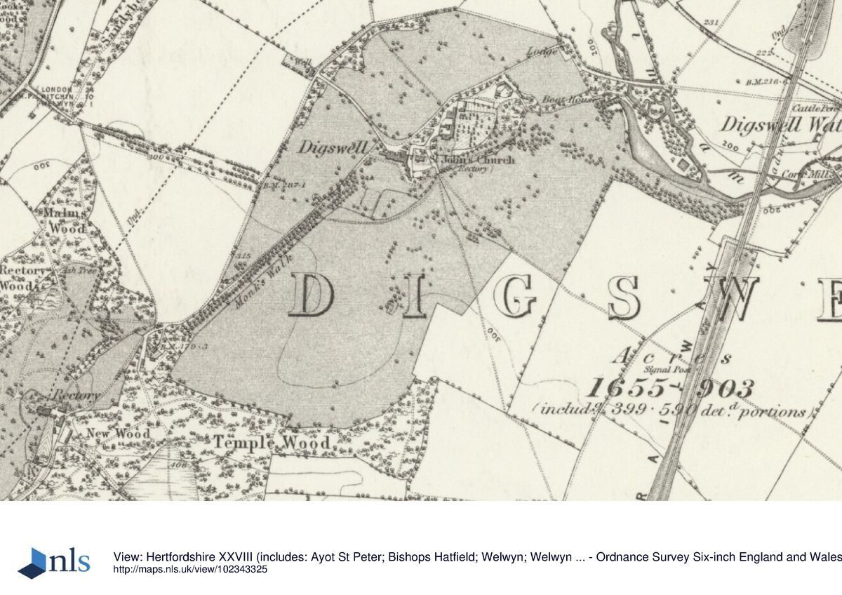
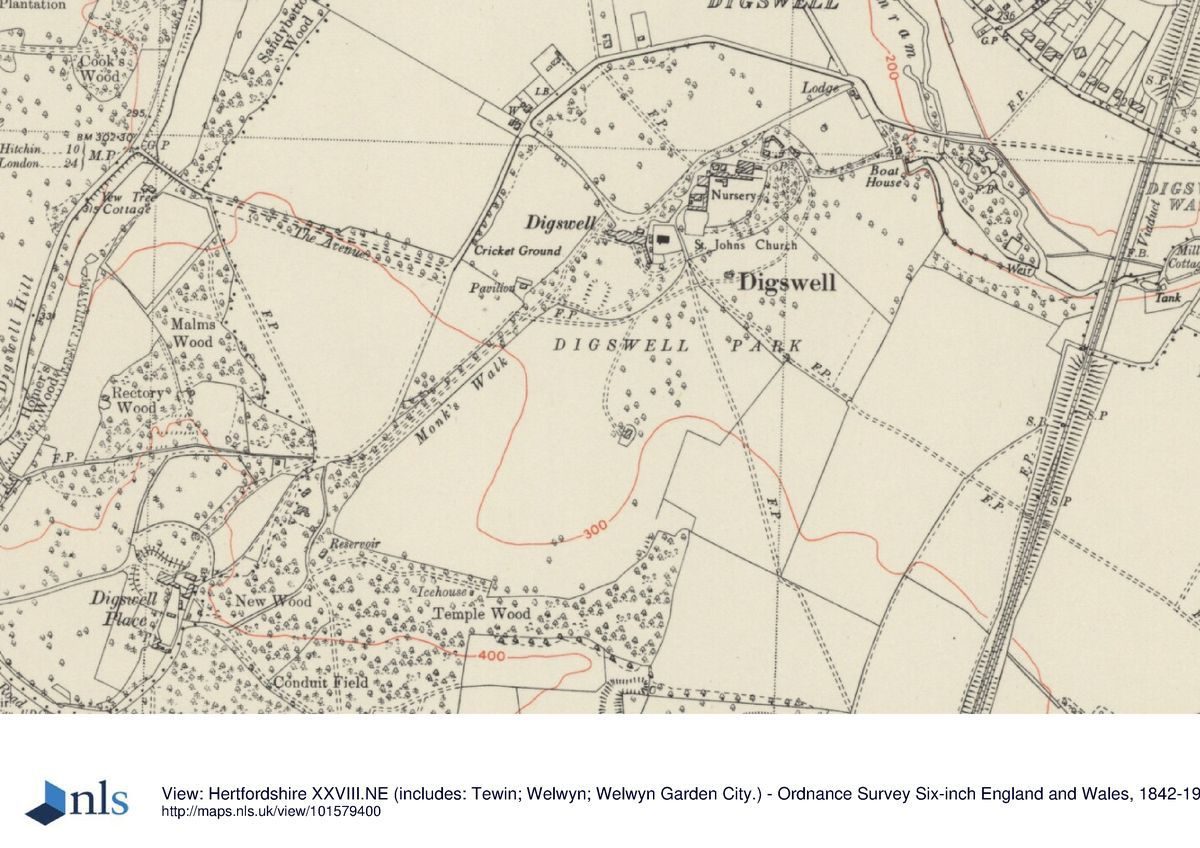
Digswell Park (around Digswell House) lies mainly in a valley running west to east on the south of the house towards Digswell Lake from which it is separated by a main road. It is now used as urban open space. Digswell Place is now connected to the Park by historic Monks Walk and is adjacent to Sherrardspark Wood which has rides and walks (see the historic plan). Both houses have been adapted to multiple occupation and the park around Digswell Place is now small paddocks.
Terrain
Entire site dips northwards from Digswell Place plateau (119-128 m) to the river Mimram (at 70m). Digswell House is on a promontory part way down with its park lying in a valley to the east.The following material was contributed by Hertfordshire Gardens Trust.
Statement of Significance
An 18th century landscape by Lancelot Brown, incorporating an earlier manorial layout and much developed on Reptonian lines in the early 19th century. One of a series of landscapes owned by the Cowper family lying along the valley of the r. Mimram with contributions from both Brown and Repton. Although much altered by the development of Welwyn Garden City enough remains to be read as a coherent landscape of some distinction.
Description
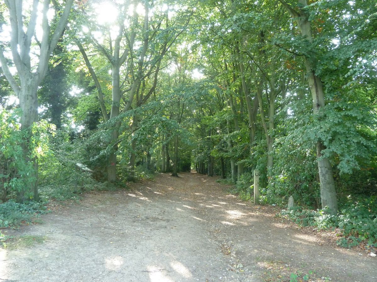
Digswell House is sited on a promontory overlooking the valley of the Mimram and the ground sweeps down to the north, east and south. To the west the land rises with the tree-lined Monks Walk to the former rectory (Digswell Place) and the woodland (Sherrardspark Wood) with formal rides laid out between 1766 and 1805.
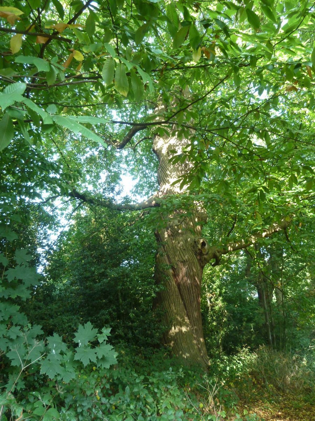
Digswell Park (around Digswell House) lies mainly in a valley running west to east on the south of the house towards Digswell Lake from which it is separated by a main road. Traces of the pre-Brownian (a grove of Sweet Chestnuts) and Brownian landscape are still extant but the early-19th century pleasure grounds have gone and the eastern end of Digswell Lake has silted up. There is also a large layering hornbeam coppice, similar to those at Stanmore and Wrotham Park. A small proportion of the park is urban open land as Digswell Park and a Cricket and Bowls ground. Monks Walk connects Digswell House, adjacent to the parish church, with the Rectory (now Digswell Place) on the small plateau above between the Mimram and Lee. Some rows of 18th century beech trees remain, as does a ditch near the southern end, separating the Walk from the Cricket Ground, which could be the remains of a sunk fence.
Digswell Place has remains of Brownian park planting and earthworks. The historic rides cut through Sherrardspark Wood are also still in use. Linear earthworks in the Park may be from the original wood and the remains of the Harpenden to Welwyn railway cutting are still traceable, as well as some swallow holes. Elsewhere the Digswell Place parkland has been replaced with small paddocks for horses, although some Brownian planting remains west of Malms Wood, reminiscent of Brown planting at Cole Green. Temple Wood, Planted by 1771 remains at the southern end of Monks walk.
Sources
Brown, J., Gardens of a Golden Afternoon (1994, Allen Lane) p190.
Clutterbuck, R., History and Antiquities of the county of Hertford 1821 (illustration by Shepherd - flower beds in same place as Trower)
Cussans, JE., History of Hertfordshire Vol II (1874-8) p254
Debois Landscape Survey Group Digswell Place, Digswell House and Digswell lake: a survey of the landscape for HGT (Dec 1997)
Prince, H., Parks in Hertfordshire since 1500 (2008, University of Hertfordshire Press)
Rook, T., Digswell Place alias Rectory alias Parsonage (1990)
Spooner, S., ‘‘A Prospect two fields distance': rural landscapes and mentalities in the eighteenth century', In: Landscape 10/1 (2009) pp101-22
Victoria County History, Hertfordshire Vol 3 Page W (ed) (1912) pp81-85
Ward, D., Digswell: From Domesday to Garden City W I District Regional Survey Assoc (1953)
Hertfordshire Archives and Local Studies (HALS):
D/P34 3/2 Plan of Rectory and Glebe 1766
D/EP T1719 b-c Estate plans 1771
D/EP T1719b Digswell Fields Book Box A No 13
D/EP F471 Edward Spencer Cowper's diary 1800
19 Sept ‘Mr Repton and his son Humphry came to Panshanger'
St 20 ‘Walked about the grounds the whole day marking plantations'
Sundy 21 1'Seymour and the two Reptons left us'
D/EP F471 EsS Cowper's diary 1802 - visited various Repton landscapes and met Samuel Wyatt at Panshanger
D/EP F471 ES C diary 1803: Wyatt at Panshanger and consulted on Digswell
D/EP A103 Accounts from1 1803: Wyatt and Clark for buildings & gardens at Digswell respectively
D/EP T1254 Conveyance to ESC 1804. Digswell pleasure ground 12 acres plus closes etc.
D/EP F471 ESC diary 1804: ‘Wyatt staked out house foundations'. Also visited Sacomb, Gaddesden Place and Ashridge Park, Tring Park.
Diaries up to 1810
D/EP F472 ESC copy of Polite Repository 1811 with plant list in ES Cowper's hand.
D/EP/A209 Account for new conservatory and sundry household alterations ‘done for the Honble ES Cowper at Digswell' 1820
Herts Tracts R Hine Coll 35 Bk Rm 9 Shelf 507 ‘Sherrards Park Wood' by Hughes .n.d.
Rook, T ‘The Fishponds at Digswell' In: Hertfordshire's Past 36 Spring 1994 p1-7
Maps:
D/EJn P15 Norden Estate Map 1599
?Pallett, Thomas. c1810. Survey of Earl Cowper's estates with plans
OS 2nd edition 6" 1899 Sheet XXVIII for 25"XXVIII.7 and 11
OS 6" 1922
OS6" 1946
Digswell Place, Welwyn Hertfordshire by Calke & Barrett for Studland Developments and Digswell Associates. March 87 Scale 1:500
Illustrations:
County Views Index DIG 13 J Trower sketch of Digswell House n.n. water colour - shows Reptonian treillage and 2 Reptonian Hardenburg baskets.
County Views DIG11 Selwin ‘Digswell Park' n.d.
Gerish Collection Box 27 Digswell Prints 23 - n.d. Old house at Digswell
- Visitor Access, Directions & Contacts
Access contact details
Sherrardspark Wood, Digswell Park urban open land.
Directions
Sherrardspark Wood car park off Rectory Road, east of B197 near Ayot Green. Digswell Park accessible from A1000, Bessemer Road in Welwyn Garden City.
- History
The following material was contributed by Hertfordshire Gardens Trust.
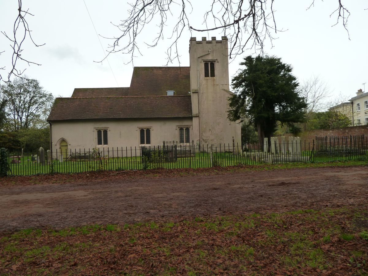
In 1415 Sir John Perient bought the manor of Digswell and built a new house. The medieval manor consisted of a moated manor house adjacent to the parish church with fish-ponds (still extant) in the river valley and a warren with keeper's house and enclosures in the park, The 1599 survey shows woodland to the south-west (including a warren and warrener's lodge). After various changes in ownership it was, in 1656, sold to Humphrey Shallcross, who had made his money as a scrivener or money-lender in London. Digswell was one of a number of estates in Hertfordshire which he purchased. It remained in the family until 1770 when it was left to the husband, Richard Willis, of his niece. Lancelot Brown was engaged at Digswell and paid £1,100 for work carried out between June 1771 and February 1773 for Willes [sic]. The formal gardens of the early 18th century (Dury & Andrews 1766) were removed but the walk to the Rectory (now Digswell Place) was left, possibly as the main house is adjacent to the parish church.
Much of the Brownian work appears around Digswell Place, with parkland clumps and the planting of Temple Wood and a plantation in 1771. There is more Brownian work around Digswell House, where the formal gardens were removed, but the formal Monks Walk to the Rectory (now Digswell Place) was retained and the grove of Sweet Chestnuts were kept. The knoll on which the House sits was enhanced with earthworks to emphasize the oak and thorn knolls and the curve of the valley which sweeps down to the river Mimram. Willis's daughter Elizabeth sold the estate to Henry Cowper, guardian of Edward Spencer Cowper in 1786. The earl assumed possession of it by 1801 and it remained in the family until the death of the 7th earl in 1905.
There was a great deal of improvement after 1804 under ES Cowper with a new house and landscape, including a lake formed by damming the river Mimram. From at least 1800 Cowper visited landscapes laid out by Repton and Repton visited Digswell following the preparation of his Red Book for Panshanger (a neighbouring estate owned by Earl Cowper). Nathaniel Kent was employed in 1812. The avenues and Brownian parkland and pleasure ground around the house were preserved. A new house (by Samuel Wyatt) was built in 1807 and a new landscape centred on Digswell House. The lake created 1809 (diary entry by ES Cowper 1810). At same time Sherrardspark Wood was felled and replanted with oak and sweet chestnut (mentioned in estate book of 1808). The major rides cut through it are shown on the Ordnance Survey Drawing. In 1820 a new conservatory was built at Digswell House, but following the death of ES Cowper in 1823, Digswell House was let out. There were no new developments until the building of the village at east end of lake in 1850 and the building of Digswell viaduct for the Great Northern Main line railway in 1848-50, spanning the Mimram valley to the north-east of Digswell House.
Much of the Cowper estate, including Digswell was sold in 1919 to pay death duties and Ebenezer Howard acquired 1688 acres (including Digswell) for the new Welwyn Garden City. With the development of Welwyn Garden City the area became developed and the house became an Arts Centre. It is now private housing. The A1000, Bessemer Rd (1950s) now cuts Digswell Park off from the lake. Digswell Place remained as a private house and it is possible that Gertrude Jekyll supplied plans (for Didswell [sic] Place) there in 1920.
Period
- 18th Century (1701 to 1800)
- Late 18th Century (1767 to 1800)
- Associated People
- Features & Designations
Designations
Green Belt
Site of Local Importance for Nature Conservation
- Reference: Welwyn Hatfield District Council: Urban Open Land
Features
- House (featured building)
- Description: The house is in Classical style.
- Earliest Date:
- Latest Date:
- Lake
- River
- Grove
- Avenue
- Parkland
- Woodland
- Walk
- Parkland
- Key Information
Type
Park
Purpose
Recreational/sport
Principal Building
Parks, Gardens And Urban Spaces
Period
18th Century (1701 to 1800)
Survival
Part: ground/below ground level remains
Hectares
82
Open to the public
Yes
Civil Parish
Welwyn
- References
References
- Brown, Jane {Gardens of a Golden Afternoon: The Story of a Partnership: Edwin Lutyens and Gertrude Jekyll} (London: Allen Lane, 1992) 190 Gardens of a Golden Afternoon: The Story of a Partnership: Edwin Lutyens and Gertrude Jekyll
- Page, W {Victoria County History: Hertford, Volume 3} (1912) Victoria County History: Hertford, Volume 3
- Debois Landscape Survey Group {Digswell Place, Digswell House and Digswell lake: a survey of the landscape for HGT} (1997) Digswell Place, Digswell House and Digswell lake: a survey of the landscape for HGT