
Introduction
Panshanger features the remains of an 18th- and 19th-century landscape park covering about 350 hectares. The site includes parkland, woodland, agricultural land, and areas used for sand and gravel extraction. Following gravel extraction the site is to be used as a country park.
Terrain
The land is undulating, with several high points in the south-west of the park.The following material, related to Cole Green, was contributed by Hertfordshire Gardens Trust:
Statement of Significance
Cole Green, laid out by L Brown in 1750s and Panshanger, laid out to designs by H Repton from 1799, face each other across the wooded valley of the river Mimram. Both utilised the house on the opposite side of the valley in their views and respected the ancient oak woodland, augmenting where necessary. Although the site has been extensively changed by demolition of both houses and gravel extraction in the park, many of the views and much of the woodland remain, together with Repton's Broad Water and the Victorian Orangery and Conservatory, albeit as ruins.
Description
The accounts ledger of the 2nd Earl Cowper details seven payments to ‘Mr Lancelot Brown' over nine years for a total of £718 7s 6d. The accounts show work starting in the garden area and later moving to the parkland, with house renovations such as a new necessary (water closet) plumbing, drains, laundry and stables. The octagonal walled garden was built in 1752 and Brown may have been consulted. By 1755, pine plants from Philip Miller of Chelsea Physic Garden were producing the first pineapples in the hothouse - resulting in a tip of half a guinea for the gardener. Letters and the first payment of £100 to Brown indicate Brown was working there in autumn/winter 1755 but additional garden labour had been hired over the summer by Cowper's Head Gardener, John Christi.
‘Brown's Head Gardener', Benjamin Read was given a tip in June 1756, presumably after preparing the ground for planting and in 1757 trees and shrubs were sent from Charles Bridgeman and John Williamson, the latter specifying that they had been sent ‘by Mr Brown's order'. These included larch and firs, pines and magnolias, gingko and tulip trees, robinia pseudacacia and American plants. Complementing these were the sweet chestnut and oak avenues from the earlier design.
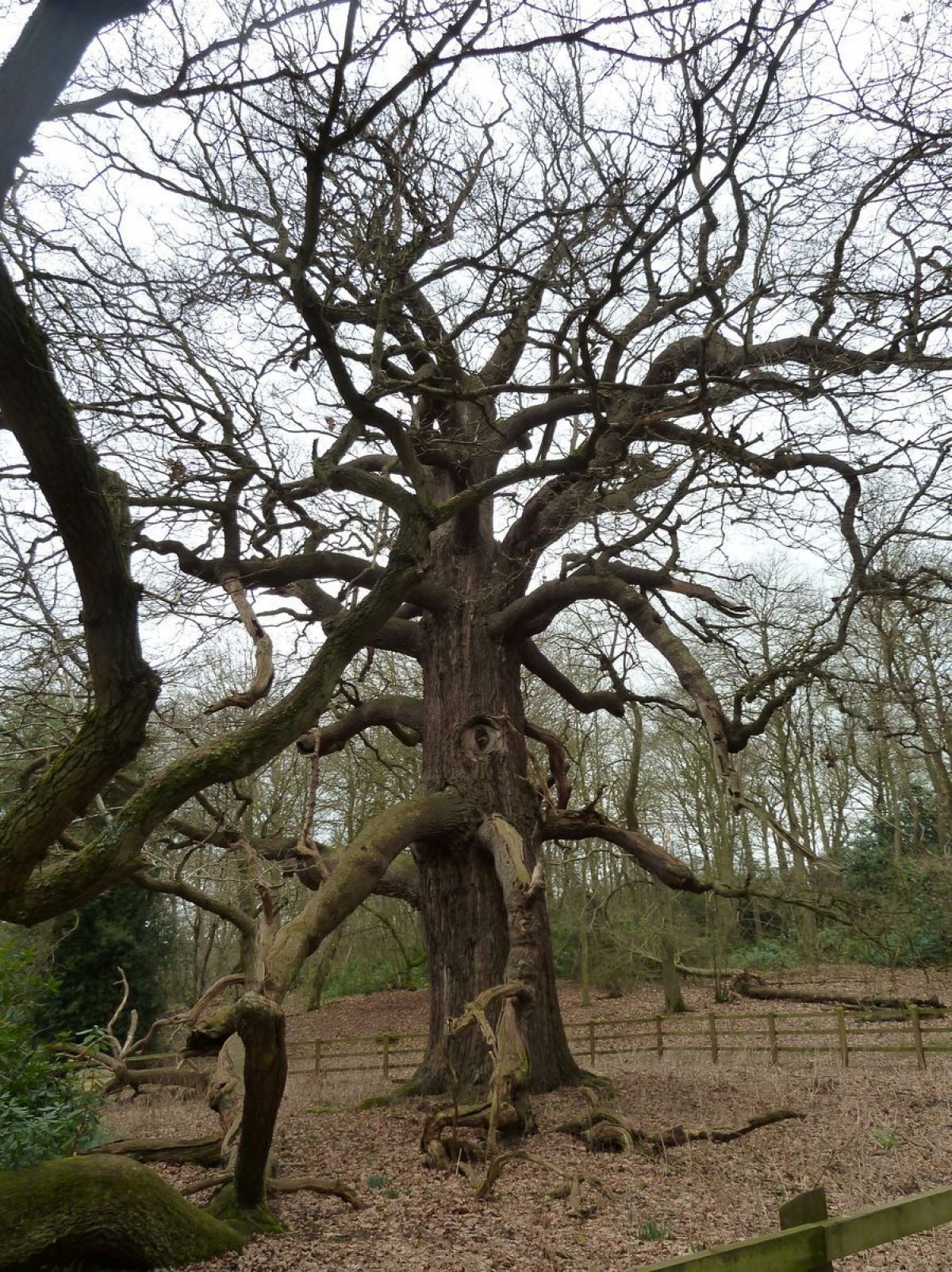
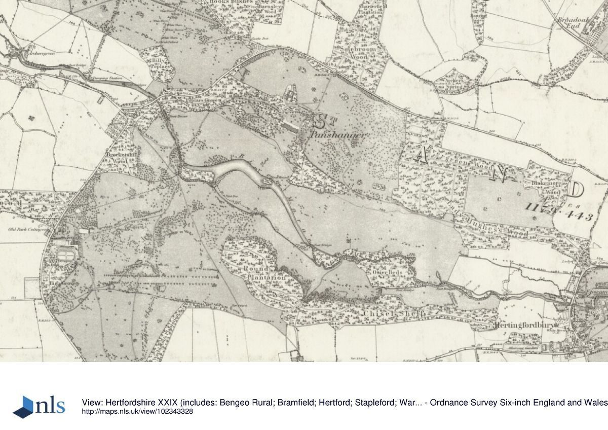
The Dury and Andrews map of 1766 shows a ha-ha encircling the house and gardens. The bricks from this were removed when the house was demolished in 1801 but the ditch survives in part on the southern side. The park has been enlarged taking in agricultural land to form open parkland and the house approach is no longer directly from the east but more serpentine. The earlier entrance court and formal gardens have been removed. Within the pleasure grounds to the rear, (north-west) of the house, a menagerie was built for ‘Hens and Virginian Turkies' in 1759, which included fan-shaped arrangement of trees providing a focal point. To the south of this a temple, bought from Lord Albermarle's sale in 1762, was erected. This appears to be a rotunda with a painted stone floor. To the east of the house three avenues radiate towards the valley of the Mimram with open view across to the Elizabethan and later house at Panshanger. Much of the four acres of woodland have been thinned to give these views. Cowper had purchased firs, pine, larch, a tulip tree and a magnolia in 1752. Old oaks still survive on the eastern side, along with sweet chestnut and beech. Within the walled garden a Gingko biloba was planted in the mid-18th century and a Robinia pseudoacacia of similar date is nearby. An undated and an signed sketch of Cole Green shows a parkland landscape with a pool of water and clumps of trees scattered on mounds, which is similar to the parkland at Beechwood. Closer to the river an ice house and a Fishing Lodge were added.
Work was still progressing when Cowper died in 1764 but his heirs decided to demolish the house and move across the valley to a new house and landscape at Panshanger. The Brown landscape was included in the Red Book produced by Repton in 1799.
By 1810 Cole Green house had been demolished, the garden railings sold and the marble urns and bricks from the ha-ha moved to the new site. However, the Cole Green landscape, a mixture of Brown informality and early 18th century avenues further from the house, was integrated with the new landscape being designed by Humphry Repton which focussed on the new Panshanger house. A beautiful estate map of 1810 shows the drives wending through entire landscape, all laid out as parkland and woodlands.
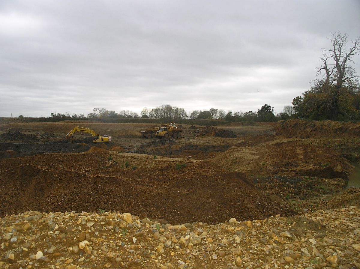
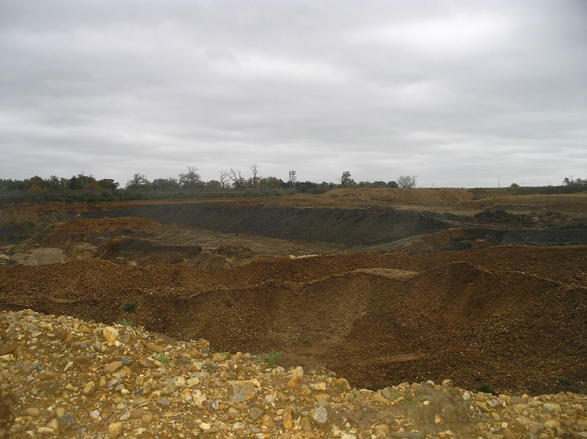
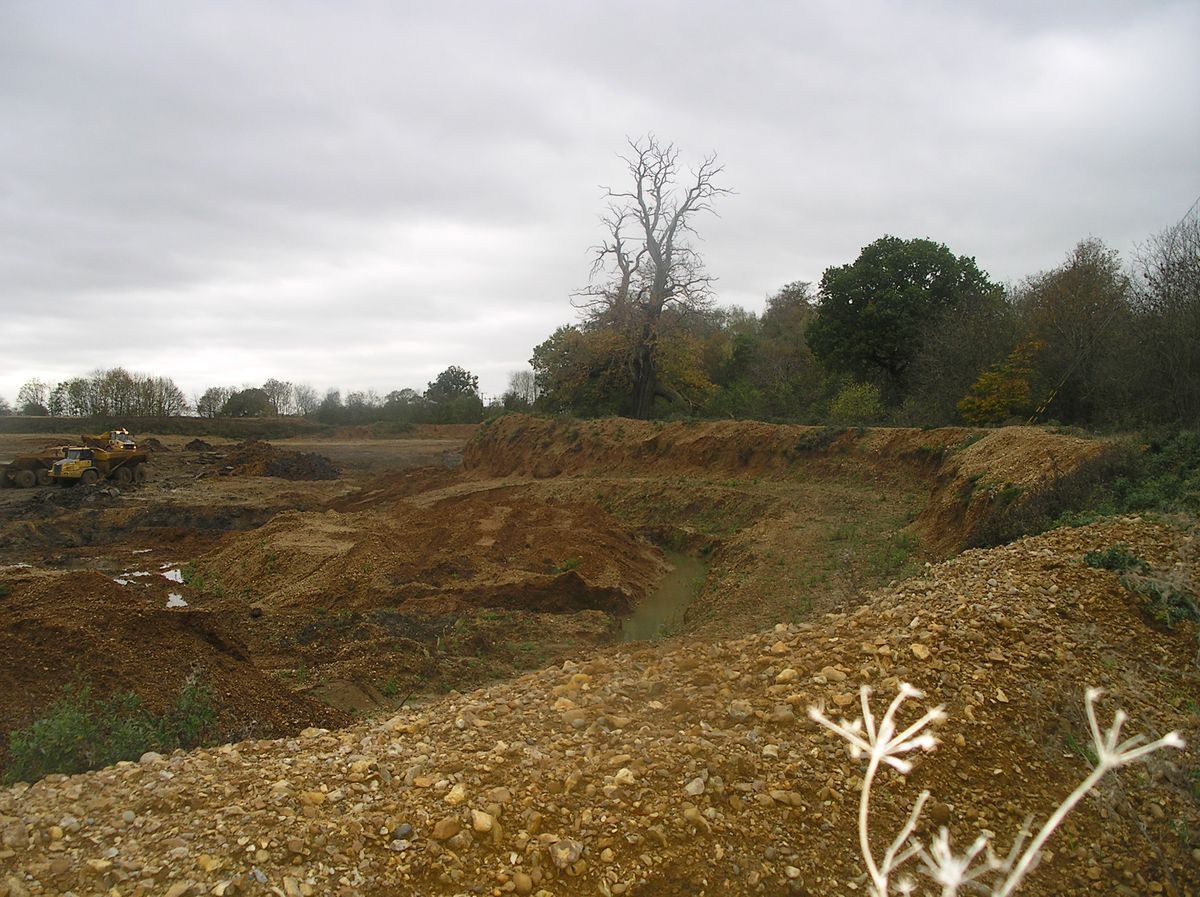
The 20th century brought the familiar challenges and following the Second World War, with no male heirs to inherit, the estate was sold. The Regency house was demolished and the grounds dug up for gravel extraction. At first this focussed on the Repton landscape in and around the river Mimram valley which Repton had fashioned into a Broadwater. But by the time ideas were being circulated for a Festival to celebrate Brown's tercentenary in 2016, it was Cole Green's turn to be remodelled again. As planning permission had been granted in 1982, before the landscape was Registered at Grade II* by English Heritage, work went ahead. Much of Brown's Cole Green lay-out is now a 20 metre hole. It will be filled in due course and maybe even an attempt at ‘re-creating' the landscape made but we have lost another page in our history, another part of our identity.
Additional Sources of Information
Leiper, H. ‘Mr Lancelot Brown and his Hertfordshire Clients' In: Hertfordshire Garden History Volume II: Gardens pleasant, groves delicious (Spring, D. ed) (University of Hertfordshire Press, 2012) pp 92-120
Leiper, H. Beautifying Colegreen: The Eighteenth Century Park and Gardens of Colegreen House in Hertfordshire, unpublished MA dissertation, Birkbeck College, University of London, 2008
Prince, H., Parks in Hertfordshire since 1500 (2008, University of Hertfordshire Press)
Repton, H Humphry Repton's Red Books of Panshanger and Tewin Water, Hertfordshire, 1799 -1800 (Hertfordshire Record Society 2011)
Victoria County History: Page, W (ed) A History of the County of Hertfordshire Vol. 3 (1912) Parish - St Andrews Rural; Manor - Panshanger pp. 468-472
Willis, P. ‘Capability Brown's Account with Drummond's Bank 1753-83', Architectural History, vol. xxvii, issue on Design and Practice in British Architecture: Studies in Architectural History Presented to Howard Colvin (1984), pp 382-91
Hertfordshire Archives and Local Studies(HALS):
DE/P/A8 Earl Cowper's accounts ledger 1755-64
DE/PA185 estimate of expenses 1747
DE/P/EA23/2, account of materials recovered from Cole Green House
DE/P/F243-4, diaries, 1752-53
DE/P/F253-6 letters from Spencer Cowper, Dean of Durham
DE/P/P5 contract and plan for Cole Green House 1704
National Maritime Museum:
Charnock, John View of Cole Green late 18th century (three views)
Hyett, William, Ordnance Survey Drawing of Hatfield area 1805 http://www.bl.uk/onlinegallery/onlineex/ordsurvdraw/h/002osd000000009u00101000.html
Detailed text updated 05/10/2013
The following is from the Register of Parks and Gardens of Special Historic Interest. For the most up-to-date Register entry, please visit the The National Heritage List for England (NHLE):
www.historicengland.org.uk/listing/the-list
A landscape park laid out from 1799, with advice from Humphry Repton, around a country house begun 1806-7 and demolished 1953-4. The park incorporated the site of an earlier house and park, improved in 1756 with advice from Lancelot Brown.
DESCRIPTION
LOCATION, AREA, BOUNDARIES, LANDFORM, SETTING
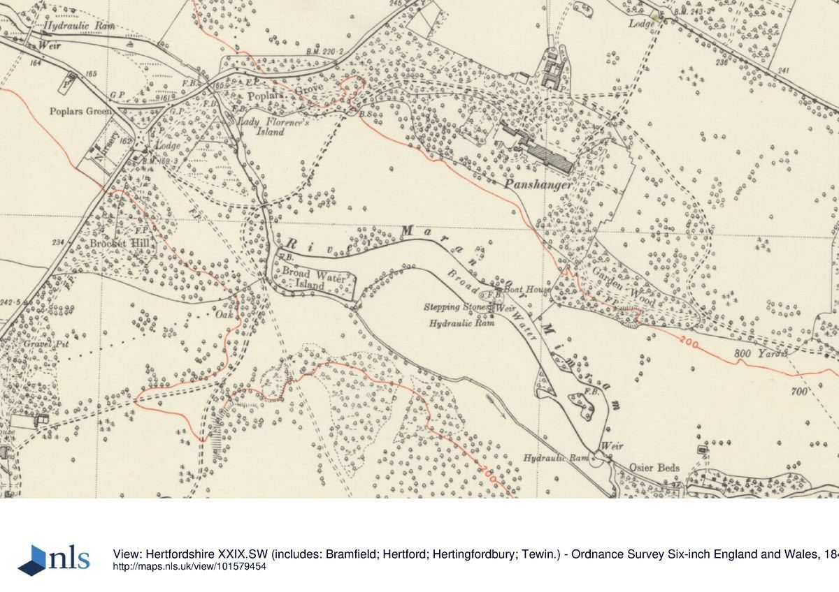
Panshanger lies 2km west of the centre of Hertford, flanked to the east by the outer suburbs of Hertford and to the west by the outer suburbs of Welwyn Garden City. The c 350ha park is bounded to the north by the B1000 road linking Hertford and Digswell Water, to the west by the lane linking Poplars Green with Cole Green, and to the south largely by the C20 A414 dual carriageway linking Hertford with the A1(M). At the south-west corner the park is bounded by Cole Green settlement and village green. The land is undulating, with several high points in the south-west of the park where the former Cole Green House and its park lay, but the dominant feature is the broad River Mimram valley which bisects the site, the river running from north-west to south-east. Plateaux extend north and south from the valley sides. The setting is largely rural, with the extremities of Hertford and Welwyn Garden City close by to the east and west, and to the west the Panshanger Aerodrome. The A414 slices through the south-west corner of the park, effectively detaching an area of woodland which gives access from the South Lodge. Here, west of the Lodge and outside the area here registered, stands Cole Green House and associated outbuildings (C18, C19, listed grade II), the house having been rebuilt by the fifth Earl in the early C19 on a new site further to the south, as a dower house for Panshanger.
Tewin Water landscape park (qv) lies 2km to the north-west, laid out after 1799 to designs by Humphry Repton for the fifth Earl, and connected to Panshanger by the River Mimram.
ENTRANCES AND APPROACHES
The surviving drive system was devised when the park was laid out during the early C19.
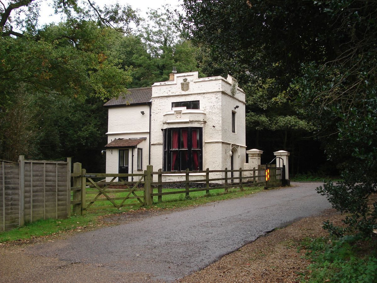
The main, north entrance lies 400m north-north-east of the site of Panshanger House, giving access from the A1000 from Hertford and Tewin. The entrance is marked by the two-storey, white-painted North Lodge in Tudor style, standing adjacent to white-painted gate piers, slightly set back off the road, flanking the drive. From here the drive extends through the north park south-west to the site of the house, passing through a belt of trees and across what was formerly an open lawn, before reaching the open remains of a formerly gravelled forecourt on the north side of the site of the house. A spur off the north drive 200m from the house leads south-west to the south side of the stable block standing 150m north of the site of the house.
Three further drives cross the park, now (1999) disused, except for access within the estate, and lost in parts. The west drive enters from Poplars Green, 1km west of the site of the house, at West Lodge, a single-storey brick cottage in Tudor style. From here the drive formerly passed through a belt of trees into parkland, descending into the river valley to the Carriage Bridge, a brick bridge carrying the drive eastwards across the River Mimram. From here the drive curves north-east (this section extant, 1999) up the hillside to arrive at the carriage sweep on the site of the north front.
The south drive enters 1.75km south-west of the house, at South Lodge (c 1830-40, listed grade II). This single-storey brick lodge, in Tudor style, stands 100m back off the main road through Cole Green, at the north edge of the village green. The entrance to the drive is marked by a pair of octagonal stone piers supporting iron gates, with a small brick gatehouse standing opposite the lodge (c 1830-40, listed grade II). From here the remains of a track, at this point following the course of a former public road stopped up c 1800, leads north through the undulating ground of the south-west corner of the park. Having passed through woodland, then beneath the A414, it runs between two high, open areas of ground, both having been quarried and their levels reinstated with landfill. That to the west appears to have been the site of the former Cole Green House and its surrounding landscape. The track continues northwards, descending into the river valley to join the west drive at the west side of the Carriage Bridge.
The east, and longest drive formerly entered the park c 1.8km east-south-east of the house at the East Lodge (outside registered area), giving access from Hertford and Hertingfordbury. The white-painted, Tudor-style lodge (much extended), was detached from the park by the construction of a spur road (mid C20) off the A414 leading north to the A1000. The remains of the drive lead west from the spur road along the south edge of the wooded plateau, overlooking the open valley below to the south. Some 700m south-east of the site of the house the drive curves north-west across the wooded plateau, to join the north drive 150m from the house.
PRINCIPAL BUILDING
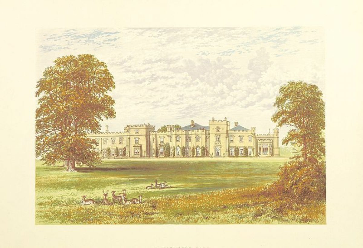
Panshanger House (William Atkinson 1806-11, demolished 1953-4) was built on the site of an earlier dwelling and stood in the northern half of the park, at the edge of the north plateau, overlooking the broad River Mimram valley below to the south. It was of two storeys, built in Romantic Gothick style with crenellated parapets, turrets, and several squat towers breaking up the facades (CL). The entrance front lay on the north side, overlooking a level lawn planted with scattered trees, whilst the south, garden front overlooked a broad, open sweep of parkland leading down to Repton's Broad Water in the Mimram valley, with distant views to countryside beyond the park to the south (OS). Almost nothing of the house survives except possibly the foundations, and the site is overgrown (1999).
The brick-built stables (c 1856, now converted to office accommodation, listed grade II) stand north of the site of the house, surrounding a square stable yard on three sides, the fourth, south side being closed by a brick wall with a central gateway. Adjacent to the north lies a farmyard, with brick yard walls, stock pens and outbuildings.
GARDENS AND PLEASURE GROUNDS
Panshanger House formerly stood within two wings of enclosed pleasure grounds which extended south-east down the valley side to Garden Wood, and west along the plateau to Poplars Grove. The largely earthwork remains of the formal garden features flank the site of the house to west and east. East of the house site lie the remains of a level, open lawn, formerly bounded to the east by a brick wall (traces of which remain), divided from the site of the house by an area of scrub. This contains the basin of a pool and fountain, formerly aligned on the centre of the east front, which marked the intersection of two paths in cruciform pattern. The basin is surrounded by a ring of overgrown box plants, with specimen yews scattered in the surrounding scrub, together with several mature cedars and pines. Formerly this area and the south terrace were graced by a group of marble vases (P van Baurscheit 1714) brought from the old Cole Green house (CL 1936).
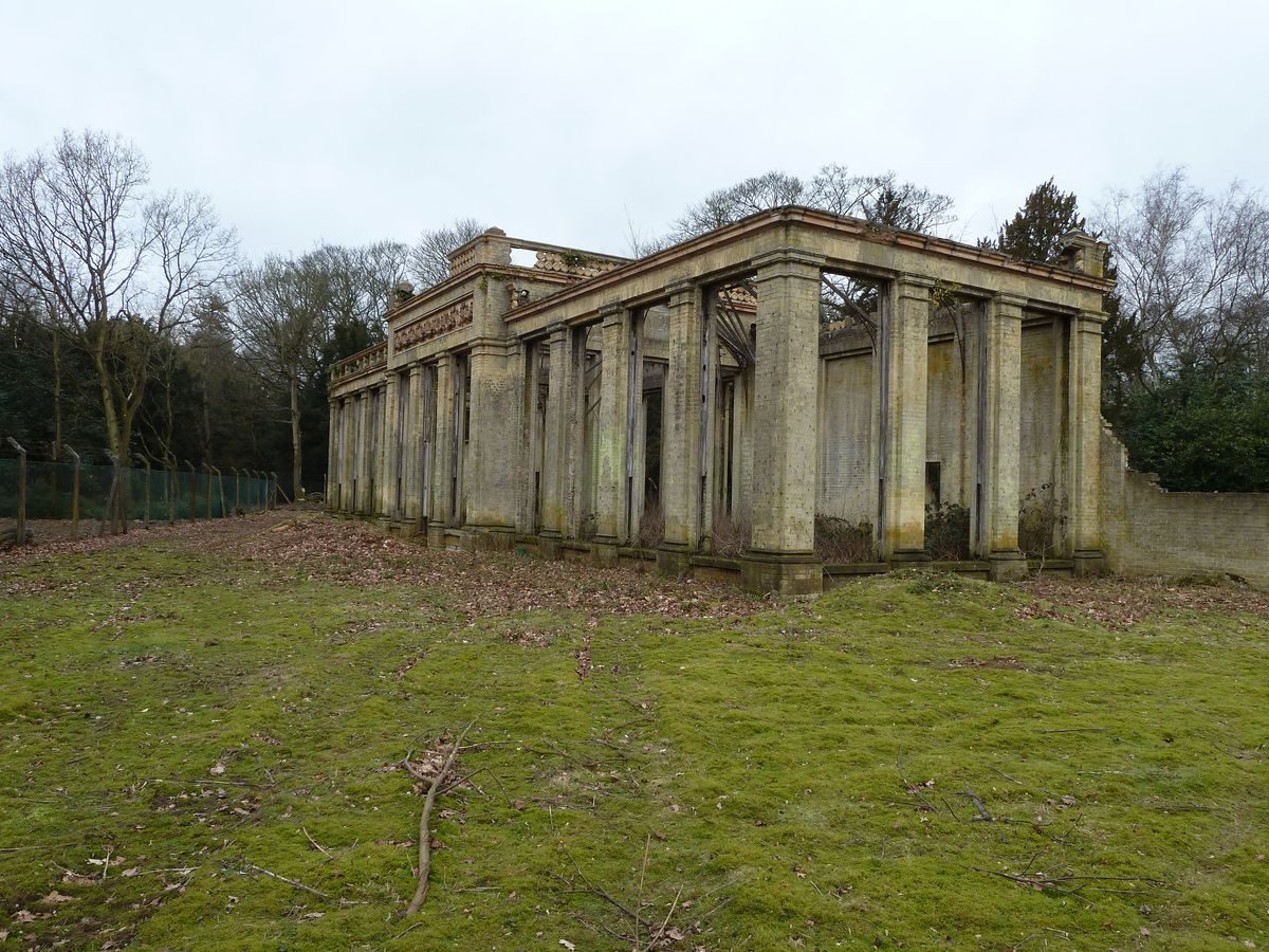
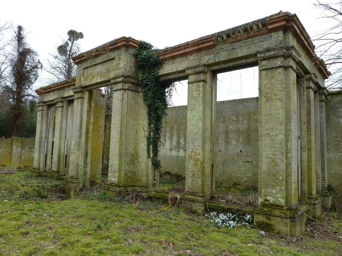
West of the remains of the house lie the remains of two formal garden areas, formerly connected to the east gardens via a terrace along the south front. An enclosure adjacent to the west side of the house site contains a large, south-facing orangery (c 1856 for seventh Earl Cowper, listed grade II), of white brick with terracotta dressings in Classical style. It has lost its roof and windows but the main structure remains. South-east of this, the orangery is linked by a brick wall to a smaller, west-facing conservatory in similar style. Formerly, the orangery overlooked a formal garden.
West of the orangery garden lay a late C19, formal, enclosed garden (OS 1898; 1923; CL 1899). At the centre stood a sundial, with a path north to a small garden house, and to the south a central sunken terrace flanked by two fountains. The site of the sundial is surrounded by a ring of mature yews (formerly clipped as a hedge), and the sunk area to the south remains. West of this, in the pleasure ground leading to Poplars Grove, stands the Panshanger Oak, a very large, single oak tree, possibly over 600 years old and remaining in good condition.
In the C19 and C20, up to 1914, the gardens were kept to a very high standard, with ornamental areas of great intricacy including the Sunken Garden (part of the south terrace, surrounded by a balustrade), the Rose Garden, the Dairy Garden, and the Box Garden (overlooked by the east front) (CL 1899).
PARK
The park is divided into three sections, such that the higher ground of the north and south parks is divided by the Mimram valley.
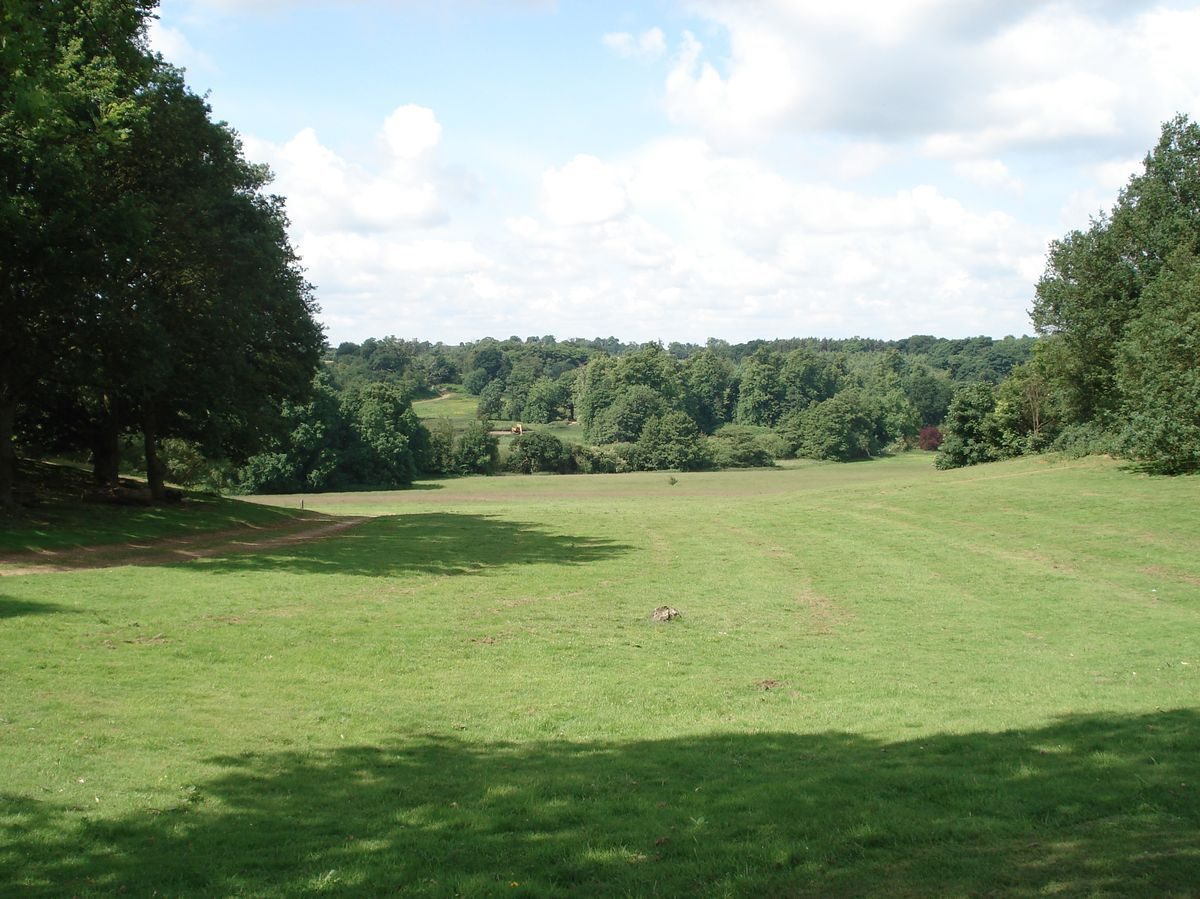
The north park, occupying the northern plateau, is laid partly to open pasture containing some clumps and single trees flanking the north drive, bounded along the road to the north by a belt containing exotic species including Wellingtonias. Woodland extends east from the open pasture, including Evergreen Wood and Lady Hughes's Wood. Gravel extraction is presently (1999) carried out in areas of this woodland. The plateau edge overlooks the valley to the south and north-facing valley side beyond, with views south-east towards Hertingfordbury and the church.
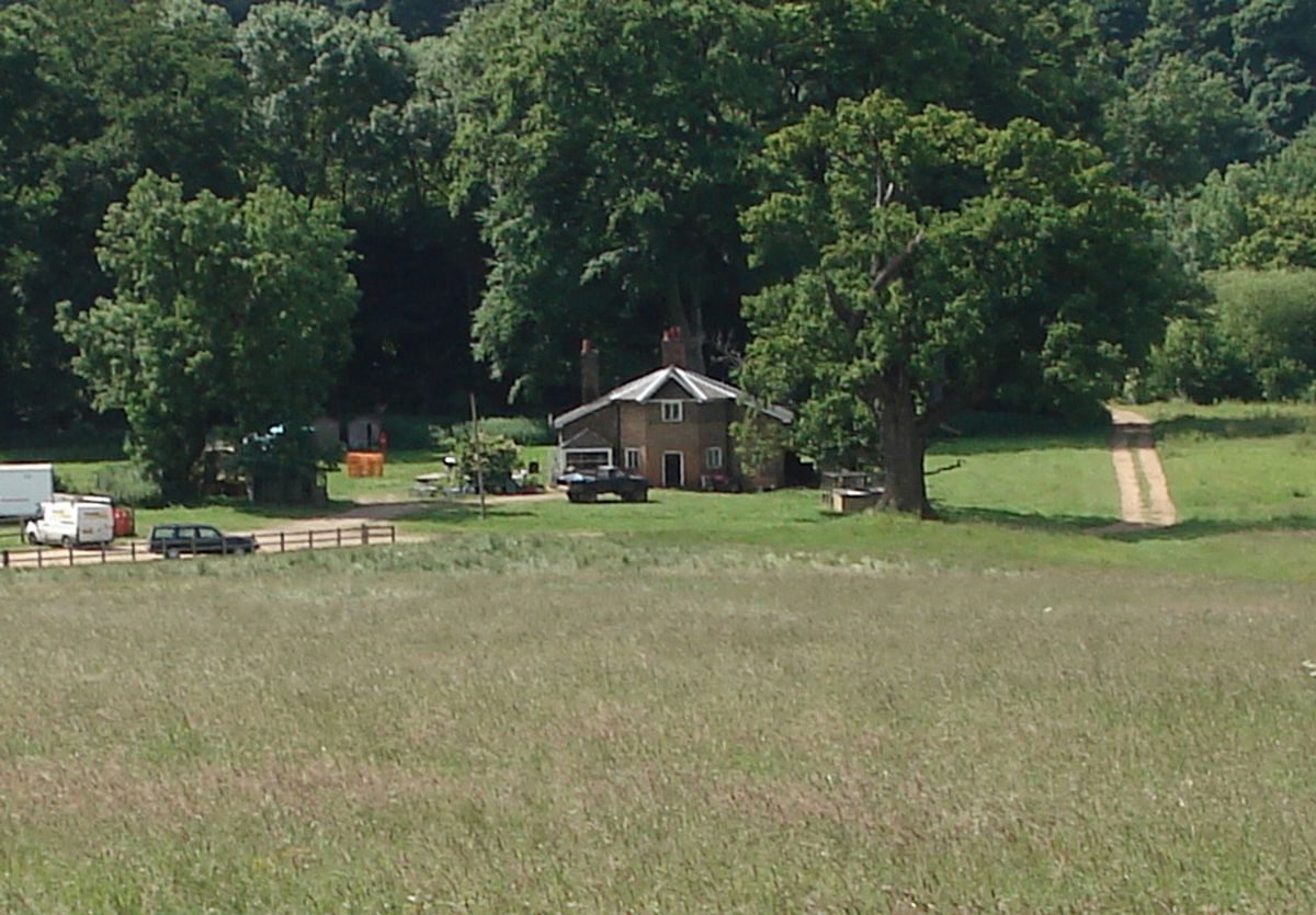
The Mimram valley is dominated by Repton's Broad Water, a diversion of the Mimram northwards, dammed to form a sinuous sheet of water overlooked to the north by the site of the house and gardens, and from the surrounding valley sides. The Broad Water is fed by the Mimram, entering the park from Marden Hill Park to the north-west, and divided into two lakes by an island lying 300m south of the site of the house, which disguises a weir and sluices. The river is crossed by several footbridges, including two brick bridges south-west of the site of the house. Riverside Cottage (1755-63, listed grade II) stands in the valley bottom, 700m south-east of the site of the house on the north side of the river. It may have been constructed as part of Brown's work for the second Earl Cowper, and was altered in Picturesque style during the works of the early C19. The Mimram leaves the park close to Hertingfordbury, 650m south-east of the site of the house. The valley is laid largely to pasture, with occasional parkland trees.
The south park is laid largely to woodland rising up the valley side and occupying the plateau, except for the undulating south-west corner which is open and contains the site of the former Cole Green House and its park. The site of Cole Green House and its gardens may lie east of the present kitchen garden, in which case any remains have probably been lost to C20 gravel extraction and subsequent landfill works. The remains of an oak avenue run south of this however, from west to east across the south drive, and are aligned at the west end on an area south of the kitchen garden which has not been disturbed; this may alternatively be the site of the former Cole Green House.
KITCHEN GARDEN
The octagonal, red-brick kitchen garden (early C18, probably for the first Earl Cowper, listed grade II), now laid to lawn, stands 1.5km south-west of the site of Panshanger House, close to the site of the former Cole Green House. The garden is entered via two large, arched and pedimented gateways in the west and east sides, with further smaller pedestrian gateways in the other sides. Adjacent to the south-east stands the two-storey, red-brick Keeper's Cottage (early C18, listed grade II), a gardener's house extended in the early to mid C19. In the later C19 the kitchen garden was surrounded by an outer enclosure, with a service yard to the north, but these areas are now (1999) open.
REFERENCES
Country Life, 6 (12 August 1899), pp 176-82; 79 (11 January 1936), pp 38-44; 151 (19 April 1972), pp 1178-9
Trans East Herts Archaeol Soc 14 pt 1, (1955-7), pp 42-58
D Stroud, Humphry Repton (1962), pp 101, 108-9
D Stroud, Capability Brown (1975), pp 220-1
G Carter et al, Humphry Repton (1982), p 154
Maps
The Estate of William Cowper ... containing certain Farms, Tenements, Woods and Lands ... Surveyed and Drawn by John Halsey, c 1703 (redrawn and published in Transactions 1955-7)
A Map of lands belonging to the manor of Panshanger, possession of the Rt Honble Wm Earl Cowper ... ,1719 (Hertfordshire Record Office)
Dury and Andrews, A topographical Map of Hartford-shire, 1766
A Bryant, The County of Hertford, 1822
Tithe map for Hertingfordbury parish, 1838 (Hertfordshire Record Office)
OS 6" to 1 mile:
1st edition published 1884
2nd edition published 1899
OS 25" to 1 mile:
2nd edition published 1898
3rd edition published 1923
Archival items
H Repton, Red Book for Panshanger, 1799 (D/EP P21A), (Hertfordshire Record Office)
Description written: February 2000
Register Inspector: SR
Edited: October 2000
- Visitor Access, Directions & Contacts
Access contact details
Panshanger Park is open to the public. Some areas are restricted but there are many new permissive paths.
Directions
North of Hertingfordbury on the north side of the A414
- History
The following is from the Register of Parks and Gardens of Special Historic Interest. For the most up-to-date Register entry, please visit the The National Heritage List for England (NHLE):
www.historicengland.org.uk/listing/the-list
HISTORIC DEVELOPMENT
Around 1704 the mansion house called Fitzjohns was pulled down and replaced by Cole Green House, a seven-bay mansion built for William Cowper, first Earl Cowper (first Lord Chancellor of Great Britain, 1707-10, again 1714-18; d at Cole Green 1723). He occupied the house in 1711 and settled there upon his retirement in 1718. Fruit and formal flower gardens lay close to the house, closely attended by the Countess. In 1719 the Earl bought the adjacent Panshanger estate. By 1738 the park surrounding Cole Green House had been extended to c 50ha (Transactions 1955-7). Entries in the Cowper ledgers exist for work carried out by Lancelot Brown in 1755-6, 1761, and 1763-4, amounting to £618. Although it is not known exactly what he did, he seems to have created a ha-ha and carried out planting (ibid).
In 1797, the fifth Earl came of age and began improvements upon his Hertfordshire estates. Humphry Repton (1752-1818) produced a Red Book for the united Panshanger and Cole Green estates, suggesting where on the Panshanger estate a new house could be sited most advantageously, and how the River Mimram could be diverted and widened into a lake to take full advantage of the valley scenery around it (Red Book, HRO). This was part of a larger scheme to landscape the Earl's estates along the River Mimram valley, including Tewin Water (qv) for which a Red Book was also produced in the same year, and where his suggestions were largely carried out, and Digswell, which was dropped from the scheme at an early stage. Repton intended that each estate in the Mimram valley within Cowper's possession should be given 'a degree of extent and consequence which it could not boast exclusive of the others, and while each possesses its independent privacy and seclusion, their united lawns will, by extending thro' the whole valley enrich the general face of the country' (Tewin Water Red Book, 1799, HRO).
Repton seems to have taken little part in the implementation of the suggestions, which were instead supervised by the Earl until his death in 1837. Planting began in 1799, continuing over several years, and Cole Green House was pulled down in 1801/2. The enclosure of Hertingfordbury parish in 1801 meant that the park could be substantially enlarged, and six miles of public rights of way were diverted around it (Transactions 1955(7). Panshanger House, modified from Repton's suggestions, was largely built 1806-9 and the Earl occupied it in 1811. After the fifth Earl's death his wife continued to manage Panshanger until 1867, she having remarried, to Lord Palmerston. Following her death the estate was managed until 1913 by the seventh Earl's wife, Katrine, who supervised the addition of formal garden features around the house.
After the First World War the estate deteriorated, and Lord Desborough, upon whom it had devolved, sold 4000 acres (c 1666ha) of it in 1919. The estate was finally broken up and sold out of the family in 1953, and by 1954 the house had been demolished. The park is now (1999) owned by a gravel extraction company.
- Associated People
- Features & Designations
Designations
Conservation Area
The National Heritage List for England: Register of Parks and Gardens
- Reference: GD1913
- Grade: II*
Green Belt
Local Listing or Building of Local Importance
- Reference: Area of Archaeological Significance (west end of park)
Site of Local Importance for Nature Conservation
- Reference: Wildlife Site, Ancient Woodland Inventory, Grassland Inventory, Heathland Inventory, Herts & Middlesex Wildlife Trust Reserve, Invertebrate Site Register. Panshanger Park 58/028.
County Wildlife Site
- Reference: Hertfordshire County Council
Style
Informal
Features
- Specimen Tree
- River
- Description: River Mimram.
- Building
- Description: Cole Green House and associated outbuildings.
- Earliest Date:
- Latest Date:
- House (featured building)
- Description: The house was demolished in 1953-4.
- Earliest Date:
- Latest Date:
- Icehouse
- Kitchen Garden
- Description: Octagonal brick wall.
- Earliest Date:
- Latest Date:
- Stable Block
- Earliest Date:
- Latest Date:
- Orangery
- Description: The orangery is now windowless and roofless.
- Earliest Date:
- Latest Date:
- Conservatory
- Description: The conservatory is now windowless and roofless.
- Earliest Date:
- Latest Date:
- Fishing Lodge
- Description: The fishing lodge was extended in the early-19th century. A small octagon with two longer sides to which there are lean-to outshuts, only one of which is original. Originally one storey now two.
- Earliest Date:
- Latest Date:
- Gate Lodge
- Description: South Lodge is in Tudor Revival style.
- Earliest Date:
- Latest Date:
- Garden Building
- Description: Gardeners House (Keeper’s Cottage, now renamed Panshanger House). Red brick. Two storey, now much altered.
- Earliest Date:
- Latest Date:
- Parkland
- Woodland
- Key Information
Type
Park
Purpose
Recreational/sport
Survival
Part: ground/below ground level remains
Hectares
350
Open to the public
Yes
Civil Parish
Hertingfordbury
- References
References
- Carter, G. et al, {Humphry Repton Landscape Gardener 1752-1818} (Norwich: Sainsbury Centre for Visual Arts, 1982), p. 154 Humphry Repton landscape gardener 1752-1818
- {English Heritage Register of Parks and Gardens of Special Historic Interest}, (Swindon: English Heritage, 2008) [on CD-ROM] Historic England Register of Parks and Gardens of Special Historic Interest
- Stroud, D., {Capability Brown} (London: Faber, 1975), pp. 220-1 Capability Brown
- Stroud, D., {Humphry Repton} (London: Country Life, 1962), p. 101, 108-9 Humphry Repton
- Page, W {Victoria County History: Hertford, Volume 3} (1912) 468-472 Victoria County History: Hertford, Volume 3
- Historic Land Management {Panshanger Park Landscape Management Plan} (2004) Panshanger Park Landscape Management Plan