Introduction
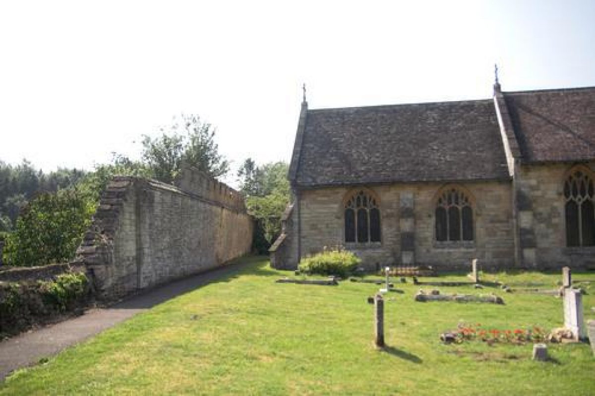
The house was demolished in 1790 and only two garden walls survive. The site is bordered to the north by the road. The outer service buildings next to the road survive and are Grade II listed. Parts of the garden wall between the church and manor house garden survive and the entrance to the church is still through the surviving service buildings alongside the road. There is a present day house (Coberely Park) but the former garden does not survive.
This site is lost except for surviving service buildings (English Heritage listed) and two garden walls.
- History
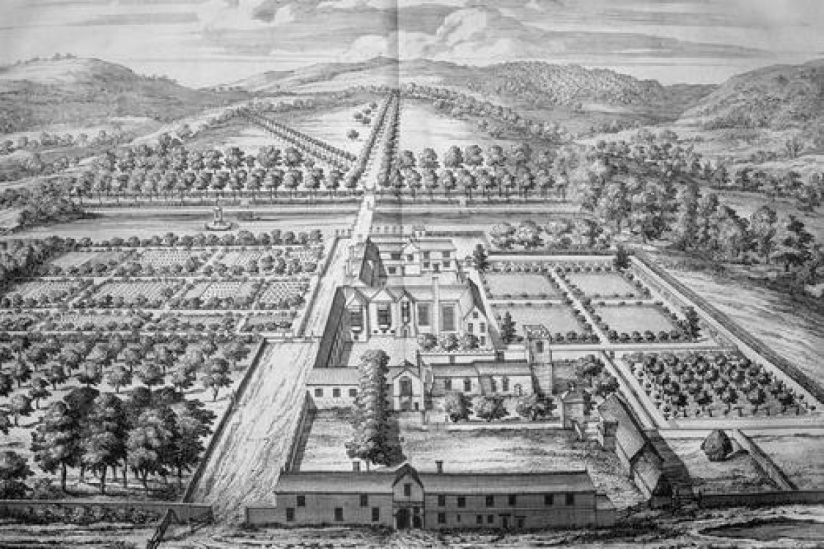
As illustrated in the Kip engraving: The garden lies between the road and a canalised tributary of the Churn. The park, with formal tree-lined avenues, extends southwards from the canal. The garden to the north of the canal is walled to the north and west. The main part of the north comprises service and farm buildings with the church and house beyond. The centre of the garden is cut through by a path which leads to a bridge over the canal. To the north of this are formal orchards and vegetable gardens. There are formal grass parterres with topiary to the west of the house and a formal orchard to the west of the church. There is a small stackyard next the farm buildings and there is also a dovecot in the outer courtyard. A small island has been created in the canal with a gazebo on it. This is a more a functional than decorative garden.
- Features & Designations
Designations
The National Heritage List for England: Listed Building
- Grade: II
Style
Formal
- Key Information
Type
Garden
Principal Building
Domestic / Residential
Survival
Lost
Civil Parish
Coberley
- References
References
- Atkyns, R {The Ancient and Present State of Gloucestershire} (London: W. Bowyer for Robert Gosling,1712) The Ancient and Present State of Gloucestershire
- Verey, D {The Buildings of England: Gloucestershire 1: The Cotswolds} (London: Penguin, 1970) 287 The Buildings of England: Gloucestershire 1: The Cotswolds