Introduction
Dowdeswell Court has 19th-century gardens and parkland, in separate ownership since about 1980. The gardens and pleasure grounds are associated with an early 19th-century house and incorporate 18th-century elements including a combined bath house and summer house.
Terrain
The site occupies a Cotswold valley set in rolling hills, with a brook running south-east to north-west down the valley, bisecting the park.Dowdeswell Court and its parkland form part of a rare view across open country of an old village comprising houses, a church and barns largely unaffected by development. The site can be seen from some footpaths and from the A4.
Sale particulars dating back to 2005 describe a secret garden, a rose garden, a formal terrace and an Italian garden.
The following is from the Register of Parks and Gardens of Special Historic Interest. For the most up-to-date Register entry, please visit the The National Heritage List for England (NHLE):
www.historicengland.org.uk/listing/the-list
An early to mid-19th-century park and pleasure ground surrounding a country house rebuilt in the 1830s by Rowland Paul on the site of a 17th-century manor house, the landscape grounds incorporating work of the 18th century, and with further landscaping in the 19th and early 20th century.
DESCRIPTION
LOCATION, AREA, BOUNDARIES, LANDFORM, SETTING
Dowdeswell Court lies 5km south-east of the centre of Cheltenham, on the west side of the village of Lower Dowdeswell and to the north-west of Upper Dowdeswell. The c 46ha site is bounded to the north-east by the houses and church of Lower Dowdeswell which overlook the park, and to the north and south-east by the village lane. The site is bounded and overlooked to the south by Upper Dowdeswell, and bounded to the west by agricultural land which formerly comprised part of the adjacent Rossley Manor estate. Rossley Manor stands c 1.1km west of Dowdeswell Court and was formerly the dower house to the Court.
The site is bounded to the north and south-east along the village lane by a stone wall, lowered at a point c 200m south-east of the Court, where an inset iron railing flanked by stone piers allows views over the adjacent farmland to the north. The site occupies a Cotswold valley set in rolling hills, with a brook running south-east to north-west down the valley, bisecting the park. The boundaries on the high ground to the north-east and south-west incorporate the embanked boundaries of two early settlements marked as 'camps' on the C19 and early C20 OS maps (1883, 1920-1). The setting is rural with long views north-west through a gap in the hills to Cheltenham below. Further views of the hills to the north are also obtained from various elevated parts of the park and pleasure grounds.
ENTRANCES AND APPROACHES
The main approach enters the site at the north-west corner, off the west end of the village lane, c 400m north-west of the Court, giving direct access from the A40 London to Cheltenham road which passes 100m to the north-west. The gateway, built c 1830s, is set back off the road, flanked by stone piers supporting iron railings, these in turn flanked by a further pair of piers which incorporate two single pedestrian gateways. The gateways are in turn flanked by convex stone walls supporting iron railings, leading back out to the road (the whole entrance c 1830s, listed grade II). South of the gateway, on the east side of the drive, stands a single-storey stone lodge, known as West Lodge (c 1830s, listed grade II), built in Greek Revival style with a small portico overlooking the drive.
From here the north drive, now (2002) disused, extends south-east through the valley bottom in the park, ascending the gentle slope overlooked by the hall. The drive passes to the south-west of a chain of three lakes and around the south end of the highest, southern lake, before turning north-eastwards c 250m south of the Court to ascend the north-east side of the valley overlooked by the south-east front of the former coach house. The drive passes below the south-west front of the former coach house before entering the forecourt c 50m from the south-east front of the Court.
The forecourt is divided into outer and inner compartments separated by a stone balustrade (c 1830s) which is itself centrally divided by the drive, flanked by stone piers. The outer court is laid to lawn, and the inner is now (2002) tarmac, with a central oval panel of lawn (OS 1883). Both compartments are cut into the north-east valley side, with the hillside rising to the north-east and descending to the south-west, the south-west edge of the outer compartment being bounded by an extension of the stone balustrade. The inner compartment of the rectangular forecourt leads to the south-east, entrance front of the Court, and the front door which is enclosed by a single-storey portico. Views extend from the south-west side of the forecourt across the garden below and the park beyond, and north-west through the valley towards Cheltenham. The level forecourt overlies the remains of C17 vaulted stone cellars and passages, in particular, at the south corner, a former outbuilding which is now (2002) entered via the C19/C20 terrace which extends south-east parallel to the forecourt from below the south-west front of the Court.
The south drive enters the park c 675m south-east of the hall, at the south-east tip of the park, giving access from Upper Dowdeswell via the Lower Dowdeswell village lane. This approach, somewhat less grand than that at West Lodge, is marked by an entrance and lodge set back off the lane. Iron gates are supported by stone piers, these in turn flanked by low stone walls supporting iron railings with linking subsidiary piers (the whole c 1834, listed grade II). East Lodge (c 1834, listed grade II) stands adjacent to the east of the entrance, a single-storey building of ashlar in Classical style, with C20 extensions. From East Lodge the south drive, now (2002) disused, extends south, turning north-west c 75m south of the Lodge, from here gently descending through the park along the lower slopes of the north-east side of the valley. Some 250m south of the Court the south drive joins the north drive to ascend the valley side and enter the forecourt.
A third, north-east drive enters the site c 75m north of the Court, giving direct access from Lower Dowdeswell. At the south-east corner of the churchyard stands a carriage entrance marked by a gateway (mid C19, listed grade II) set obliquely back off the lane, with iron gates flanked by stone piers, these in turn linked by iron railings to further subsidiary piers. A pedestrian gateway is set into the railings, flanked by wrought-iron panels. This entrance was superseded in the late C20 by another entrance, 10m to the south. From the C19 gateway the drive extends south-east, gently descending the contour of the hillside, joined by the short spur from the late C20 gateway. The drive, largely flanked by shrubbery, passes immediately to the east of the service wing of the Court, in which wall is a blocked doorway which formerly provided service access at first-floor level to the Court. From here the drive continues down the slope through shrubbery and mature trees towards the north-west front and the courtyard of the former coach house. Immediately north-west of the coach house, where a spur leads into the yard, the drive turns sharply west to join the north drive at the entrance to the forecourt, c 80m from the Court.
The 1838 Tithe map shows the estate as it was being remodelled. The area now (2002) occupied by the forecourt was at that time occupied by a narrower rectangular space of similar length aligned on the former house, flanked by two irregular rows which were probably chiefly service buildings. On this map the approach to the Court from the village lane is not clearly defined, and none of the present drives is depicted. Bryant (1824) however shows the former house being reached by a drive which apparently largely follows the course of the present north-east drive, leaving the village lane to the south-east of the church.
PRINCIPAL BUILDING
Dowdeswell Court (1833-5, listed grade II) stands close to the north-east boundary of the site. Built in Classical style by Rowland Paul of Cheltenham, it is of ashlar with a slate roof, and is set into the hillside which slopes up to the north-east. The present mansion, which replaces a C17 house on the same site, was rebuilt for the Rogers family. Formerly of three storeys, it was reduced to two in the 1920s. The main entrance on the south-east front overlooks the forecourt, with the garden front to the north-west. The south-west front overlooks a terrace walk, below which extend the garden and park occupying the valley side beyond, with views north-west towards Cheltenham.
The former coach house and stables (C19, listed grade II) stands 100m south-east of the hall, and has been converted to residential use (2002). It is of two storeys and built of stone, set into the hillside to the north-east with the main ornamental front to the south-east. Its two main wings to the south-east and south-west enclose a yard, the entrance to which is to the north-west off the north-east drive. The coach house overlooks the main drive below to the south-west and beyond this the park.
GARDENS AND PLEASURE GROUNDS
The gardens and pleasure grounds are divided into two main sections: a formal lawn adjacent to the north-west front of the hall, together with what are now (2002) informal pleasure grounds below to the west and south; and a pleasure-ground walk extending from the north end of the formal lawn along the top of a hanging beech wood adjacent to the south-east boundary and the village lane.
The garden is entered via the north-west, garden front of the Court, from which a doorway leads onto a formal rectangular terrace laid largely to lawn surrounded by a gravel path, with a stone pool at the centre. From the lawn a bank planted with mature trees and shrubs leads north-east towards the north-east drive above. A path leads along the north-west end of the lawn up a gentle slope to the top of this bank and beyond to the north-east drive, formerly giving access to the north end of the pleasure-ground walk along the south-east boundary. The path up from the terrace lawn also formerly gave access to an octagonal garden building (now gone) which stood at the centre of the bank among trees (OS 1883). The base of the building may survive within the remaining shrub planting.
From the west corner of the terrace lawn a curving path leads down a bank to a lawn overlooking the park below to the south-west, from which paths lead north-west to two blocked doorways in the south-east wall of the kitchen garden. The bank contains remains of steps and pools overgrown with shrubbery. By the early C20 this area was laid out as a rose garden, overlooked by a rock garden occupying the slope leading north-east up to the terrace lawn. A summerhouse formerly overlooked the north side of the rose garden, which was surrounded by a concentric arrangement of circular paths and beds, at the centre of which was a circular lily pool and fountain (Gardeners' Chronicle 1921; OS 1922). This feature is also shown on the 1883 OS map.
From the south corner of the terrace lawn a flight of stone steps leads south-west down to the north-west end of a terrace walk which runs parallel to and below the south-west front of the Court, giving access to informal lawns below. These lawns are separated from the former rose garden to the north-west by a shrubbery through which runs an informal connecting path.
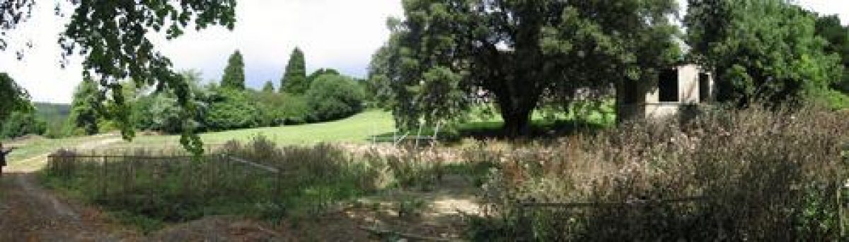
The south-east half of the terrace walk runs parallel to and below the forecourt retaining wall, leading to the C17 building which is enveloped by the forecourt. Below the forecourt and terrace walk a lawn slopes away to the south-west, planted with mature holm oak and other trees and shrubs, within which stands the bath-house (1773, listed grade II) (Kingsley and Hill 2000; Coxwell-Rogers, c C19). This two-storey, octagonal stone building contains a bath-house at ground level with a summerhouse above which formerly enjoyed views over the parkland and lakes below and north-west towards Cheltenham, these views now (2002) obscured by mature trees. The bath-house is entered at the lower level from the south-west, giving access to the octagonal plunge pool. The summerhouse at the upper level is entered from the north-east. West of the bath-house lies a levelled area which since the Second World War has been occupied by a long, low, rectangular building erected by the Air Ministry around which scrubby trees and shrubs have grown up. This area may be the site of an earlier narrow, serpentine water feature which appears on the 1838 Tithe map.
The scarp slope extends from the Court south-east alongside the village lane, occupied by woodland known as Crawthorn Grove in the 1830s (Tithe map). Through the woodland, almost at the top of the slope, a path runs parallel with the stone boundary wall, the path in places cut into the hillside, with intermittent views across the park to the south-west. Alongside the path runs a broadly spaced line of large, mature beech trees, possibly over 150 years old. The boundary wall adjacent to the path drops down for several metres 200m south-east of the Court, supporting iron railings with small finials forming a clairvoie (c early C19) from which views extend across farmland to the north-east (outside the area here registered). A clearing extends south-west from the clairvoie down the steep slope providing views into the park, this being partly obscured by recent growth. The clearing was present by the late C19 (OS 1883). Some 450m south-east of the Court the path crosses a fence line situated on ground rising above the stone wall, at which point extensive views open up to the countryside to the north and south of the site. From here the path gently descends the scarp through the remains of the woodland belt to emerge in the park, crossing the south drive c 150m west of East Lodge as a public footpath which leads to the south boundary, giving access to Upper Dowdeswell.
During the late C19 the path at the top of the scarp was approached from the terrace lawn to the north-west of the Court via the bank above on which stood the former summerhouse. A path led across the north-east drive to the north end of the scarp slope path, this approach obscured by later growth (2002).
The park is bounded at the top of the south-west side of the valley by a strip of woodland named on the 1838 Tithe map as Comb's Grove, which may have had ornamental walks leading through it (OS 1883).
PARK
The parkland lies to the south-west and south-east of the Court and is laid to pasture. The park occupies a valley at the bottom of which is a brook which rises above the park to the south-east, in Upper Dowdeswell, flowing though the valley bottom, leaving the park at the north-west corner close to West Lodge. A small stone cottage (c late C18/early C19), of two storeys with Gothick-style windows, stands at the head of the valley overlooking the brook as it flows through the southern half of the park. The brook widens into a series of three lakes 200m south-west of the Court, the smallest at the south end, and the largest at the north end, overlooked by the Court and surrounding gardens. The northernmost lake is now (2002) silted up and contains self-sown trees.
The park is planted with many scattered mature trees as singles and clumps, particularly in the northern half, and is bounded by woodland to the west and south-west (outside the area here registered) and by the belt of hanging woodland to the south-east. Some 500m south-west of the Court, at the top of the south-west side of the valley, stands a single-storey cottage, possibly a former lodge. A short path (now gone) formerly led from the cottage into the north end of Comb's Grove (OS 1883). A longer path led down the valley side through the park towards the north end of the northernmost lake (OS 1883). From this side of the valley, which overlooks the lakes below the village of Lower Dowdeswell and the Court itself, views extend north-west towards Cheltenham.
The park and lakes are not shown on the Tithe map (1838), but are said to have been laid out as part of the development of the estate by Edward Coxwell-Rogers, c 1830s (Description of estate, GRO), and are shown complete on the 1883 OS map.
KITCHEN GARDEN
The rectangular, stone-walled kitchen garden (c early C19) stands 80m north-west of the hall. The garden was formerly entered via two doorways in the south-east wall which have been blocked up. A path leads north-west from the house via the ornamental garden to these doors.
REFERENCES
J B Burke, Visitation of Seats I (i), (1852), p 247
Victoria History of the County of Gloucestershire Volume 2, (1907), pp 6-8, 10-11; Volume 9, (2001), pp 42-69
Gardeners' Chronicle, ii (1921), p 249
H Colvin, A Biographical Dictionary of British Architects, 1600-1840 (3rd edition 1995), p 744
English Heritage Register Review, Dowdeswell Court (2000)
N Kingsley and M Hill, The Country Houses of Gloucestershire Volume Three 1830-2000 (2000), pp 110-11
Maps
Isaac Taylor, Map of Gloucestershire, 1773 (Gloucestershire Record Office)
A Bryant, Map of Gloucestershire, 1824 (Gloucestershire Record Office)
Tithe map for Dowdeswell parish, 1838 (Gloucestershire Record Office)
OS 6" 1 mile: 1st edition published 1883; 3rd edition surveyed 1920-1
OS 25" 1 mile: 1st edition published 1883; 3rd edition published 1922
Archival items
R Coxwell-Rogers, Description of the Dowdeswell estate (no date, 19th century) (D269A F19), (Gloucestershire Record Office)
Sale particulars, 1935-9 (D4858, 2/3), (Gloucestershire Record Office)
- Visitor Access, Directions & Contacts
- History
The 1883 Ordnance Survey map shows a formal garden layout with rectangular and circular paths. It also shows three lakes, the northernmost of which has an island on it. Between 1883 and 1922 there appear to have been few changes to the gardens. The 1938 sale particulars describe a terrace with fine views, broad walks, a variety of specimen trees, a fountain near the house, two ornamental lakes, a rockery and the octagonal bath house. There is also mention of a walled kitchen garden with stone-capped brick walls and two heated greenhouses. The parkland is described as being 'finely studded with Forest and other trees.'
After the Second World War the property was in institutional use under a succession of owners. In 1980 the landscape park was sold separately with the coach house which was converted into a separate residence. The rest of the property was sold in 1986 for conversion into a nursing home. Between 2001 and 2005 the house was in private ownership and was renovated.
The following is from the Register of Parks and Gardens of Special Historic Interest. For the most up-to-date Register entry, please visit the The National Heritage List for England (NHLE):
www.historicengland.org.uk/listing/the-list
HISTORIC DEVELOPMENT
The Rogers family acquired the Dowdeswell Court estate in 1582 (Victoria County History 2001) and lived there until about 1900. In 1773 an octagonal stone building comprising a bath-house and summerhouse was built for Robert Newman at a cost of £114 (Kingsley and Hill 2000; Coxwell-Rogers, about 19th century). By the 1820s (Bryant, 1824) a small park or pleasure ground surrounded the Court. The 17th-century house was rebuilt for Hester Rogers, 1833-5, in Classical style to a design by Rowland Paul (active 1820-50) (Colvin 1995).
An undated mid- to late 19th-century description of the estate (Gloucestershire Record Office) written by R Coxwell-Rogers states that:
'The Garden and pleasure grounds are surrounded by a high coped wall which makes the premises more private. The view from the terrace [of the house] is particularly striking and extensive commanding the rich vale of Gloucester with Mary Hill beyond and terminated by the Black Mountains or Brecknock in Wales.
A sheet of water, lately made, ornaments the valley below the mansion and is well stocked with all kinds of fish. The plantations on and about the surrounding hills and grounds, with the flower garden and shrubberies were laid out under the superintendence and care of the late E R Coxwell-Rogers [1801-43], nephew of Miss Rogers [Hester] and reflect credit upon his judgement and good taste.' (D269A F19, GRO)
The hall passed through several hands during the 20th century, and the garden was extended during the early 20th century (OS 1920-1). Col Henry Blagrove removed the upper of the three floors of the hall in the 1920s. Dowdeswell Court was requisitioned by the Air Ministry during the Second World War, after which it remained in institutional use until the late 1990s and is now (2002) unoccupied. The park and coach house were sold separately in 1980, and the estate remains in divided ownership (2002).
- Features & Designations
Designations
The National Heritage List for England: Register of Parks and Gardens
- Reference: GD5156
- Grade: II
The National Heritage List for England: Listed Building
- Reference: East Lodge (now a house)
- Grade: II
The National Heritage List for England: Listed Building
- Reference: former Coach House
- Grade: II
The National Heritage List for England: Listed Building
- Reference: Gates and gatepiers forming north entrance to the Court
- Grade: II
The National Heritage List for England: Listed Building
- Reference: Gates, gate piers and railings to East Lodge
- Grade: II
Features
- House (featured building)
- Description: The house was built by Rowland Paul in the 1830s on the site of the 17th-century manor house.
- Earliest Date:
- Latest Date:
- Bath House
- Description: An octagonal bath house in the Palladian style with a first floor summer house.
- Earliest Date:
- Latest Date:
- Key Information
Type
Park
Purpose
Ornamental
Principal Building
Domestic / Residential
Survival
Extant
Hectares
46
Open to the public
Yes
Civil Parish
Dowdeswell
- References
References
- Kingsley. N., {The Country Houses of Gloucestershire, Volume 1, 1500-1660} (Cheltenham: Phillimore, 1989), p. 210 The Country Houses of Gloucestershire, Vol. I 1500-1660
- Kingsley. N., and M. Hill, {The Country Houses of Gloucestershire, Volume 3, 1830-2000} (Cirencester: Phillimore, 2000), pp. 110-1 The Country Houses of Gloucestershire, Vol. III 1830-2000
- {English Heritage Register of Parks and Gardens of Special Historic Interest}, (Swindon: English Heritage, 2008) [on CD-ROM] Historic England Register of Parks and Gardens of Special Historic Interest
- {The Victoria History of the County of Gloucester} ([n.p.]: Oxford University Press, Volume 2, 1907), pp. 6-8, 10-11 Victoria County History: Gloucester, Volume 2
Contributors
Gloucestershire Gardens & Landscape Trust
- Related Documents
-
CLS 1/93/376
Hard copy
-
CLS 1/93/376