Introduction
Claremont has 18th-century landscaped pleasure grounds and a park. Features include a lake, amphitheatre, grotto and water pavilion.
Terrain
The site is laid out on gently sloping ground, with the house on a natural plateau and a higher ridge of ground immediately to the south-west.www.historicengland.org.uk/listing/the-list
Extensive and complex pleasure grounds and park around a country mansion. Main phases C18 and early C19, with early C18 work by Sir John Vanbrugh with Charles Bridgeman and possibly Stephen Switzer, and William Kent with Thomas Greening; mid C18 work by Lancelot Brown; and early C19 work by J W Hiort, J B Papworth, and A C Pugin. Claremont was highly influential in the English landscape garden movement during the C18.
SUMMARY DESCRIPTION
The site is situated on the south side of Esher, in the county of Surrey. It is bounded by the A244 to the east and the A307 to the west, with C20 housing development and a late C19 golf course encroaching on the former parkland to the north, east, and south. Remnants of open land survive to the south-west (West End Common), south-east (Arbrook Common), and beyond a belt of C20 housing, to the south (Esher Common). The c 58ha site is laid out on gently sloping ground, with the house on a natural plateau and a higher ridge of ground immediately to the south-west.
The main approach to the house is from the north, off Copsem Lane (A244) and leads between North and South Lodges (Henry Holland 1770, listed grade II, with late C18 gate piers, listed grade II) and then south-west for c 700m along an C18 drive to The Close (the former C18 coach house and stables, listed grade II). From here the drive divides: one branch continues in a straight line to a former entrance in the south-east corner, another branch curves south-west, up to the house, and then south-east back to the main drive. A further branch leads west between C18 to C20 buildings to the north of the house, to a car park and then by a late C20 drive, to an exit on Portsmouth Road (A307). The approach to Claremont Landscape Gardens is from the south-west and leads off the A307 and then by a short C20 drive to a car-parking area on the north-west side of the lake.
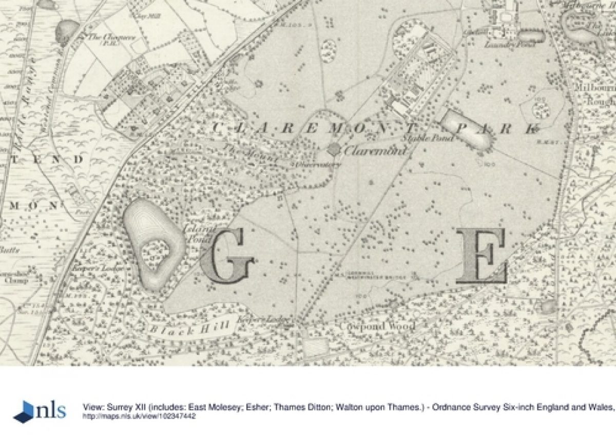
The site consists of extensive pleasure grounds, park, woodland, and former kitchen gardens, the house being separated from the main area of pleasure grounds. Claremont house (1770 by Henry Holland, Lancelot Brown, and John Soane for Lord Clive, replacing the early C18 house by Vanbrugh, listed grade I) is sited on a natural plateau near the centre of the site. There are views from the house to the west over open parkland and to the east over former C18 parkland, now playing fields. The open ground is backed by planting by Brown to the north and south of the house, with shrubberies and mature trees. Further playing fields on former parkland lie to the north-west of the house. To the north-east of the house lies the former walled kitchen garden of c 3.6ha (early C18 brick walls, attributed to Vanbrugh, listed II*), the divided areas of which were largely developed in the C20 with detached houses and gardens. The south-west division remains undeveloped and retains its C19 layout. White Cottage (Vanbrugh c 1720, listed grade II*) and the former coach house (The Close, now Claremont Junior School) adjoin the outside of the south wall, and the Gardener's House (late C18, listed grade II) is located on the northern end of the west wall. An C18 tunnel links the kitchens in the basement of the house to a path leading to the walled gardens, adjacent to which are a range of C20 buildings within areas of C18 shrubbery. Tennis courts lie to the south of the house, partly screened by C18 shrubberies, with further C20 buildings to the south of these, c 200m south of the house. In the north-east corner of the site, c 300m north-east of the house, is a large, early C18 rectangular pond, known as Stable Pond, surrounded by mature C19 trees.
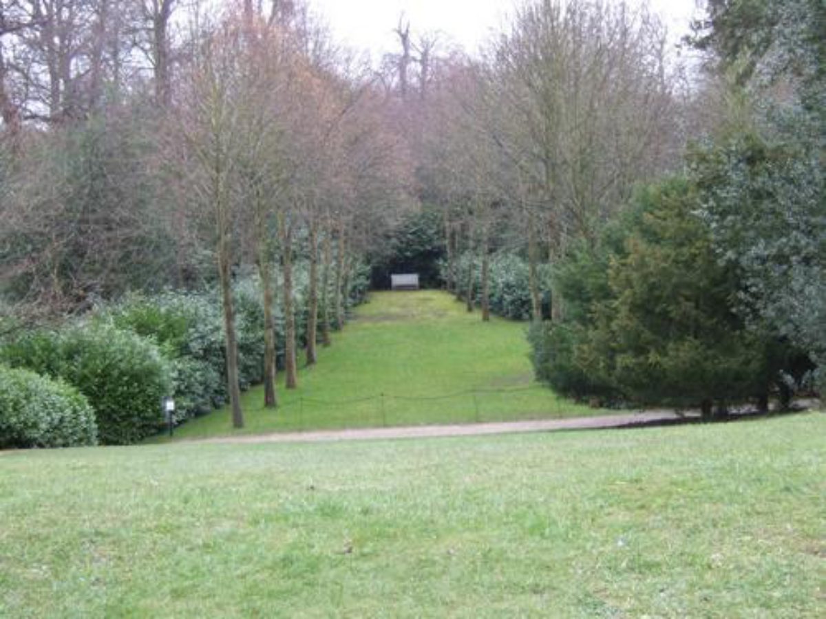
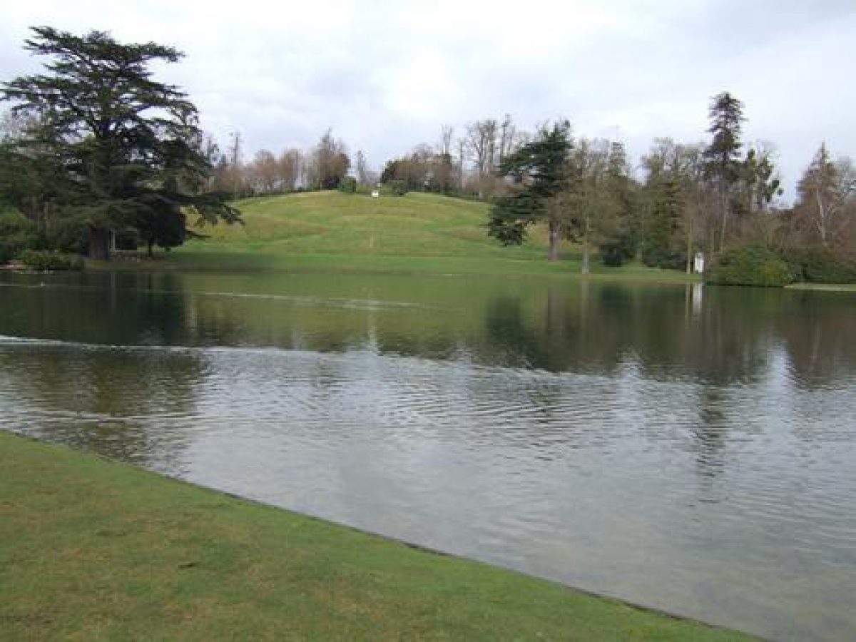
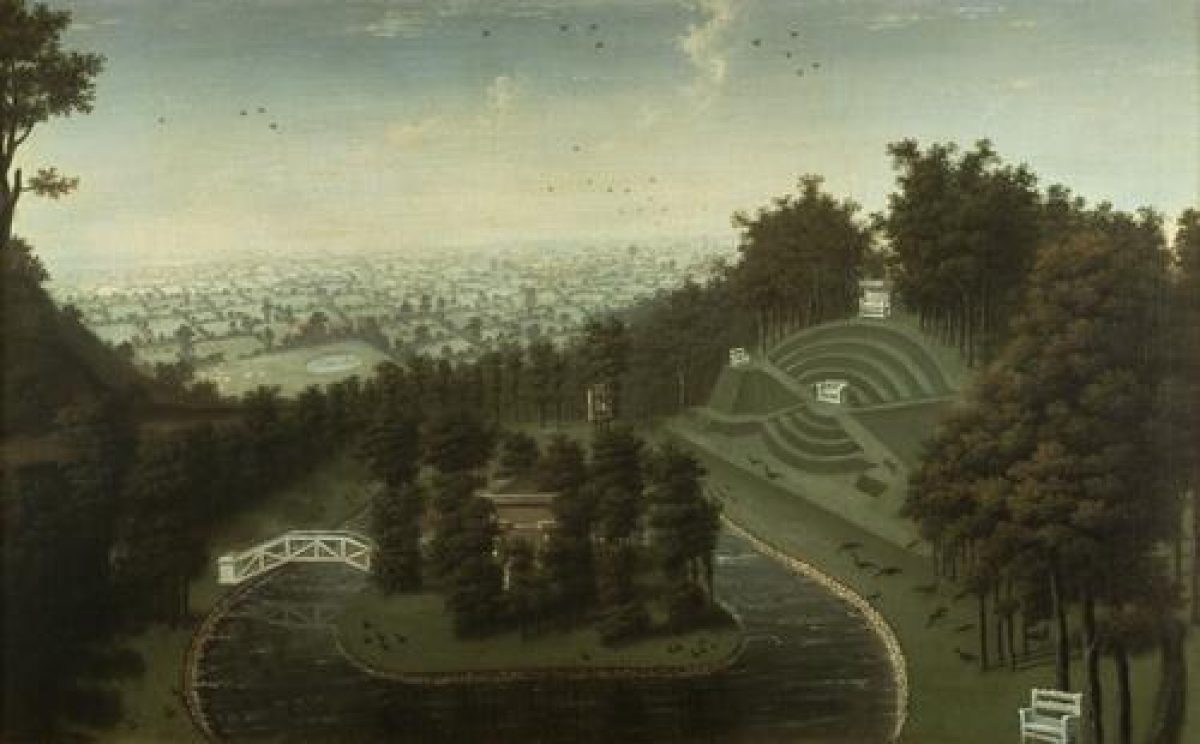
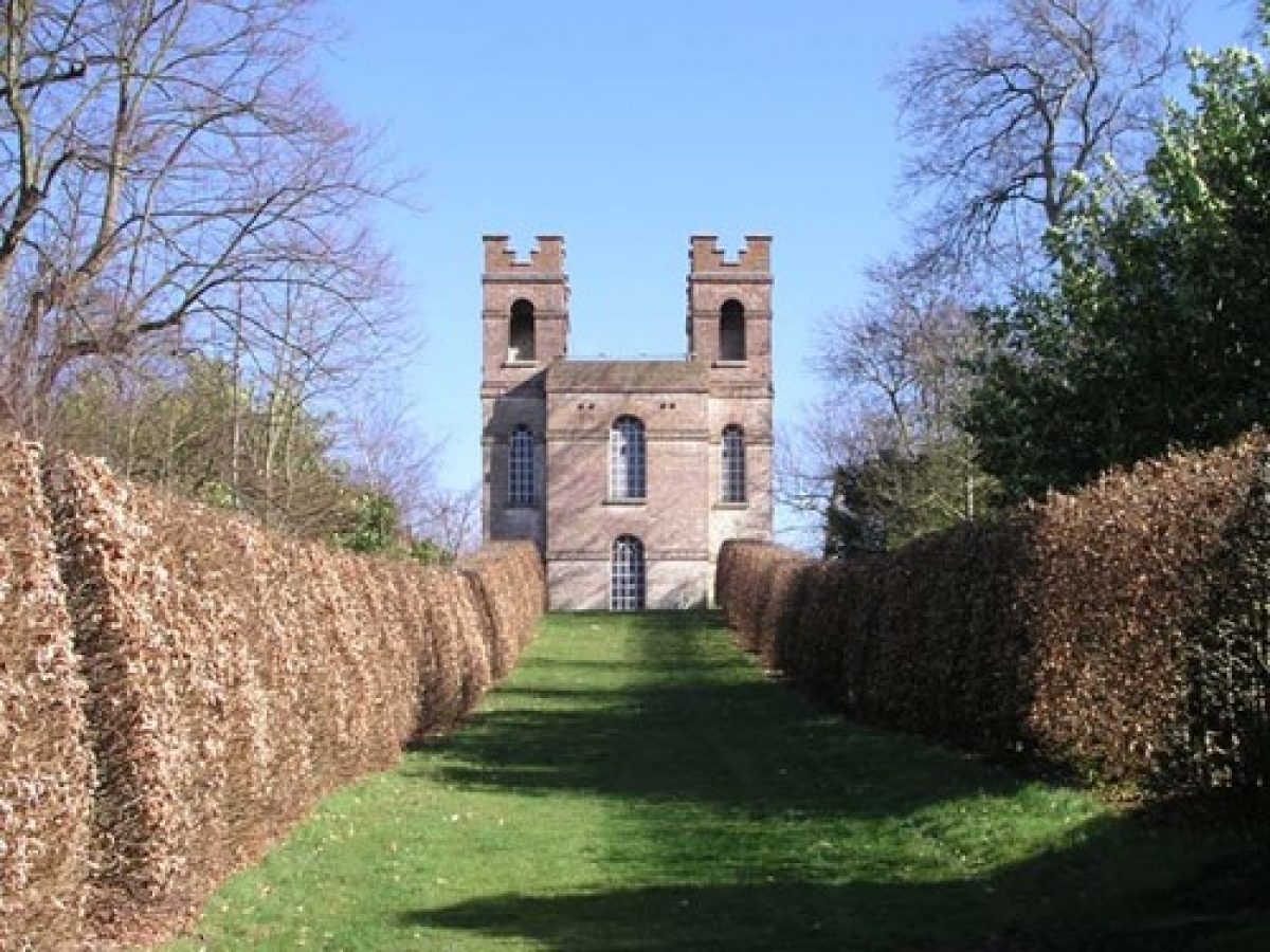
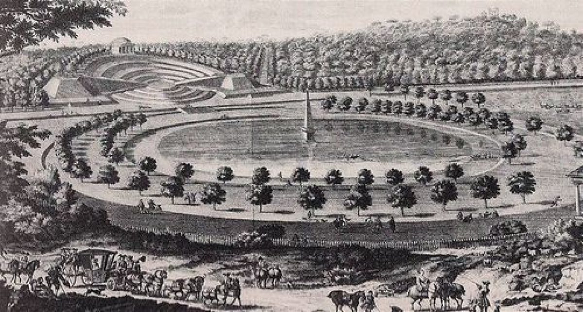
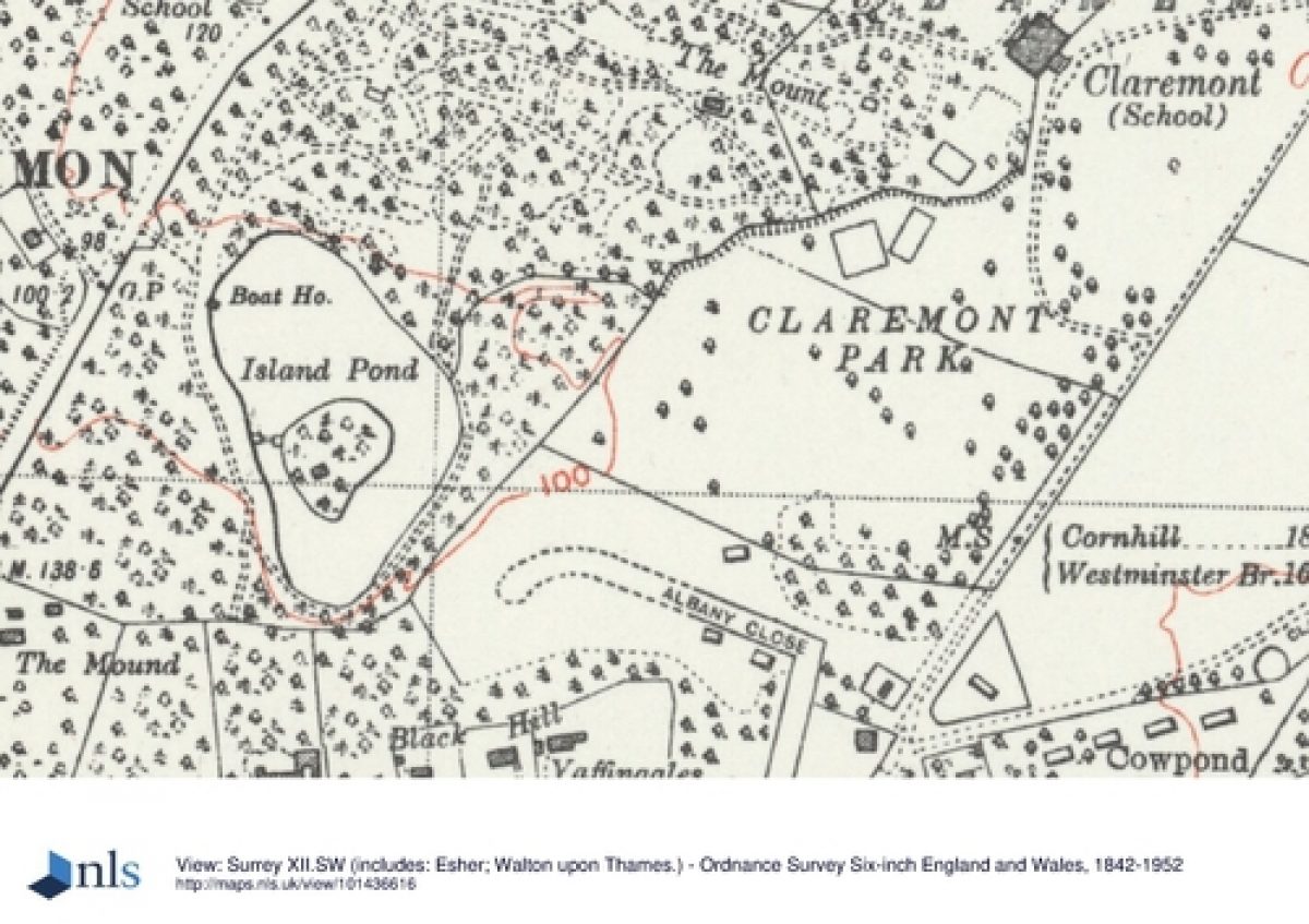
On the south-east tip of a natural ridge, c 200m to the south-west of the house, is an early C18 Belvedere by Vanbrugh (listed grade II*). The Belvedere,of two storeys with three-storey battlemented corner towers, is approached from the gardens around the house by winding C18 paths up the side of the mount, which is densely planted with shrubs. The main C18 approach to the Belvedere was from the west by the c 250m long axial turf walk, along gently rising ground between woodland and with a rectangular bowling green (early C18, modified by Kent), flanked by yews and earthwork ramparts, situated approximately midway along the walk; the approach is now (2000) blocked by a C20 fence and gate across the eastern end. The walk forms the northern limit of the pleasure grounds (now Claremont Landscape Gardens) which have a circuit walk with interconnecting serpentine paths, based on the early C18 layout by Bridgeman, later altered and extended by Kent. The planting includes C18 and C19 exotics, largely conifers, and large early to mid C18 specimen oak, lime, and sweet chestnut, with mid C18 evergreens and cedars planted by Brown.
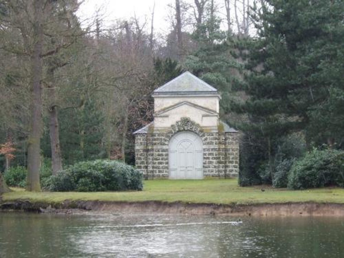
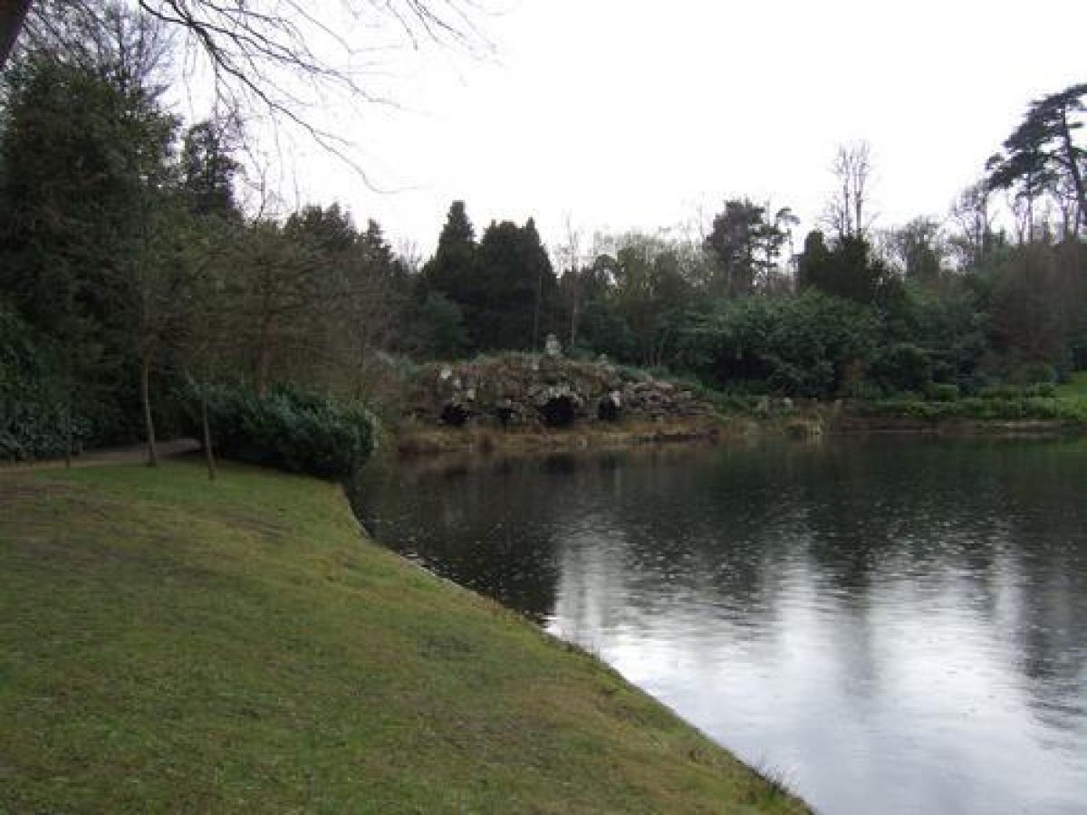
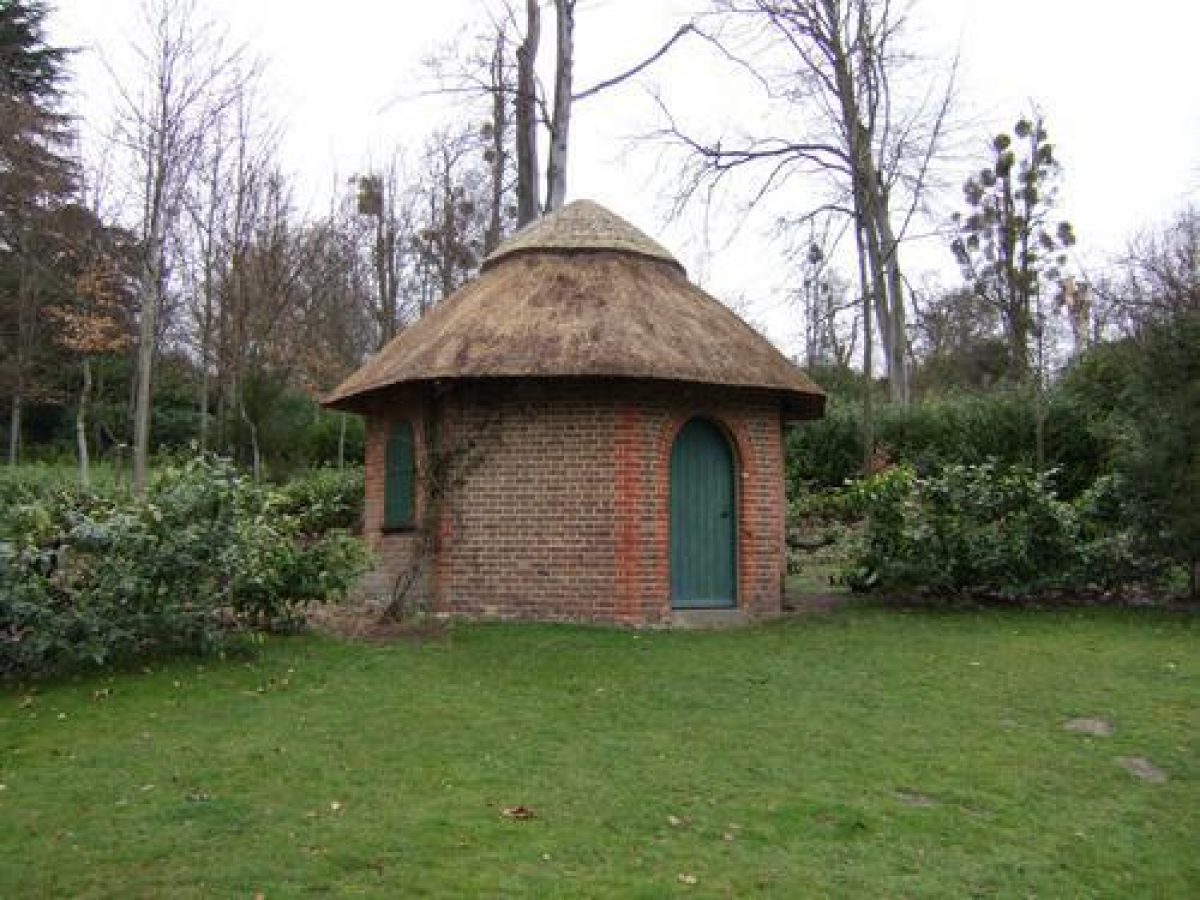
At the western end of the turf walk, a path leads south to the head of an early C18 turf amphitheatre designed by Bridgeman (restored 1975-80 by the NT). The foundations of a Mausoleum (designed as a Tea House by Papworth and Pugin in 1817 and demolished in the 1920s) stand on a platform above the amphitheatre, overlooking the lake and surrounding pleasure grounds to the south. A walk known as Nine Pin Alley leads east, past the foundation remains of an C18 temple, to the east side of the gardens, with the remains of a C19 Camellia House (Papworth 1824, of which the raised beds survive) on the Camellia Terrace (with early C19 iron balustrading) to the north of the Alley and an C18 Thatched House (rebuilt C19, listed grade II) in a glade to the south of the Alley, both set within C18 and C19 woodland and shrubberies, intersected by gravel and grass paths. The eastern end of Nine Pin Alley joins a path which runs north to the Camellia Terrace, or south-west alongside a serpentine ditch (by Kent, altered by Brown to align with the house) and a ha-ha (by Brown to replace Vanbrugh and Bridgeman's bastioned and ramparted enclosure) through open lawns with mature trees towards a lake which dominates the southern half of the pleasure grounds. An early C18 temple (listed grade II) on an island forms the focal point of views across the lake, which was enlarged and altered by Kent from Bridgeman's round pond on the site. A grotto (listed grade II) at the southern end was adapted in the mid C18 from an early C18 cascade by Kent.
REFERENCES
Note: There is a wealth of material about this site. The key references are cited below.
C Campbell, Vitruvius Britannicus (1725)
Country Life, 2 (18 December 1897), pp 688-90; 10 (14 December 1901), pp 776-81; 63 (21 January 1928), pp 80-8; 165 (17 May 1979), pp 1547-50
N Pevsner et al, The Buildings of England: Surrey (1971), pp 160-2
P M Cooper, The Story of Claremont (5th edn 1972)
Claremont Landscape Garden, guidebook, (National Trust 1988)
Claremont: Storm Damage 1987, Grant Aid Application to English Heritage, (National Trust 1990)
C K Currie, An Archaeological and Historical Survey of the Claremont Landscape Garden, Esher, Surrey, 2 vols, (report for National Trust 1999)
Maps
Plan of the Garden and Plantations of Claremont in Surrey (in Campbell 1725)
John Rocque, Plan of Claremont, 1738 (reproduced in guidebook)
John Rocque, One of the Seats of his Grace the Duke of Newcastle, 1750 (reproduced in guidebook)
J Rocque, Map of Surrey, surveyed c 1762, published 1768
OS 25" to 1 mile:
1st edition surveyed 1866-7, published 1879
2nd edition revised 1894-5, published 1897
3rd edition revised 1912, published 1914
Description written: May 2000
Register Inspector: CB
Edited: April 2003
- Visitor Access, Directions & Contacts
Telephone
441372467806Access contact details
The garden is open daily (except Mondays) throughout the year. Through summer it is open 7 days a week.
Directions
The gardens lie east of the A307 1 mile south of Esher.
Owners
The National Trust
PO Box 39, WA5 7WD
- History
The following is from the Register of Parks and Gardens of Special Historic Interest. For the most up-to-date Register entry, please visit the The National Heritage List for England (NHLE):
www.historicengland.org.uk/listing/the-list
NOTE This entry is a summary. Because of the complexity of this site, the standard Register entry format would convey neither an adequate description nor a satisfactory account of the development of the landscape. The user is advised to consult the references given below for more detailed accounts. Many Listed Buildings exist within the site, not all of which have been here referred to. Descriptions of these are to be found in the List of Buildings of Special Architectural or Historic Interest produced by the Department of Culture, Media and Sport.
HISTORIC DEVELOPMENT
In c 1709 Sir John Vanbrugh built a small villa for himself at Chargate Farm, near Esher. Vanbrugh sold the property in 1711 to his friend and patron, Thomas Pelham-Holles, Earl of Clare (later created Duke of Newcastle), who changed the name to Claremont. Vanbrugh was employed to transform the house into a country mansion. With the assistance of Charles Bridgeman, Vanbrugh also designed the surrounding garden and plantations from c 1715 onwards, the work including Vanbrugh's Belvedere Tower (c 1715) and Bridgeman's turf amphitheatre, bowling green, round pond, planting, and paths. In c 1734 William Kent was called in to extend and naturalise the gardens by enlarging Bridgeman's round pond into an irregular lake, with an island and pavilion, planting groves of trees, laying out serpentine paths, and adding further buildings including a cascade at the head of the lake. The Duke died in 1768 and Claremont was sold to Lord Clive of India in 1769, who demolished the house and employed Lancelot Brown and Henry Holland to build a new one on a more elevated site. Brown also made alterations to the landscape, altering the line of the ha-ha, diverting the Portsmouth Road, and planting the amphitheatre with cedars and evergreens. Clive died in 1774 and Claremont was purchased by Lord Galway, and then by the Earl of Tyrconnel. In 1807 it was purchased by Mr Rose-Ellis MP, and then in 1816 it was bought by the Commissioners of Woods and Forests for Princess Charlotte of Wales and Prince Leopold of Saxe-Coburg. Princess Charlotte died later that year but Prince Leopold continued to reside at Claremont, employing J W Hiort to direct the gardens. Papwoth and Pugin were both employed during this period to build the Tea House, later Mausoleum, and the Camellia House. In 1831 Prince Leopold lent Claremont to Queen Victoria, and from 1848 King Louis-Phillipe, ex-King of France and Queen Amelie lived at Claremont. Queen Amelie died in 1866 and Queen Victoria bought an interest in the estate for her youngest son, the Duke of Albany, on his marriage. During the First World War Claremont was used as a convalescent home and from 1916 it was let to a girls' school in Leatherhead. After the Duchess of Albany's death in 1922 the property was sold to Sir W Corry, then to speculators in 1926, and finally to Mr E Eugen Speyer in 1928. Large portions of the park were sold to a syndicate for housing development.
The house and remaining park were bought by Claremont School and in 1949, the National Trust was given c 20ha of the gardens, known as 'Claremont Lake and Woods' and managed by Elmbridge Borough Council. This land was restored by the National Trust between 1975 and 1980 as 'Claremont Landscape Gardens' and from 1979, the Trust took over the management of the land. The school and the National Trust continue (2000) to be the main owners and the remaining land is in divided, private use.
- Associated People
- Features & Designations
Designations
The National Heritage List for England: Register of Parks and Gardens
- Reference: GD1266
- Grade: I
Style
English Landscape Garden
Features
- Lake
- Description: Serpentine lake.
- Water Pavilion
- Grotto
- Amphitheatre
- Description: Turf amphitheatre.
- Specimen Tree
- Description: Lebanese cedar.
- School (featured building)
- Description: The Vanbrugh house of the early-18th century was demolished, and a new one was built on a more elevated site.
- Earliest Date:
- Key Information
Type
Garden
Purpose
Ornamental
Survival
Extant
Hectares
58
Open to the public
Yes
Electoral Ward
Esher
- References
References
- {English Heritage Register of Parks and Gardens of Special Historic Interest}, (Swindon: English Heritage, 2008) [on CD-ROM] Historic England Register of Parks and Gardens of Special Historic Interest
- Pevsner, N. et al., {The Buildings of England: Surrey} (New Haven, Connecticut and London: Yale University Press, 1971), pp. 160-2 The Buildings of England: Surrey
- Churchman Landscape Architects {Landscape Management Plan for the Claremont Fan Court School} (2012) Landscape Management Plan for the Claremont Fan Court School
- Whitton Associates {Claremont Landscape Gardens Conservation Plan} (2003) Claremont Landscape Gardens Conservation Plan
- Wilkie, Kim {Plan for Claremont School} (2003) Plan for Claremont School
- Inskip and Jenkins {Claremont: The Belvedere Options Appraisal} (2012) Claremont: The Belvedere Options Appraisal
- Rutherford, Sarah {Claremont Conservation / Action Plan} (2014) Claremont Conservation / Action Plan
- Related Documents
-
CLS 1/880
Landscape Management Plan (Final Draft) - Hard Copy.
Churchman, Landscape Architects - 2012
-
CLS 1/880