Introduction
Chatsworth has a landscape park, woodland, pleasure grounds and water features surrounding a large hall. The 18th-century park, which occupies about 405 hectares, replaced an earlier formal design but elements of this layout have survived. New areas added in the 20th century include the Sensory Garden and Kitchen Garden.
Terrain
The site lies within the valley of the River Derwent which runs north/south through the park. On the east side of the site the land slopes steeply up to an escarpment while the land rises more gently on the west side of the river.The following is from the Register of Parks and Gardens of Special Historic Interest. For the most up-to-date Register entry, please visit the The National Heritage List for England (NHLE):
Formal gardens and pleasure grounds with elements of a layout of c 1688-1703 by George London and Henry Wise, and M Grillet for the first Duke of Devonshire, which were remodelled during the early and later C18 and subsequently by the sixth Duke with Jeffry Wyatville and Joseph Paxton during the first half of the C19. Landscape park by Lancelot Brown of c 1755-65 with C17 origins.
NOTE This entry is a summary. Because of the complexity of this site, the standard Register entry format would convey neither an adequate description nor a satisfactory account of the development of the landscape. The user is advised to consult the references given below for more detailed accounts. Many Listed Buildings exist within the site, not all of which have been here referred to. Descriptions of these are to be found in the List of Buildings of Special Architectural or Historic Interest produced by the Department of Culture, Media and Sport.
SUMMARY DESCRIPTION
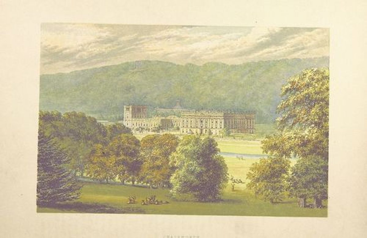
Chatsworth lies within the Peak National Park c 16km west of Chesterfield. The c 405ha site lies within the valley of the River Derwent which runs north/south through the park. On the east side of the site the land slopes steeply up to an escarpment while the land rises more gently on the west side of the river. Fences and walls divide the park from agricultural land and from open moorland.
On the north-west side of the site a drive leads south-east from the B6102 in Edensor and curves to run north-east as the land drops, before crossing the river via the Three Arch Bridge (James Paine 1759-64 incorporating C17 sculpture by Cibber, listed grade I). The drive continues to the stables and north side of the House. Three Arch Bridge is of central importance to the landscape and views to and from the House. The route from Edensor with falling parkland in the foreground and views of the bridge and the House beyond backed by steeply rising wooded slopes is one of the most impressive approaches to a country house in England.
Other entrances include the Baslow Lodge (gates, piers and railings by Jeffry Wyatville c 1839-42, all listed grade II) on the north side of the site, which incorporates wrought-iron gates and screens designed by Tijou, and Beeley Lodge (1855, listed grade II) on the south side of the site.
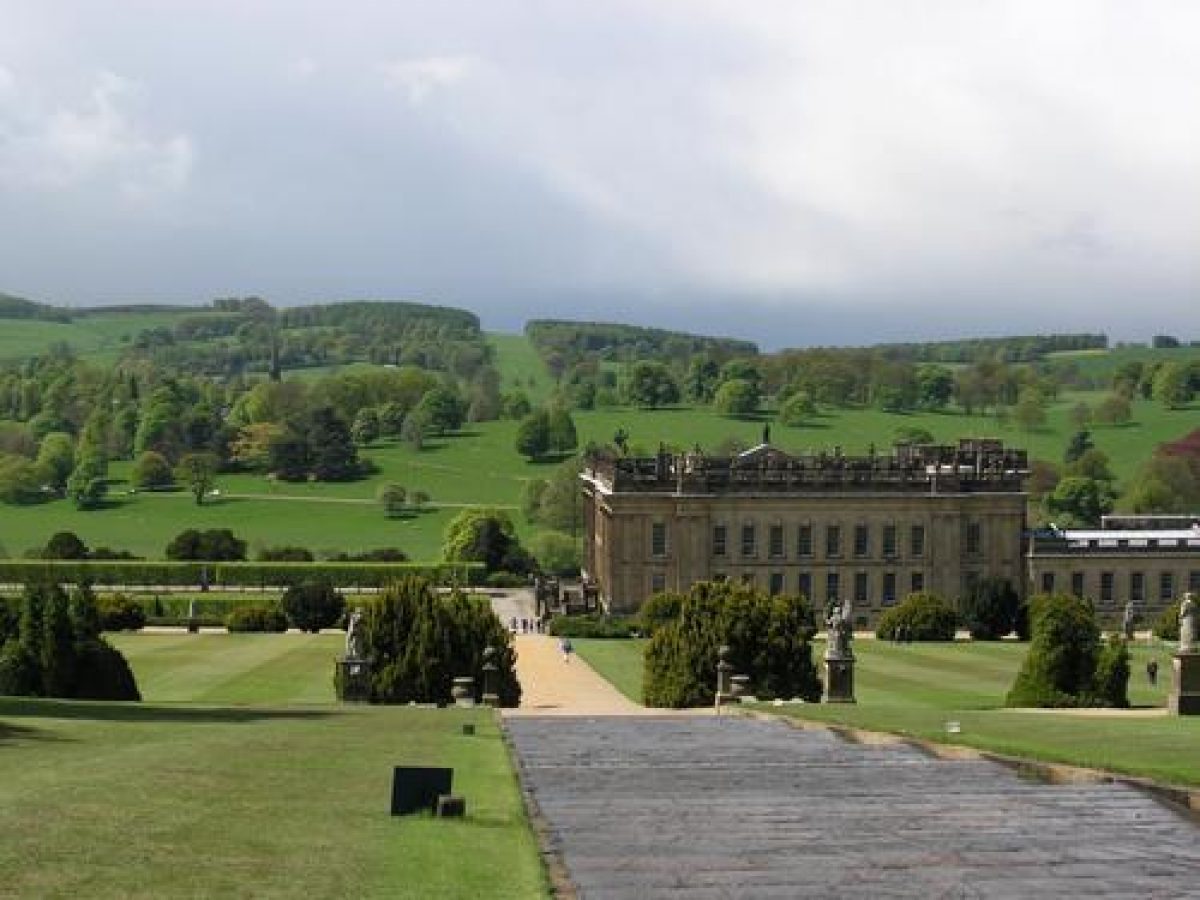
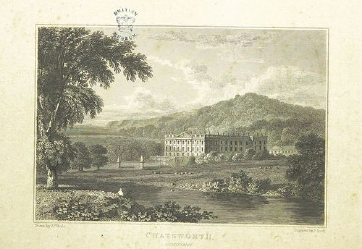
Chatsworth House (listed grade I) lies on rising ground to the east of the Derwent. It originated in 1552 with a house built by Sir William Cavendish and his wife Elizabeth (Bess) of Hardwick. In 1686 the fourth Earl of Devonshire erected a new south wing to the design of William Talman and subsequently a new east front, also by Talman. The west front, built 1700(3 was probably based on a design by Thomas Archer, as was the north front, built 1705-7. In 1820 the sixth Duke engaged Jeffry Wyatt (later Sir Jeffry Wyatville) to remodel parts of the House and to design a new north wing, which was capped in 1827 by a belvedere storey built to the Duke's own design. Chatsworth House is one of the greatest country houses in England with interiors by some of the finest artists and sculptors of their day. It is in use as a private residence (1998).
Some 200m north-east of the main building a stable block (listed grade I) ranged around a courtyard was designed by James Paine for the fourth Duke and built 1758-63.
The west side of the House overlooks terraced gardens. A raised walk with a retaining wall runs alongside the House and a centrally positioned double staircase (walkway, staircase and sphinx piers c 1690, listed grade II) leads down to a terrace below which has a central circular pond around which a planting scheme of c 1960 of golden box represents the ground plan of Chiswick House (qv) in London. The terrace is divided from the park by a wall linked by piers at the north-west and south-west corners which support statues of sphinxes by Cibber. The linking wall was demolished c 1760 when the park swept up to the staircase. The formal garden and terrace wall was reinstated in 1826 by the sixth Duke working with Wyatville.
There are extensive views to the west over open parkland with many scattered trees and clumps. The serpentine course of the widened River Derwent and Three Arch Bridge are important elements in the middle ground, with the spire of Edensor church (C11, rebuilt 1867 by G G Scott, listed grade I) rising beyond. Close to Three Arch Bridge on the east side of the river, Queen Mary's Bower (listed grade II*) was probably designed as a fishing lodge or banqueting house. It stood within a pond and is the only surviving feature of water gardens covering an area of c 8ha built by Sir William Cavendish in the late C16. To the south-west views of open parkland are framed by New Piece Wood which lies on a ridge of high ground on the south-west boundary of the park.
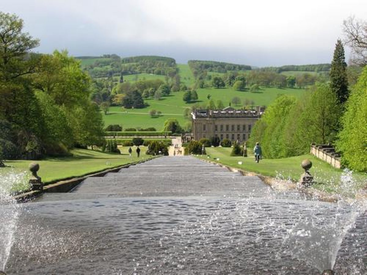
On the south side of the House there is a rectangular lawn flanked by pleached limes planted in 1952. A central circular pond with a fountain (with figures by Cibber, listed grade II) was placed on the south side of the House in 1694 and repositioned during the 1760s when formal gardens were remodelled. South of the lawn the early C18 Canal Pond stretches for a distance of c 500m from the House, which appears to rise directly from the sheet of water when it is viewed from the south end of the canal. The Emperor Fountain (listed grade II) is positioned near the north end of the canal. It was installed by Joseph Paxton 1843-4 and is one of the most impressive working Victorian fountains in the country, throwing water to a height of c 80m.
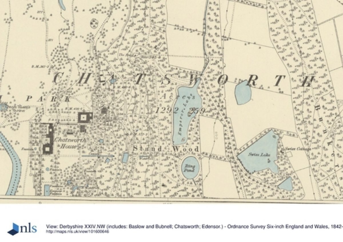
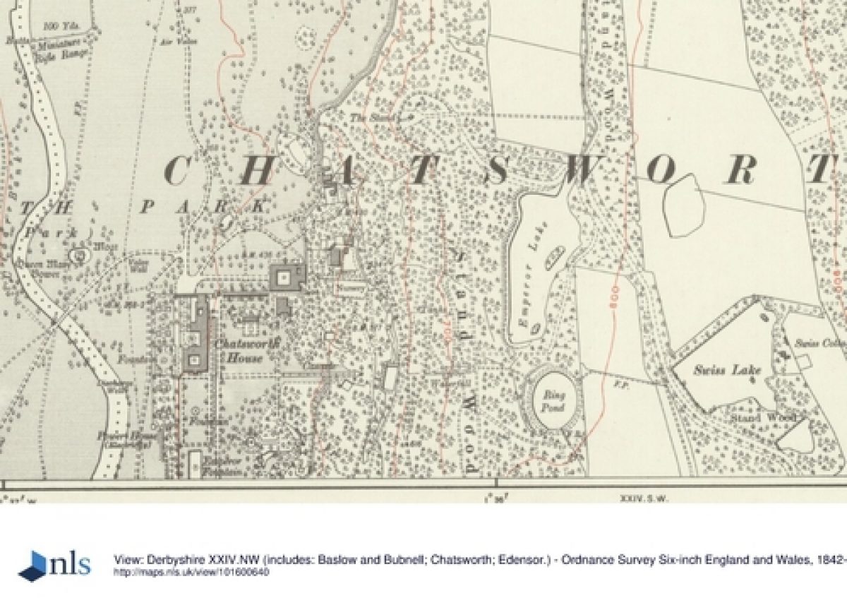
Gardens and pleasure grounds on the east side of the House are on land which slopes up to the east, with Stand Wood, which covers the steeply rising slopes east of the pleasure grounds, forming a backcloth. Formal elements and north/south and east/west axiality close to the House give way to less formal areas further to the east, and the garden incorporates features dating from the C17 through to the late C20. The Broad Walk is the main axial route which runs south from Flora's Temple (probably by Talman c 1695, listed grade I) which was originally sited south-west of the House and had been moved to its present position c 20m east of the north-east corner of the building by the 1760s. The Broad Walk was laid out c 1820 by Jeffry Wyatville and the sixth Duke; it runs parallel to the House and continues southwards, alongside and above the Canal Pond, terminating at its south end with an urn on a pedestal (listed grade II).
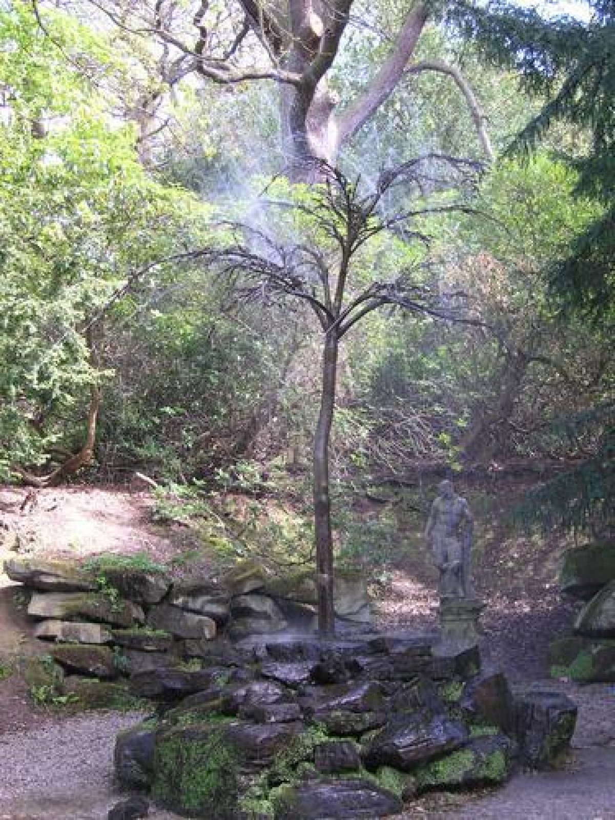
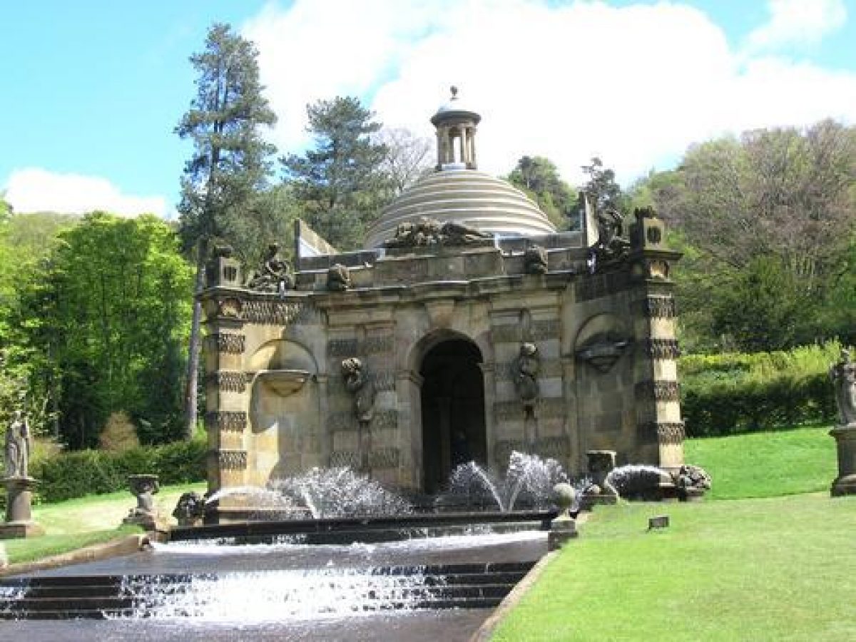
Immediately east of Flora's Temple the Conservative Wall (listed grade II) is a heated wall with glass frames covering its whole length which was designed by Paxton and completed in 1848. Some 50m south of the Wall the first Duke's Greenhouse (c 1698, listed grade II*), one of the largest and best-preserved C17 greenhouses in the country, fronts a rose garden. Knyff and Kip show it lying somewhat to the north of its present position to which it had been moved by the mid C18. South of the Greenhouse there are lawns called Salisbury Lawns and c 350m east of the south-east corner of the House is the Cascade House (Thomas Archer 1702(3, listed grade I) and Cascade (Grillet 1694-6, rebuilt and remodelled C18 and C19, listed grade I) which runs east/west down the slope. Aligned with the Cascade and visible from it, the Aqueduct (Paxton c 1840, listed grade II) is a striking feature which lies c 200m to the east in Stand Wood above the pleasure grounds.
A circular pool, shown on a map of 1773, lies c 200m south-east of the House. It is surrounded by a circular beech hedge planted in 1953 which has an opening on the north side giving views of the Greenhouse, and an opening on the south side from which serpentine beech hedges, also planted in 1953, run south framing views of a bust of the sixth Duke (listed grade II).
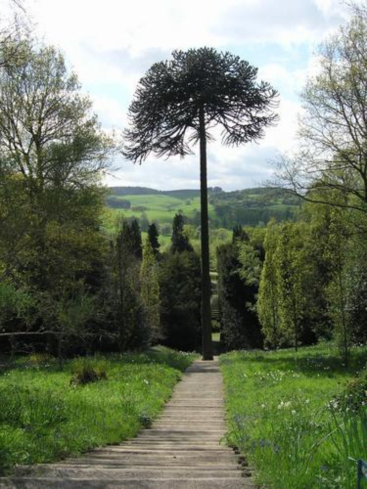
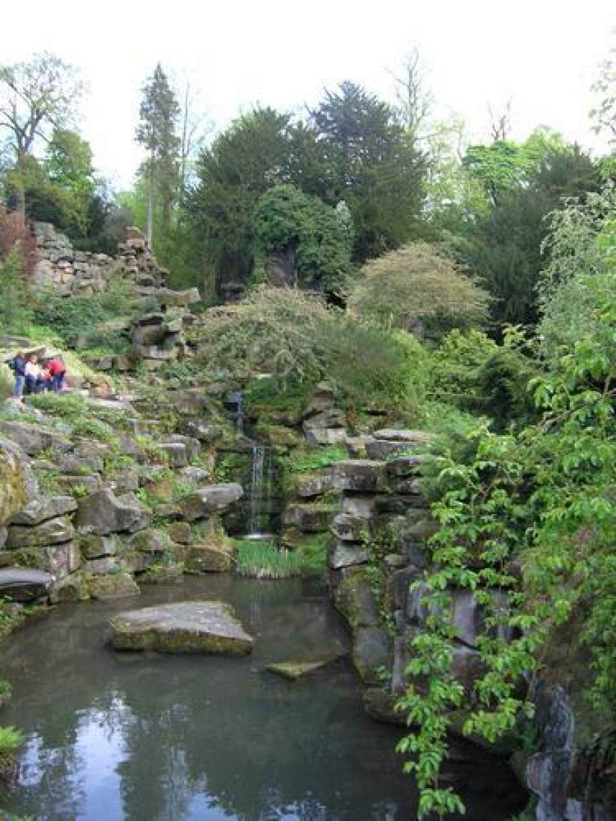
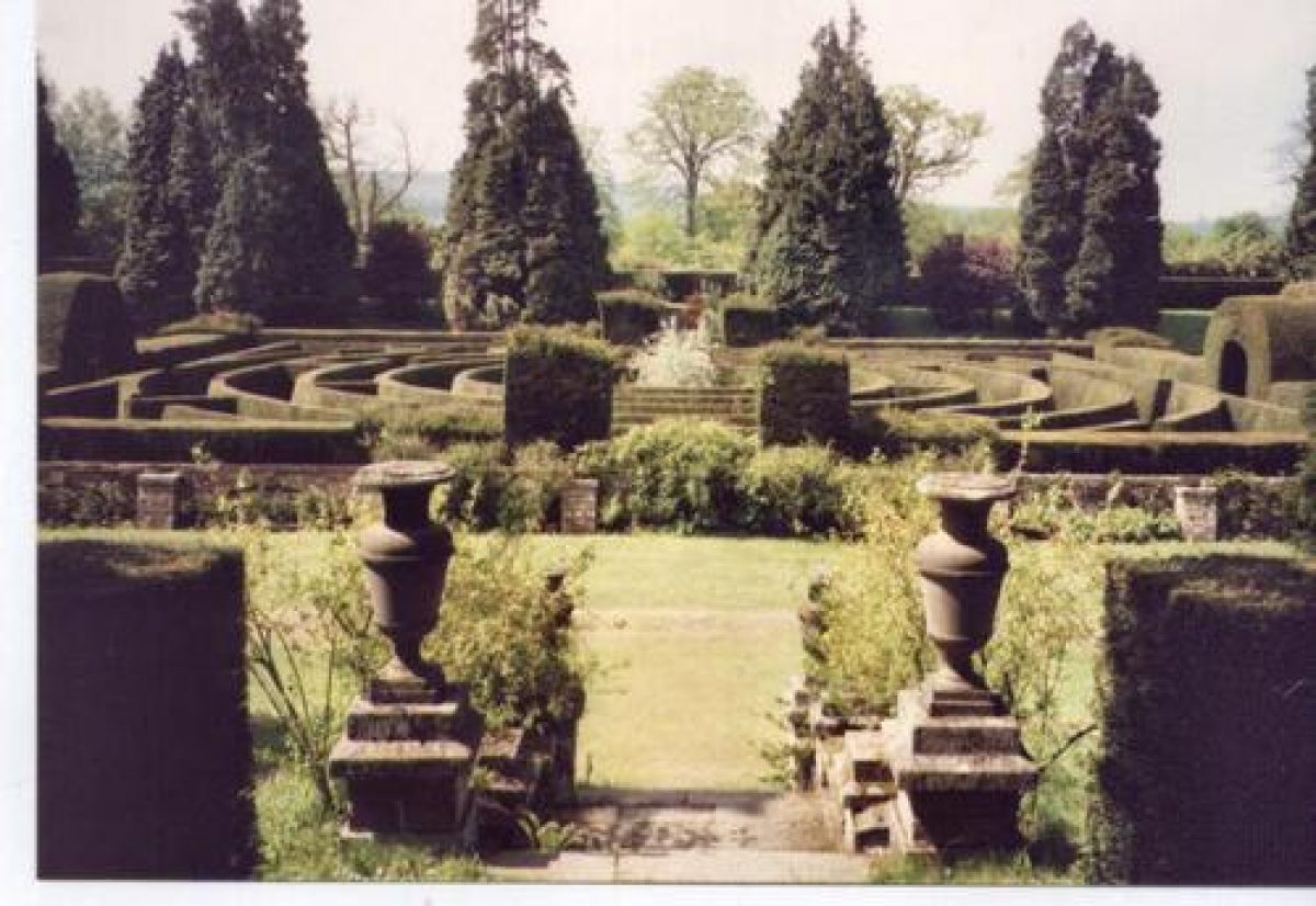
The east side of the garden is covered with light woodland which merges into Stand Wood. A woodland area south of the Cascade House is an arboretum started by Paxton in 1835. His pinetum, started in 1829, is in the south-east corner of the grounds. Curving paths lead through woodland and there are substantial areas of rockwork designed by Paxton in the 1840s which represent some of the most impressive and ambitious works of their type in the country. The Old Conservatory Gardens, c 700m south-east of the House, contain the foundations of the Great Conservatory (listed grade II), which was designed by Paxton with Decimus Burton. When completed in 1840 it was the largest glasshouse in the world. It was demolished in 1920 and the foundations incorporated into a sunken garden with a central maze designed in 1962 by Dennis Fisher.
The water features in the garden are fed from a group of lakes on high land above the escarpment to the east. They probably originated in the C18 and the largest, Emperor Lake, was created in 1843-4 to supply a head of water for the Emperor Fountain.
The Hunting Tower (possibly by Robert Smythson c 1582, listed grade II*) is a prominent landmark in woodland on the edge of the escarpment c 600m north-east of the House.
KITCHEN GARDEN
The kitchen garden lies c 800m north-west of the House and is in use as a caravan park (1998). It replaced earlier gardens south-west of the House and was completed in 1765.
REFERENCES
Knyff and Kip, Britannia Illustrata 1, (1714)
W Adam, Gem of the Peak (1838), pp 75-109
V Markham, Paxton and the Bachelor Duke (1935)
Architect Hist 4, (1961), pp 77-92
G F Chadwick, The Works of Sir Joseph Paxton (1961), pp 22-43
P Coates, Great Gardens of the Western World (1963), pp 126-35
D Stroud, Capability Brown (1975), p 499
N Pevsner and E Williamson, The Buildings of England: Derbyshire (2nd edn 1978), pp 126-39
J Harris, The Artist and the Country House (1979), pp 75, 268
A Hellyer, Gardens of Genius (1980), pp 181(5
Duchess of Devonshire, The Estate: A View from Chatsworth (1982)
G and S Jellicoe et al, The Oxford Companion to Gardens (1986), pp 108-9
Garden History 23, no 1 (1995), pp 29-55
Chatsworth Garden, guidebook, (Duchess of Devonshire 1996)
Chatsworth Historic Landscape Survey, (Historic Landscape Management (HLM), 3 vols 1998)
Maps [all reproduced in HLM 1998]
W Senior, Estate Map, 1617
S Brailsford, Plan of Chatsworth, 1751
G Barker, Survey of Chatsworth, 1773
E Campbell, Plan of Chatsworth, 1858 E Campbell, Plan of Chatsworth, 1858, corrected and updated by W Roberts, 1887
Archival items
For a full list of sources, including NMR photographic collection, see HLM (1998)
Description written: October 1998
Amended: March 1999
Register Inspector: CEH
Edited: November 1999
- Visitor Access, Directions & Contacts
Website
https://www.chatsworth.org/Access contact details
The site is open daily with the exception of the Christmas break.
For more detailed visitor information visit the Chatsworth website.
- History
The following is from the Register of Parks and Gardens of Special Historic Interest. For the most up-to-date Register entry, please visit the The National Heritage List for England (NHLE):
www.historicengland.org.uk/listing/the-list
HISTORIC DEVELOPMENT
The estate was bought in 1549 from the Leche family by Sir William Cavendish. Following the accession of the fourth Earl (created first Duke in 1694) in 1684 existing gardens were modified and extensive new gardens laid out by George London (d 1714) and Henry Wise (1653-1738). French gardeners M Huet and M Audias supervised wider alterations to the landscape, and waterworks were supervised by M Grillet (fl 1690), while Caius Gabriel Cibber and Jan Nost designed statuary for the garden. The works are illustrated in an engraving of 1699 by Knyff and Kip. Additions and modifications to the scheme continued into the early decades of the C18. The pleasure grounds and gardens were transformed by the sixth Duke working with Jeffry Wyatville (1766-1840) c 1820 and Joseph Paxton (1803-65) from c 1826 to 1846.
A map of 1617 by William Senior shows the park occupied the area east of the Derwent and extended to the east of the escarpment on the east side of the site in an area which had been disparked by the late C18 and is outside the boundary of the registered site. Large-scale transformation of the landscape took place in the period from c 1755 to c 1770 with the imparkment of the area west of the river and the closure of a number of roads around and within the park. Extensive new areas of woodland were planted and substantial earth-moving works undertaken, which included widening the Derwent and grading its banks. The work was supervised by Mr Millican under the direction of Lancelot Brown (1716-83). A campaign of extension and improvements to the park began in the late C18 and contnued into the C19. The approach from Edensor was improved and part of the village demolished and rebuilt in a different position, with many of the buildings being designed by Paxton. The estate remains in private ownership (1998).
- Associated People
- Features & Designations
Designations
The National Heritage List for England: Register of Parks and Gardens
- Reference: GD1303
- Grade: I
Features
- Hedge
- Description: A serpentine beech hedge.
- Earliest Date:
- Latest Date:
- Maze
- Description: A yew maze.
- Earliest Date:
- Latest Date:
- Conservatory
- Description: The Great Conservatory, designed by Joseph Paxton, was the largest conservatory in the world. Also known as the Great Stove.
- Earliest Date:
- Latest Date:
- Ornamental Fountain
- Description: The Emperor Fountain is the tallest gravity-fed fountain in the world. Water can reach up to 90.83 metres (298 feet).
- Earliest Date:
- Latest Date:
- Sculpture
- Description: A water-powered kinetic steel sculpture entitled 'Revelation'.
- Earliest Date:
- Latest Date:
- Tunnel
- Description: A recently excavated coal tunnel.
- Sculpture
- Description: War Horse.
- Earliest Date:
- Latest Date:
- Statue
- Description: The statue of Samson slaying the Philistine is a copy of the original by Giambologna from 1623. This version was originally bought to Chiswick House in the 1720s but was moved to Chatsworth during the 1920s.
- Earliest Date:
- Latest Date:
- Great House (featured building)
- Earliest Date:
- Latest Date:
- Parkland
- Woodland
- Hall
- Kitchen Garden
- Key Information
Type
Park
Purpose
Ornamental
Principal Building
Domestic / Residential
Survival
Extant
Hectares
405
Open to the public
Yes
Civil Parish
Chatsworth
- References
References
- Stroud, D {Capability Brown} (1975) p 499 Capability Brown (Country Life article)
- {English Heritage Register of Parks and Gardens of Special Historic Interest} (Swindon: English Heritage 2008) [on CD-ROM] Historic England Register of Parks and Gardens of Special Historic Interest
- Harris, J {The Artist and the Country House} (1979) pp 75, 268 The Artist and the Country House
- Pevsner, N and Williamson, E {The Buildings of England: Derbyshire} (Harmondsworth: Penguin, 1978) pp 126-139 The Buildings of England: Derbyshire
- Historic Land Management {Chatsworth Historic Landscape Survey - The Park and Garden} (1997) Chatsworth Historic Landscape Survey - The Park and Garden
- Historic Land Management {Chatsworth Historic Landscape Survey - A Brief History} (1997) Chatsworth Historic Landscape Survey - A Brief History
- Historic Land Management {Chatsworth Historic Landscape Survey - The Park and Garden A Notebook} (1997) Chatsworth Historic Landscape Survey - The Park and Garden A Notebook
- Historic Land Management {Chatsworth Parkland Management Plan} (2013) Chatsworth Parkland Management Plan
- The Landscape Agency {Chatsworth Estate Outline Management Plan for the Park and Garden} (2006) Chatsworth Estate Outline Management Plan for the Park and Garden