
Introduction
Castle Hill is an early-18th-century landscape park and woodland of around 225 hectares, with about 20 hectares of gardens and pleasure grounds. There is a further 1300 hectares of agricultural land.
Terrain
The River Bray flows in a north/south valley some 0.5 km east of the house, with the land rising to Oxford Down west of the house, and north to the Castle.
The following is from the Register of Parks and Gardens of Special Historic Interest. For the most up-to-date Register entry, please visit The National Heritage List for England (NHLE):
An early 18th century formal landscape with structures and water features laid out by Earl Clinton around a mansion designed by Lord Burlington, altered to a more natural form and extended in the mid 18th century by Matthew, Lord Fortescue. Further 19th century developments include early 19th century structures and pleasure grounds around the house and extensive late 19th century ornamental planting across the estate.
Location, Area, Boundaries, Landform and Setting
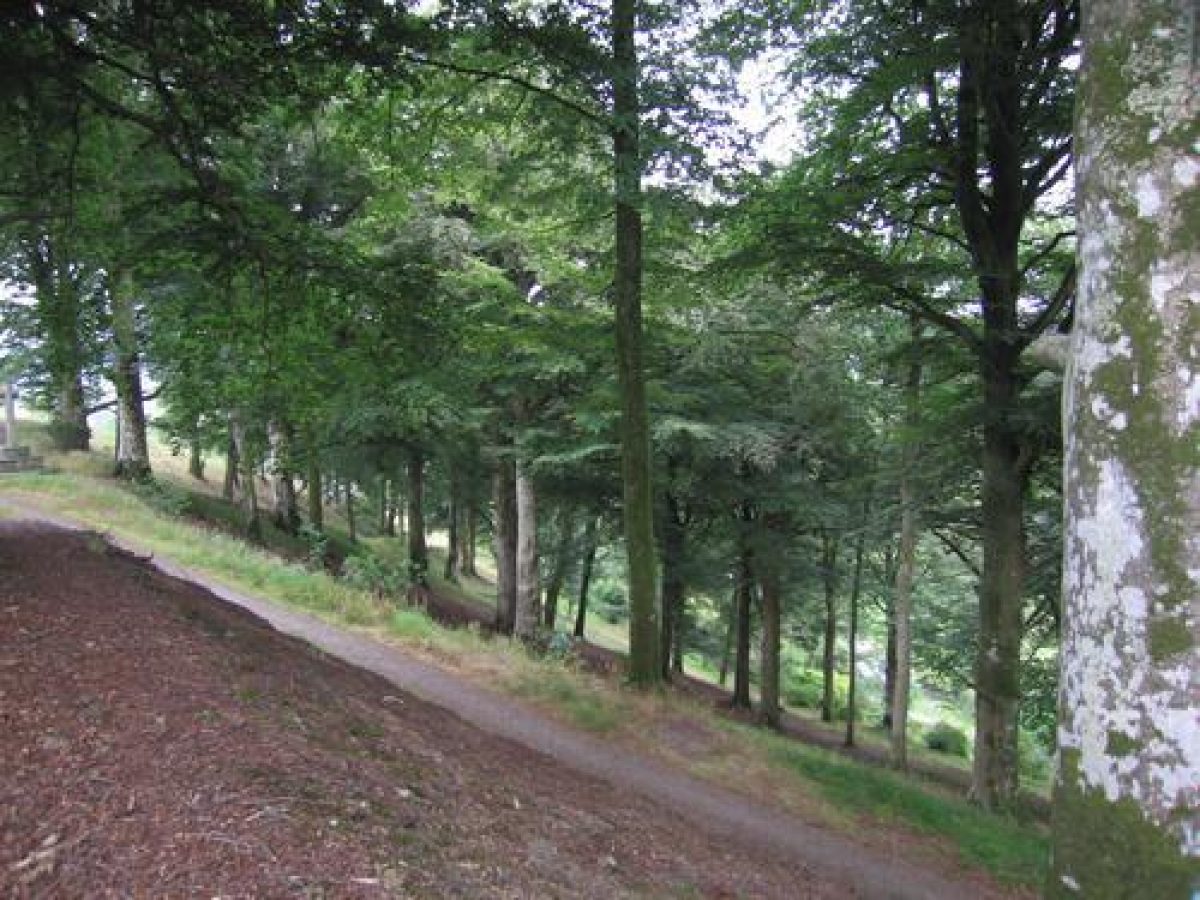
Castle Hill is situated c 3km north-west of the town of South Molton and 0.5km north-east of the village of Filleigh. The site is crossed south of the house by a minor road, formerly the A361, which runs from South Molton to Barnstaple, while the North Devon Link Road follows the line of the mid C19 railway c 1km north of the house. The c 1550ha site, which comprises some 20ha of gardens and pleasure grounds, 225ha of parkland, and a further c 1300ha of agricultural land and ornamental plantations, is generally enclosed by traditional hedges and banks. The River Bray flows in a north/south valley c 0.5km east of the house, while a tributary stream flows in a shallow west/east valley south of the house, with the land rising to Oxford Down west of the house, and north to the Castle. South of the former A361 the land rises to a wooded ridge which forms the horizon from the house and park. The early C18 formal plan from which the later landscape has evolved is evident in a complex series of inter-related vistas, particularly to the south, east and west of the house, while from the Sham Castle there are extensive views in all directions.
Entrances and Approaches
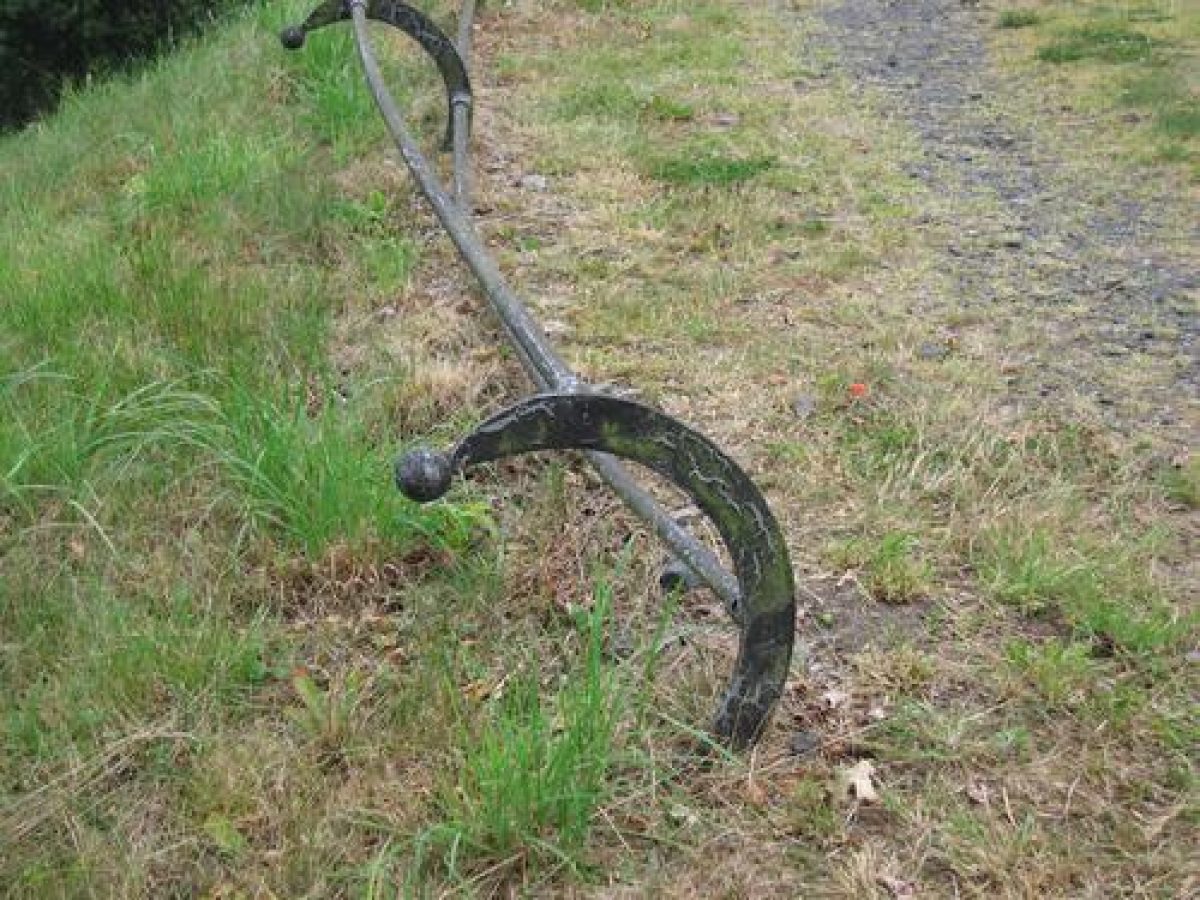
The site is approached from a minor road to the south, at a point c 0.5km east of Filleigh church. The road was diverted to its present course c 1730 by Lord Clinton, having formerly run c 400m north across the park close to the Platform and terraces south of the house. The road is enclosed by C19 ornamental cast-iron railings (listed grade II), while the entrance is flanked by mid C19 gate piers of rusticated stone surmounted by wreathed ball finials, which support cast-iron gates with spear finials, and which are flanked by short sections of similar railings (all listed grade II).
North-west of the entrance stands Meadow Park Lodge, designed by Blore in 1845 (listed grade II). From Meadow Park Lodge the tarmac drive passes c 150m north-north-east through parkland enclosed by metal estate fencing to Black Bridge, a mid C18 rubble double-span stone bridge (listed grade II). The drive continues c 150m north approximately following the line of Earl Clinton's early C18 east drive, before reaching Blore's stables (1843, listed grade II*) east of the house and a carriage court to the north enclosed by a steep rock face ascended by mid C19 steps leading to the north shrubbery.
A further drive following the line of the pre-1719 North Molton road extends from the Castle east and north-east c 250m to Shrubbery Lodge, a red-brick and stone-banded two-storey lodge by Butterfield (1872, extended late C20) which adjoins a mid C19 gateway flanked by brick piers with stone coping and wreathed ball finials. Beyond Shrubbery Lodge the drive continues c 300m north-east, partly through an avenue of limes, to reach Park Lane which separates the park from the Deer Park. A service and agricultural drive c 130m south of the house built in 1843 below the terraces follows the line of the turnpike diverted c 1730.
Principal Building
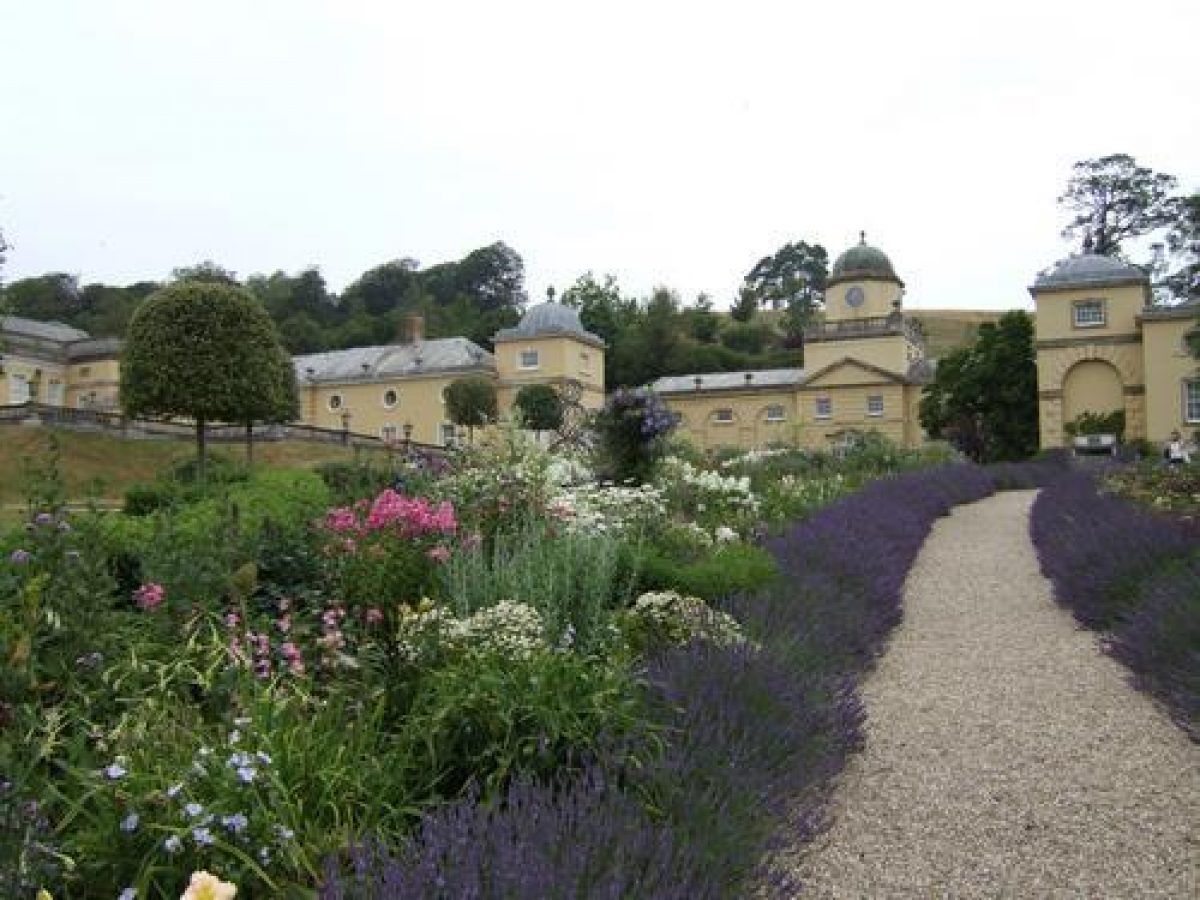
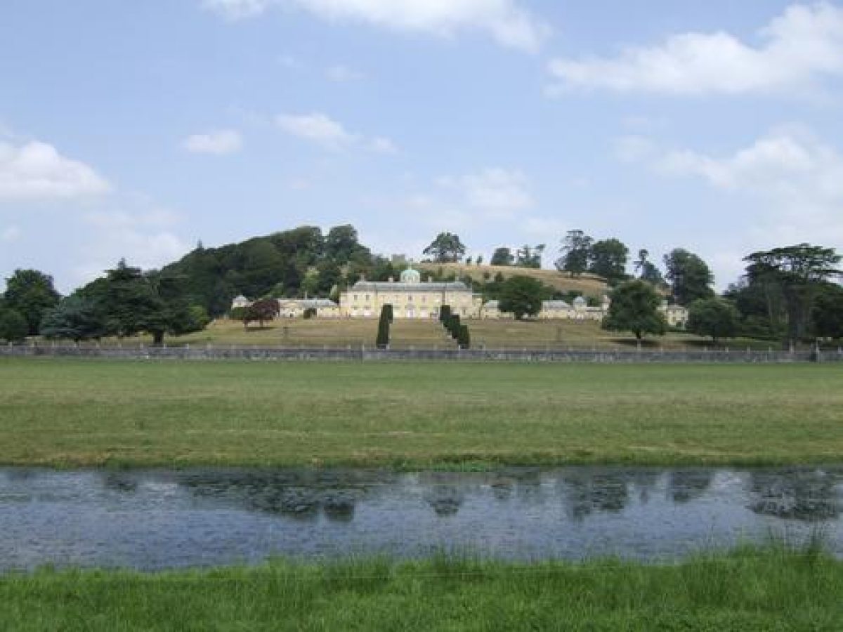
Castle Hill House (listed grade II*) stands on a level platform cut into the south-facing slope of the hill on which stands the Sham Castle from which it takes its name. A late Tudor house was rebuilt in 1684, this structure forming the core of the present central block. In the early C18 Hugh, Lord Clinton consulted Lord Burlington and the ninth Earl of Pembroke on the remodelling of the house, and a contract of 1728-9 with Roger Morris survives for the refacing of the house. The north or entrance front is reached via a monumental arch leading through Blore's mid C19 stables which lie behind the east wing. A further arch leads to a service court behind the west wing which formerly contained the domestic offices. Lord Gerald Wellesley's rebuilding following the fire of 1934 returned the exterior of the house to its early C18 proportions.
Gardens and Pleasure Grounds
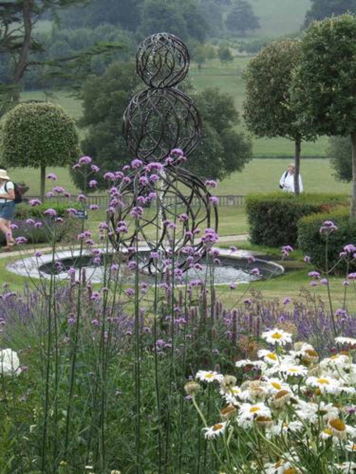
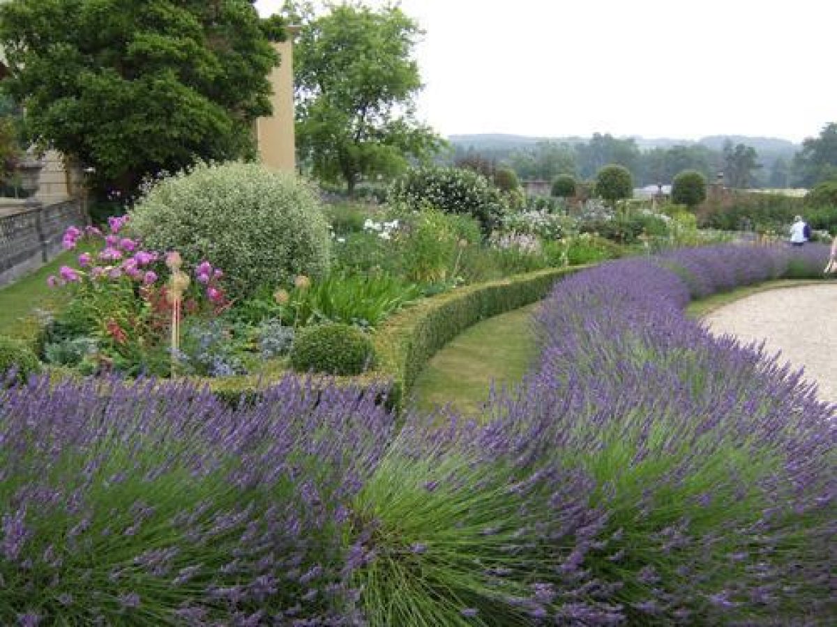
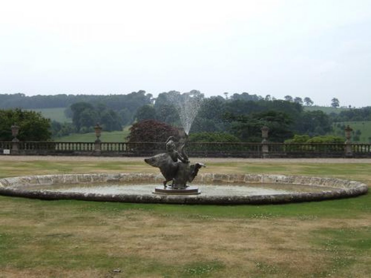
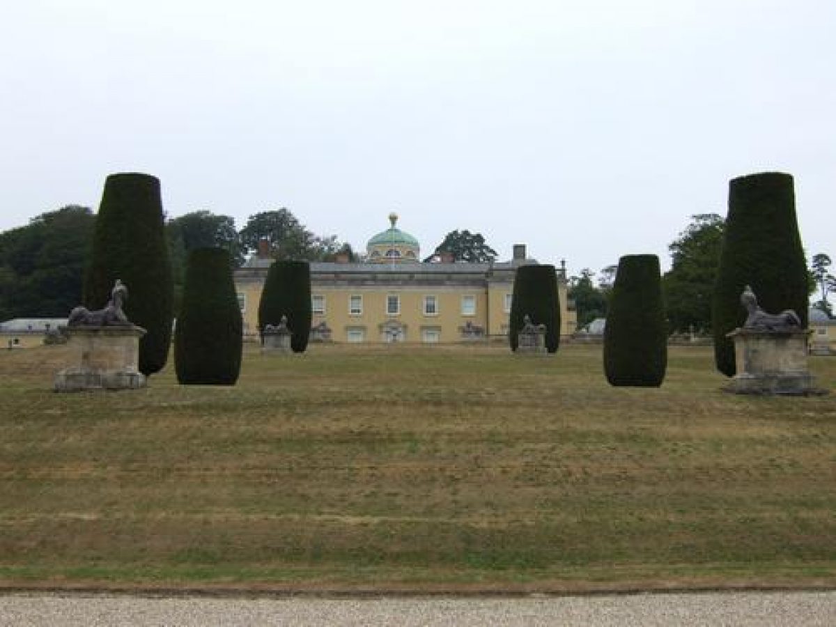
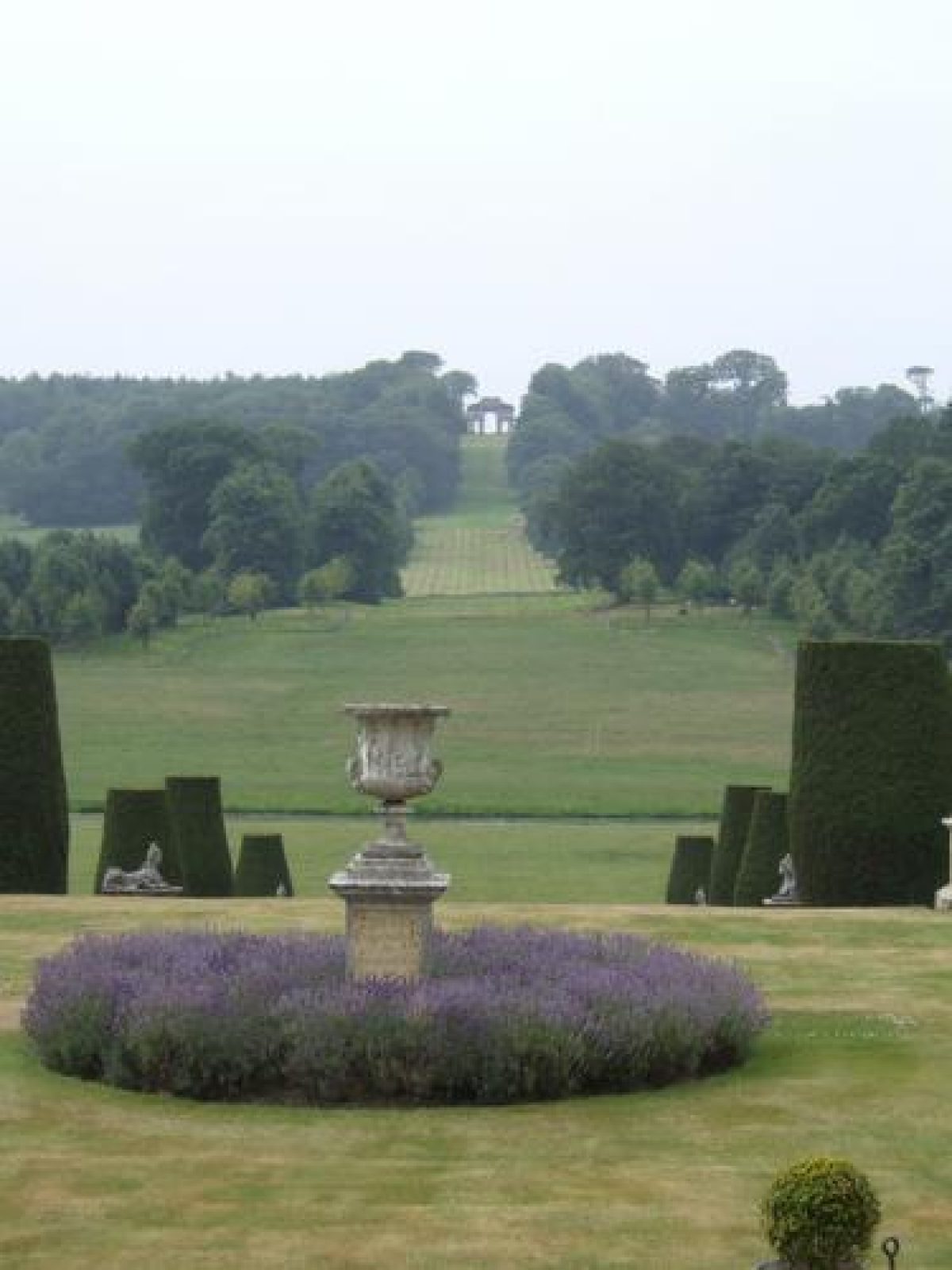
The formal and informal gardens and pleasure grounds lie to the south, west and north of the house. To the south C19 formal gardens with circular fountain pools lie in the recesses east and west of the central block, and axially placed stone steps descend to a series of four formal grass terraces separated by grass banks which survive from Earl Clinton's early C18 Platform. The upper terrace comprises a lawn conforming in width to the central block of the house, with a centrally placed carved stone urn and pedestal (dated 1831, listed grade II) set in a circular flower bed, and enclosed to the south, east and west by low balustrades (partly re-cast in concrete) with urns surmounting the principal uprights (listed grade II).
A wide opening to the south is flanked by a pair of C18 lead lions (listed grade II) framing the principal vista. The axis is continued through the three lower terraces by pairs of Irish yew and two pairs of C18 lead sphinxes set on high stone plinths (listed grade II). The design of these ornaments has been linked to those at Chiswick, London (qv) and has been attributed to Cheere (Cherry and Pevsner 1989). The lowest terrace forms a broad gravel walk terminated east and west by C19 carved stone seats and enclosed to the south by balustrades ornamented with stone and lead urns (listed grade II). The balustrades break forward echoing the central block of the house, and formed part of Blore's mid C19 alteration to the terraces (Colvin and Moggridge 1991).
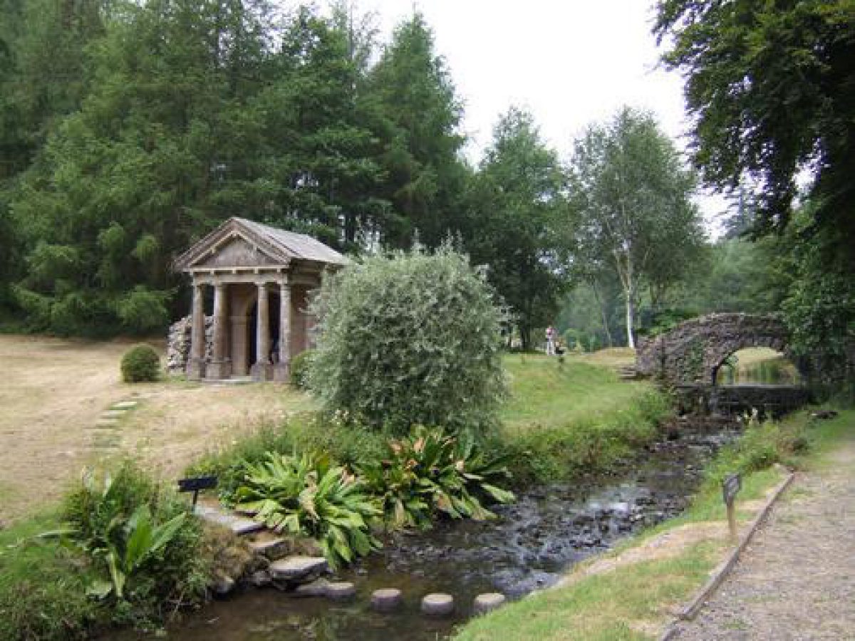
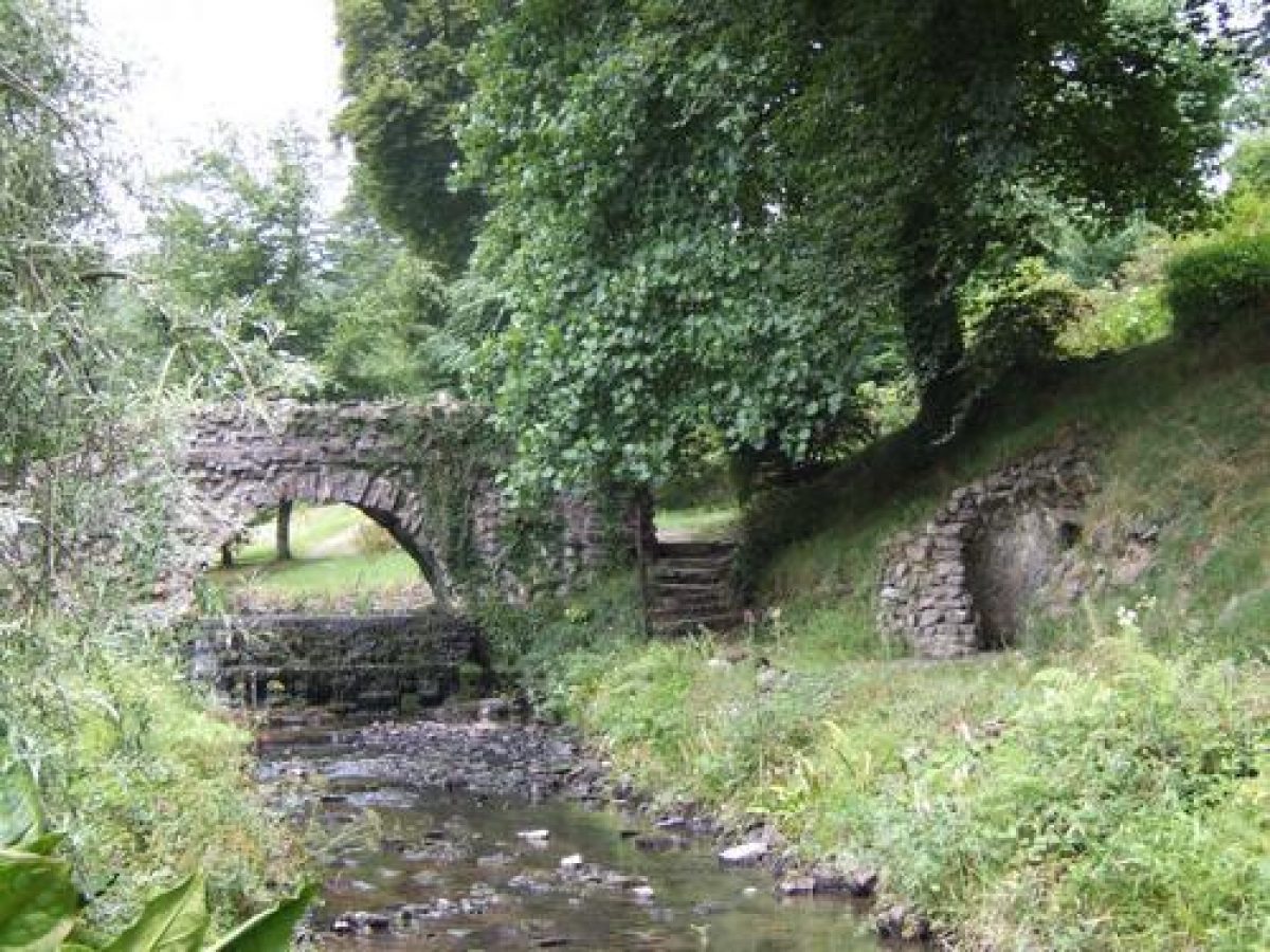
Gravel walks extend west and north-west following the east bank of the Filleigh Brook in the valley west of the house, leading some 260m north-west to a group of three early C18 structures, the Sybil's Cave, the Satyr's Temple (listed grade II) and the Ugly Bridge (listed grade II) which serves to connect them across a serpentine 'river' and cascade. The Sybil's Cave is built into the west-facing valley side, with two rustic stone arched entrances leading to an inner chamber; the Ugly Bridge is similarly rustic in style, while the Satyr's Temple has a Doric pedimented façade originally flanked by a pair of rustic stone blind arches, now partly decayed. This group of structures on the Filleigh Brook formed part of Earl Clinton's early C18 landscape, together with a Chinese Temple (now gone) which stood c 30m north-east on the site of a relocated C18 lead figure of Pan.
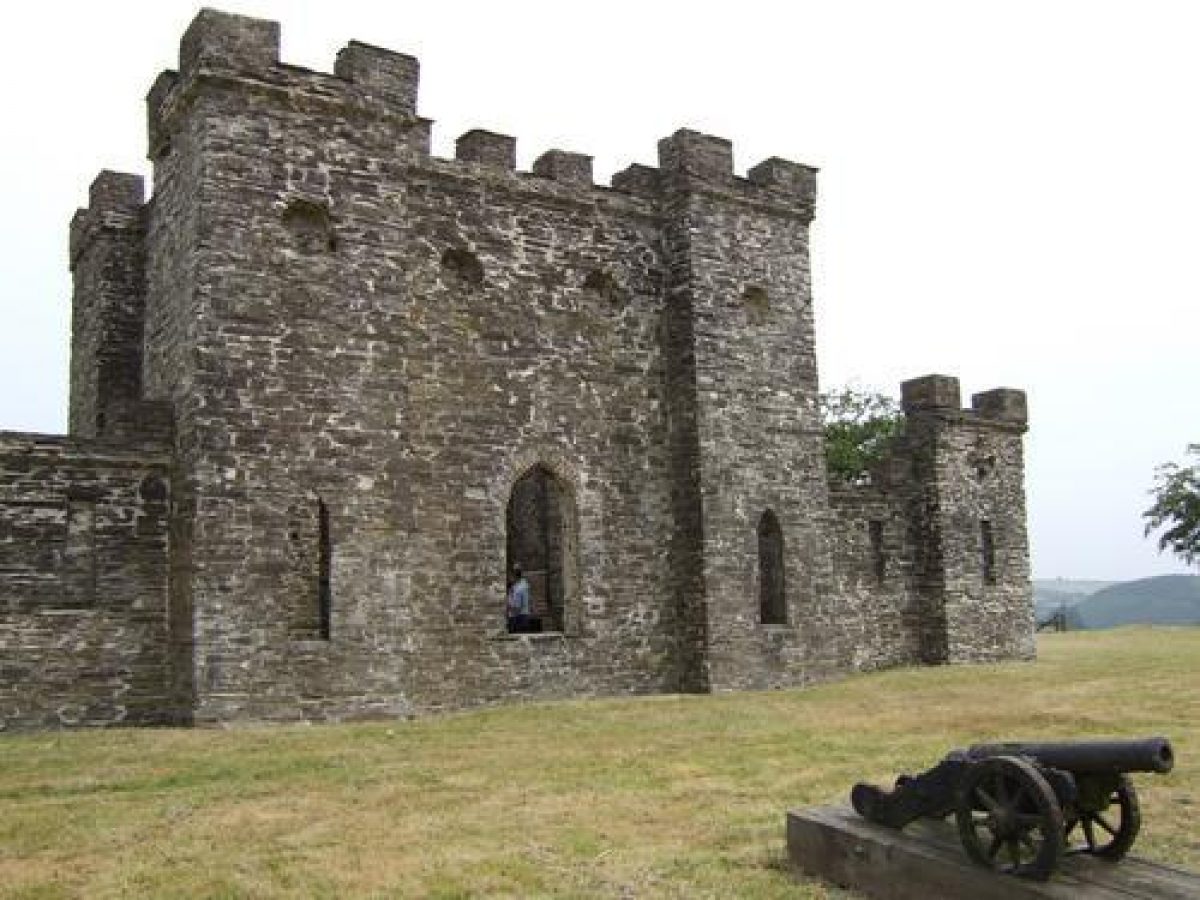
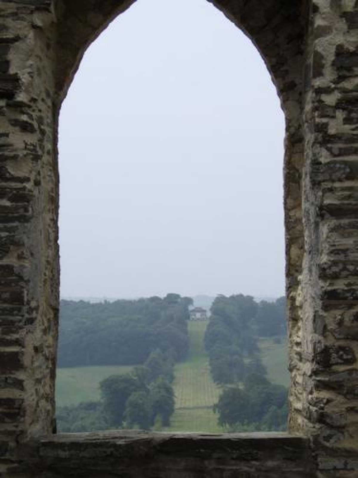
A network of walks, including the former Dark Lane, traverses the west- and north-west-facing slopes of Darklane Wood, which in the C20 has been extensively planted with ornamental shrubs. The Sunset Temple (listed grade II) stands in an elevated position c 230m north-north-west of the house. Dated 1831 (restored late C20), the simple pedimented structure affords wide views north-west to the coast and Lundy. The early C18 Sham Castle (listed grade II) on the hilltop c 270m north of the house stands on a raised mound with a rubble-stone, buttressed retaining wall at the north-east extremity of the pleasure grounds. Approached from the north through a stone gothic arched gateway, the rubble-stone Sham Castle is a symmetrical structure comprising a castellated central block with corner turrets, flanked by lower walls terminating in castellated turrets. Now roofless, the Sham Castle originally contained a panelled room and furniture (Batey and Lambert 1990), and gothic windows in the south, west and east facades focus on significant vistas through the ornamental landscape.
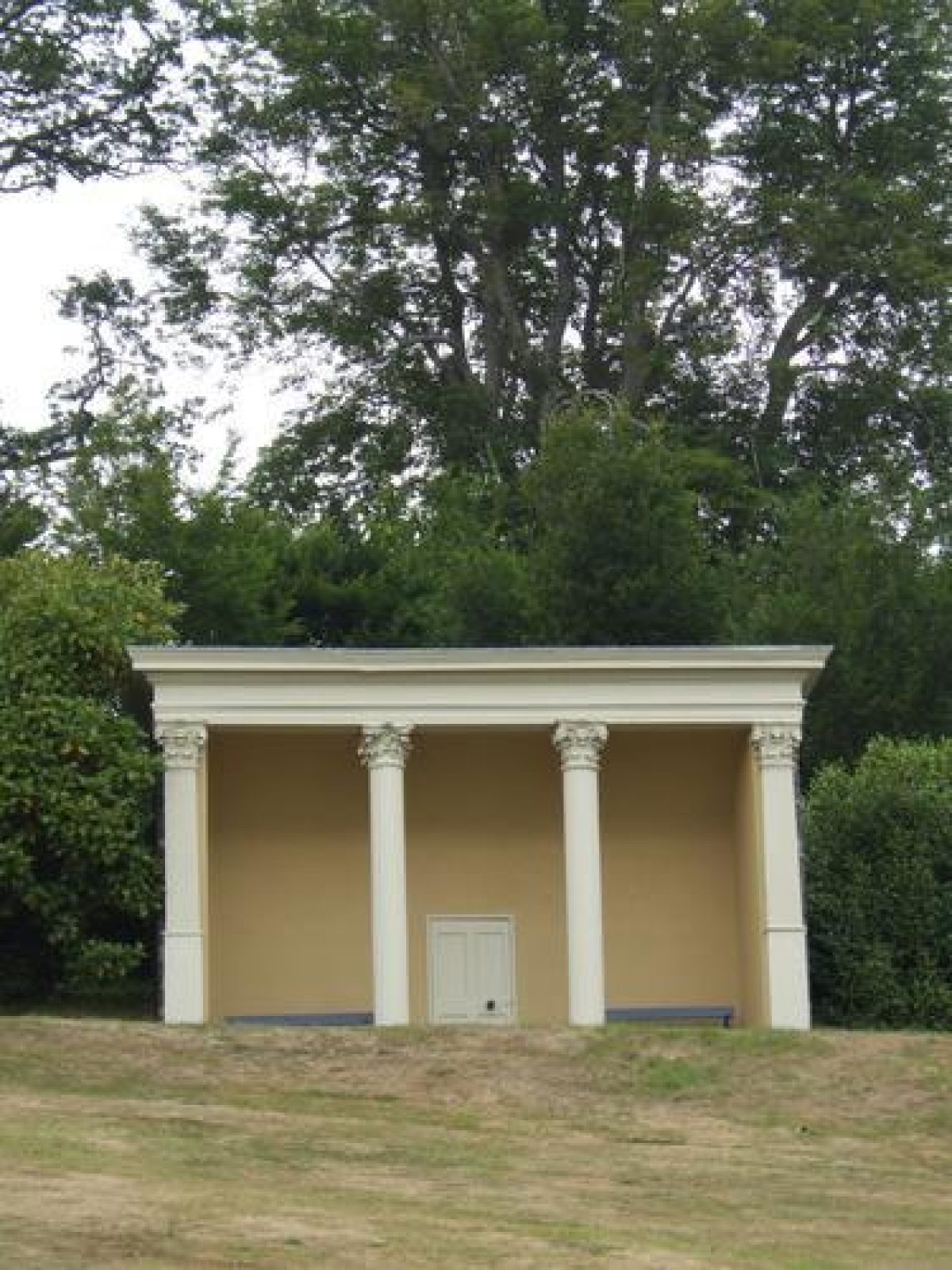
The Castle mound allows wide views in all directions, and a series of miniature cannons ornament the southern retaining wall. Gravel walks return along the east side of Darklane Wood with views east across parkland. Some 180m north-north-west of the house stands an C18 lead bust of Bacchus mounted on a stone pedestal as a herm (listed grade II), while within the woodland c 200m north-west of the house is a cross on a stepped base (listed grade II), probably of C15 origin re-set in this position in 1833 (inscription). North of the house the pleasure grounds comprise C19 and C20 shrubbery, and adjacent to the steps leading down the rock face into the carriage court, a C19 rockery. The Sunrise Temple (listed grade II) some 30m north-east of the house is dated 1831 and comprises an open-fronted structure supported on two fluted timber Corinthian columns. It stands adjacent to the site of the early C18 Menagerie.
Park
The park lies to the north-east, east, south and west of the house. The Deer Park c 550m north-east of the house represents the detached C16 or C17 park which was expanded by Earl Clinton from 1719. Separated from the grounds around the house by Park Lane, the Deer Park is entered through an C18 gateway comprising red-brick piers with stone dressings originally surmounted by ball finials (missing 1998), supporting simple wrought-iron gates. Flanking brick walls have stone quoins and corner ball finials (one missing 1998). Immediately north of the gateway is Park Gate Cottage, originally a thatched cottage orné but now tiled, built for the first Earl Fortescue in 1815.
The Deer Park includes a roughly conical hill west of the River Bray which is crowned by a small conifer plantation, while boundary planting to the north and on the slope above the River Bray appears to survive from the mid C18 (Field Map, 1763). An avenue of Scots pine running north-west from the Park Gate parallel to the Park's west boundary follows the course of an C18 avenue (ibid). Earthwork remains of a park pale, deer course and stand survive in the Deer Park, together with the site of a lodge (Colvin and Moggridge 1991). Some 320m north-east of Park Gate the early or mid C18 Deer Park Bridge, a triple-arched stone structure with a rustic stone parapet carries a former carriage drive across the Bray. The Deer Park was extended in 1785-7 onto the east bank of the Bray, and is closed to the east by Brembridge Wood.
A drive east of the Bray leads past the site of Earl Clinton's Hermitage (partly rebuilt, late C20) c 1.1km north-east of Park Gate to Embercombe Lodge. The mid C19 rubble-stone piers of a railway viaduct now support a viaduct for the late C20 North Devon Link Road. The park east, south and west of the house is generally meadow with scattered broadleaf trees, and includes land south of the minor road, formerly the A361. Some 200m south of the house a canalised stream is the remnant of Earl Clinton's cruciform lake which was reformed into a more natural 'river' in the mid C18 by Matthew, Lord Fortescue.
To the west a chain of ponds leads south-west c 1.2km from the house to Spa Pond and Spa House in Spa Wood. The Spa House (listed grade II) originated as one of Earl Clinton's early C18 eyecatchers. A Palladian structure with a central tower, it originally housed a basin for a chalybeate spring, but is now a private residence. The principal southern vista from the house extends c 1km to the early C18 Triumphal Arch (listed grade II, restored c 1960), a triple-arched structure based on the Arch of Constantine which stands on the horizon framed by woodland and at the head of an avenue which extends c 650m south from the former A361. The Long Walk Drive extends south-east from Filleigh to the Triumphal Arch and Temple Wood, where some 1.5km south-east of the house, the remains of the Holwell Temple (1770) stand on a steep wooded slope above the River Bray. Matthew, Lord Fortescue's south-east eyecatcher, the Temple overlooked a sheet of water which incorporated an artificial port with ships' masts formed from shredded trees.
This lake was removed in the early C19, while the Temple, intended as a banqueting house, is said to have remained incomplete (Colvin and Moggridge 1991). Ruined by fire in the mid C20, substantial remains survive including large brick-vaulted cellars which form the podium for the structure. Some 200m south-east of the Temple, the remains of the early C18 Sham Village survive in woodland. Conceived by Earl Clinton as a ruined village with a false church tower, the structures were rendered habitable c 1790 but fell into decay in the mid C20. West of the house the park rises to Oxford Down, a high ridge with ornamental plantation on its southern slopes. The remains of Earl Clinton's early C18 gothic Kennels survive c 350m west of the house. Studd Drive which runs west through the park approximately follows the line of the former Turnpike removed c 1730 and leads to the Barnstaple Lodge c 900m west of the house.
Kitchen Garden
Some 30m south-east of the house, the C18 kitchen garden is enclosed to the north, east and west by buttressed stone-coped brick walls c 3m high. The coping sweeps down at the north-west corner where a gateway is constructed across the angle with brick and stone piers surmounted by stone ball finials which support an C18 wrought-iron gate and scrolled overthrow (all listed grade II). The east and west walls are ornamented with stone ball finials, and ornamental shrubs have been trained against the exterior of the west wall. The interior of the garden is divided by C20 hedges to form tennis courts and ornamental gardens associated with a late C20 single-storey rendered and classically detailed residence which has been constructed at the centre of the southern section of the garden.
Other Land
The wider estate was ornamented with a series of mixed plantations and carriage drives in the late C19 and early C20 which are included in the registered site. Interspersing a traditional agricultural landscape, these areas of woodland are a significant feature of the landscape, and in some instances include the reclamation of earlier quarry and clay workings as at Tilery Covert c 1.75km north-west of the house, and Rubble Hills c 1.5km south-east. In land beyond the park significant structures act as eyecatchers. These include Cheere, also known as Menagerie Cottage, c 1km east-south-east of the house, an early C18 Palladian structure with tall first-floor windows aligned to overlook the Deer Park c 500m north-west; and the late C20 Ebrington Tower, a stone tower c 1.5km south-east of the house, erected in memory of the late Viscount Ebrington (killed in action, 1942) by Lady Margaret Fortescue. Significant estate buildings include the mid C19 Filleigh Saw Mill (listed grade II) c 650m east-south-east of the house, and the cob and thatch house Shallowford c 1.2km east-north-east of the house, which was occupied in the early C20 by the author Henry Williamson.
Maps
- Field Map of the Castle Hill Estate, 1763 (1262M/E22/5), (Devon Record Office)
- W Hole, Map of the Barton of Castle Hill, the lands of Matthew Lord Fortescue, 1765 (private collection)
- B Donn, Map of the County of Devon, 1765
- Field Map of the Castle Hill Estate, 1790 (1262M/E22/2), (Devon Record Office)
- Tithe map for Filleigh parish, 1838 (Devon Record Office)
- Map of Castle Hill Barton, Filleigh, Devon, 1859 (Devon Record Office)
- Map of the Parish of Filleigh, Devon, 1880 (Devon Record Office)
- OS 6" to 1 mile: 1st edition published 1886
- 2nd edition published 1904
Illustrations
- J Wootton, Castle Hill from the south, 1735-1740 (private collection)
- J Lange, Castle Hill from the south, 1740 (destroyed), (in Country Life 1934)
- J Lange, Castle Hill from the Sham Castle, 1740 (destroyed), (in CL 1934)
- Feary, Castle Hill House from the South West, c 1785 (private collection)
- J Watts, Castle Hill House from the South West, 1785 (private collection)
Archival items
- The Fortescue of Castle Hill Collection, including estate accounts, instructions for improvements to the house and grounds, correspondence concerning landscape improvements and buildings, C18 and C19 is held at the Devon Record Office (1262M/E 1-29).
- Travels of Dr Richard Pococke, Bishop of Osary in 1764, 2 vols (Add MS 14, 260(1), British Library)
- The second Earl Fortescue's MS description of the Park from 1854, continued by the third Earl to 1885 (private collection)
Description written: January 1999
Amended: March 1999; July 1999
Edited: July 2000, March 2022
- Visitor Access, Directions & Contacts
Telephone
01598 760421Access contact details
The gardens are open all year Monday to Friday 11am - 4pm.
For more information visit the Castle Hill website.
Directions
Follow the B3226 off the A361 at South Molton. Follow signs to Filleigh.
For more detailed directions visit the Castle Hill website.
Owners
The Earl and Countess of Arran
Castle Hill, EX32 0RH
- History
The following is from the Register of Parks and Gardens of Special Historic Interest. For the most up-to-date Register entry, please visit The National Heritage List for England (NHLE):
15th Century
Martin Fortescue, eldest son of Chief Justice Sir John Fortescue, acquired an estate at Filleigh through marriage in 1454. A house on the site of the present mansion was associated with a detached deer park to the north-east, and the medieval parish church stood immediately west of the house, surrounded by modest gardens and orchards and confined by roads to the south, north and north-west (Colvin and Moggridge 1991).
18th Century
Sir Hugh Fortescue (created Lord Clinton in 1721 and Earl of Clinton and Lord Fortescue in 1746), a leading Whig politician, inherited Castle Hill in 1719. A programme of improvement, with a concentrated period of activity in the early 1730s coinciding with his resignation from political office included the remodelling of both house and grounds. A new Palladian mansion was designed by Lord Burlington (1694-1753) with advice from the ninth Earl of Pembroke (1693-1749). The extent of Earl Clinton's landscape is recorded on field surveys (1763 and 1765), and views by John Wootton (about 1735-1740) and John Lange (1741).
Bishop Pococke visiting in 1764 described the landscape created by 'the late Lord Clinton'. A close associate of Lord Burlington, Lord Pembroke and Lord Cobham, Clinton's half-sister was married to Lord Lyttleton of Hagley, Worcestershire, and it has been suggested that the Sham Castle at Castle Hill is related to Sanderson Miller's Castle at Hagley (Cherry and Pevsner 1989). Like Stowe, Buckinghamshire, Earl Clinton's landscape comprised a central north/south vista passing from the gothic Sham Castle on the hill behind the house to a Triumphal Arch on the southern horizon; it also included a viewing Platform or terrace below the south façade of the house, and a cruciform lake. A series of landscape buildings, including significant early examples of Gothic Revival, were built from the early 1720s and engravings of them illustrated Dr James Fortescue's Essays (1759). The design of the Palladian buildings may be attributed to Lord Burlington, but elsewhere Earl Clinton appears to have been his owner designer (Colvin and Moggridge 1991).
In 1751 the estate was inherited by Earl Clinton's half-brother, Matthew, Lord Fortescue. From 1767 with the assistance of his agent, Hilliard, he undertook a series of alterations including the construction of the Holwell Temple (1770-1772) and an associated lake south-east of the house, balancing Earl Clinton's south-west vista to Filleigh church. The cruciform lake south of the house was naturalised into a serpentine river, and the formal lines of the planting east and west softened, in about 1771 as shown on a Field Map (1790).
Lord Fortescue died in 1785, leaving the estate to his son, created Earl Fortescue in 1789. From 1785 until his death in 1841, the first Earl consolidated and expanded the early 18th century park to include the formerly detached Deer Park east of the house through a land exchange.
19th Century
Between 1820 and 1840 the Tithe map (1838) shows that plantations were extended into adjoining agricultural land, and a series of ornamental drives through the woodland created. From the mid 19th century, under the second and third Earls Fortescue, agricultural land was improved and many of the mature woodlands replanted. The house and south terraces were extensively altered by Edward Blore in 1842-1843, and William Butterfield provided designs for estate buildings in about 1870. The mid and late 19th century landscape is reflected on both parish (1859; 1880) and Ordnance Survey maps (1886; 1903).
20th Century
In 1934 the mansion was partly destroyed by fire and was subsequently rebuilt (1935-1938) to designs by Lord Gerald Wellesley. The mature 18th and 19th century landscape suffered serious storm damage in 1990, which has been followed by an extensive programme of restoration to both the landscape and its structures.
21st Century
Castle Hill remains (2022) private property.
- Associated People
- Features & Designations
Designations
The National Heritage List for England: Register of Parks and Gardens
- Reference: GD1015
- Grade: I
Features
- House (featured building)
- Description: Privately owned Palladian house, re-built in the 1930s.
- Earliest Date:
- Latest Date:
- Folly
- Description: There are several follies.
- Garden Building
- Description: Sham castle.
- Arch
- Description: Triumphal arch.
- Key Information
Type
Estate
Purpose
Ornamental
Principal Building
Domestic / Residential
Survival
Extant
Hectares
1550
Open to the public
Yes
Civil Parish
Filleigh
- References
References
- {English Heritage Register of Parks and Gardens of Special Historic Interest} (Swindon: English Heritage 2008) [on CD-ROM] Historic England Register of Parks and Gardens of Special Historic Interest
- Pevsner, N {The Buildings of England: Devon} (Harmondsworth: Penguin, 1952) The Buildings of England: Devon
- Gilpin, W., (1798), pp 174-175 Observations on the Western Parts of England
- Lysons, D and S., (1822), p 240 Magna Britannia: Devon II
- Rockley, A., (1938), pp 168-169 Historic Gardens of England
- Delderfield, E R., (1968), p 24 West Country Houses
- Synge, P M., (1977), pp 31-33 Gardens of Britain I
- Harris, J., (1979), pp 180-181, 230 The Artist and the Country House
- Batey, M and Lambert, D., (1990), pp 209-214 The English Garden Tour: a view into the past
- (Colvin and Moggridge 1991) Castle Hill: Summary and Evaluation of History
- Pugsley, S., (ed) (1994), pp 42-58 Devon Gardens
- Gray, T., (1995), pp 68-70 The Garden History of Devon An illustrated guide to sources
- Fortescue, J., (1759) Essays, and discourses, etc, in prose and verse, 2 vols
- (1884), pp 651-652 Gardeners' Chronicle II
- Vol 75, (17 March 1934), pp 272-277; (24 March 1934), pp 300-305; 165 (4 January 1979), pp 18-21 Country Life
- Vol 13, no 2 (1985), pp 102-125 Garden History
- Related Documents
-
CLS 1/273/5
Castle Hill Park - Restoration Management Plan - Digital copy
Colvin and Moggridge - 2000
-
CLS 1/274/1
Castle Hill Park - Restoration Management Plan - Digital copy
Colvin and Moggridge - 2000
-
CLS 1/273/5