Introduction
Bicton has 18th-century formal gardens and parkland, extensively developed with 19th-century tree plantings. The gardens have been in divided use and ownership since 1957, separated into three different and distinct freeholdings. The site, of about 130 hectares, comprises some 20 hectares of formal gardens and pleasure grounds, and about 110 hectares of parkland and woodland.
Terrain
The site slopes gently from a ridge of high ground, Baker's Brake, on the north-west towards the south-east boundary, with Bicton House standing above a shallow valley which runs from west to south-east.
The following is from the Register of Parks and Gardens of Special Historic Interest. For the most up-to-date Register entry, please visit The National Heritage List for England (NHLE):
Early 18th century formal gardens with later 18th and 19th century structures, set in 18th and 19th century parkland and pleasure grounds with a mid 19th century arboretum, on which W S Gilpin, John Webb and J C Loudon advised.
Location, Area, Boundaries, Landform and Setting
Bicton is situated c 3km north of Budleigh Salterton and c 1.5km north-west of the village of Otterton, to the west of the A376 road which runs north from Budleigh Salterton to Newton Poppleford. The c 130ha site comprises some 20ha of formal gardens and pleasure grounds, and c 110ha of parkland and woodland. To the east the site is bounded by walls and fences adjoining the A376 road, while to the west the boundary is formed by hedge banks on a minor road leading north from East Budleigh to Stowford.
To the south, north-west and north it adjoins agricultural land. The site slopes gently from a ridge of high ground, Baker's Brake, on the north-west towards the south-east boundary, with Bicton House standing above a shallow valley which runs from west to south-east. The site enjoys views south, east and north-east across adjoining agricultural land and the valley of the River Otter c 1.5km east. There are wide views in all directions from the Belvedere in Baker's Brake, while vistas radiate from the formal gardens to the obelisk to the south, and a group of pines on high ground to the south-east.
Entrances and Approaches
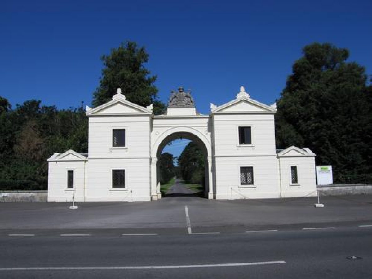
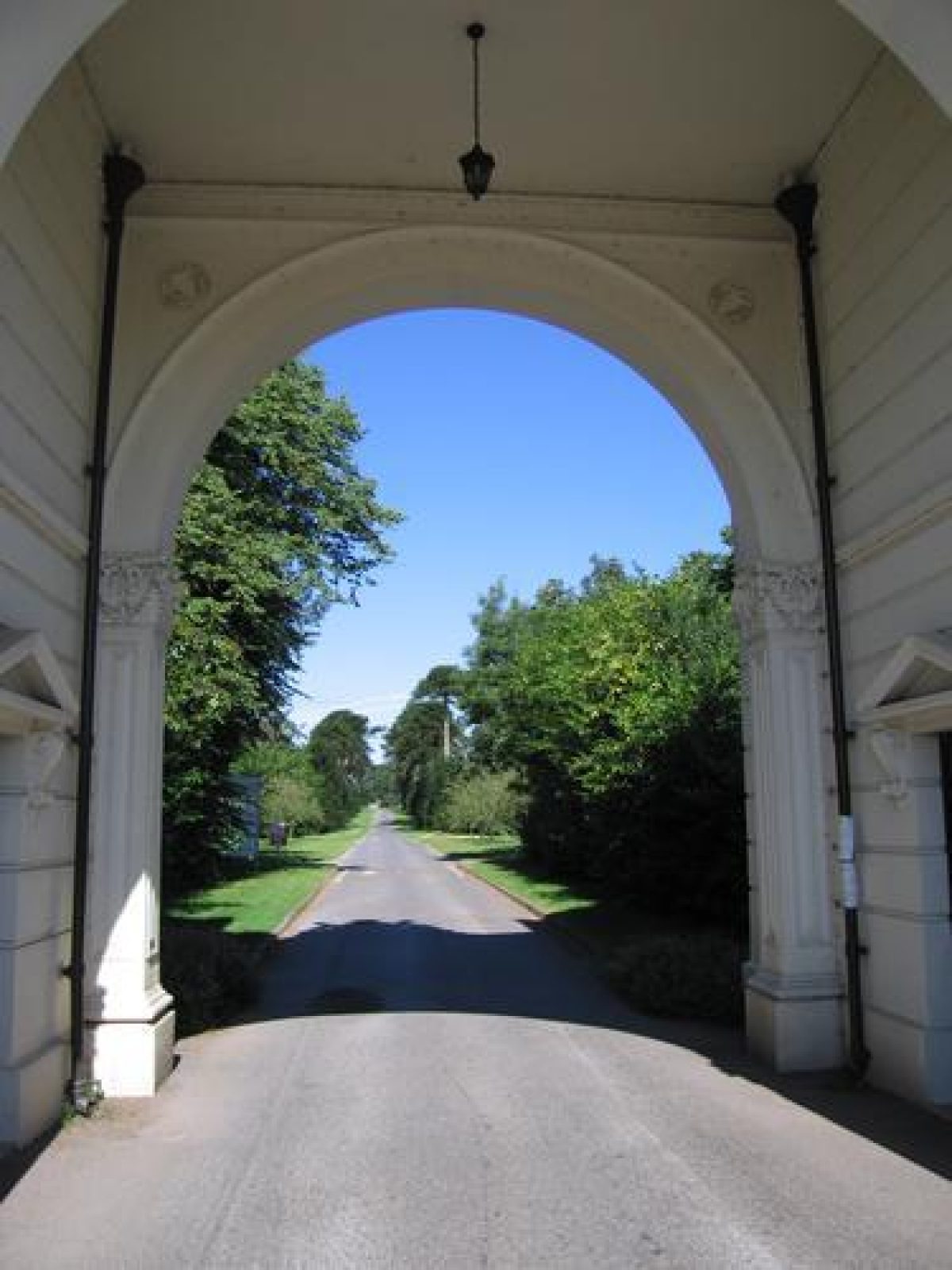
The site is approached from the A376 road to the east, at a point c 1.5km north-east of the village of East Budleigh. Low, concave stuccoed brick wing walls terminating in stuccoed piers flank the Sidmouth Lodge (all listed grade II*), a pair of two-storey, rusticated, stuccoed early C19 lodges linked by a monumental arch surmounted by the Rolle arms carved in stone. Opposite the lodge, to the east of the A376 road, curved iron railings supported by four piers (listed grade II) allow views over agricultural land. Entering the site the tarmac drive is flanked to north and south by groups of mid C20 houses set behind wide lawns.
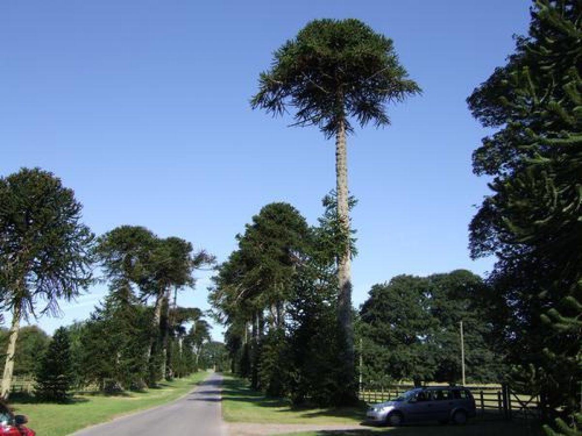
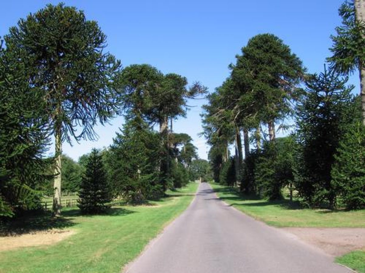
After c 50m the drive enters an avenue of monkey puzzles, originally planted by James Barnes with the advice of James Veitch in 1842, using plants raised from seed collected for the Veitch nursery by William Lobb (1809-63). The avenue, some 400m in length, was widened in 1852 (Elliott 1986). Today (1999), several original trees planted on mounds survive, while new specimens have been introduced to fill gaps. The avenue leads to Flint Lodge, also known as New Lodge, which stands to the north of a gateway flanked by tall, square, red-brick piers surmounted by carved stone lions holding shields. Iron railings with spear finials stand on low brick walls decorated with a flint band to north and south of the gateway, forming a total length of c 60m.
To the south of the gateway, the railings are supported by a further brick pier with a carved stone pineapple vase finial, and the railings terminate to the south at a further gateway (disused, 1999) formerly leading from the park to the formal gardens, and which is formed by brick piers with bands of flint ornamentation, surmounted by similar pineapple finials (all listed grade II). The drive east of Flint Lodge was constructed in the early C19 as part of Lord John Rolle's extension of the park, although a plan of c 1758 indicates the existence of an informal avenue or vista across farmland on the line of the mid C19 monkey puzzle avenue. From Flint Lodge the drive sweeps north and north-west for c 350m across the park, to approach the carriage circle to the south of the House from the south-east.
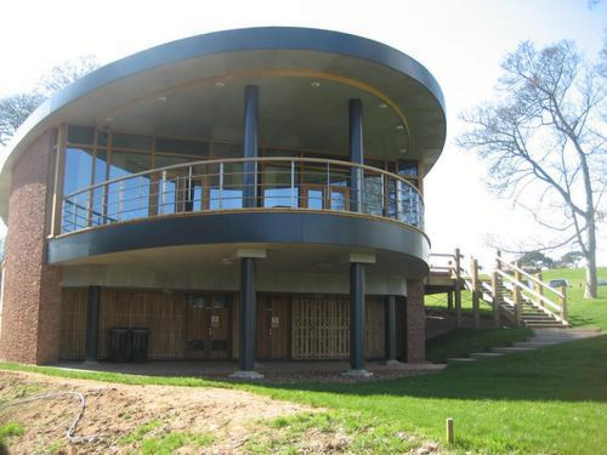
Car parking facilities have been constructed east of the House (1999). A service drive diverts north-west c 30m south-east of the House to reach the stables which adjoin the House immediately to the north. Passing late C20 college buildings north-east of the House, a spur leads c 160m north-west to the kitchen garden, and thence west c 270m to a minor lane which separates the pleasure grounds from Baker's Brake to the north-west.
The early C19 south-west drive enters the site at Sandycross Lodge (listed grade II), a pair of single-storey, neo-classical, square-plan lodge houses standing c 10m north of ornate early C19 wrought-iron gates and pedestrian gates supported on wrought-iron piers surmounted by heraldic badges and coronets. The gates are flanked by low stone walls which extend east and west to tall stone piers surmounted by the Rolle arms carved in stone. The piers are in turn flanked by low quadrant walls terminating in similar tall stone piers. Opposite the lodges, south of the road, a similar low stone wall with ornamental piers closes the view from the park.
The south-west drive passes north for c 260m through the park, before turning east-north-east and north-east for c 670m to reach Aldergrove Lodge, an early C19 single-storey cottage orné constructed in flint, set behind early C19 ornamental wrought-iron railings, which stands c 530m south-west of the House. From Aldergrove Lodge the drive passes north-east across the park to approach the House and carriage court from the south-west. The south-west drive today (1999) serves the late C20 Bicton Arena in the south-west park, the construction of which has obliterated its course from a point c 400m north-east of Sandycross Lodge. North-east of Aldergrove Lodge the drive survives as a concrete track serving mid and late C20 agricultural buildings immediately to the north.
Principal Building
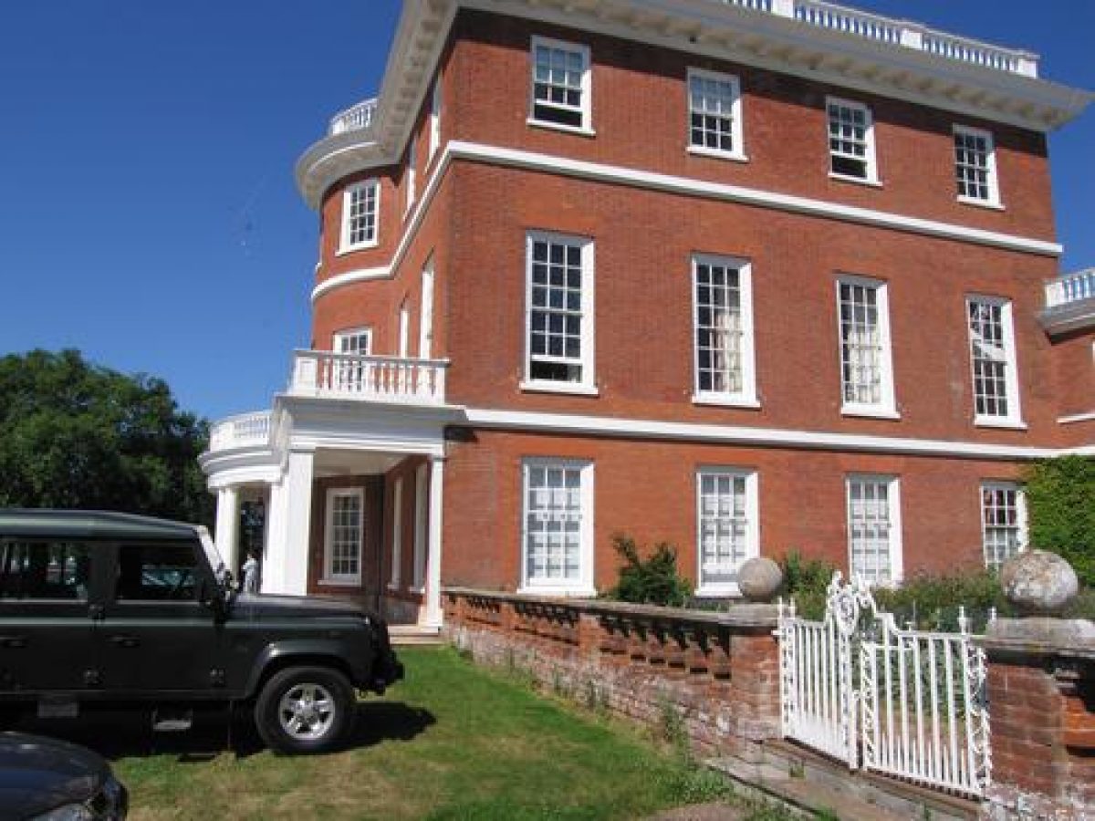
Bicton House (listed grade II*) is said to have been commenced in the early C18 when John Rolle demolished a C16 house which stood on a site to the south of the present house (Bicton College 1992). The House remained unfinished until c 1800, when Lord John Rolle commissioned James Wyatt to complete the structure (Cherry and Pevsner 1989). It was further remodelled and enlarged in 1908-9 by Sir Walter Tapper for Lord Clinton. Today (1999) the red-brick house comprises a three-storey, square-plan main block with a central south-facing bow and single-storey portico supported on pairs of Tuscan columns, which extends the full width of the façade. The main block is symmetrical, with stucco ornamentation and a roof balustrade. It was raised to its present height in 1908-9. The main block is connected by lower, two-storey quadrant wings to two-storey east and west wings, which partly enclose the carriage and service court to the north. The north wing is pierced by a large central carriageway which is surmounted by a bellcote.
Gardens and Pleasure Grounds
The C19 pleasure grounds lie to the west of the House, and are connected to the detached early C18 formal gardens to the south-east by a carriage drive which runs through the early C19 arboretum to the west, south-west and south of the House. Immediately adjoining the House, early C20 square formal gardens with geometric beds separated by gravel walks are enclosed by early C20 brick balustrades. These gardens, set in the angles between the main block and the lower east and west wings, are approached from the carriage circle by stone steps leading to low, white-painted early C20 wrought-iron gates supported by low brick piers surmounted by stone ball finials.
The pleasure grounds west of the House comprise C19 and C20 mixed ornamental planting, separated from parkland by an early C19 ornamental iron fence, the design of which is attributed to W S Gilpin (Bicton College 1992). The fence follows an irregular serpentine plan and is continued along the entire length of the boundary separating the arboretum from the park. A mid C19 otter pool lying c 50m west of the House in a glade in the pleasure grounds comprises a circular pool c 5m in diameter, enclosed by a raised stone curb supporting tall iron railings. Two narrow stone walks supported on pierced brick walls divide the pool and lead to a central island composed of rustic rockwork. The outer stone kerb is supported on brick arches. The pool was used to house otters in the mid C19 (B Wright pers comm, 1999).
The arboretum carriage drive leaves the south-west drive at a point c 50m west of the House, and passes c 400m north and north-west through the pleasure grounds and arboretum. Turning south-west, a subsidiary drive leads north-west through tall wooden gates supported on stone piers with pyramid caps, across a public road to enter Baker's Brake. The main carriage drive continues south-west for c 370m, running parallel to a stone wall which separates the grounds from the public road. Some 400m west-north-west of the House the carriage drive passes an arched stone recess built against the boundary wall, which in the C19 contained an ancient tree stump which served as a boundary marker (B Wright pers comm, 1999). Some 530m west of the House the drive turns south and south-south-east for c 400m, passing through an overgrown area containing the remains of a rock garden attributed to W A T Ingwersen (1905-90) (Bicton College 1992), to reach Aldergrove Lodge and the south-west drive.
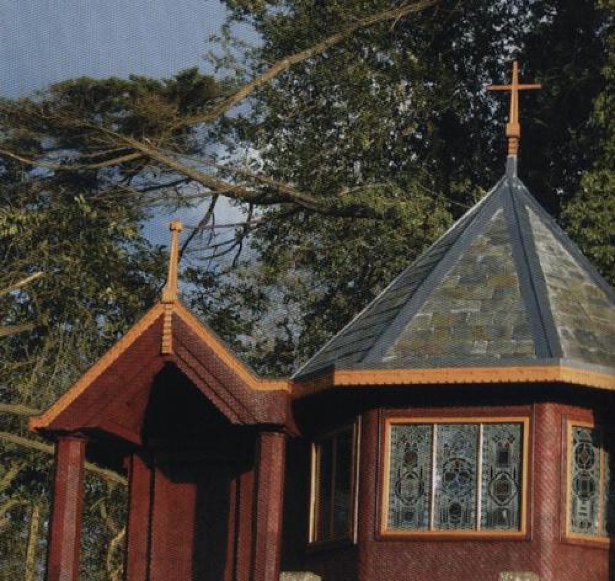
Continuing to the east of the drive, the carriage drive passes through further C19 ornamental planting, overlooking a shallow valley to the north which contains a mid C19 rock and water garden, beyond which stands a picturesque rustic Hermitage of 1839 (all listed grade II*), c 350m south-west of the House. The Hermitage stands on a terrace connected to a lower terrace and long stone-lined pool with a central island by a flight of stone steps, and is a single-storey brick structure clad in rustic timber with a fish-scale shingle roof. The building is backed by trees and evergreen shrubs, while the rockeries and cascades to east and west are planted with dwarf conifers.
Late C20 planting follows a path and narrow-gauge railway constructed in 1976 leading east to the formal gardens. The arboretum carriage drive continues south from the Hermitage, following a stone ha-ha which allows views west across the park. After c 260m the drive turns east, following the site boundary for c 260m and entering an area of informal mid C19 planting west of the formal gardens and south of the lake. This was developed as a pinetum and retains predominantly evergreen planting today (1999). Late C20 buildings and play areas have been constructed in a depression south-east of the lake c 480m south-south-east of the House. The arboretum and pinetum were developed in 1839-40 for Lord John Rolle and Lady Rolle by Robert Glendinning, with advice from W S Gilpin, J C Loudon and James Veitch. Messrs Veitch and Son of Exeter supplied staff who were responsible for the maintenance of the trees and shrubs, which were arranged according to the 'Natural System', with specimens planted and labelled so as to be visible from a carriage (Gardener's Mag 1842).
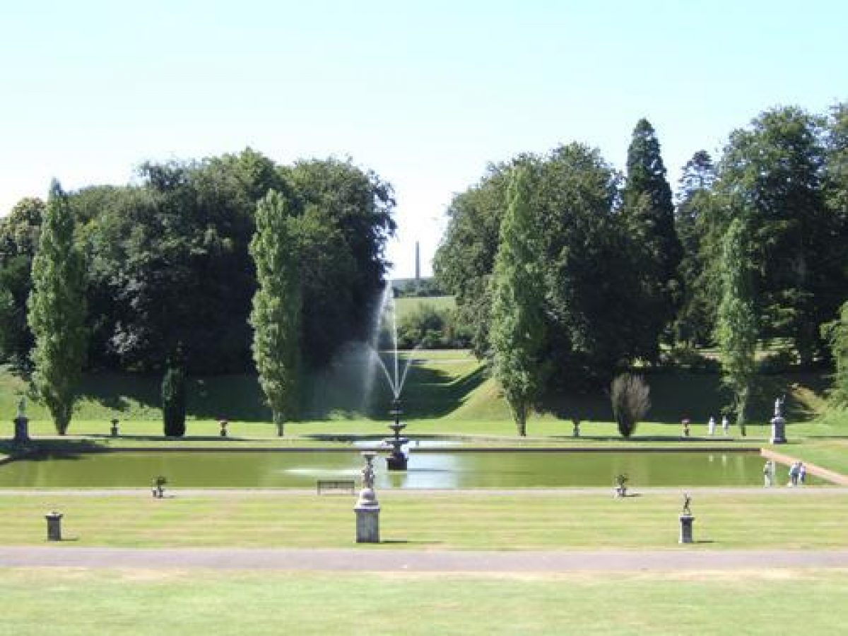
The formal gardens occupy a south-west-facing slope c 500m south-east of the House, and were originally separated from the House and park by a public road (closed c 1800) which followed the ha-ha and wrought-iron fence south of Flint Lodge. The gardens were developed c 1730 by Henry Rolle, and a plan of c 1758 shows a sloping lawn enclosed by trees and shrubbery to north-west and south-east which descended to a large U-shaped canal with an axially placed circular pool to the south. The U-shaped canal enveloped a large rectangular pond to the north. The pond and canal survive today (1999).
The central north/south axis of the gardens is aligned on an obelisk (listed grade II) which stands in fields c 1km south of the House (included as an outlier in the registered area). The vista is framed by steep grass banks planted with trees, and further banks south of the ponds screen the churchyard and ruins of the C15 parish church which was partly converted into a mausoleum for Lady Rolle by A W N Pugin in 1850 (listed grade I). The gardens were further embellished in the early and mid C19 with structures and ornaments (all listed grade II*), and a new parish church (listed grade II*) built to designs by J Hayward in 1848-50. The church stands on a lawn enclosed by a late C20 yew hedge at the south-east extremity of the formal gardens some 750m south-east of the House, and serves as an eyecatcher.
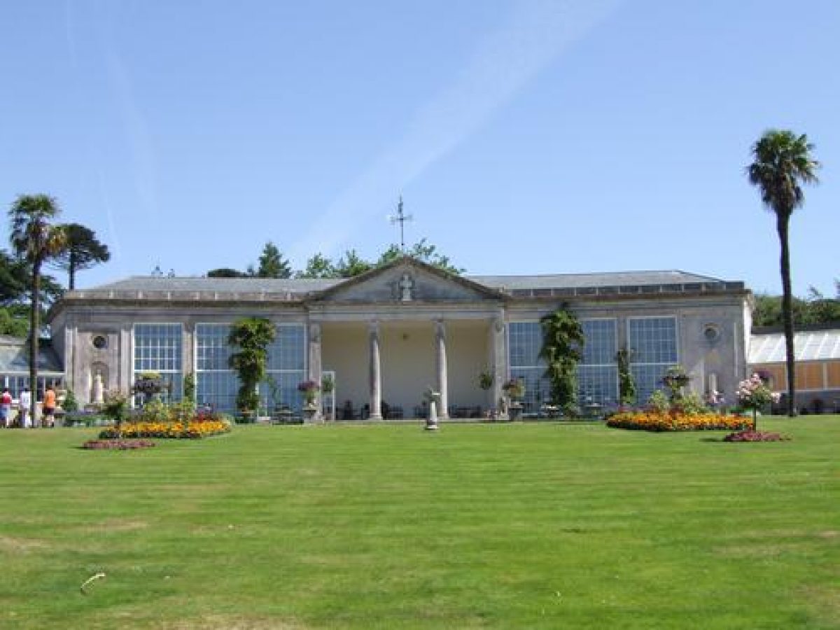
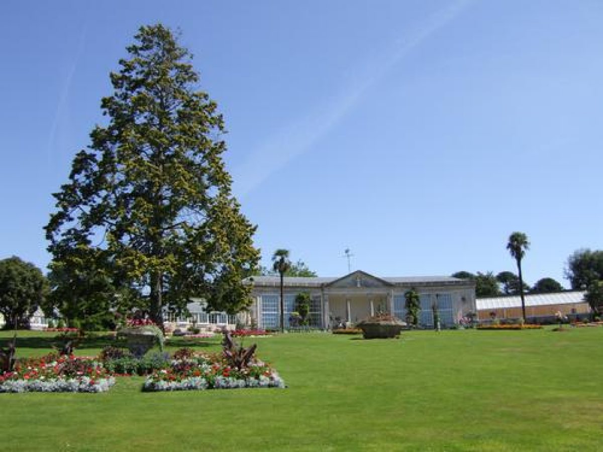
In the early C19 the formal gardens were enclosed to east and west by brick walls (listed grade II*), and the slope divided into three south-facing terraces separated by grass slopes. To the north the curved orangery (listed grade II*) was constructed, enclosing the gardens from service yards. The pedimented, open central colonnade is flanked to east and west by curved rooms lit by tall sash windows. The façade is ornamented with Coade stone busts of Lord Nelson and Sir Walter Raleigh set on fluted pedestals in niches, while the pediment contains a bust of the Duke of Wellington. The orangery is flanked to each side by two C19 stepped-down lean-to glasshouses (all listed grade II*).
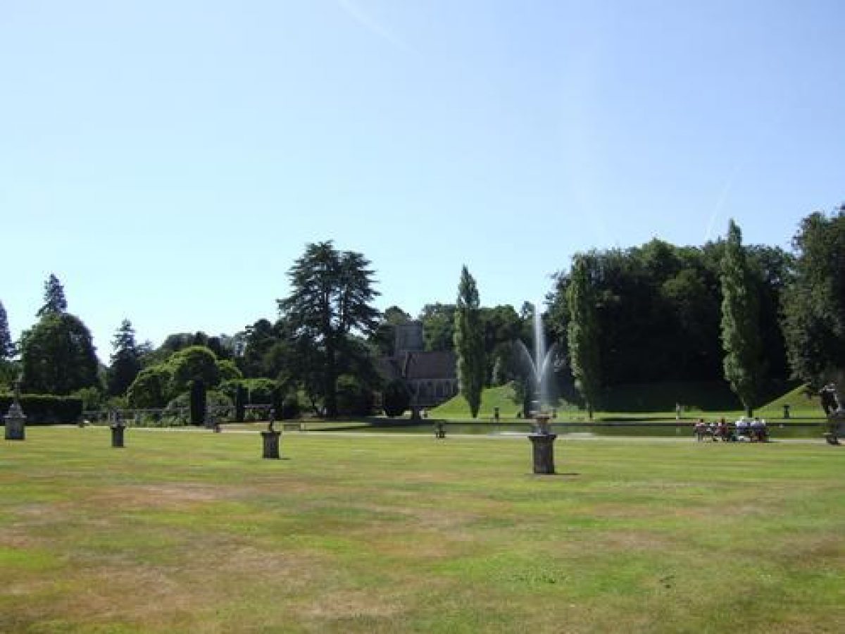
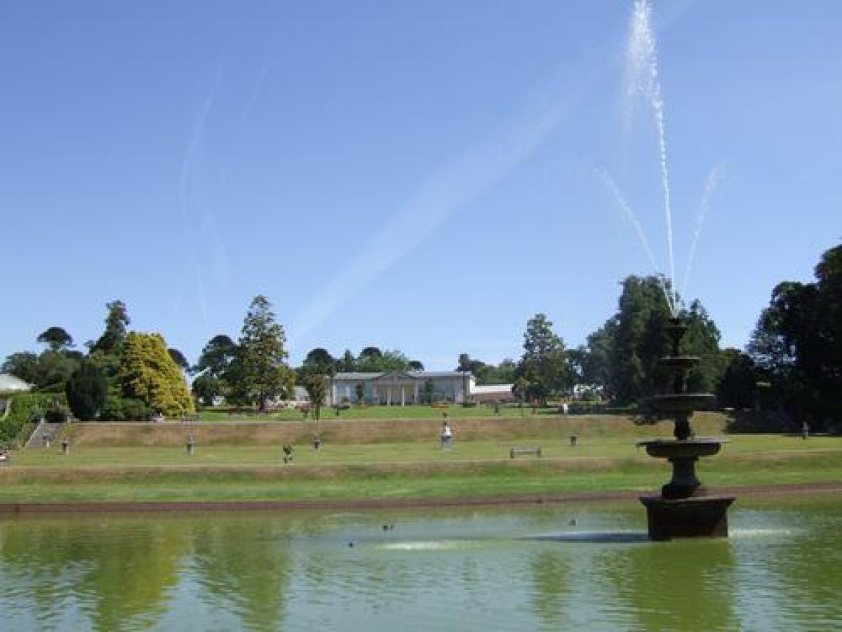
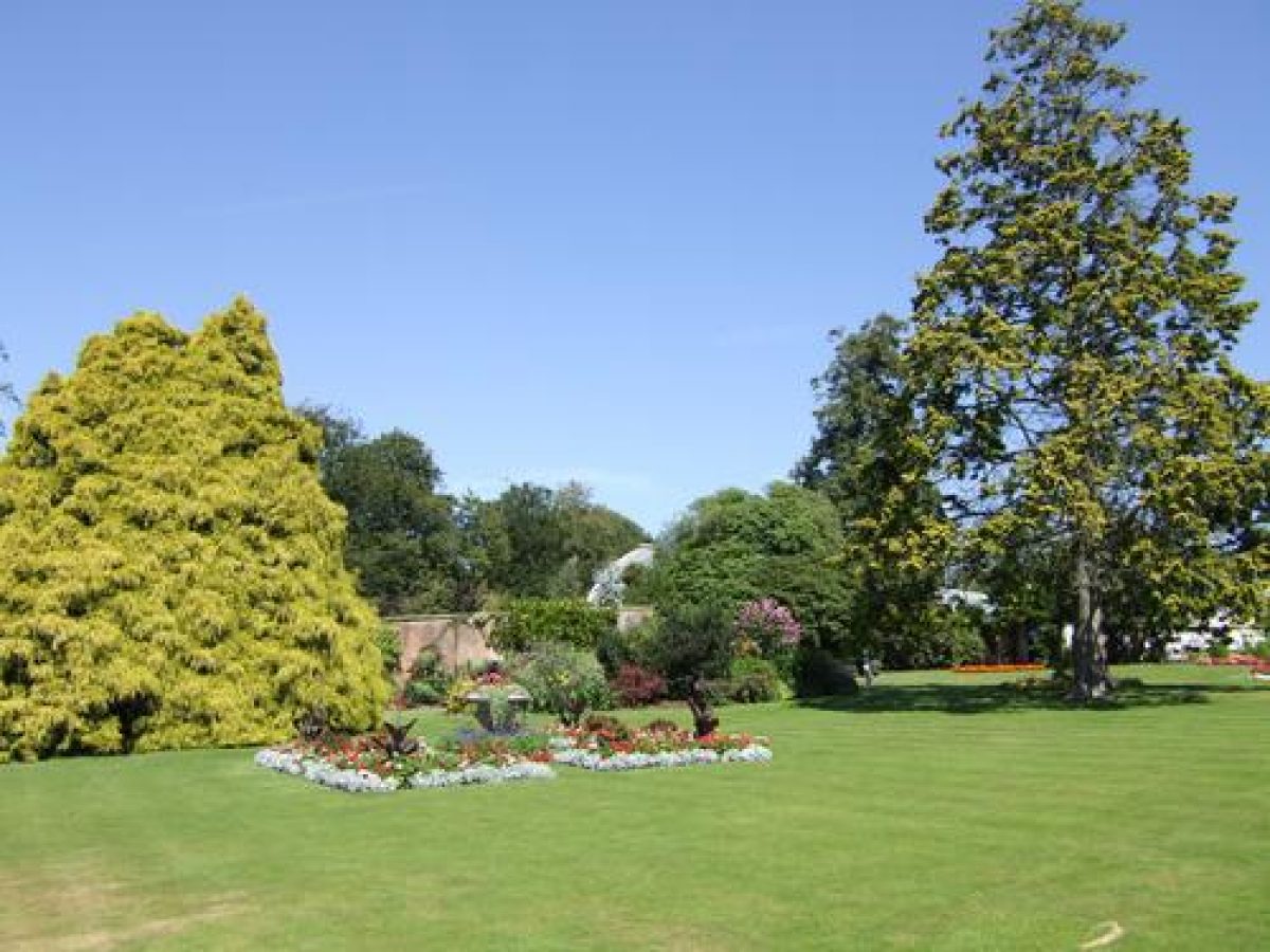
On the sloping terrace below the orangery are two circular pools with lead figure fountains, and to south-east and south-west by monumental, octagonal, stone-edged raised flower beds. Geometric beds for seasonal bedding are cut in the lawn, together with circular beds containing rhododendrons, specimen conifers and Torbay palms. A perimeter path of tarmac laid over cobbles extends south-east and south-west from the orangery to flights of stone steps with C19 cast-iron handrails, which descend to the second terrace. A transverse walk linking the steps is ornamented by a pair of C19 stone bench seats. The second or middle terrace is narrow and laid to lawn enclosed to north and south by transverse walks. The third terrace comprises the early and mid C18 water garden, enclosed to the south by a further walk. A five-tiered C19 cast-iron fountain stands on a granite pedestal in the centre of the pool.
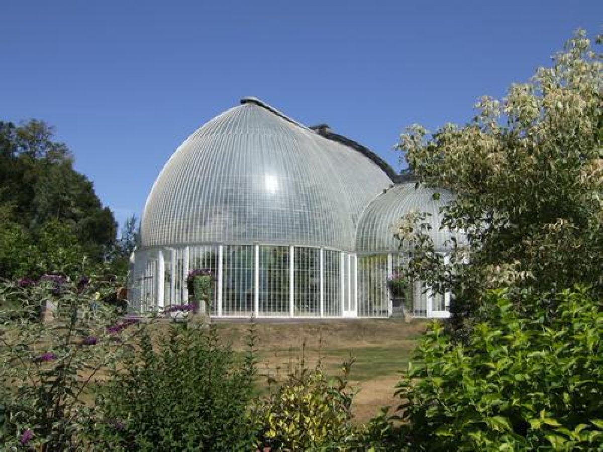
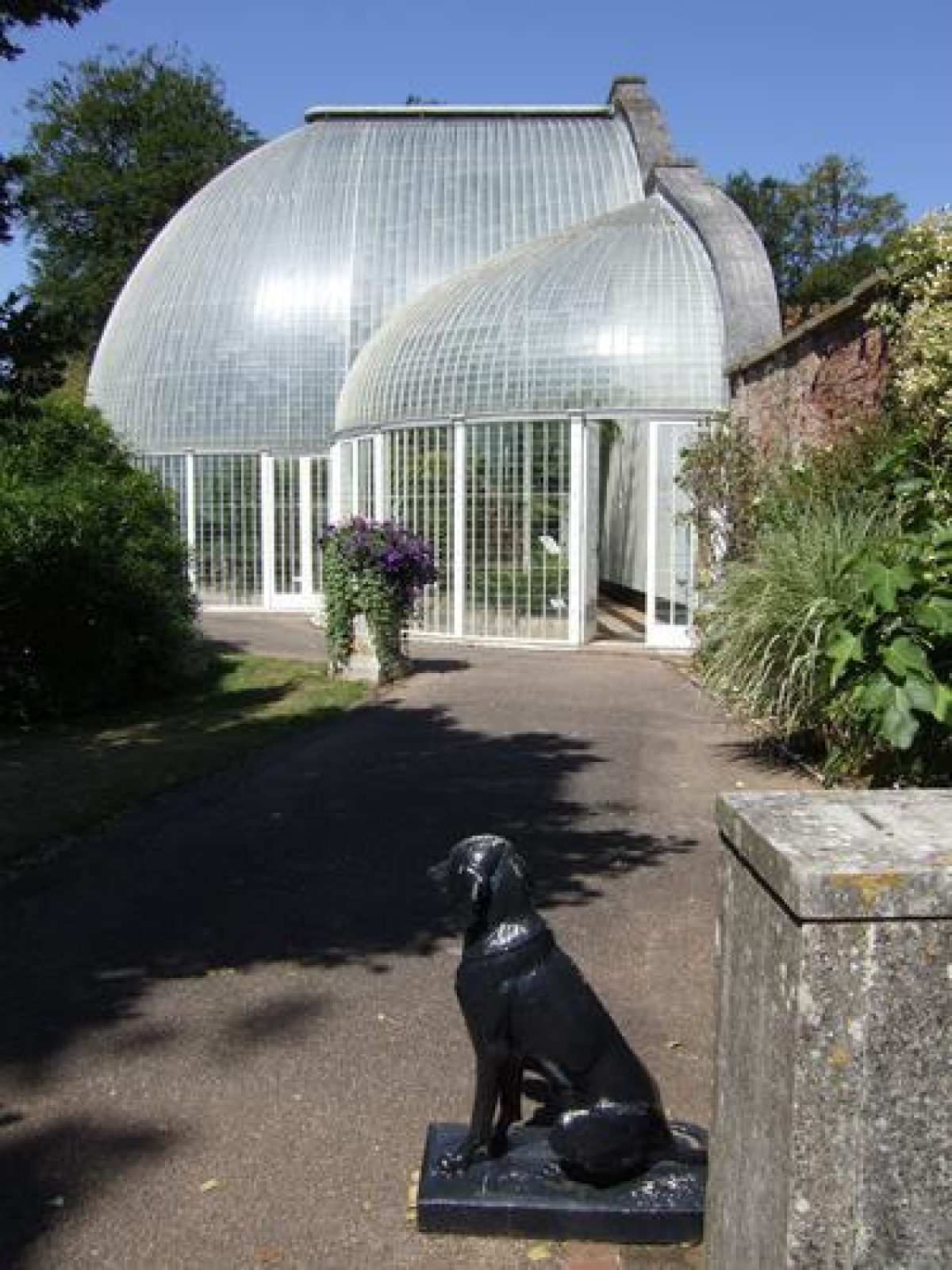
The upper terrace of the formal gardens is extended west from the orangery to form a further south-west-facing terrace on which stands an early C19 palm house (listed grade I). Standing c 480m south-south-east of the House, the palm house was built c 1820-5 and comprises a cast-iron-framed, domed central house flanked to east and west by lower domed houses which project from a high stone and brick north wall containing louvered vents. The palm house was restored c 1980 and contains a collection of exotic plants including palms. A terrace walk adjoining the palm house is ornamented with C19 urns on pedestals, and leads west to a gateway in the brick garden wall which gives access to the pinetum. A grass slope below the terrace walk descends to lawns planted with specimen trees and shrubs, and a rose garden (restored c 1990) which overlooks a late C20 Mediterranean garden below the stone and brick ha-ha which retains the palm house terrace.
East of the formal garden and entered through an arch in the garden wall east of the orangery, an area of early and mid C19 informal gardens is known as the American Garden. Some 660m south-east of the House and c 80m south-east of the orangery, the early C19 Shell House (listed grade II) is a rustic flint and limestone grotto in the form of a circular, single-storey structure containing a south-west-facing circular room overlooking an early C19 rockery constructed from large blocks of rough stone (listed grade II). The rockery is symmetrical on plan and has a central circular pool containing a fountain in the form of a rocky cairn. Walks extend south-east from the American Garden through an area of informal planting, developed as a stream garden in 1990. Here, c 750m south-east of the House, a group of eight Bronze Age standing stones (listed grade II) (originally from Mutters Moor near Sidmouth) were re-erected as a garden feature in the early or mid C19. The stones were removed c 1990.
Park
Lying to the west, south and east of the House, the park developed from a C17 core which lay around the earlier house to the south of the present mansion. The C17 and C18 park was separated from agricultural land to the east by a brick ha-ha c 430m in length, which survives in the park north of Flint Lodge, and the wall and wrought-iron fence which survives to the south of Flint Lodge. A public road adjoined the ha-ha to the east, but was diverted to its present course c 700m east of the House in the early C19, when the park was extended to its present eastern boundary. John Webb produced a plan with proposed improvements to the park in 1825, and James Veitch advised Lord John Rolle in 1826-7 on planting in the new east park (Bicton College 1992).
To the south-west the C18 park extended to the site of Aldergrove Lodge, but was extended south-west to the present entrance at Sandycross Lodge in the early C19. Some 190m south of the House an irregular lake with two small islands was formed c 1835 by the head gardener, Robert Glendinning, under the direction of W S Gilpin (Gardener's Mag 1842). The lake is lined with large pebbles, and is retained by a dam to the south-east, with a late C19 timber boathouse in a small mixed plantation on the north shore c 190m south of the House. A mid C18 survey of Bicton shows a narrow, informal serpentine lake or artificial river running c 480m from west to east some 100m south of the House. This feature survived to be shown on a parish plan of 1838, but appears to have been removed c 1840 as it is not mentioned in Loudon's description of 1842 (ibid), or shown on the mid C19 Tithe map. The east drive was carried across the serpentine river on a single-arched stone bridge c 190m south-east of the House, which is shown in a view of 1831. The bridge does not survive.
Kitchen Garden
Some 160m north of the House, the square kitchen garden is enclosed by brick walls c 3m high with stone coping. A range of late C19 brick and timber lean-to glasshouses stands against the inner face of the north wall, and fruit trees, including figs and pears, are trained against the inner faces of the west and south walls. Further fruit trees are trained on the outer walls. The garden retains a central circular dipping pool and cruciform paths, and is today (1999) divided into a series of display gardens and areas for commercial crops (guidebook). South-east of the kitchen garden the frame yard is (1999) used as a plant sales area, and retains the brick structures of several cold frames. The C19 gardener's house stands c 30m west of the kitchen garden.
Other Land
Baker's Brake, a plantation c 400m north-west of the House, was developed as part of the mid C19 pleasure grounds, with a network of carriage drives and walks linked to the arboretum carriage drive north-west of the House, as shown on a plan of 1843. In 1839-42 Lady Rolle built the Belvedere or China Tower, a four-storey, gothic, castellated folly on high ground in the plantation. Today (1999) Baker's Brake is predominantly a commercial coniferous plantation, but ornamental planting survives on the southern boundary, together with a network of drives which appear to conform to the C19 pattern. The Belvedere also survives and affords wide views across the site and surrounding country.
Maps
- A Map of the Parish of Bicton, c 1758 (private collection)
- John Webb, A Plan of the Park and Demesne lands of Bicton ... with some alterations, 1825, (private collection)
- J Olten, A Plan of the Parish of Bicton in the County of Devon, surveyed 1835, published 1838 (Devon Record Office)
- Tithe map for Bicton parish, c 1840 (Devon Record Office)
- Bicton, Devon, 1843 (Devon Record Office)
- W Ewens, Map of Bicton Estate, Devon, the property of the Right Honble Lady Rolle, 1852, (Devon Record Office)
- Bicton, Devon, 1855 (private collection)
- OS 6" to 1 mile:
- 1st edition surveyed 1888, published 1889
- 2nd edition revised 1903, published 1906
Archival items
- Some Rolle family papers including estate papers, personal papers and accounts are held at the Devon Record Office (96addM).
- Clinton and Rolle estate papers including estate plans (private collection)
Description written: July 1999 Amended: August 1999; May 2000
Register Inspector: JML
Edited: July 2000, March 2022
- Visitor Access, Directions & Contacts
Telephone
01395 568465Website
https://www.bictongardens.co.ukAccess contact details
The gardens are open all year round from 10 am until 5 pm in the winter, 6 pm in the summer.
Closed Christmas Day and Boxing Day.
For more details regarding visitor opening visit the Bicton Parks Garden website.
Directions
Take junction 30 from the M5, then the A3052 to Newton Poppleford. Turn right onto the B3178.
- History
The following is from the Register of Parks and Gardens of Special Historic Interest. For the most up-to-date Register entry, please visit The National Heritage List for England (NHLE):
11th Century
Bicton belonged to William Porto in the mid 11th century, and subsequently passed to the Arbalister, Sachvill and Copleston families. In the mid 16th century it was sold to Sir Robert Dennys, who built a manor house to the south of the present mansion, and enclosed a deer park.
17th - 18th Century
The estate passed by marriage and inheritance to Henry Rolle of Stevenstone in north Devon in the early 17th century. John Rolle (d 1730) demolished the 16th century manor house and began to construct the present mansion on a new site, but this remained incomplete at his death and was not finally completed until about 1800. Formal gardens were developed in about 1735 by John Rolle's son, Henry (d 1759), who was created Baron Rolle in 1748. Henry Rolle's brother, Dennis (d 1797) made extensive plantations at Bicton in the mid 18th century, including 101,394 Scots pines, for which he received a gold medal from the Society of Arts in 1761 (Jacques 1983).
John, second Baron Rolle inherited Bicton in 1797, and employed James Wyatt to complete the house (Cherry and Pevsner 1989), and expanded the park, making improvements with the advice of John Webb (1754-1828) and William Sawrey Gilpin (1762-1843).
19th Century
In the 1830s Robert Glendinning (1805-1862) was head gardener at Bicton, and was advised on the development of the grounds by James Veitch of Exeter and J C Loudon (Elliott 1986). Glendinning was succeeded in 1839 by James Barnes (1806-1877), who remained in office until 1868. Under the supervision of these men, Bicton was recognised as one of the most important gardens in the country, and was praised by Loudon in 1842 (Gardener's Magazine). Lord John Rolle's second wife was Louisa Trefusis (d 1885), daughter of the seventeenth Baron Clinton, and after Lord John's death in 1842 Bicton passed to her nephew, the Honourable Mark Trefusis, who in 1852 assumed the name of Rolle. The dowager Lady Rolle continued to make improvements to Bicton in the mid 19th century.
20th Century
On the death of the Hon. Mark Rolle in 1907, Bicton passed to his nephew, Charles, twenty-first Baron Clinton (d 1957), for whom the mansion was remodelled in 1908-1909. During the Second World War the House was used by a girls' boarding school evacuated from Sussex, and in 1946 a lease on the House, park and Home Farm was granted to Devon County Council to establish the Devon Farm Institute.
In 1955 the Devon Agricultural College purchased the property, while the formal gardens and remainder of the park continued in private occupation. The formal gardens were opened to the public in about 1960, and were vested in the Bicton Park Trust Company in 1986. They were subsequently sold in 1998 and remain a commercial undertaking, while the south-west area of the park accommodates an equestrian arena developed in 1975, and, together with Baker's Brake to the north-west, remains private property.
- Associated People
- Features & Designations
Designations
The National Heritage List for England: Register of Parks and Gardens
- Reference: GD1282
- Grade: I
Features
- Planting
- Description: The Italian garden.
- Earliest Date:
- Latest Date:
- Planting
- Description: The American and Stream Gardens.
- Earliest Date:
- Latest Date:
- Planting
- Description: Mediterranean and rose gardens.
- Plantation
- Description: Fernery.
- Garden Building
- Description: Shell house.
- Tree Feature
- Description: Pinetum and arboretum.
- Mansion House (featured building)
- Description: Bicton House (listed grade II*) is said to have been commenced in the early C18
- Latest Date:
- Formal garden
- Description: Bicton has 18th-century formal gardens and parkland
- Parkland
- Description: Bicton has 18th-century formal gardens and parkland
- Woodland
- Drive, Avenue, Monkey puzzles
- Description: Drive enters an avenue of monkey puzzles, originally planted by James Barnes
- Arch, Lodge
- Description: A monumental arch surmounted by the Rolle arms carved in stone. Opposite the lodge.
- Piers, Carving
- Description: Red-brick piers surmounted by carved stone lions holding shields.
- Monkey puzzles, Farmland
- Description: Farmland on the line of the mid C19 monkey puzzle avenue
- Piers, Carving
- Description: The railings are supported by a further brick pier with a carved stone pineapple vase finial.
- Drive, Lodge
- Description: The drive east of Flint Lodge was constructed in the early C19.
- Stables
- Description: The stables adjoin the House immediately to the north.
- Kitchen Garden
- Description: A spur leads c 160m north-west to the kitchen garden, and thence west c 270m to a minor lane
- Pleasure ground
- Description: The C19 pleasure grounds lie to the west of the House
- Gates
- Description: White-painted early C20 wrought-iron gates supported by low brick piers surmounted by stone ball finials.
- Pool
- Description: A mid C19 otter pool lying c 50m west of the House
- Formal garden
- Description: The formal gardens occupy a south-west-facing slope c 500m south-east of the House.
- Orangery
- Description: A curved orangery (listed grade II*) was constructed, enclosing the gardens from service yards.
- Pool, Fountain
- Description: On the sloping terrace below the orangery are two circular pools with lead figure fountains.
- Plantation
- Description: Baker's Brake, a plantation c 400m north-west of the House, was developed as part of the mid C19 pleasure grounds.
- Key Information
Type
Garden
Purpose
Educational
Survival
Extant
Hectares
130
Open to the public
Yes
Civil Parish
Bicton
- References
References
- {English Heritage Register of Parks and Gardens of Special Historic Interest} (Swindon: English heritage 2008) [on CD-ROM] Historic England Register of Parks and Gardens of Special Historic Interest
- Pevsner, N {The Buildings of England: Devon} (Harmondsworth: Penguin, 1952) The Buildings of England: Devon
- Jekyll, G., (1918), pp 343-4, 346 Bicton Trees and Shrubs (1934) Garden Ornament
- Rockley, A M., (1938), pp 154-5 Historic Gardens of England
- Hoskins, W G., (1954), p 335 Devon
- Delderfield, E R., (1968), pp 10-13 West Country Houses
- James, N D G., (1969) The Trees of Bicton
- Jones, B., (1974), pp 311-12 Follies, Grottoes and Garden Buildings
- Synge, P M., (1977), pp 23-9 Gardens of Britain I
- Elliott, B., (1986), pp 35-7, 214 Victorian Gardens
- Gray, T., (1995), pp 43-5 The Garden History of Devon An illustrated guide to sources
- Jacques, D., (1983), p 67 Georgian Gardens, The Reign of Nature
- Polwhele, R., (1793-1806), pp 221-2 The History of Devonshire II
- Allom,T., (1829-32) Devonshire Illustrated
- Gendall, W W J., (1830), p 63 Views of Country Seats
- Vol 14 (1903), pp 854-62 Country Life
- (1858)pp 49-51, 65-8 The Cottage Gardener 21
- (Bicton College of Agriculture 1992) Bicton Park Restoration Plan
- Britton, J B., and Brayley, E W., (1832), p 100 Devon & Cornwall Illustrated
- (Bicton College of Agriculture nd) Guide to the Gardens and Grounds, guidebook
- (Bicton Parish Church nd) St Mary's Church, Bicton A Brief Guide, guidebook,
- (1871), pp 221-3 Journal of the Royal Horticultural Society 46
- (1894), pp 529-30; ii (1898), pp 153-4, 177-8, 183, 190-1 Gardeners' Chronicle II
- The Gardens at Bicton Park, guidebook
- Related Documents
-
CLS 1/115/449
Bicton Park Restoration Plan - Hard copy
Bicton College of Agriculture - 1992
-
CLS 1/410/3
A Study of the Designed Landscape at Bicton Arena - Hard copy
Scott Wilson - Jul-04
-
CLS 1/410/4
Draft Outline Masterplan Report - Hard copy
LHC and Bell Cornwall - 2013
-
CLS 1/115/449