Introduction
A la Ronde and the Point-in-View has a late-18th and early-19th century landscape garden with views. The grounds were 10 hectares at their most extensive, but are now largely pasture.
Terrain
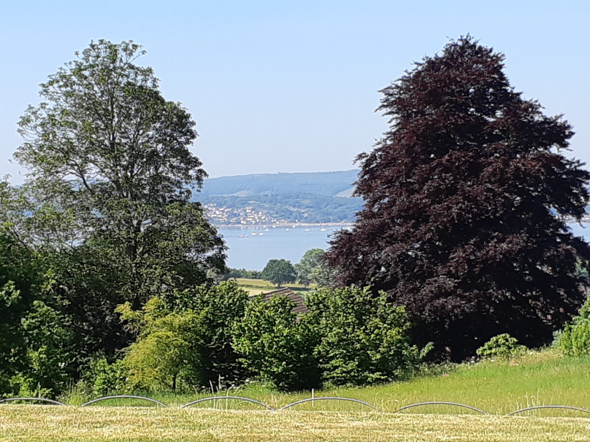
Sloping south-west towards the Exe estuary, the site has wide views to the Halden Hills to the west, and across Exmouth to the sea to the south.
The following is from the Register of Parks and Gardens of Special Historic Interest. For the most up-to-date Register entry, please visit The National Heritage List for England (NHLE):
Developed in the late 18th and early 19th century with further alterations in the late 19th century, A La Ronde and the associated grounds of the chapel, Manse and almshouses known as The Point in View, form a Regency ferme ornée. Ornamental landscape features are combined with more practical paddocks, orchards and kitchen gardens creating an ornamented estate.
Location, Area, Boundaries, Landform and Setting
A La Ronde is situated c 1.5km north-west of Exmouth and 0.5km south-east of Lympstone, to the south-east of Exmouth Road and the south of Summer Lane. The 10ha site comprises c 3.5ha of formal and informal gardens, a pleasure ground and orchard around the house, and a further area of c 6.5ha of meadow to the east and north-east which includes the land associated with The Point in View and the Manse.
Boundaries to the north, east and south are formed by mixed hedges with many mature oaks and other trees following public roads or footpaths, while those to the south-east and south-west adjoin gardens of C20 houses. The south-west boundary has been re-enforced by mixed native planting within the paddock to screen housing constructed on the site of the kitchen garden and orchard. The Bee Garden 80m south-east of the house projects from the south-east boundary and is surrounded on three sides by modern houses. Sloping south-west towards the Exe estuary, the site has wide views to the Haldon Hills to the west, and across Exmouth to the sea to the south.
Entrances and Approaches
The site is approached from a minor road, Summer Lane, which forms its northern boundary. An entrance c 160m east of the junction of Summer Lane with Exmouth Road leads to a pair of rustic wooden gates which replicate those shown in an engraving by L W Martens (1829). A modern drive turns east and south-east allowing access to the car park on the north-east side of the house, while the original drive continues south-south-east to a small carriage court adjacent to the north-east side of the house. This drive is enclosed to the north-east by a clipped hedge, and to the south-west by metal estate fencing which allows views of the house and over the paddock below.
The path shown on the 1838 Tithe map which led north-east from the house to The Point in View does not survive, and the chapel and Manse are now approached by separate entrances 270m and 375m respectively further east along Summer Lane. A tarmac path leads south-east from a field gate to the chapel, while a vehicular entrance gives access to a car park west of the Manse and bungalows.
Principal Building
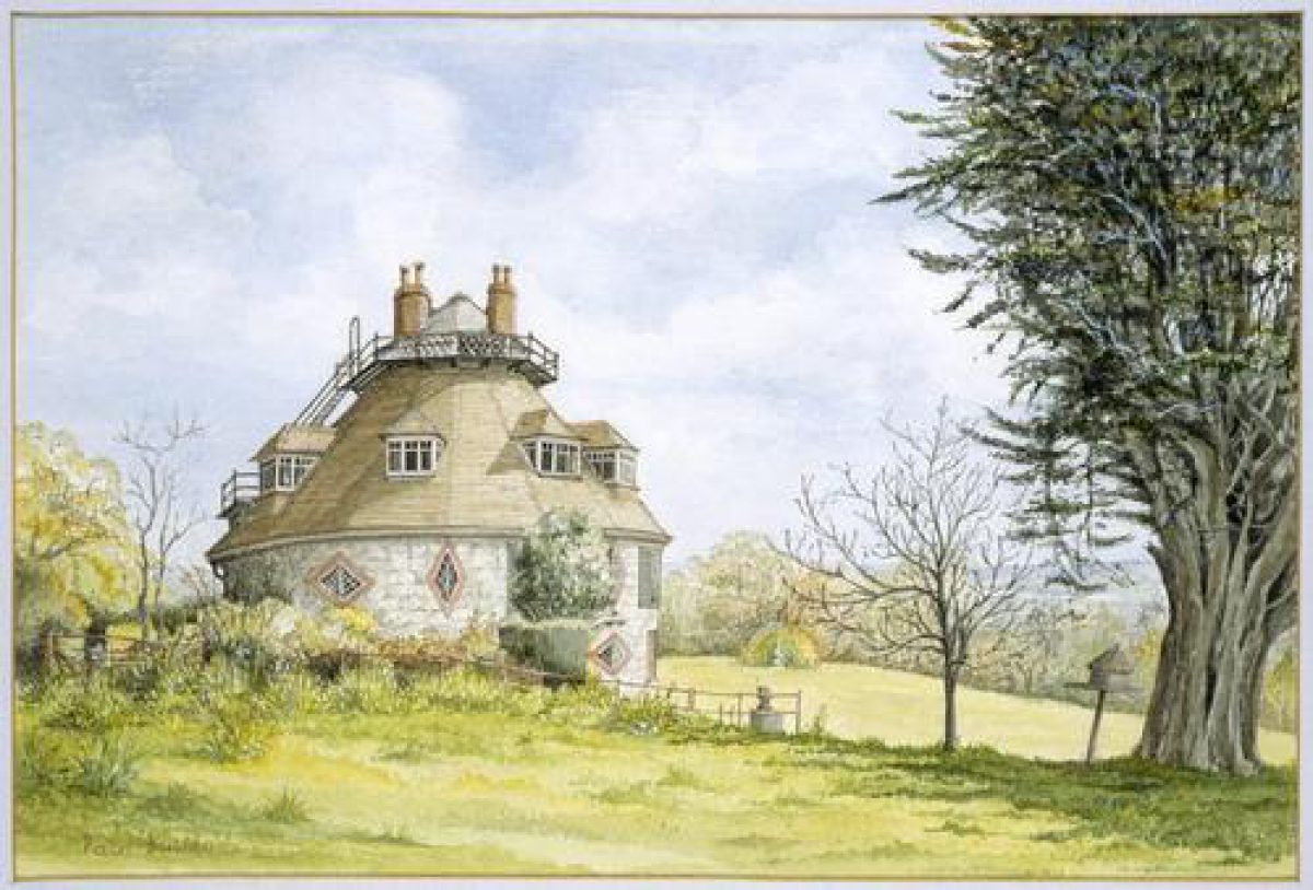
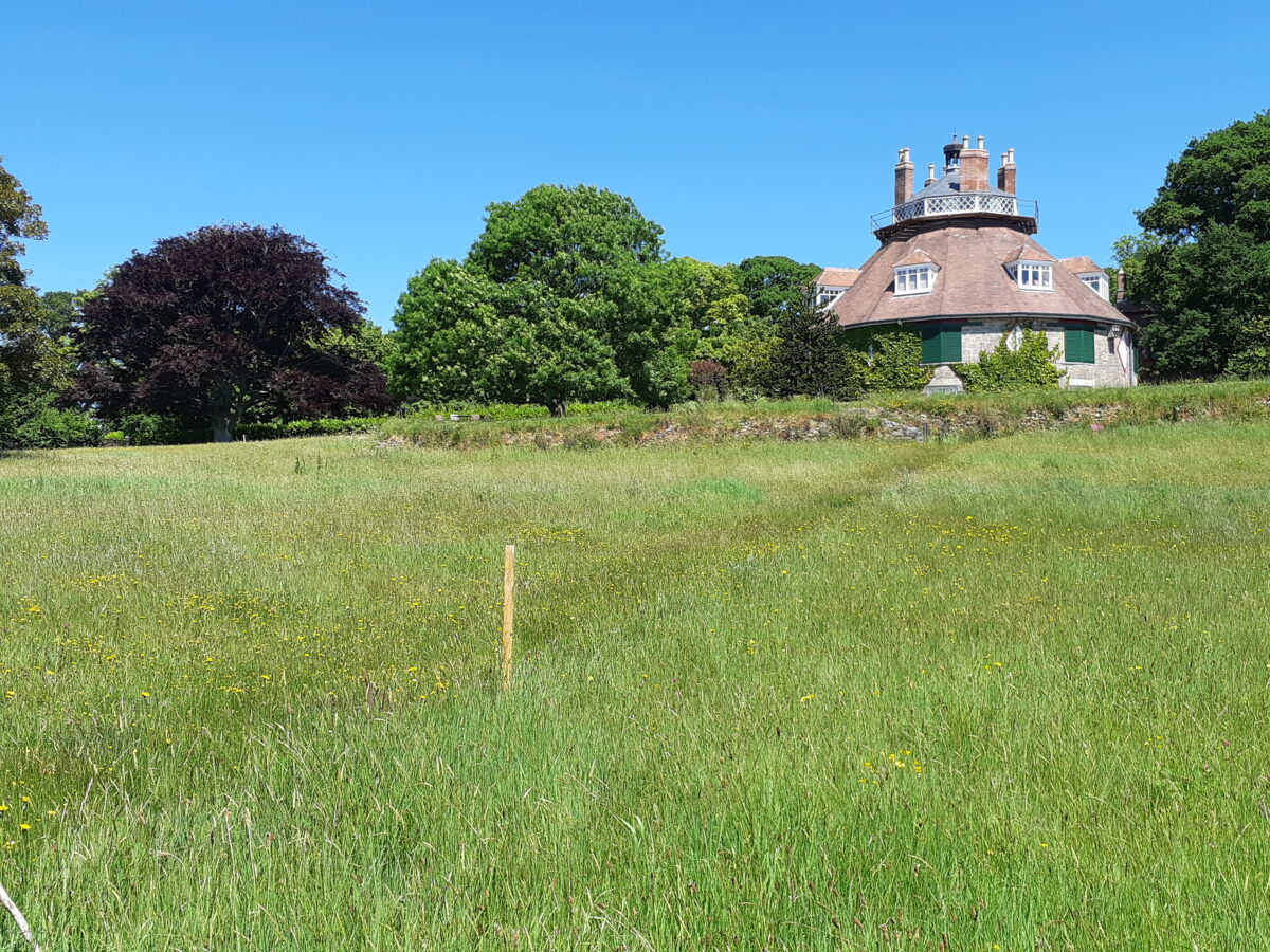
A La Ronde (listed grade I), built c 1798, was designed either by Jane Parminter herself, or by a young relation, John Lowder, and is said to have been inspired by San Vitale, Ravenna which the Misses Parminter had visited. Of unusual plan, the stone house has sixteen sides and was originally covered by a thatched conical roof terminating in an octagonal gallery and bell cupola. The roof was tiled and dormer windows inserted to light new rooms formed in the attic by Rev Reichel c 1890, and further internal alterations and changes to the fenestration were carried out.
A conservatory corridor was constructed linking the house to the barn and stables to the north-east, which had a further conservatory built against its south-west wall. The conservatory was demolished in the mid C20, but the tiled floor survives as a path. Originally of cob and thatch construction, the stable range was faced in brick and a brick water tower was built at the south end in the late C19. The stables are now used for visitor facilities.
Gardens and Pleasure Grounds
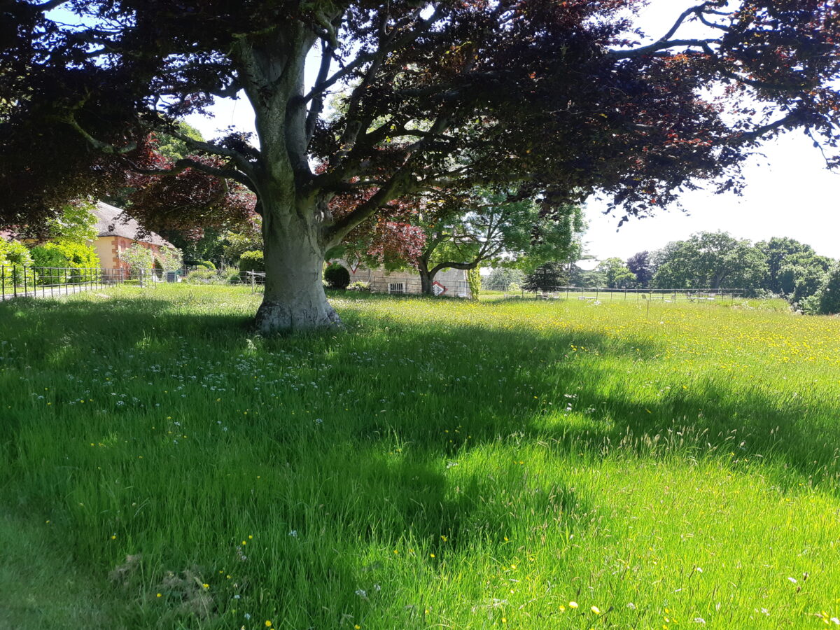
A drystone ha-ha (restored 1996-7) supports a square area of level lawn to the north, west and south of the house. Earth mounds in the lawn to the west and south of the house are of uncertain origin, while a pebble path (restored 1997-8) follows the outer edge of the lawn. The garden is separated from the drive to the north, and carriage court to the south, by banks of planting including bay, box, Robinia and Philadelphus. Monkey puzzles to the north and south of the house, and flower beds between the pebble path and ha-ha shown in late C19 photographs do not survive.
The axis of the original drive is continued south-south-east beyond the carriage court by a grass terrace walk which originally led into the perimeter walk around the paddocks. Enclosed to the north-east by mixed evergreen shrubs backed by mature trees, the walk is terminated to the north by a late C20 copy of the Venus de Milo, and to the south by a stone obelisk on a cobbled base (1995) commemorating the centenary of the National Trust, which replaced a former obelisk standing '200 yards to the west' (Duterloo 1996).
The obelisk is backed by shrubs which partly obscure the line of the early C19 perimeter walk which now turns south-west towards the Bee Garden, a rectangular enclosure to the south-east side of the walk bounded by earth banks to the north-east and south-east. The Bee Garden lacks the figs, mulberries and walnuts recorded in 1938 (CL), but the remains of a structure shown at the east corner in 1888 and 1905 (OS) survive. The Bee Garden has been laid out as a private garden in the late C20 with cobble paths, a pond and ornamental planting. The line of the walk south-west of the Bee Garden is now obscured, but some ornamental planting on the south and north sides of the paddock indicate its former route.
Sloping ground below the ha-ha and within the former perimeter walk is laid out as an ornamental paddock with scattered groups of specimen trees and shrubs including a copper beech to the north of the house, a large group of hazel to the north-west and a mature cedar to the south-west set in mown grass. To the north-east of the house and stables two paddocks enclosed by metal estate fencing form a poultry ground to the north-west and an orchard to the south-east. The orchard has been replanted with standard fruit trees and serves as a picnic area. This arrangement reverses the C19 plan, and the paddocks have been reduced on the north-east side to accommodate the late C20 car park.
Kitchen Garden
The site of the kitchen garden and orchard c 100m south-west of the house has been developed for housing and now lies outside the registered site. A section of kitchen garden wall survived on the south-west boundary of the site in 1996 (Duterloo), but was not located in 1998.
Other Land
The early C19 landscape extended to the north-east of the surviving pleasure grounds with a path linking the house to The Point in View c 300m north-east. This land remains in agricultural use with the exception of the immediate grounds of the chapel and Manse, and the gardens of Three Acres, a house on Summer Lane built in 1930. The Point in View (listed grade I), a low, square, white rendered building with a short lead spire, stands inside a square enclosure separated from the surrounding meadow by low concrete block walls which have replaced the lattice fences shown c 1845 (Kershaw engraving). The enclosure, which originally served as gardens to the almshouses within the chapel building, is still laid out as a garden with a mature standard apple, a mature oak and herbaceous planting.
The Manse (listed grade I) stands 50m north-east of the chapel in gardens separated from the meadow by metal estate fencing. Mature oaks behind the Manse and the late C20 bungalows to its north and south survive from early C19 planting shown on the 1838 Tithe map.
Maps
- Tithe map for Withycombe Raleigh parish, 1838 (Devon Record Office)
- OS 6" to 1 mile: 1st edition surveyed 1888, published 1890
- OS 25" to 1 mile:
- 1st edition surveyed 1888, published 1889/1890
- 2nd edition published 1905
- 1933 edition
Illustrations
- L W Martens, Cottage Near Exmouth, 1829 (National Trust Collection)
- Kershaw and Son, A view of A La Ronde from the south-west, c 1845 (West Country Studies Library)
- Kershaw and Son, A view of The Point in View from the north-west, c 1845 (West Country Studies Library)
- W Bounsall, Exmouth from A La Ronde, c 1850 (National Trust Collection)
- Watercolour, A view of A La Ronde from the north, c 1850 (National Trust Collection)
Archival items
- Photographs, views of A La Ronde, late C19 (National Trust Collection)
- Sale particulars for A La Ronde, 1929 (375/M/P1), (Devon Record Office)
- Sale particulars for A La Ronde, 1990 (National Trust Collection)
Description written: August 1998, Amended: May 2000
Register Inspector: JML
Edited: July 2000, March 2022
- Visitor Access, Directions & Contacts
Telephone
0844 800 1895Website
http://www.nationaltrust.org.ukAccess contact details
The A la Ronde house and gardens are open between March and November. For more detailed information regarding visitor opening visit the National Trust website.
No details are available for Point in View.
Directions
The property lies 2 miles north of Exmouth on the A376.
For more detailed directions visit the National Trust website.
Owners
The National Trust
Heelis, Kemble Drive, Swindon, SN2 2NA
- History
The following is from the Register of Parks and Gardens of Special Historic Interest. For the most up-to-date Register entry, please visit The National Heritage List for England (NHLE):
18th Century
A La Ronde was built on an undeveloped site comprising some 16 acres (about 6.5 hectares) which was purchased by Miss Jane Parminter and her cousin Mary in 1795. Jane Parminter was the daughter of a Devon merchant who owned a wine export business at Lisbon, and was initially brought up in Portugal.
Following her father's death in 1784, Jane and her sister Elizabeth, their orphaned cousin Mary and a female companion, undertook an extended European tour, visiting France, Italy, Germany, Switzerland and probably Spain and Portugal. Returning to England in 1795, Elizabeth Parminter died soon after, leaving her sister and cousin to settle near the newly fashionable resort of Exmouth, which was also home to Jane's married sister, Marianne Frend.
19th Century
The house and grounds were complete by the time of Jane Parminter's death in November 1811. Her will describes the garden and grounds, which were 'full of bowers, arbours, three obelisks - fountains, glass-houses and rare tropical plants, orangeries - also two milch cows and eighteen sheep grazing'. The will also included a clause providing that 'These oaks [on the estate] shall remain standing and the hand of man shall not be raised against them till Israel returns and is restored to the Land of Promise'. The arrangement of the gardens and grounds at A La Ronde is shown on the 1838 Tithe map: the house stood in a square enclosure at the centre of a group of four bell-shaped paddocks and orchards, with a boundary walk and kitchen garden to the west.
A path through meadows connected the house to the chapel and Manse (built 1829) to the north-east. The single structure comprising chapel, school and almshouse known as The Point in View was built about 300 metres north-east of the house during the summer of 1811. A deed of about 1813 set out its charitable purposes, which included the promotion of Christianity among the Jews, the accommodation of four elderly spinsters and the education of six girls. In all cases preference was to be given to Jewish converts, while the chapel was to be served by a dissenting minister.
Mary Parminter's will (1849) also included a description of the pleasure grounds which contained 'ornamental trees ... the new obelisk (pump) fountain shellery hothouse green houses and ornamental seats which shall be in or about my gardens shrubberies walks and grounds at A La Ronde'. Other garden features included a sundial, ornamental gates and lattice work, and some of these, together with grazing sheep and cattle in the paddocks, are shown in lithographs dated about 1845 (Kershaw and Son).
Mary Parminter sought to preserve the estate intact and limited inheritance to only unmarried kinswomen. The property thus passed to her unmarried cousins, Jane and Sophia Hurlock, while another cousin, Stella Reichel, inherited in 1879.
19th - 20th Century
Legal changes enabled her to pass the estate to her brother, the Reverend Oswald Reichel, who made significant alterations to the house and gardens between 1886 and 1923 which included the planting of monkey puzzles north and south of the house and the erection of a conservatory linking the house to the stables to the east. Reichel's widow wished to sell the property for development, but it was acquired by a niece, Margaret Tudor, who opened the house to the public in 1935. The orchard was compulsorily purchased for housing in about 1950, and further land was sold by Ursula Tudor Perkins after inheriting the property in 1973 to provide the house with an endowment.
In 1990 the house and about 10 acres (about 4 hectares) were offered for sale, and with the help of a grant from the National Heritage Memorial Fund it was purchased by the National Trust in 1991. Land to the north-east of A La Ronde is in private hands and is associated with a house, Three Acres, built by Julia Reichel in 1930. The area adjacent to the chapel, Manse and almshouses is the property of the Trustees of the Mary Parminter Charity. The Trustees erected three bungalows to the north of the Manse in 1971 to replace the original dwellings within the chapel building, and two further bungalows were built to the south of the Manse in 1978.
Period
- 18th Century (1701 to 1800)
- Late 18th Century (1767 to 1800)
- Features & Designations
Designations
The National Heritage List for England: Register of Parks and Gardens
- Reference: GD1677
- Grade: II
Features
- House (featured building)
- Description: This is a very unusual 16-sided house.
- Earliest Date:
- Latest Date:
- Ha-ha
- Landscape garden
- Description: A late-18th and early-19th century landscape garden with views.
- Orchard, Formal garden, Pleasure ground, Informal Garden
- Description: The 10ha site comprises c 3.5ha of formal and informal gardens, a pleasure ground and orchard around the house,
- Kitchen Garden
- Gates
- Description: A pair of rustic wooden gates
- Stables, Barn
- Description: A conservatory corridor was constructed linking the house to the barn and stables
- Water tower
- Description: A brick water tower was built at the south end in the late C19
- Chapel
- Description: The chapel and Manse are now approached by separate entrances
- Ha-ha
- Description: A drystone ha-ha (restored 1996-7) supports a square area of level lawn.
- Monkey puzzles
- Terraced Walk
- Description: Beyond the carriage court by a grass terrace walk
- Walk
- Description: The former perimeter walk is laid out as an ornamental paddock
- Kitchen Garden
- Description: kitchen garden wall survived on the south-west boundary of the site in 1996
- Key Information
Type
Ferme Ornee
Purpose
Ornamental
Principal Building
Domestic / Residential
Period
18th Century (1701 to 1800)
Survival
Extant
Hectares
4
Open to the public
Yes
Civil Parish
Exmouth
- References
References
- {English Heritage Register of Parks and Gardens of Special Historic Interest} (Swindon: English heritage 2008) [on CD-ROM] Historic England Register of Parks and Gardens of Special Historic Interest
- Pevsner, N {The Buildings of England: Devon} (Harmondsworth: Penguin, 1952) The Buildings of England: Devon
- Webb, W., (1872), pp 158-9 Memorials of Exmouth
- (30 April 1938), pp 448-52; no 28 (12 July 1990), p 71; no 5-31 January 1991), p 74; no 7 (14 February 1991), pp 38-41 Country Life, 83
- Jones, B., (1974), p 312 Follies, Grottoes and Garden Buildings
- Gray, T., (1995), p 33 The Garden History of Devon An illustrated guide to sources
- Duterloo, F., (unpublished historical survey 1996) The Garden History of Devon An illustrated guide to sources
- (National Trust 1991) A La Ronde, Devon, guidebook