Introduction
Belvoir Castle has partially reconstructed and restored gardens, originally laid out by the 5th Duchess of Rutland in 1799. The individual gardens were much influenced by Italian terraced gardens, which the Duchess observed on her Grand Tour.
Terrain
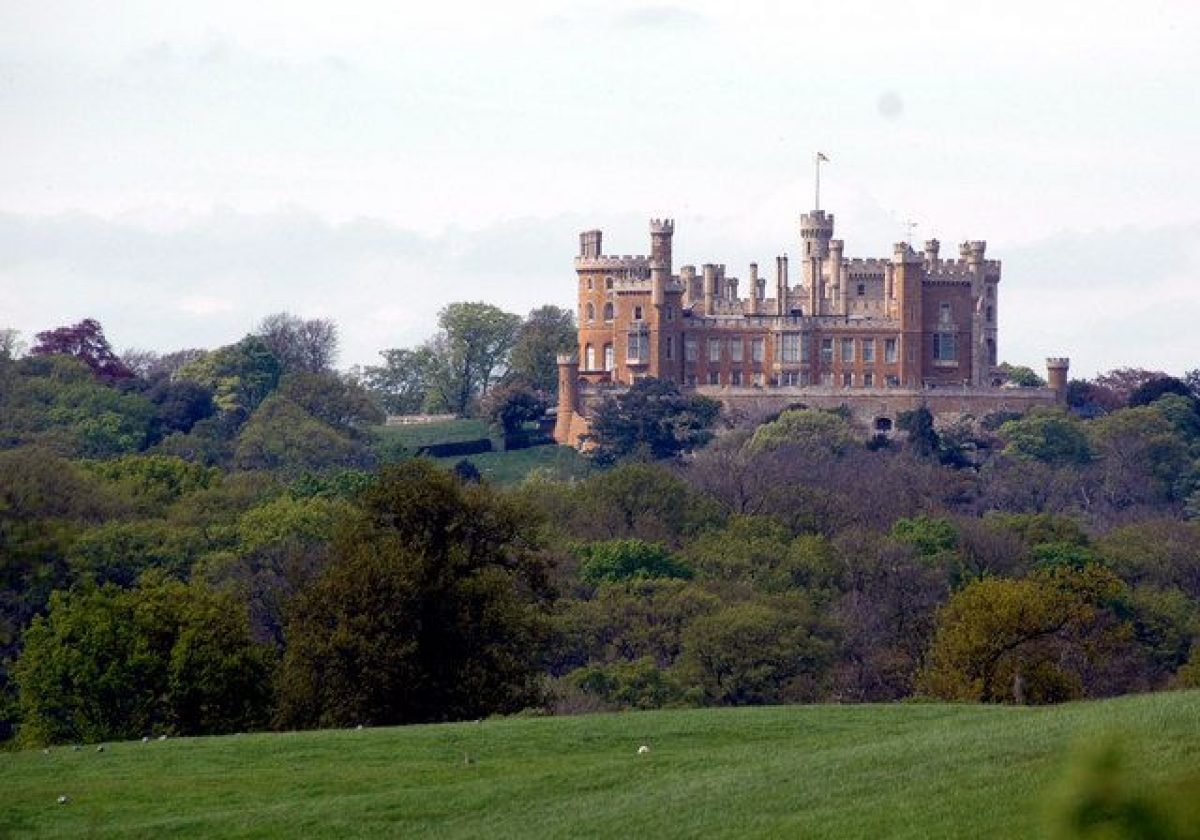
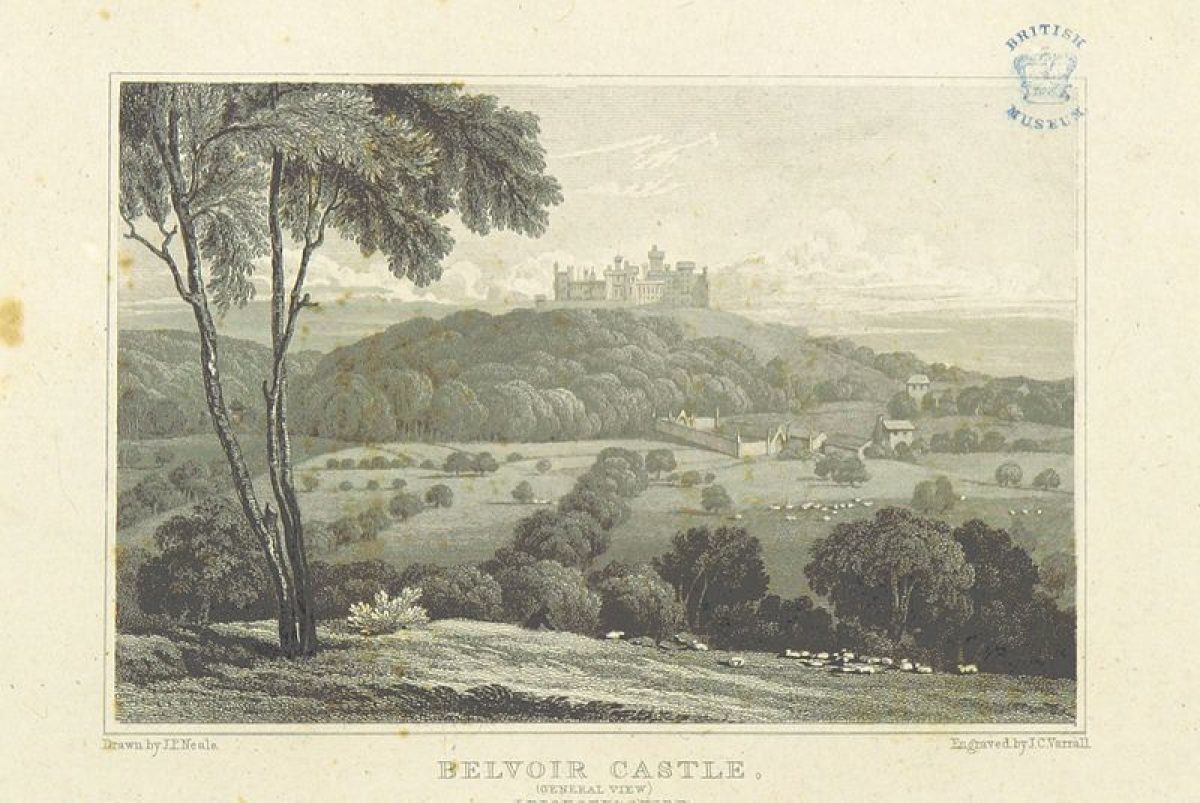
Belvoir Castle stands on an isolated hill on the south-east edge of the Vale of Belvoir over which it enjoys panoramic views.www.historicengland.org.uk/listing/the-list
Various gardens, mostly dating back to the early 19th century but incorporating later 17th-century elements, and an extensive landscape park, associated with a spectacular, early 19th-century, hilltop castle.
LOCATION, AREA, BOUNDARIES, LANDFORM, SETTING
Belvoir Castle stands 8 kilometres west of Grantham, close to the meeting points of Leicestershire, Nottinghamshire and Lincolnshire, on an isolated hill on the south-east edge of the Vale of Belvoir over which it enjoys panoramic views. The area here registered is roughly 660 hectares.
ENTRANCES AND APPROACHES
There are numerous approaches to the Castle. Most of them meet south-west of the Castle before a common drive approaches past the Rose Garden and the Battery to enter the west side of the courtyard. The main private drive enters the grounds 300m north of the Castle, via a gate shared with the drive to the estate yard. It then curves around the north-west side of the Castle hill.
Other approaches, through the park, are longer. From the east there is a 3.5km long drive from The Lodge, an ornate two-storey stone building of 1885, 1km east of Woolsthorpe. This curves along a plateau above Woolsthorpe, where the drive (here Foster's Avenue) is tree lined, with panoramic views towards the Castle and across the Vale of Belvoir beyond. The drive then drops, crossing the bridge between the two lakes, before running through Middlesdale towards the main approach to the Castle. A second drive, from the south-east, enters the park past an ornate mid C19 lodge 600m north-east of Knipton village. This runs on a straight line roughly north, west of the Upper Lake and Belvoir Hunt Kennels, to join the Woolsthorpe drive 500m north-east of the bridge. A third approach is from the north-west, by a long straight avenue from Redmile.
PRINCIPAL BUILDING
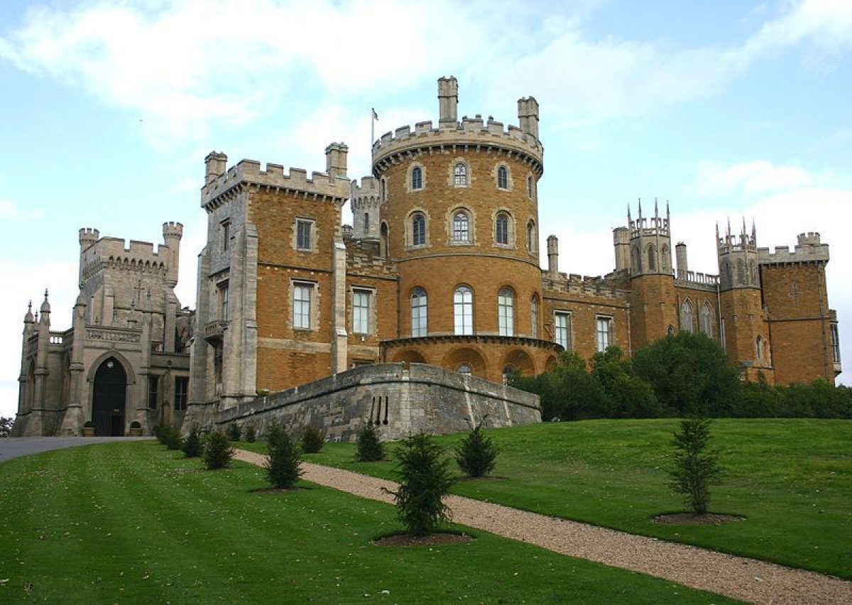
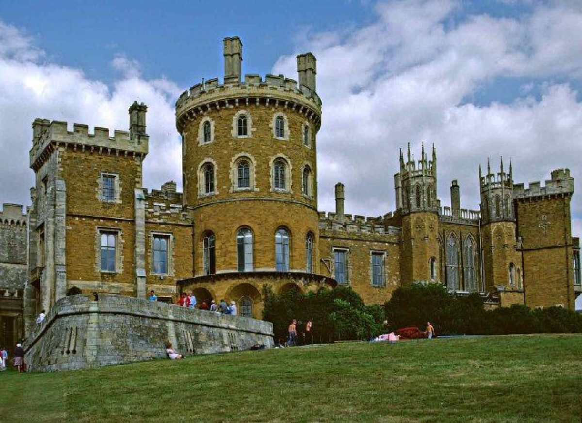
A hilltop castle was established here, overlooking the Vale of Belvoir, in the late C11. Major rebuildings took place in the earlier C16, by John Webb (d 1672) 1654-68 after Civil War slighting, and in the early C19. The last works began after the fifth Duke came of age in 1801 when Matthew Wyatt (d 1813) was brought in to rebuild Belvoir. In 1816, by when the south-west and south-east fronts were complete, a great fire destroyed the north-west and north-east fronts. Their reconstruction was directed by the Rev Sir John Thoroton (d 1820), rector of Bottesford and friend of, and domestic chaplain to, the Duke. He was assisted by Elizabeth, Duchess of Rutland, who had been brought up at Castle Howard (Yorkshire, qv) and was likewise an enthusiastic amateur architect. Before her death in 1825 the Duchess was was also responsible for laying out new gardens and enhancing the Castle's setting. The Castle (listed grade I) is little changed since the early C19, a massive, quadrangular, hilltop feudal palace with a skyline of turrets and battlements. Its main feature is Thoroton's huge projecting tower on the centre of the north-east front, which echoes Wyatt's tower on the south-west side.
At the bottom of the slope, 200m north-east of the Castle, is a U-plan two-storey ironstone stables block (listed grade II*) of 1704-5 by John Barker (d 1727), now used as offices and for accommodation. Within its courtyard is an exercise ring (listed grade II*) of c 1819, probably the earliest free-standing structure of its kind in England and occupying an important position in the history of hunting. About 20m north-east of Barker's stables are others (listed grade II) of the early C18, while 15m south of the former is a six-bay house (listed grade II) of the early C18. Of similar date is Brewery Row (listed grade II), a row of four houses 25m south-east of Barker's stables.
GARDENS AND PLEASURE GROUNDS
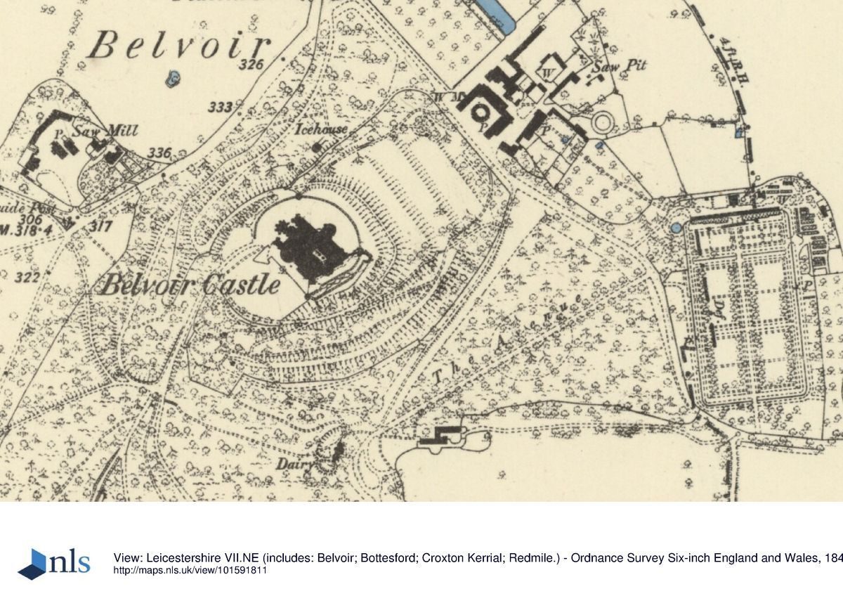
North-east of the Castle, descending the hillside to the stables complex, is a flight of three broad terraces. On the middle one is a swimming pool and hard tennis court. On the north-west side of the terraces is an icehouse (listed grade II) of c 1830.
A broad walled terrace runs around the north and west sides of the Castle. From this there is access to the Battery, a 20m long bastion-like crenellated projection armed with C18 canon, which projects south-west of the Castle to command the main approach from the south-west. Believed to represent the motte of the Norman castle, the Battery was remodelled as a promenade ground and is shown thus on Badeslade's views of 1731. The present Battery, which is considerably smaller, represents an early C19 remodelling.
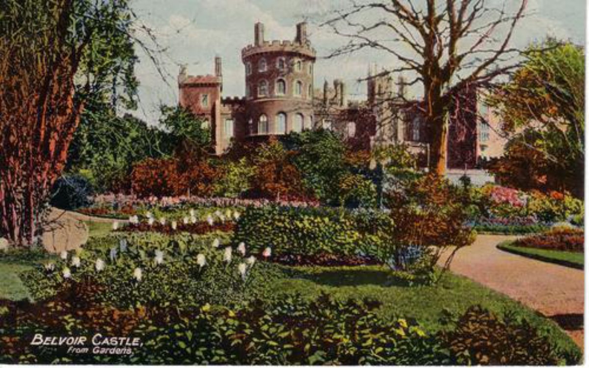
The Battery overlooks a lawn leading to the Rose Garden with flagged paths and geometric beds, which occupies the sloping ground south-west of the Castle. It was laid out early in the C20 by Violet (d 1937), wife of the eighth Duke. Yew hedges run around the north-west and north-east sides of the garden, along the top (north-east) of which, alongside a stone terrace wall, runs a curving terrace path with mature specimen trees. This path appears to be the broad walk along which Cibber's statues were placed shown on Badeslade's views of 1731. A statue of Winter (listed grade II*) of c 1680 by Caius Gabriel Cibber (d 1700) stands at the head of an axial path which leads from the terrace path on a south-westerly line, while close to the east end of the terrace path is a C17 Chinese statue of a horse brought to Belvoir in 1831. C17 stone urns along the path were brought from the family home at Chieveley, near Newmarket, demolished pre 1914.
At the bottom of the axial path down the Rose Garden, 110m south-west of the Castle, is a stone bastion, which in the early C20 supported a rustic summerhouse. Beneath the bastion is a gothic-arched seat, which overlooks the Statue Garden. This, approached via an elaborately stone-balustraded path with urns and rockwork (all probably earlier C19) at its north-west corner, comprises six further life-size statues (Juno, Taste, Smell, Spring, Summer, Autumn: all listed grade II*) of c 1680 by Cibber, arranged in two curving rows down a steeply-sloping grass slope. Across the bottom of the slope is a terrace, at one end of which is a stone bench seat. It seems likely that the Statue Garden was among the early C19 gardening works at Belvoir. In 1905 there was massed bedding in the Statue Garden.
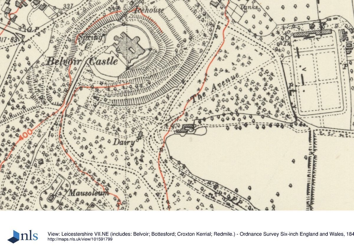
From south-west of the Statue Garden a terrace path passes through ornamental woodland to the Duchess', or Spring, Garden, created c 1810 by the Duchess of Rutland. This comprises walks around a natural south-facing amphitheatre-like embayment c 180m in diameter, well planted with mature specimen trees, shrubs and other plants. On the main grass terrace path around the north side of the garden is the Duchess' Seat, a splendid hexagonal roothouse (listed grade II) of c 1810, with thatched roof, moss-filled walls, and rustic furniture. East of it is a low inscribed column topped with a vase.
North-west of the Duchess' garden, and c 450m south-west of the Castle, is the family Mausoleum (listed grade II), a limestone building of 1826-8 in the Romanesque style by Benjamin Dean Wyatt (d 1855) and Philip Wyatt (d 1835).
Like the Castle, the gardens were remodelled after the Civil War, and the results are shown in illustrations by Badeslade of 1731. Descending from Castle to stables is a flight of terraces, which survive in simplified form today. East of these, in the vicinity of the later walled kitchen garden, was an extensive geometric wilderness or labyrinth, suggested by Harris (1995, 60) to be the product of garden works recorded at Belvoir for the third Duke after 1721. South of this, running around the eastern and southern slopes of the Castle mound, were concentric plantations, perhaps terraced. Cibber's statues, for which there is a contract of 1680 for the seven, at £35 each, can be seen spaced regularly along a broad walk around the bottom of the Battery. This scheme had been much simplified by 1744, and by the early C19 had been virtually obliterated.
PARK
Belvoir's park extends for c 2km east, west and south of the Castle. Around the hill on which the Castle stands, through the low ground of Middlesdale to its south, and around the sides of Blackberry Hill which rise south of that, is woodland, largely of an ornamental character. The plateau on top of Blackberry Hill is open ground, and earlier in the C20 was used as a private golf course. Frog Hollow pool lies in the valley between Blackberry Hill and the rising ground of Granby Wood to its south. In 1905 there was a bog garden here. South-west of this, along the edge of the park, extensive elder woods were planted in the 1990s, the flowers of which were gathered for a locally manufactured beverage. North-west of Castle and Blackberry Hills the park slopes down into the Vale of Belvoir. This land, West Wong, is arable land with some clumps of trees.
North-west of the estate yard, 300m north-east of the Castle, are two fishponds. One is 200m long, the other (named Westminster) 100m. Some 200m to the west, on the edge of the registered area, is the site of a medieval Benedictine priory. Until the Civil War there is also believed to have been a village here, sited between the priory and the estate yard 300m to the south-east.
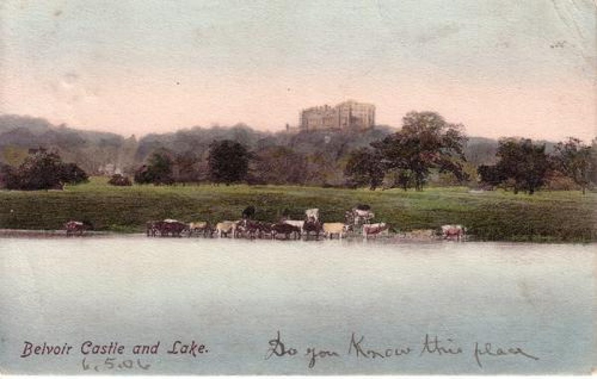
Set against the bottom of the wooded slope of the Castle and 250m to its south is Dairy Cottage (listed grade II), built c 1810, probably by James Wyatt, as an ornamental dairy. This has an octagonal, two-storey, central block with pavilions to either side. It looks down a grass paddock, on the east side of which, c 75m from the dairy, is a wooden, six-bay, thatched cowhouse (now used for timber seasoning), probably contemporary with the dairy. The pasture looks towards Lower Lake, the more northerly of two sheets of water on the River Devon, each 500m long and separated by an early C19 five-arched stone bridge (listed grade II). On the west bank of Upper Lake, 100m south-west of the bridge, are the Kennels (listed grade II) of the Belvoir Hunt, founded in 1740 and always among the country's most prestigious. Four-sided with turrets to the corners, the complex was designed in 1802 to accommodate four packs of hounds. South-west of the kennels is Knipton Pasture, a 1km long tract of level ground, now arable. East of Upper Lake is the Devan, steeply-rising permanent pasture, well studded with mature specimen trees. East of Lower Lake the ground, crossed by the drive from east of Woolsthorpe, climbs slightly less steeply, although again there are large numbers of mature trees. As the drive reaches the top of the slope, 200m south-east of Woolsthorpe church, it passes an irregular area of wooded ground, Holywell Wood, within which are springs and a Holy Well. East of Holywell Wood the park is permanent pasture.
The medieval Belvoir park, created in 1306 and probably disparked in the 1460s, lay in Redmile, north-west of the later park. When the present park was created is unknown, although during the period of post-Civil War reconstruction seems probable. There was certainly a deer park here by 1731. In 1780 Lancelot Brown (1716-83) was consulted on landscaping Belvoir and improving the Castle, but although detailed drawings were prepared (at a cost of £496) his ideas were not implemented. As seen today the park is very much a product of the early C19 landscaping and gardening at Belvoir.
KITCHEN GARDEN
At the bottom of the wooded slopes of the hill below the Castle are ornate, early C19, brick-walled kitchen gardens (listed grade II) of playing card plan. They are aligned north/south, and measure 220m long by 120m wide. The northernmost quarter is divided off by a wall, broken in the centre to allow an axial view down the garden from the mid C19 gothic Garden House (listed grade II) situated 50m north of the walled garden. This looks through to a highly ornate iron-gated entrance, with ornate limestone detailing to the arched surround in the centre of the south side. Similar gates lie on the east and west sides of the northern compartment. Other entrances are pedimented, and these alternate with octagonal columns topped with decoratively carved limestone ogee capitals. Some gardening still went on in the northern compartment in 1998; the main garden area was grazed, and lines of young trees ran down the centre. Along the north wall is a full range of brick sheds with lancet doors and windows. Various glasshouses and other structures, some of C19 date, stand outside the north-east corner of the garden.
The precise date of the garden walls remains to be established. Almost certainly it is they which are alluded to in an 1831 description of Belvoir (Gardener's Magazine 1831), and it would therefore seem likely that they were among the early C19 improvements by the Duchess and her professional advisers.
REFERENCES Used by English Heritage
T Badeslade and J Rocque, Vitruvius Britannicus 4, (1739), plates 47-50
Gardener's Magazine 7, (1831), pp 421-2
Country Life, 4 (27 August 1898), pp 240-3; (3 September 1898), pp 272-5; 120 (6 December 1956), pp 1284-90; (13 December 1956), pp 1402-5
The Gardeners' Magazine, (11 March 1905), pp 165-8
Transactions of the Leicestershire Arch Hist Society 46, (1970-1), p 19
D Stroud, Capability Brown (1975), p 217
J Harris, The Artist and the Country House (1979), pp 167, 179
J Harris, The Artist and the Country House (1995), p 60
M Symes, Garden Sculpture (1996), pp 31-2
Maps
OS 6" to 1 mile:
Leicestershire sheet 7 NE, 1st edition 1891, surveyed 1883-6; 2nd edition 1904, surveyed 1902; 1952 edition
Leicestershire sheet 7 SE, 1st edition published 1888; 2nd edition published 1904; 1950 edition
Leicestershire sheet 8 NW, 1st edition 1890, surveyed 1884-6; 2nd edition 1905, surveyed 1902-3; 1950 edition
OS 25" to 1 mile:
Leicestershire sheet 7.4, 2nd edition published 1907
Leicestershire sheet 7.8, 2nd edition published 1904
Description written: July 1998
Edited: June 1999
- Visitor Access, Directions & Contacts
Telephone
(0)1476 871001Website
https://www.belvoircastle.comAccess contact details
The gardens are open between March and October, Sunday to Thursday inclusive.
Directions
http://www.belvoircastle.com/contact/visit-us
Owners
Duke and Duchess of Rutland
- History
The following is from the Register of Parks and Gardens of Special Historic Interest. For the most up-to-date Register entry, please visit the The National Heritage List for England (NHLE):
www.historicengland.org.uk/listing/the-list
HISTORIC DEVELOPMENT
In the Middle Ages Belvoir Castle was held by the Ros family, passing by marriage in the later 15th century to that of Manners. Sir Thomas Manners (died 1543) was created first Earl of Rutland in 1526, and ever since Belvoir has descended with the earldom (from 1703 dukedom). It remains (1998) in private hands.
- Associated People
- Features & Designations
Designations
The National Heritage List for England: Register of Parks and Gardens
- Reference: GD1955
- Grade: II
Features
- Summerhouse
- Castle (featured building)
- Description: The present Castle is the fourth to have stood on the site in the last one thousand years. The existing Castle was completed in the early-19th century after previous buildings suffered complete or partial destruction during the Wars of the Roses, the Civil War and a major fire in 1816.
- Earliest Date:
- Latest Date:
- Approach
- Description: There are numerous approaches to the Castle.
- Gate Lodge
- Description: The Lodge, an ornate two-storey stone building.
- Earliest Date:
- Latest Date:
- Stable Block
- Description: A U-plan two-storey ironstone stables block.
- Earliest Date:
- Latest Date:
- Animal Enclosure
- Description: An exercise ring, probably the earliest free-standing structure of its kind in England and occupying an important position in the history of hunting.
- Earliest Date:
- Latest Date:
- Stable Block
- Description: About 20m north-east of Barker's stables are others of the early-18th century.
- Earliest Date:
- Latest Date:
- Building
- Description: Brewery Row, a row of four houses 25 metres south-east of Barker's stables.
- Terrace
- Description: North-east of the Castle, descending the hillside to the stables complex, is a flight of three broad terraces.
- Pool
- Description: Swimming pool.
- Icehouse
- Description: On the north-west side of the terraces is an icehouse.
- Earliest Date:
- Latest Date:
- Bastion
- Description: The Battery, a 20 metre long bastion-like crenellated projection armed with 18th-century canon, which projects south-west of the Castle to command the main approach from the south-west.
- Lawn
- Description: The Battery overlooks a lawn.
- Rose Garden
- Description: Rose Garden with flagged paths and geometric beds.
- Earliest Date:
- Latest Date:
- Specimen Tree
- Statue
- Description: A statue of Winter stands at the head of an axial path.
- Earliest Date:
- Latest Date:
- Statue
- Description: Seventeenth century Chinese statue of a horse brought to Belvoir in 1831.
- Earliest Date:
- Latest Date:
- Urn
- Description: Seventeenth century stone urns along the path were brought from the family home at Chieveley, near Newmarket.
- Earliest Date:
- Latest Date:
- Bastion
- Description: 110 metres south-west of the Castle, is a stone bastion.
- Garden Seat
- Description: Gothic-arched seat, which overlooks the Statue Garden.
- Path
- Description: An elaborately stone-balustraded path with urns and rockwork.
- Statue
- Description: There are six further life-size statues (Juno, Taste, Smell, Spring, Summer, Autumn), arranged in two curving rows down a steeply-sloping grass slope.
- Earliest Date:
- Latest Date:
- Garden Seat
- Description: Stone bench seat.
- Planting
- Description: The Duchess', or Spring, Garden, created around 1810 by the Duchess of Rutland. This comprises walks around a natural south-facing amphitheatre-like embayment some 180 metres in diameter, well planted with mature specimen trees, shrubs and other plants.
- Earliest Date:
- Latest Date:
- Root House
- Description: The Duchess' Seat, a splendid hexagonal roothouse, with thatched roof, moss-filled walls, and rustic furniture.
- Earliest Date:
- Latest Date:
- Column
- Description: A low inscribed column topped with a vase.
- Mausoleum
- Description: The family Mausoleum, a limestone building of 1826-8 in the Romanesque style by Benjamin Dean Wyatt and Philip Wyatt.
- Earliest Date:
- Latest Date:
- Terrace
- Description: Descending from Castle to stables is a flight of terraces, which survive in simplified form today.
- Labyrinth
- Description: In the vicinity of the later walled kitchen garden, was an extensive geometric wilderness or labyrinth, suggested by Harris (1995, 60) to be the product of garden works recorded at Belvoir for the third Duke after 1721.
- Earliest Date:
- Pool
- Description: Frog Hollow pool lies in the valley between Blackberry Hill and the rising ground of Granby Wood to its south.
- Fishpond
- Description: 300 metres north-east of the Castle are two fishponds.
- Dairy
- Description: Dairy Cottage was probably created by James Wyatt as an ornamental dairy. This has an octagonal, two-storey, central block with pavilions to either side.
- Earliest Date:
- Latest Date:
- Garden Building
- Description: A wooden, six-bay, thatched cowhouse (now used for timber seasoning), probably contemporary with the dairy.
- Earliest Date:
- Latest Date:
- Lake
- Description: Lower Lake, the more northerly of two sheets of water on the River Devon.
- Ornamental Bridge
- Description: An early-19th-century five-arched stone bridge.
- Earliest Date:
- Latest Date:
- Kennels
- Description: On the west bank of Upper Lake are the Kennels of the Belvoir Hunt, founded in 1740 and always among the country's most prestigious. Four-sided with turrets to the corners, the complex was designed in 1802 to accommodate four packs of hounds.
- Earliest Date:
- Latest Date:
- Lake
- Description: Upper lake.
- Kitchen Garden
- Description: Ornate, early-19th century, brick-walled kitchen gardens of playing card plan. They are aligned north/south, and measure 220m long by 120m wide.
- Earliest Date:
- Latest Date:
- Garden House
- Description: The mid-19th-century gothic Garden House situated 50m north of the walled garden.
- Earliest Date:
- Latest Date:
- Entrance
- Description: A highly ornate iron-gated entrance in the kitchen garden, with ornate limestone detailing to the arched surround.
- Glasshouse
- Description: Various glasshouses and other structures, some of 19th-century date, stand outside the north-east corner of the garden.
- Gardens
- Key Information
Type
Estate
Purpose
Ornamental
Principal Building
Domestic / Residential
Survival
Reconstructed
Hectares
660
Open to the public
Yes
Civil Parish
Belvoir
- References
References
- {English Heritage Register of Parks and Gardens of Special Historic Interest}, (Swindon: English Heritage, 2008) [on CD-ROM] Historic England Register of Parks and Gardens of Special Historic Interest
- Stroud, D., {Capability Brown} (London: Faber, 1975), p.217 Capability Brown
- Harris, J., {The Artist and the Country House} (London: Russell Chambers, 1979), pp. 167, 179 The Artist and the Country House