
Introduction
Mamhead consists of 18th-century parkland and woodland covering about 400 hectares, now in divided use and ownership. There are the remains of 19th-century formal gardens beside the house.
Terrain
The site occupies an east-facing hillside which rises to a ridge of high ground about 500 metres west of the House.The following is from the Register of Parks and Gardens of Special Historic Interest. For the most up-to-date Register entry, please visit the The National Heritage List for England (NHLE):
www.historicengland.org.uk/listing/the-list
C18 parkland partly attributed to Lancelot Brown, with mid C18 landscape structures, around an early C19 mansion with formal terraced gardens.
Location, Area, Boundaries, Landform and Setting
Mamhead Park is situated c 5km north-west of Dawlish and c 4.5km west of the village of Starcross and the Exe estuary, to the south of the former B3381 road which leads west from Starcross to Little Haldon. The c 166ha site comprises some 7ha of gardens and pleasure grounds around the House and Orangery, c 90ha of parkland, and c 69ha of plantations. To the north the site is bounded by the former B3381 road, while to the east it is enclosed by minor roads, domestic properties and farmland. To the south and south-west the boundaries are formed by further minor roads and agricultural land, while to the west the site adjoins woodland.
The site occupies an east-facing hillside which rises to a ridge of high ground c 500m west of the House. From the House the park falls gradually to the south-east boundary of the site. The site has wide views east towards Powderham Castle (qv) and the Exe estuary, and towards the sea to the south-east. To the north of the former B3381 road the site adjoins the wooded grounds of Oxton House (qv). Some 3km south-south-west of the House and outside the site here registered, Ashcombe Tower (listed grade II) is an early C19 folly, possibly designed by Salvin, which was intended as an eyecatcher; the building was converted into a country house by Brian O'Rorke in 1933-6.
Entrances and Approaches
The site is approached from the former B3381 road to the north. Late C20 wing walls flank the entrance which lies opposite the early C19 Pier Lodge (listed grade II) some 300m north of the House. The tarmac drive extends c 270m south-south-east through woodland and shrubbery on an east-facing slope, before turning south-east for c 100m and descending to the stables (listed grade II*) to the north and above the House. Designed by Salvin in 1828-33, the red sandstone stable block is modelled on Belsay Castle, Northumberland (qv) and comprises a massive, squat gatehouse with a portcullis door, which leads to the stable court with south and west ranges of stables, and a three-storey brewery to the south-east with battlements and corner turrets.
From the forecourt north of the stables the drive sweeps down north and east, before turning south to approach the carriage court on the north side of the House. Entered between cast-iron gate piers to the north-east, the carriage court comprises a roughly circular terrace with a circular central lawn and flower bed. To the west the court is enclosed by a rocky bank planted with evergreen shrubbery, while to the east the perimeter is marked by Irish yews which stand above grass banks which descend to the gardens.
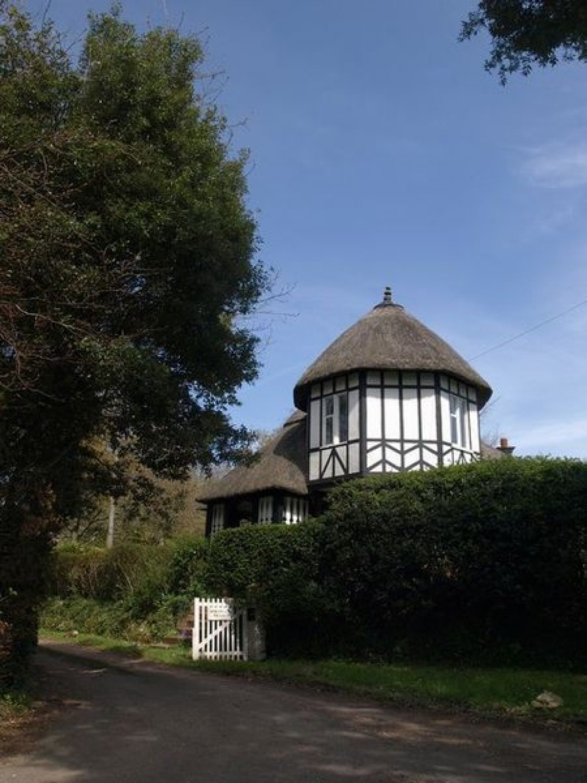
A north-east drive formerly approached the site from the C19 Black Forest Lodge c 1.5km north-east of the House on the B3381. The drive now (1999) continues as a track, passing south and west through a mixed plantation, Black Forest, for c 900m to reach the minor road which forms the eastern site boundary, which here runs in a cutting. A walk was formerly carried over the road on an arch to the north of Arch Lodge (listed grade II) which stands to the south of the drive on the west side of the road and is today (1999) known as Forest Gate. Built to designs by Salvin c 1828-33, the red sandstone lodge is thatched with ornamental bargeboards and late C20 alterations. A late C20 house, Oakleigh, stands to the west of Arch Lodge.
The north-east drive passes south-west and west across the park for c 850m, to join the main drive some 130m north of the House. A south drive enters the site c 670m south of the House from the minor road forming the southern site boundary. Dawlish Lodge (listed grade II), a sandstone and rendered, imitation half-timbered, thatched picturesque lodge designed by Salvin in 1828-33 stands east of a simple timber gate at the south entrance.
The drive passes north c 270m through late C20 coniferous plantations, before entering the park c 320m south of the House and turning west and north to pass below the garden terraces and join the main drive c 130m north of the House. West of Mamhead parish church c 270m south of the House, a subsidiary drive leads west and north-west c 300m through C18, C19 and C20 gardens to the Orangery. The junction of this drive with the south drive is marked by a C19 conifer enclosed within a circular arrangement of early C19 spiked iron railings (listed grade II). A further subsidiary drive, now (1999) a footpath, leads south-east from the south drive at a point c 400m south-south-east of the House to the kitchen garden. A late C20 bungalow has been built below the garden terraces adjacent to the south drive c 100m north-east of the House. The pattern of drives and walks around the House reflects that shown on the Tithe map (1839).
Principal Building
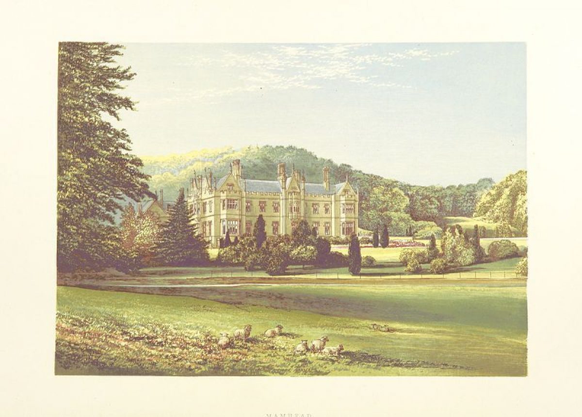
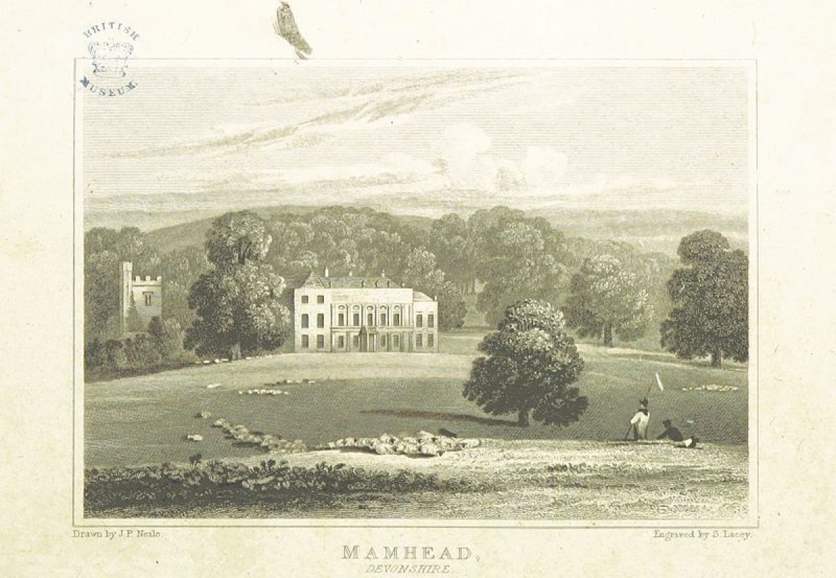
Mamhead House (listed grade I), also known as Mamhead Park, was built to designs by Anthony Salvin in 1828-33 on foundations laid for a projected Italianate mansion designed by Charles Fowler in 1822. The present mansion replaced a C17 house remodelled by Robert Adam in 1769, which stood north of the parish church, some 200m south-south-east of its replacement. Plans supplied by Adam in 1777-80 for a new house were not implemented (CL 1955).
Salvin's mansion stands on a level terrace below the steep east-facing escarpment, set above parkland. Salvin's first major country house, it is symmetrical with a principal east wing overlooking the garden terraces, and a lower west wing containing service quarters enclosing a courtyard. The House is entered from the north, while to the south-west a conservatory extends from the south facade and terminates in a two-storey pavilion. The balustrade of the conservatory contains a carved quotation from Chaucer's Roman de la Rose above four tall perpendicular windows. The House is principally of two storeys with Tudor-gothic gables, pinnacles, windows and embattled parapets. It is constructed in Bath stone.
Gardens and Pleasure Grounds
The gardens comprise formal terraces to the east and south of the House, with informal pleasure grounds associated with the Orangery to the south and south-west. Salvin's perspective design (1828) shows a circular carriage court north of the House, and a stone balustraded terrace and grass banks above the south drive, which conforms to the arrangement shown on the Tithe map (1839). A wide gravelled terrace extends south from the carriage court below the east front, and is retained by a high, buttressed stone wall (listed grade II*).
The east terrace leads south to a sunken parterre surrounded by gravel walks which projects east in a semicircular bastion planted with Irish yews. Stone steps flanked by urns (listed grade II*) to the north, west and south descend from the outer walk to cruciform gravel walks which separate four geometric grass panels containing flower beds. At the intersection of the gravel walks a stone-walled pool of round-lobed quatrefoil shape contains a Renaissance-style tazza fountain (all listed grade II*) which was designed c 1828-33 by Salvin. An early C19 stone bench seat (listed grade II) is placed axially to the south of the sunken garden. The semi-circular eastern section of the sunken garden is laid out with a series of segmental flower beds with narrow turf edges, separated by gravel walks, which radiate from a centrally placed stone, Jacobean-style baluster sundial (listed grade II*) which was designed by Salvin in 1828(33.
Below the upper east terrace a wide grass terrace and gravel walk runs north to south with a central semicircular bastion containing a circular bed projecting to the east. Grass banks descend to a lower terrace which has the remnants of a mid C19 symmetrical scheme of rhododendrons, monkey puzzles and other specimen trees and shrubs. To the south the lower terrace contains a mid C20 swimming pool. Mid C19 planting on the terraces was undertaken by Veitch of Exeter, and Lucombe and Pince of Exeter (Gray 1995). The pleasure grounds lie to the south and south-west of the House, and comprise areas of lawn and groups of specimen trees and shrubs planted on an east-facing slope.
The bank to the west of the House is formed into two wide terraces, and was formerly planted (aerial photograph 1952, in Binney and Hills 1979), but is now (1999) grass. Some 190m south-west of the House, the Orangery (listed grade II*) stands towards the head of a valley running from west to east. Built for Thomas Balle in about 1740, the Orangery was originally a water house standing at the head of a cascade (CL 1955). The single-storey stone building was converted into a temple by Robert Adam in 1769, and subsequently into a dwelling (ibid). A central five-sided pavilion is crowned by a dome and cupola, and flanked by wings with urn-decorated balustrades to north and south. The Orangery stands on a terrace, with a further area of levelled ground to the east, and has wide views east across the park to the Exe estuary, now partly obscured by late C20 conifers. The valley below the Orangery contains C18, C19 and C20 specimen trees and shrubs. The Tithe map (1839) shows the two terraces below the Orangery, and a formal canal with a central circular pool, together with two further formal ponds and an irregular pool on the hillside c 130m south-west of the Orangery. With the exception of the surviving irregular pool, these features were removed by 1888 (OS), and appear to relate to the mid C18 formal gardens described by Polwhele.
Park
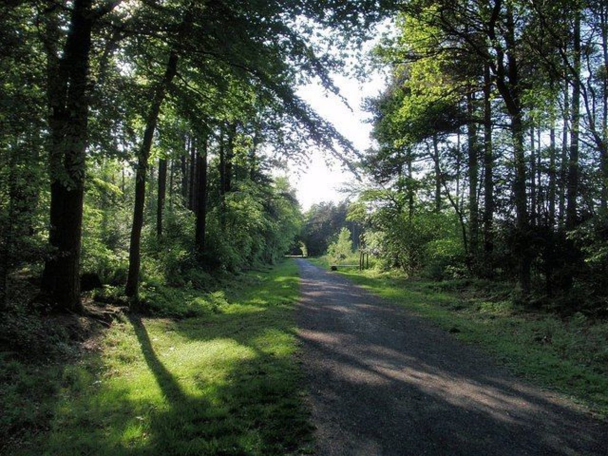
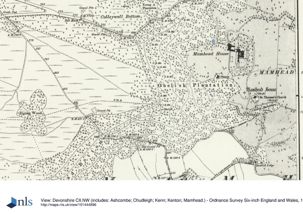
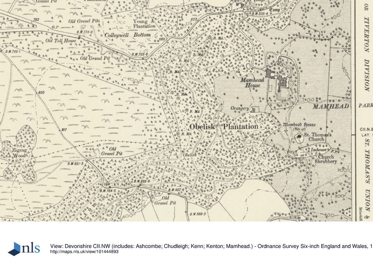
Lying to the north-east, east and south-east of the House, the park consists of undulating pasture with scattered groups of trees, and is enclosed to the north, north-east, east and south by boundary plantations. Lancelot Brown (1716-83) was consulted by the Earl of Lisburne in 1772, and visited Mamhead in 1773, providing plans for the alteration of the House and grounds, the charges for which appear in his account book for 1778-9 (Stroud 1957). A diarist recorded work in the park in 1778 (Gray 1995). The C13 and C15 parish church (listed grade II*) stands c 270m south-south-east of the House (outside the registered area), and, together with planting in the churchyard and Church Shrubbery on a north-facing bank to the south, serves as a feature in the park landscape. A brick icehouse (listed grade II), probably of C18 origin, is situated in Church Shrubbery c 400m south-south-east of the House. Late C20 sports pitches and facilities have been created in the park c 150m south-south-east of the House. Extensive mixed plantations known as Obelisk Plantation grow on the east-facing slope to the north-west, west and south-west of the House.
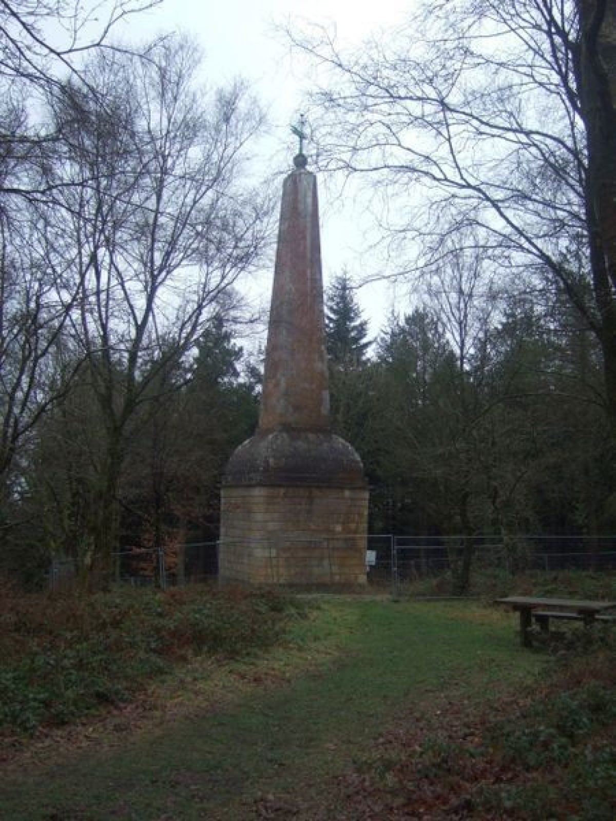
The woodland rises to the ridge, on which an obelisk (listed grade II*) stands some 590m south-west of the House, built as a daymark for shipping in the Exe estuary by Thomas Balle in 1742. The limestone obelisk rises from a convex-topped pedestal, and is surmounted by a ball finial and copper weathervane in the form of a flaming arrow. Carriage drives and walks shown on the Tithe map (1839) which survive as footpaths afford wide views north-east, east and south-east across the park and surrounding country to the sea and Exe estuary. In 1835 the expansion of the plantations and introduction of silver fir west of the House was noted (Gardener's Mag 1835). A further mixed plantation, Black Forest, adjoins the north-east drive c 1.25km north-east of the House, and was described by Loudon in 1842 (Gardener's Mag 1842).
Kitchen Garden
Lying c 800m south-east of the House at the south-east corner of the park, the kitchen garden occupies a south-east-facing slope which runs down to a stream. Enclosed to the north, north-west and north-east by early or mid C19 ramped brick walls (listed grade II) c 3m high, ornamented with stone urns, the kitchen garden was laid out with cruciform walks (OS 1888). It is today (1999) cultivated as gardens for the former gardener's house and the converted Palm House. The gardener's house, known as Brinshill (listed grade II), is a stuccoed mid C19 Italianate remodelling of an earlier cottage, with a prominent tower to the west, which stands to the east of the garden. The mid C19 Palm House (listed grade II) stands to the east of the gardener's house on a brick terrace (listed grade II) ornamented with urns, which was constructed c 1835 (Gardener's Mag 1835). The Palm House has rendered walls with tall, south-east-facing round-headed windows separated by giant pilasters, and a late C20 hipped slate roof which replaced the original flat roof which was concealed behind a parapet. The structure was converted into a dwelling in the late C20, and land to the south formerly cultivated as kitchen garden and orchard was developed as domestic gardens.
REFERENCES
R Polwhele, The History of Devonshire II, (1793-1806), pp 154-6
J P Neale, Views of the Seats of Noblemen and Gentlemen ... I, (1818)
Gardener's Magazine 11, (1835), pp 127-32; 18, (1842), pp 491-4, 531-2
J B Burke, Visitation of Seats II, (1853), p 175
The Cottage Gardener and Country Gentleman 21, (1858), pp 115-17
F O Morris, A Series of Picturesque Views of Seats of Noblemen 3, (1880), p 7
D Stroud, Capability Brown (rev edn 1957), pp 98, 163-4, 220
Country Life, 117 (26 May 1955), pp 1366-9; (2 June 1955), pp 1428-31
C Hussey, English Country Houses: Late Georgian (1958), p 193
B Jones, Follies and Grottoes (1974), p 313
M Binney and A Hills, Elysian Gardens (1979), p 21
M Girouard, The Victorian Country House (rev edn 1979), pp 33, 44, 62, 94, 123, 173, 441
B Cherry and N Pevsner, The Buildings of England: Devon (1989), pp 557-9
R Desmond, Dictionary of British and Irish Botanists and Horticulturists (1994), p 441
T Gray, The Garden History of Devon An Illustrated Guide to Sources (1995), pp 145-9
Maps
Tithe map for Mamhead parish, 1839 (Devon Record Office)
OS 6" to 1 mile: 1st edition surveyed 1888, published 1890
OS 25" to 1 mile:
1st edition surveyed 1888, published 1890
2nd edition revised 1904, published 1905
Illustrations
View of Old Mamhead from the east, c 1780 (reproduced in CL 26 May 1955)
Rev J Swete, watercolour views of Mamhead, 1792(9 (564M, F2, 17, 23; F8, 51, 55, 57, 66; F9, 37, 49, 57; F13, 47; F15, 85), (Devon Record Office)
Archival items
Balle family papers (484M), (Devon Record Office)
Newman family papers including garden works 1846(50 (867B), (Devon Record Office)
Lisburne family papers with items relating to Mamhead to 1827 (National Library of Wales, Dept Manuscripts and Records)
Adam plans for Mamhead, RIBA (catalogue vol S, 14)
Description written: June 1999 Amended: July 1999
Register Inspector: JML
Edited: July 2000
- Visitor Access, Directions & Contacts
Directions
5 kilometres north-west of Dawlish
- History
The following is from the Register of Parks and Gardens of Special Historic Interest. For the most up-to-date Register entry, please visit the The National Heritage List for England (NHLE):
www.historicengland.org.uk/listing/the-list
HISTORIC DEVELOPMENT
In the C13 Mamhead belonged to the Peverell family, from whom it passed by marriage to Sir Nicholas Carew in the early C14. In 1547 it was sold to Giles Balle of Axminster. Sir Peter Balle (d 1680) rebuilt an existing house near the parish church in the mid C17 (Polwhele; CL 1955). Sir Peter Balle and Thomas Balle (d 1749) were noted sylviculturists, and the latter introduced cork oaks, ilex oaks, wainscot or Turkey oaks, acacias, Spanish chestnuts and various cedars into his plantations (Gray 1995). The Exeter nurseryman William Lucombe (c 1696-1794) was employed as gardener at Mamhead by Thomas Balle (Gardener's Mag 1835; Desmond 1994). The early and mid C18 gardens are shown in a painting of c 1780 (CL 1955), and were formal, with terraces, fountains and pools on the hillside above the House (Polwhele). In 1749 Thomas Balle, the last of the family, left Mamhead to his relative Thomas Apreece, who sold it to Joseph Nightingale. From Nightingale it passed by inheritance in 1755 to the third Viscount Lisburne, created Earl of Lisburne in 1776. In 1769 Robert Adam (1728-92) provided plans for the improvement of the House and alteration of a cascade house, which appear to have been implemented, while in 1778 the grounds were improved with the advice of Lancelot Brown (Stroud 1957). Mamhead remained the principal seat of the earls of Lisburne until 1822, when the estate was sold by the third Earl to R W Newman, a merchant from Dartmouth and MP for Exeter. A new mansion designed by Anthony Salvin (1799-1881) was built from 1828, and the old house near the church demolished on its completion c 1830. Newman was created a baronet in 1836, while his grandson, the fourth baronet, became the first and last Baron Mamhead in 1931. The estate continued in the family until c 1985, but under the fifth baronet the House was let first as a holiday centre for evangelical clergy, and later as a school. The House and stables are now company offices, while the Orangery, kitchen garden, Palm House and lodges are now (1999) in separate private ownership.
Period
18th Century (1701 to 1800)
- Associated People
- Features & Designations
Designations
The National Heritage List for England: Register of Parks and Gardens
- Reference: GD1542
- Grade: II*
Features
- House (featured building)
- Now Offices
- Earliest Date:
- Latest Date:
- Orangery
- Tower
- Description: Ashcombe Tower is an early-19th-century folly, possibly designed by Salvin, which was intended as an eyecatcher. The building was converted into a country house by Brian O'Rorke in 1933-1936.
- Earliest Date:
- Latest Date:
- Key Information
Type
Estate
Purpose
Ornamental
Principal Building
Commercial
Period
18th Century (1701 to 1800)
Survival
Extant
Hectares
166
Open to the public
Yes
Civil Parish
Mamhead
- References
References
- {English Heritage Register of Parks and Gardens} (Swindon: English Heritage 2008) [on CD-ROM] Historic England Register of Parks and Gardens of Special Historic Interest
- Pevsner, N {The Buildings of England: Devon} (Harmondsworth: Penguin, 1952) The Buildings of England: Devon
- Nicholas Pearson Associates {Mamhead Landscape Management Plan} (2003) Mamhead Landscape Management Plan