
Introduction
Uppark House has pleasure grounds and a landscape park laid out to schemes designed in part by Humphry Repton. The gardens are now fully restored.
Terrain
The site lies high on the crest of the South Downs, its undulating landscape of broad-backed ridges and dry, steep-sided combes falling south-westwards from Tower Hill in the north-east corner.The following is from the Register of Parks and Gardens of Special Historic Interest. For the most up-to-date Register entry, please visit The National Heritage List for England (NHLE):
A mid C18, informal walled garden, laid out to a plan attributed to Lancelot Brown, altered and added to in the early C19 by Humphry Repton and in the late C20 by the National Trust, with, additionally, remnants of early C18 formal gardens and set in a park of medieval origin which was developed in the early and mid C18, further improved (possibly also by Repton) in the late C18 and in the C19.
Location, Area, Boundaries, Landform and Setting
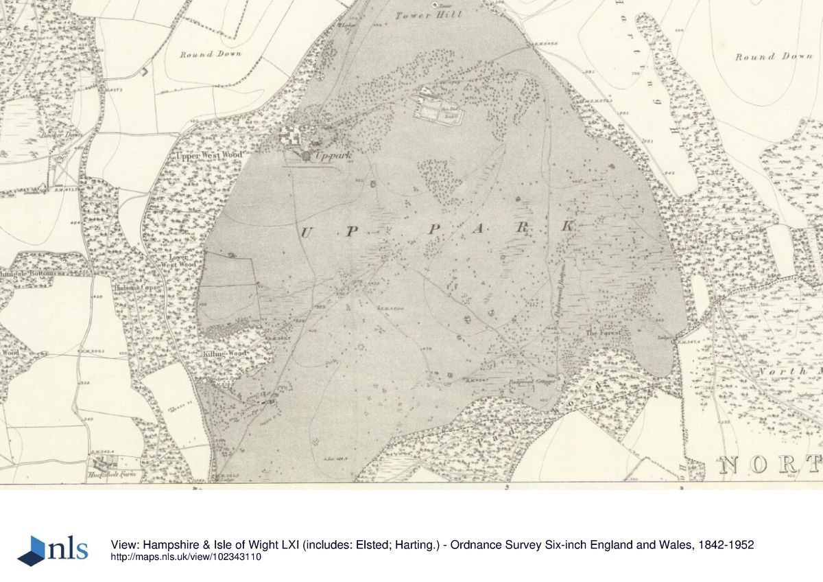
Uppark is situated between the B2146 and the B2141, immediately south of their junction and some 0.5km south of the village of South Harting. The 362ha registered site, comprising c 5ha of ornamental gardens and c 357ha of parkland and wooded farmland, lies high on the crest of the South Downs, its undulating landscape of broad-backed ridges and dry, steep-sided combes falling south-westwards from Tower Hill in the north-east corner. A similar landscape surrounds the site, the Downs rising to a greater height (on Harting Down) just beyond the north-east boundary. The roughly triangular site is bounded to the north-east and north-west by the two B roads, from which it is largely shielded by internal woodland belts. To the south, a further woodland belt (Pads Wood) encloses the site from rolling wooded farmland beyond.
Entrances and Approaches
Uppark is approached from the north-west, the main North Drive (in existence by the late C18) entering from the B2146 at North Lodge (0.6km due north of the house and built between 1840 and 1873) and climbing southwards along the steep wooded hillside to the north side of the stable block (listed grade I). This drive, which continues southwards as South Drive (now a track) to South Lodge (built 1840-73) in the extreme south-west corner of the site, formed the public road until the present B2146 was built between 1746 and 1795 (Webb 1990).
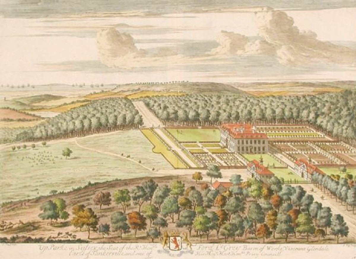
The main North Drive turns east from the stables and runs 60m along the north wall of the gardens to reach double cast-iron gates (known as the Golden Gates) set between stone piers flanked by curving flint wings (ensemble listed grade II). Inside the gates, the gravelled drive, flanked by an avenue of Norway maple planted in the 1990s, runs 120m southwards to a circular forecourt on the north front of the house. This northern approach and its entrance gateway were built between 1810 and 1814 to designs by Humphry Reptonand shown in sketches in his Red Book. Knyff and Kip's view of Uppark in 1695-1701 (published 1707) shows the house approached on the east side, this remaining the main arrival point (a drive and turning circle are shown on the OS drawing surveyed 1808-13) until Repton's alteration in the early C19.
Principal Building
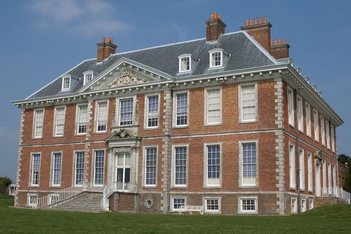
Uppark (listed grade I) stands towards the north-west boundary of the park, on a level terrace on the lower slope of Tower Hill and commanding extensive views south over the park to the coast and the Isle of Wight. Built in red brick with a hipped, slate roof and originally to a half H-shaped plan, it has two storeys, an attic and semi-basement and steps leading up to a pedimented doorway on the principal, south front.
The house was built in c 1690 and is attributed (by James Dallaway in 1815) to William Talman (1650-1719). The main entrance front, on the north side, features a single-storey stone colonnade added, with extensions which altered the H shape to the present oblong, by Repton (with assistance from his son John Adey Repton) from 1810 to 1814, a sketch of the colonnade being shown in his Red Book. The former approach on the east front entered through two walled courtyards (Knyff and Kip's view of 1707), the easternmost one flanked to north and south by two service buildings.
By c 1720-30 (painting of Uppark of that date by Pieter Tillemans), the courtyards had gone and in c 1750 the service buildings were demolished and replaced by two pavilions, to the north-east and north-west of the house (attributed to James Paine (1717-89), or Daniel Garrett (d 1753)), these surviving as (respectively) the east service block (Greenhouse and Laundry) and south wing of the stable courtyard. In 1989, the two upper floors of Uppark were almost completely destroyed by fire; the house has since been restored by the National Trust to its state before the fire and was re-opened to the public in 1995.
Gardens and Pleasure Grounds
The gardens lie largely to the west, north and east of the house, the present main ornamental gardens lying to its north and north-east and the remnants of former formal terraces to its east and west.
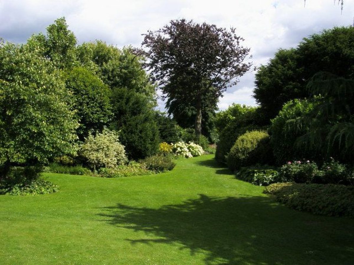
Steps lead down from the principal south front onto open grass which extends as mown lawn to a terrace bank, beyond which the ground falls away gently and then more steeply to the park, the upper slope containing the site (revealed in aerial photos of 1976 (RCHME)) of the large pond shown on Tillemans' painting. Further terrace banks extend some 80m to east and west of the house, these possibly surviving from the C18 formal layout (which may have been the work of George London (c 1653-1714)) or from their subsequent re-establishment (Inspector's Report 1998). The terraces are enclosed from the park at their east and west ends by holm oaks (planted 1971) and small deciduous plantations of the 1990s.
Northwards, above the terrace banks, level areas of lawn, enclosed from the stables and the ornamental gardens by iron paling erected in the 1990s, extend east and west of the house, the lawn to the west laid out on the site of the bowling green shown on Knyff and Kip's view published in 1707. The lawn is overlooked on the north side by a raised terrace walk running along the south wall of the stable courtyard with, built into its western end, a porticoed dairy (listed grade II) probably of late C18 origin (c 1800) or by Repton after 1810 (NT agent pers comm, 1998).
North and north-east of the house, the main, roughly oval-shaped ornamental garden lies enclosed within a c 1.2m high flint wall, its line first shown on a plan of the gardens attributed (Stroud 1984) to Lancelot Brown. This walled enclosure replaced a narrow, U-shaped garden which extended due north of the house in 1746 (sale plan), the extensive terrace and kitchen garden recorded on the north side of the house by Knyff and Kip c 1700 having been largely removed by the 1730s (Tillemans' painting shows only a small walled garden on this side of the house). Either side of its route from the north front to the gates, the main drive is bordered by gently rising lawn enclosed by flanking belts of tall, largely evergreen shrubbery. Set within the shrubbery at the southern end of the west side, and enclosed from the drive by a north to south yew hedge, is a semicircular rose garden (replanted 1971), its beds set in grass and surrounded by gravel and pebble paths.
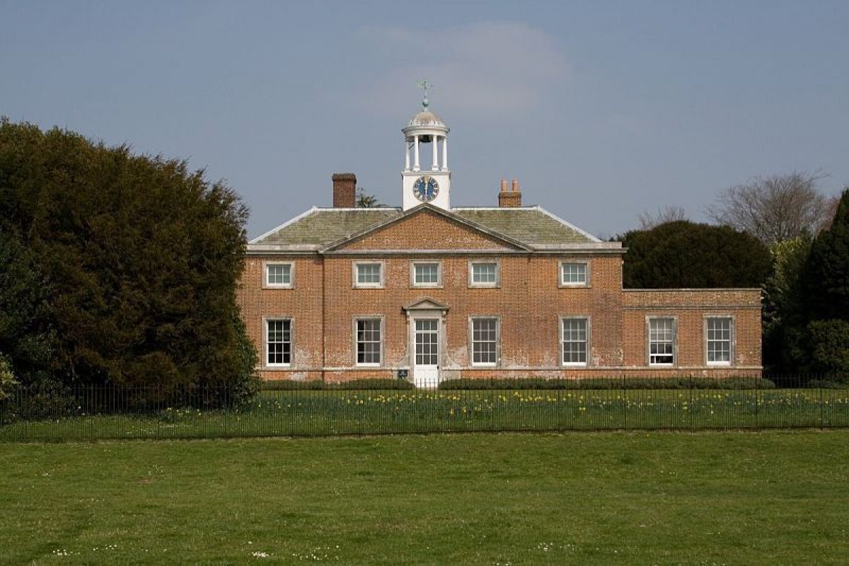
On the east side of the drive, 30m north-east of the house, is the Greenhouse and Laundry building (listed grade I), a two-storey brick pavilion built c 1750 as a laundry and kitchen with an orangery on the south side and in use since 1970 as a tea room. On its north side, the rising ground of its small garden is laid to banks of lawn bisected by a north to south axial path and flight of steps and is enclosed by a dense belt of tall, mixed shrubbery, within which on the west side is an octagonal, flint-faced game larder (listed grade II), apparently built to a design by Repton in c 1810.
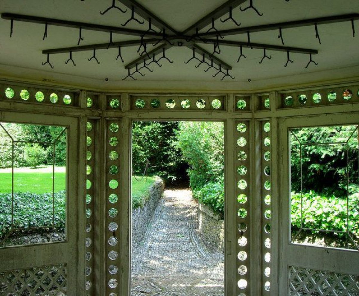
Facing south from the shrubbery and sited on a mound 10m to the east of the Greenhouse (shown as the Little Mount on the plan attributed to Brown) is the canopied, half-octagonal, gothick summerhouse (listed grade II), erected by Sir Matthew Fetherstonhaugh and probably dating from c 1760 (possibly by the architect of the Vandalian Tower, Henry Keene). North-east of the Greenhouse and Laundry garden and extending to the surrounding wall, the Amphitheatre Garden (shown as open lawn with trees and surrounding shrubbery on plan attributed to Brown) is laid to lawns with serpentine island and perimeter shrubberies and lightly dotted with trees, the island beds and trees added in the 1990s following severe storm damage to the whole garden. In the north-west corner of the lawns, adjacent to the Golden Gates, is a mount crowned with a Coade stone vase, the mount being recorded on the 1746 sale plan and shown as a site for a rotunda (probably never built) on the plan attributed to Brown of c 1750.
Park
The majority of the park extends for roughly 1.5km in a wide arc to the south-west and south east of the house, its broad ridges divided into fields under arable cultivation. Only a few clumps of mature trees scattered over Sixteen Acre Plain (to the south-east) survived the post-war (1939-45) clearance of the significant parkland planting shown established in the early C19 (OS surveyor's drawing 1808-13) and extensively increased by 1873 (OS 1st edition). New planting, mostly along field boundaries, has been carried out since 1987.
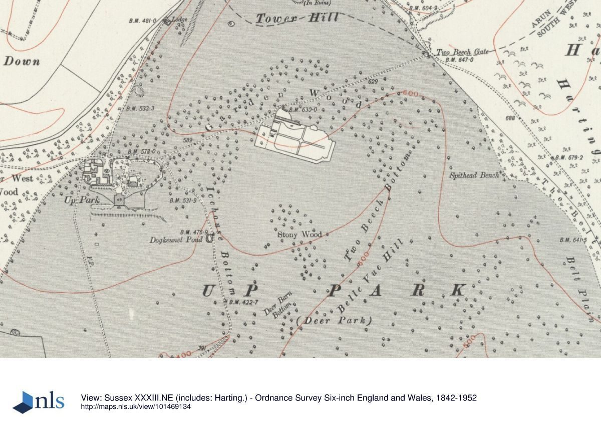
The park was established in the medieval period and was still in use as a deer park in 1686, Knyff and Kip's c 1700 view showing deer grazing up to the south front terraces. A C17 lodge known as Deerkeepers Cottage (listed grade II) stands in the park 1.1km south-west of the house. The present park boundaries are very similar to those shown on Budgen's 1724 map of Sussex, except for the south-east corner beyond Long Coppice and Padswood Bottom which was added between 1795 and 1808-13. There are several small plantations and copses, largely on the unploughed sides of the dry valleys running north-east to south-west between the ridges (Deer Barn Bottom and Long Coppice). The significant areas of woodland lie on the west and south boundaries and north-east of the house. To the west, Upper and Lower West Wood and Killing Wood, and Garden Wood to the north-east (mixed age deciduous wood with areas of coppice and post-storm replacements), appear established by the early C18, while Pads Wood to the south was planted after the incorporation of its land in the early C19.
Throughout the C18, the house and its southern lawn (which extended south to Lawn Bottom) were closely framed by an eastward extension of West Wood and an extension southwards of Garden Wood, the present open character of this apron of parkland being established in the early C19 (OS surveyor's drawing). Although Repton's Red Book proposed only minor thinning of the parkland tree cover to improve vistas, archival evidence suggests that he may also have been responsible for earlier improvements in the park (Webb 1990). In the south-east corner of the park is Irongates Lodge, comprising one C18 (listed grade II) and one C19 brick lodge house, the pair connected by a high arch with iron gates (listed grade II).
The arch was possibly added by Repton as the entrance to the serpentine drive which he laid out across the park to the house (shown on the OS surveyor's drawing, gone by 1988). North-east of the house, the ridge slope rises to the highest point of the park on Tower Hill and is crowned by the ruins of the Vandalian Tower (listed grade II). Erected on the site of a former ornamental mount by Henry Keene (1726-76), probably to celebrate Sir Harry's coming of age in 1775, it is built in the form of a pinnacled, gothick viewing house. The tower was destroyed by fire in 1842 and the ruins were stabilised in 1982.
Kitchen Garden
The kitchen garden lies 450m north-east of the house, the brick-walled enclosure forming a 170m x 100m rectangle with cut-off corners. The garden probably dates from c 1732 (payments recorded in the Tankerville accounts) and is first shown on the sale plan of 1746. The interior is quartered by paths lined by mature hornbeam hedges and is laid largely to grazing and vegetable cultivation. The central sundial was presented by the Duke and Duchess of Bedford in c 1812 (Webb 1990). The glasshouses on the north wall shown established in 1873 are now (1998) gone.
Maps
- Budgen, Map of Sussex, 1724
- J Crow, sale plan of Uppark, 1746 (west Sussex Record Office)
- Plan attributed to Lancelot Brown, c 1750 (Fetherston Deposit, West Sussex Record Office)
- OS surveyor's drawing, surveyed 1808-13
- OS 6" to 1 mile:
- 1st edition surveyed 1873-4, published 1880
- 2nd edition published 1899
- 3rd edition published 1914
- OS 25" to 1 mile:
- 1st edition surveyed 1873
- 2nd edition published 1910
Illustrations
- Pieter Tillemans, Painting of Uppark, c 1720-30 (hanging at Uppark 1998)
Archival items
- The Fetherstonhaugh Deposit, which includes Repton's Red Book, the plan attributed to Brown and a range of account books, ledgers and plans is held by the West Sussex Record Office.
- Aerial photographs, RCHME 1976 (SU 7717/4426, SU 7717/446-81)
Description written: March 1998 Amended: January 2000
Register Inspector: VCH
Edited: June 2000, March 2022
- Visitor Access, Directions & Contacts
Telephone
441730825415Access contact details
The gardens are open from 12.30 pm between March and October. The site is closed on Fridays and Saturdays.
For more detailed information about visiting and opening times visit the National Trust website.
Owners
The National Trust
Heelis, Kemble Drive, Swindon, SN2 2NA
- History
The following is from the Register of Parks and Gardens of Special Historic Interest. For the most up-to-date Register entry, please visit The National Heritage List for England (NHLE):
15th - 17th Century
Uppark was part of the manor of Harting granted to the Hussey family, who occupied it until the beginning of the C15, after which it passed to Henry Lovell and then to the Ford family. The daughter of Sir Edward Ford (d 1670) married Ralph, Lord Grey of Warke, and their son, Ford Grey, later created Earl of Tankerville, built the present house c 1690 and laid out formal gardens and rides through the park which were described by the writer Celia Fiennes on her visit in 1695 (Morris 1949).
18th - 19th Century
Uppark passed to Ford Grey's daughter and then to her husband, Lord Ossulston (who was created first Earl Tankerville of the second creation). Their son embarked on improvements to the house and park before selling in 1746 to Matthew Fetherstonhaugh who extended the estate and carried out further substantial alterations to the house and grounds, including work in the ornamental gardens to a plan attributed to Lancelot Brown (1716-83).
Their son, Sir Harry, who succeeded in 1774, engaged Humphry Repton (1752-1818) to improve the house and grounds, Repton's first visit occurring in 1793 and a Red Book being produced in 1810. Sir Harry died in 1846 leaving Uppark to his wife Mary Ann, on whose death it passed to her sister Frances who took the name of Fetherstonhaugh. Frances left Uppark to the Hon Keith Turnour for life, he in turn leaving it to Admiral the Hon Herbert Meade, both men taking the name of Fetherstonhaugh.
20th - 21st Century
In 1954, Admiral Meade-Fetherstonhaugh and his son Richard gave Uppark and the surrounding ornamental gardens to the National Trust; the park remains (2022) in private ownership.
- Associated People
- Features & Designations
Designations
The National Heritage List for England: Register of Parks and Gardens
- Reference: GD1295
- Grade: II*
Style
Picturesque
Features
- Great House (featured building)
- Earliest Date:
- Latest Date:
- Parkland
- Gardens
- Key Information
Type
Park
Purpose
Ornamental
Principal Building
Domestic / Residential
Survival
Extant
Hectares
362
Open to the public
Yes
Civil Parish
Harting
- References
References
- {English Heritage Register of Parks and Gardens of Special Historic Interest}, (Swindon: English Heritage, 2008) [on CD-ROM] Historic England Register of Parks and Gardens of Special Historic Interest
- Morris, C. (ed), {The Illustrated Journeys of Celia Fiennes 1865-c1715} (London: Macdonald, 1982) The Illustrated Journeys of Celia Fiennes 1685-c1712
- Nairn, I. and N. Pevsner, {The Buildings of England: Sussex} (Harmondsworth: Penguin Books, 1965), pp. 336-7 The Buildings of England: Sussex
- ACTA {Assessment of the Proposed Improvements at Uppark} (2008) Assessment of the Proposed Improvements at Uppark
- Webb, Marigold {Uppark: park and garden survey} (1990) Uppark: park and garden survey
- Rutherford, Sarah {Uppark: Garden Conservation Statement} (2012) Uppark: Garden Conservation Statement
- Knyff, L, and Kip, J., (1707) Britannia Illustrata, Vol. 1
- Dallaway, J., (1815) A History of the Western Division of the County of Sussex
- Morris, C., (ed), (1949, reprinted 1962) The Journeys of Celia Fiennes (c 1685-1703)
- (14 June 1941), pp 520-4; (21 June 1941), pp 540-4; (28 June 1941), pp 562-6 Country Life, 89
- (English Heritage 1988) Inspector's Report: Uppark
- (1983), pp 215-19 Sussex Archaeology Collect 21