Introduction
Stansted Park has gardens, pleasure grounds, a landscape park with avenues and 230 hectares of Stansted Forest. The gardens were laid out in the late-19th century but the 12th-century park was further developed from the 17th century. The site also features an arboretum and light railway.
Terrain
The site lies on the gently rising, south-facing lower slope of the dip-slope of the South Downs and is set within a landscape of undulating wooded farmland.The following is from the Register of Parks and Gardens of Special Historic Interest. For the most up-to-date Register entry, please visit The National Heritage List for England (NHLE):
www.historicengland.org.uk/listing/the-list
Formal and walled gardens and informal pleasure grounds of early to late C19 and C20 origin, set within a late C17 landscape of parkland, formal avenues and woodland rides which was in part developed and altered in the later C18 and early C19.
DESCRIPTION
LOCATION, AREA, BOUNDARIES, LANDFORM, SETTING
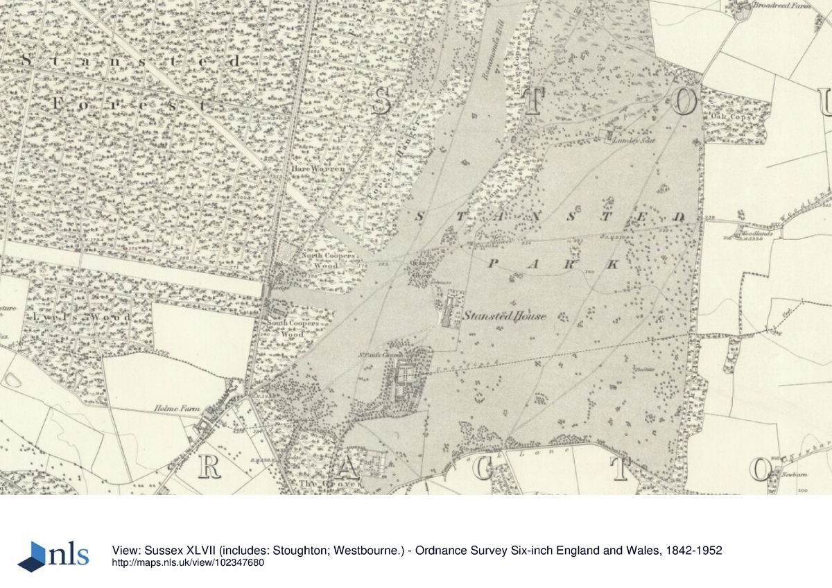
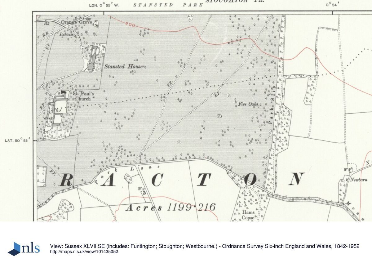
Stansted is situated 1.5km east of the B2149 which runs north from Havant, and on the immediate eastern edge of Rowlands Castle village. The c 520ha registered site comprises the c 230ha of Stansted Forest, c 11ha of formal, walled and ornamental gardens and c 280ha of woodland, parkland and farmland. The site, largely enclosed by agricultural fencing except for a stretch of flint walling in the south-west corner, lies on the gently rising, south-facing lower slope of the dip-slope of the South Downs and is set within a landscape of undulating wooded farmland. Village housing abuts the south-west corner and a minor lane running north to south divides the site roughly into two halves, the majority of Stansted Forest lying to the west and the house and the park to the east. The Racton Monument, a circular tower of red brick, now in ruins (designed by Theodosius Keene, built between 1766 and 1775, listed grade II), stands outside the registered site some 0.5km to the south-east of the house.
ENTRANCES AND APPROACHES
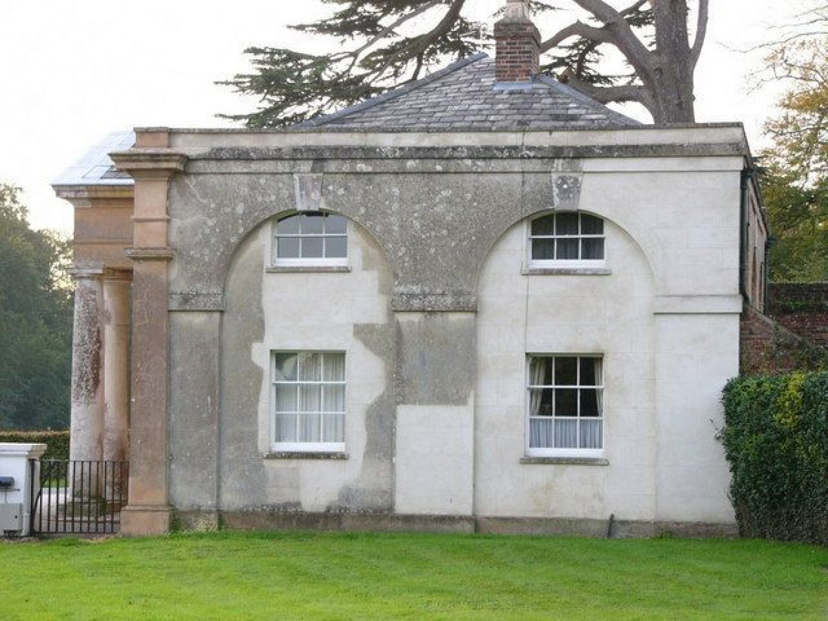
The present principal entrance is at the two-storey porticoed South Lodge (built 1840 by Thomas Hopper (1776-1856), listed grade II), which stands on the continuation south of Forestside Road, c 0.8km south-west of the house. A drive, laid out between 1825 and 1840, follows a gentle north-easterly curve to arrive at the gravelled forecourt on the principal, west front of the house. There is a second entrance from Forestside Road c 0.7km north of South Lodge at Middle Lodge (also built by Thomas Hopper in 1840 and listed, as North Lodge, grade II), the curving drive from here to the house being laid out by 1813 (OS Old Series). At the far west end of the site, a further C19 approach drive enters at the Rowlands Castle lodge (probably by Thomas Hopper 1840, listed grade II) and winds eastwards through the Forest, on the north side of the main avenue. Kip and Knyff's view of 1727 shows the house similarly approached on the west front but through a formal, walled forecourt, the drive to which was linked to the main east/west avenue and vista through the Forest by a double avenue of trees. By 1785 (Barwell's plan) these had been removed, although the route of the approach, which is shown terminating in a turning circle at the house, remained until the late 1780s (engraving of 1789 in the European magazine).
PRINCIPAL BUILDING
Stansted (listed grade II*) stands towards the south-east boundary of the registered site, on level ground and with its principal west front focused on the vista created by the three radiating avenues (that to the south-west largely gone) cut through the Forest. The present house, built in 1902-3 by the architect Arthur Conran Blomfield (a cousin of Sir Reginald Blomfield), is square in plan, with two storeys and an attic. Constructed in red brick with Portland stone quoins and a balustraded parapet, the west front has a stone portico of six Ionic columns supporting a balustrade. Of the substantial house recorded at Stansted in 1327, which was rebuilt in 1480, part survives as the present chapel which was created by Lewis Way in c 1812 and restored by H S Goodhart-Rendel in the 1920s (160m south-east of the house, listed grade I). The house built in 1686, on the site of the present one, was altered in 1786-91 and its stables replaced by pavilions to north and south by James Wyatt (1748-1813) and Joseph Bonomi (1739-1808). These were in turn replaced by Thomas Hopper in 1840 with the present, pedimented, seven-bay stable block with its columned cupola, which survived the fire which destroyed the house in 1900.
GARDENS AND PLEASURE GROUNDS
The formal parts of the garden lie on the immediate east and south sides of the house. From the east front portico steps lead down onto an east to west gravelled walk and a rectangle of lawn, enclosed along most of its perimeter by sections of mature yew hedge (that to the south planted in the 1990s), probably of early C20 origin (Masters 1998) and with, on the axis of the portico, a central, raised stone basin. The layout of a formal enclosure of parterres ending in a semicircular wall, shown on this side of the house by Knyff and Kip in 1727, remained until at least 1785 (Barwell's plan). The outline of the present garden was established by 1840 (Tithe map) and was planted with shrubberies and conifers at the north end by 1875 and with intricate formal bedding around the basin in 1912 (photograph in sale particulars), which had gone by the mid C20. The south front opens onto level lawn which then descends a southward slope which is planted with the remnants of an early C20 line of cedars (with additional late C20 replacements), the flower beds and borders described in 1912 now gone. The lawns are enclosed along their east and south sides by further straight runs of mature yew hedges, parts of which date from c 1900.
At the south-west corner of the south lawn (100m from the house) is the entrance to the Arboretum, shown established on the OS 1st edition of 1875 and laid out on the site of early C18 walled gardens removed by 1813 (OS Old Series). The northern part of the Arboretum, which extends down the east side of the walled gardens, is bisected by a broad straight path (line shown on the Tithe map of 1840) which terminates in a circular grassy enclosure, formerly laid out (in 1912) as a rose garden, with a central stone well-head. The eastern boundary, which was extended eastwards to its present line in the C20, is enclosed with a post and rail fence and the whole area is planted with conifers including cedar, Wellingtonia and redwood dating from the both the early and mid to late C19 (Masters 1998) and with mixed mid to late C20 planting. Photographs of 1912 show the central path flanked by mown lawn and formal planting beds, gone by the mid C20. The southern part of the Arboretum extends south and west of the walled gardens and is planted with a scatter of conifers in the south-east corner and, to the west, with remnants of early C20 orchard trees and further mature conifers.
The west front and forecourt open onto a broad lawn, shown occupied in Knyff and Kip's 1727 view by a walled forecourt, bowling green and orchard, all of which had been removed by 1777 (Montague plan). The lawn is enclosed to the south-west by a grove of mature trees, replanted in the C20 as replacements for an earlier grove, and on the north-west side by the Orange Grove, planted with a scatter of mixed trees in rough grass. The 1727 view shows a formal, semicircular orangery garden in this position which by 1777 (Montague plan) had been replaced by a plantation through which Barwell's later plan (1785) shows the route of a circuit of the gardens and grounds. This feature, and other improvements also shown on Barwell's plan, may represent proposals attributable to Lancelot Brown, although no field or other documentary evidence of their execution appears to survive (CBA 1995; Masters 1998). A number of the trees in the Orange Grove survive from Lewis Way's planting in the early C19. Immediately north of the house, beyond a shrubbery established in the mid to late C19, is the North Paddock, dotted with mid to late C20 trees and containing, on the eastern boundary with the park, a tennis court and outbuildings associated with a late C20 pheasantry and aviary.
PARK
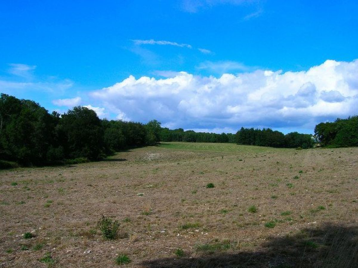
Areas of open parkland lie to the north, east and south of the house. The East Park, with the exception of the field immediately east of the house and grazed areas to the south, is under mixed arable cultivation with only a few isolated tree clumps. A short length of triple beech avenue, planted in 1957, extends eastwards for c 300m across the park on the east to west axis of the house (and on the line of an avenue shown on Knyff and Kip's 1727 view). The East Park is shown laid out with irregular tree clumps in the early C17, a pattern which survived until the mid C20. The park contains several small woods, including the belts that enclose the eastern site boundary (Park Slip North and South), Lumley Wood and Long Copse to its north-east (both shown established by the late C18). At the north-east end of Lumley Wood, facing south over the park and with extensive views to the coast, is Lumley Seat (listed grade II), a former Ionic temple built 1766-70 by Lord Halifax which was destroyed by fire in the Second World War and later converted to a private house. The southern boundary of the park is enclosed by a fringe of coppice which, as a wider belt of woodland, is shown threaded by a serpentine walk on Barwell's plan of 1785. North of the house there is a vista (created by the late C18) over rising ground to Rosamond's Hill, Barwell's plan of 1785 showing the Hill crowned by a temple.
KITCHEN GARDEN
The kitchen garden, which appears laid out to its present form by 1813 (OS Old Series), lies to the south-west of the house, on the south side of the chapel. It comprises a series of three, north to south walled compartments which are bisected and connected by a central axial path. The northernmost and smallest compartment is laid out, partly on the site of former glasshouses, as a Dutch Garden (dating from between 1912 and 1924) with a central circular pool set in stone paving flanked by low, box-edged compartments of herbaceous plants and roses. Southwards, the second and largest compartment is laid to lawns and shrubs, its axial path lined by box hedging and mixed borders. Against the north wall is a range of glasshouses including an orangery and vinery and a peach and camellia house, shown established by 1875 but now (1998) in poor condition. It is intended to restore these and lay out the garden for ornamental display in 1999-2000. Southwards again, the third compartment is densely and ornamentally planted as a sculpture garden. Along the west side of the walled gardens in a now-derelict area bounded by a hedge and formerly occupied by lean-to glass and frames (removed 1950s) it is intended to erect new glasshouses in 1999-2000.
OTHER LAND
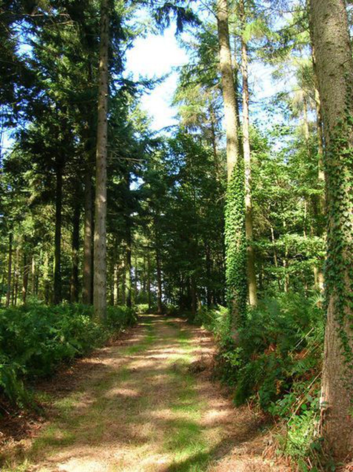
On the east side of Forestside Road, the parkland is enclosed to the north and west by plantation woodland compartments including Firtree Piece and Forest Hanger, both shown on the plan of 1785. West of the road, the remainder of the site is occupied by Stansted Forest which has its origins in the C13 Forest of Bere and which is now (1998) largely planted with varied compartments of sweet chestnut coppice (classified by English Nature as semi-natural, broadleaved woodland) and coniferous plantations. The Forest is cut by a broad, grassed, east to west avenue, some 2km long, which forms the central radial of the goose-foot pattern focused on the west front of the house and which appears to have been cut between 1680 and 1690 (Loudon 1838). The avenue, which is shown on Knyff and Kip's 1727 view, is lined with avenue trees of mixed age, the beeches on the north side at the west end surviving from Lewis Way's replanting in 1820 (CBA 1995). To the north, the Forest is cut by the north-west running radial of the goose foot, the north-west end of which was linked by 1785 to the central avenue by the south-running Broadwalk. This avenue, which focused on a vista south to the coast, was lined with a beech avenue until the trees were felled in the mid 1970s and is now (1998) overgrown. The former avenue to the south-west which completed the goose foot has now gone.
REFERENCES
L Knyff and J Kip, Noveau théâtre de la Grande Bretagne ... (1727)
J C Loudon, Arboretum et Fruticetum Britannicum iii, (1838), pp 1957-8
I Nairn and N Pevsner, The Buildings of England: Sussex (1965), pp 336-7
Country Life, 171 (11 February 1982), pp 346-9; (18 February 1982), pp 410-13; (25 February 1982), pp 478-82
Stansted Park: Inspector's Report (English Heritage 1988)
Stansted Park, Survey, repair and management plan, (Chris Blandford Associates (CBA) 1995)
P Masters, The Setting of Stansted House: Report to the Stansted House Foundation (1998) [copy on EH file]
Stansted Park, guidebook, (nd)
Maps
A Plan of Stansted Park belonging to Miss Ann Maria Montague, 1777 (West Sussex Record Office)
A Plan of Stansted Estate belonging to Richard Barwell, 1785 (West Sussex Record Office)
OS Old Series 1" to 1 mile, published 1813
OS 6" to 1 mile:
1st edition surveyed 1875, published 1880
2nd edition surveyed 1895-6, published 1899
3rd edition surveyed 1910, published 1914
OS 25" to 1 mile:
1st edition surveyed 1874
3rd edition surveyed 1910
Illustrations
Standsed House, 1789 (engraving published in the European magazine) [copy in Masters 1998]
Description written: April 1998
Register Inspector: VCH
Edited: June 2000
- Visitor Access, Directions & Contacts
Telephone
023 9241 2265Website
https://www.stanstedpark.co.ukAccess contact details
http://www.stanstedpark.co.uk/visitor-attractions/opening-times.html
Directions
http://www.stanstedpark.co.uk/visitor-attractions/stansted-park-location.html
- History
The following is from the Register of Parks and Gardens of Special Historic Interest. For the most up-to-date Register entry, please visit the The National Heritage List for England (NHLE):
www.historicengland.org.uk/listing/the-list
HISTORIC DEVELOPMENT
Stansted probably originated as a park within the Royal Forest of Bere Porchester, whose over-lords were the earls of Arundel. It was recorded as in use for hunting and for timber production in the medieval period, while a survey of buildings of the Manor of Stansted in 1327 included a hall and a chapel. On the death of Jane, daughter of the last Fitzalan earl, in 1576, and then of her husband, John Lumley, in 1609, Stansted passed to his cousin Sir Richard Lumley. In 1686 his son Richard, second Viscount Lumley, later created first Earl of Scarborough, began building a new house on the site of the present one and laying out formal gardens, radiating avenues and parkland on its east side. He probably also cut the central avenue through Stansted Forest to the west. The second Earl inherited in 1721 after which the estate passed to his younger brother who died in debt in 1766, leaving Stansted to his nephew, George Montague-Dunk, second Earl of Halifax. He built two follies, one of which was the Racton Tower (outside the registered site), and added to the planting in the park, the landscape of which was praised by Horace Walpole in his essay On Modern Gardening in 1785. The estate was sold in 1781 to Richard Barwell, who commissioned Lancelot Brown (1716-83) that year to visit and prepare proposals for the house and grounds although there is no further evidence of his having executed landscape improvements. Barwell died in 1804 and the estate was sold to Lewis Way. He replanted the entire estate, including the Forest (although retaining most of the rides), laid out new, informal drives to the house and probably rebuilt the kitchen gardens. In 1826, the estate was bought by Charles Dixon who significantly altered the house. On Dixon's death in 1855 Stansted passed to his widow and then to her grandson George Wilder who, with his son who succeeded him in 1896, continued the development of the gardens around the house and the chapel. Following its destruction by fire in 1900, Stansted was rebuilt in 1902 and sold by the Wilder family to Major Cecil Whitaker who sold on in 1924 to the ninth Earl of Bessborough. In 1983, the tenth Earl transferred the house and estate to the Stansted Park Foundation, which now (1998) owns and manages them as a charitable trust.
- Associated People
- Features & Designations
Designations
The National Heritage List for England: Register of Parks and Gardens
- Reference: GD1271
- Grade: II*
Features
- Tower
- Description: The Racton Monument, a circular tower of red brick, now in ruins, was designed by Theodosius Keene.
- Earliest Date:
- Latest Date:
- Gardens
- Arboretum
- Parkland
- Woodland
- Railway
- Key Information
Type
Park
Purpose
Recreational/sport
Principal Building
Domestic / Residential
Survival
Extant
Hectares
520
Open to the public
Yes
Civil Parish
Stoughton
- References
References
- {English Heritage Register of Parks and Gardens of Special Historic Interest}, (Swindon: English Heritage, 2008) [on CD-ROM] Historic England Register of Parks and Gardens of Special Historic Interest
- Nairn, I. and N. Pevsner, {The Buildings of England: Sussex} (Harmondsworth: Penguin Books, 1965), pp. 336-7 The Buildings of England: Sussex
- ACTA {Stansted Park: Revision of the 1995 Survey, Report and Management Plan (2 vols)} (2007) Stansted Park: Revision of the 1995 Survey, Report and Management Plan (2 vols)
- Related Documents
-
CLS 1/1050
Proposed Strategy for Stansted Park, Stansted Mountfichet, 2nd Draft
Liz Lake Associates - 1999
- CLS 1/1192
-
CLS 1/960
Report on the Historic Landscape - Digital copy
Nick Owen (Debois Landsdcape Survey Group) - 1999
-
CLS 1/961
Plan 1 :Trees and Field Archaeology - Digital copy
Nick Owen (Debois Landsdcape Survey Group) - 1999
-
CLS 1/962
Plan 2: Analysis - Digital copy
Nick Owen (Debois Landsdcape Survey Group) - 1999
-
CLS 1/1050