Introduction
Treowen has the earthwork remains of a mid-16th-century garden featuring a raised walk around three sides of a square lawn. There are fishponds, probably medieval, in valleys to the east and west of the house. The house is currently (2012) let out for holidays and weddings. The gardens have some open days in the summer months.
Location, Area, Boundaries, Landform and Setting
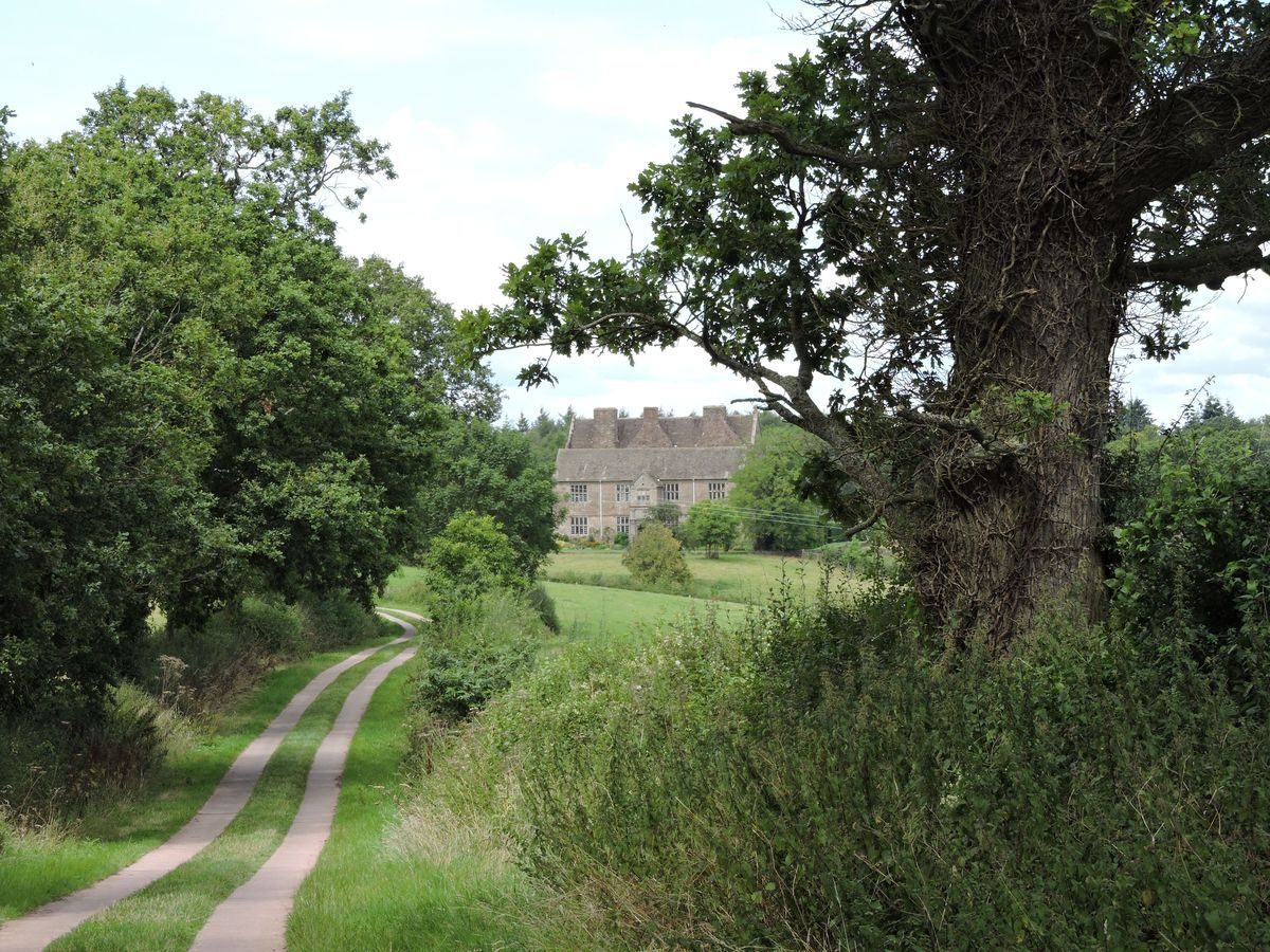
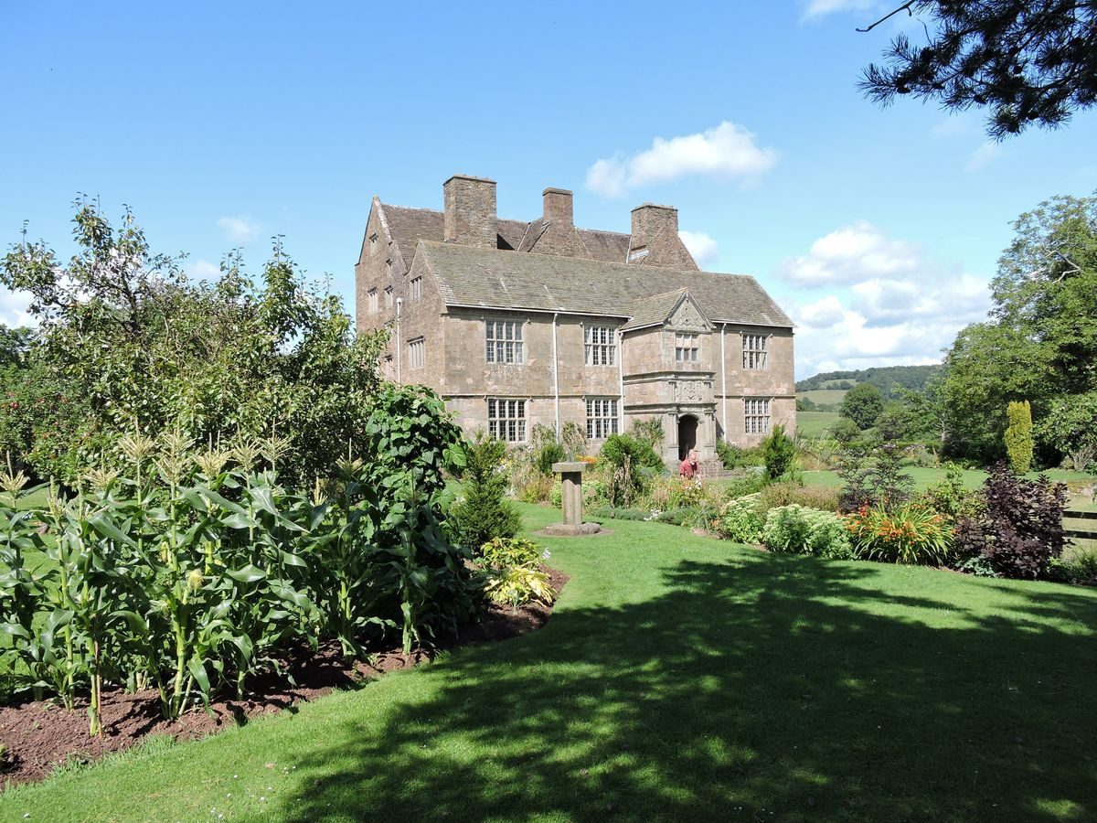
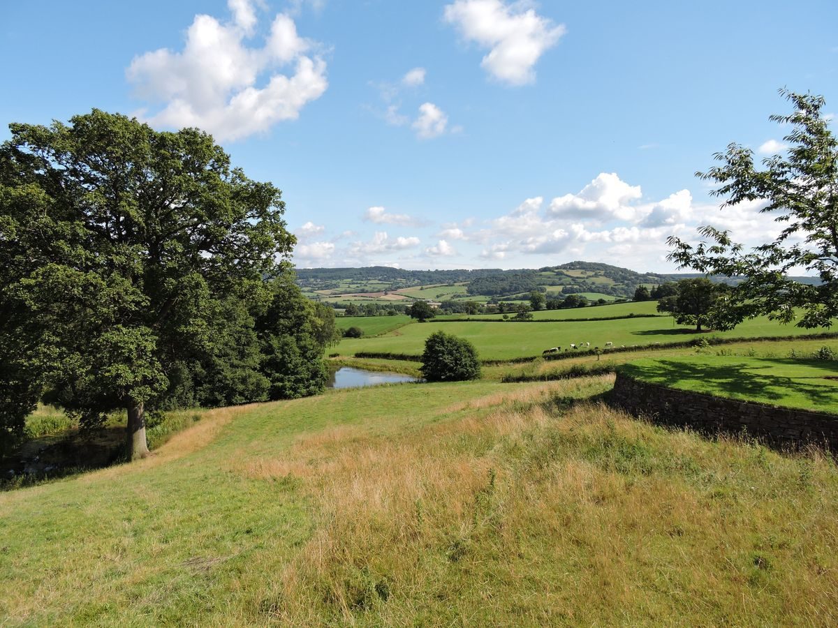
Treowen house stands at an elevation of about 75mOD on a ridge some 45m above the east side of the valley of the River Trothy, about three quarters of a kilometre north-east of Dingestow church. At the village of Dingestow the river Trothy, which up to this point flows north to south, turns abruptly to flow west to east to join the River Wye south-east of Monmouth some 5.5 km away. The position commands extensive views west and south over the Trothy valley toward the Wye valley and the Forest of Dean, westward to the Monmouthshire valleys and northward as far as the Black Mountains.
Entrances and Approaches
Treowen is accessed from the Dingestow to Monmouth road via a long concrete surfaced driveway with central grass. On reaching the northern end of a group of farm buildings a short gravel road leads to a parking area adjacent to the west elevation of the main house. There is also another parking area just north of the house on the west side of the driveway. The associated estate comprises about 160 hectares (400 acres) of woods and farmland.
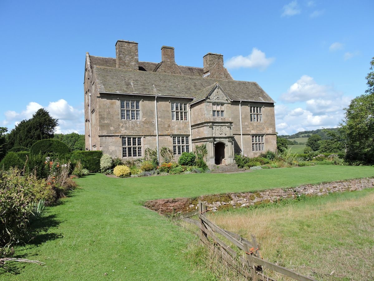
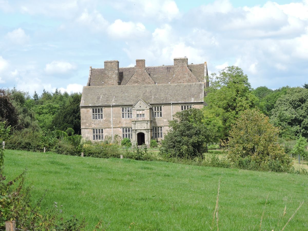
Principal Building
The house has gardens on the south, east and north sides totalling about 0.38 hectares in area.
Gardens and Pleasure Grounds
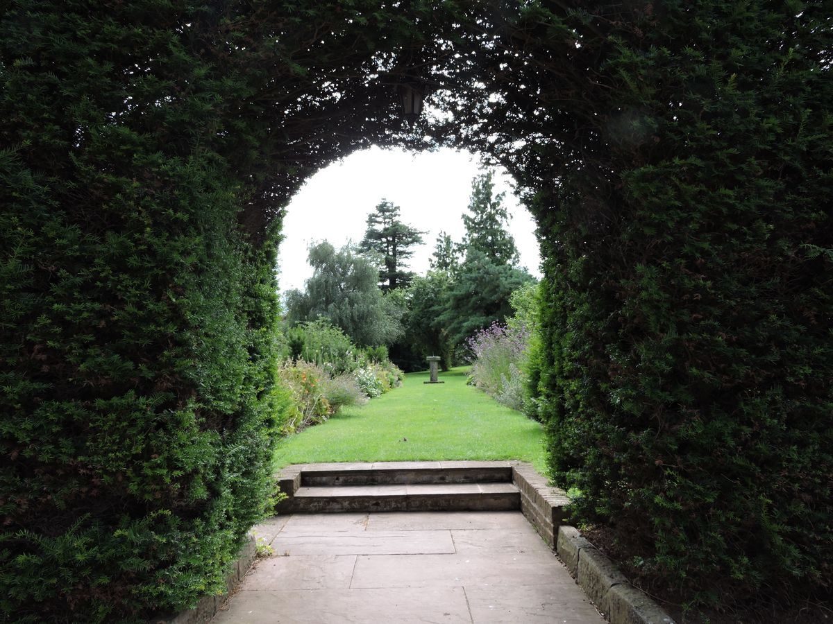
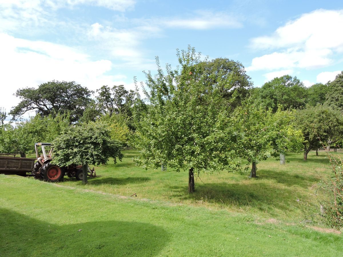
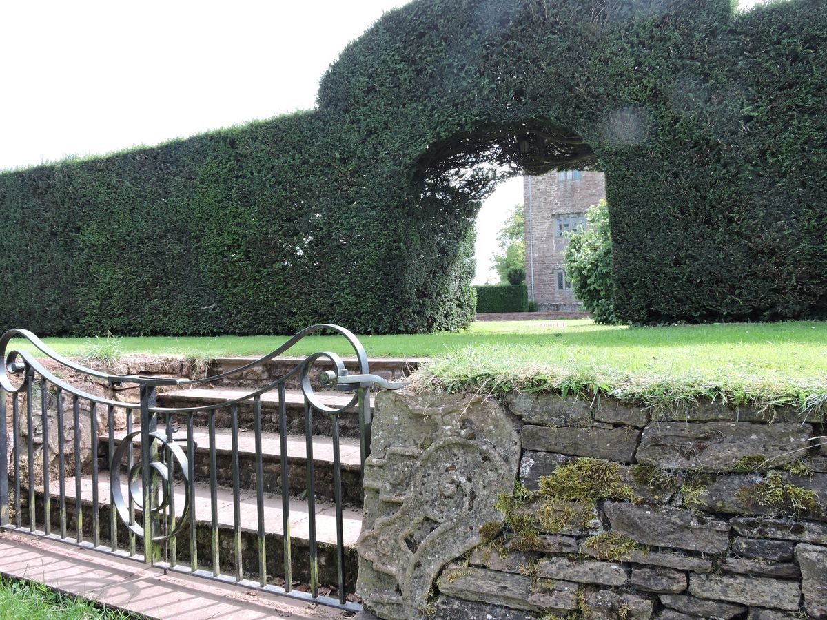
On the south side of the house steps lead down from the entrance porch to an informal L shaped garden, which can also be accessed from the parking area on the west side of the house via an archway through a yew hedge. It contains beautifully kept lawns, ornate flowerbeds, vegetable plots and a small orchard and features a sundial. It is separated from the adjacent agricultural land to the south and east by a ha-ha constructed in the late-1950s and is sheltered from the prevailing westerlies by the farm buildings.
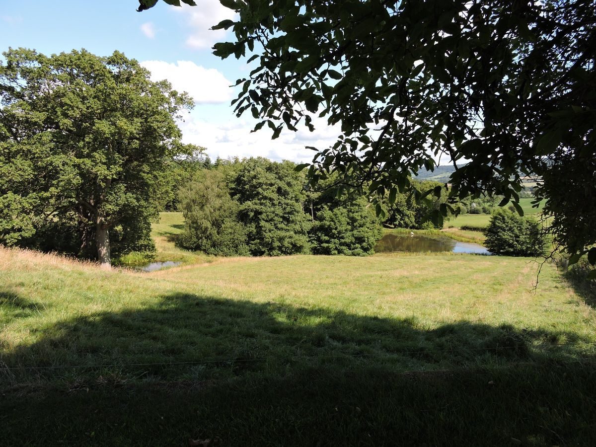
Adjacent to the east elevation of the house there are flower beds protected by a yew hedge. On the east side of this hedge is a raised grassed walkway which includes a semicircular belvedere which extends about ten metres further east into the adjacent field. The walkway connects with the north garden at which point steps give access down to the adjacent fields where there are four fish-ponds, probably of medieval origin, which were restored between the early 1990s and 2001.
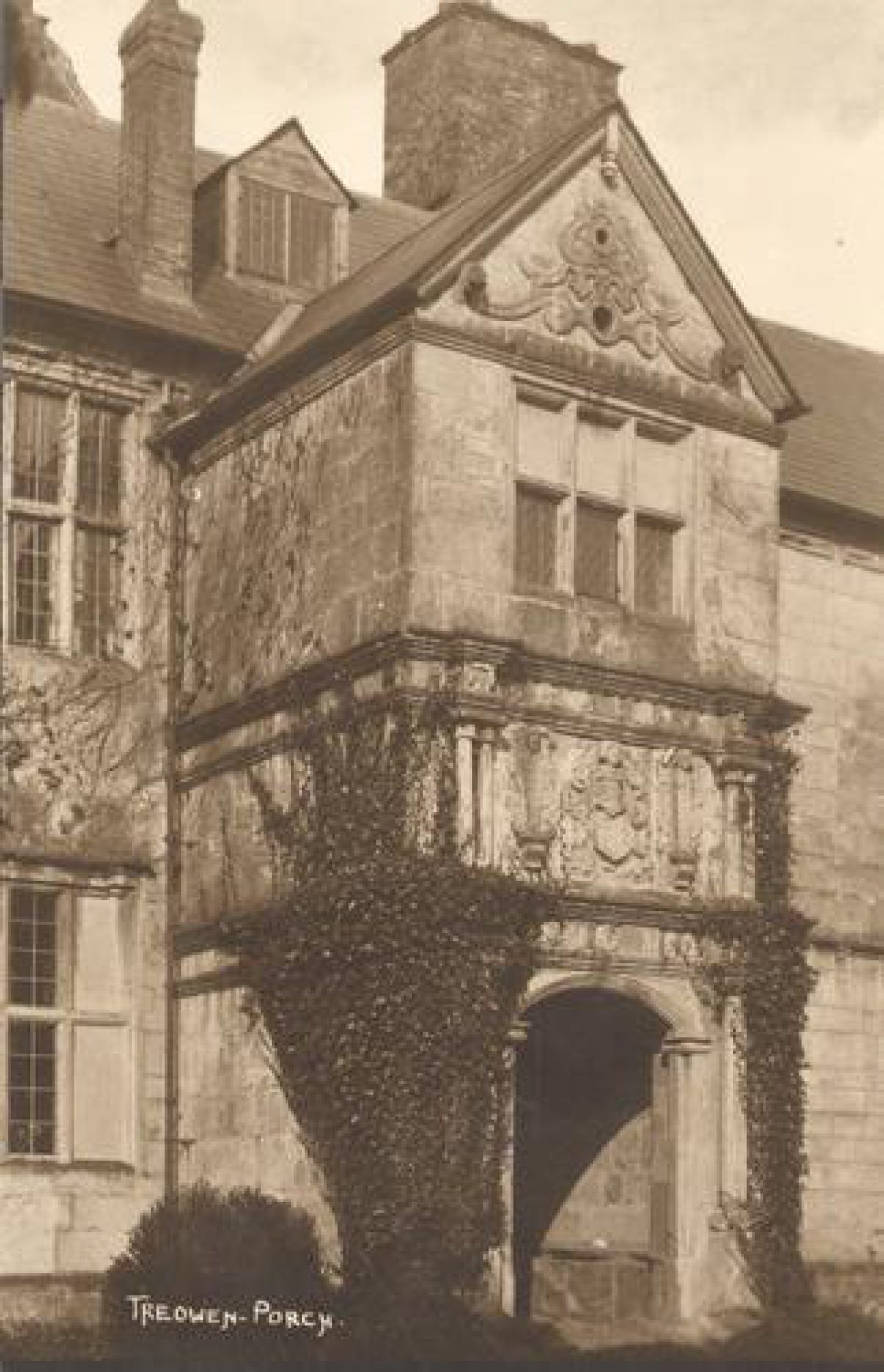
The north garden is square in shape and somewhat wider than the house. There is access to it from the house via steps down from a door in the centre of the north elevation and from the parking area on the west elevation of the house. This garden area is thought to originally date to the Tudor period. It now comprises a lawn with a central mulberry tree and corner beds currently under development, within new low brick walls. These are, in turn, surrounded on the east, west and north sides by a raised flat-topped earthwork bank, revetted on the outside by a stone and brick wall. On top of this bank stands a high clipped yew hedge, with an archway in the middle of the north side. This arch gives access down steps to an orchard containing further earthwork features. Around the steps the revetment contains pieces of elaborately carved stonework, which apparently pre-date the existing house. These were found in the grounds and were subsequently re-used at this location by the present owners during restoration work carried out between 1997 and 2005.
Detailed description added 09/09/2014
- Visitor Access, Directions & Contacts
Telephone
07402 246502Website
https://www.treowen.co.uk/Access contact details
The garden is open to the public on Fridays from May to August from 10 am to 4 pm at a charge of £5. (Admission to the house as well is £7.50.)
For more information contact welcome@treowen.co.uk or 07402 246502
Directions
Approaching from the south - take Raglan turning off A449 dual carriageway onto A40 signposted Abergavenny. Almost immediately take first available right turn signposted Dingestow. Follow signs for Dingestow turning left after about 4.5km. In Dingestow village turn right onto Monmouth road (over the River Trothy) and after about 650m turn left onto a concrete driveway with central grass (Buarth Owen) which heads NNE reaching the house after a further 650m. (Note Buarth Owen continues past the house and connects with another minor country lane 700m to the NE.) Approaching from the west on A40 from direction of Abergavenny go past Raglan and immediately before the A449 junction turn left to Dingestow – then follow directions for approach from south above. Approaching from the northwest on the A40 dual carriageway just before the tunnel at Monmouth take left turn onto B4293 signposted Trellech. Take first right then first left passing through Wonastow and Jingle Street. About three quarters of a mile west of Jingle Street turn right onto concrete drive with central grass up to the house. Approaching from Wye Valley or Forest of Dean at Monmouth bridge over river Wye turn left (south) onto A40 dual carriageway then follow directions for approach from northwest above.
Owners
- History
17th Century
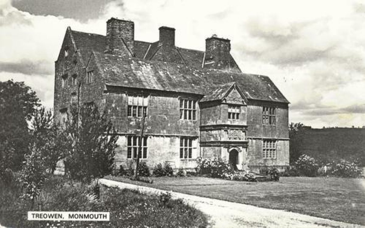
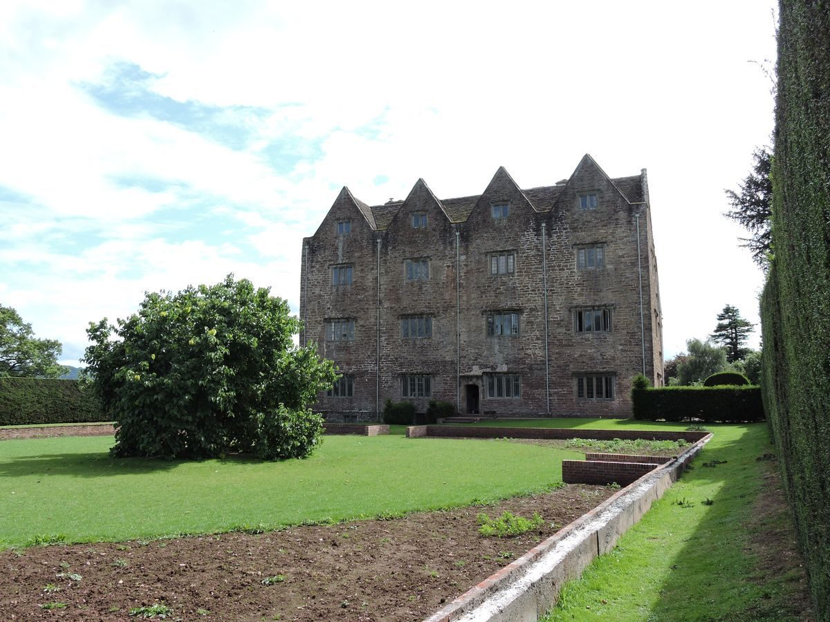
The first recorded owner of the Manor of Treowen was Sir Peter Huntley who had assisted Hamelin de Ballon, the first baron Abergavenny with his conquest of Gwent. The Manor passed by inheritance down the centuries to one William Jones who, between about 1614 and 1627, built the house that still stands. An archaeological survey carried out in 1995 provided evidence to show that the old manor house probably stood in the field immediately to the south of the new house and was demolished in the early-17th century. Towards the latter part of the 17th century the Jones family moved to Llanarth Court and from that time onwards Treowen house was let out to tenant farmers. This is the main reason that the house has survived without any significant modernisation. The only major change to the house since it was built is that the front elevation was lowered by one storey some 200 or so years ago.
19th Century
The census of 1841 shows the tenant farmer was James Williams aged 75. Although the 1841 census does not state relationships, also living at Treowen with the surname Williams were Eliza 65, Ann 25, Elizabeth 20 and Elinor 20 (no stated occupations), James 20 and Daniel 11 (male servants) together with three other male servants William Price 25, William Mache? 20, James Jarrett 15 and a female servant Mary Ford 15. Treowen was offered to let in the Monmouthshire Merlin 13 & 20 October 1832 and it would appear that James Williams became the tenant, although he is recorded as living at Treowen in 1829, when it was reported that he lost a considerable amount of grass due to flooding in the Trothy valley (Monmouthshire Merlin). It is further known that his brother in law was Nathaniel Curzon (sic) (Monmouthshire Merlin 17/08/1833). This makes it highly likely that the 65 year old woman present in the 1841 census was in fact his wife Eliza Maria Curson, born Oldcastle, Monmouthshire 1785. He was also Overseer to the parish of Wonastow (Monmouthshire Merlin 21/03/1835).
The name Treowen does not appear in the 1851 census, but in the parish of Wonastow Walter Nicholas 48 born Cwmcarvan was a farmer of 410 acres and the only farm of this size in the parish was Treowen. He was living there with his wife Jane (probably neé Williams) 41 (who according to the record of their marriage in 1834 in the Monmouthshire Merlin of 17 May 1834 was from Treowen), sons John 6, William 4 and Walter 3 and daughter Ellen 1. Also living in the house were farm bailiff George Cox 31, agricultural labourers James Waters 28, William Pritchard 18, Thomas Probert 16, John Hoskins 22 and Edward Morgan 14, together with house servants Eliza Evans 19 and Jane Price 13.
In 1861, the tenant was John Watkins 56 born Langenny, Breconshire and his wife Jane aged 52 together with daughters Maria 16 and Elizabeth 14, bailiff Henry Addis 21, dairy maid Mary Williams 20, carter John Walby 23, cowman George Cole 17, carter's boy Thomas Williams 15 and house maid Mary Farr 17. In March 1868 one Thomas Jenkins, a carter in the employ of John Watkins of Treowen drowned together with 3 cart horses trying to cross the Trothy Bridge on the Momouth road, which was covered by flood water which swept them away.
In 1871, John Lawrence 47 born Blagdon, Somerset was the tenant. He was living with his wife Louisa 46, daughters Rosina 22, Emily 18, Louisa K 12 and sons Frederick 15 and Frances J 8. There were two general servants living with them, William Addicott 60 born Blagdon, (he was with the family in the 1861 census) and Thomas Matthews 14. On August 31st 1871 there was a serious fire in the out-buildings of Treowen farm resulting in the uninsured loss of the entire season's grain harvest (Monmouthshire Merlin 8 Sept). As a consequence the barn had to be rebuilt. In 1875 Mr Lawrence was fined 5s with costs for failure to report an outbreak of foot and mouth disease on the farm. On January 24th 1877 whilst Mr Lawrence was away on business, his youngest son used an old muzzle loading double barrelled shotgun to try to shoot a pigeon. The land agent apparently witnessed this and complained to his mother, who informed her husband when he returned home. In a temper Mr Lawrence took the gun by the barrels with the intention of breaking off the stock by striking it against the stone floor. Unknown to him the gun was still loaded in one barrel and as it struck the floor it went off and shot him in the abdomen. He died a week later. Louisa Lawrence, together with other family members continued to farm and live at Treowen until her death in 1902.
20th Century
In the 1911 census the tenant was Thomas Davies 60 who was living with his wife Sarah 58 together with sons William John 34 and Benjamin Rees 17 and daughter Lettitia Agnes 22. (A photograph of this family can be found in the booklet "Treowen" by Harriet Wheelock, see references.) Also living with them were wagoner Edwin Howells 26 and under cowman Alesa Lonton 20.
Ivor John Caradoc Herbert inherited Treowen from his father John Arthur Edward Herbert (formerly Jones) in 1895. He served with the Grenadier Guards in Egypt and South Africa and eventually attained the rank of Major-General. He was made a baron in 1917 taking the title Lord Treowen. After World War 1 he undertook extensive restoration works at Treowen which were crucial to its ongoing survival and helped to ease unemployment in the locality. Lord Treowen's only son Elydyr John Bernard Herbert had been killed in action in Palestine in 1917 and when Lord Treowen died in 1933 his estate passed to his nephew Sir John Arthur Herbert, governor general of Bengal. He died in Calcutta in 1943 and in 1945 Treowen was sold by his executors to the sitting tenant Mr Benjamin Rees Davies, youngest son of Thomas Davies. B R Davies won prizes for his sheep in several of the Cowbridge Agricultural shows in the 1930s.
In 1954, Treowen was purchased by Harry Wheelock for his son Richard Hugh Wheelock. The Wheelock family remained at Treowen until 1993. The present owners Dick and John Wheelock now run the house as a self catering holiday and wedding venue.
Treowen has been used as a location for the filming of Twm Sion Cati, Time Riders, Bread of Heaven and Doctor Who. It has also been featured on Discovering Welsh Houses , Fishlock's Wild Tracks and Y Ty Cymreig (The Welsh House).
Detailed history added 09/09/2014
Period
- Post Medieval (1540 to 1901)
- Tudor (1485-1603)
- Features & Designations
Designations
CADW Register of Landscapes Parks and Gardens of Special Historic Interest in Wales
- Reference: PGW(Gt) 23
- Grade: II
CADW Register of Listed Buildings in Wales
- Reference: Treowen
- Grade: I
Features
- House (featured building)
- Earliest Date:
- Latest Date:
- Walk
- Description: Raised walk.
- Earthwork
- Description: The earthwork remains of a mid-16th-century garden.
- Fishpond
- Ha-ha
- Key Information
Type
Garden
Purpose
Ornamental
Principal Building
Domestic / Residential
Period
Post Medieval (1540 to 1901)
Survival
Extant
Open to the public
Yes
- References
References
- Cadw and ICOMOS UK, 'Treowen' in {Register of Landscapes, Parks and Gardens of Special Historic Interest in Wales: Gwent} (Cardiff: Cadw, 1994), pp. 150-1 Register of Landscapes, Parks and Gardens of Special Historic Interest in Wales: Gwent
-
Royal Commission on the Ancient and Historical Monuments of Wales, 'Treowen, Garden, Dingestow',
- Wheelock, H. {Treowen} (2013) Treowen
Contributors
Michael Statham