Introduction
Stonelands House has 19th- and 20th-century pleasure grounds occupying about 4.5 hectares, surrounding a house designed by Sir John Nash.
Terrain
Stonelands is situated on south- and south-west-facing slopes to the east and north-east of Dawlish Water.The following is from the Register of Parks and Gardens of Special Historic Interest. For the most up-to-date Register entry, please visit The National Heritage List for England (NHLE):
19th and 20th century pleasure grounds surrounding a villa designed by Sir John Nash.
Location, Area, Boundaries, Landform and Setting
Stonelands is situated c 0.5km west of Dawlish, to the west of Aller Hill. The c 4.5ha site is bounded to the east by Aller Hill, from which it is separated by rubble-stone walls, and to the north-east by Ashcombe Road, from which it is separated by similar stone walls and hedges. To the north-west the site adjoins a track which separates it from the early C19 kitchen gardens associated with Luscombe Castle, while to the west the boundary is formed by Dawlish Water, a stream which flows from north-west to south-east through the site separating it from Luscombe Home Farm. To the south the boundary of the site is formed by stone walls separating it from paddocks to the north of Bere Hill, while to the south-east Aller Hill is carried across Dawlish Water by the early C19 Stonelands Bridge (listed grade II). Stonelands is situated on south- and south-west-facing slopes to the east and north-east of Dawlish Water, and enjoys important reciprocal views to the parkland associated with Luscombe Castle to the west of the river.
Entrances and Approaches
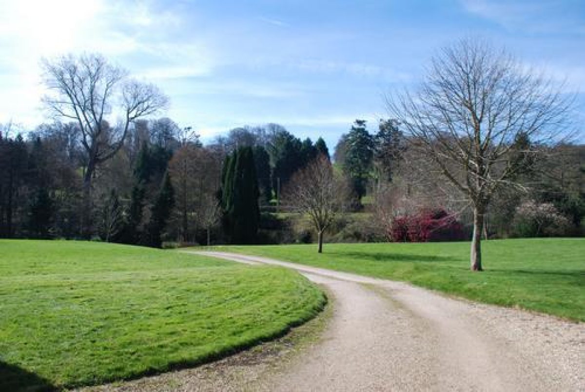
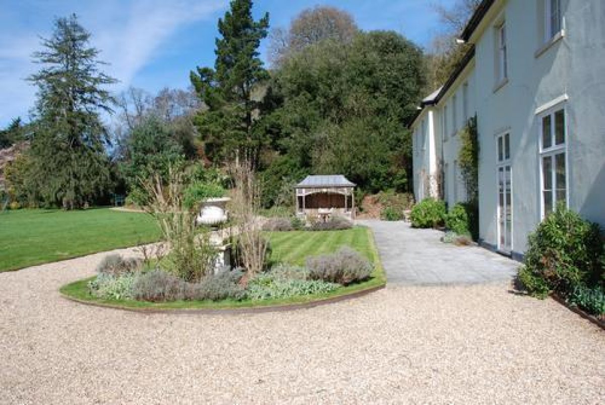
Stonelands is approached from Aller Hill at a point c 10m north of Stonelands Bridge. The entrance is set in the C19 rubble-stone wall which separates the site from the public road, and comprises a pair of late C20 rendered piers under gabled caps which support a late C20 ornamental timber gate of C19 design. The piers are flanked by late C20 rubble-stone quadrant walls, and mature evergreen shrubs. Beyond the entrance, a gravel drive extends c 100m north-west, running parallel with Dawlish Water to the south-west and an early C20 rock garden planted with specimen trees and shrubs to the north-east. This section of the drive follows the course of a section of the C19 riverside walk which formed part of a circuit of walks in the pleasure grounds (OS 1870). The drive turns north-east, crossing the lawn to approach the house from the south-west. A gravelled carriage turn is situated below the south-east facade of the house, and is separated from the lawn by a C20 beech hedge and a C19 grass bank (OS 1870).
A service drive returns below the north-east facade of the house to reach the domestic offices. The carriage turn and service drive correspond to those shown on the Tithe map (1839), while the present drive is of late C20 construction, replacing a C19 drive which extended north-north-west from the entrance along the eastern boundary of the lawn, to approach the house from the south-east (Tithe map, 1839). A service drive led north-east and east from this drive to reach the stables and coach house c 100m south-east of the house. The drive was realigned when the property was divided and the stables and coach house converted to domestic use.
Principal Building
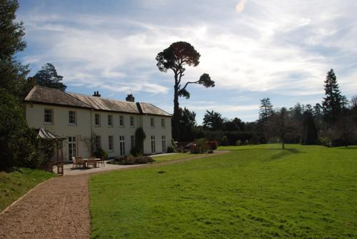
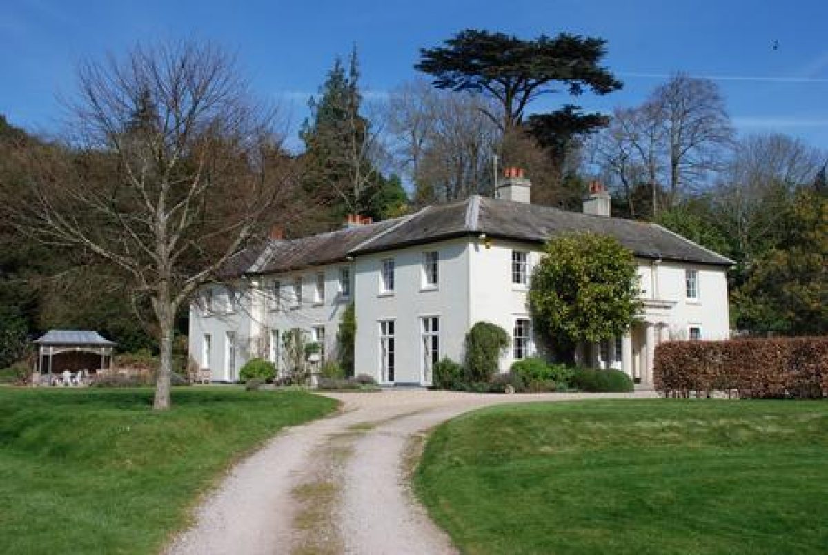
Stonelands (listed grade II*) is a two-storey, early C19 villa of rendered construction under a shallow-pitched slate roof. Rectangular in plan, the house has an entrance or south-east facade comprising five bays with a central, single-storey Greek Doric portico. The garden or south-west facade is symmetrical and comprises eight bays with two slightly projecting bays to the north-west and south-east. The north-west and north-east facades are plain, symmetrical compositions. The interior of the house retains a fine entrance hall with a ceiling supported by four Ionic columns, while an imperial staircase rises to the first floor. Stonelands was constructed in 1817 to the design of John Nash, the design having originally been submitted to Charles Hoare in 1799 for the site occupied by Luscombe Castle. The building has been comprehensively restored in the late C20.
Gardens and Pleasure Grounds
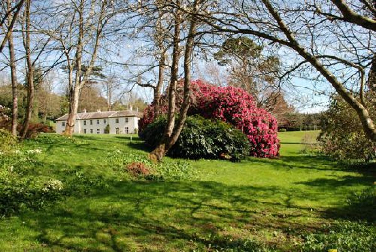
Stonelands is situated towards the centre of the site, with areas of lawn extending west and south-west from the house, and areas of ornamental shrubbery and plantations on south- and west-facing slopes above and to the north and east of the house.
An early C21 Portland stone-flagged terrace with circular beds and formal lawn extends below the south-west facade of the house, replacing a late C20 arrangement of formal beds. Immediately south-west of the formal lawn, a late C20 rectangular swimming pool is enclosed by chain-link fences; this is now (2002) being filled-in. The terrace is separated from the lawns to the west by a grass bank which appears to correspond to a similar feature shown on the 1870 OS map. A conservatory constructed at right-angles to the south-west facade of the house and shown on the1870 OS map and in C20 photographs does not survive.
The grass bank supporting the terrace to the south-west of the house returns along the south-east boundary of the carriage turn and extends c 50m south-east beyond the south-east corner of the house forming a gently sloping grass walk above an artificially levelled lawn to the south-east of the house. This lawn appears to have assumed its present form in the C19 and was probably used for tennis (OS 1870). The sloping grass walk is planted with a mature specimen stone pine, while the boundary of late C20 properties developed on the site of the early C19 stables and coach house is screened by a late C20 conifer hedge and an early C21 ornamental shrubbery hedge.
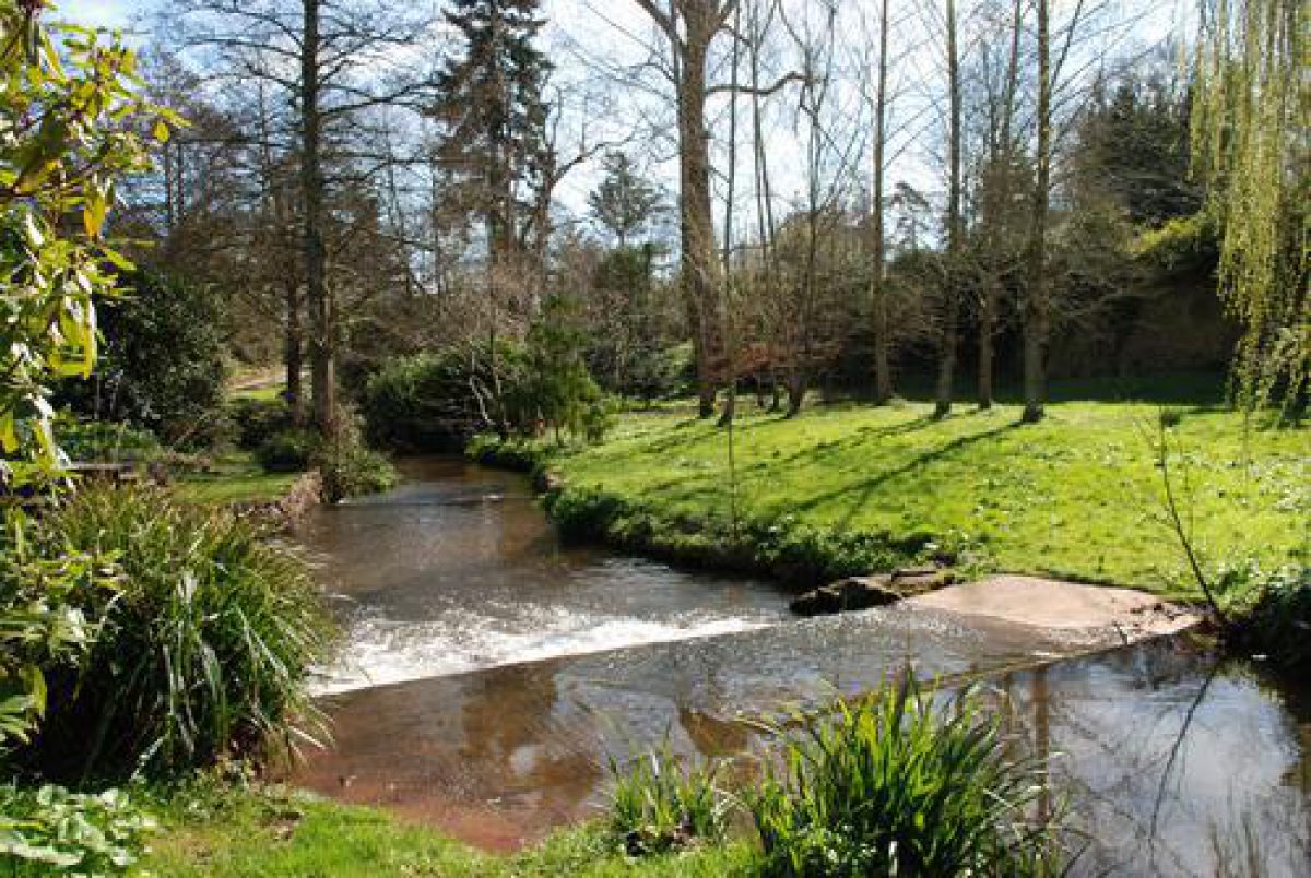
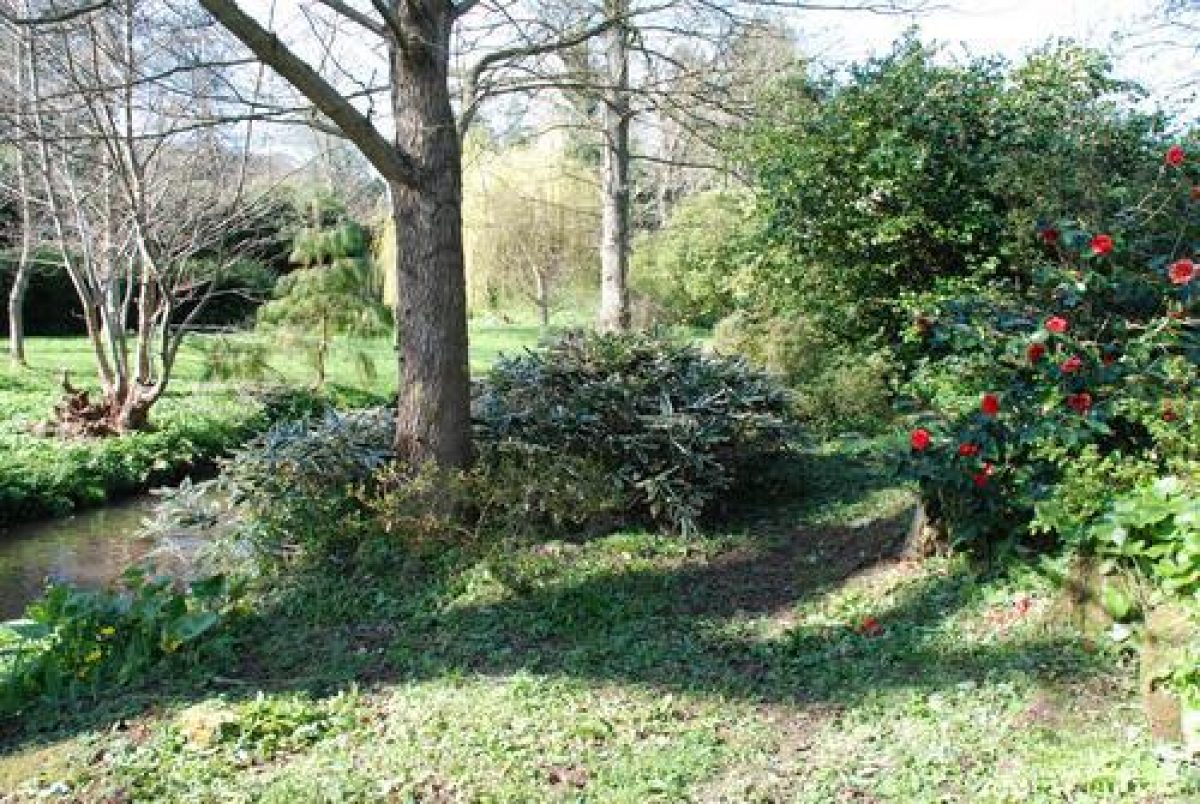
The lawns to the south and west of the house slope gently towards the Dawlish Water, from which they are separated by the late C20 drive and early C20 rock garden to the south-east and south, and by groups of ornamental shrubs which line the early C19 riverside walk to the west. Constructed in Devon sandstone (CL 1963), the rock garden extends c 200m from south-east to north-west and comprises several linked sections planted with specimen trees, shrubs, and herbaceous plants. An informal walk extends through the rock garden, crossing the Dawlish Water on two footbridges, thus incorporating a small island in the river into the scheme. The rock garden was constructed by W J Chinneck in the 1930s, and is partly planted with specimens surviving from the collections of rhododendrons, camellias, and magnolias which he planted from 1937 (CL 1963).
The Dawlish Water is dammed by three weirs which form low, ornamental cascades; two of these date from Mr Chinneck's early and mid C20 improvements, while the third, immediately below the island, is of C19 construction (OS 1870). The riverside walk continues to the north-west of the rock garden, reaching after c 40m a footbridge leading across the river to a path which formerly linked Stonelands to Luscombe Castle (OS 1870). Immediately north of this footbridge a cascade on the western bank of the river provides a picturesque incident on the riverside walk, which extends c 150m north-west, passing a group of late C20 timber stables, to reach the shrubbery and woodland garden north-west of the house.
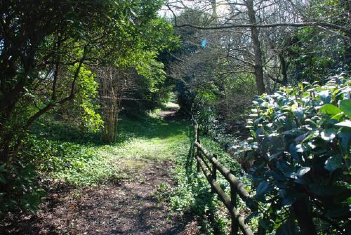
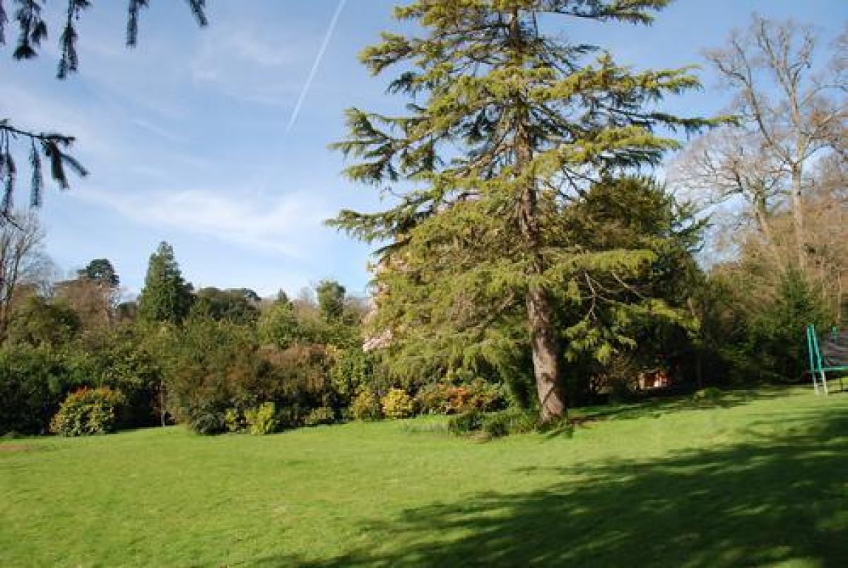
The shrubbery and woodland garden comprises mature ornamental trees and conifers underplanted with evergreen shrubbery and a collection of C19 and C20 rhododendrons. The shrubbery is planted on south- and south-west-facing slopes and screens the kitchen garden to the north-east and the Luscombe Castle kitchen garden to the north. Walks pass through the shrubbery, while the riverside walk leads north, away from the river, before turning south-east to return towards the house. Some 100m north-west of the house the walk passes an informal, approximately elliptical pond which corresponds to a feature shown on the Tithe map (1839). The walk continues beyond the pond to reach the western terrace adjacent to the north-west corner of the house. The ornamental trees and shrubbery extend across the south-facing slope to the north of the house, where a single mature cedar, the survivor from a group of early C19 cedars, is a prominent feature.
A network of grass walks ascends the slope to the north of the house and joins a broad, sloping walk which ascends north to reach the kitchen garden. To the east of this walk, a rectangular grass terrace (overgrown, 2002) extends c 200m south-east. Enclosed to the north by a belt of mature trees and shrubs which screen the Ashcombe Road boundary, and to the south by the pleasure-ground shrubbery, this artificially levelled area was planted in the early C20 with fruit trees, but during the C19 was a lawn (Tithe map, 1839; OS 1870). This lawn may have been intended to provide south-easterly views across Dawlish towards the sea.
The surviving disposition of lawn and shrubbery corresponds closely to that shown on the Tithe map (1839), while the circuit of walks, including the riverside walk and the shrubbery walks, reflects the arrangement shown on the OS map of 1870. The Tithe map describes the shrubbery to the north and north-west of the house as planted with 'fir', but by 1870 (OS) it had assumed it present, more mixed character.
Kitchen Garden
The kitchen garden is situated on high ground c 150m north-north-west of the house. The artificially levelled rectangular garden is today (2002) uncultivated and partly overgrown. The garden is enclosed to the north-east by a stone and cob wall, while sections of walls to the north-west and south-east also survive. It is entered at its north-east corner, and is approached by a walk which ascends through the pleasure grounds, and directly from Ashcombe Road. The entrance from the road is marked by a pair of simple granite piers surmounted by pyramid caps, which support a pair of painted timber gates. Immediately north of the entrance, the walls of a cob structure, known as the Potato House, stand abutting the boundary wall. A partly sunken potting shed of brick construction stands c 10m west of the Potato House, while a derelict brick and timber glasshouse stands c 10m north-west of the Potato House.
The Potato House and the potting shed correspond to structures marked on the Tithe map (1839). The Tithe map (1839) and the 1870 OS map indicate that the kitchen garden was laid out with slip gardens surrounding a central rectangular walled enclosure; this inner wall does not appear to survive (2002). The sale advertisement of May 1822, which is believed to relate to Stonelands, refers to a 'walled enclosed garden' (Roberts 2002), perhaps indicating that the kitchen garden was constructed at the same period as the house.
Other Land
An area of grass planted with specimen trees extends to the south of the Dawlish Water, c 100m south of the house, east to Stonelands Bridge. This area formed part of the grounds of Stonelands in 1839 (Tithe map), and by 1870 (OS) was being cultivated as a nursery. The land remains part of the grounds associated with Stonelands (2003).
To the north-east of Ashcombe Road, c 120m north of the house, a mixed plantation incorporating mature specimen trees is situated on a south-west-facing slope. This small plantation forms a visual continuation of the boundary planting and shrubbery to the south. Shown on the Tithe map (1839), it has been suggested that this plantation formed part of Repton's ornamentation of the wider landscape around Luscombe Castle (Debois 1991).
REFERENCES
Exeter Flying Post, 10 June 1820; 3 May 1822
Country Life, 133 (4 April 1963), pp 702-704
B Cherry and N Pevsner, The Buildings of England: Devon (1989), p 333
Luscombe Castle, Devonshire: A Survey of the Landscape, (Debois Landscape Survey Group 1991)
Stonelands House Historic Landscape Survey and Garden Plan, (Nicholas Pearson Associates 2000)
B M Roberts (ed), Stonelands A Regency Mansion, (Dawlish Local History Group 2002), pp 1-4
Maps
- Tithe map for Dawlish parish, 1839 (Devon Record Office)
- OS 6" to 1 mile: 2nd edition surveyed 1904, published 1906
- OS 25" to 1 mile: 1st edition published 1870
- 2nd edition published 1890
Illustrations
- Humphry Repton, drawing of villa proposed by John Nash for the site of Luscombe Castle, incorporated in the Red Book for Luscombe Castle, 1799 (private collection)
Archival items
- Humphry Repton, Red Book for Luscombe Castle, 1799 (private collection)
- Garden notebooks for Stonelands, 1920s (private collection)
- Early C20 photographs of the gardens at Stonelands (private collection)
Description written: August 2002
Amended: July 2003
Edited: July 2003
- Visitor Access, Directions & Contacts
Directions
The site is half a kilometre west of Dawlish.
- History
The following is from the Register of Parks and Gardens of Special Historic Interest. For the most up-to-date Register entry, please visit the The National Heritage List for England (NHLE):
www.historicengland.org.uk/listing/the-list
HISTORIC DEVELOPMENT
Stonelands House was constructed in 1817 on a previously undeveloped site for Charles Hoare, owner of adjacent Luscombe Castle. The Luscombe estate had been purchased by Charles Hoare in the late 18th century, and between 1800 and 1804 a castellated mansion was constructed to the design of John Nash (1752-1835) while between 1800 and about 1817 the grounds were laid out under the direction of Humphry Repton (1752-1818). Nash's original proposal for Luscombe was a relatively plain classical villa, but Repton, in his Red Book for Luscombe Castle (1799), successfully argued for a more picturesque composition. Nash's design was finally implemented when Stonelands was constructed, possibly with the intention that it should be used as a dower house; it appears never to have been used for this purpose. Instead, in about 1820, Stonelands was let to Henry Drummond (Roberts 2002), and was subsequently sold in 1822 to Codrington Parr, a County Magistrate from Exeter. At about the same time the property is believed to have been let to Sir John Rennie (1794-1874), Engineer to the Admiralty, who was engaged on work at Plymouth between 1821 and 1832 (Nicholas Pearson Associates 2000).
Codrington Parr continued to own Stonelands until about 1860, when the property was sold to Peter Richard Hoare who had succeeded to the Luscombe Estate in 1856. During the 1860s and 1870s Stonelands was used to house successive priests serving the Oratory of St Alban at Luscombe Castle, a chapel built by P R Hoare in 1862. By 1881 the property was let to Alexander McCasland, a gentleman from Lanarkshire (Census, 1881), while in 1924 it was leased to W J Chinneck of Dawlish. The Luscombe Estate sold Stonelands to Mr Chinneck in 1938, and subsequently, with the assistance of his gardener, Mr Webster (previously head gardener at Greenway, Devon), he developed the gardens, constructing a rock garden by the Dawlish Water, and planting an extensive collection of rhododendrons and magnolias, some of which were obtained from major collections in Cornwall and Surrey (Country Life 1963).
Mr Chinneck died in 1961 and was succeeded at Stonelands by his daughter, who continued to live there until 1965. In the mid 20th century the property passed through several hands before becoming the premises of the Dawlish Squash Racquets Club. In the late 20th century Stonelands was again sold several times, with part of the site being sold for development in the 1990s. The house and pleasure grounds were sold to the present owners in 1999, and today (2002) the site remains in divided, private ownership.
The early 19th century villa was set in extensive pleasure grounds with areas of ornamental plantation on rising ground to the north-west of the house, and lawns extending west to Dawlish Water; a reciprocal view across the stream to the park associated with Luscombe Castle was framed by boundary planting. A kitchen garden to the north was screened by ornamental planting, as were the buildings of Luscombe Home Farm to the north-west. An advertisement for the sale of the property in 1820 described the 'excellent and substantial mansion' being set in 'thriving shrubberies and plantations, garden ground, orchard, meadow, arable and pasture land' (Exeter Flying Post, 1820). A further advertisement dated May 1822, believed to relate to Stonelands, refers to a lawn in front of the house, and a walled garden (Roberts 2002). This arrangement is recorded on the Tithe map (1839), and is shown with only minor modifications on the late 19th century Ordnance Survey map (OS 1890). Further changes were made in the 20th century, when W J Chinneck developed various garden features from 1924, and in about 1997 when the property was divided and the former stables redeveloped.
The ornamental planting around the house appears to incorporate specimen trees, particularly several mature oaks, which pre-date the construction of the house. It has been suggested that these formed part of Repton's development of the wider landscape around Luscombe Castle in 1801-1817, although it is clear that, due to his death in 1818, Repton would not have had any involvement in the planning of the pleasure grounds at Stonelands (Debois 1991; Nicholas Pearson Associates 2000).
- Associated People
- Features & Designations
Designations
The National Heritage List for England: Register of Parks and Gardens
- Reference: 5164
- Grade: II
Features
- House (featured building)
- Earliest Date:
- Latest Date:
- Boundary Wall
- Description: Rubble-stone walls.
- Stream
- Description: Dawlish Water, a stream which flows from north-west to south-east through the site.
- Ornamental Bridge
- Description: Stonelands Bridge.
- Earliest Date:
- Latest Date:
- Key Information
Type
Garden
Purpose
Recreational/sport
Principal Building
Domestic / Residential
Survival
Extant
Hectares
4.5
Open to the public
Yes
Civil Parish
Dawlish
- References
References
- {English Heritage Register of Parks and Gardens of Special Historic Interest} (Swindon: English Heritage 2008) [on CD-ROM] Historic England Register of Parks and Gardens of Special Historic Interest
- Pevsner, N {The Buildings of England: Devon} (Harmondsworth: Penguin, 1952) The Buildings of England: Devon
- Askew Nelson {Stonelands Landscape masterplan} (2009) Stonelands Landscape masterplan